
Events
Event Status
Scheduled
Date and time: Friday, Oct. 23, noon to 1:15 p.m.
Location:Online
In this Data & Donuts workshop, we will share best practices for publishing open data. We will: Walk through a documentation template; Talk about file formats & codebooks; and Identify what is and is not a proper repository.
Event Status
Scheduled
Date and time: Oct. 30, noon to 2 p.m.
Location:Perry-Castañeda Library
The When You Return: Digital Methods for Managing Your Research Archive, participants will learn strategies and important considerations for organizing and working with digital and digitized research materials.
Event Status
Scheduled

Date and time: Nov. 5, 11 a.m. to 3:30 p.m.
Location:Perry-Castañeda Library
Join us and learn about the complexity of digital preservation from a panel of library professionals, how to implement some best practices for your personal archiving or academic research, and hear from faculty and students on how they engage and practice digital preservation in their own projects.
Event Status
Scheduled
Date and time: Nov. 8, 6 to 9 p.m.
Location:Perry-Castañeda Library
Looking for a productive way to tackle your assignments? Join the University Writing Center and UT Libraries for a Sunday evening Writing and Research Rodeo, to make progress on your coursework with support from writing and research experts.
Event Status
Scheduled
Date and time: Nov. 11, 1 to 3 p.m.
The pop-up will teach participants how to create cyanotypes – a slow-reacting method of photographic printing led by Rachel C. Hill. The Perry-Castañeda Library's Scan Tech Studio will introduce digitization and preservation concepts when creating zines.
Event Status
Scheduled

Date and time: Nov. 12, noon to 1 p.m.
Location:Online
Getting and using your free ORCID iD and ORCID record can help you save time and get credit for your work in funding, publishing, and research reporting workflows.
Event Status
Scheduled
Date and time: Nov. 29, 6 to 9 p.m.
Location:Perry-Castañeda Library
Looking for a productive way to tackle your assignments? Join the University Writing Center and UT Libraries for a Sunday evening Writing and Research Rodeo, to make progress on your coursework with support from writing and research experts.
Event Status
Scheduled
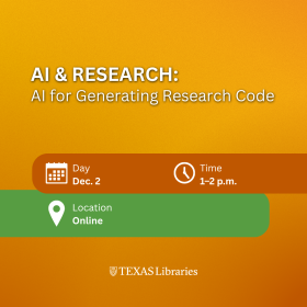
Date and time: Dec. 2, 1 to 2 p.m.
Location:Online
Join this virtual session to learn about the use of AI tools for facilitating the development of research software.