Perry-Castañeda Library
Map Collection
Israel Maps
| Israel Maps | West Bank Maps | Gaza Maps | Golan Heights Maps | Middle East Maps | Other Israel Map Sites |
|---|
The following maps were produced by the U.S. Central Intelligence Agency unless otherwise noted.
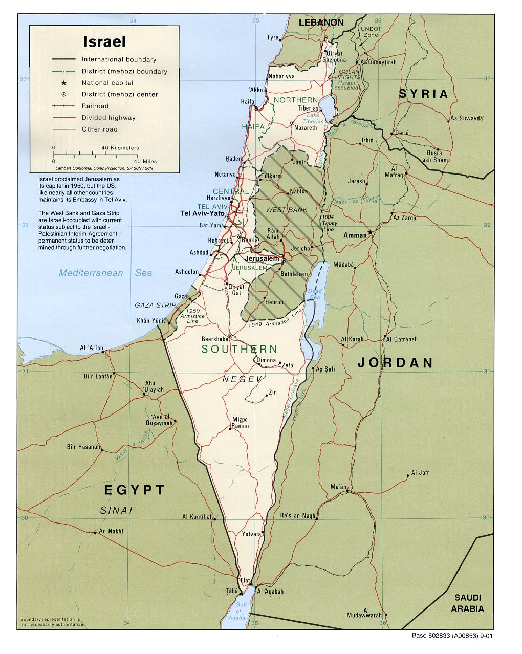
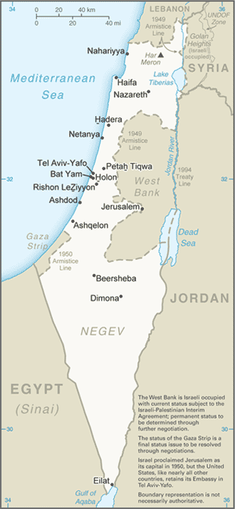
Country Maps- Israel (Political) 2001 (226K) and pdf format (204K)
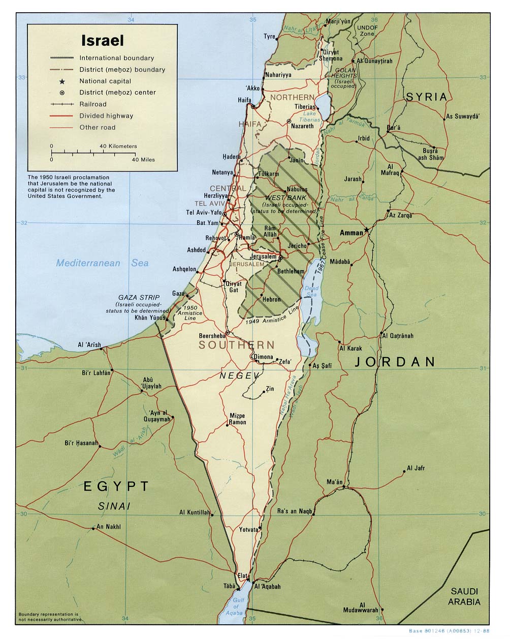
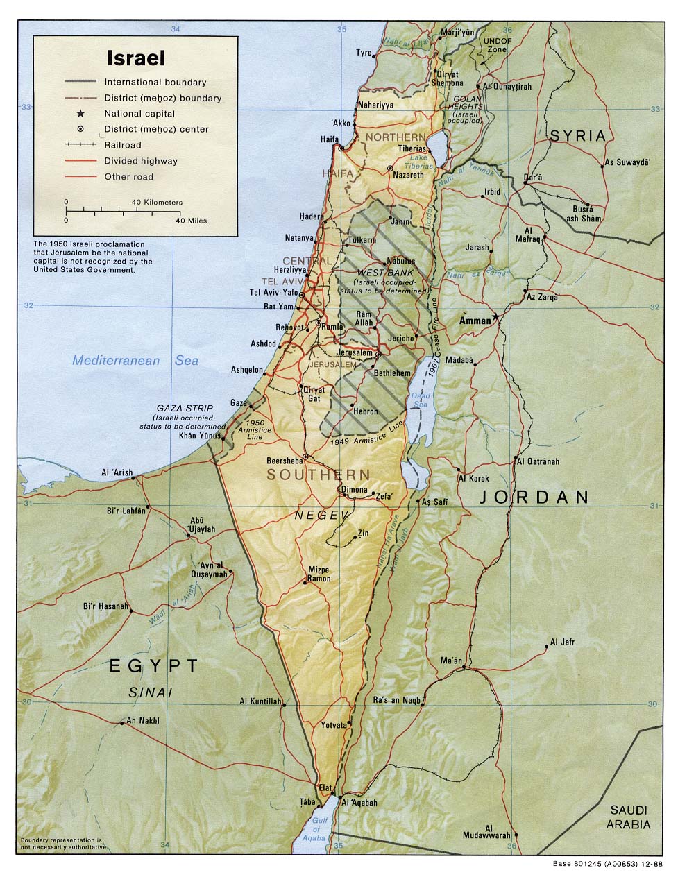
- Israel (Political) 1988 (207K) and pdf format (214K)
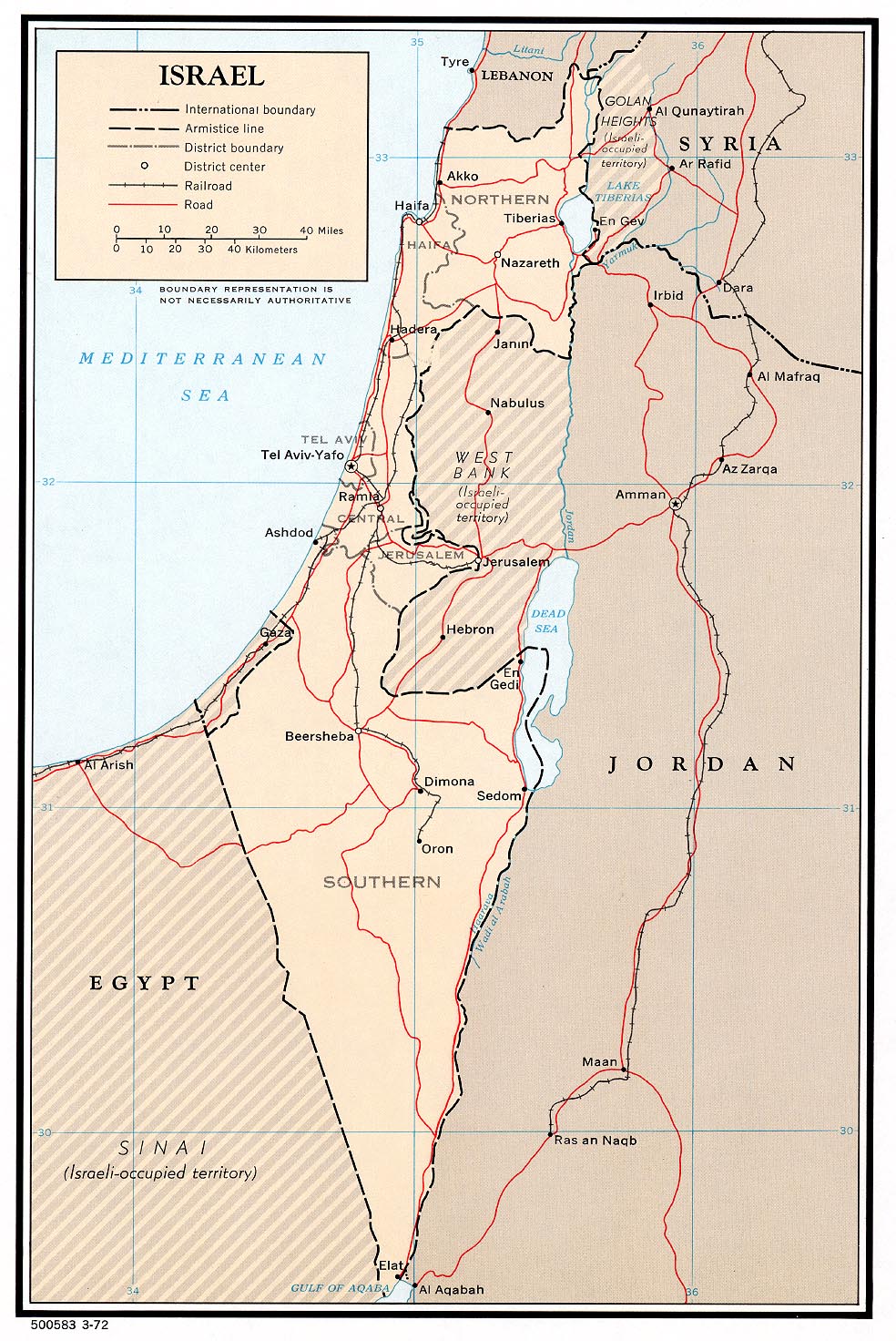
- Israel (Political) 1972 (331K) and pdf format (342K)
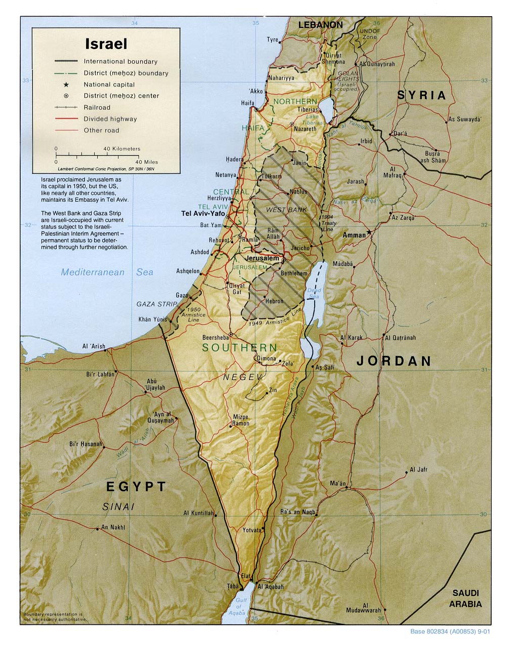
- Israel (Shaded Relief) 2001 (268K) and pdf format (272K)
- Israel (Shaded Relief) 1988 (247K)
- Israel (Small Map) 2016 (15.7K)
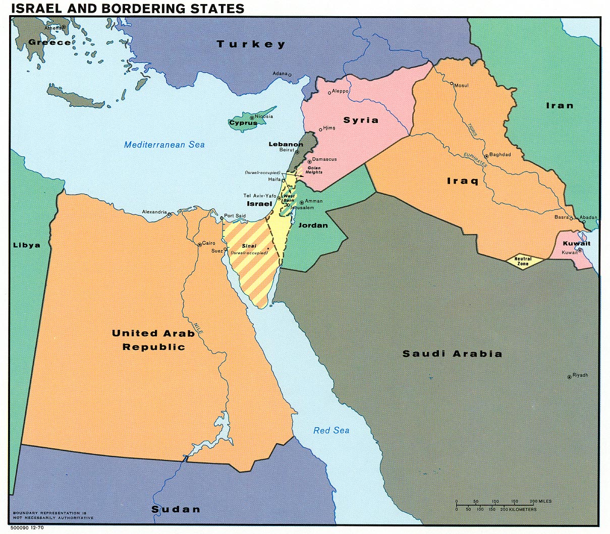
- Israel and Bordering States (Political) 1970 (438K)and pdf format (451K)
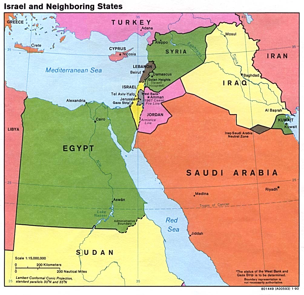
- Israel and Neighboring States (Political) 1990 (170K) and pdf format (174K)
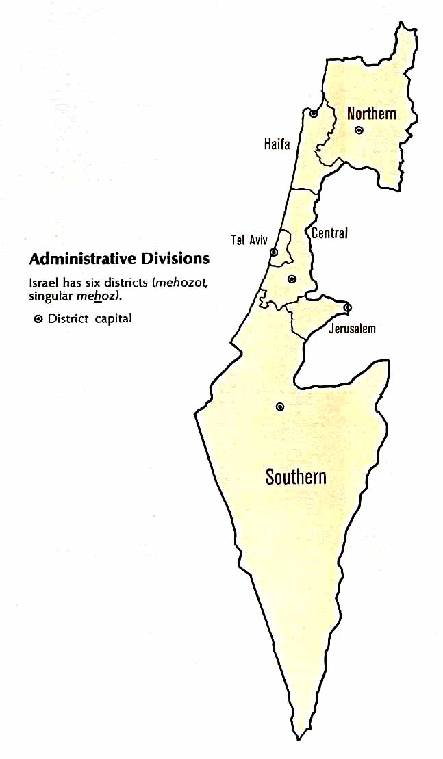
- Israel - Administrative Divisions from Atlas of the Middle East, U.S. Central Intelligence Agency, January 1993 (41K)
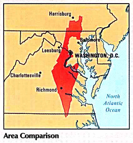
- Israel - Area Comparison from Atlas of the Middle East, U.S. Central Intelligence Agency, January 1993 (37K)
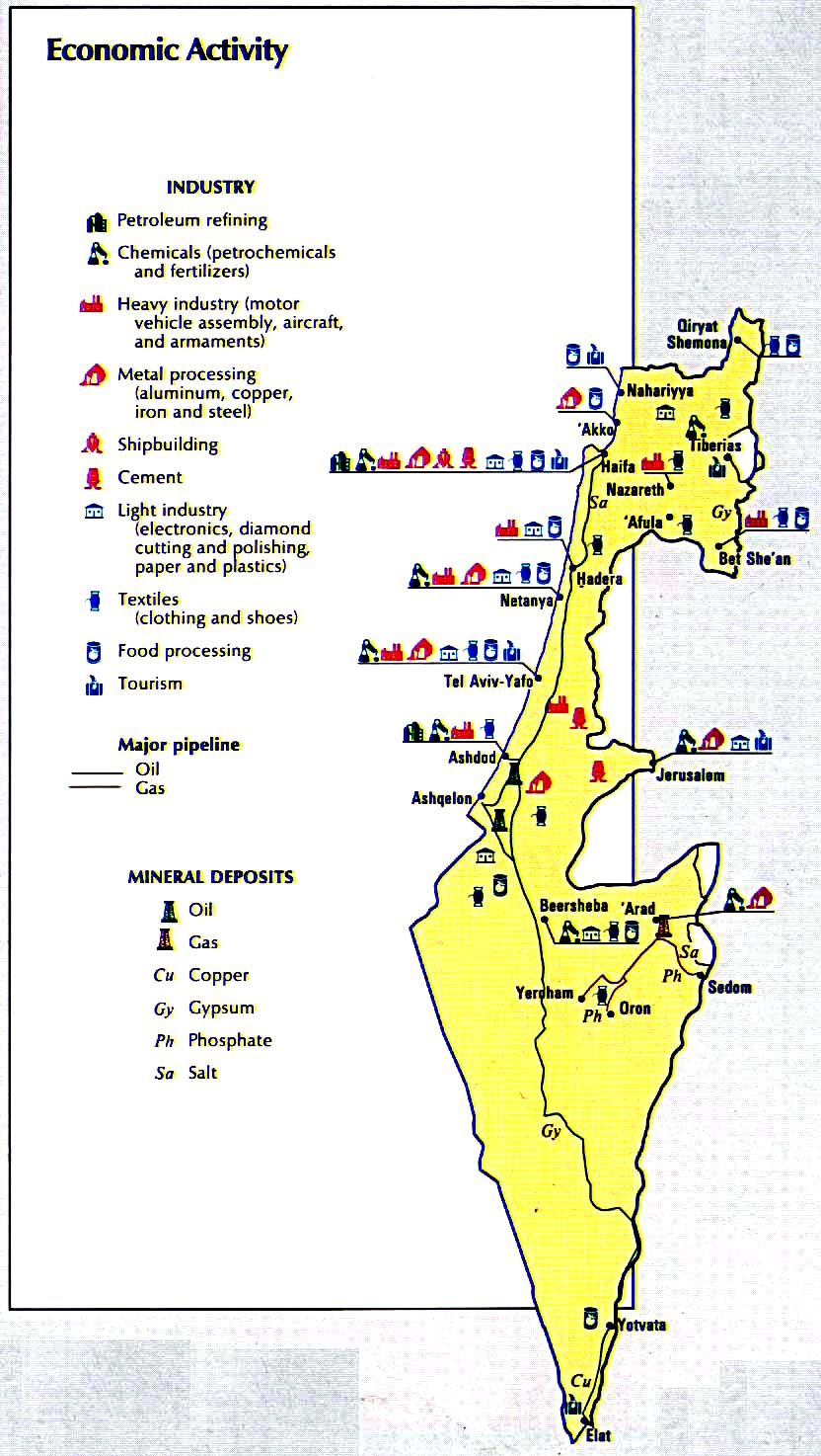
- Israel - Economic Activity from Atlas of the Middle East, U.S. Central Intelligence Agency, January 1993 (196K)
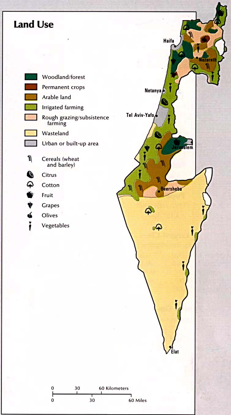
- Israel - Land Use from Atlas of the Middle East, U.S. Central Intelligence Agency, January 1993 (107K)
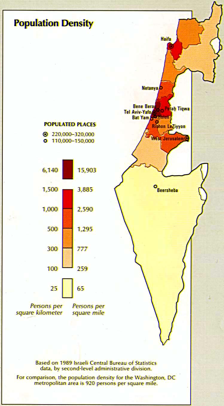
- Israel - Population Density from Atlas of the Middle East, U.S. Central Intelligence Agency, January 1993 (114K)
- Middle East Historical Maps
- Middle East Maps
- 1:,000,000 - Operational Navigation Chart Series
U.S. Defense Mapping Agency Aerospace Center. Not for navigational use
- Sheets G-4 and H-5 include Israel
- 1:500,000 - Tactical Pilotage Chart Series U.S. Defense Mapping Agency Aerospace Center. Not for navigational use
- This series covers all of Israel
- 1:500,000 - World Series 1404, Great Britain. War Office and Air Ministry. 1958-
- This series covers all of Israel
- 1:100,000 - Palestine Series K631 (4078), Great Britain War Office, 1942-
- This series covers parts of Israel
- Sheets G-4 and H-5 include Israel
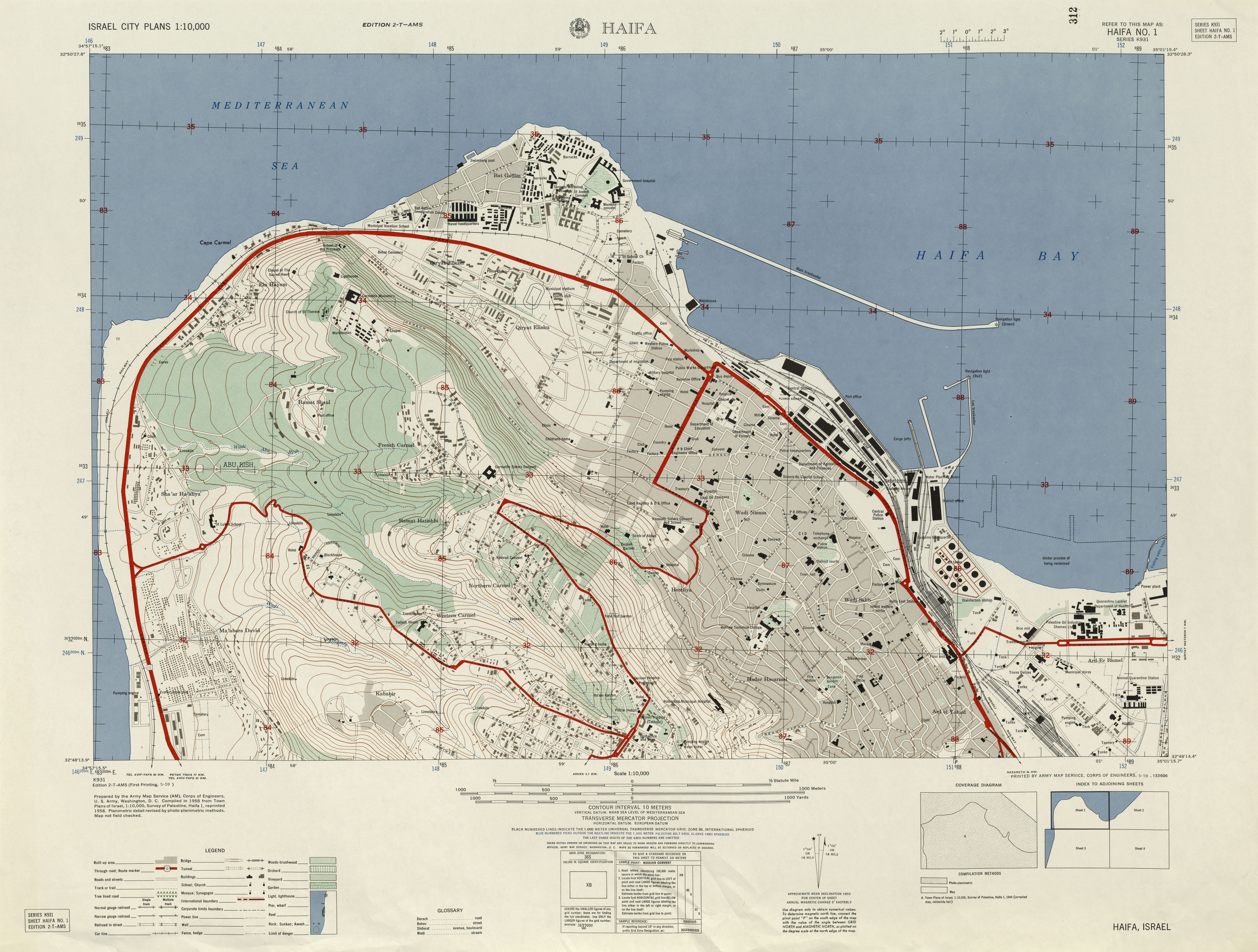
- Haifa Northwest Haifa No. 1, 1:10,000, Edition 2-T-AMS, Series K931. U.S. Army Map Service, 1958 (4MB)
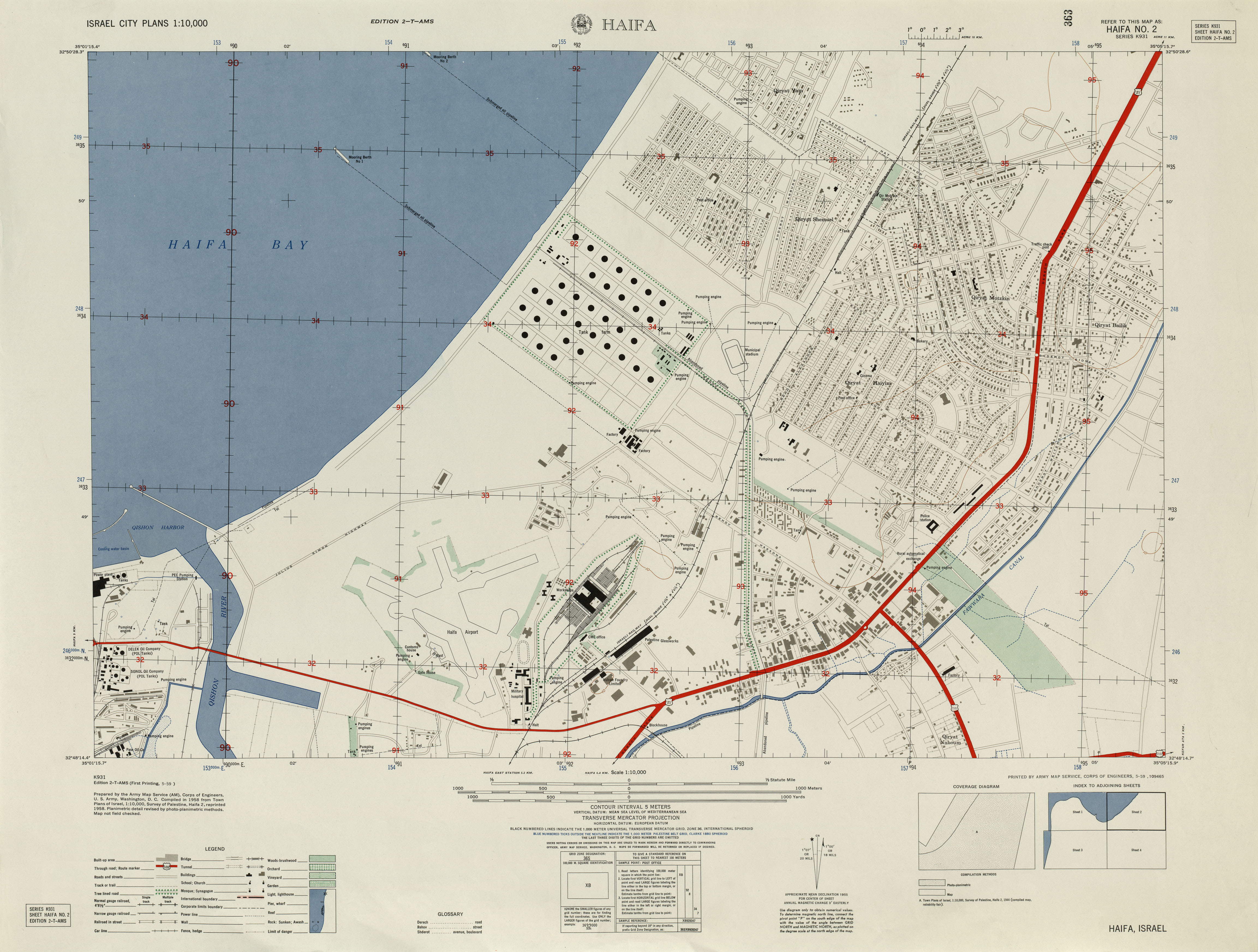
- Haifa Northeast Haifa No. 2, 1:10,000, Edition 2-T-AMS, Series K931. U.S. Army Map Service, 1958 (3.1MB)
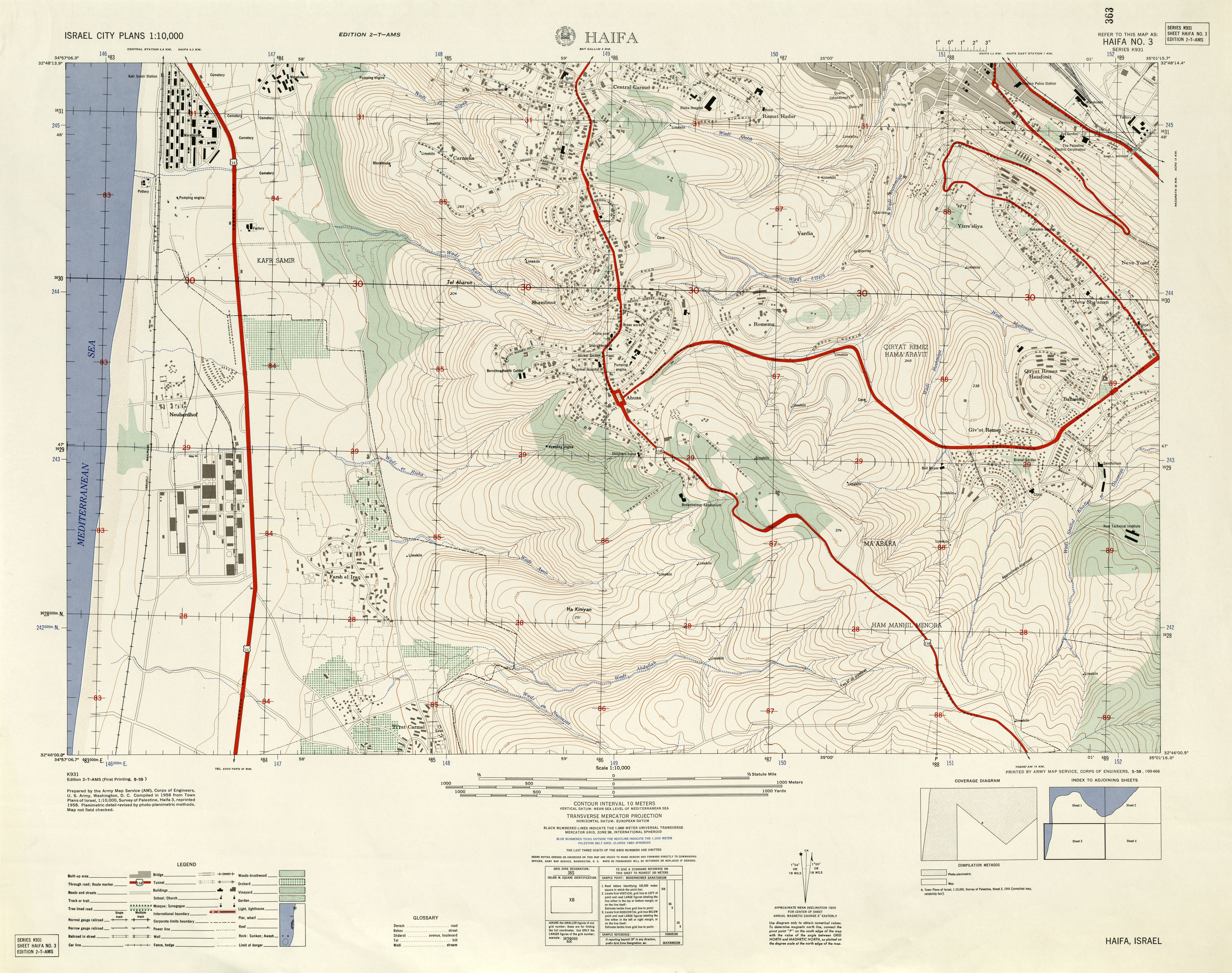
- Haifa Southwest Haifa No. 3, 1:10,000, Edition 2-T-AMS, Series K931. U.S. Army Map Service, 1958 (4.1MB)
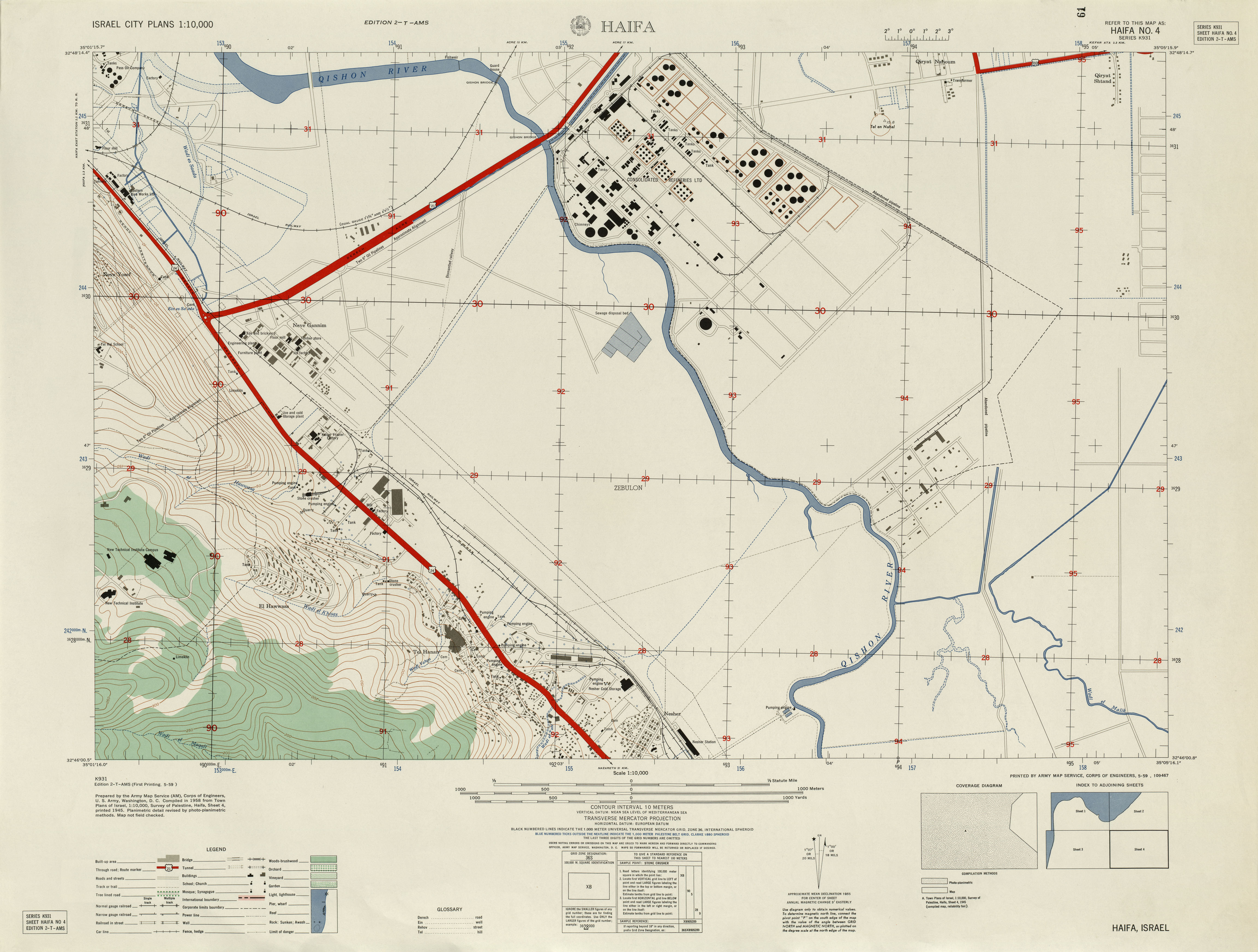
- Haifa Southeast Haifa No. 4, 1:10,000, Edition 2-T-AMS, Series K931. U.S. Army Map Service, 1958 (2.7MB)
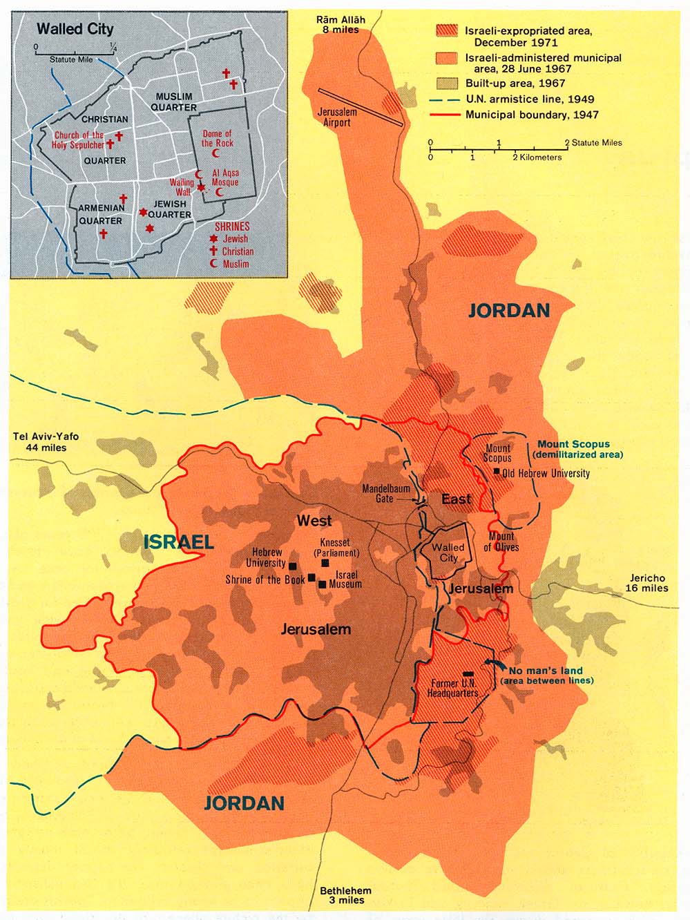
- Jerusalem from Issues in the Middle East, Atlas, U.S. Central Intelligence Agency, 1973 (197K)
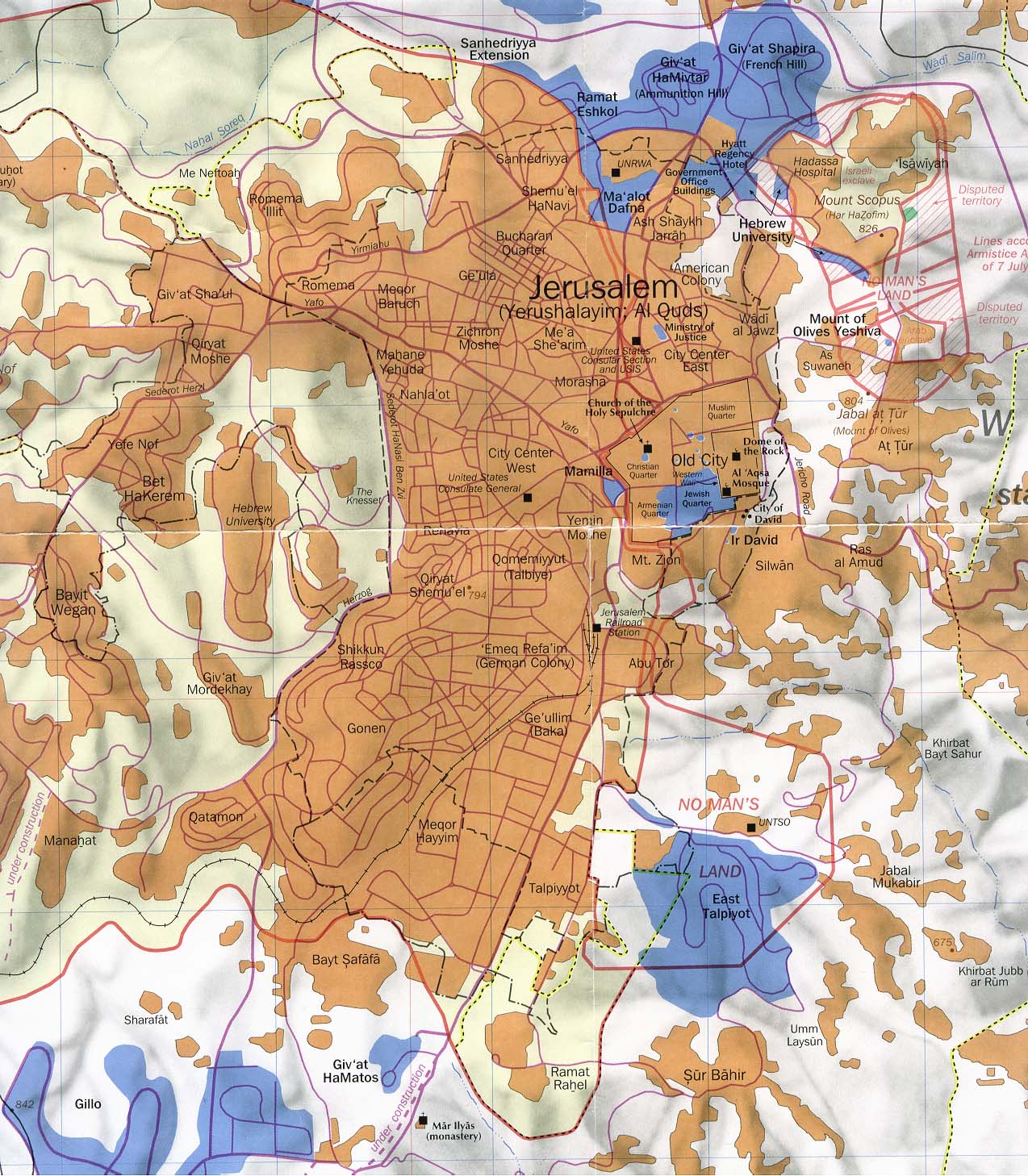
- Jerusalem part of "Jerusalem and Vicinity" March 1993 original scale 1:35,000 (294K)
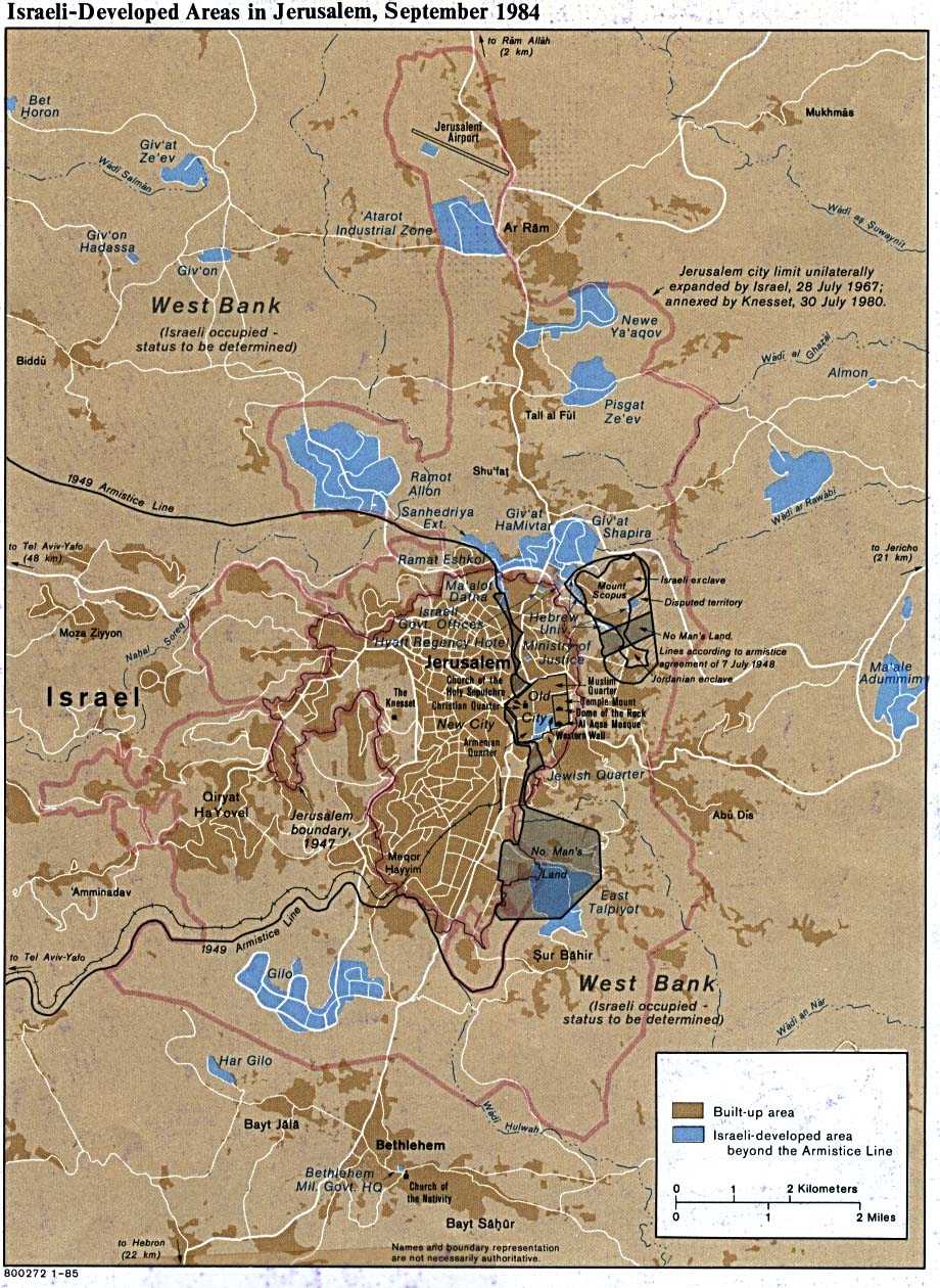
- Jerusalem, Israeli-Developed Areas in 1984 (299K)
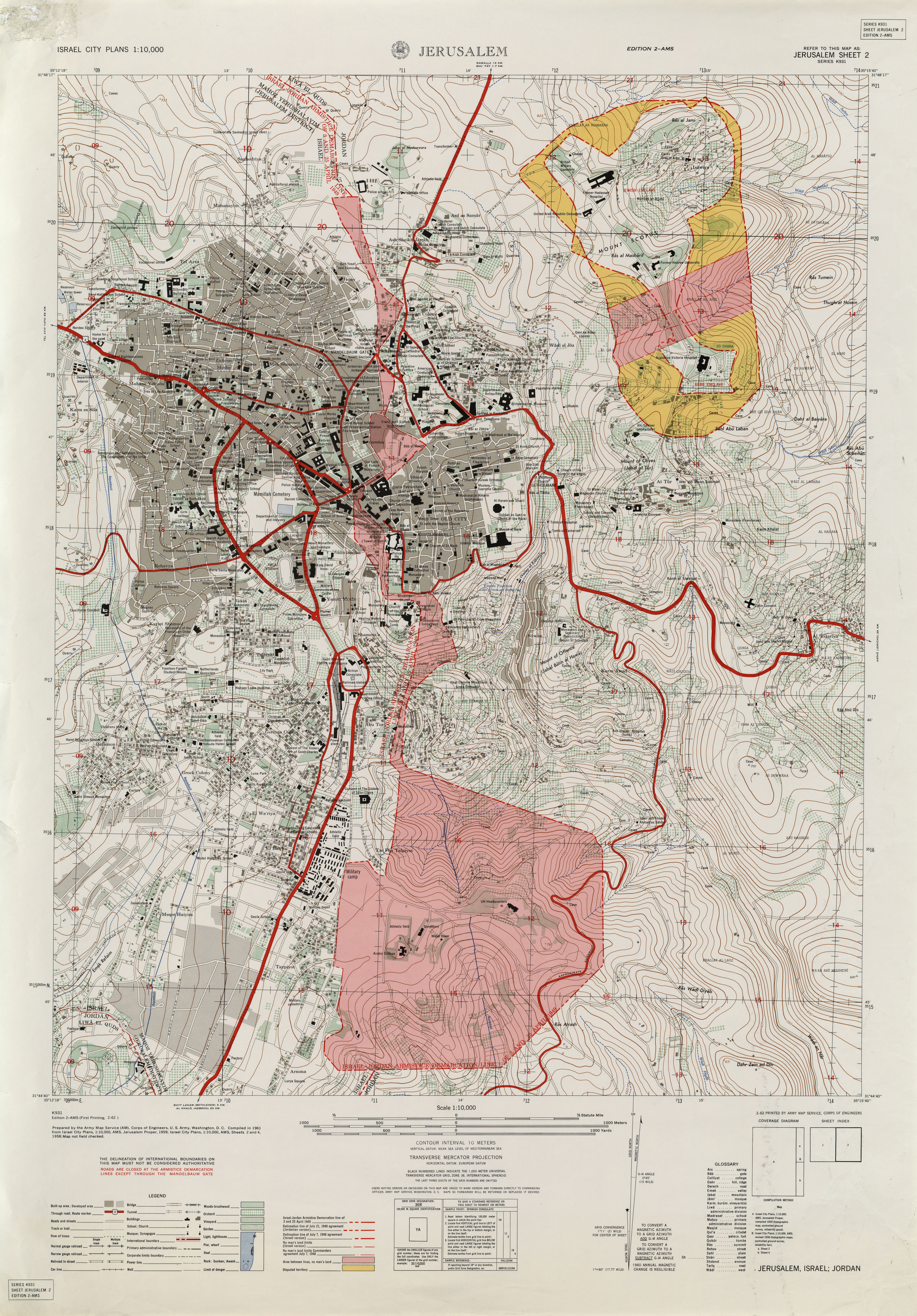
- Jerusalem - East Jerusalem Sheet 2, 1:10,000, Edition 2-AMS, Series K931. U.S. Army Map Service, 1961 (8.6MB)
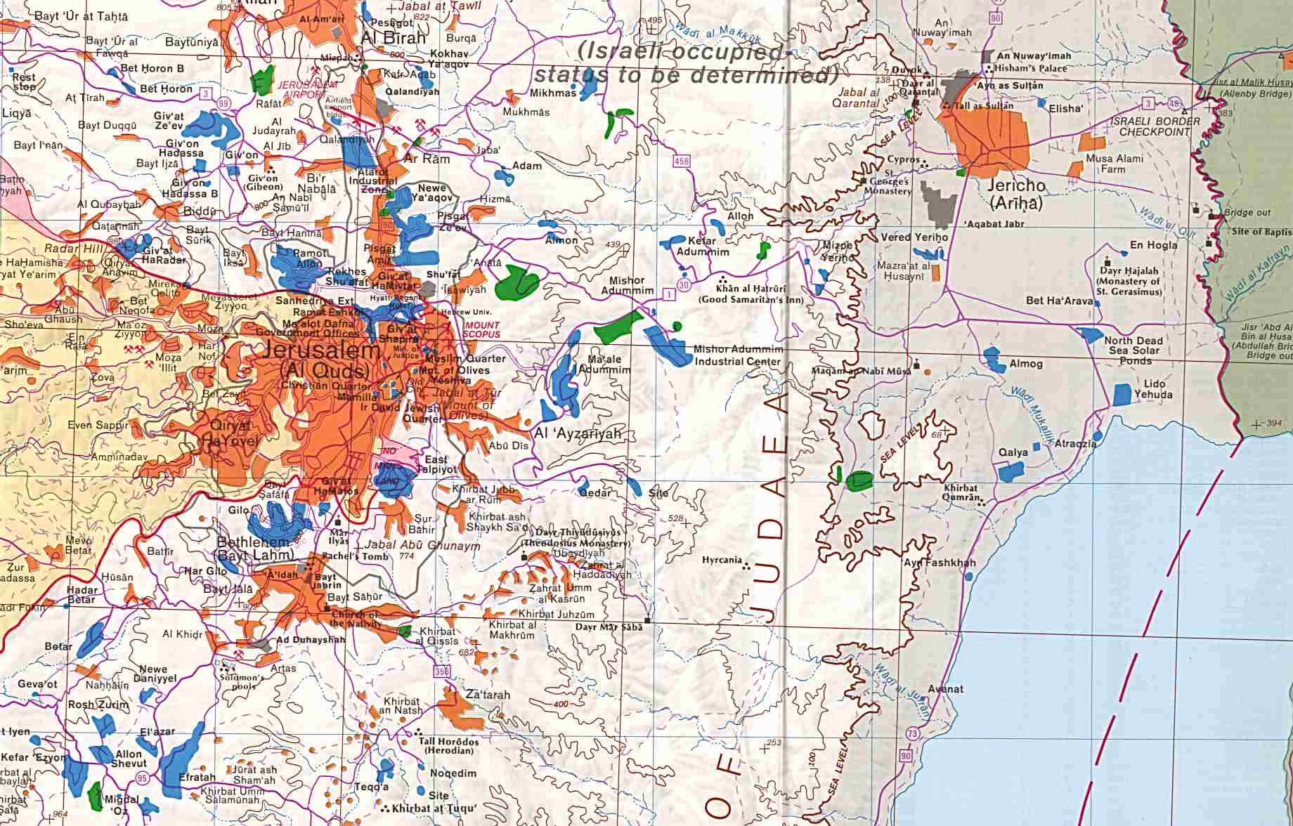
- Jerusalem-Jericho Area original scale 1:150,000 1992 (219K)
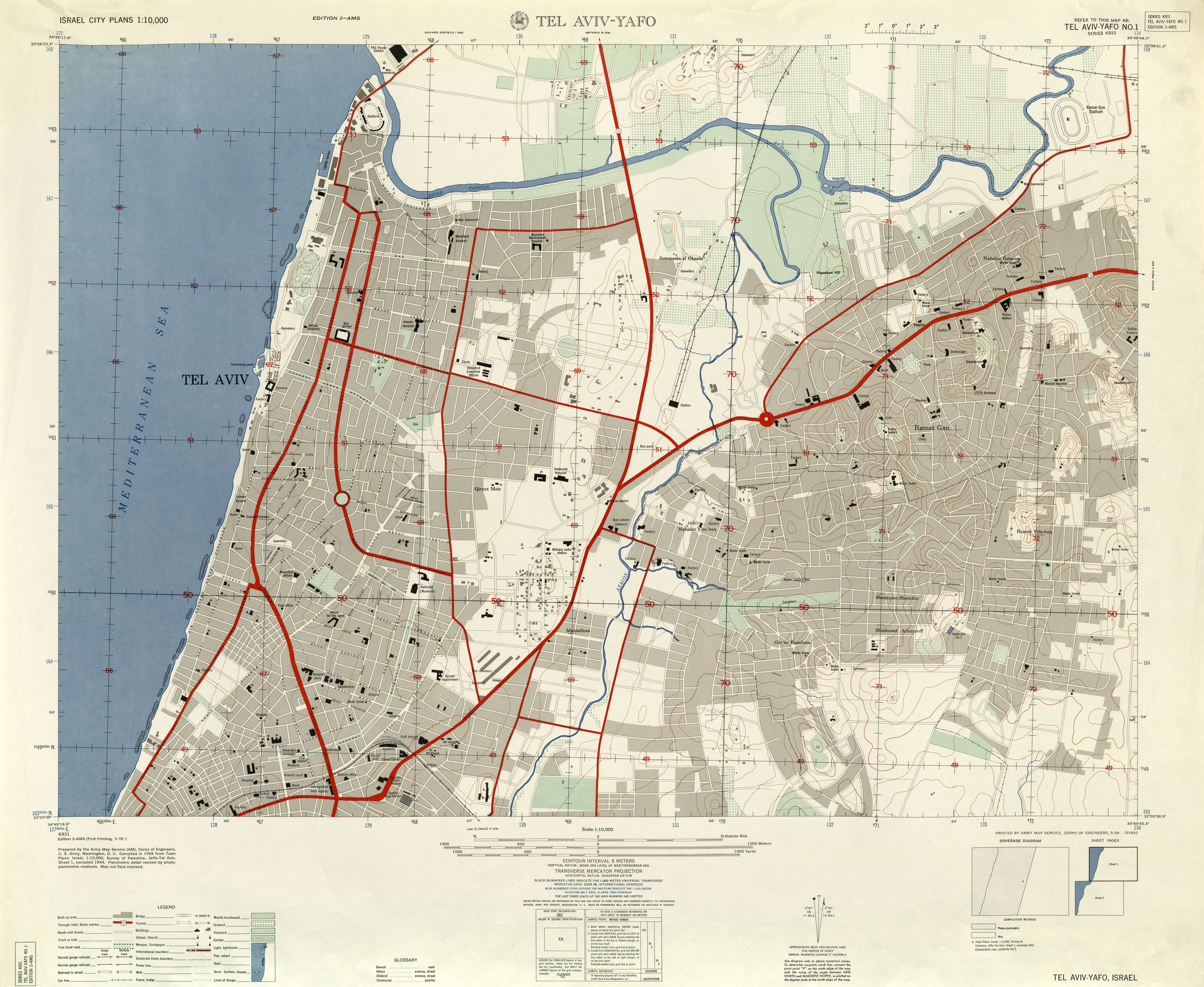
- Tel Aviv-Yafo - North Tel Aviv-Yafo No. 1, 1:10,000, Edition 2-AMS, Series K931. U.S. Army Map Service, 1958 (4.4MB)
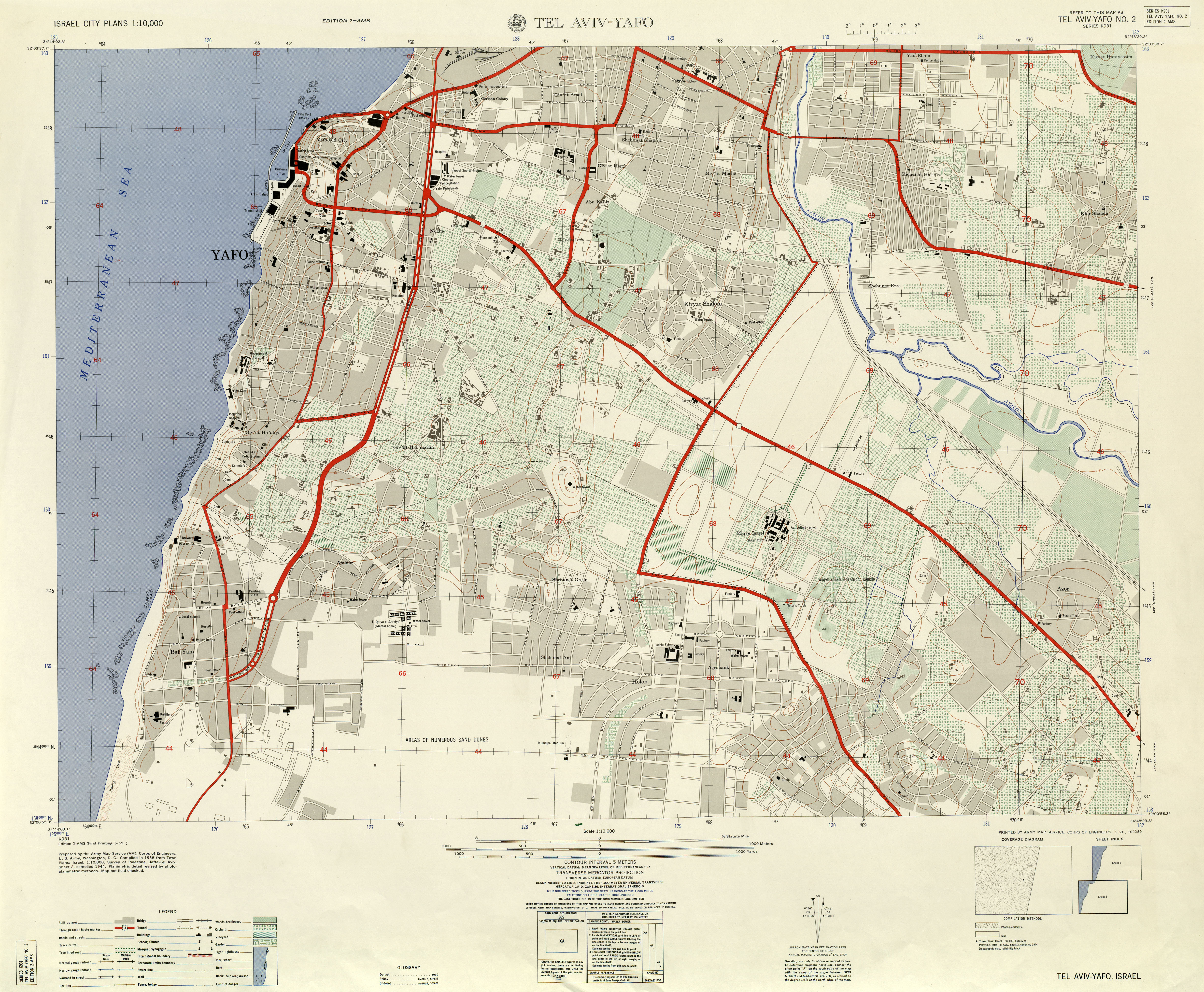
- Tel Aviv-Yafo - South Tel Aviv-Yafo No. 2, 1:10,000, Edition 2-AMS, Series K931. U.S. Army Map Service, 1958 (5MB)
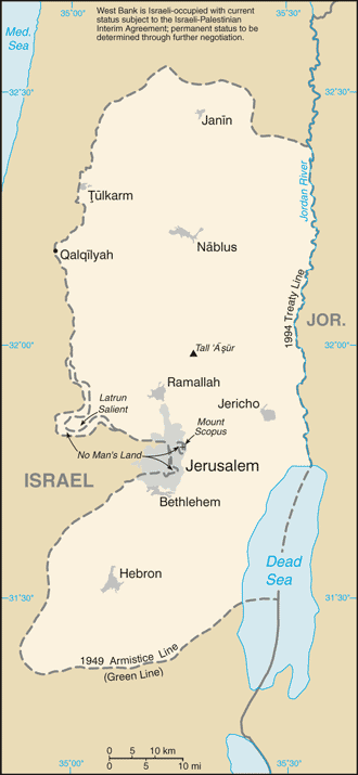
- West Bank (Small Map) 2013 (27K)
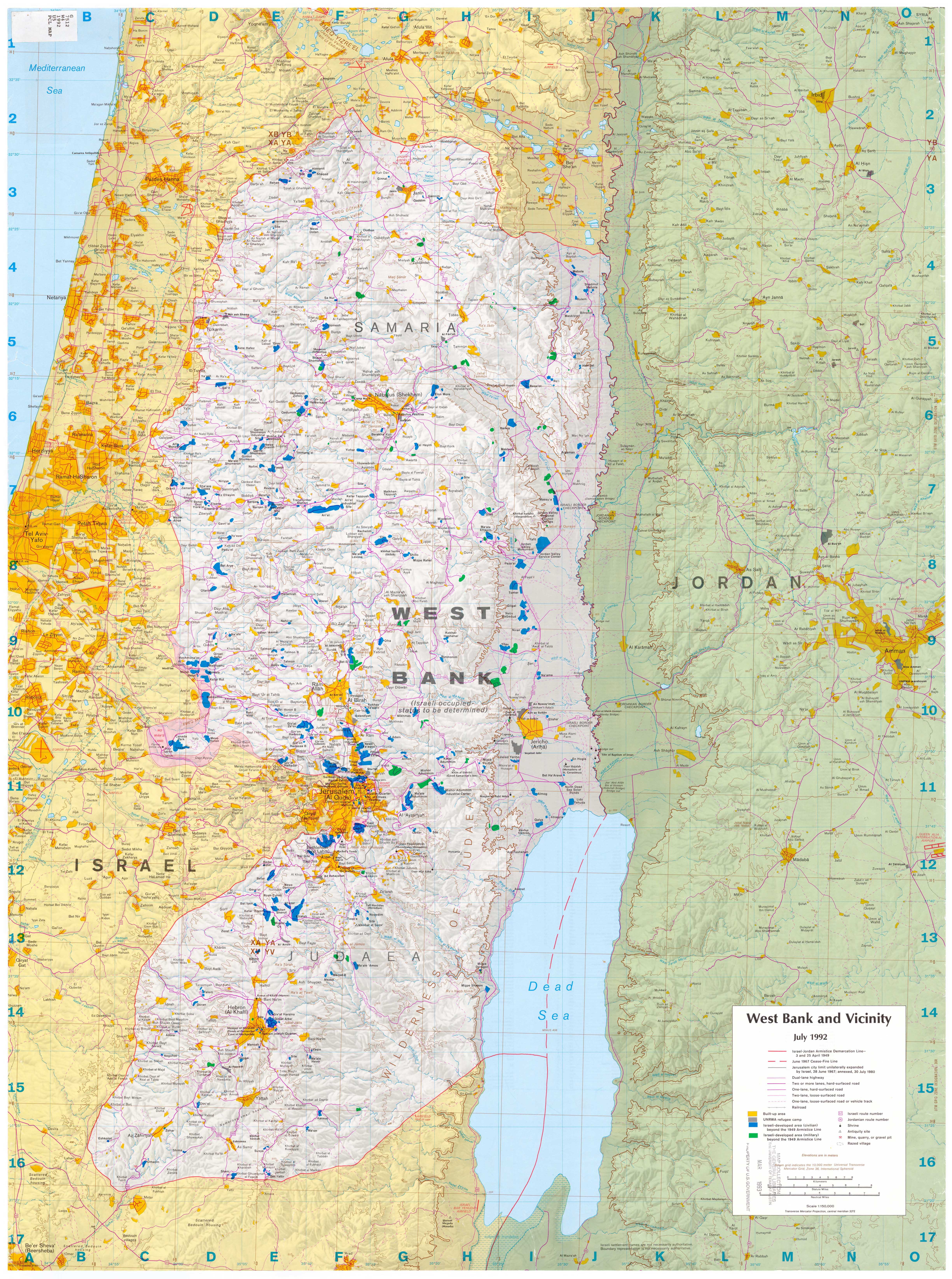
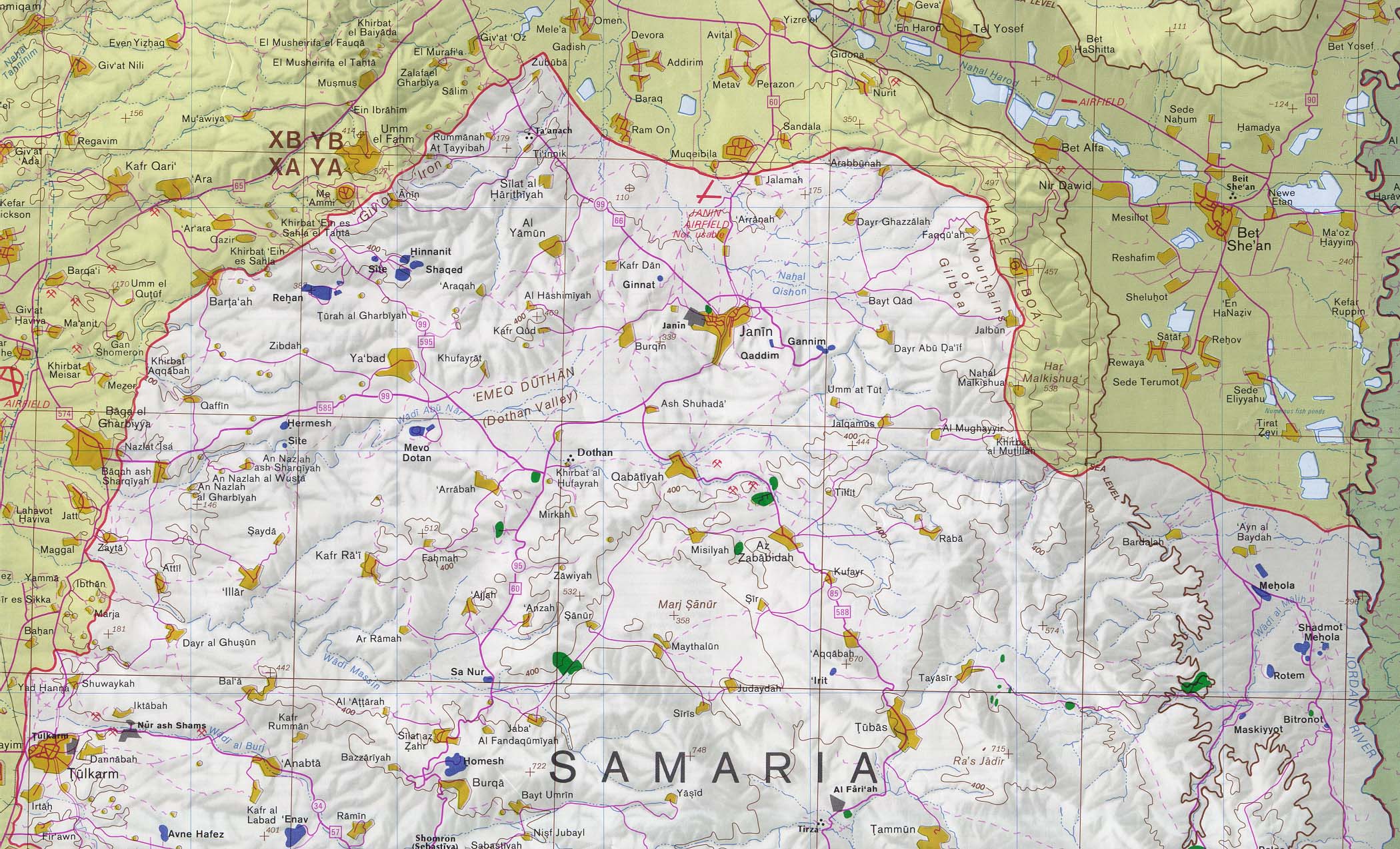
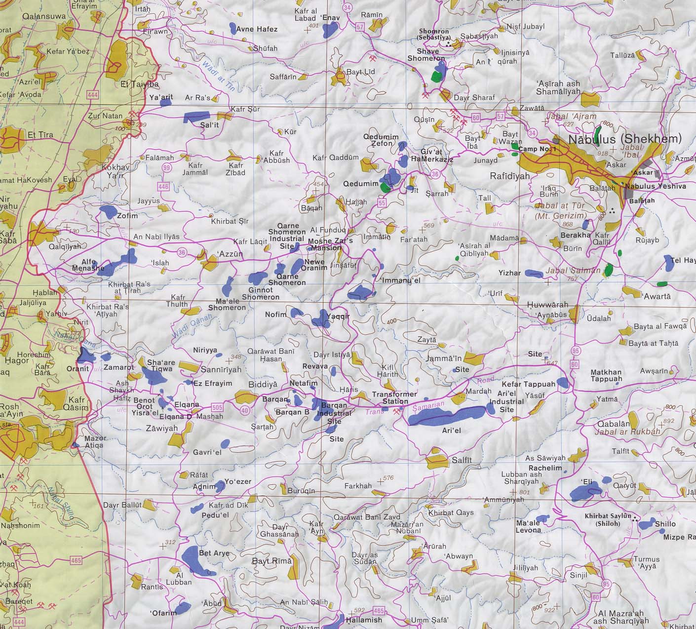
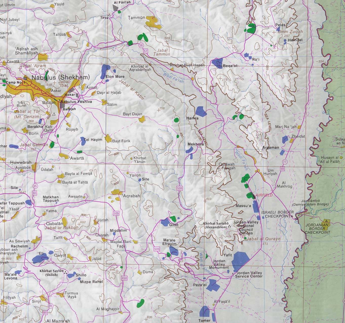
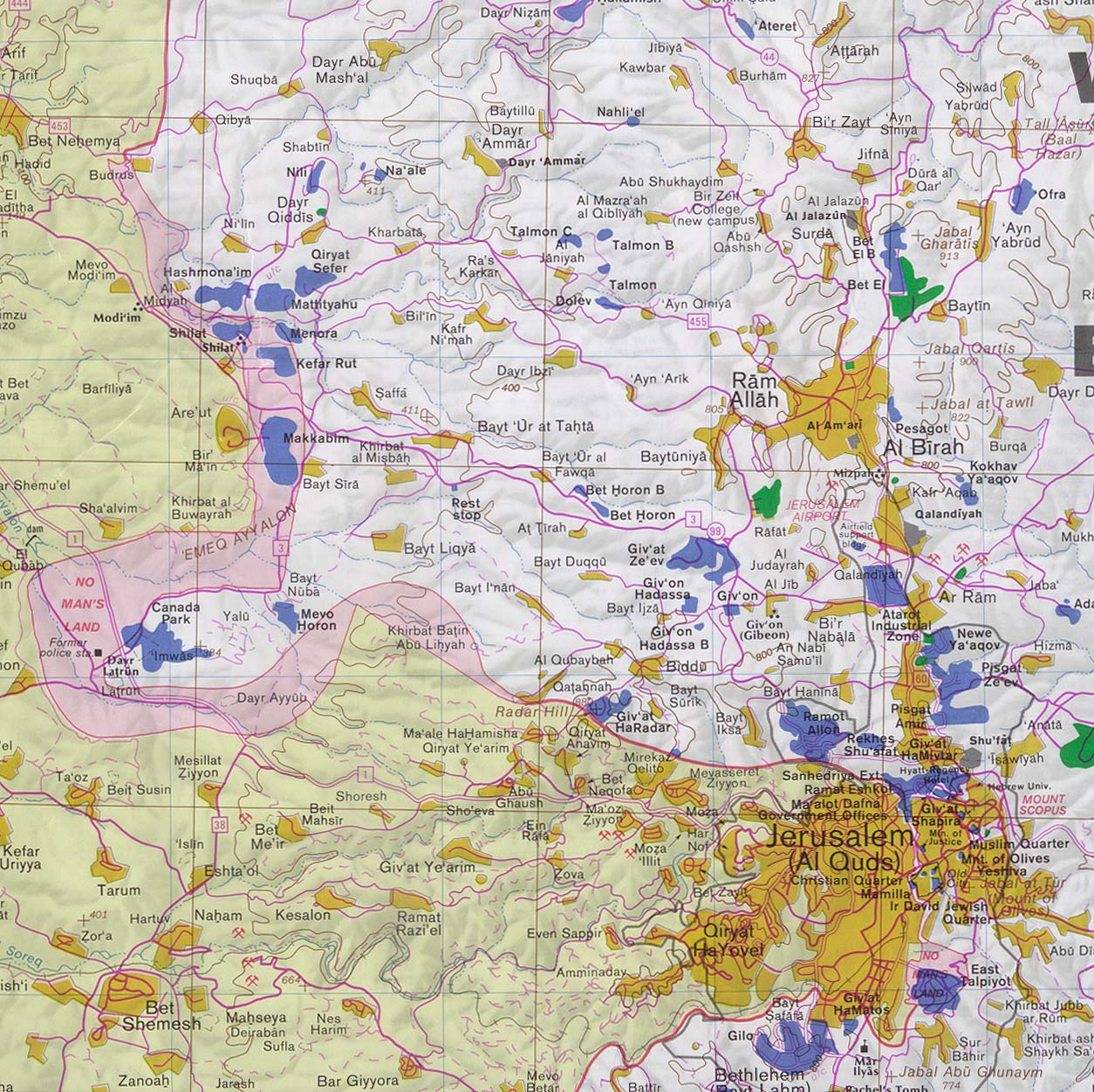
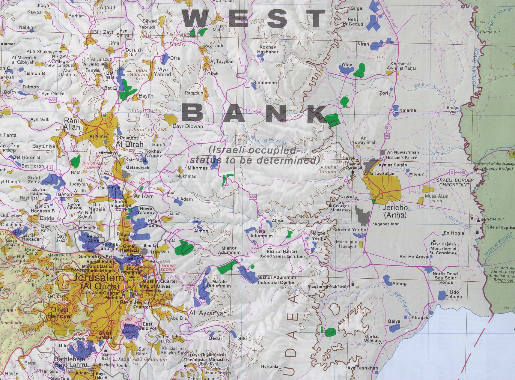
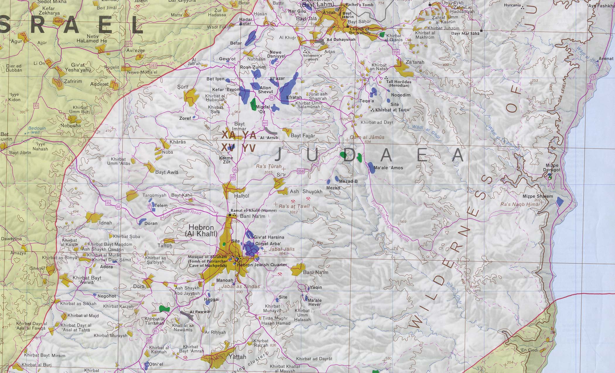
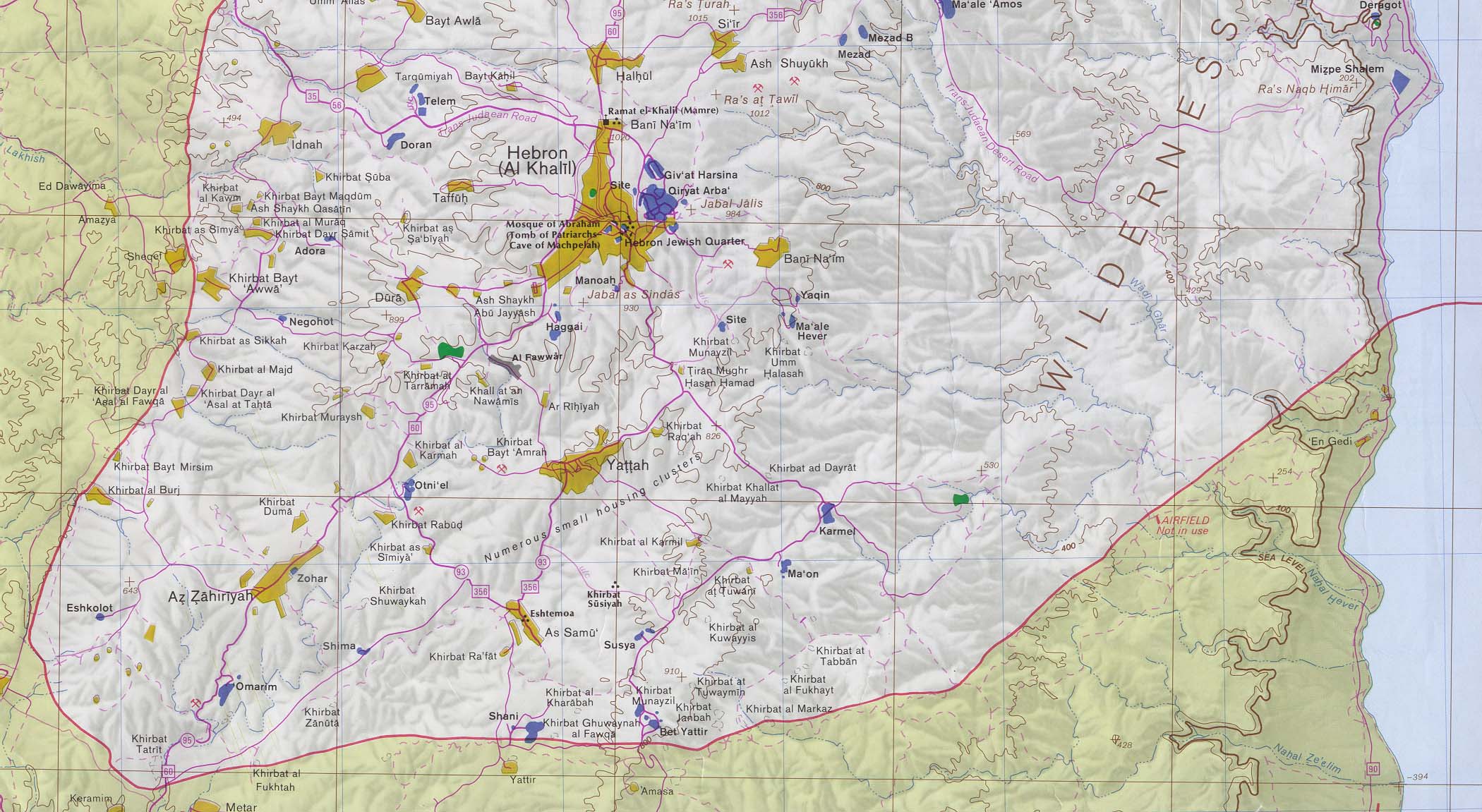
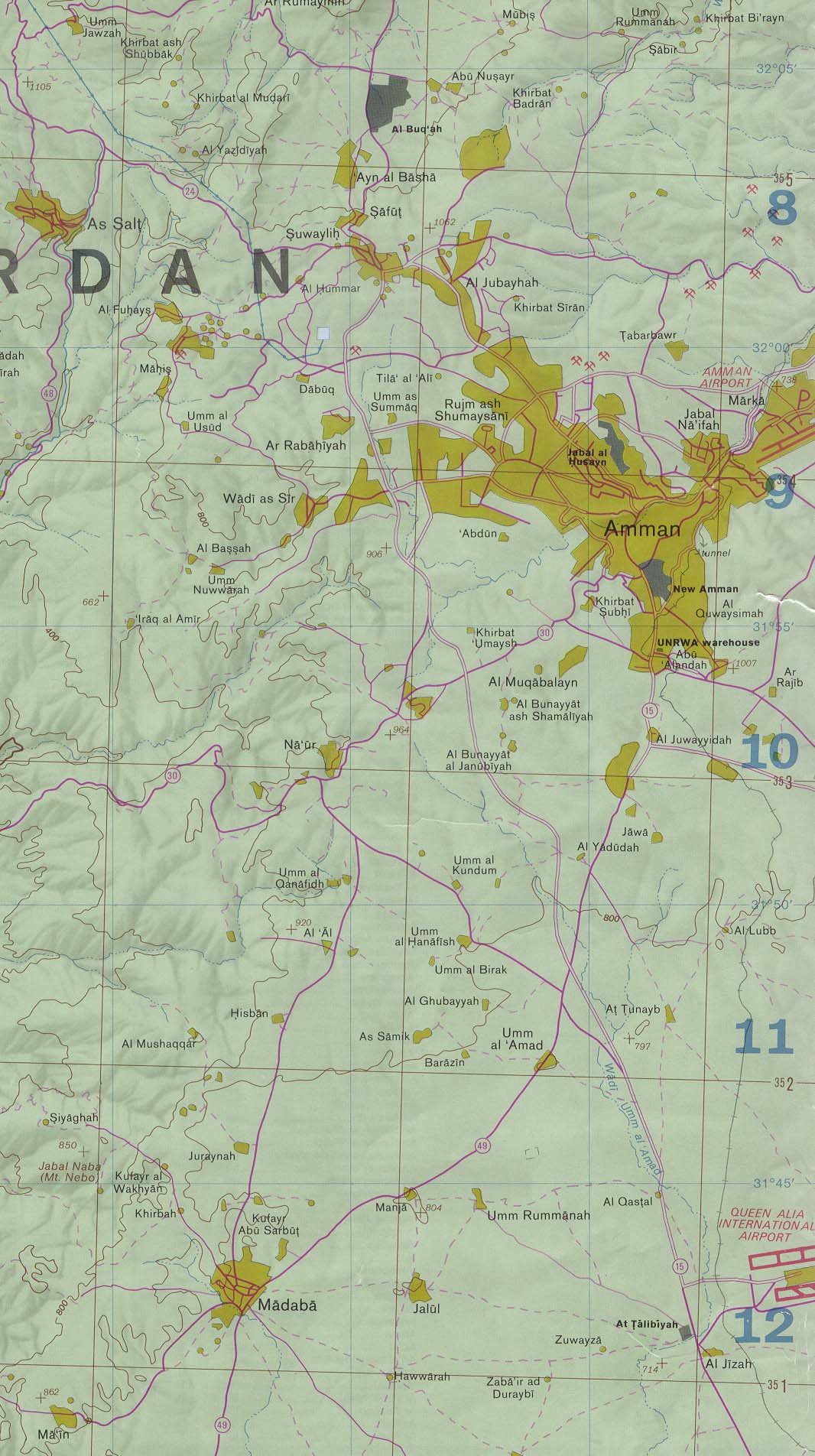
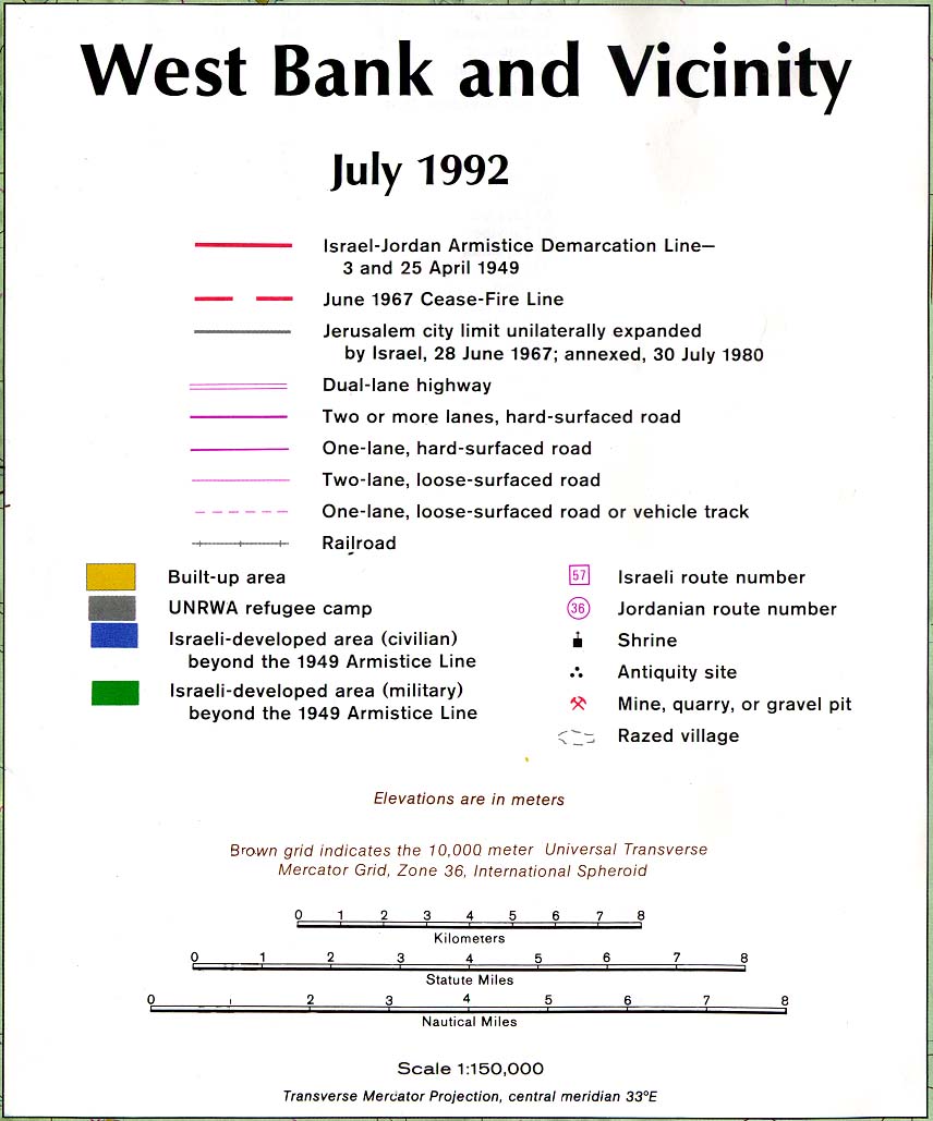
- West Bank and Vicinity 1:150,000, Central Intelligence Agency, July 1992 (3.5MB) and sections of this map: West Bank - Far North (North of Nabulus) (547K), West Bank - Nabulus and West (370K), West Bank - Nabulus and East (306K), West Bank - Jerusalem and West (includes Ramallah) (407K), West Bank - Jerusalem and East (includes Jericho) (420K), West Bank - Bethlehem and South (includes Hebron) (469K), West Bank - Far South Including Hebron (388K), Amman, Jordan Region (278K) and Map Legend and Scale
- [West Bank] Map shows Jerusalem, Northern Dead Sea, adjacent West Bank and Amman, Jordan (topographic map in Russian) original scale 1:200,000. Soviet General Staff sheet H-36-VI, 1985 (2.4MB)
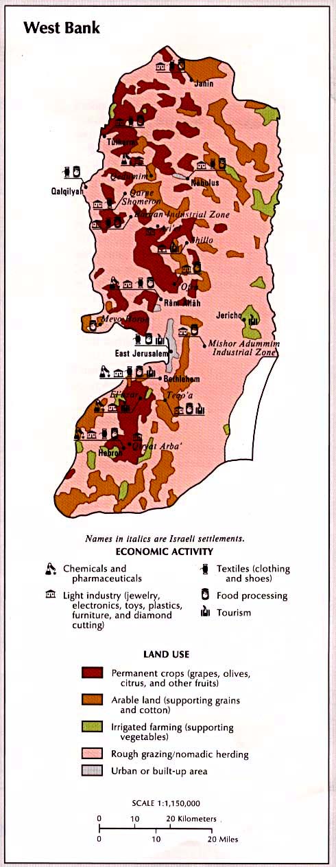
- West Bank - Economic Activity and Land Use (103k) from Atlas of the Middle East (U.S. Central Intelligence Agency, January 1993)
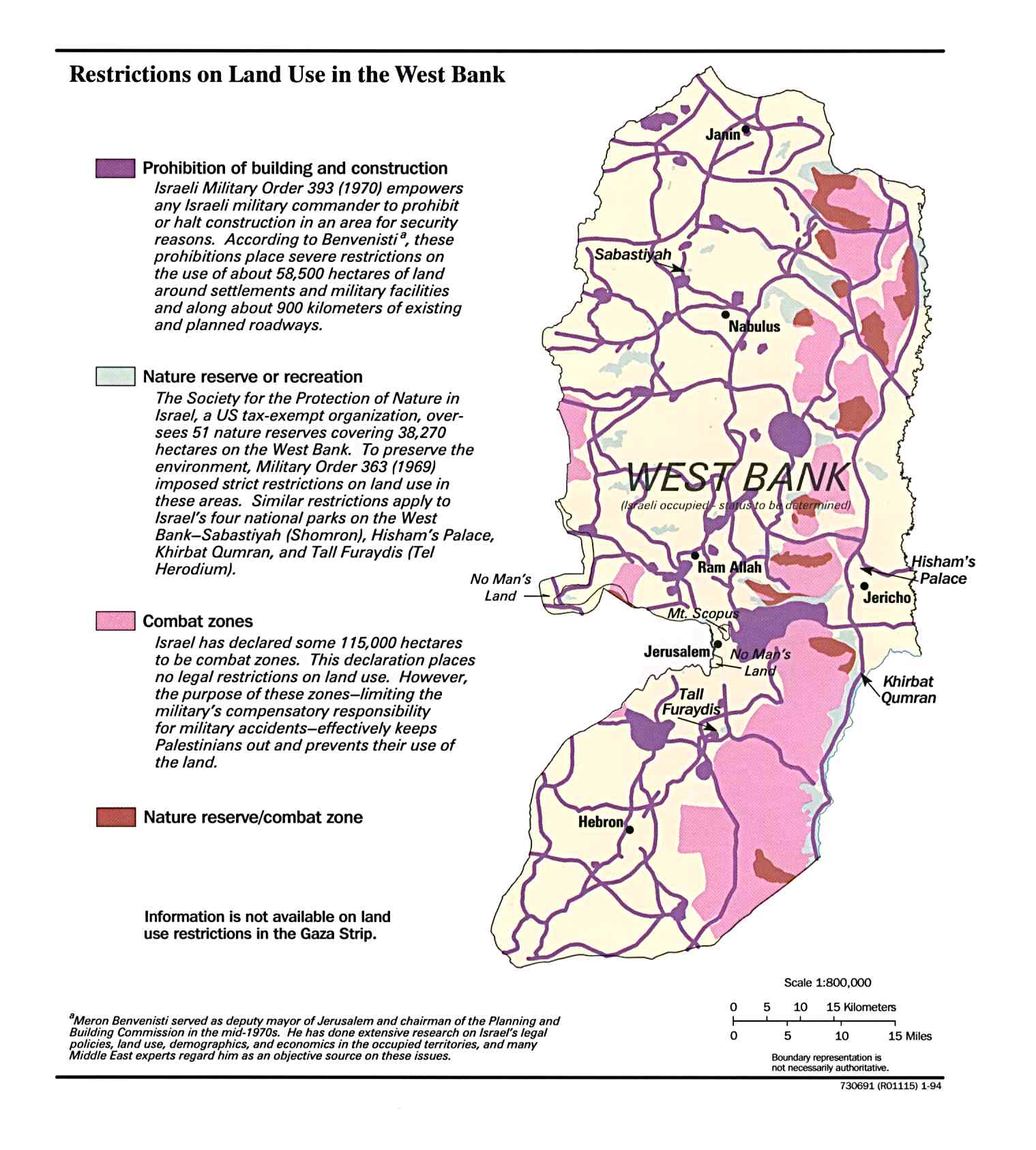
- West Bank - Restrictions on Land Use in December 1993 (191K)
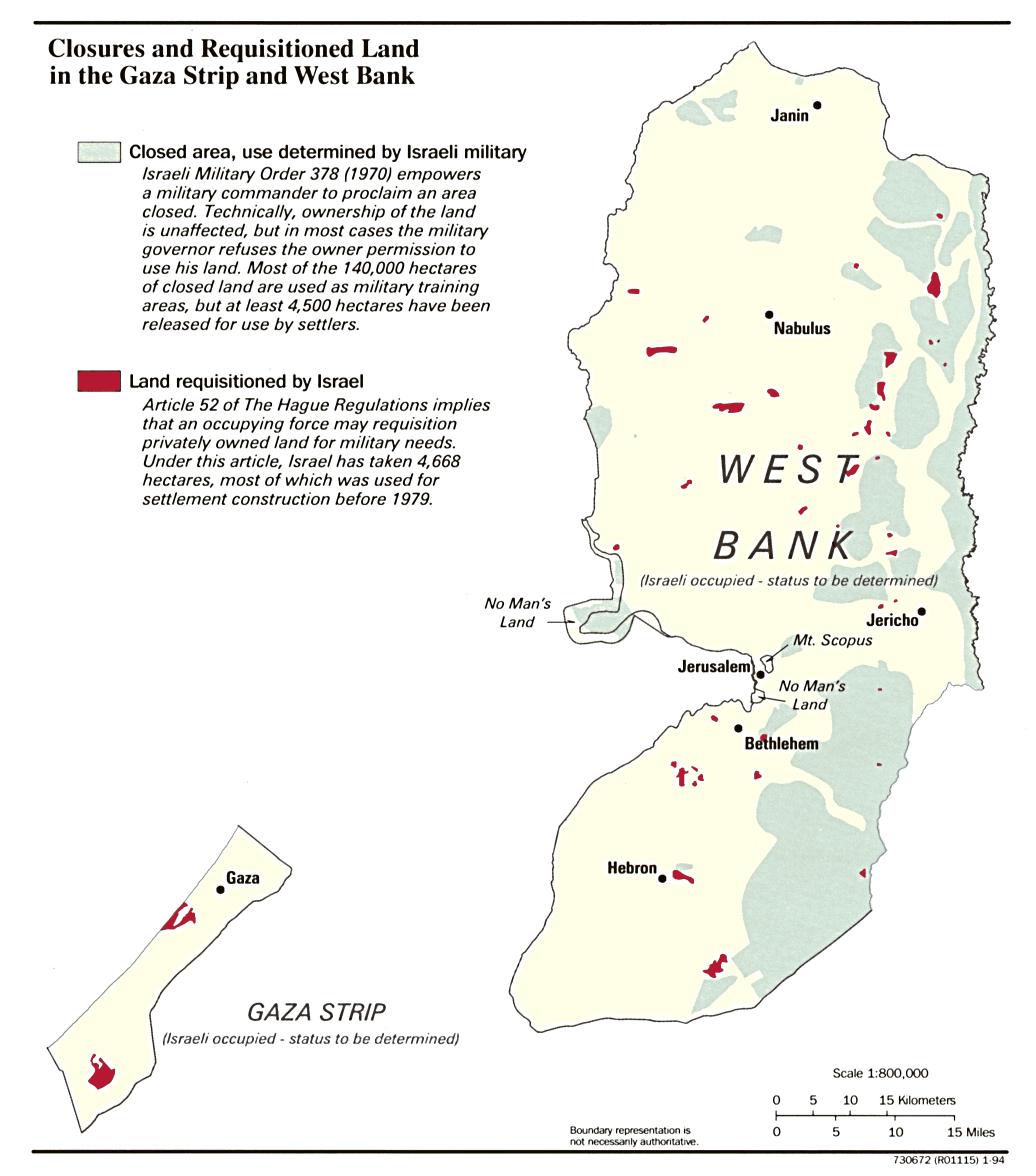
- Gaza Strip and the West Bank, Closures and Requisitioned Land in January 1994 (339K)
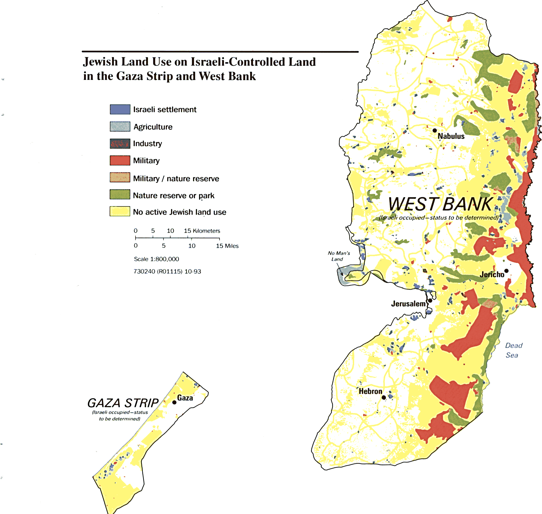
- Gaza Strip and the West Bank, Jewish Land Use on Israeli-Controlled Land in October 1993 (235K)
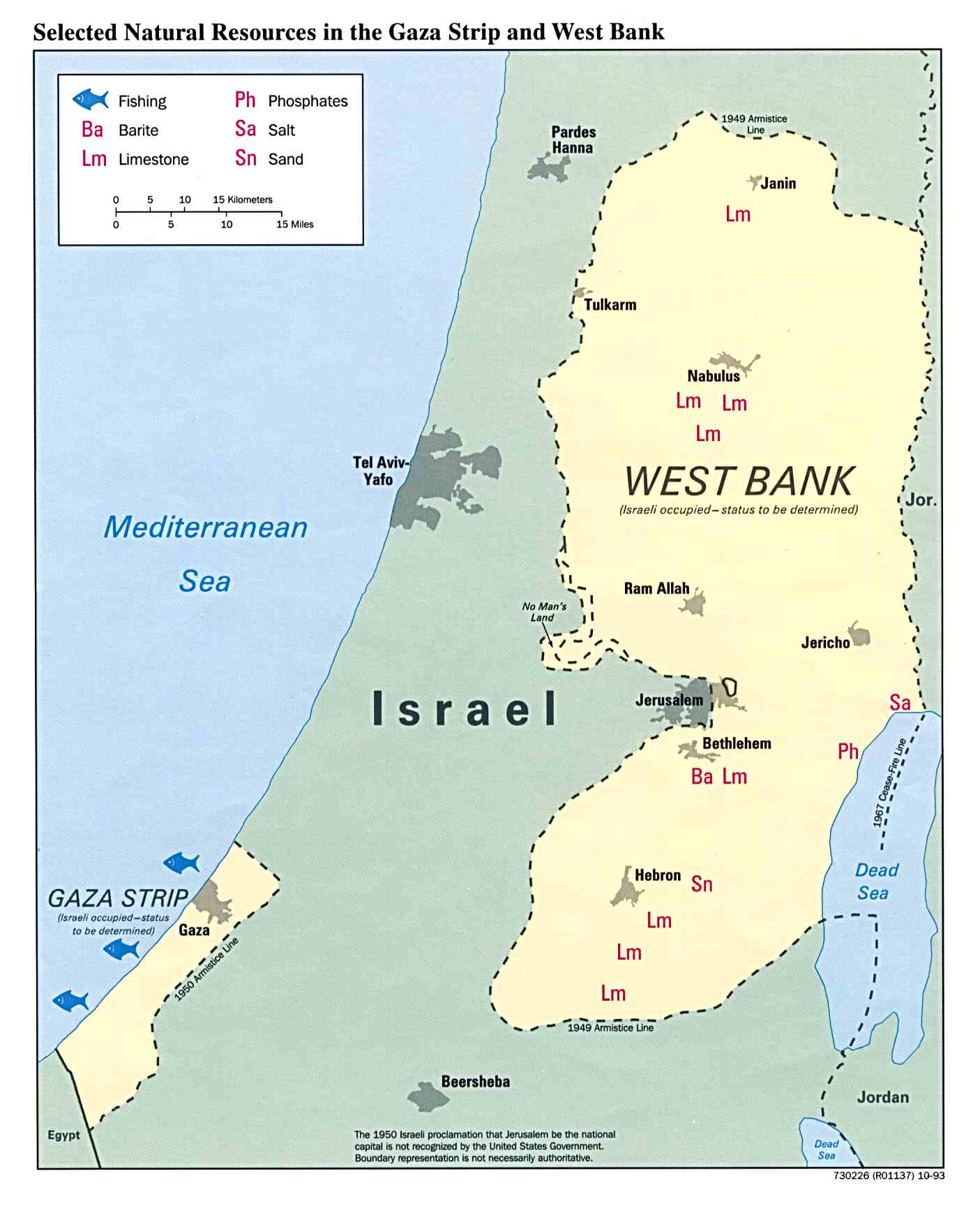
- Gaza Strip and the West Bank, Selected Natural Resources January 1994 (134K)
- Israeli Settlements in the West Bank 1993 (216K)
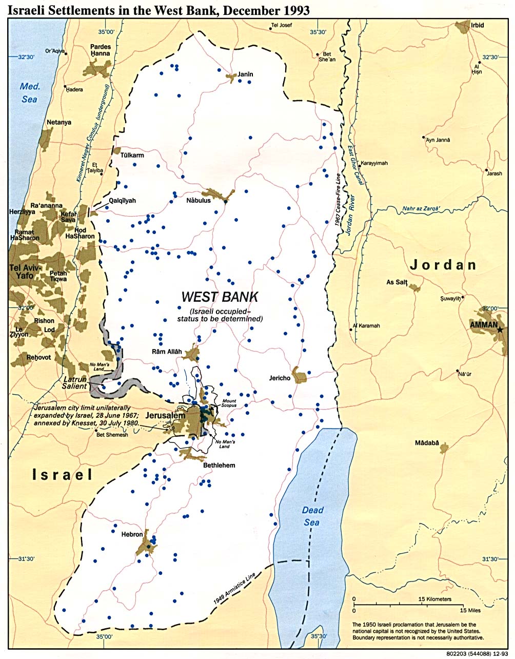
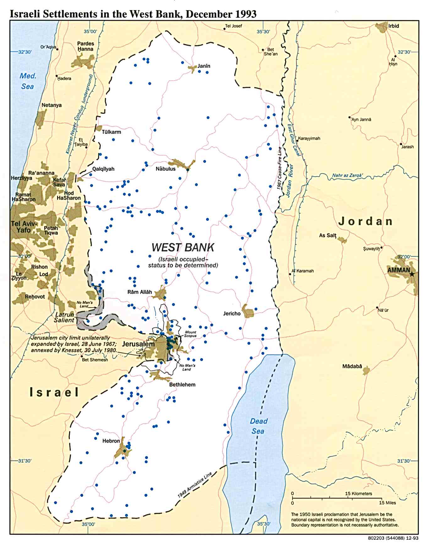
- Israeli Settlements in the West Bank December 1993 (156K)
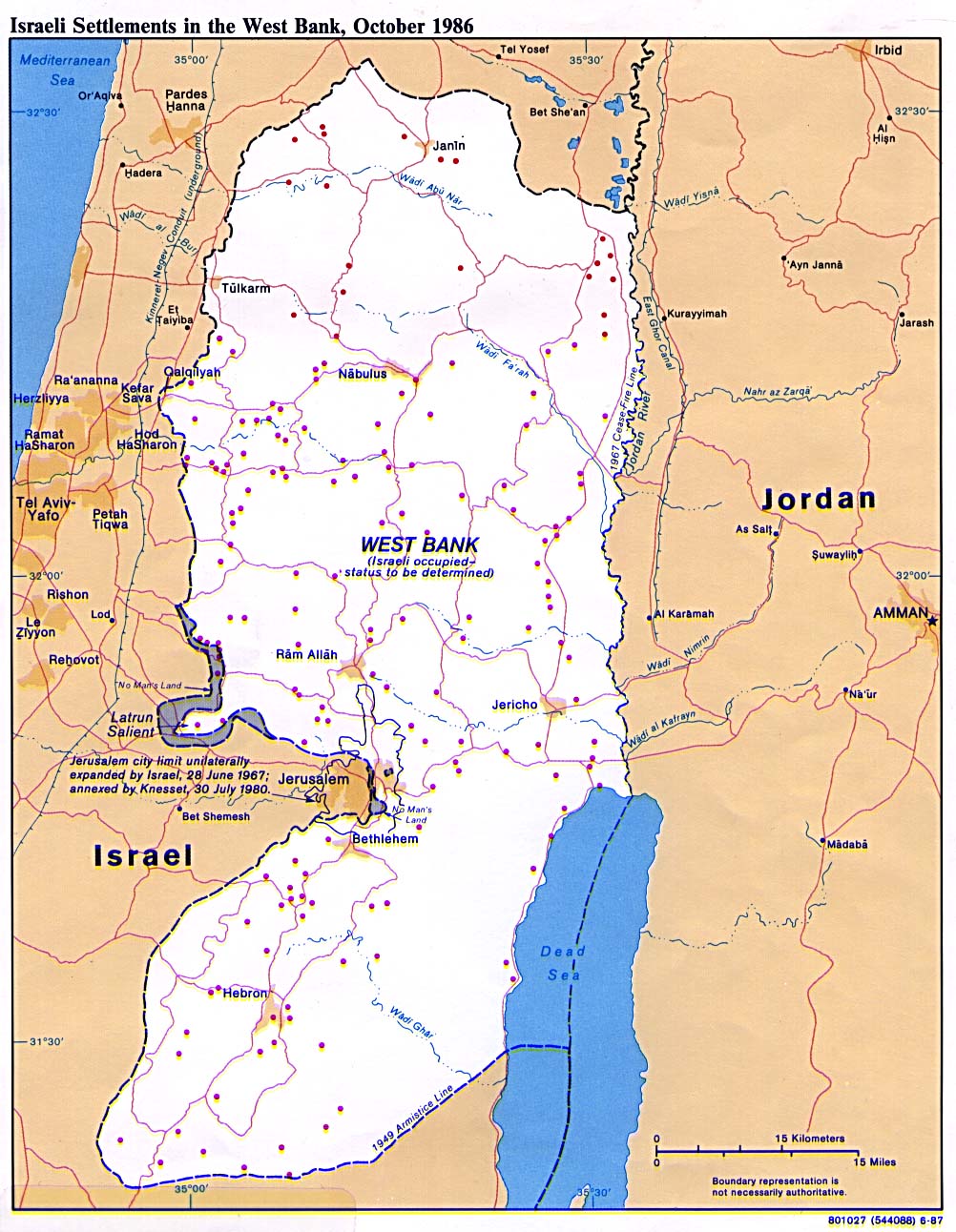
- Israeli Settlements in the West Bank 1986 (256K)
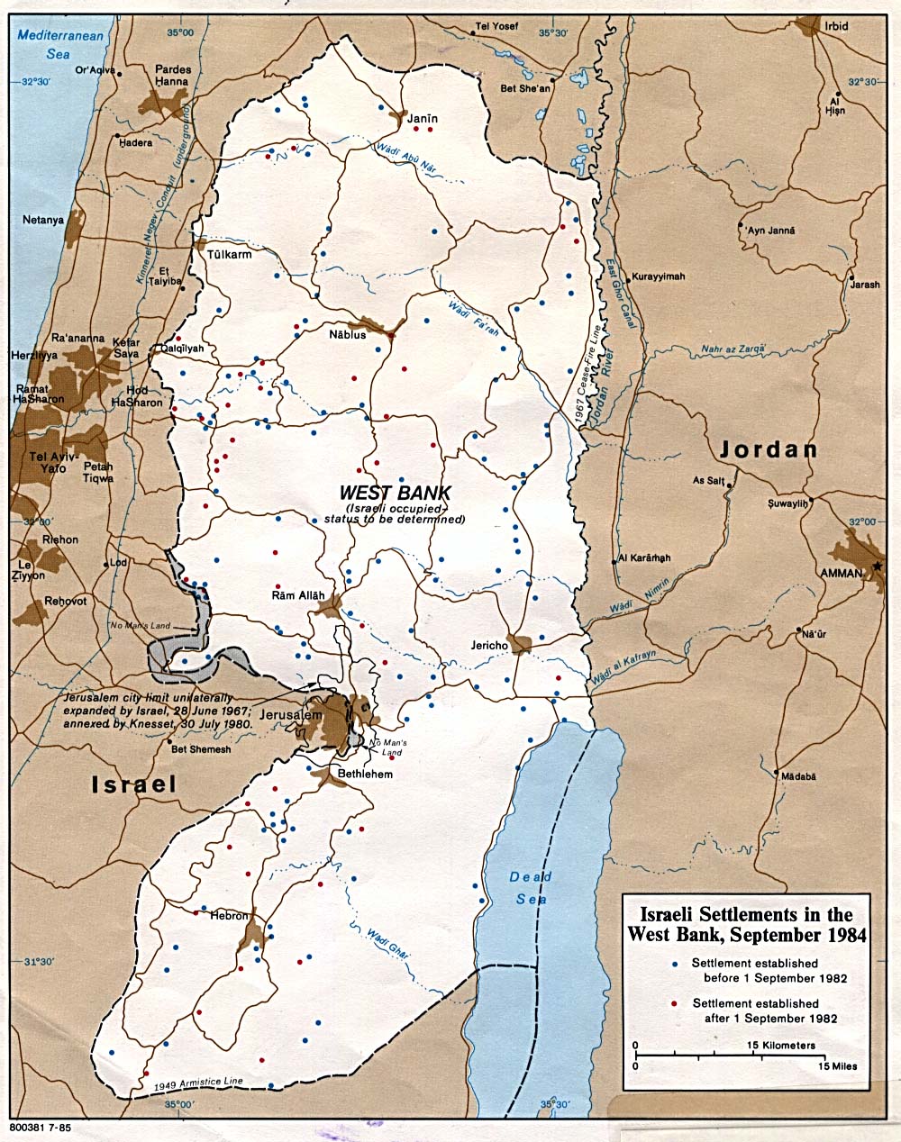
- Israeli Settlements in the West Bank 1985 (278K)
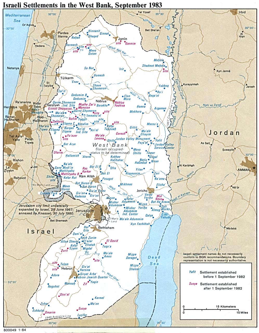
- Israeli Settlements in the West Bank 1983 (289K)
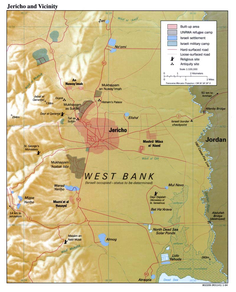
- Jericho and Vicinity January 1994 (294K)
- West Bank Maps on Other Web Sites
![[West Bank]](middle_east_and_asia/amman_1985.jpg)
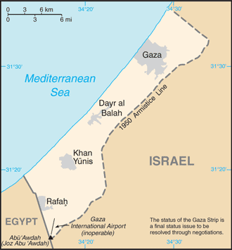
- Gaza Strip (Small Map) 2013 (16K)
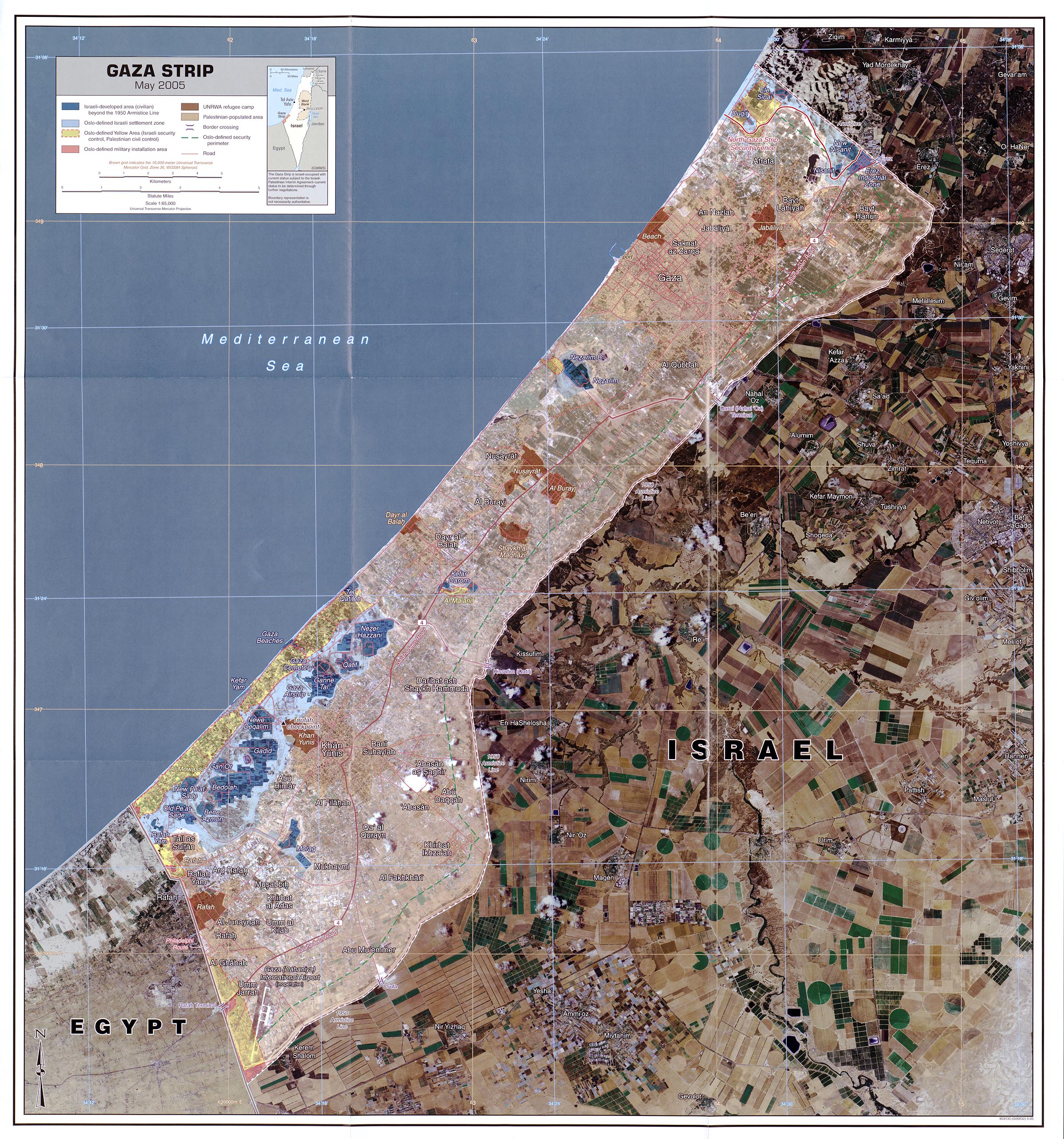
- Gaza Strip May 2005, scale 1:65,000 (1.4MB)
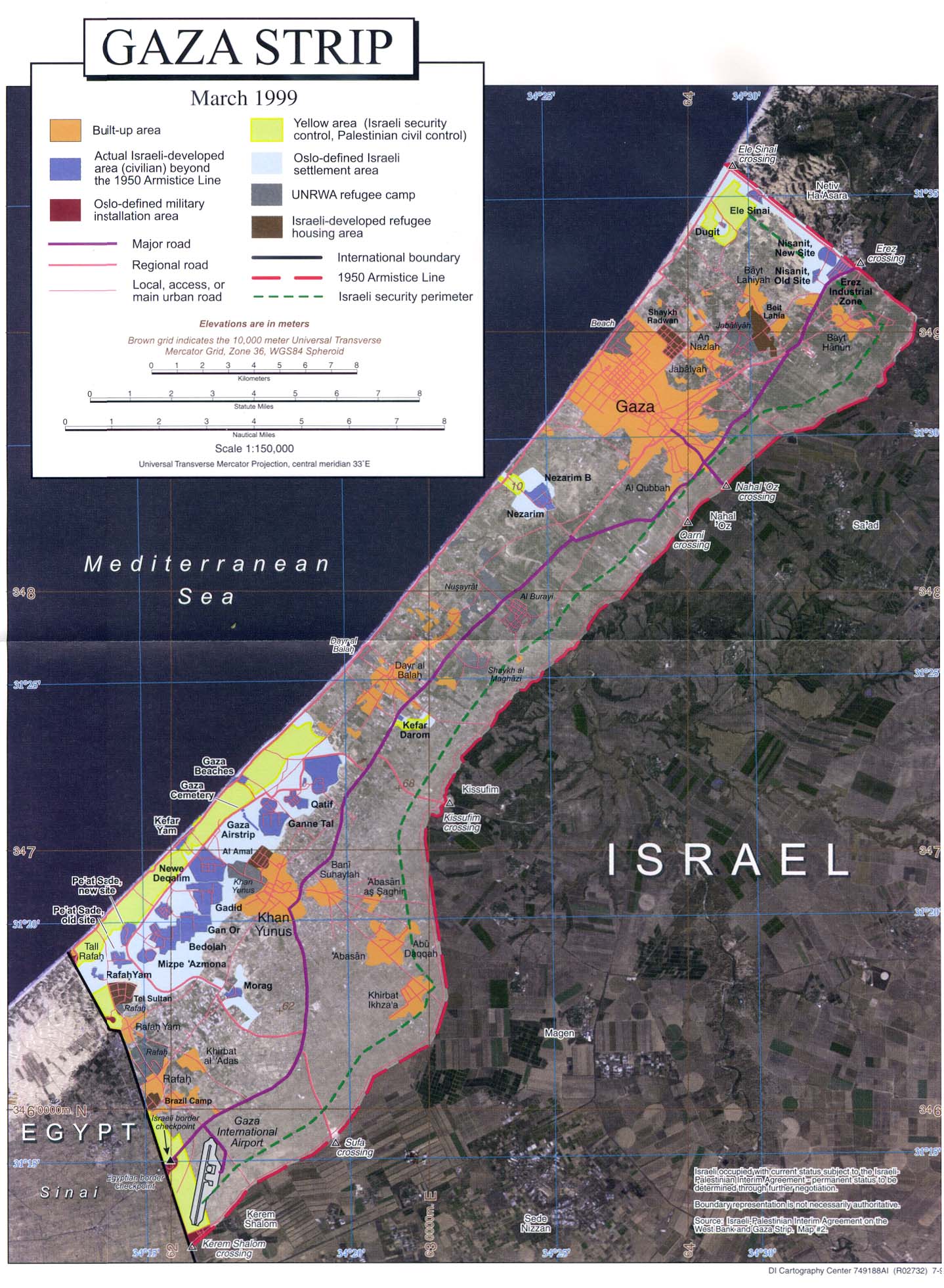
- Gaza Strip July 1999, scale 1:150,000 (364K) Orthophoto map
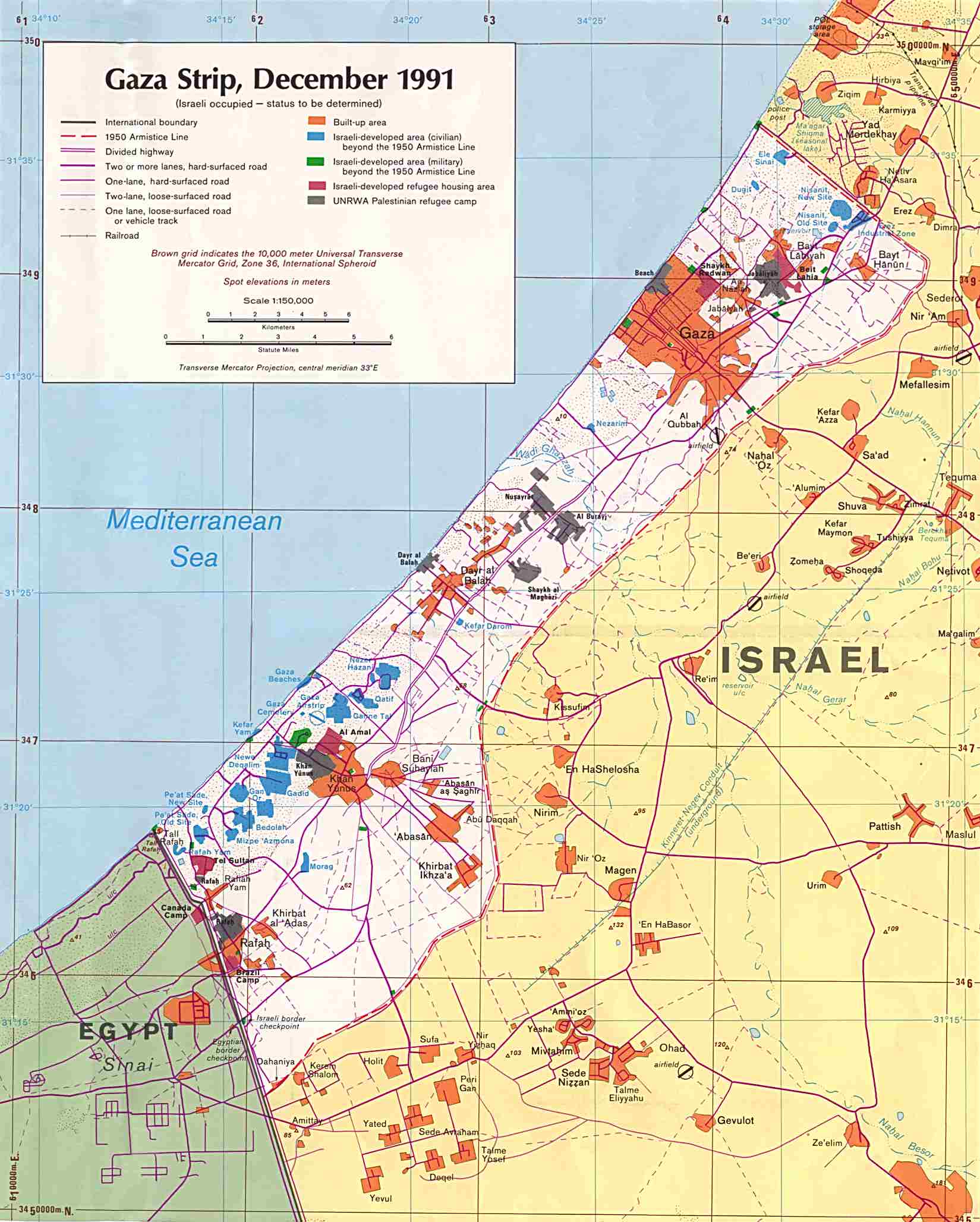
- Gaza Strip December 1991, scale 1:150,000 (238K)
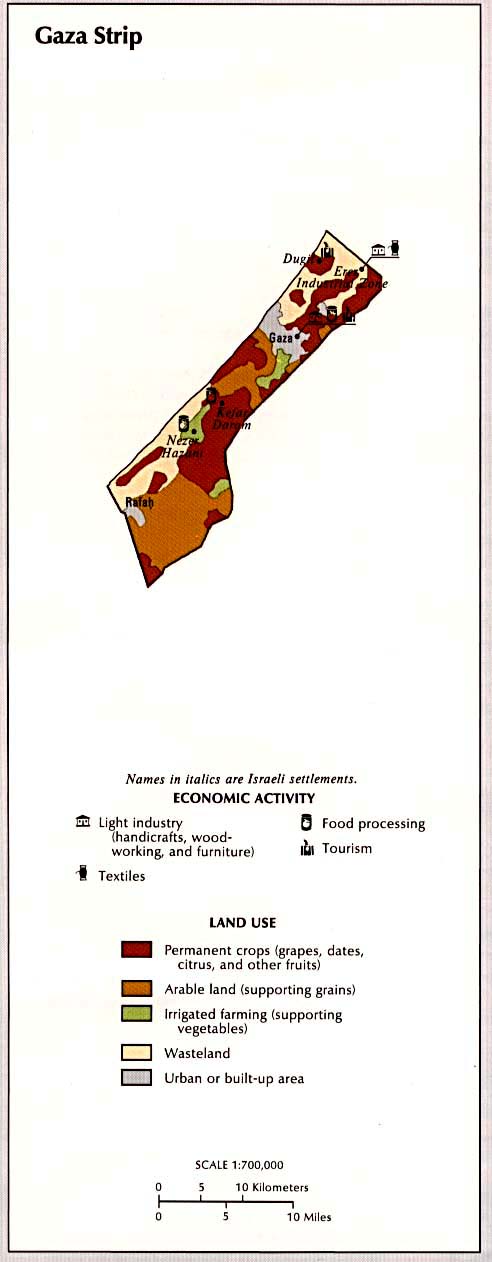
- Gaza Strip - Economic Activity and Land Use January 1993 (57k) from Atlas of the Middle East, U.S. Central Intelligence Agency
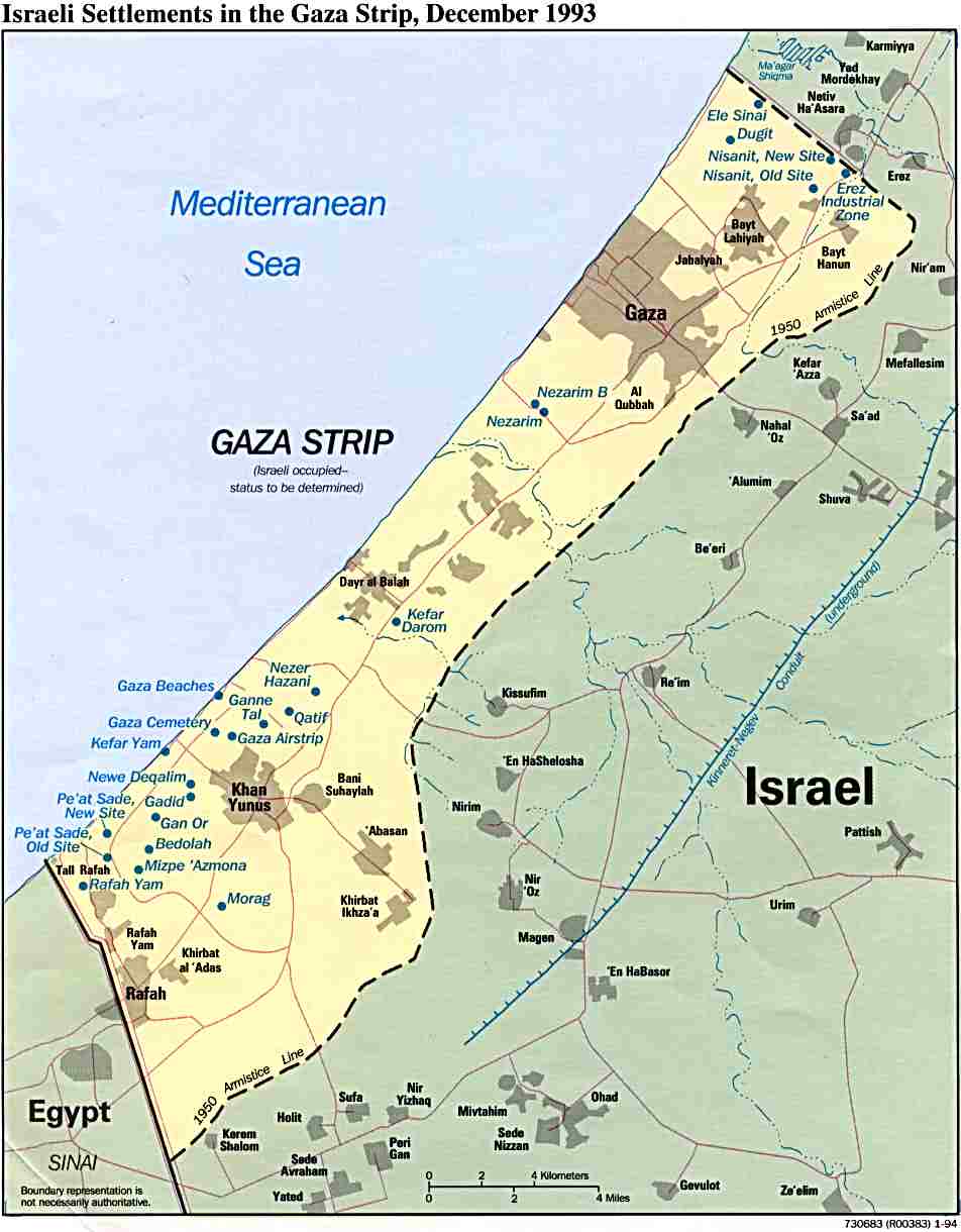
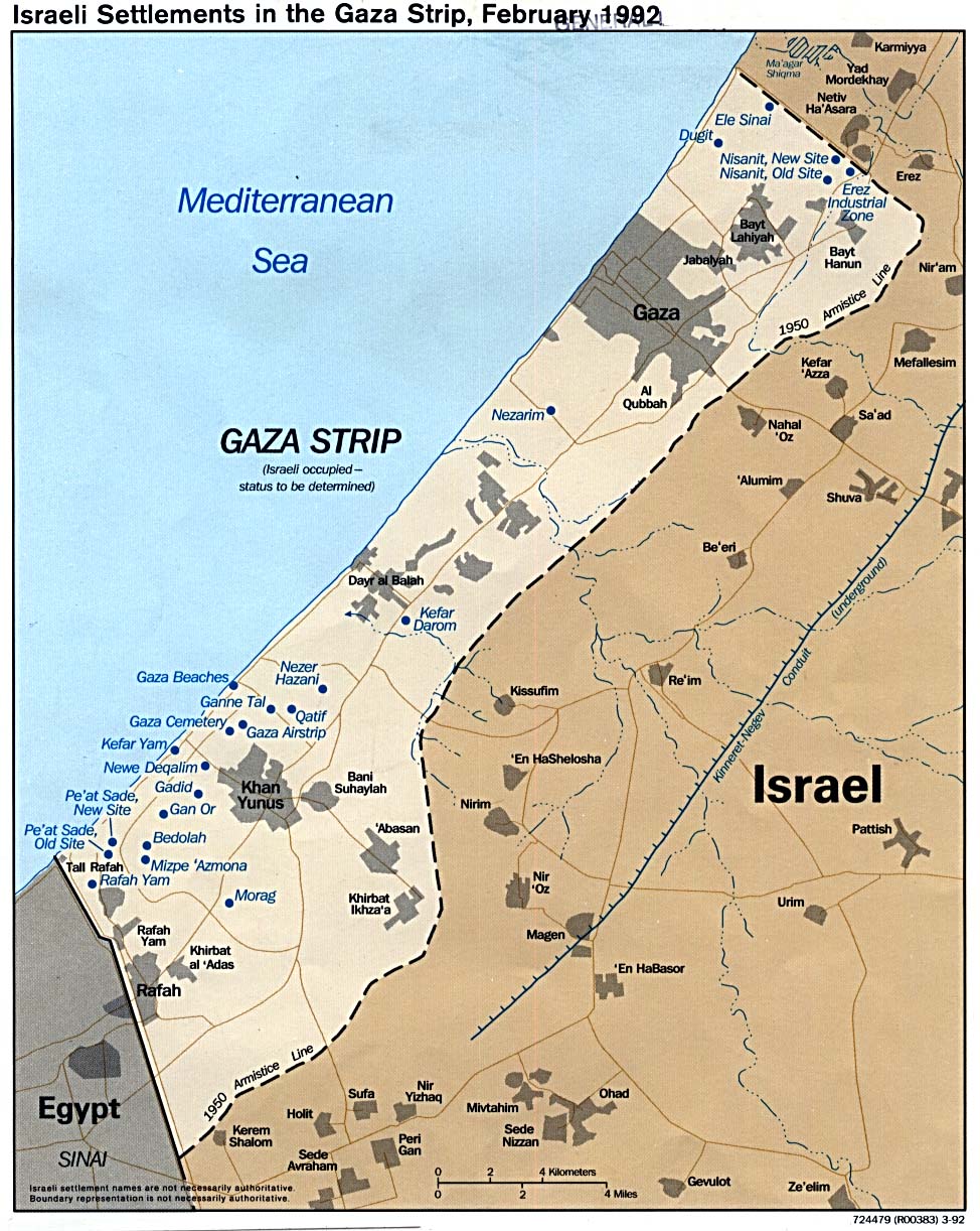
- Gaza Strip, Israeli Settlements December 1993 (75K)
- Gaza Strip, Israeli Settlements 1992 (242K)
- Gaza Strip and the West Bank, Closures and Requisitioned Land in January 1994 (339K)
- Gaza Strip and the West Bank, Jewish Land Use on Israeli-Controlled Land in October 1993 (235K)
- Gaza Strip and the West Bank, Selected Natural Resources January 1994 (134K)
- Gaza Maps on Other Web Sites
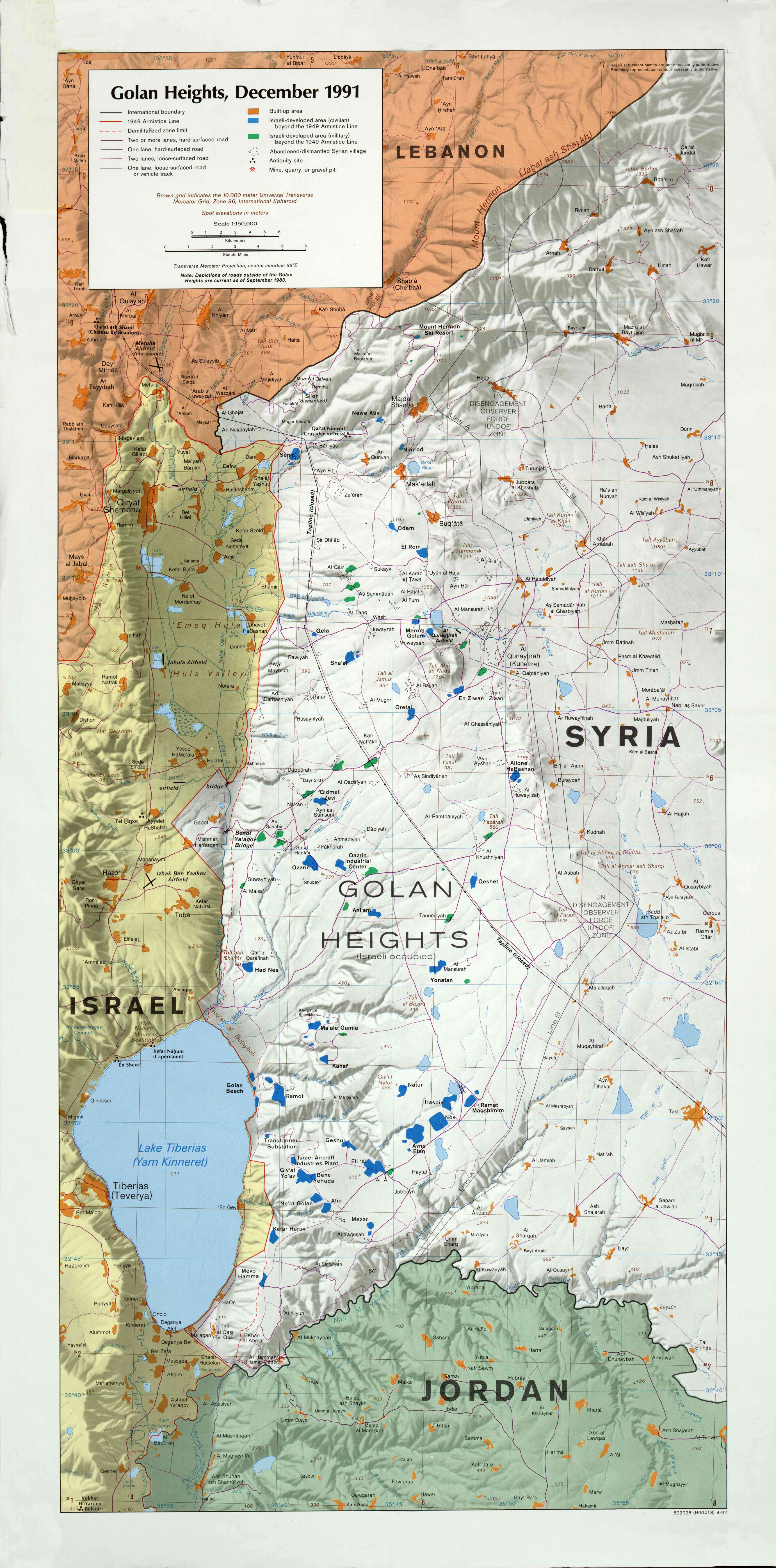
- Golan Heights, December 1991 1:150,000 1992 (4.5MB)
- Golan Heights - Economic Activity and Land Use from Atlas of the Middle East (U.S. Central Intelligence Agency, January 1993) (62k)
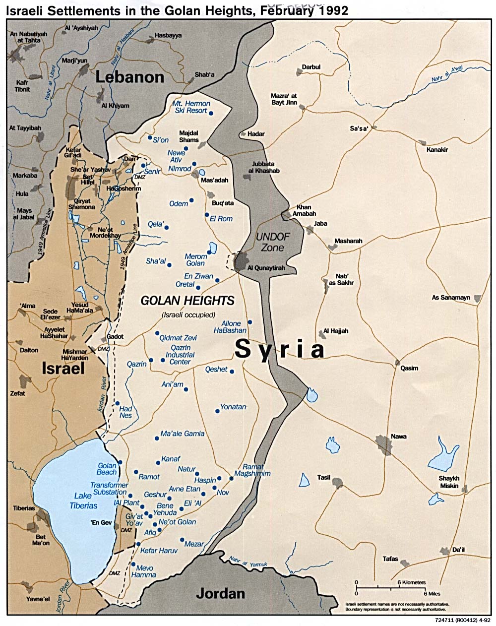
- Israeli Settlements in the Golan Heights 1992 (241K)
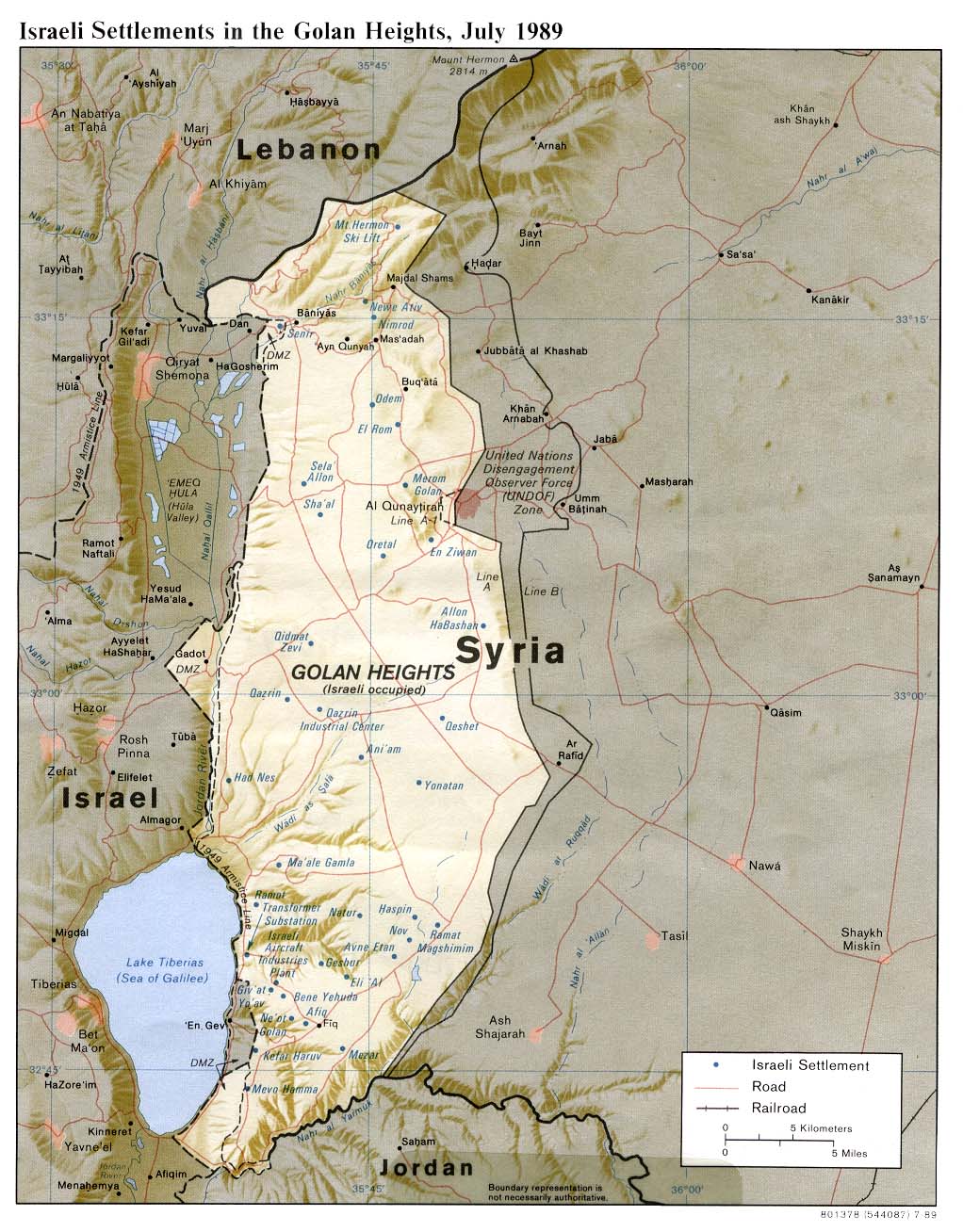
- Israeli Settlements in the Golan Heights (Shaded Relief) 1989 (211K)