Perry-Castañeda Library
Map Collection
Uganda Maps
The following maps were produced by the U.S. Central Intelligence Agency, unless otherwise indicated.
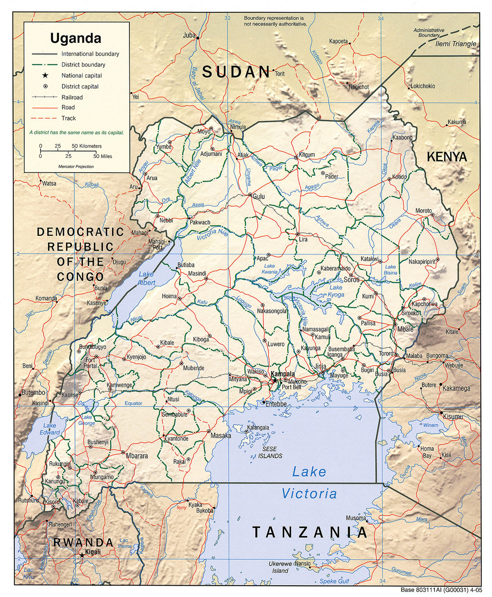
Country Maps- Uganda (Physiography) 2005 (1.9MB) and pdf format (1.1MB)
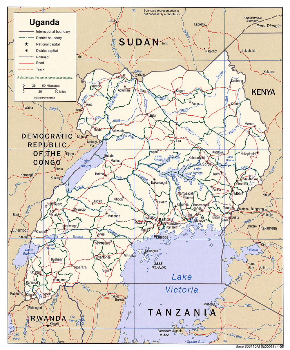
- Uganda (Political) 2005 (720K) and pdf format (722K)
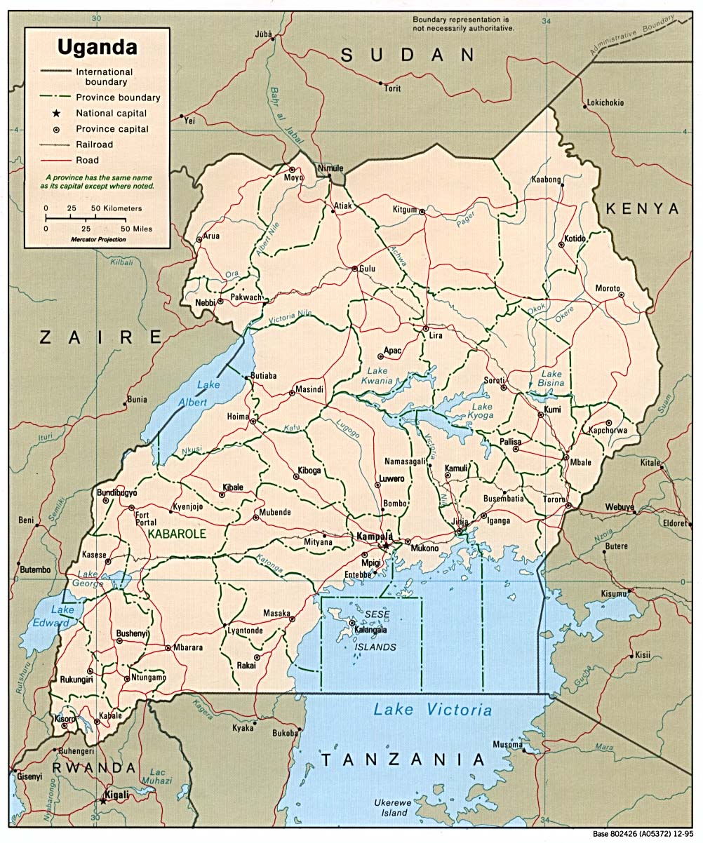
- Uganda (Political) 1995 (276K) and pdf format (278K)
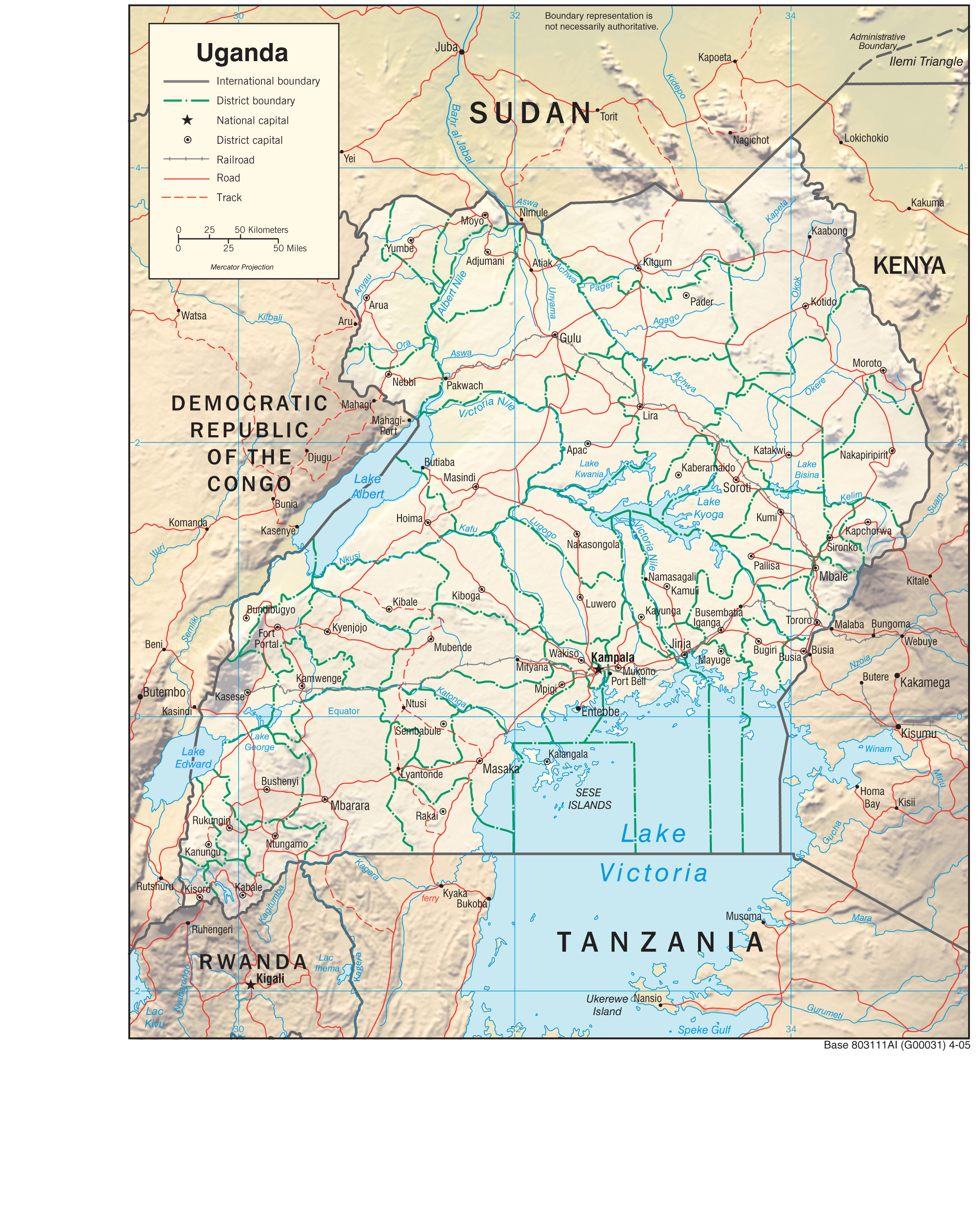
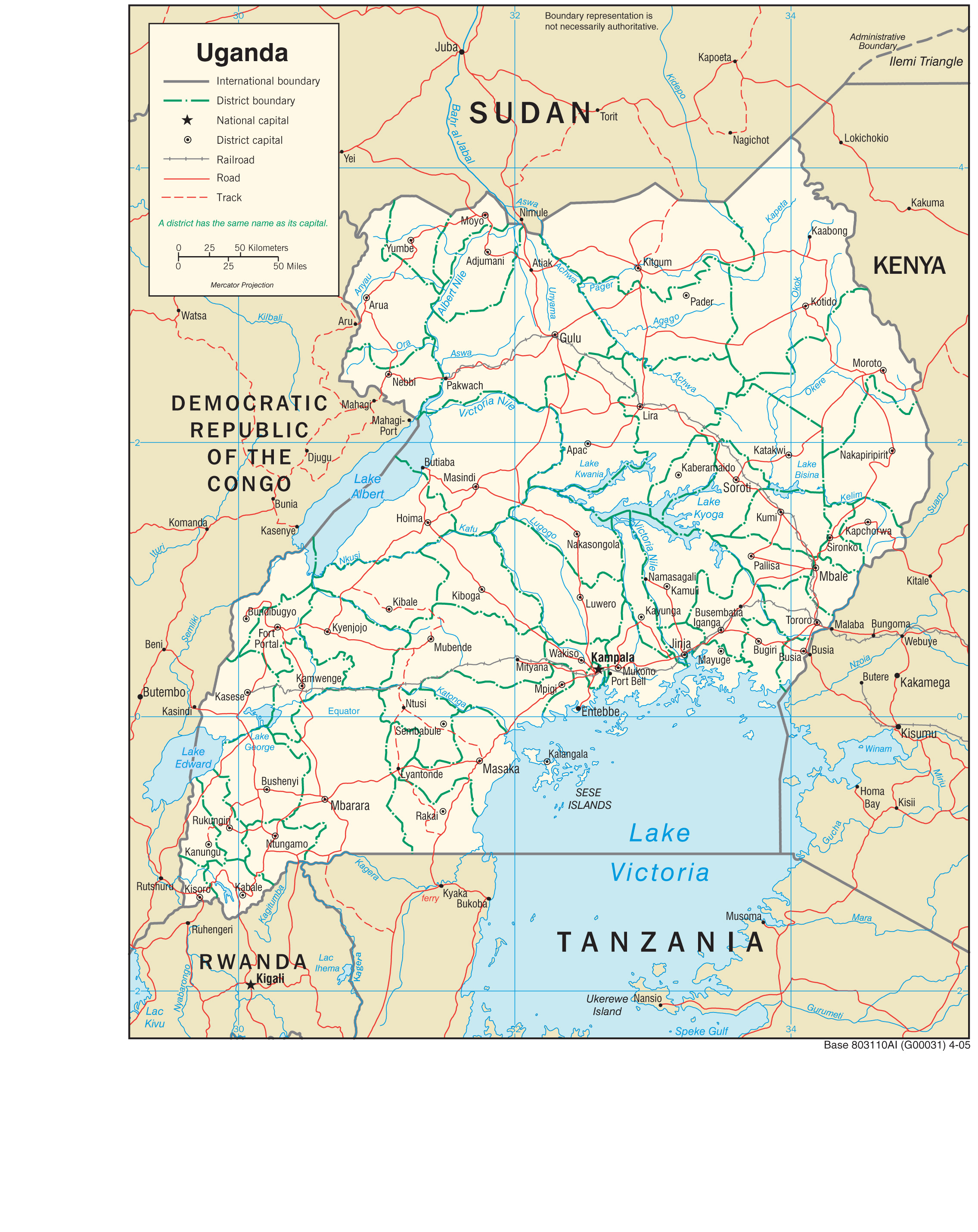
- Uganda (Shaded Relief) 2005 (774K) and pdf format (776K)
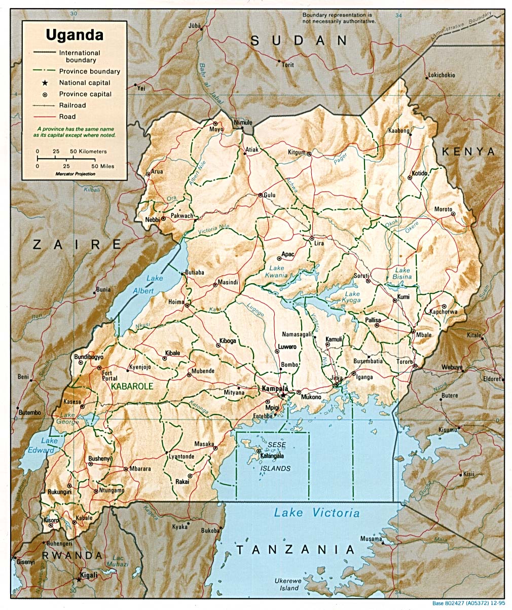
- Uganda (Shaded Relief) 1995 (321K) and pdf format (324K)
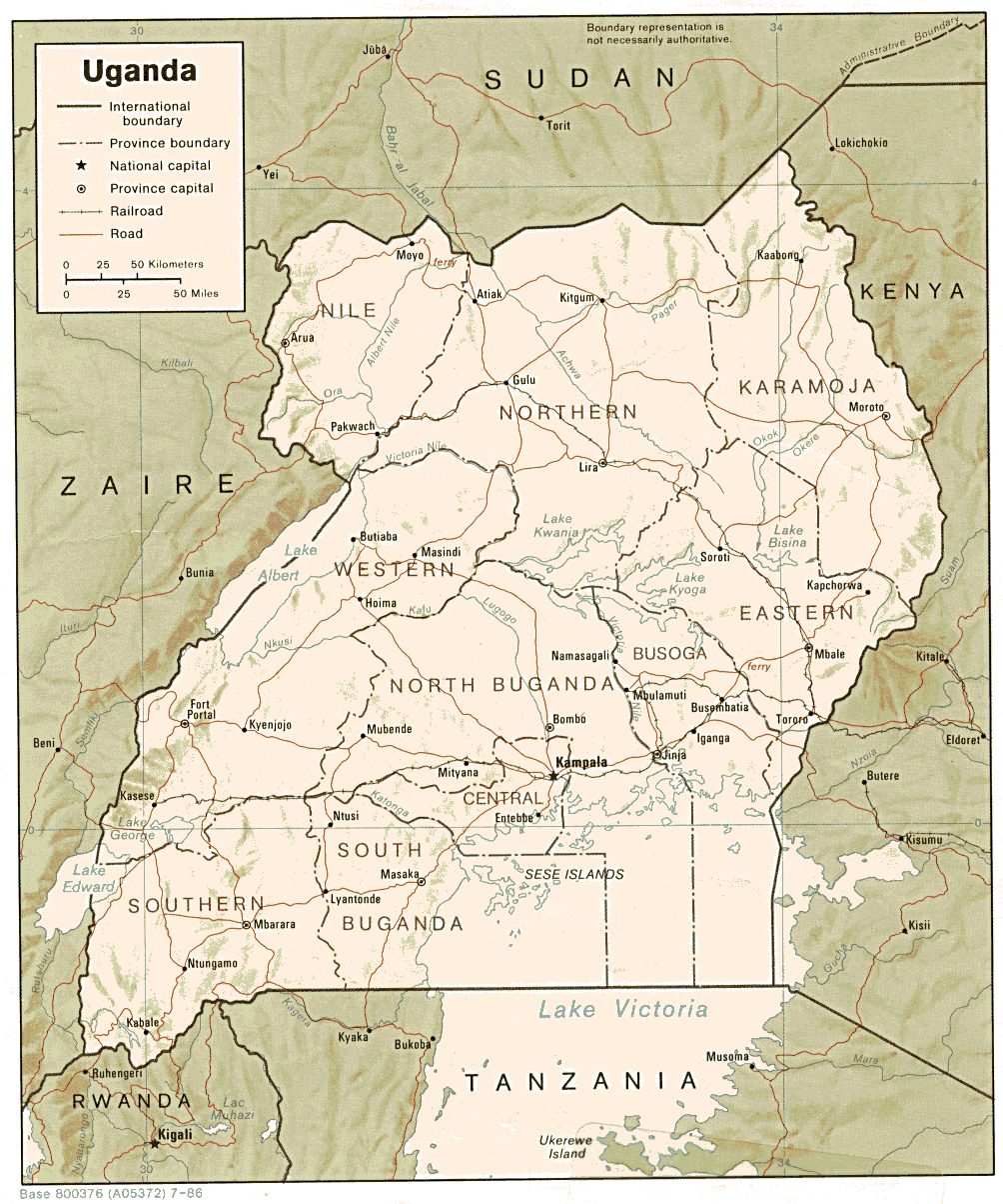
- Uganda (Shaded Relief) 1986 (287K) and pdf format (306K)
- Uganda (Small Map) 2016 (22.9K)
- Uganda (Transportation) 2005 (1.7MB) and pdf format (522K)
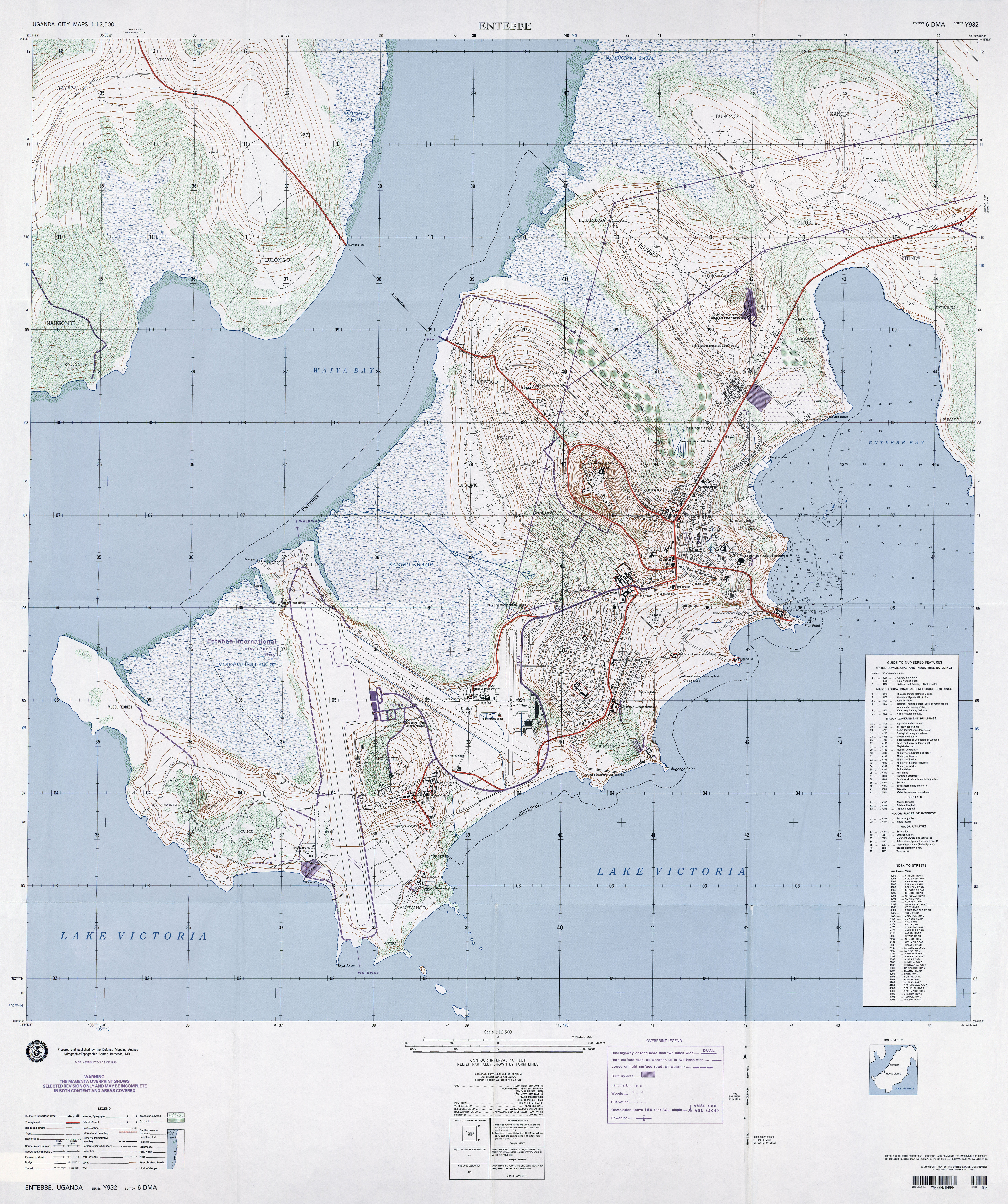
- Entebbe original scale 1:12,500, Edition 6-DMA, Series Y932. U.S. Defense Mapping Agency, 1990. (10.4MB)
- Jinja original scale 1:12,500, Edition 2-AMS, Series Y932. U.S. Army Map Service, 1963. (10.8MB)
- Kampala original scale 1:12,500, Edition 6-DMA, Series Y932. U.S. Defense Mapping Agency, 1987. (15.4MB)
- 1:2,000,000 - Africa Topographic Maps U.S. Army Map Service, Series 2201
- Sheets 23 and 24 include all of Uganda
- 1:1,000,000 - International Map of the World U.S. Army Map Service
- This map series includes all of Uganda. Clickable map. The map below is an excerpt from this series.
- 1:1,000,000 - Uganda - South East Portion of Kampala sheet, International Map of the World. Topographic Map NA 36, Series 1301. U.S. Army Map Service, Corps of Engineers, 1964 (652K)
- 1:1,000,000 - Operational Navigation Chart Series U.S. Defense Mapping Agency Aerospace Center. This series covers all of Uganda. Not for navigational use
- 1:1,000,000 - Uganda - North (operational navigation chart) original scale 1:1,000,000 Portion of Defense Mapping Agency ONC L-5, Edition 3, 1973 (1.3MB) Not for navigational use
- 1:500,000 - Tactical Pilotage Charts U.S. National Imagery and Mapping Agency. Not for navigational use
- This series covers Uganda
- 1:250,000 - East Africa Series Y503, U.S. Army Map Service, 1958-
- This series covers parts of Uganda
- 1:250,000 - Joint Operations Graphic (Air) Series 1501, U.S. Defense Intelligence Agency Not for navigational use
- This series covers parts of the western border area of Uganda including Lake Albert. Courtesy of T. R. Smith Map Collection, University of Kansas Libraries
- Sheets 23 and 24 include all of Uganda
Maps on Other Web Sites