Perry-Castañeda Library
Map Collection
Tunisia Maps
The following maps were produced by the U.S. Central Intelligence Agency, unless otherwise indicated.
Country Maps- Tunisia (Political) 1990 (149K) and pdf format (203K)
- Tunisia (Shaded Relief) 1990 (249K) and pdf format (262K)
- Tunisia (Small Map) 2016 (14.5K)
- Tunisia (Topographic) (1.18MB) and map key and scale (472K)
- Portion of AMS Series 2201, Sheet 3 "Tunis", original scale 1:2,000,000. Published by the U.S. Army Topographic Command, 1969.
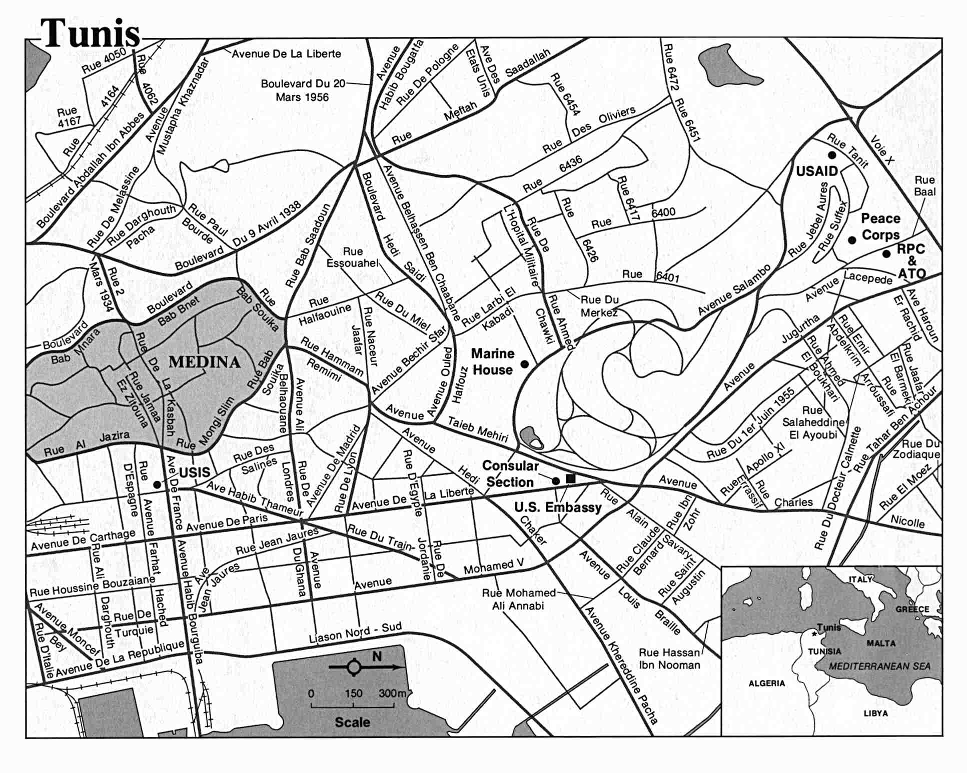
- Tunis U.S. Dept. of State (215K)
- 1:2,000,000 - Tunis Sheet U.S. Army Topographic Command, 1969 (3.8 MB)
- 1:1,000,000 - Tunis-Sfax International Map of the World, U.S. Army Map Service, 1958 (6.2MB)
- 1:1,000,000 - Operational Navigation Chart Series U.S. Defense Mapping Agency Aerospace Center. Not for navigational use
- Sheets G-2 and H-3 include all of Tunisia
- 1:500,000 - Tactical Pilotage Charts U.S. National Imagery and Mapping Agency. Not for navigational use
- This series covers parts of Tunisia
- 1:500,000 - World Series 1404, Great Britain. War Office and Air Ministry. 1958-
- This series covers parts of Tunisia
- 1:250,000 - North Africa Joint Operations Graphic Aeronautical charts. U.S. National Imagery and Mapping Agency. Not for navigational use
- This series covers most of Tunisia
- 1:250,000 - North Africa Topographic Maps U.S. Army Map Service, Series P502
- This series covers most of Tunisia
- 1:200,000 - Tunisia Great Britain War Office, Series 4227
- This series covers all of Tunisia
- 1:100,000 - Tunisia Great Britain War Office, Series 4226
- 1:50,000 - Tunisia Great Britain War Office, Series 4225
- Sheets G-2 and H-3 include all of Tunisia
- Tunisia City Plans U.S. Army Map Service, 1942-1943
Maps on Other Web Sites