Perry-Castañeda Library
Map Collection
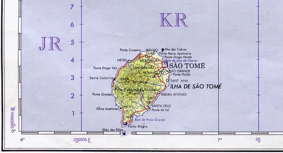
Sao Tome and Principe Maps
The following maps were produced by the U.S. Central Intelligence Agency, unless otherwise indicated.
Country Maps- Sao Tome and Principe (Political) U.S. Department of State 1991 (71K)
- Sao Tome and Principe (Small Map) 2016 (11.1K)
- 1:2,000,000 - Africa Topographic Maps, Sheet 22 U.S. Army Map Service
- Sheet 22 includes Sao Tome and Principe (7.4MB)
- 1:1,000,000 - Operational Navigation Chart Series, Sheet L-3 U.S. Defense Mapping Agency Aerospace Center. Not for navigational use
- Sheet L-3 includes Sao Tome and Principe (16.2MB)
- 1:1,000,000 - International Map of the World, Sheet NA-32 U.S. Army Map Service
- Sheet NA-32 includes Sao Tome and Principe (6.1MB)
- 1:1,000,000 - Sao Tome Portion of International Map of the World Sheet NA-32 above. Original Scale 1: 1,000,000. Printed by U.S. Army Map Service, Corps of Engineers, 1963 (81K)
- 1:500,000 - Tactical Pilotage Charts U.S. National Imagery and Mapping Agency. Not for navigational use
- This series covers Sao Tome and Principe
- Sheet 22 includes Sao Tome and Principe (7.4MB)