Perry-Castañeda Library
Map Collection
Commonwealth of the Northern Mariana Islands Maps
Country Maps
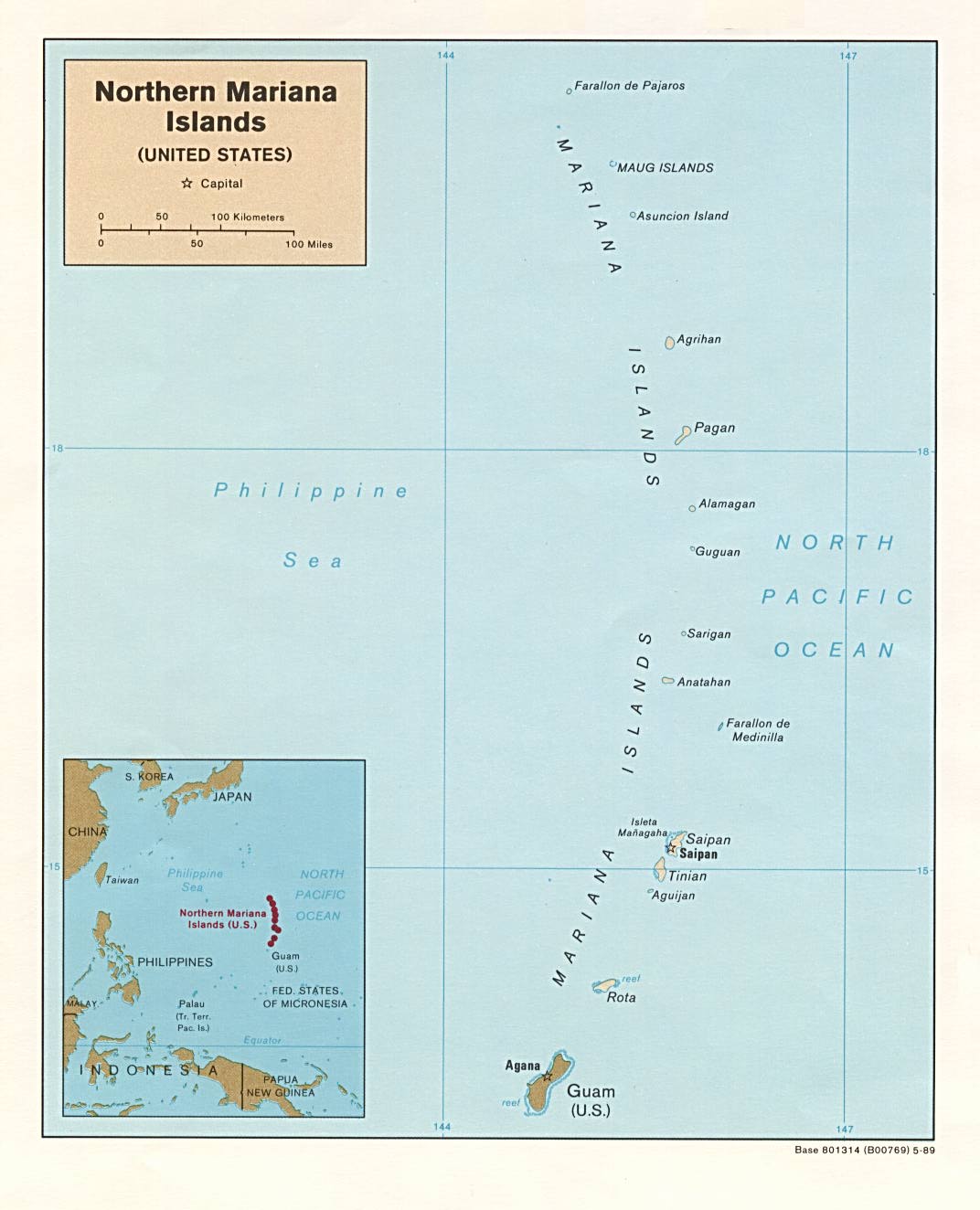
- Northern Mariana Islands (Political) 1989 (122K) and pdf format (122K)
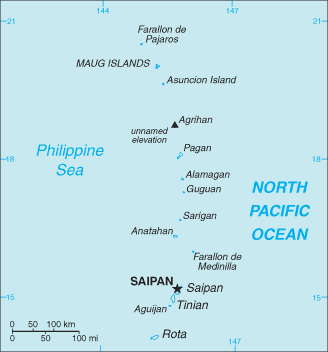
- Northern Mariana Islands (Small Map) 2016 (6.3K)
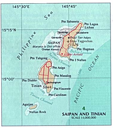
- Northern Mariana Islands - Saipan and Tinian Islands (Political) U.S. National Atlas 1970 (38K)
Detailed Maps
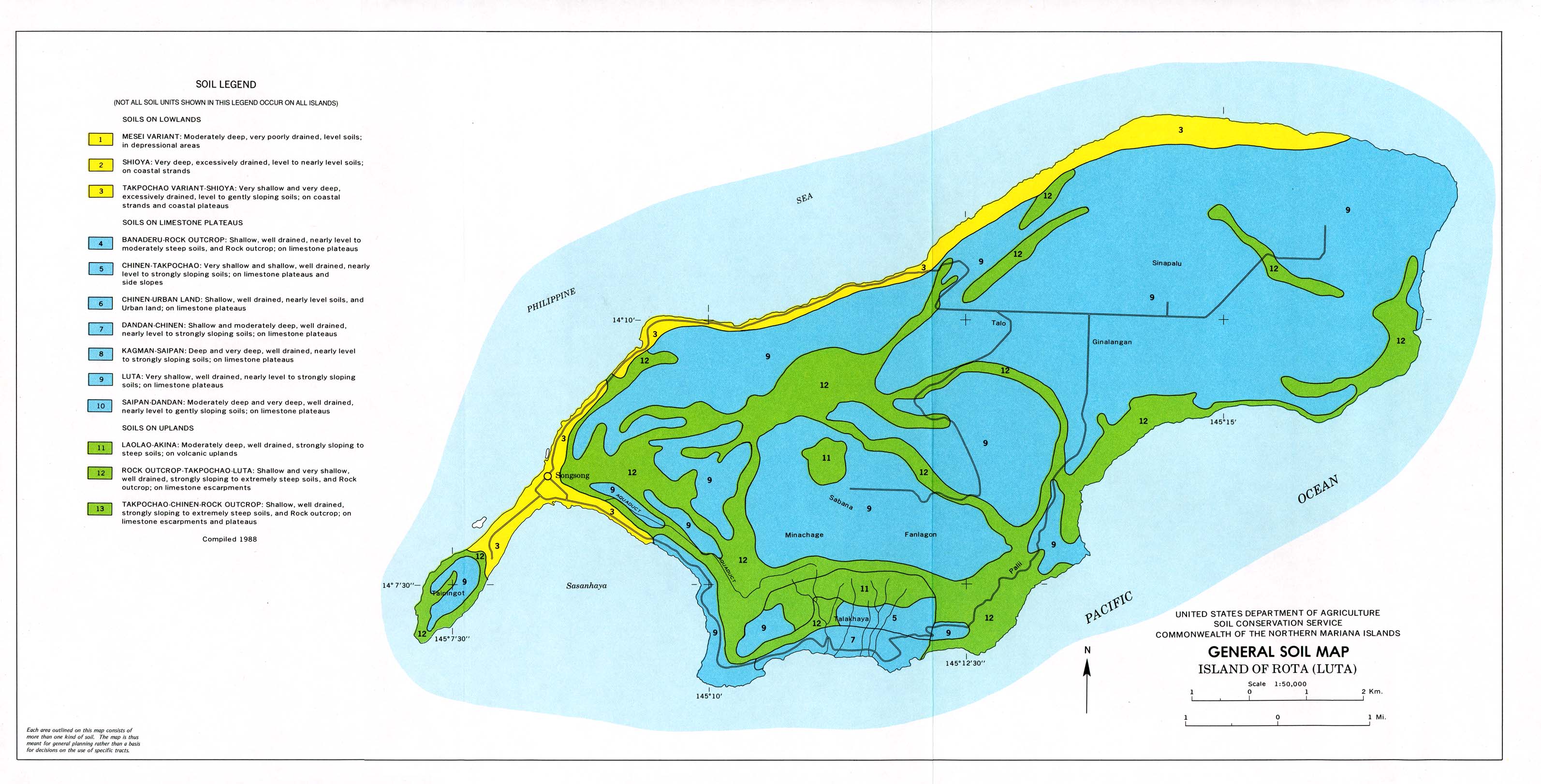
- Island of Rota (Luta) (General Soil Map) United States Department of Agriculture, Soil Conservation Service. Compiled 1988 (495K)
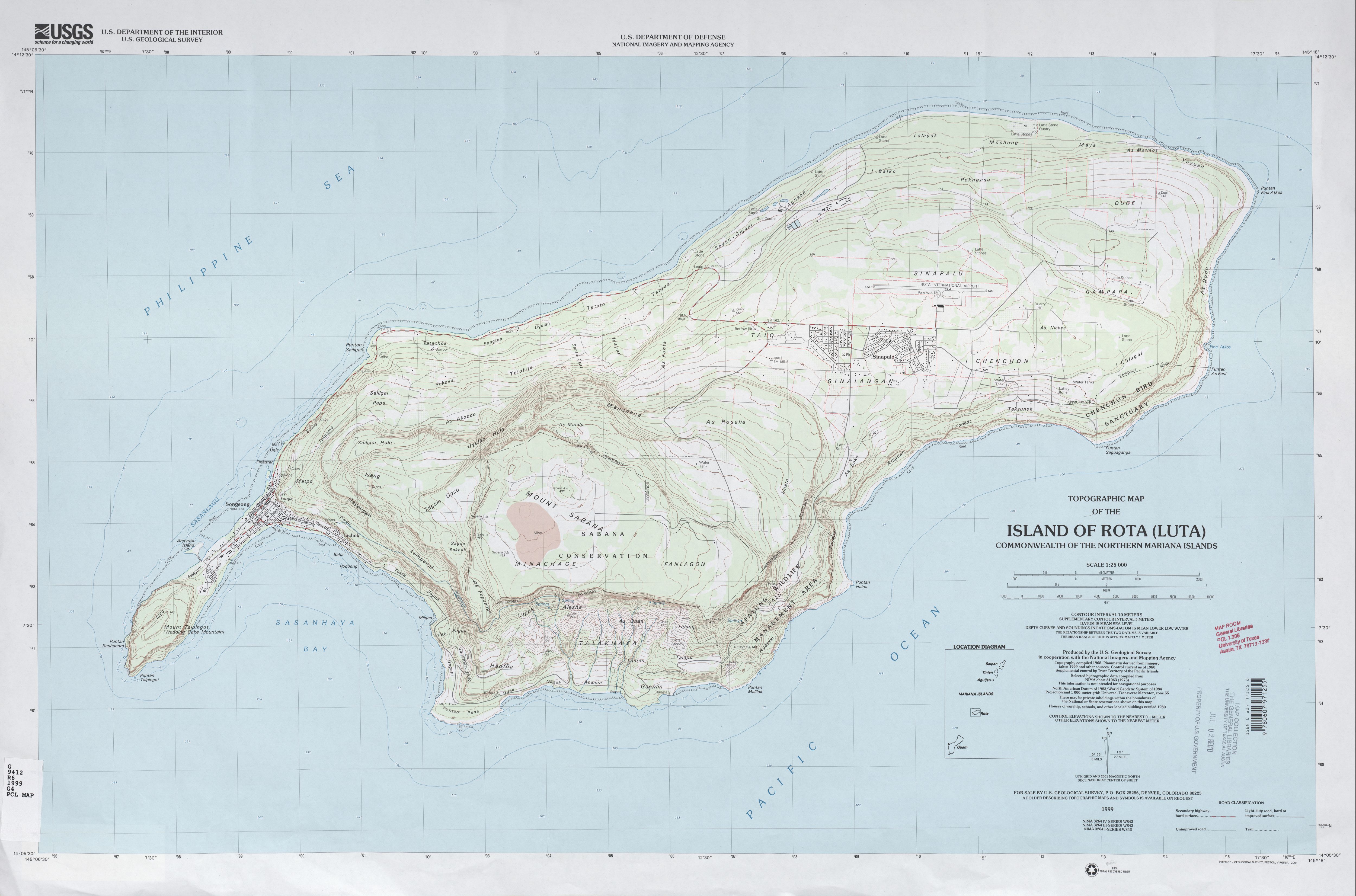
- Island of Rota (Luta) (Topographic Map) 1:25,000 U.S. Geological Survey, 1999 (2.1 MB)
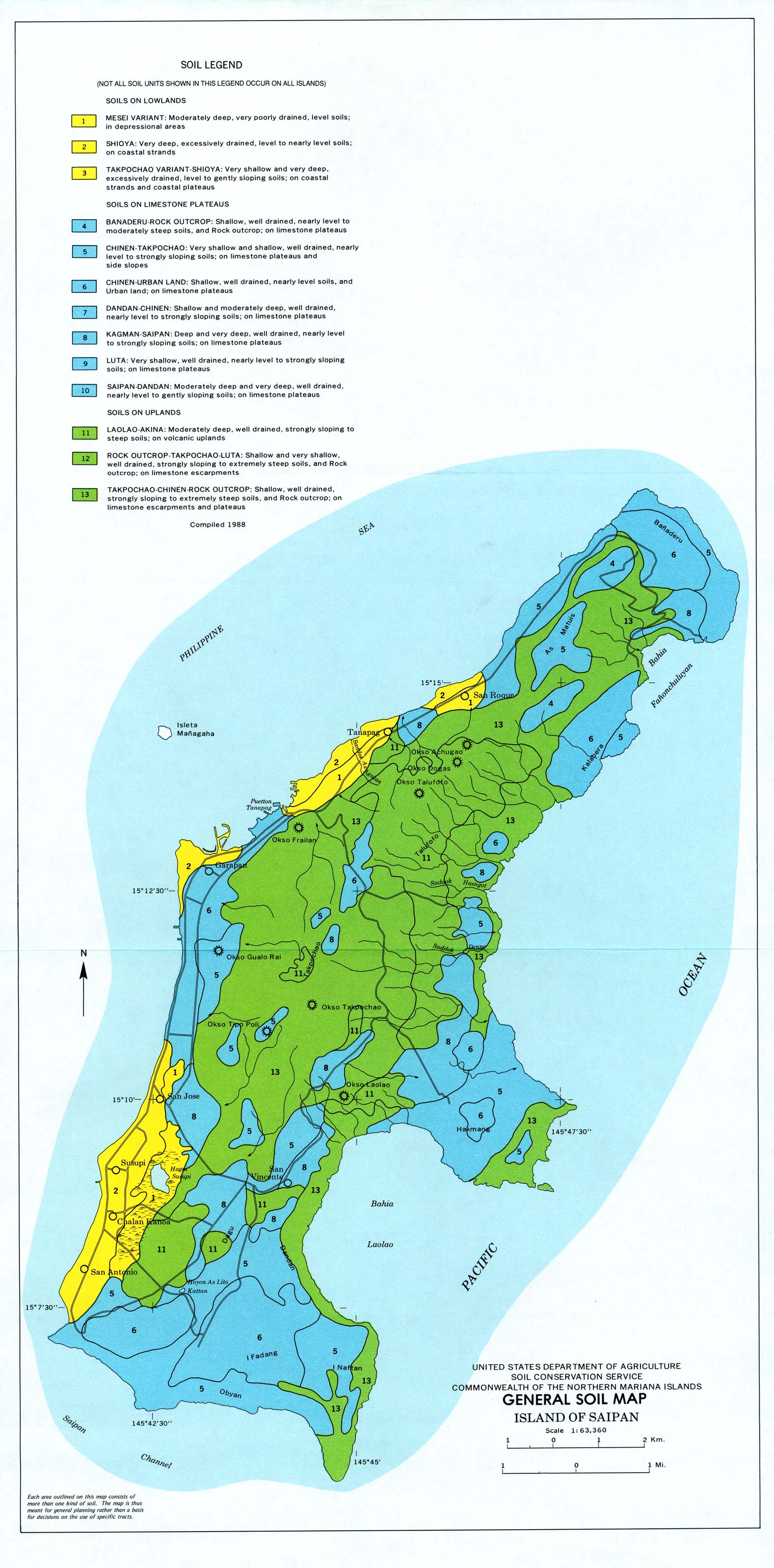
- Island of Saipan (General Soil Map) United States Department of Agriculture, Soil Conservation Service. Compiled 1988 (517K)
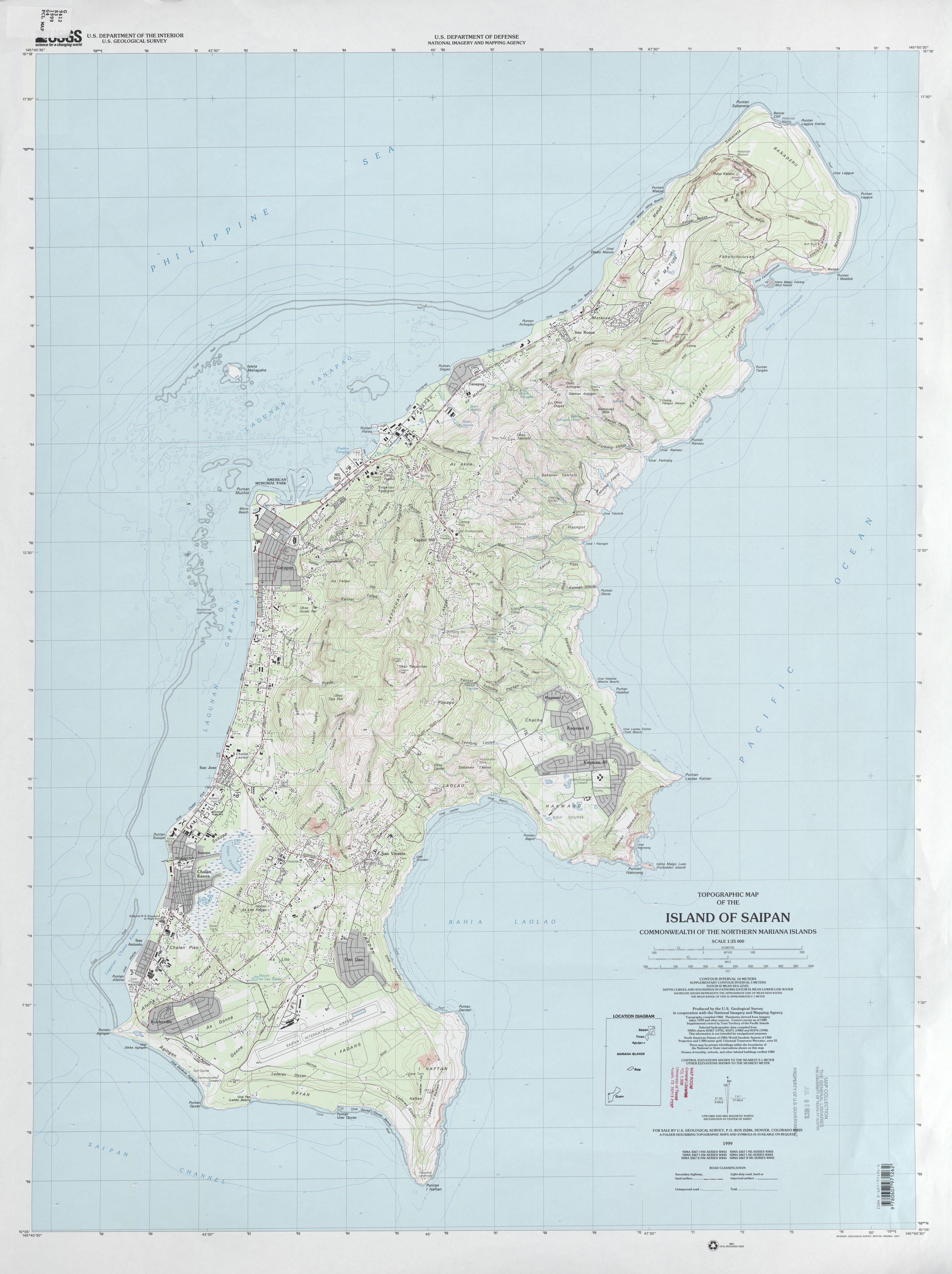
- Island of Saipan (Topographic Map) 1:25,000 U.S. Geological Survey, 1999 (2.5 MB)
- [Island of Saipan] Chalan Kanoa Area Portion of Saipan map (Topographic) 1:25,000 U.S. Geological Survey, 1983 (740K)
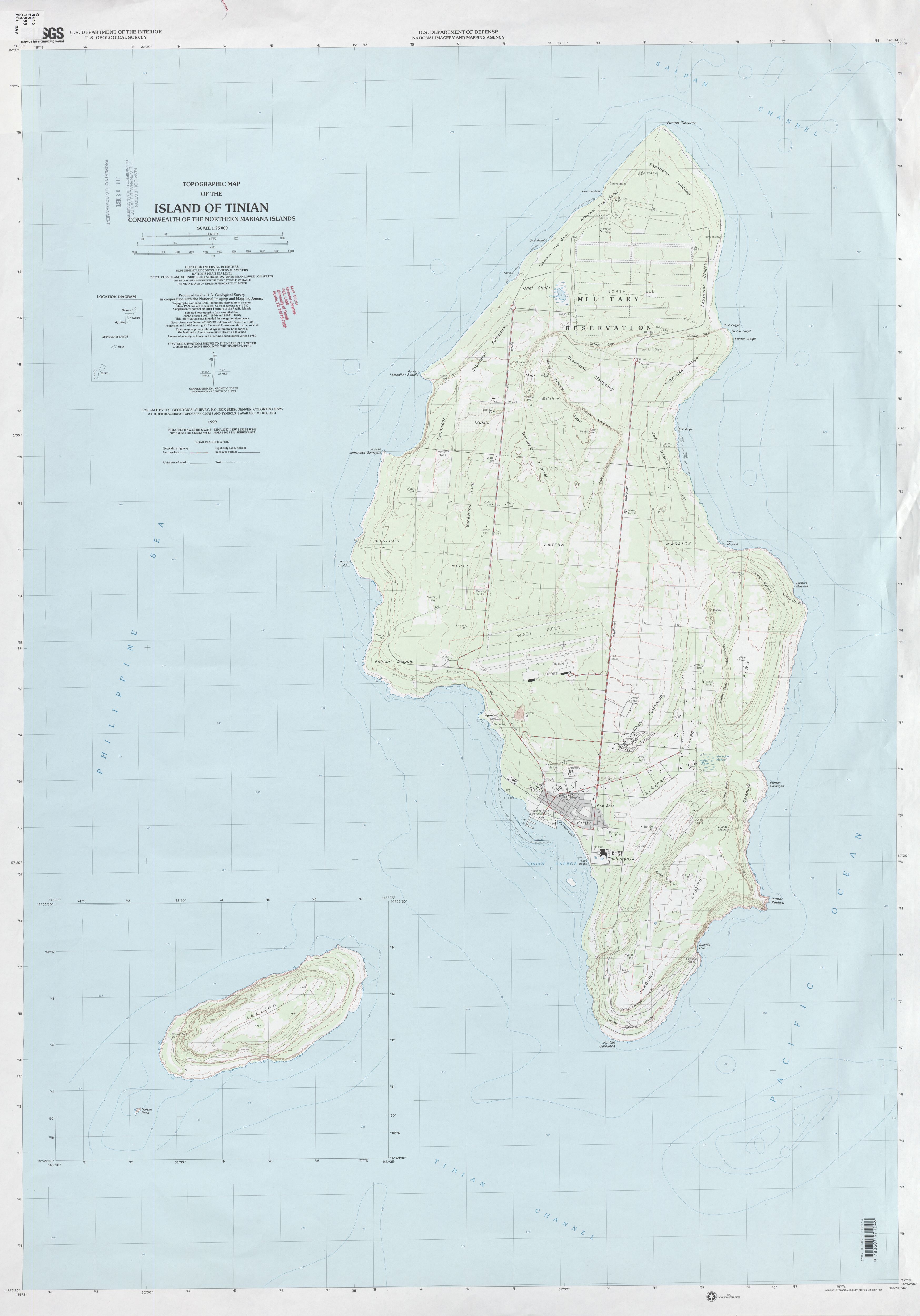
- Island of Tinian (Topographic Map) 1:25,000 U.S. Geological Survey, 1999 (1.7 MB)
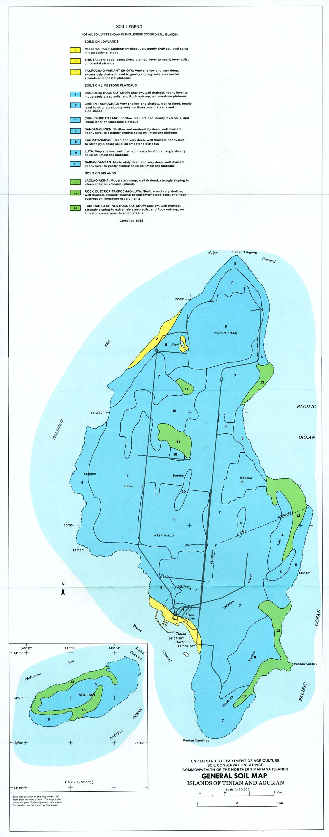
- Islands of Tinian and Aguijan (General Soil Map) United States Department of Agriculture, Soil Conservation Service. Compiled 1988 (288K)
- Mariana Islands Series W543, 1:250,000, U.S. Army Map Service, 1955-
![[Island of Saipan] Chalan Kanoa Area](australia/saipan_83.jpg)
Aeronautical Charts
- 1:1,000,000 - Operational Navigation Chart Series (Aeronautical Charts) U.S. Defense Mapping Agency Aerospace Center Not for navigational use
- Sheets J-14 and K-13 include the Northern Mariana Islands
- 1:500,000 - Tactical Pilotage Charts U.S. National Imagery and Mapping Agency. Not for navigational use
- This series covers Northern Mariana Islands
- Sheets J-14 and K-13 include the Northern Mariana Islands
Maps on Other Web Sites