Perry-Casta�eda Library
Map Collection
Outline Map Sites
Click on letter to select a continent, country or state:
A, B, C, D, E, F, G, H, I, J, K, L, M, N, O, P, Q, R, S, T, U, V, W, X, Y, Z
Updated 9/6/16
These links are to outline maps on other web sites unless otherwise noted.For additional maps and information see:
-
A
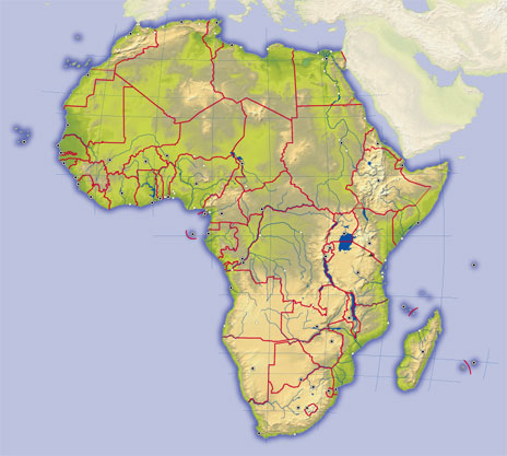
- Africa (DK Clip Art)
- Africa (Theodora.com)
- Africa (Scott Foresman)
- Africa - Country borders, only major lakes named (University of Alabama) [pdf]
- Africa - Physical (Education Place) [pdf]
- Africa - Political - no labels (Education Place) [pdf]
- Africa - Political - no labels (UTK)
- Africa - Political - with labels (Education Place) [pdf]
- Alabama Base Maps (University of Alabama)
- Alabama - Outline Maps (Netstate)
- Alaska (50states.com)
- Alaska - Census Areas (National Atlas) [pdf]
- Alaska - Outline Maps (Netstate)
- Antarctica (UTK)
- Arizona - Outline Maps (Netstate)
- Arkansas - Outline Maps (Netstate)
- Asia (UTK)
- Asia - North and Central (Education Place) [pdf]
- Asia - South [India] (Education Place) [pdf]
- Asia - Southeast, with Australia (Education Place) [pdf]
- Asia/Pacific - Political (Education Place) [pdf]
- Australia (UTK) B
- Brazil - Outline Maps (Cartoth�que)
- British Isles (Astakos Primary School) C
- California - Blank map with dots for major cities (50states.com)
- California - Outline Maps (Netstate)
- California - Regions (Education Place) [pdf]
- Canada - Outline Map - with labels (Education Place) [pdf]
- Caribbean and Central America (Cartotheque)
- Central America - Political - no labels (Education Place) [pdf]
- China - Outline Maps (Cartoth�que)
- Colorado - Outline Maps (Netstate)
- Connecticut - Outline Maps (Netstate)
- Cradles of Civilization - With names (Florida Geogaphic Alliance) [pdf] D
- Delaware - Outline Maps (Netstate) E
- Eastern Hemisphere (Education Place) [pdf]
- Eurasia - Blank map (Theodora.com)
- Europe - with labels (Education Place) [pdf]
- Europe (University of Alabama) [pdf]
- Europe (UTK)
- Europe - Political - without labels (Education Place) [pdf] F
- Florida - Outline Maps (Netstate) G
- Georgia - Outline Maps (Netstate)
- Germany - Political - without labels (WorldAtlas.com)
- Great Britain - Outline Maps (Ordnance Survey) H
- Hawaii - Outline Maps (Netstate) I
- Idaho - Outline Maps (Netstate)
- Illinois - Outline Maps (Netstate)
- Indiana - Outline Maps (Netstate)
- Iowa - Outline Maps (Netstate) J
- Japan - Blank map (Florida Geogarphic Alliance) [pdf] K
- Kansas - Outline Maps (Netstate)
- Kentucky - Outline Maps (Netstate) L
- Louisiana - Outline Maps (Netstate) M
- Maine - Outline Maps (Netstate)
- Maryland - Blank map with dots for major cities (50states.com)
- Maryland - Outline Maps (Netstate)
- Massachusetts - Outline Maps (Netstate)
- Mediterranean Sea (University of Alabama) [pdf]
- Mediterranean Sea - Ancient (DePaul University)
- Michigan - Outline Maps (Netstate)
- Michigan - Outline Maps (Waterproof-Paper)
- Minnesota - Outline Maps (Netstate)
- Minnesota - Outline Maps (Waterproof-Paper)
- Mississippi - Outline Maps (Netstate)
- Mississippi - Outline Maps (Wateproof-Paper)
- Missouri - Outline Maps (Netstate)
- Missouri - Outline Maps (Waterproof-Paper)
- Montana - Outline Maps (Netstate)
- Montana - Outline Maps (Waterproof-Paper) N
- Nebraska - Outline Maps (Netstate)
- Nebraska - Outline Maps (Waterproof Paper)
- Nevada - Outline Maps (Netstate)
- New Hampshire - Outline Maps (Netstate)
- New Jersey - Outline Maps (Netstate)
- New Mexico - Outline Maps (Netstate)
- New York - Outline Maps (Netstate)
- North America (Alan A. Lew)
- North America (UTK)
- North Carolina - Outline Maps (Netstate)
- North Dakota - Outline Maps (Netstate)
- Northern Hemisphere (Education Place) [pdf] O
- Ohio - Outline Maps (Netstate)
- Oklahoma - County names (Census Bureau)
- Oklahoma - Outline Maps (Netstate)
- Ontario (Brock University)
- Oregon - Outline Maps (Netstate) P
- Pennsylvania - Outline Maps (Netstate) R
- Rhode Island - Outline Maps (Netstate)
- Russia - Outline Maps (Cartoth�que) S
- South America (University of Alabama) [pdf]
- South America (UTK)
- South America (WorldAtlas.com)
- South America - Political - no labels (Education Place) [pdf]
- South America - Political - with labels (Education Place) [pdf]
- South Carolina - Outline Maps (Netstate)
- South Dakota - Outline Maps (Netstate)
- Southern Hemisphere (Education Place) [pdf]
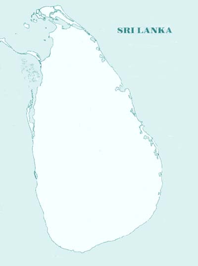
- Sri Lanka (Katargama) T
- Tennessee (UTK)
- Tennessee - Outline Maps (Netstate)
- Texas - Blank map with dots for major cities (50states.com)
- Texas - County Outline Map, with county names (PCL Map Collection) [jpeg format]
- Texas - County Outline Map, with county names, latitude and longitude (U.S. Bureau of the Census / PCL Map Collection) [pdf]
- Texas - County Outline Map, with county names (U.S. Bureau of the Census / PCL Map Collection) [pdf]
- Texas - Outline Maps (Netstate)
- Texas - Simple Labeled Map (Owl and Mouse) U
- U.S. - Blank with states (Education Place) [pdf]
- U.S. - Blank with states (PCL Map Collection)
- U.S. - blank with states and rivers (Alan A. Lew)
- U.S. - Climate (Education Place) [pdf]
- U.S. - Colonial America (Education Place) [pdf]
- U.S. County Outline Maps for States (PCL Map Collection)
- U.S. - Electoral College (University of Alabama) [pdf]
- U.S. - Name the State Capitals (WorldAtlas.com)
- U.S. - Name the States (WorldAtlas.com)
- U.S. - Northeast (Cartoth�que)
- U.S. - Physical (Education Place) [pdf]
- U.S. States with capital cities starred (Education Place) [pdf]
- U.S. States with Postal Abbreviations (Education Place) [pdf]
- U.S. 1860 (Education Place) [pdf]
- Utah - Outline Maps (Netstate) V
- Vermont - Outline Maps (Netstate)
- Virginia - Outline Maps (Netstate) W
- Washington State - Outline Maps (Netstate)
- West Virginia - Outline Maps (Netstate)
- Western Hemisphere (Education Place) [pdf]
- Wisconsin - Outline Maps (Netstate)
- World (Nations Online)
- World (UTK)
- World - Climate (Education Place) [pdf]
- World - Continents (Education Place) [pdf]
- World - Continents and Oceans - Quiz Map (WorldAtlas.com)
- World - Countries with latitude/longitude grid (Education Place) [pdf]
- World - Countries centered on Pacific Ocean (Education Place) [pdf]
- World - Outline Maps (University of Alabama)
- World - Physical (Education Place) [pdf]
- Wyoming - Outline Maps (Netstate)
- Africa (Theodora.com)
![Texas - County Outline Map, with county names (PCL Map Collection) [jpeg format]](states/texas.jpg)