Perry-Castañeda Library
Map Collection
West Bank and Gaza Maps
The following maps were produced by the U.S. Central Intelligence Agency unless otherwise noted.
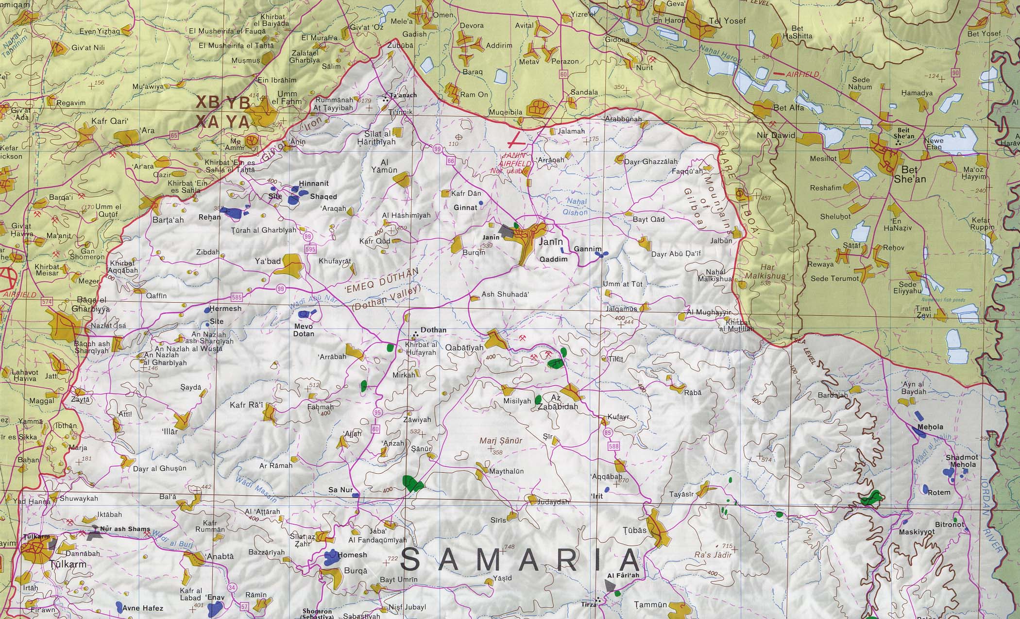
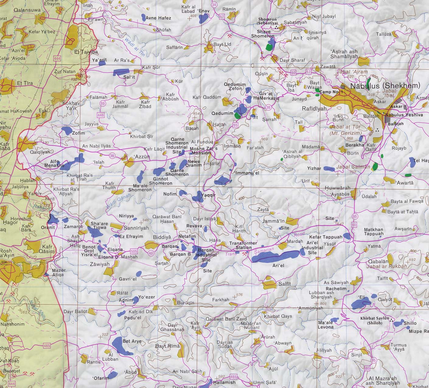
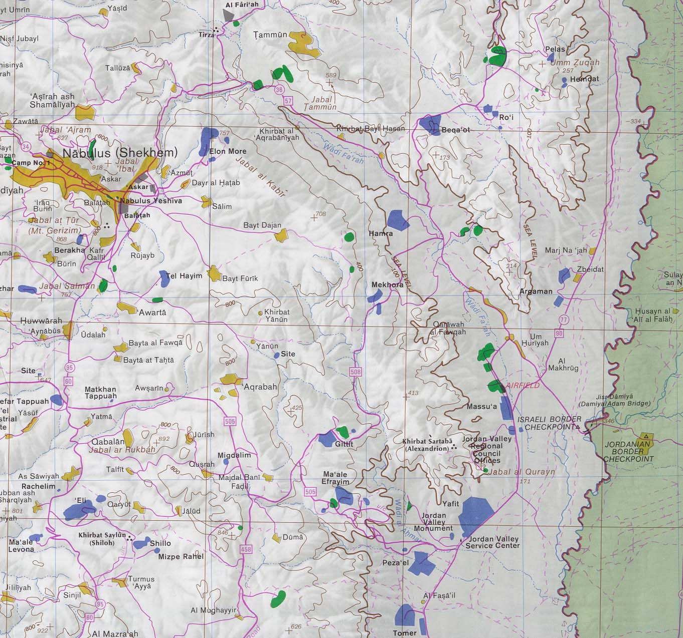
The following eight maps are taken from the detailed CIA map "West Bank and Vicinity" published in July 1992. The scale of the printed map is 1:150,000. To approximate distances on the sectional maps, see the map legend and scale, scanned at the same dpi as the maps. The maps below cover all of the West Bank with an additional scan of the Amman, Jordan region from the same map.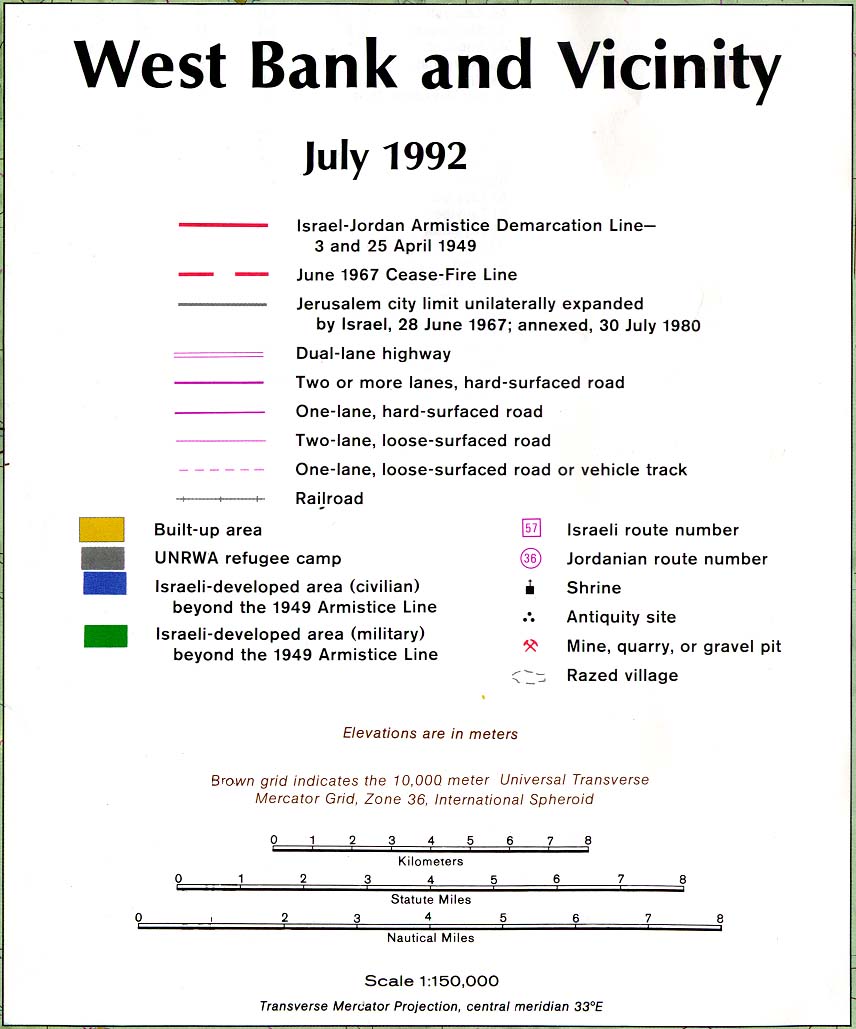
The maps are arranged in order from north to south:
- West Bank - Far North (North of Nabulus) (547K)
- West Bank - Nabulus and West (370K)
- West Bank - Nabulus and East (306K)
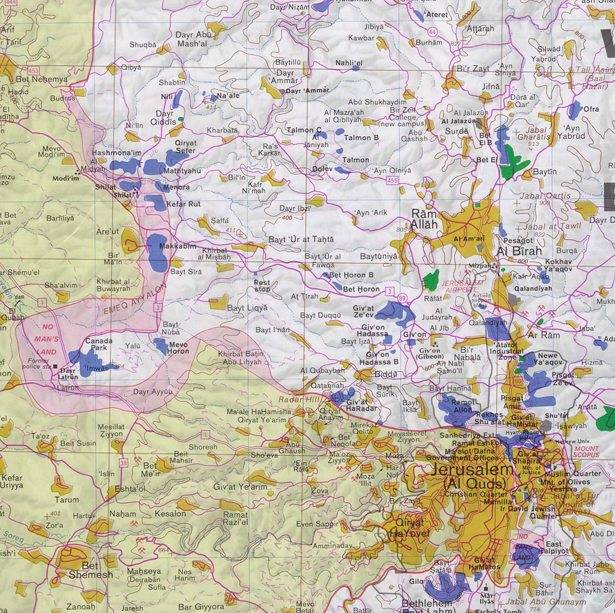
- West Bank - Jerusalem and West (includes Ramallah) (407K)
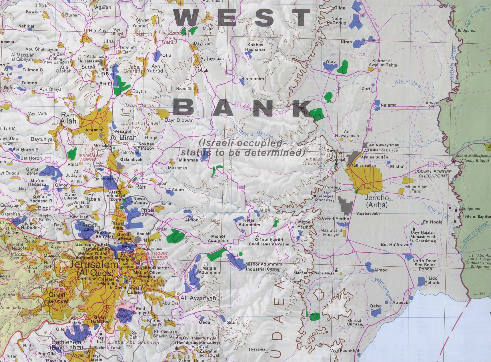
- West Bank - Jerusalem and East (includes Jericho) (420K)
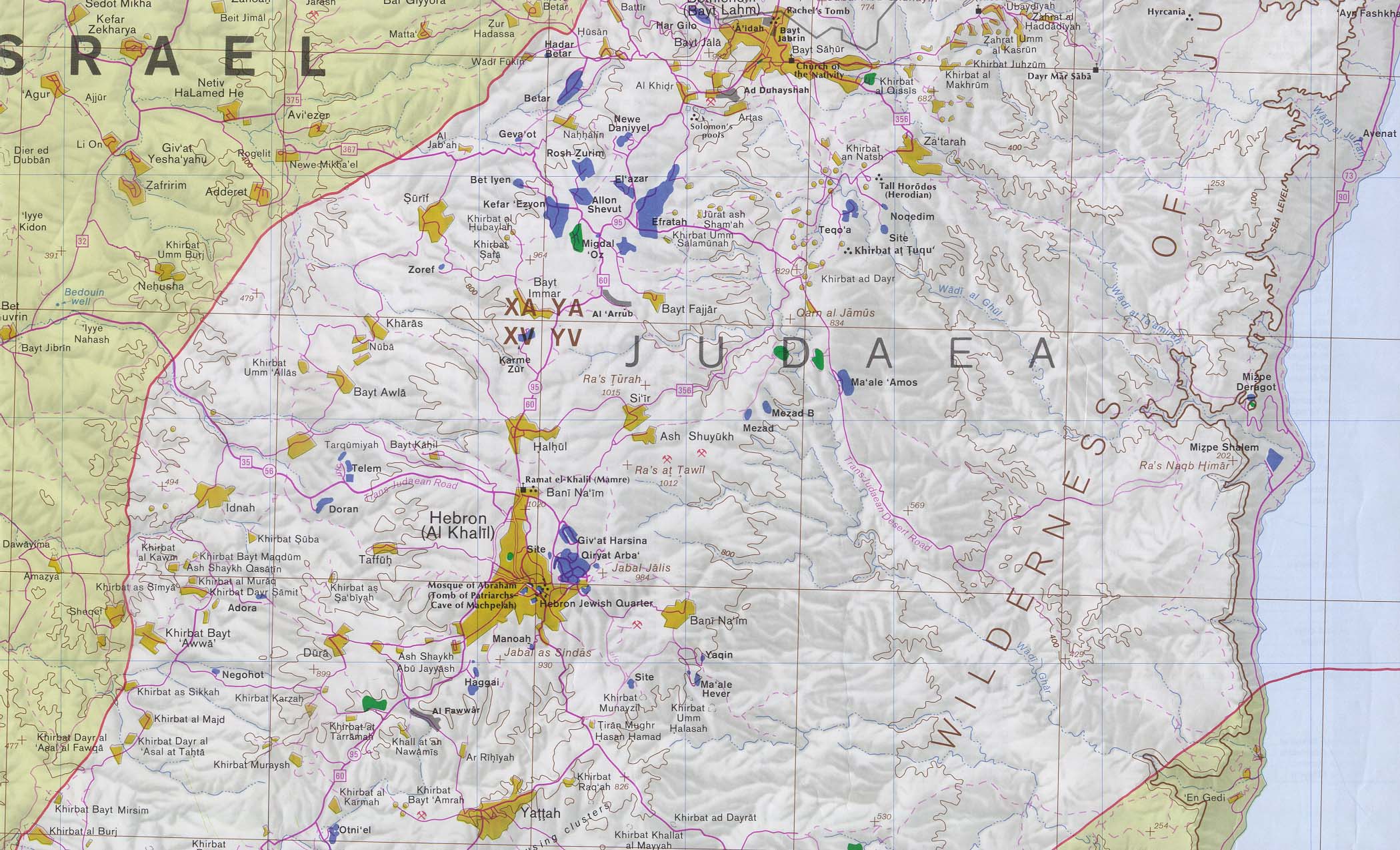
- West Bank - Bethlehem and South (includes Hebron) (469K)
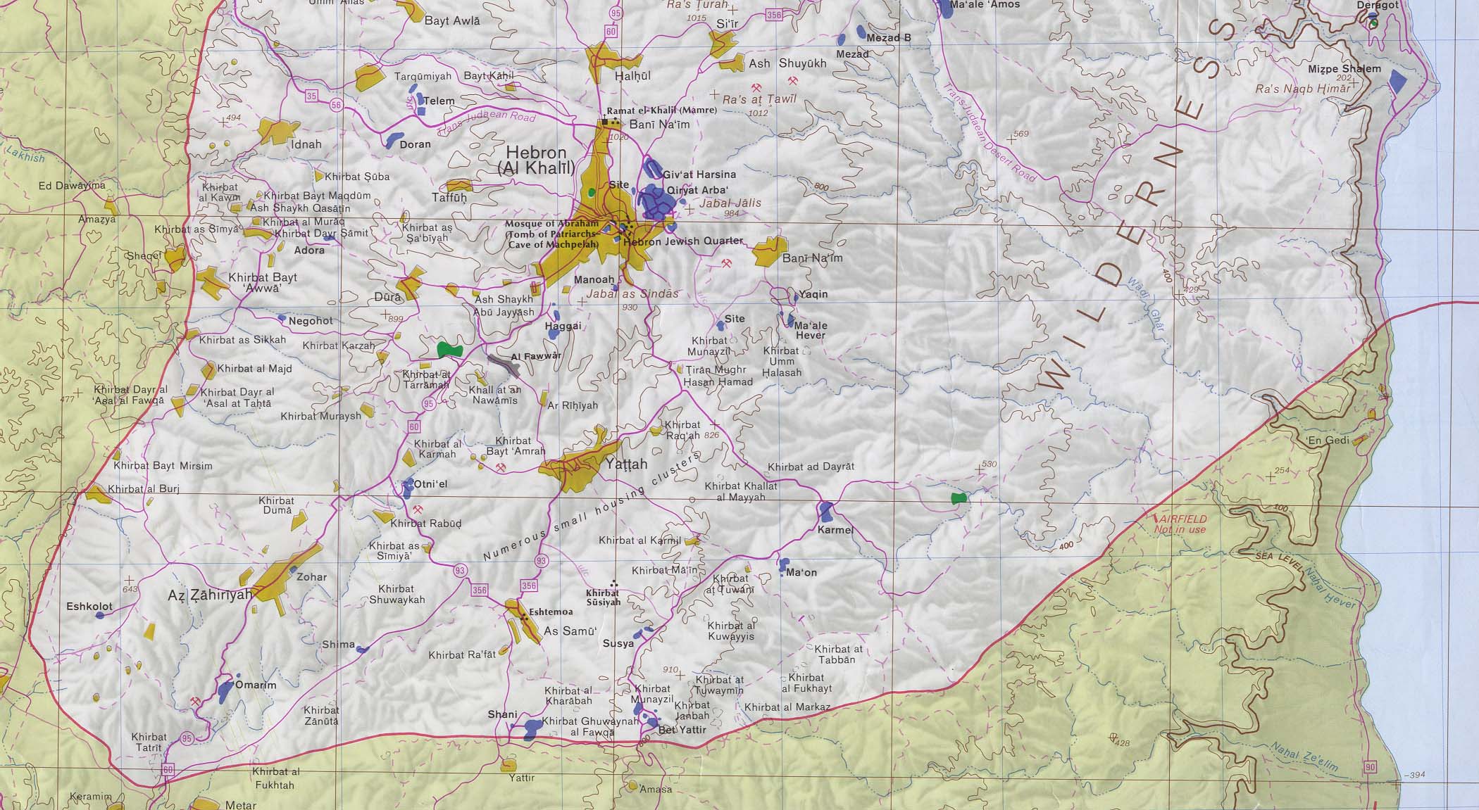
- West Bank - Far South Including Hebron (388K)
- Amman, Jordan Region (278K)
- West Bank - Entire Map (3.5MB)
- West Bank 2008 original scale 1:150,000 (12.2MB) Orthophoto map
- West Bank (Small Map) 2014 (30.9K)
- [West Bank] Map shows Jerusalem, Northern Dead Sea, adjacent West Bank and Amman, Jordan (topographic map in Russian) original scale 1:200,000. Soviet General Staff sheet H-36-VI, 1985 (2.4MB)
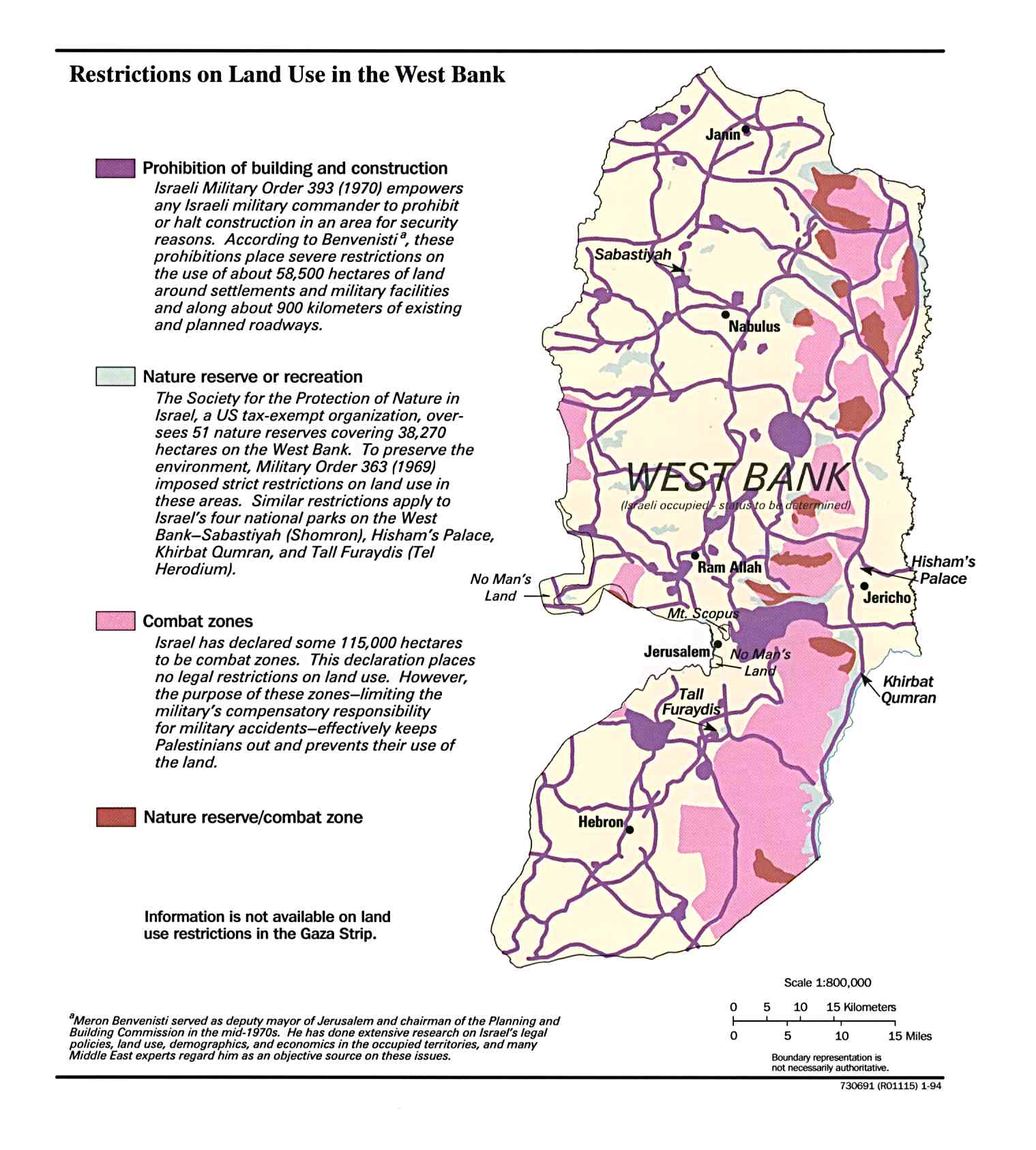
- West Bank, Restrictions on Land Use in December 1993 (191K)
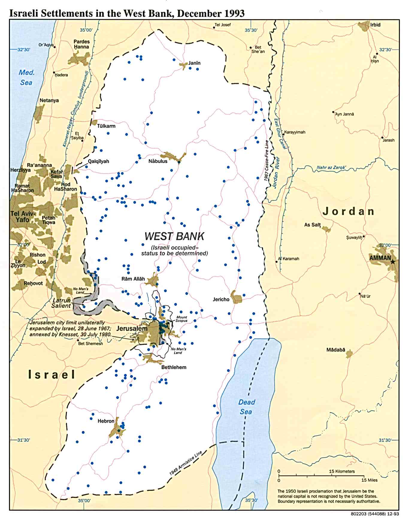
- Israeli Settlements in the West Bank 1993 (216K)
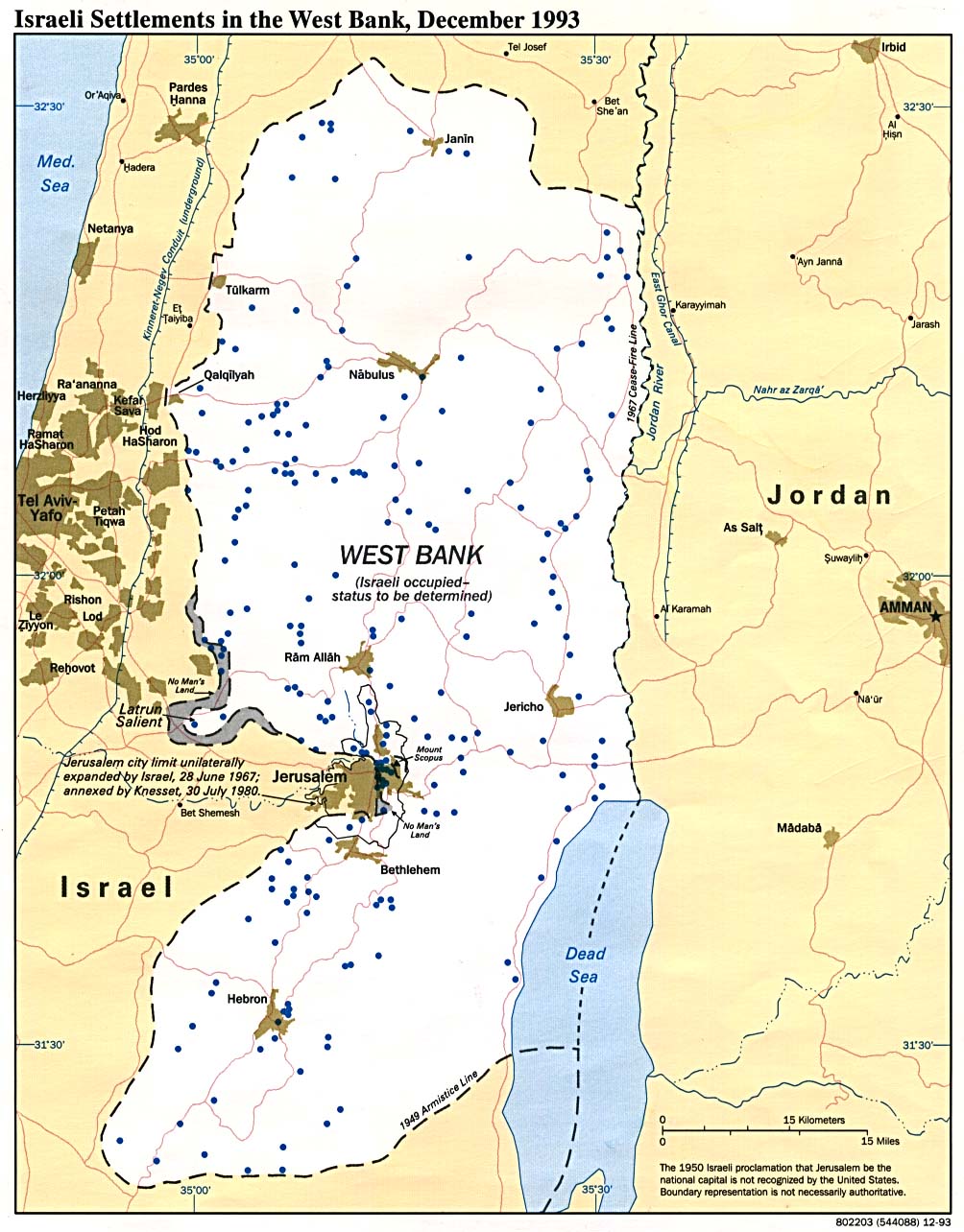
- Israeli Settlements in the West Bank December 1993 (156K)
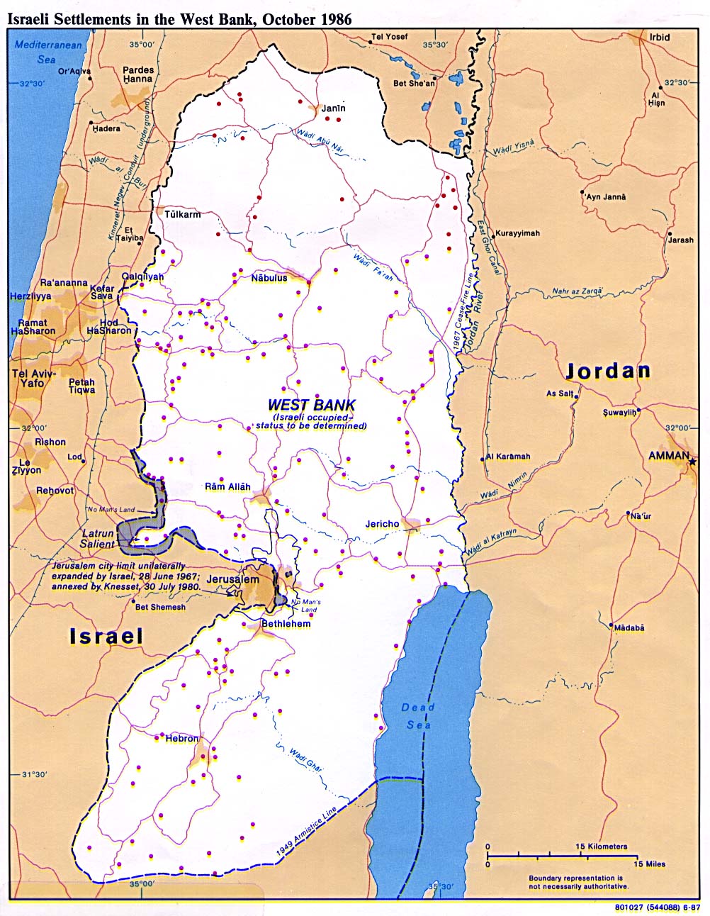
- Israeli Settlements in the West Bank 1986 (256K)
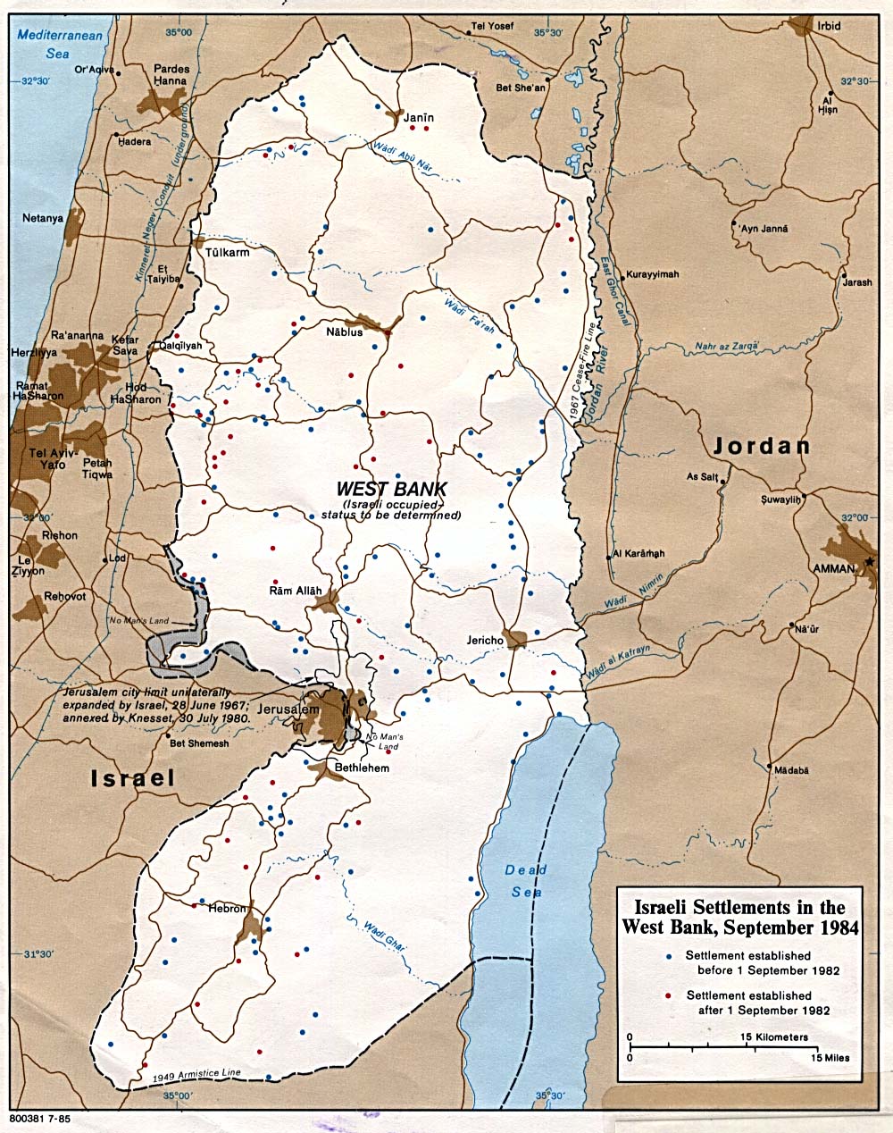
- Israeli Settlements in the West Bank 1985 (278K)
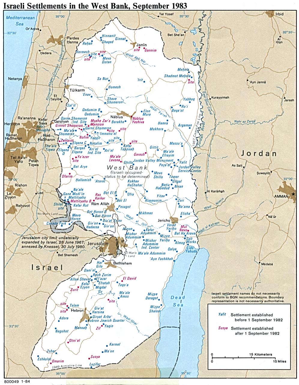
- Israeli Settlements in the West Bank 1983 (289K)
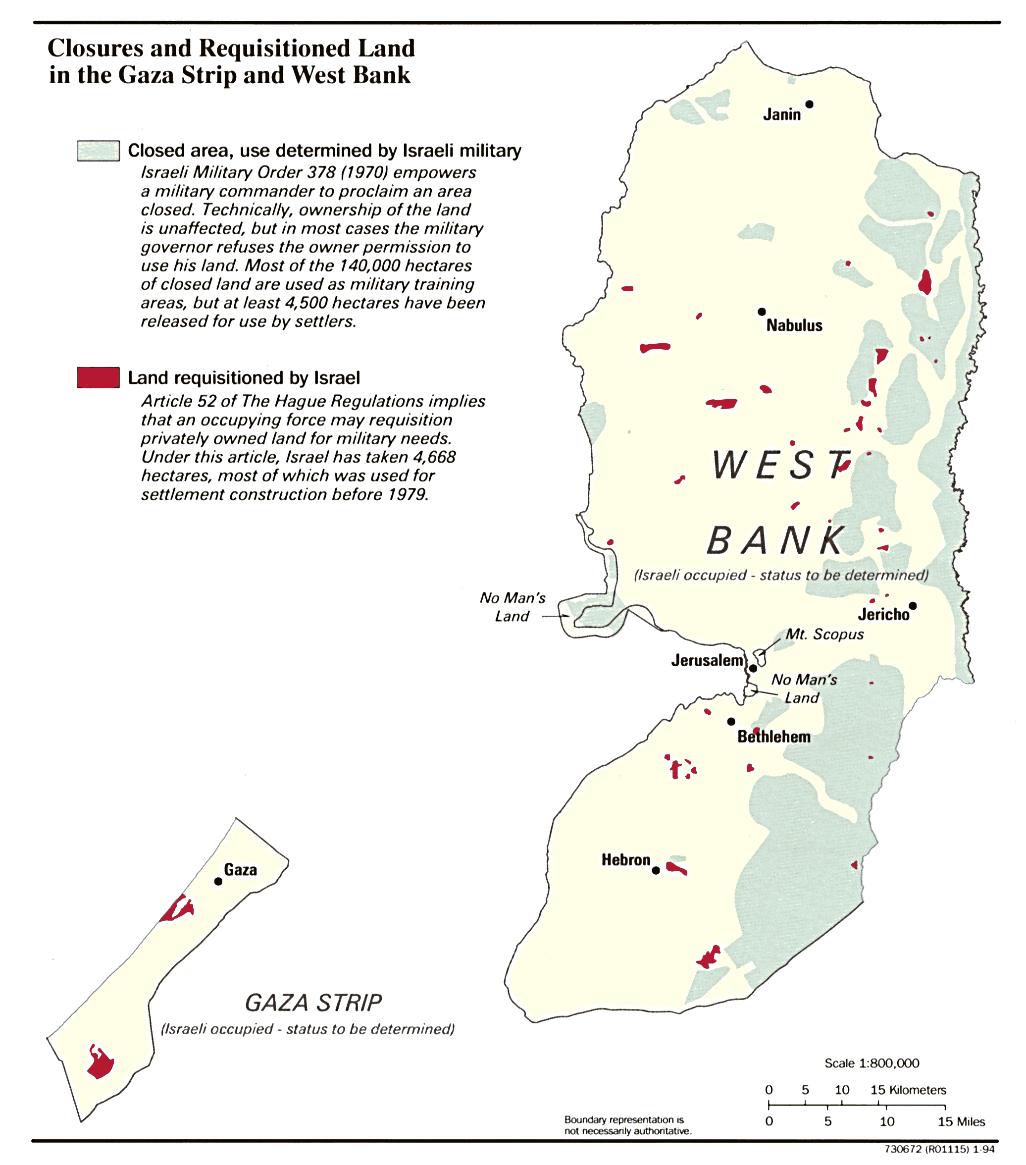
- Gaza Strip and the West Bank, Closures and Requisitioned Land in January 1994 (339K)
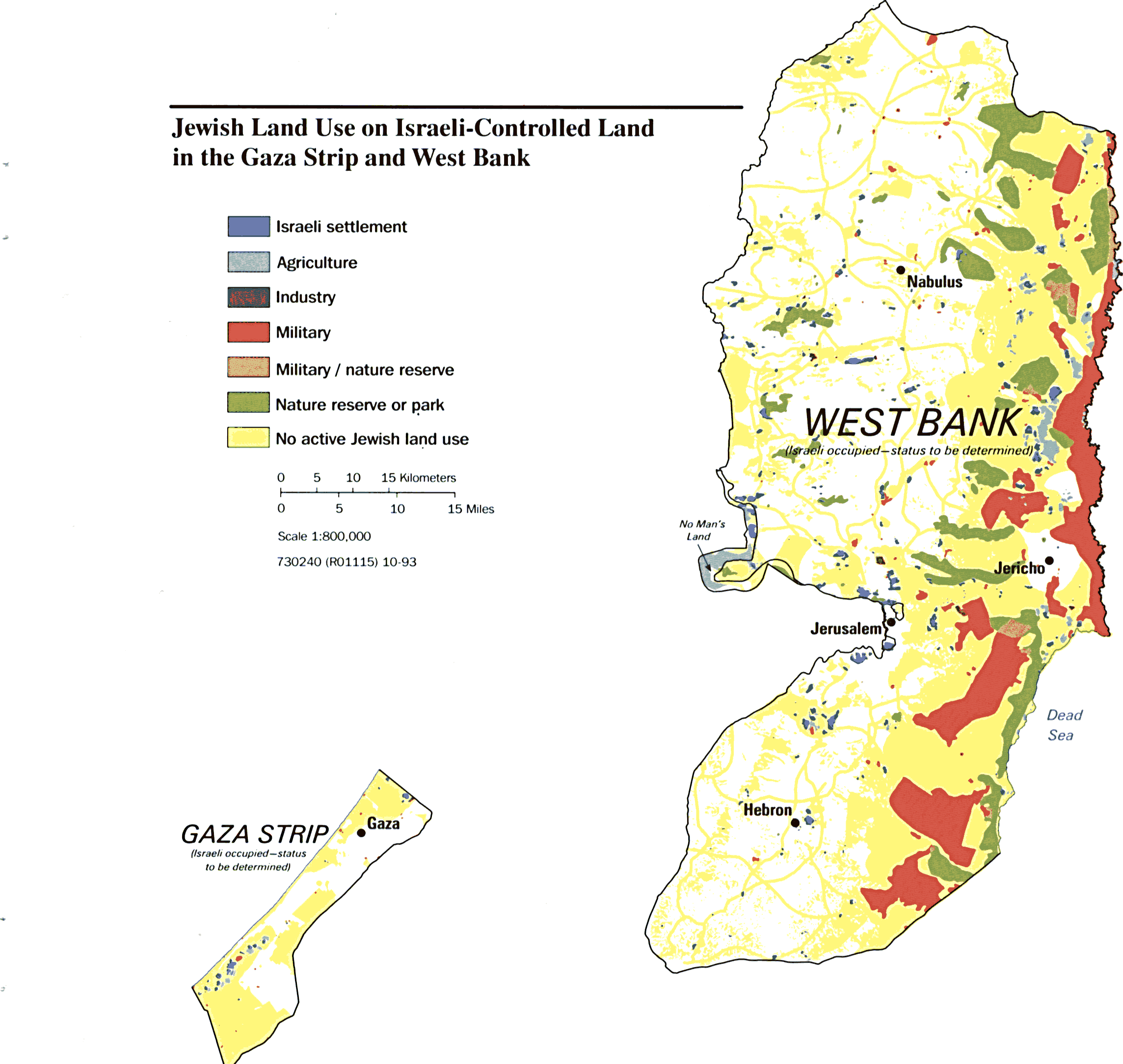
- Gaza Strip and the West Bank, Jewish Land Use on Israeli-Controlled Land in October 1993 (235K)
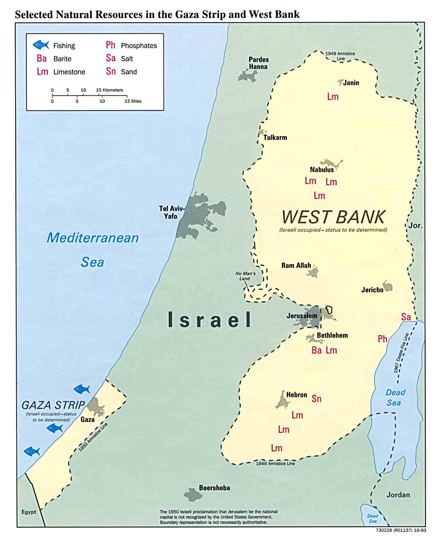
- Gaza Strip and the West Bank, Selected Natural Resources in January 1994 (134K)
![[West Bank]](middle_east_and_asia/amman_1985.jpg)
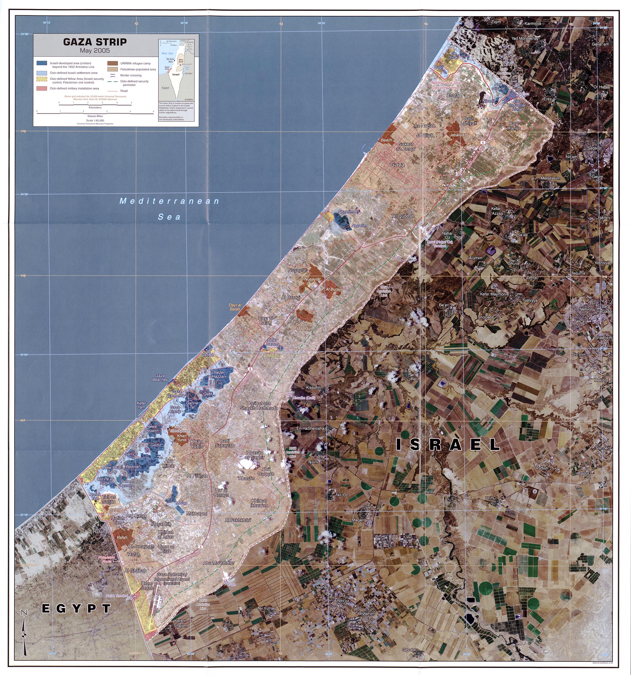
- Gaza Strip May 2005 scale 1:65,000 (1.4MB)
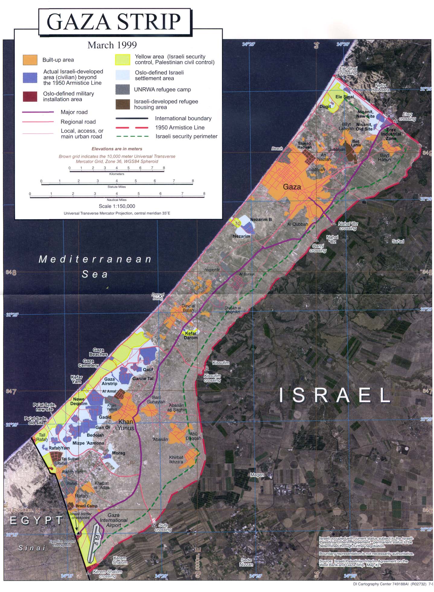
- Gaza Strip July 1999 original scale 1:150,000 (364K) Orthophoto map
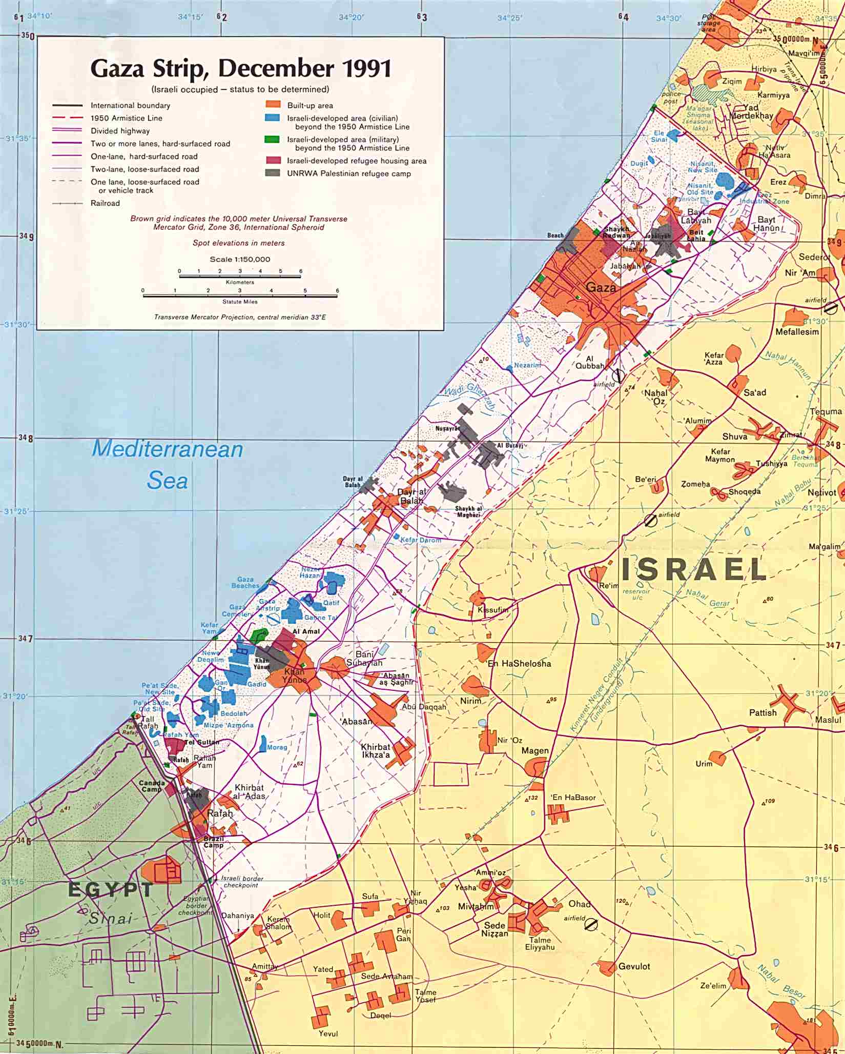
- Gaza Strip December 1991 original scale 1:150,000 (238K)
- 1:500,000 - Tactical Pilotage Charts U.S. National Imagery and Mapping Agency. Not for navigational use
- This series covers Gaza Strip
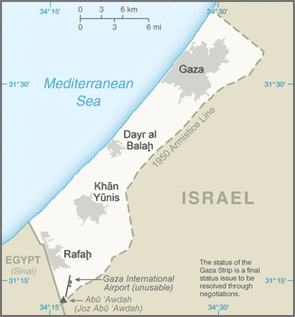
- Gaza Strip (Small Map) 2016 (16.4K)
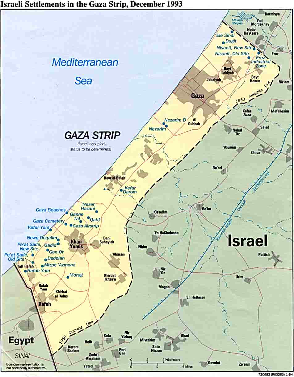
- Gaza Strip, Israeli Settlements December 1993 (75K)and pdf format (78K)
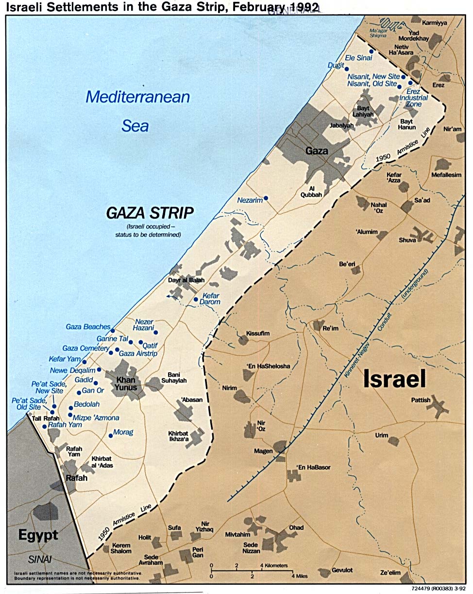
- Israeli Settlements in the Gaza Strip 1992 (242K)
- Gaza Strip and the West Bank, Closures and Requisitioned Land in January 1994 (339K)
- Gaza Strip and the West Bank, Jewish Land Use on Israeli-Controlled Land in October 1993 (235K)
- Gaza Strip and the West Bank, Selected Natural Resources in January 1994 (134K)
- This series covers Gaza Strip
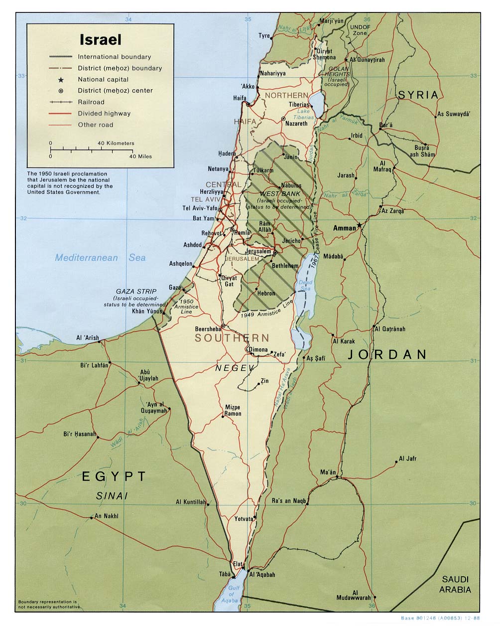
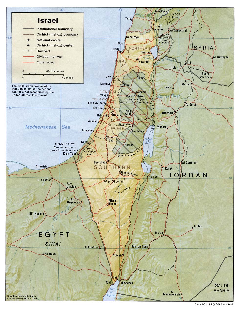
- Israel (Political) 1988 (207K)
- Israel (Shaded Relief) 1988 (247K)
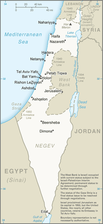
- Israel (Small Map) 2016 (42.7K)
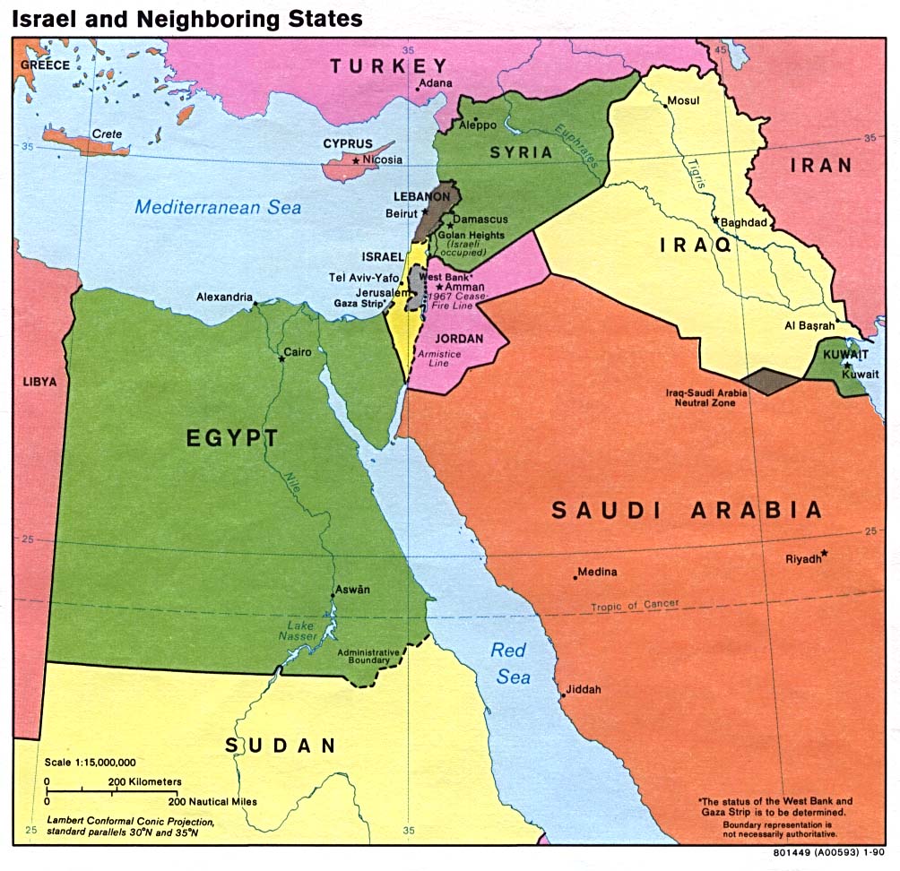
- Israel and Neighboring States (Political) 1990 (170K)
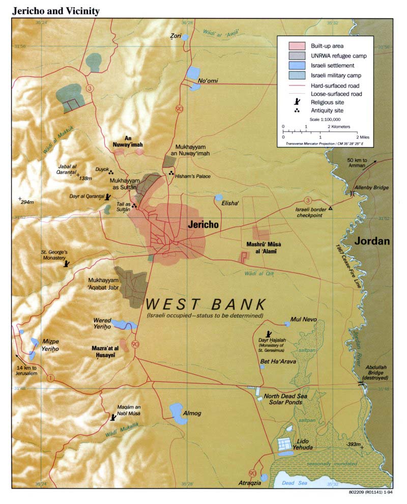
- Jericho and Vicinity January 1994 (294K)
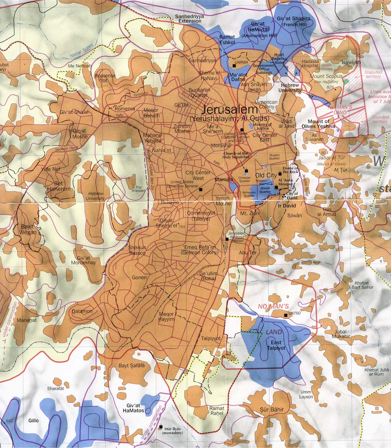
- Jerusalem Portion of "Jerusalem and Vicinity" March 1993 original scale 1:35,000 (294K)
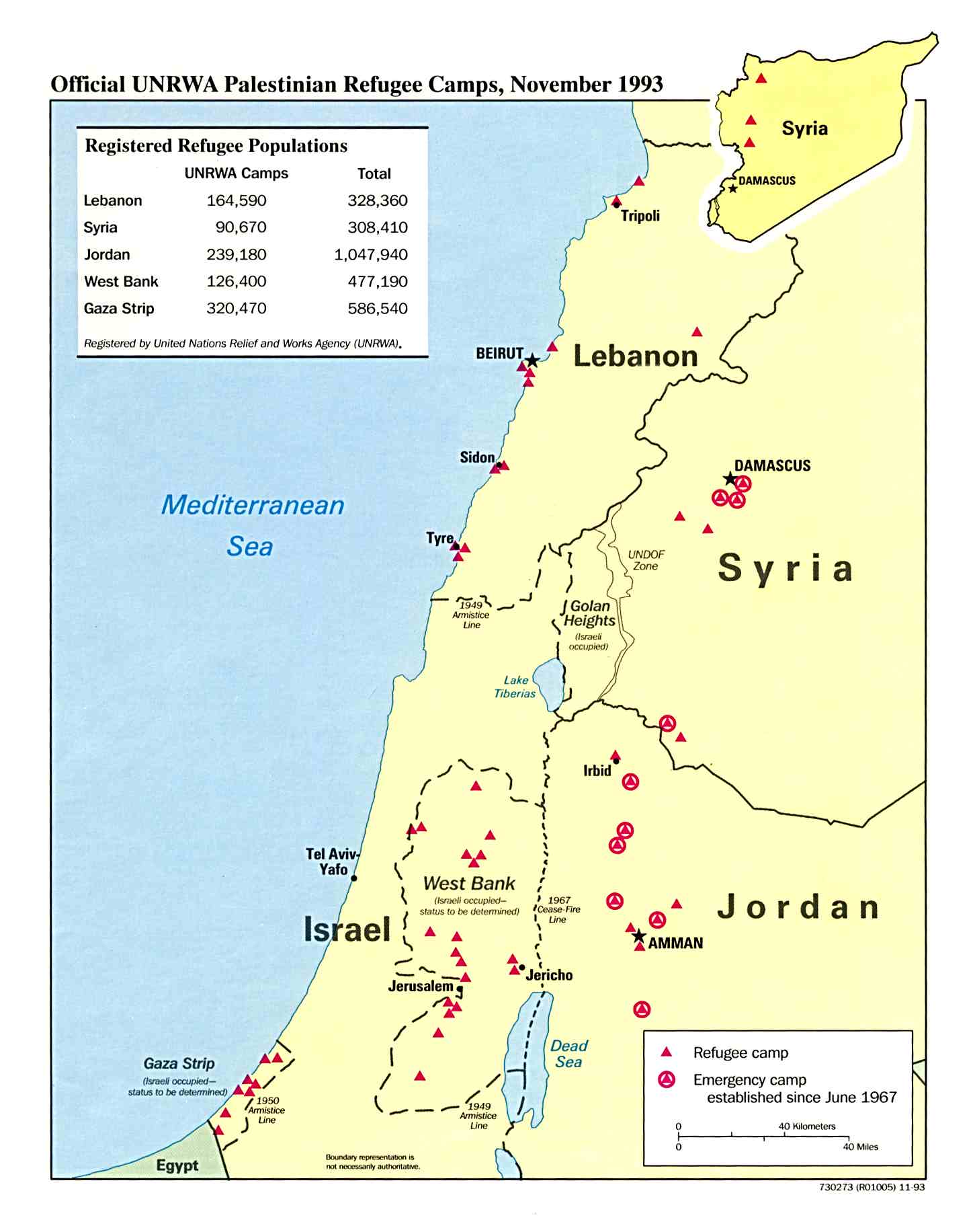
- Palestinian Refugee Camps November 1993 (133K)
Maps on Other Web Sites