Perry-Castañeda Library
Map Collection
Eritrea Maps
The following maps were produced by the U.S. Central Intelligence Agency unless otherwise indicated.
Country Maps- Eritrea (Political) 1986 (219K) and pdf format (226K)
- Eritrea (Shaded Relief) 1993 (216K)and pdf format (219K)
- Eritrea (Small Map) 2016 (22.4K)
- Eritrea and Ethiopia 2009 (1.73MB)
- Eritrea and Northern Ethiopia (Shaded Relief) 2000 (185K)and pdf format (191K)
- Eritrea and Northern Ethiopia (Shaded Relief) 1999 (321K) and pdf format (332K)
- Asmara/Massawa Area (tactical pilotage chart) original scale 1:500,000 Portion of Defense Mapping Agency TPC K-5B 1988 (331K) Not for natigational use
- Assab (tactical pilotage chart) original scale 1:500,000 Portion of Defense Mapping Agency TPC K-5B 1988 (274K) Not for natigational use
- 1:2,000,000 - Africa Topographic Maps U.S. Defense Mapping Agency
- Sheet 15 includes Eritrea (formerly part of Ethiopia)
- 1:1,000,000 - International Map of the World U.S. Army Map Service
- Covers most of Eritrea (formerly part of Ethiopia). Clickable map
- 1:1,000,000 - Operational Navigation Chart Series [Aeronautical Charts] Not for navigational use
- Sheets K-5 and J-6 cover Eritrea (formerly part of Ethiopia)
- 1:500,000 - Tactical Pilotage Charts U.S. National Imagery and Mapping Agency. Not for navigational use
- This series covers Eritrea
- Sheet 15 includes Eritrea (formerly part of Ethiopia)
- Ethiopia Maps
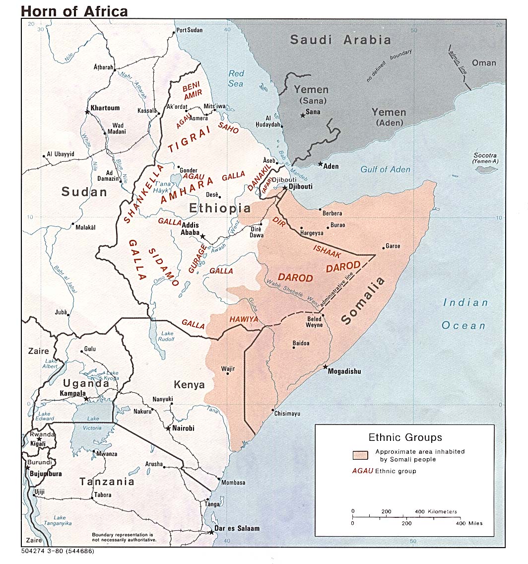
- Horn of Africa Ethnic Groups 1980 (213K)
Maps on Other Web Sites