Perry-Castañeda Library
Map Collection
Burundi Maps
The following maps were produced by the U.S. Central Intelligence Agency, unless otherwise indicated.
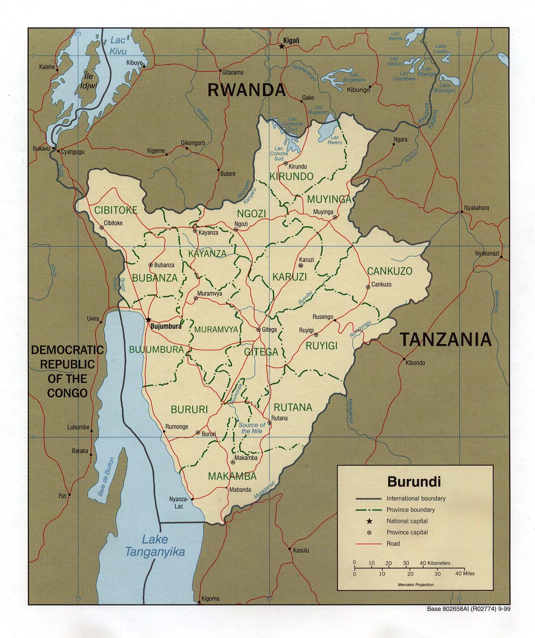
Country Maps- Burundi (Political) 1999 (262K)and pdf format (271K)
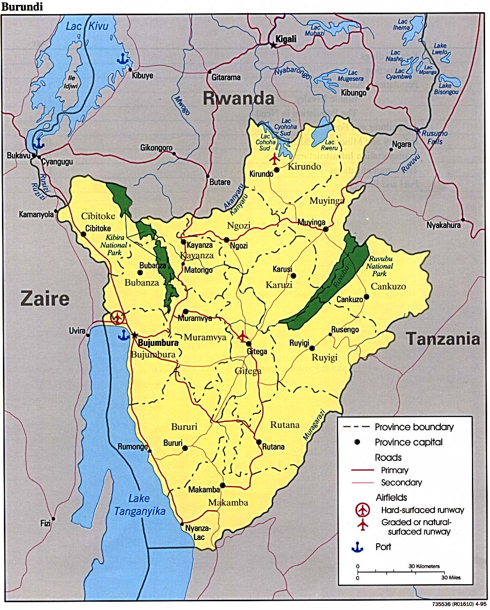
- Burundi (Political) 1995 (325K) and pdf format (329K)
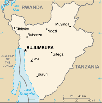
- Burundi (Small Map) 2016 (10.5K)
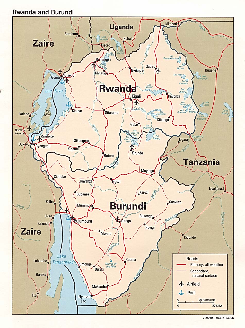
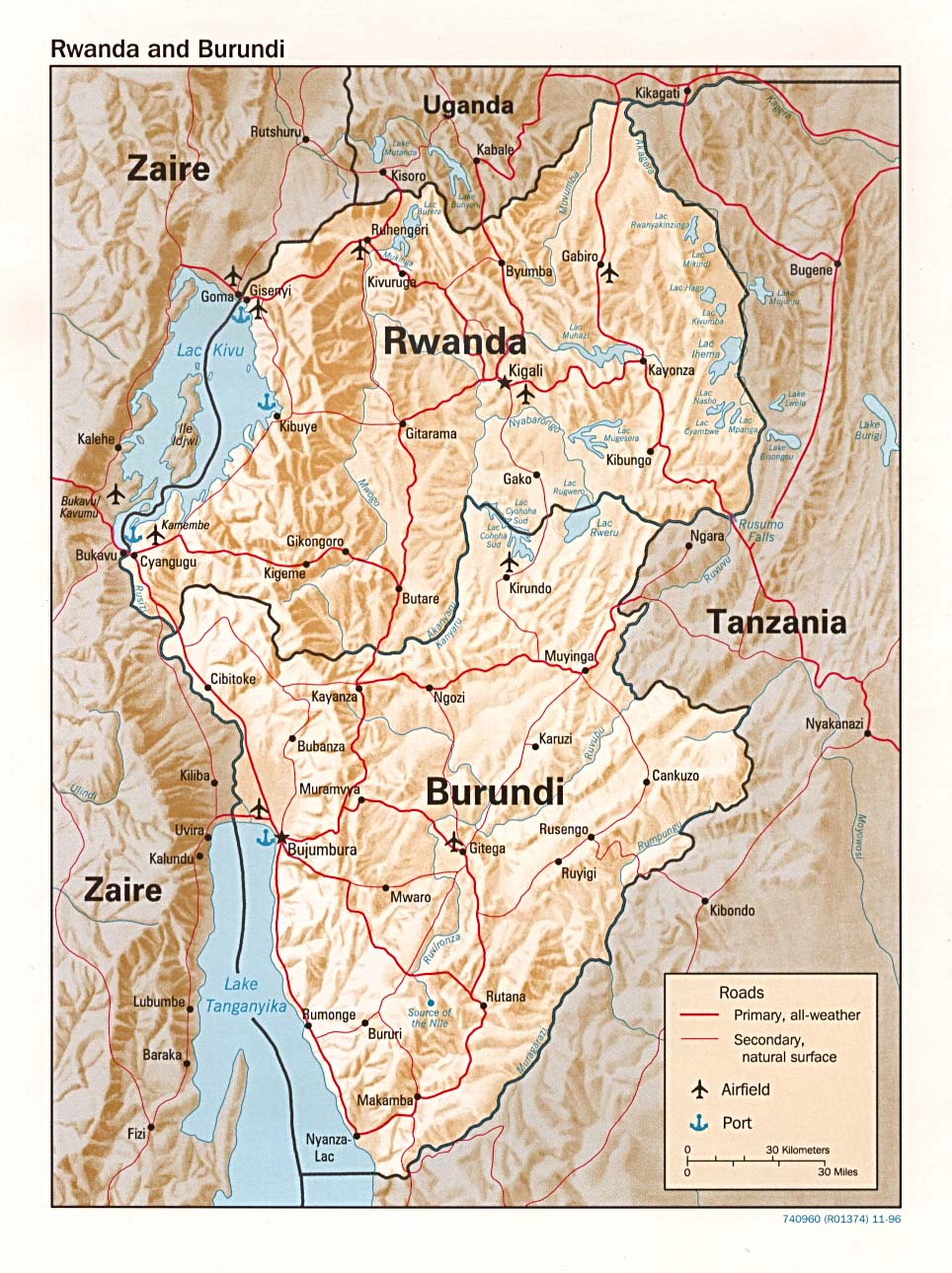
- Burundi and Rwanda (Political) 1996 (254K)
- Burundi and Rwanda (Shaded Relief) 1996 (293K)
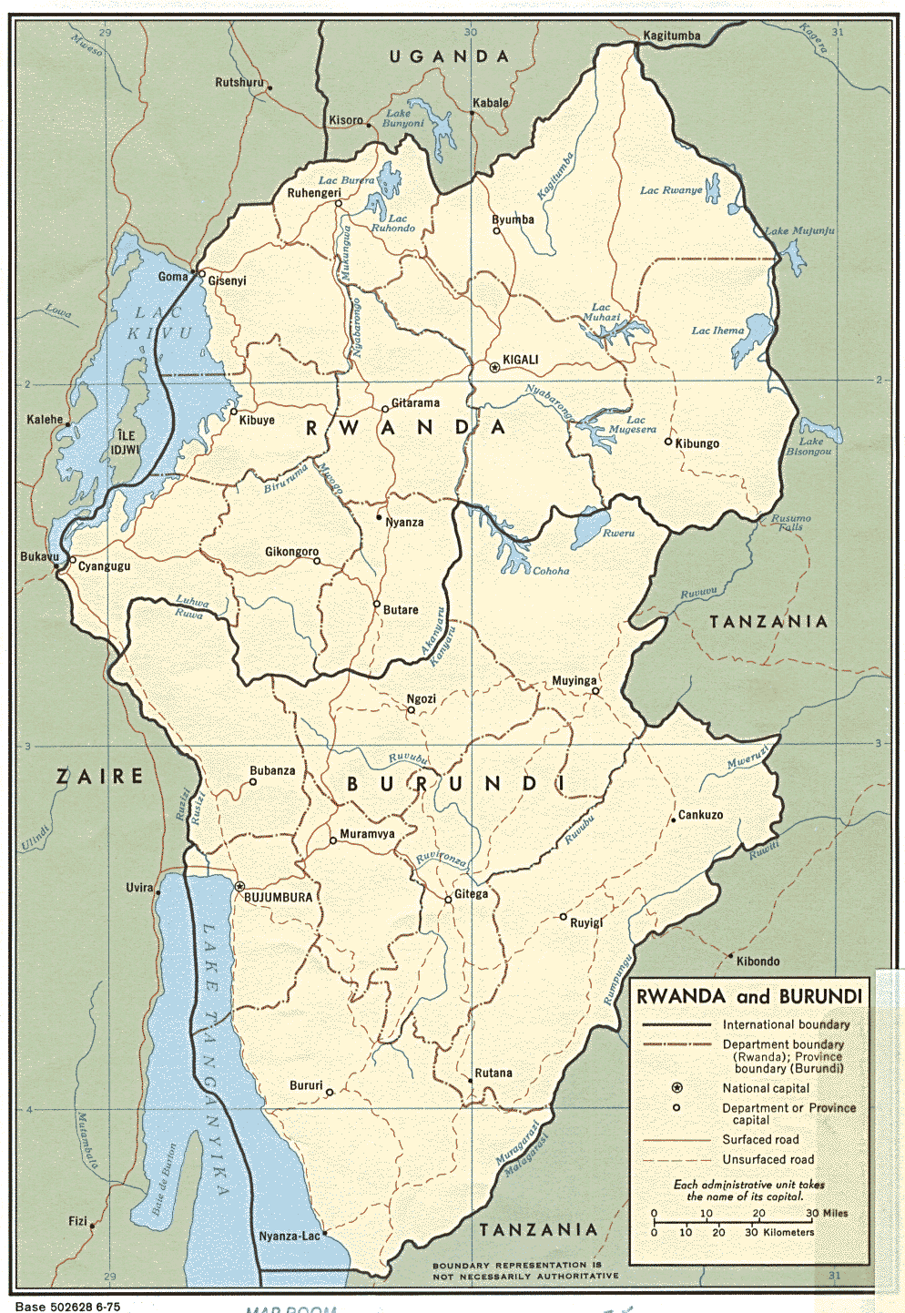
- Burundi and Rwanda (Political) 1975 (311K)
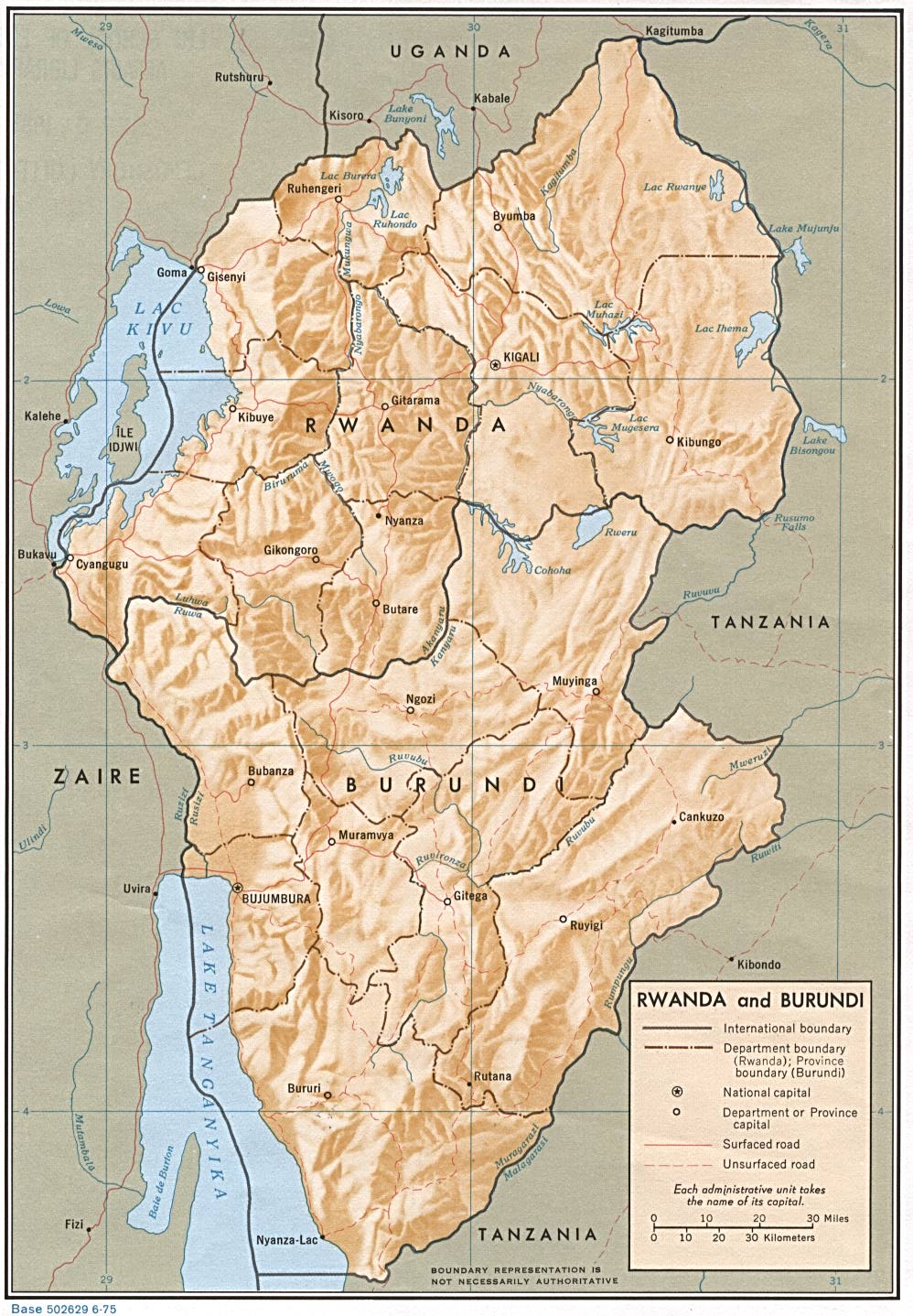
- Burundi and Rwanda (Shaded Relief) 1975 (288K)
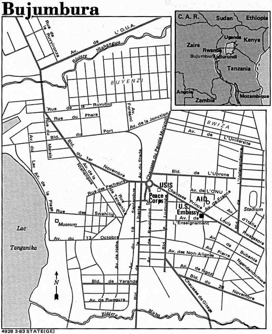
- Bujumbura U.S. Dept. of State 1983 (80K)
- Bujumbura 1:12,500, Edition 3-DMA, Series Z921, Defense Mapping Agency, 1991 (11MB)
- 1:2,000,000 - Africa Topographic Maps Series 2201, U.S. Army Map Service
- Sheets 23, 24, 27 and 28 cover Burundi
- 1:1,000,000 - International Map of the World U.S. Army Map Service
- Covers Burundi. Clickable map
- 1:500,000 - Tactical Pilotage Charts U.S. National Imagery and Mapping Agency. Not for navigational use
- This series covers most of Burundi
- 1:250,000 - Joint Operations Graphic (Air) Series 1501, U.S. Defense Intelligence Agency Not for navigational use
- Sheets SA 35-12 and SB 35-4 cover parts of Burundi. Courtesy of T. R. Smith Map Collection, University of Kansas Libraries
- 1:200,000 - Ruanda-Urundi Topographic Maps U.S. Army Map Service, Series Z522, 1942
- 1:100,000 - Ruanda-Urundi Topographic Maps U.S. Army Map Service, Series Z621, 1942
- 1:50,000 - Burundi Topographic Maps Series Z724, U.S. Defense Mapping Agency, 1981-1994
- This series covers most of Burundi
- Sheets 23, 24, 27 and 28 cover Burundi
- Burundi - Major Agricultural Areas 1995 (232K)
- Burundi - Population Density by Commune, 1990 1995 (195K)
- Burundi - Power Network, 1990 1995 (266K)
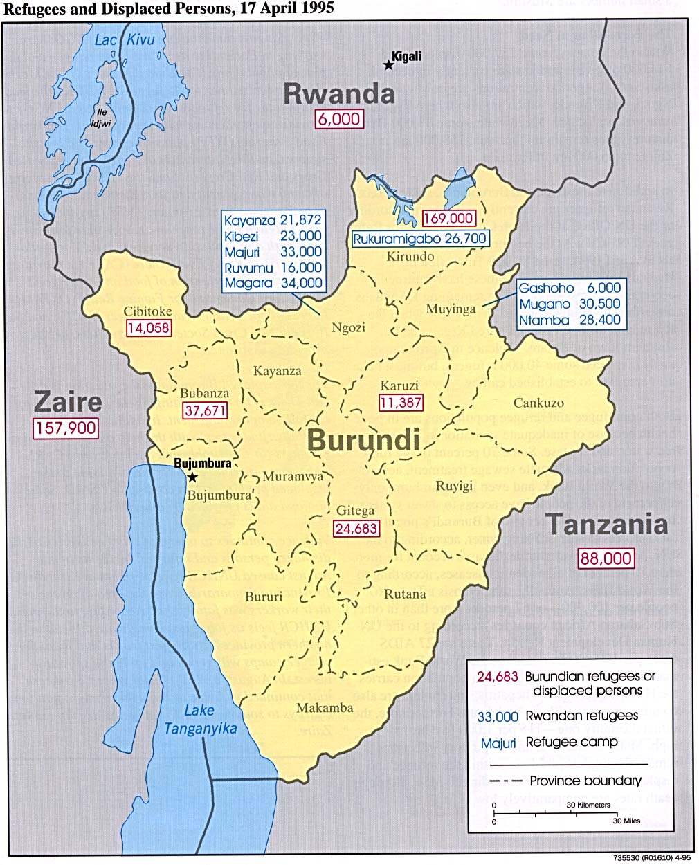
- Burundi - Refugees and Displaced Persons, 17 April 1995 1995 (228K)
Maps on Other Web Sites