Perry-Castañeda Library
Map Collection
Democratic Republic of the Congo (former Zaire) Maps
The following maps were produced by the U.S. Central Intelligence Agency, unless otherwise indicated.
Country Maps- Congo, Democratic Republic (former Zaire) (Political) 1998 (425K) and pdf format (248K)
- Congo, Democratic Republic (former Zaire) (Shaded Relief) 1998 (476K) and pdf format (328K)
- Congo, Democratic Republic (former Zaire) (Small Map) 2016 (24K)
- Zaire (Political) 1997 (264K) and pdf format (253K)
- Zaire (Shaded Relief) 1997 (272K) and pdf format (261K)
- Zaire (Shaded Relief) 1983 (256K)
- Zaire 1973 (761K)
- Bukavu original scale 1:12,500, Edition 5-DMA, Series Z901. U.S. Defense Mapping Agency, 1981. (13.5MB)
- Goma original scale 1:7,500, Edition 3-DMA, Series Z091. U.S. Defense Mapping Agency, 1982. (14.2MB)
- Kalemie [Albertville/Albertstad] original scale 1:12,500, Edition 1-DMA, Series Z901. U.S. Defense Mapping Agency, 1980. (6.6MB)
- [Kananga] Luluabourg original scale 1:12,500, Edition 2-AMS, Series Z901. U.S. Army Map Service, 1952. (11.6MB)
- Kisangani 1:12,500, Edition 2-NIMA, Series Z901. National Imagery and Mapping Agency, 1997 (12MB)
- Kinshasa "Plan de Kinshasa" (851 K) and Gombe and Centre Ville Area (590 K) Tourist Map circa 2001
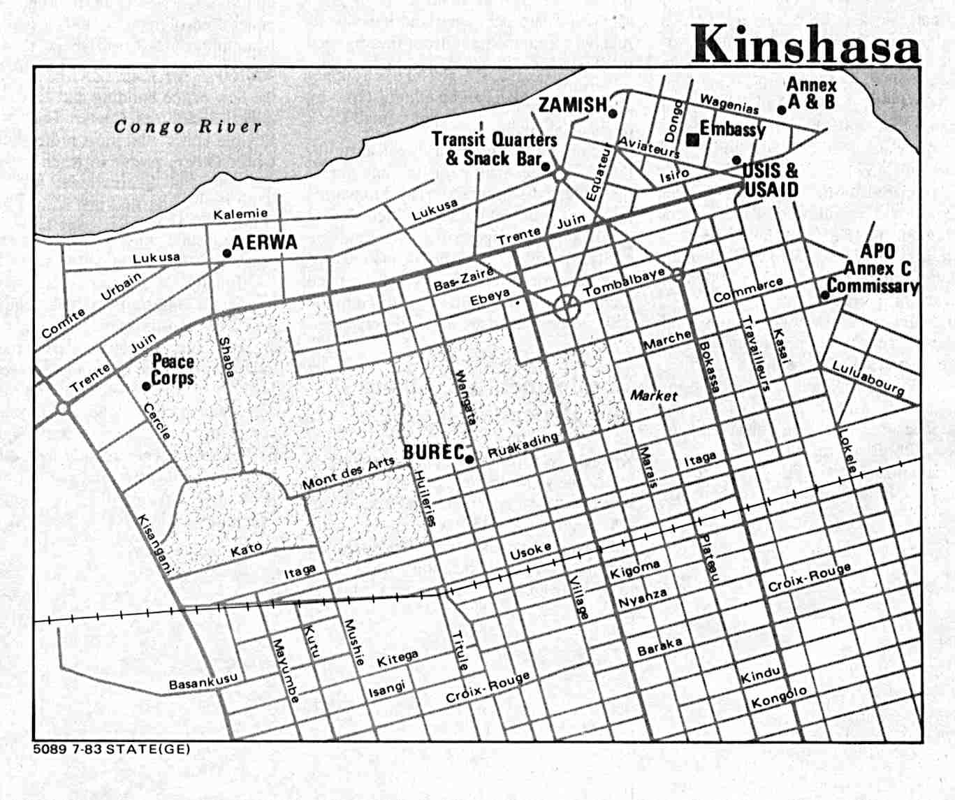
- Kinshasa U.S. Dept. of State 1983 (107K)
- Likasi [Jadotville/Jadotstad] original scale 1:12,500, Edition 1-DMA, Series Z901. U.S. Defense Mapping Agency, 1980. (9.8MB)
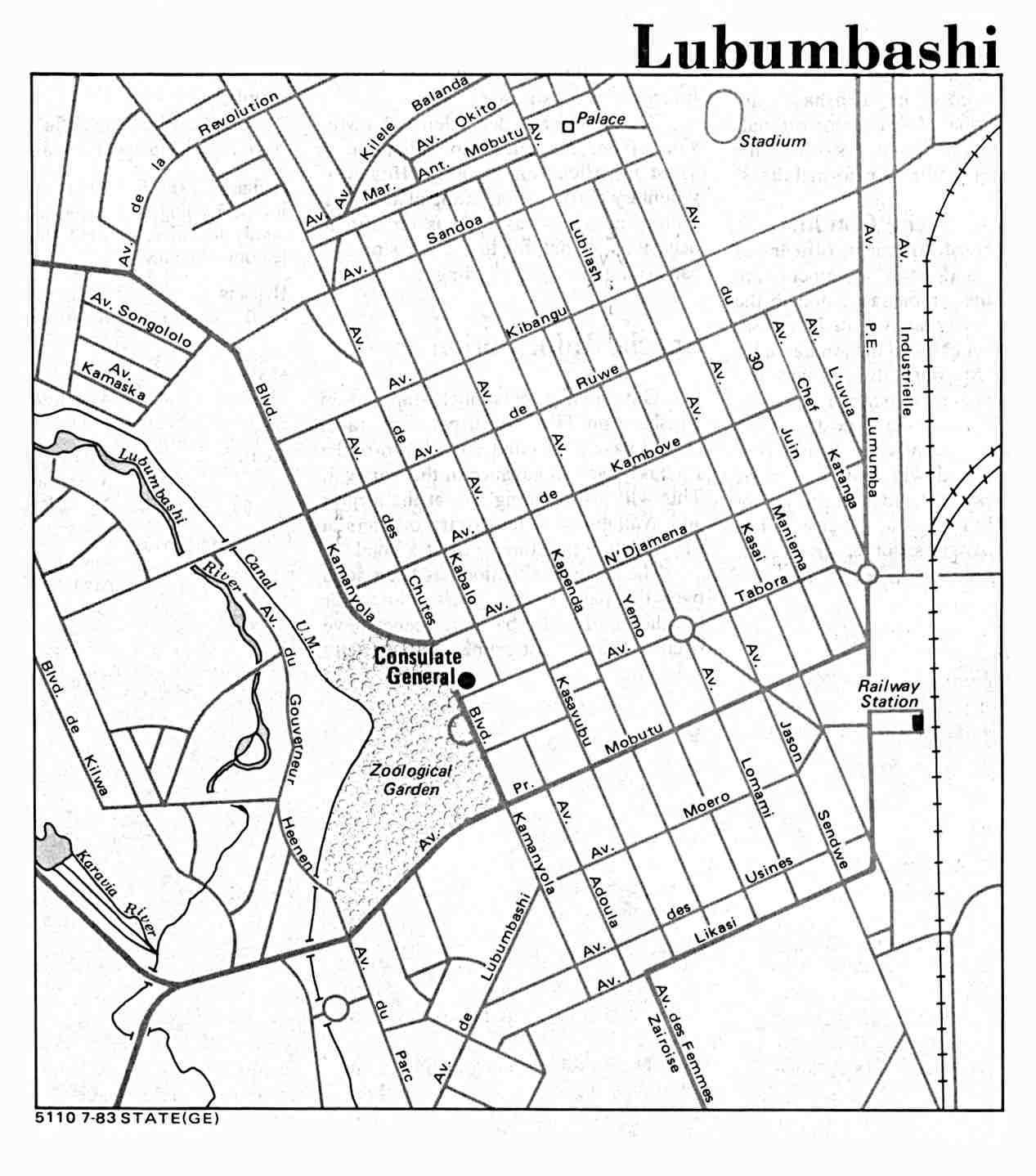
- Lubumbashi U.S. Dept. of State 1983 (107K)
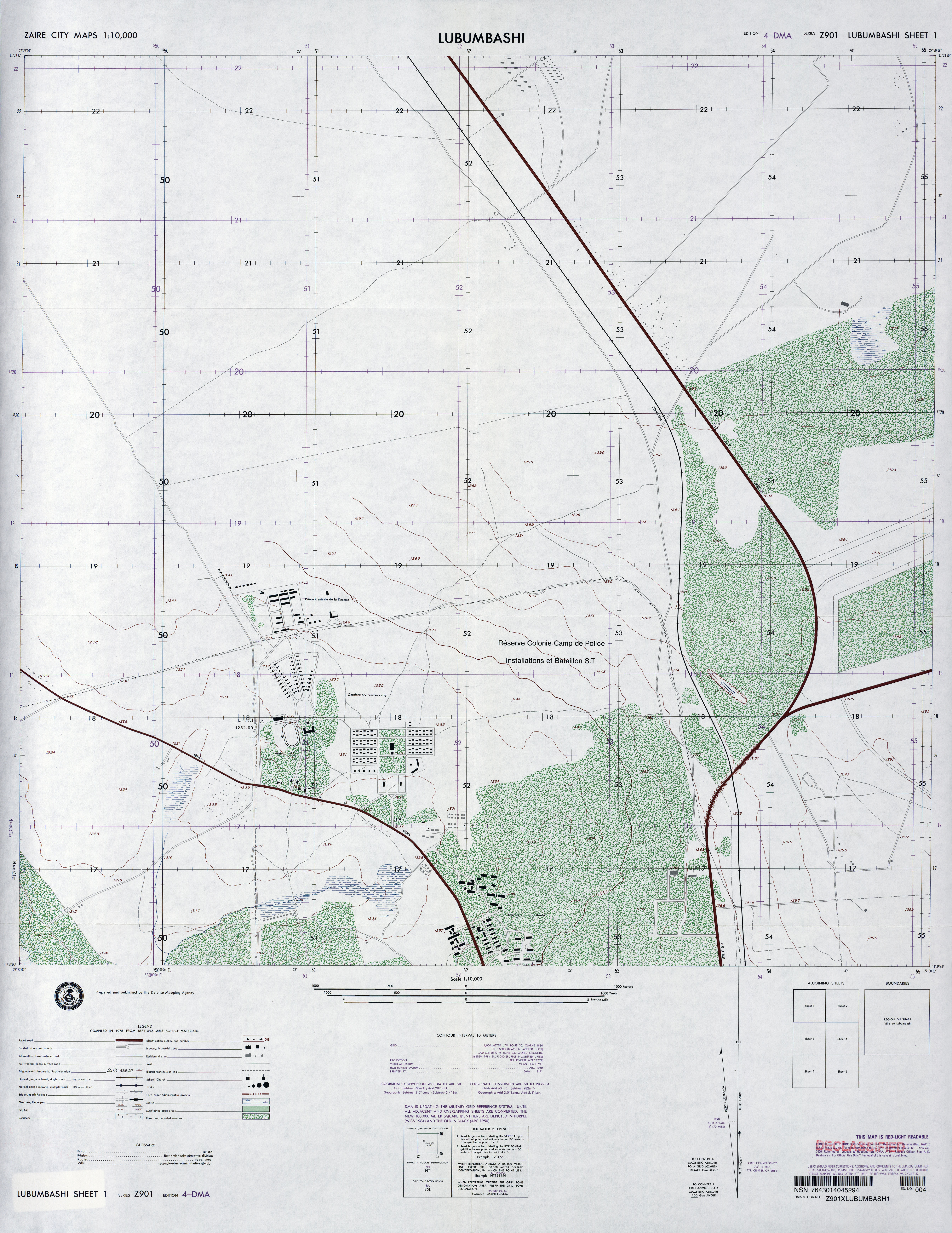
- Lubumbashi, Sheet 1 1:10,000, Edition 4-DMA, Series Z901. U.S. Defense Mapping Agency, 1978 (6.1MB)
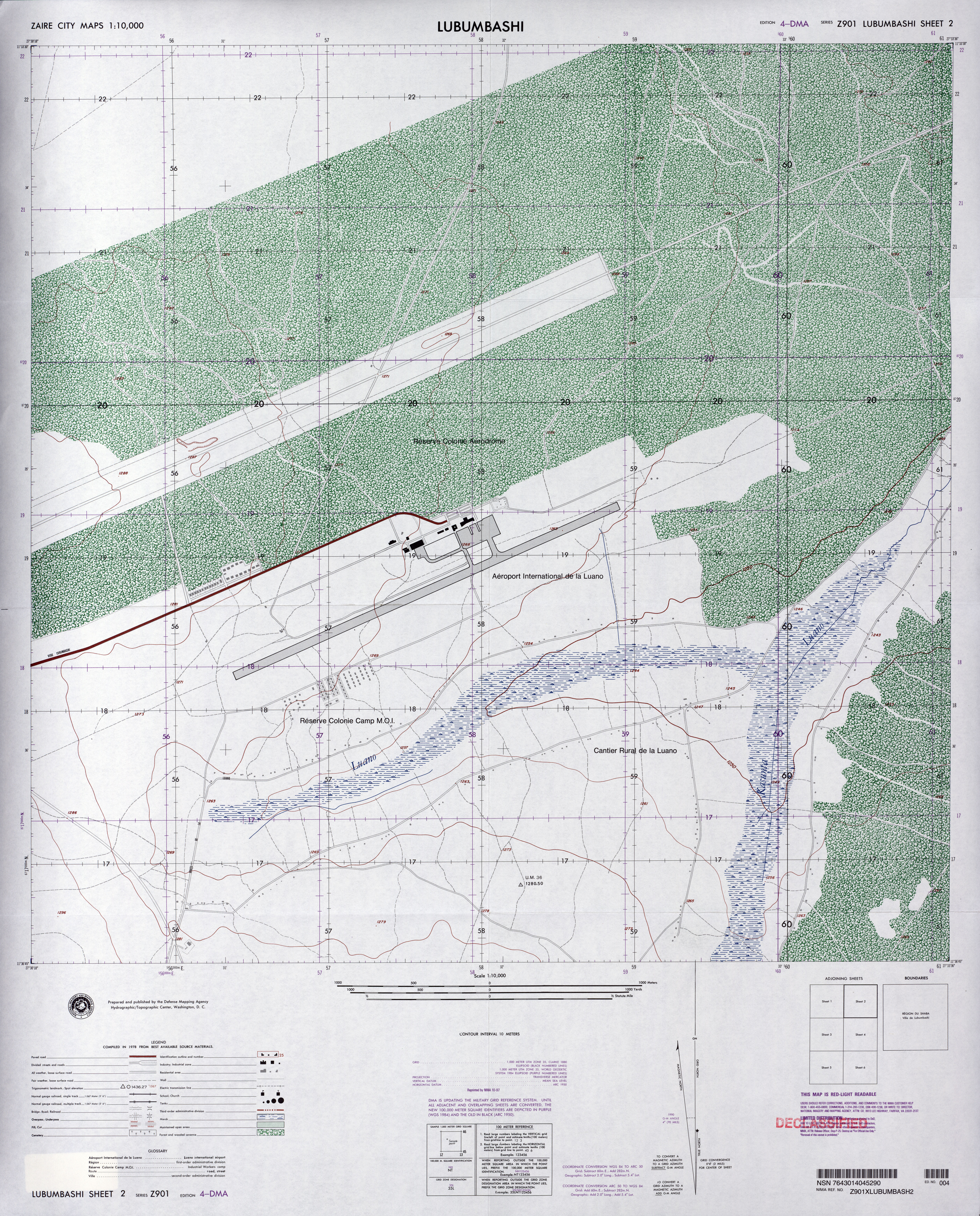
- Lubumbashi, Sheet 2 1:10,000, Edition 4-DMA, Series Z901. U.S. Defense Mapping Agency, 1978 (9.1MB)
- Lubumbashi, Sheet 3 1:10,000, Edition 4-DMA, Series Z901. U.S. Defense Mapping Agency, 1978 (7.7MB)
- Lubumbashi, Sheet 4 1:10,000, Edition 4-DMA, Series Z901. U.S. Defense Mapping Agency, 1978 (5.7MB)
- Lubumbashi, Sheet 5 1:10,000, Edition 4-DMA, Series Z901. U.S. Defense Mapping Agency, 1978 (8.2MB)
- Lubumbashi, Sheet 6 1:10,000, Edition 4-DMA, Series Z901. U.S. Defense Mapping Agency, 1978 (5.1MB)
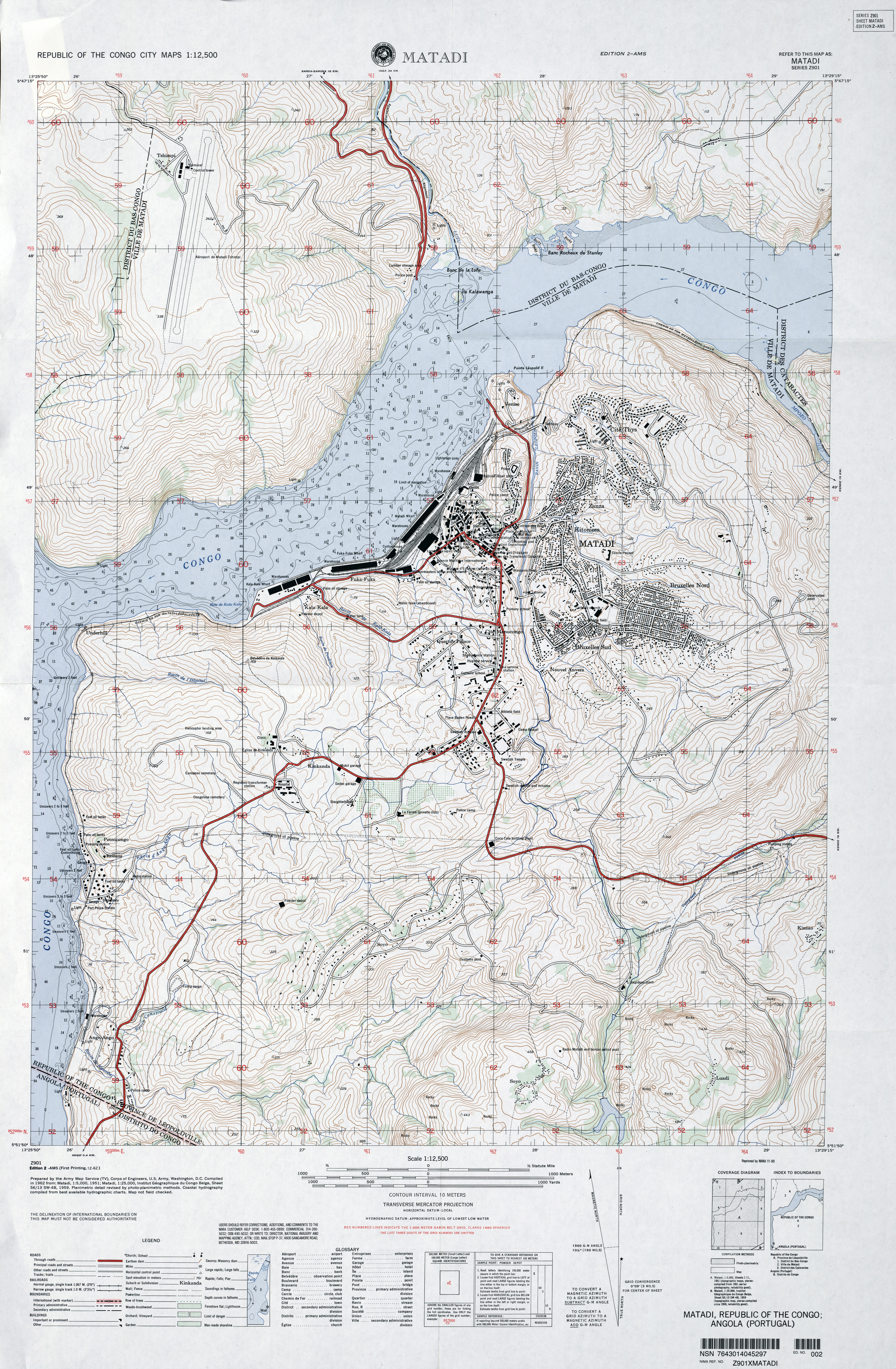
- Matadi original scale 1:12,500, Edition 2-AMS, Series Z901. U.S. Army Map Service, 1959. (8.3MB)
![Kalemie [Albertville/Albertstad]](africa/txu-oclc-55759960-kalemie-1980.jpg)
![[Kananga] Luluabourg](africa/txu-oclc-29595290-luluabourg-1952.jpg)
![Likasi [Jadotville/Jadotstad]](africa/txu-oclc-71752615-likasi-1980.jpg)
- 1:2,000,000 - Africa Topographic Maps Series 2201, U.S. Army Map Service
- Sheets 19, 22, 23, 24, 26, 27, 28 and 30 cover all of the country
- 1:2,000,000 - Zaire (West Central Region) portion of U.S. Army Map Service, 1957, revised 1961 (511K)
- 1:1,000,000 - International Map of the World U.S. Army Map Service
- Includes most of Congo. Clickable map
- 1:500,000 - Tactical Pilotage Charts U.S. National Imagery and Mapping Agency. Not for navigational use
- This series covers parts of Zaire
- 1:500,000 - Kinshasa Area (tactical pilotage chart) original scale 1:500,000 Portion of Defense Mapping Agency TPC M-3C 1996 (452K) Not for navigational use
- 1:250,000 - Joint Operations Graphic (Air) Series 1501, U.S. Defense Intelligence Agency. Clickable Index Map (29K) Not for navigational use
- Includes much of Congo. Many of these maps are courtesy of T. R. Smith Map Collection, University of Kansas Libraries
- 1:250,000 - Topographic Maps 1954- [South Africa Series] Series Z501, U.S. Army Map Service
- Includes the Katanga region
- 1:250,000 - Katanga Series Z523, U.S. Army Map Service, 1953-1960
- 1:200,000 - Belgian Congo Series Z521, U.S. Army Map Service, 1943
- 1:100,000 - Belgian Congo U.S. Army Map Service, 1942
- Zaire (Eastern Region) portion of CIA map, 1979 (476K)
- Sheets 19, 22, 23, 24, 26, 27, 28 and 30 cover all of the country
Related Maps on Other Web Sites