Perry-Castañeda Library
Map Collection
Western Sahara Maps
The following maps were produced by the U.S. Central Intelligence Agency, unless otherwise indicated.
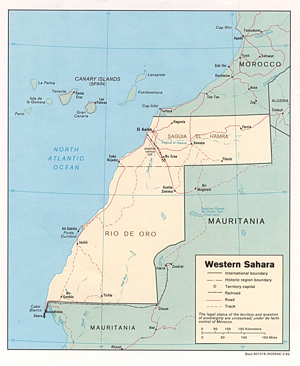
Country Maps- Western Sahara (Political) 1989 (157K) and pdf format (180K)
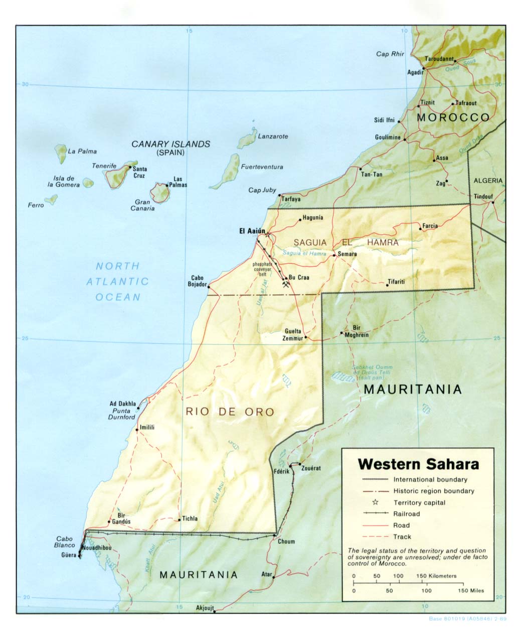
- Western Sahara (Shaded Relief) 1989 (135K) and pdf format (141K)
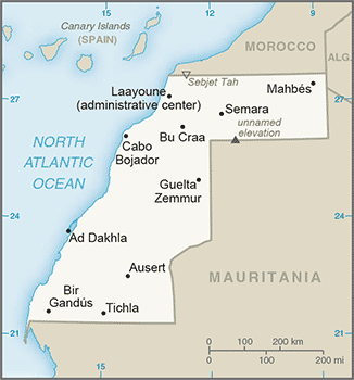
- Western Sahara (Small Map) 2016 (18.1K)
- 1:1,000,000 - Operational Navigation Chart Series U.S. Defense Mapping Agency Aerospace Center. Not for navigational use
- This series covers all of Western Sahara. Clickable map
- 1:1,000,000 - International Map of the World U.S. Army Map Service.
- Sheets NH 29, NG 28 and NF 28 include most of Western Sahara. Clickable map
- 1:2,000,000 - Africa Topographic Maps, Series 2201 U.S. Army Map Service
- Sheet 6 includes Western Sahara. Clickable map
- 1:500,000 - Tactical Pilotage Charts U.S. National Imagery and Mapping Agency. Not for navigational use
- This series covers Western Sahara
- 1:250,000 - North Africa Joint Operations Graphic Aeronautical charts. U.S. National Imagery and Mapping Agency. Not for navigational use
- This series includes 12 sheets for parts of Western Sahara. Clickable map
- 1:250,000 - West Africa Topographic Maps, Series P502 U. S. Army Map Service.
- This series includes the southern tip of Western Sahara
- This series covers all of Western Sahara. Clickable map
Related Maps on Other Web Sites