Perry-Castañeda Library
Map Collection
Washington Maps
State Maps
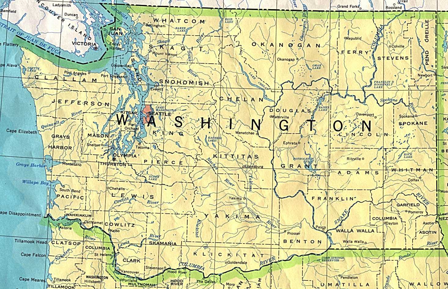
- Washington (base map) JPEG format (476K) County boundaries and names, county seats, rivers. Original scale 1:2,500,000 U.S. Geological Survey, 1972 limited update 1990
- Washington (outline map) JPEG format (86K) County boundaries and names. U.S. Bureau of the Census, 1990
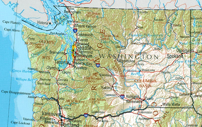
- Washington (reference map) JPEG format (237K) Shaded relief map with state boundaries, forest cover, place names, major highways. Portion of "The National Atlas of the United States of America. General Reference", compiled by U.S. Geological Survey 2001, printed 2002
- Washington (reference map) PDF format (240K) Shaded relief map with state boundaries, forest cover, place names, major highways. Portion of "The National Atlas of the United States of America. General Reference", compiled by U.S. Geological Survey 2001, printed 2002
- Washington - Federal Lands and Indian Reservations PDF format (603K) The National Atlas of the United States of America, U.S. Geological Survey, 2003
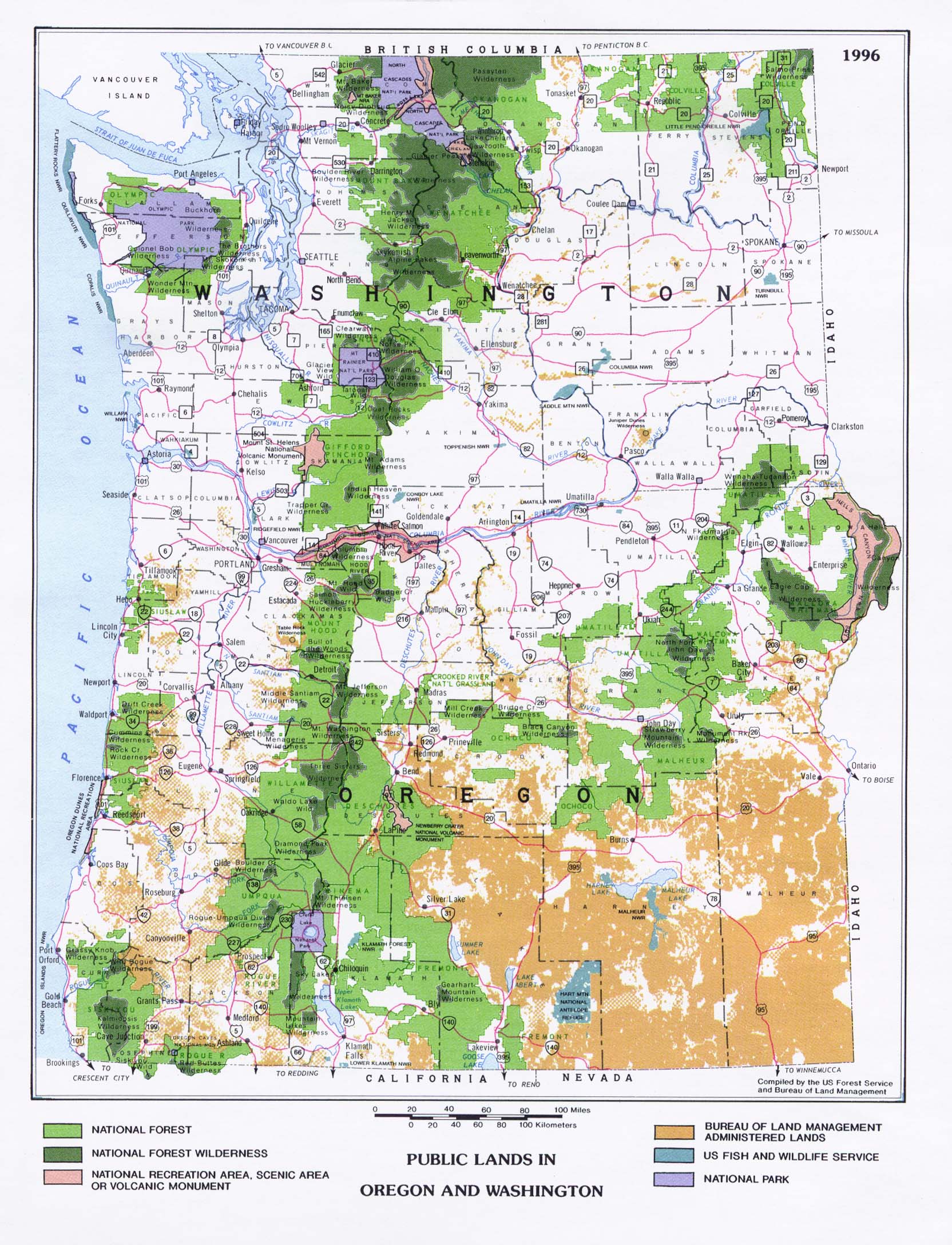
- Public Lands in Oregon and Washington Compiled by the U.S. Forest Service and Bureau of Land Management 1996 (545K)
City Maps
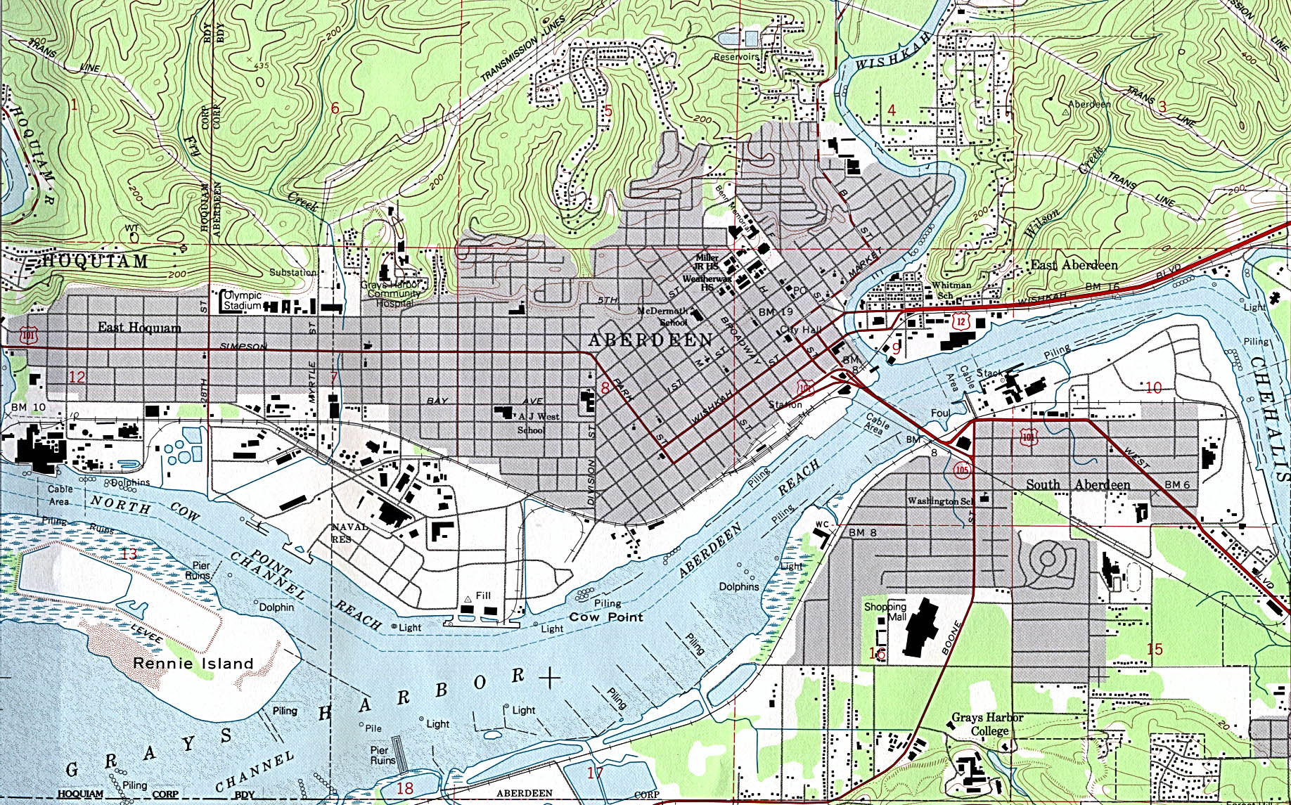
- Aberdeen (topographic) original scale 1:24,000 U.S.G.S. 1957 revised 1994 (774K)
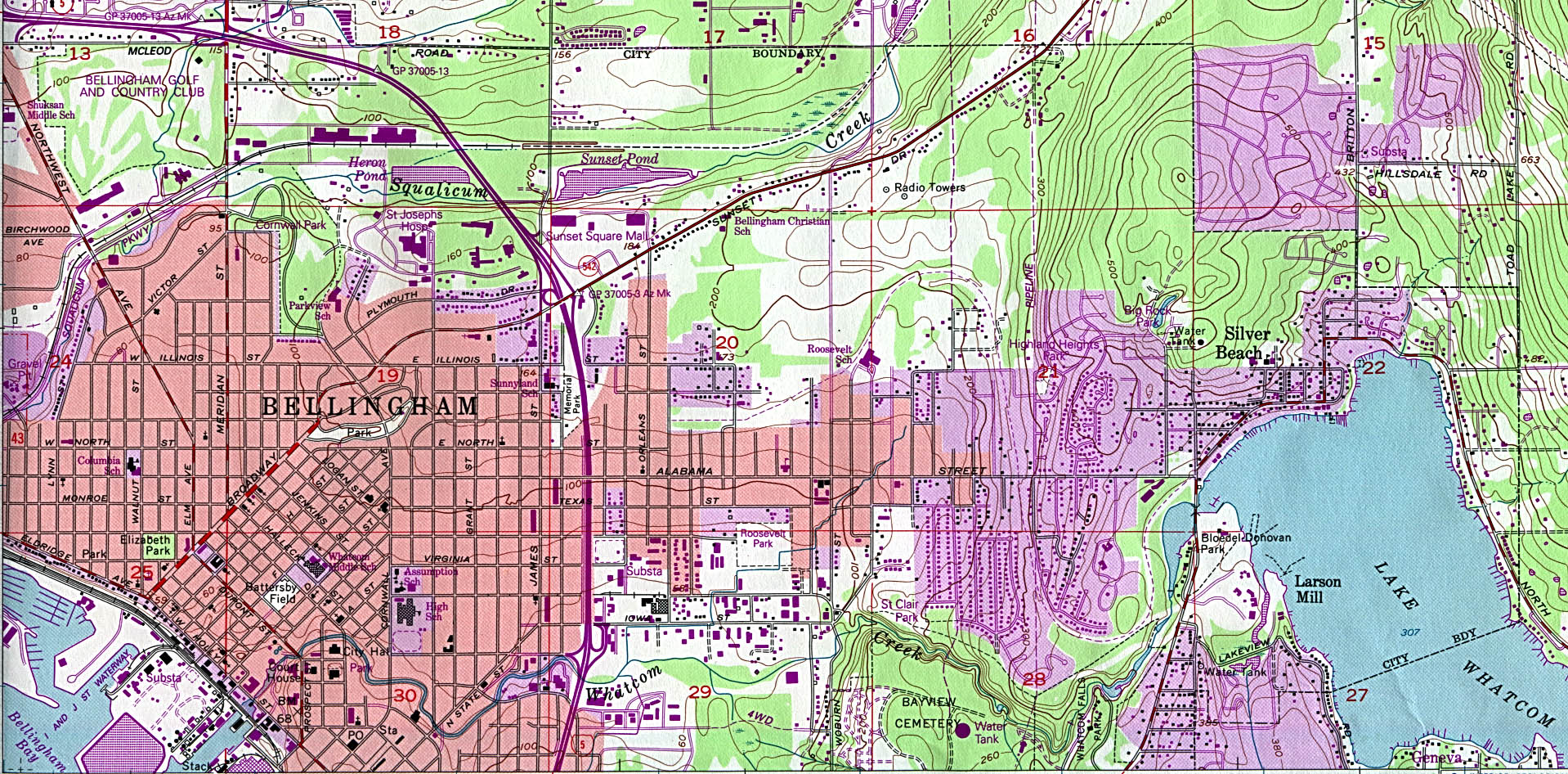
- Bellingham North (topographic) original scale 1:24,000 U.S.G.S. 1954 revised 1994 (748K)
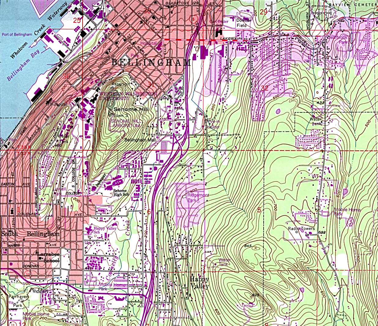
- Bellingham South (topographic) original scale 1:24,000 U.S.G.S. 1954 revised 1995 (731K)
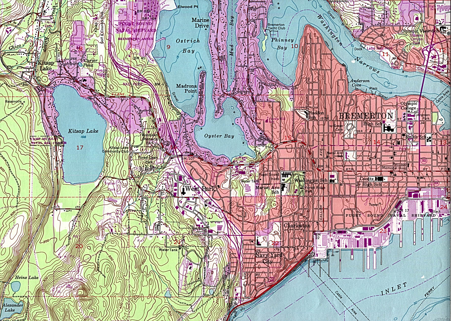
- Bremerton (topographic) original scale 1:24,000 U.S.G.S. 1953 photorevised 1981 (969K)
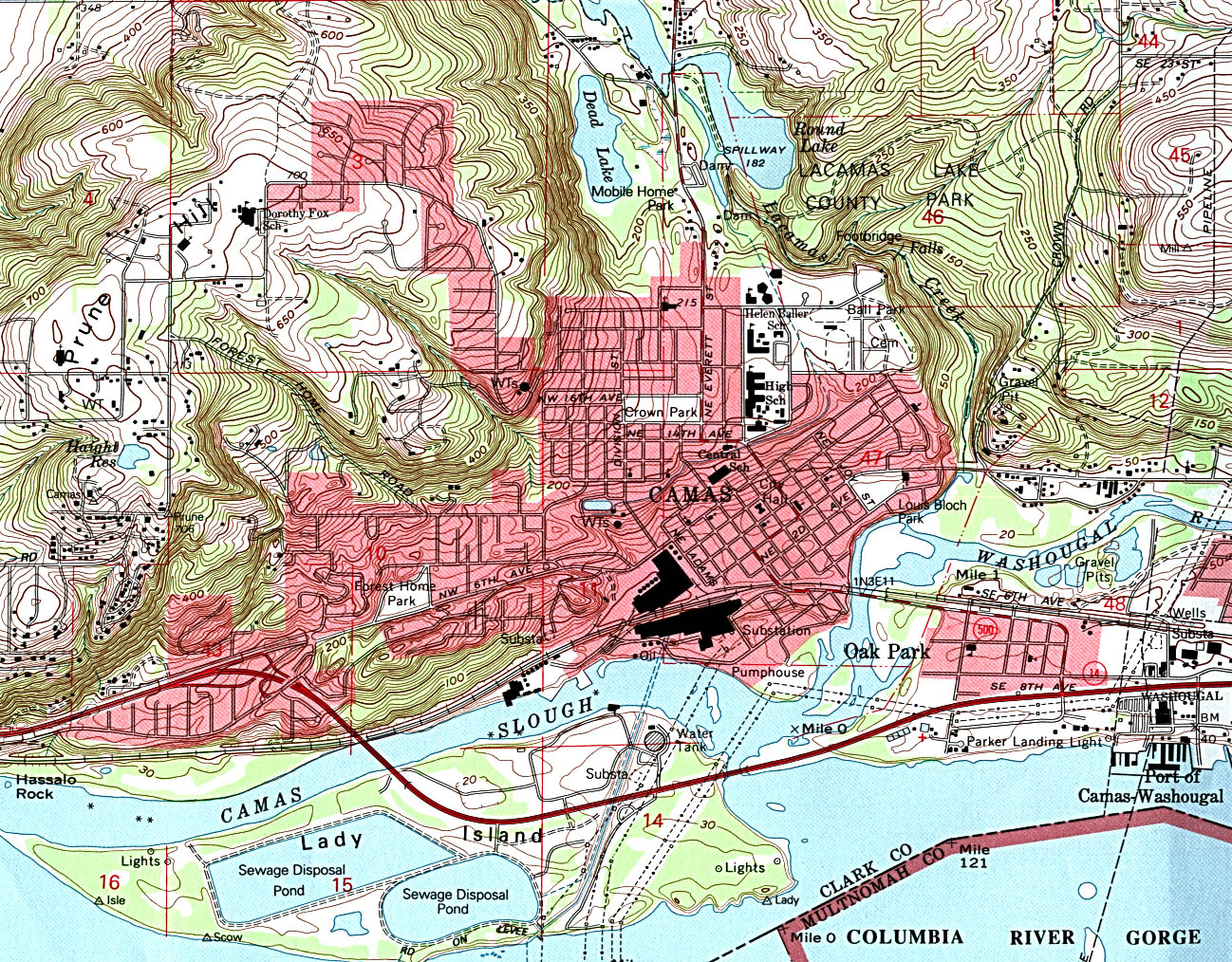
- Camas (topographic) original scale 1:24,000 U.S.G.S. 1993 (740K)
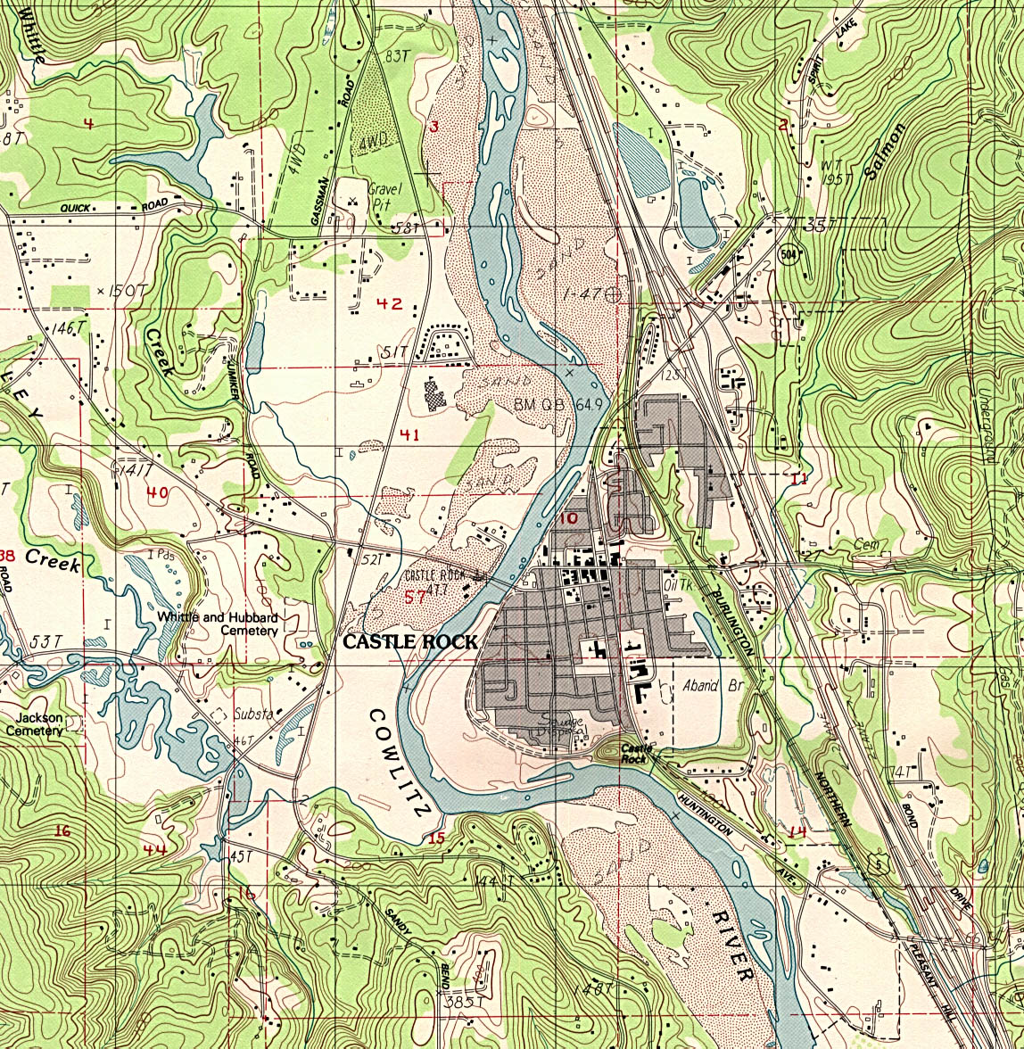
- Castle Rock (topographic) original scale 1:24,000 U.S.G.S. provisional edition 1984, minor revision 1993 (646K)
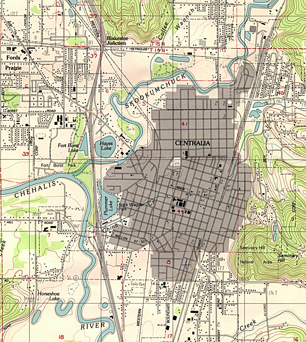
- Centralia (topographic) original scale 1:24,000 U.S.G.S. provisional edition 1985, minor revision 1993 (527K)
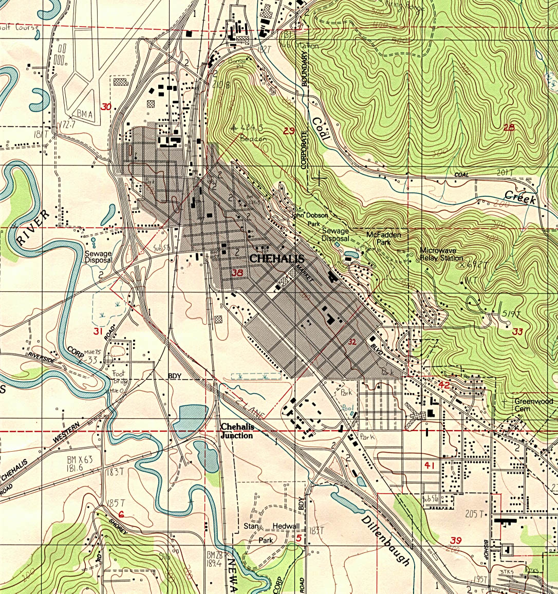
- Chehalis (topographic) original scale 1:24,000 U.S.G.S. provisional edition 1985, minor revision 1993 (561K)
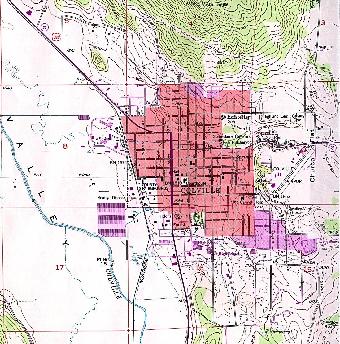
- Coville (topographic) original scale 1:24,000 U.S.G.S. 1952 photorevised 1986 (468K)
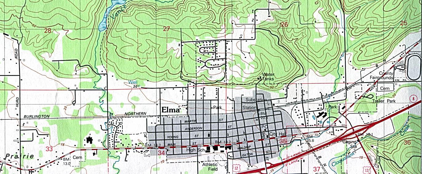
- Elma (topographic) original scale 1:24,000 U.S.G.S. 1981 (281K)
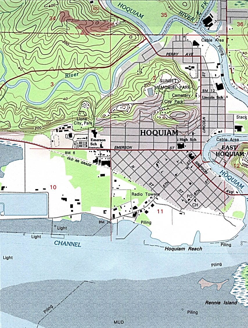
- Hoquiam (topographic) original scale 1:24,000 U.S.G.S. 1957 revised 1994 (425K)
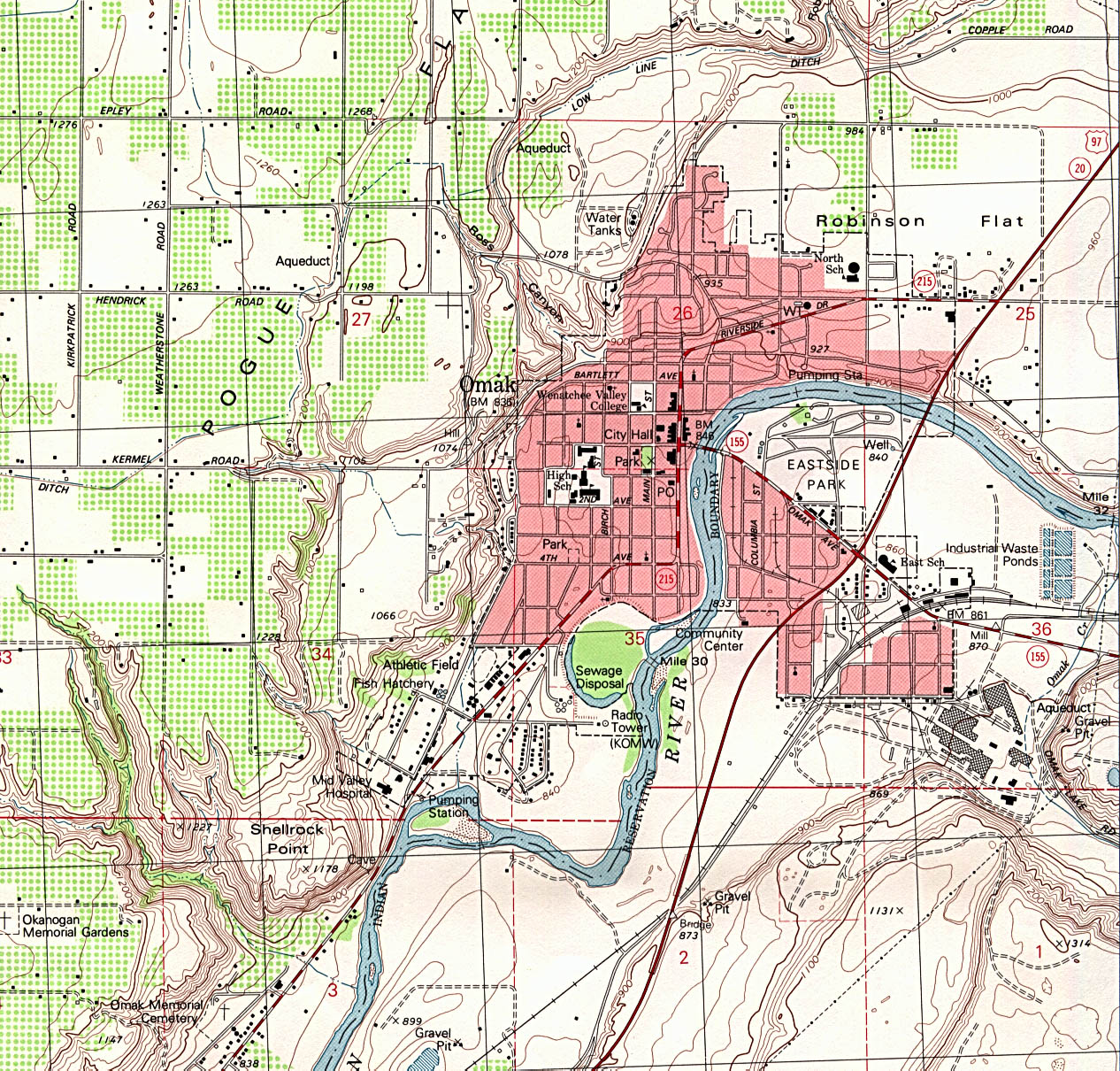
- Omak (topographic) original scale 1:24,000 U.S.G.S. 1980 minor revision 1993 (655K)
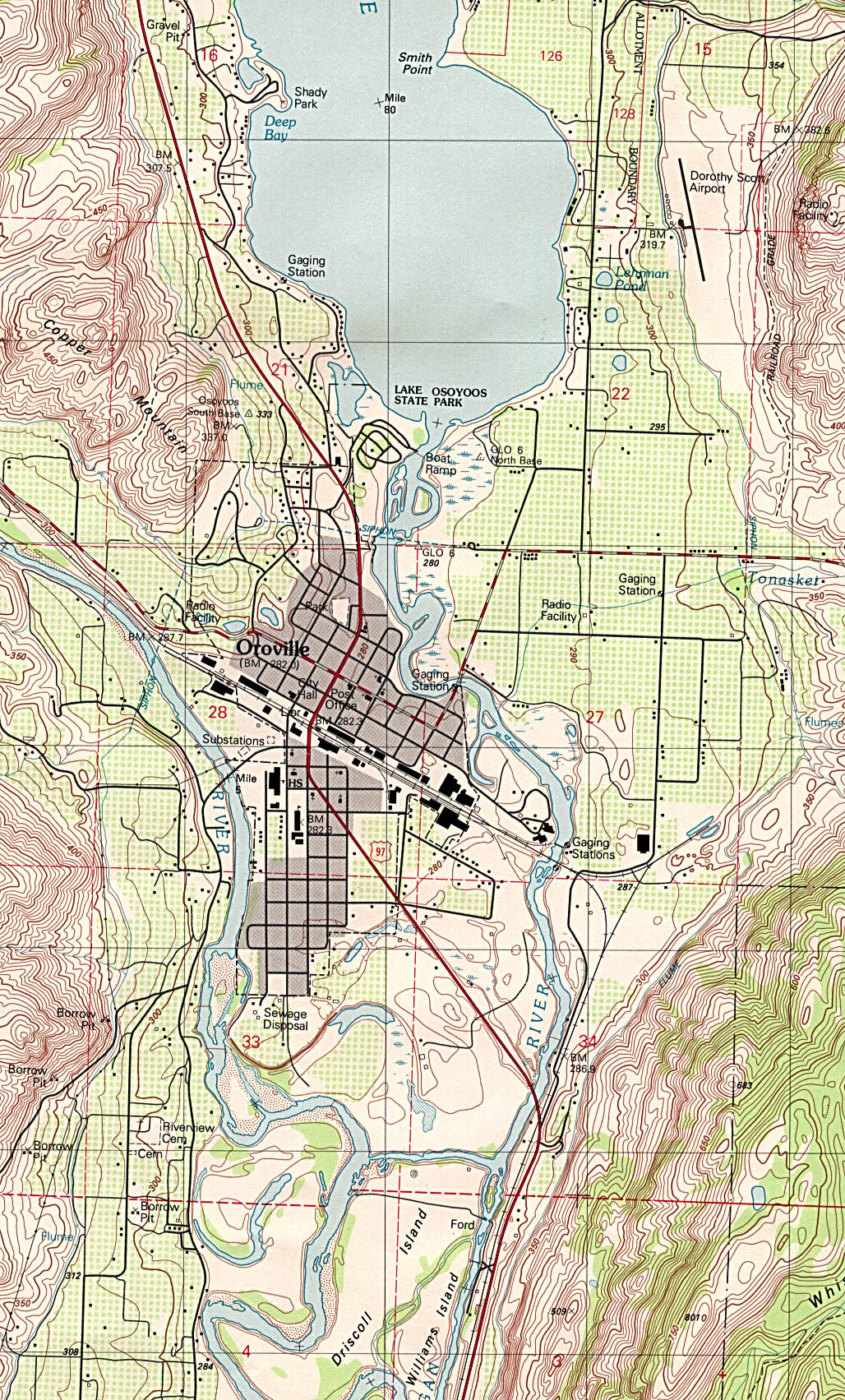
- Oroville (topographic) original scale 1:24,000 U.S.G.S. 1982 (714K)
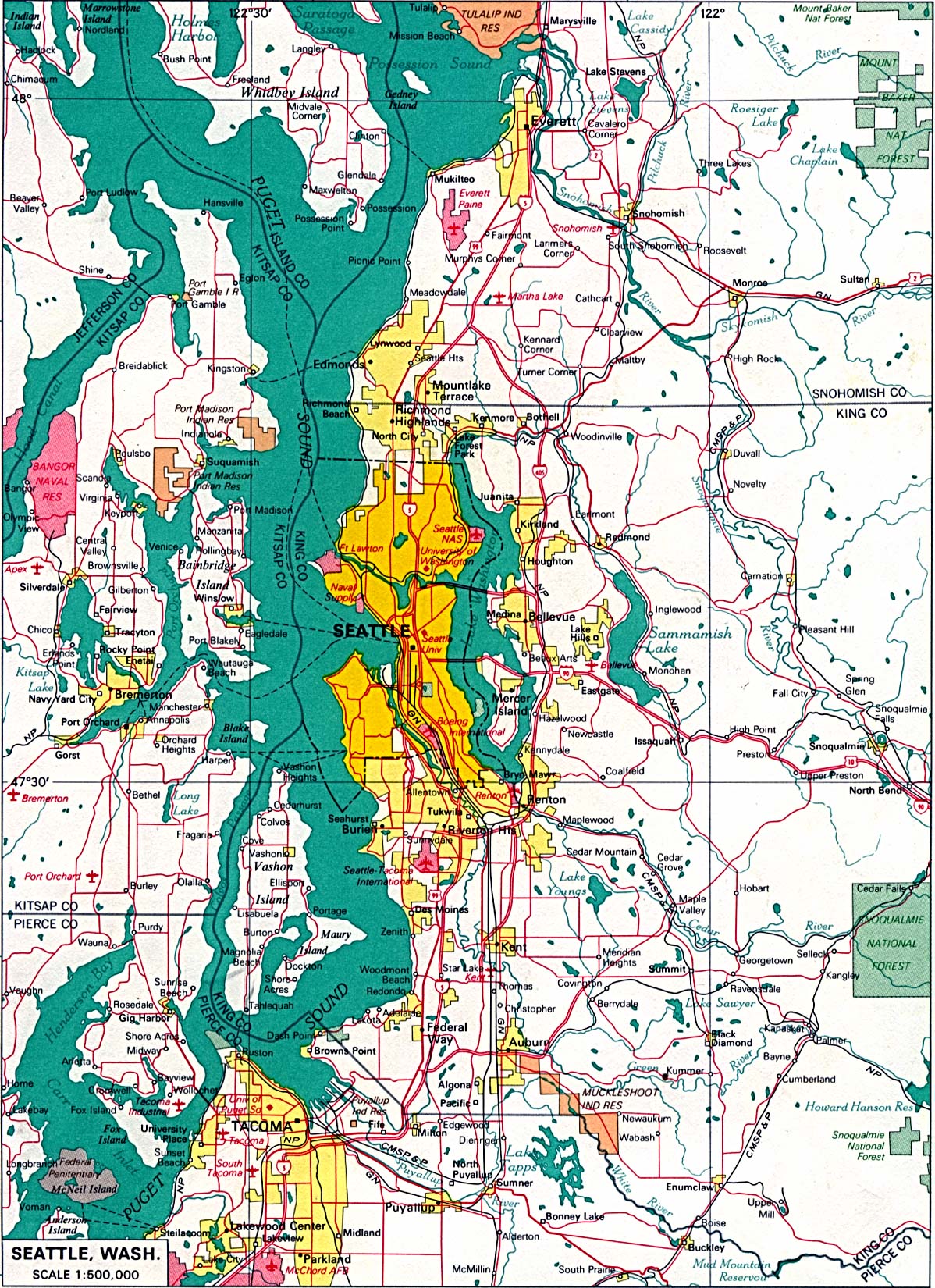
- Seattle original scale 1:500,000 U.S. National Atlas 1970 (636K)
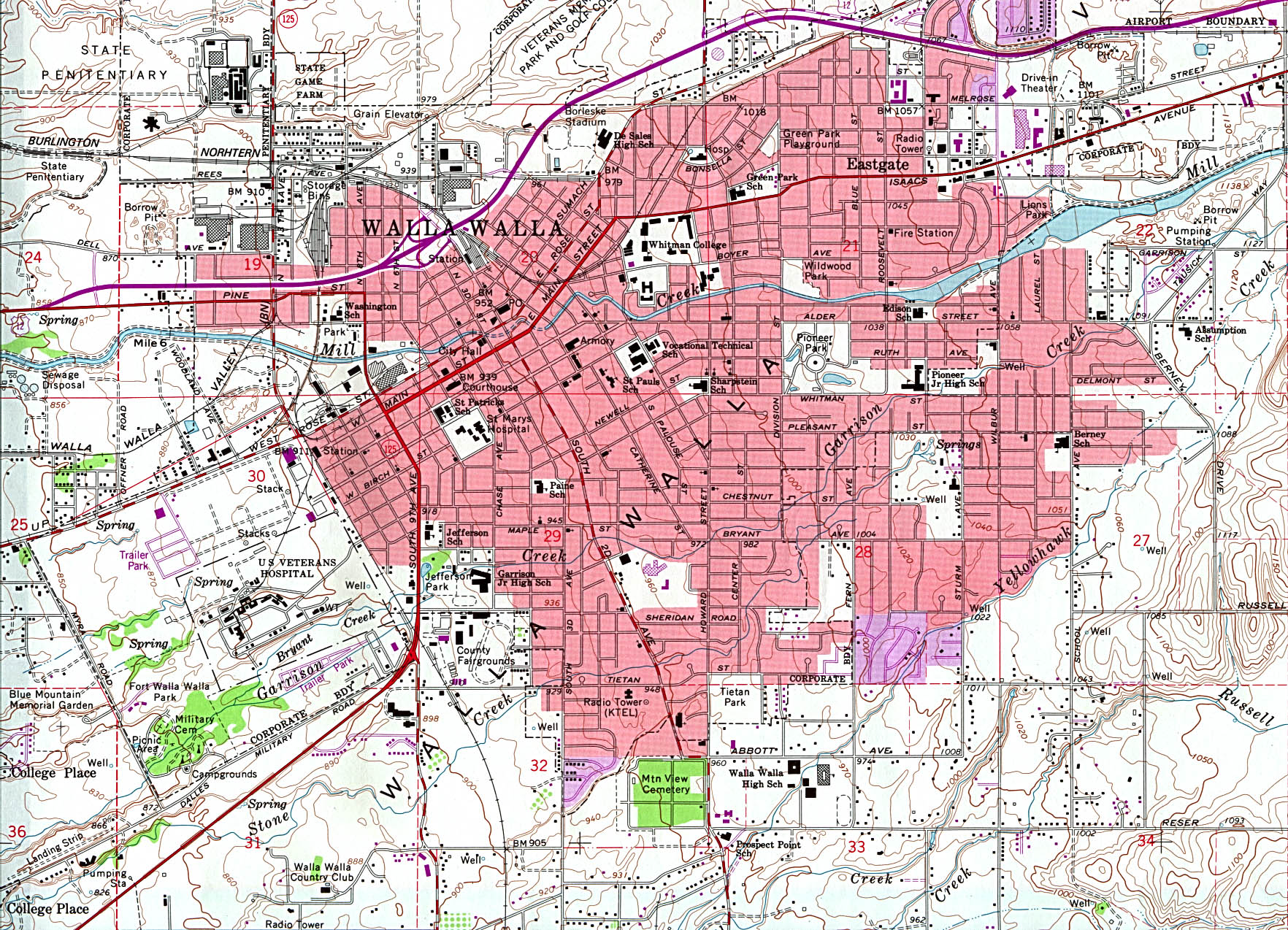
- Walla Walla (topographic) original scale 1:24,000 U.S.G.S. 1966 photorevised 1978 (850K)
- Washougal (topographic) original scale 1:24,000 U.S.G.S. 1994 (629K)
Historical City Maps
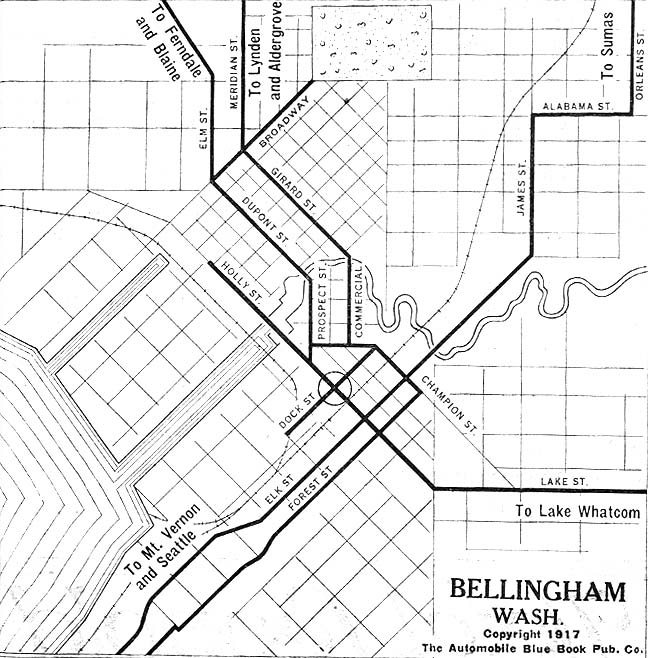
- Bellingham 1917 Automobile Blue Book 1917 Vol. 8, Section 2 (147K)
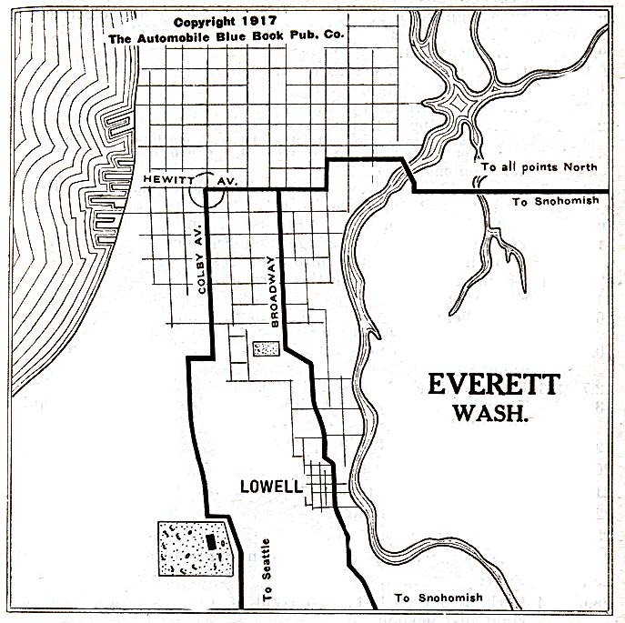
- Everett 1917 Automobile Blue Book 1917 Vol. 8, Section 2 (137K)
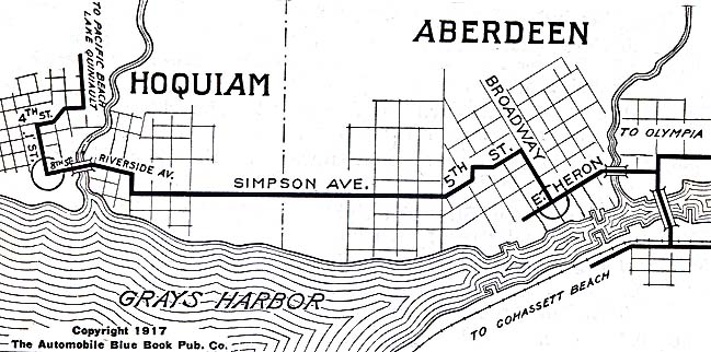
- Hoquiam and Aberdeen 1917 Automobile Blue Book (98K)
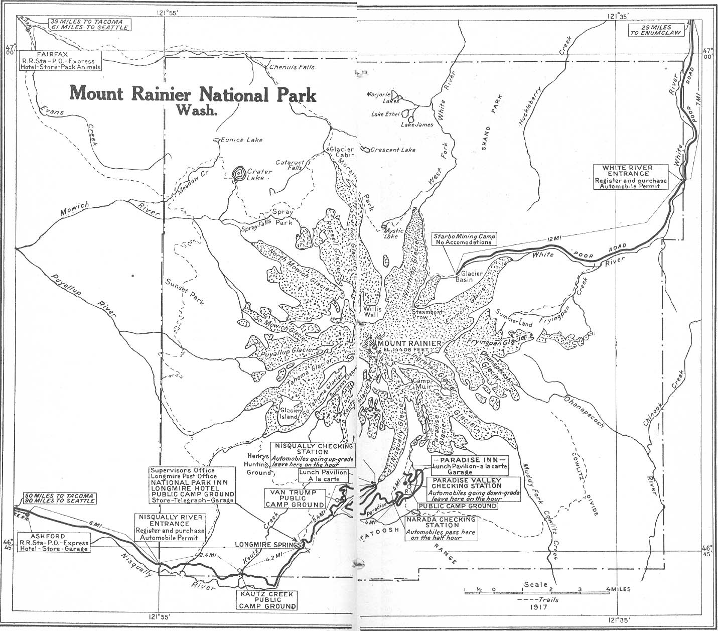
- Mount Rainier National Park 1917 Automobile Blue Book (328K)
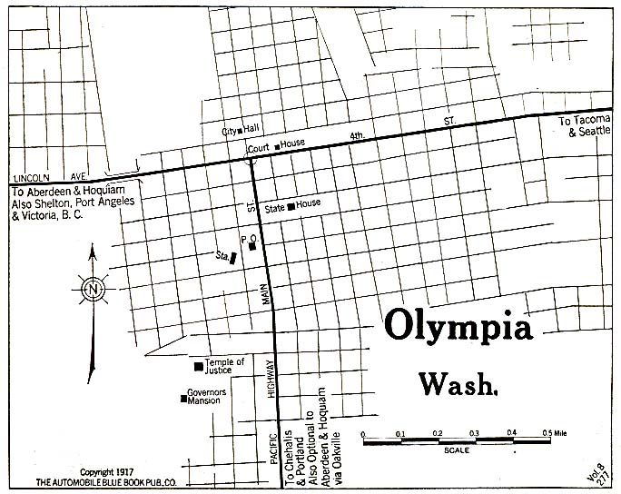
- Olympia 1917 Automobile Blue Book (117K)
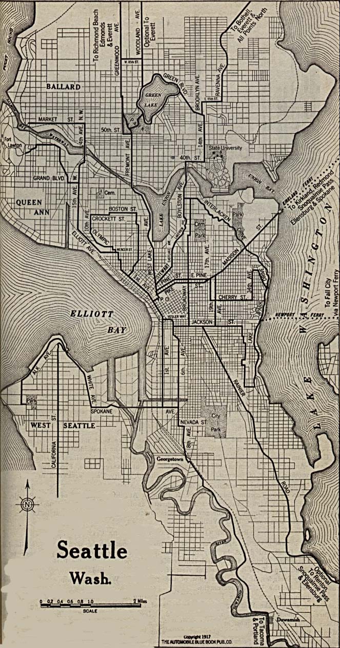
- Seattle 1917 Automobile Blue Book 1917 Vol. 8, Section 2 (289K)
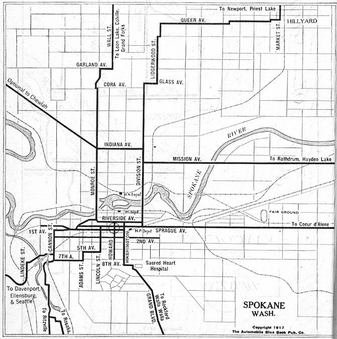
- Spokane 1917 Automobile Blue Book 1917 Vol. 8, Section 2 (122K)
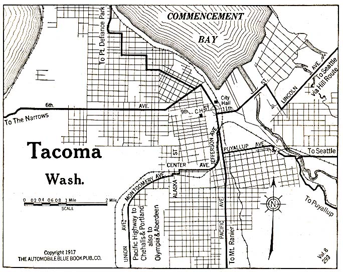
- Tacoma 1917 Automobile Blue Book (176K)
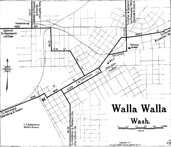
- Walla Walla, Washington 1917 Automobile Blue Book 1917 Vol. 8, Section 2 (114K)
Historical Topographic Maps
- Washington Historical Topographic Maps (U.S. Geological Survey)
- Pre-1945 maps, scales 1:125,000, 1:62,500
Maps of National Parks, Monuments, and Historic Sites
The following maps were produced by the U.S. National Park Service unless otherwise noted.
- Fort Vancouver National Historic Site (Area Map) 1997 (65K) (PDF Format)
- Fort Vancouver National Historic Site (Schematic) 1995 (800K)
- Klondike Gold Rush - Seattle Unit National Historical Park (Seattle 1898) 1999 (65K) (PDF Format)
- Lake Roosevelt National Recreation Area (Area Map) 1997 (129K) (PDF Format)
- Lake Roosevelt National Recreation Area (Park Map) 1997 (581K) (PDF Format)
- Mount Rainier National Park (Area Map) (42K)
- Mount Rainier National Park (Park Map) (1.8MB)
- Mount Rainier National Park (Park Map) 1999 (129K) (PDF Format)
- Nez Perce National Historical Park [Idaho / Oregon / Washington / Montana] (All Sites Map) 1997 (65K) (PDF Format)
- North Cascades National Park (Area Map) (86K)
- North Cascades National Park (Park Map) (1MB)
- North Cascades National Park (Park Map) 1997 (908K) (PDF Format)
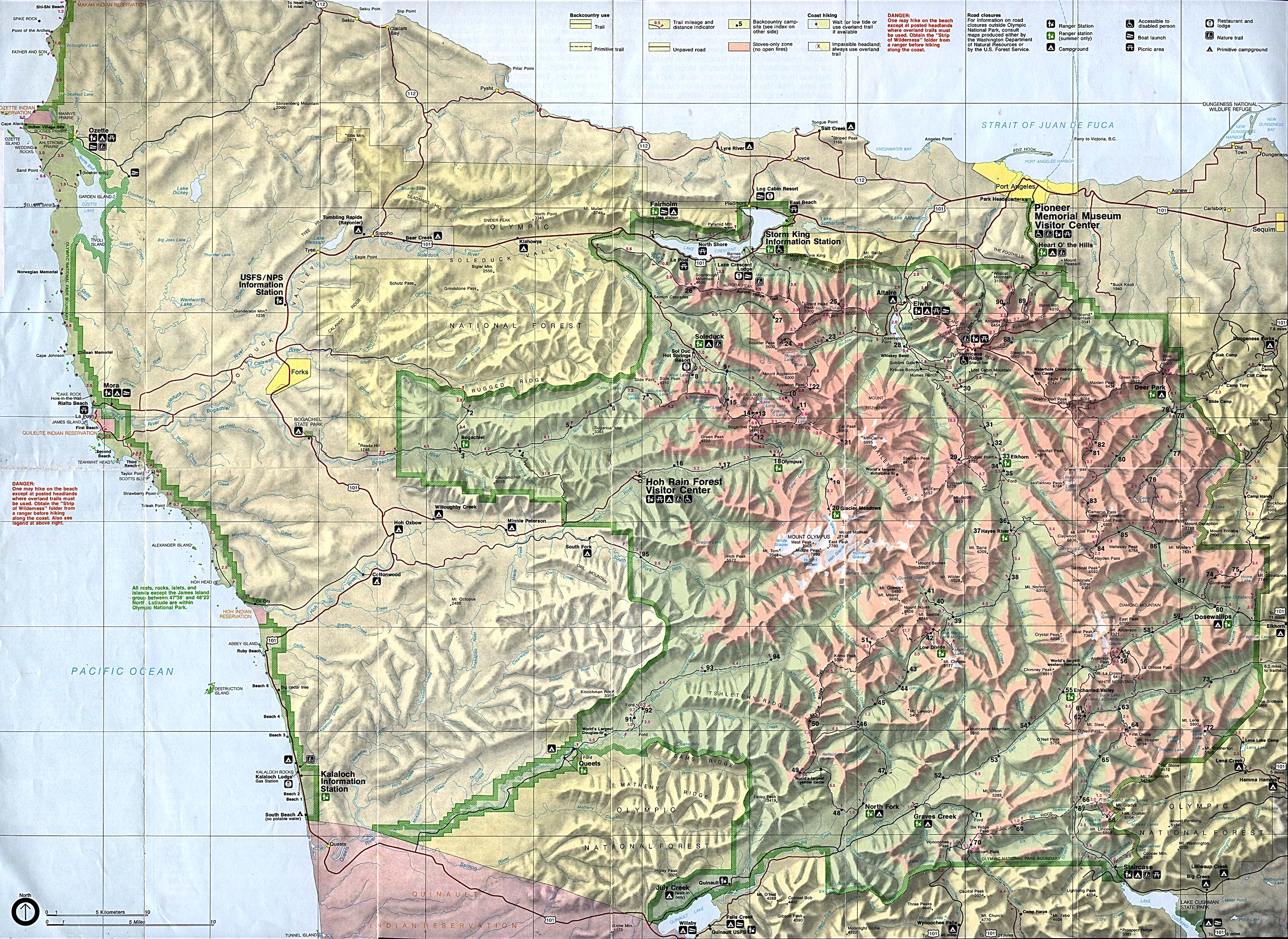
- Olympic National Park (Park Map) (1MB)
- Olympic National Park (Park Map) 1999 (1.1MB) (PDF Format)
- San Juan Island National Historical Park - American Camp (Park Map) 1997 (357K)
- San Juan Island National Historical Park - English Camp (Park Map) 1997 (323K)
Maps on Other Web Sites