Perry-Castañeda Library
Map Collection
Sudan Maps
The following maps were produced by the U.S. Central Intelligence Agency unless otherwise indicated.
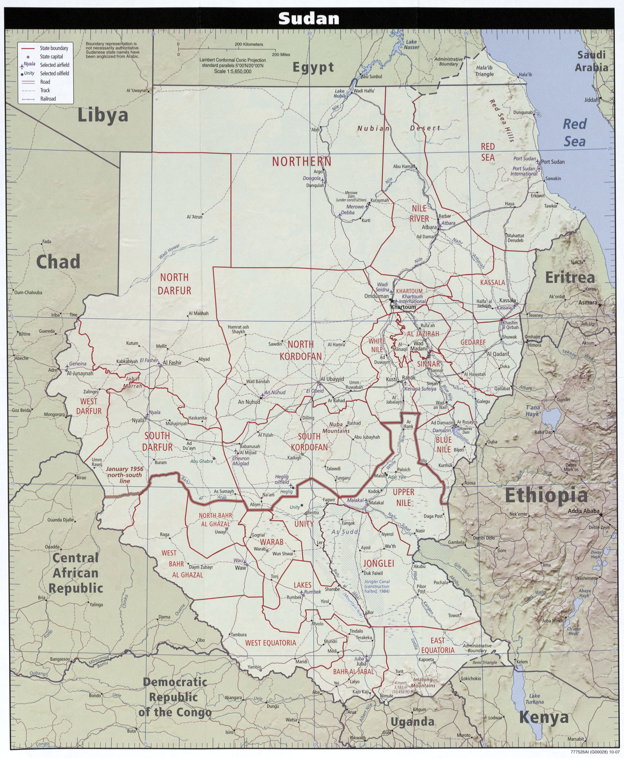
Country Maps- Sudan (Political) 2007 (1.1MB)
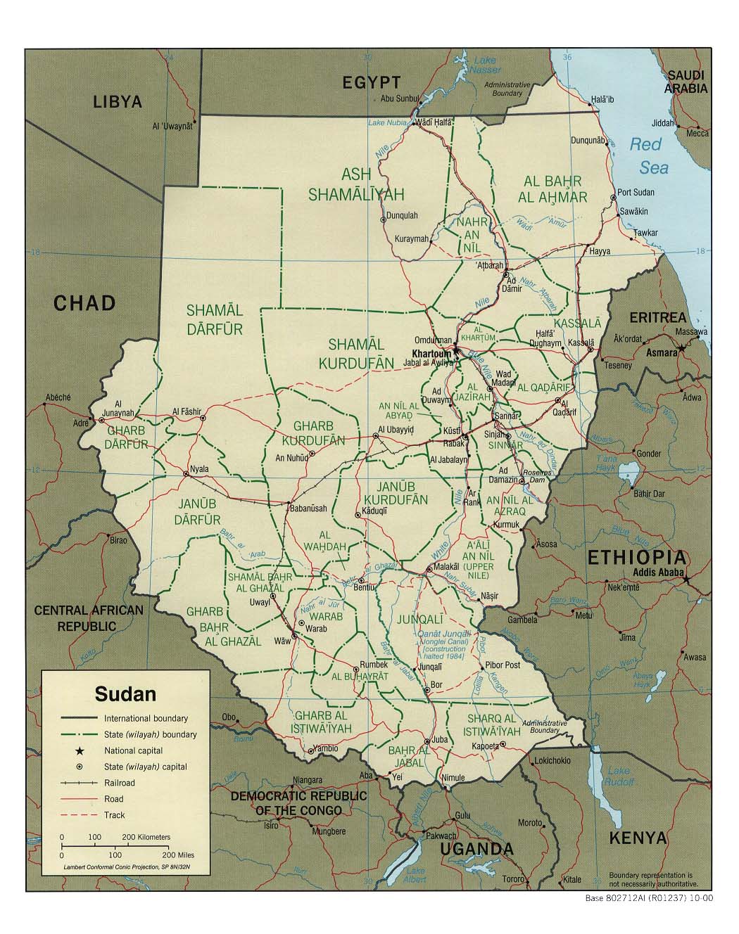
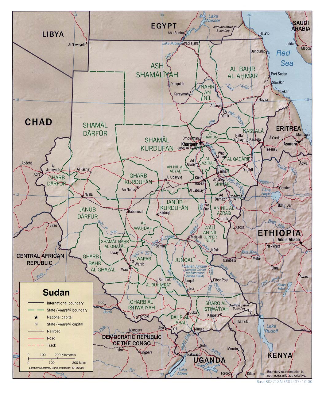
- Sudan (Political) 2000 (210K) and pdf format (229K)
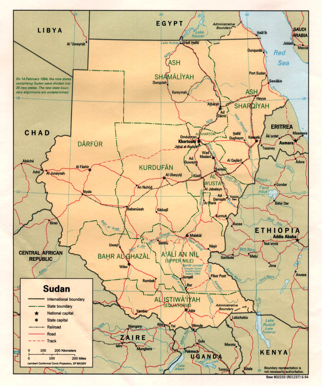
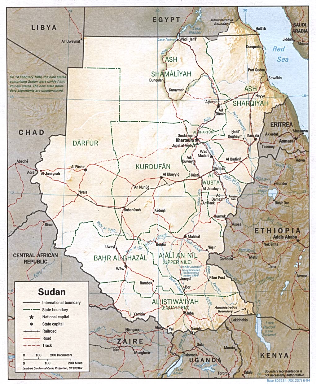
- Sudan (Political) 1994 (387K) and pdf format (301K)
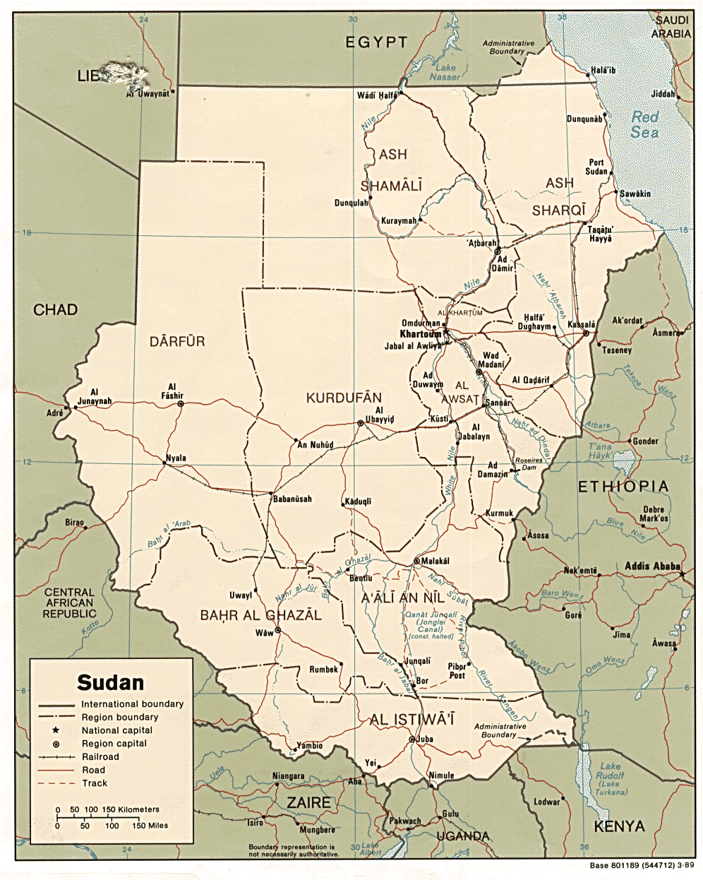
- Sudan (Political) 1989 (324K)
- Sudan (Shaded Relief) 2000 (276K) and pdf format (295K)
- Sudan (Shaded Relief) 1994 (280K) and pdf format (283K)
- Sudan (Small Map) 2016 (24.7K)
Topographic Maps
- 1:2,000,000 - Africa Topographic Maps U.S. Army Map Service/U.S. Defense Mapping Agency
- This series covers all of Sudan
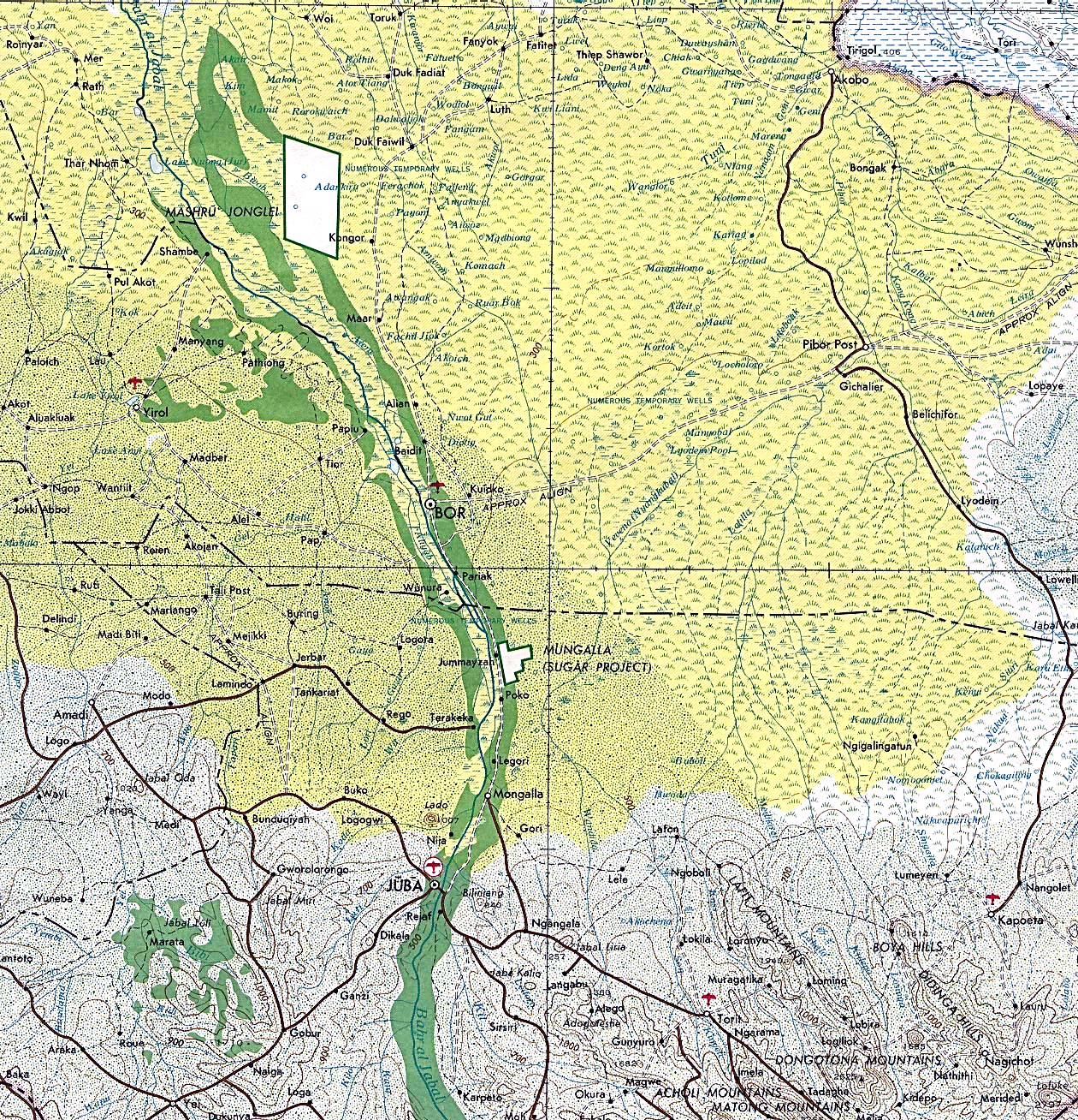
- 1:2,000,000 - Juba Portion of U.S. Defense Mapping Agency Series 2201, Sheet 20 1980 (970K)
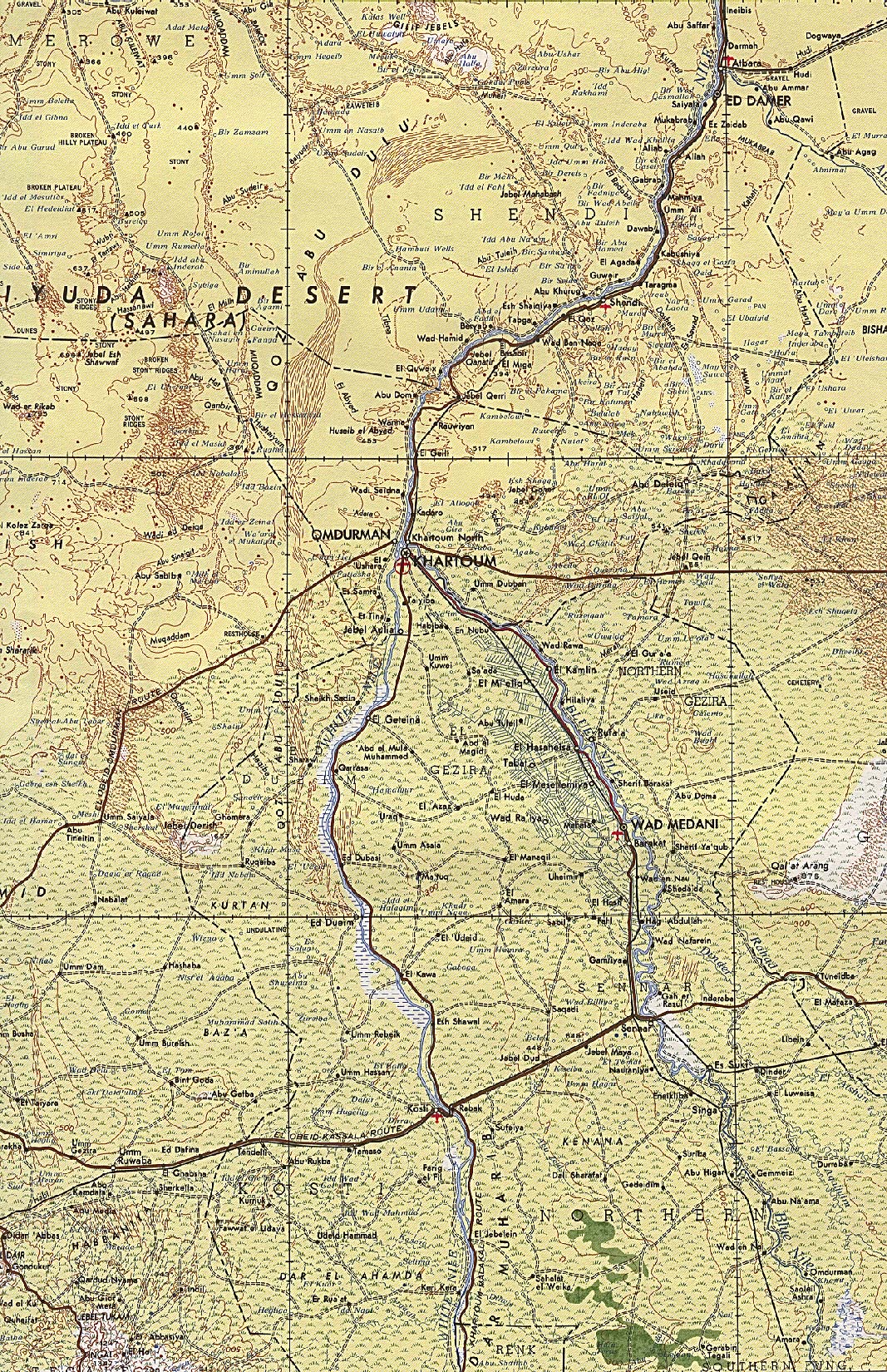
- 1:2,000,000 - Khartoum Portion of U.S. Defense Mapping Agency Series 2201, Sheet 15 1968 (1MB)
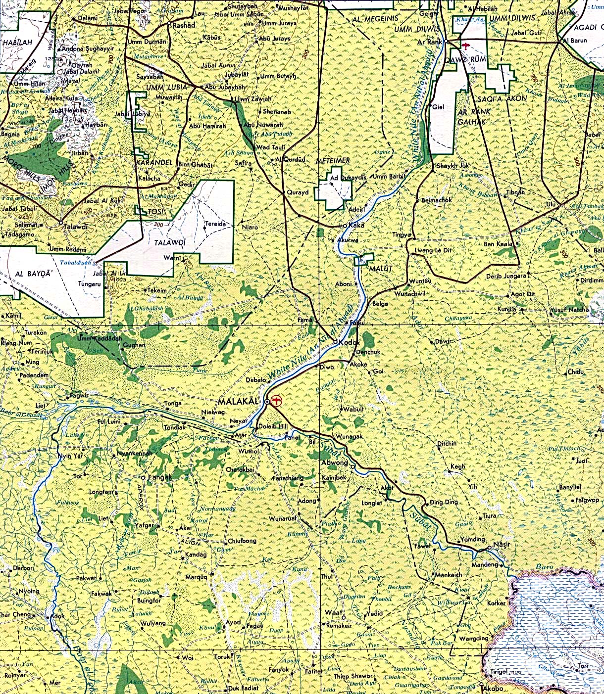
- 1:2,000,000 - Malakal Portion of U.S. Army Map Service Series 2201, Sheet 20 1980 (808K)
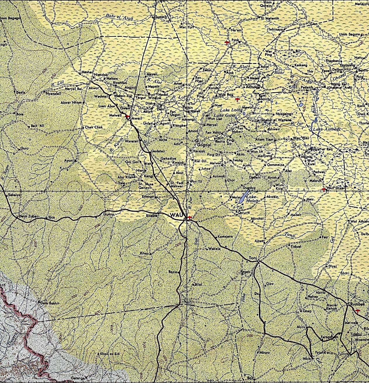
- 1:2,000,000 - Wau Portion of U.S. Army Map Service Series 2201, Sheet 19 1965 (1MB)
- 1:1,000,000 - Operational Navigation Chart Series U.S. Defense Mapping Agency Aerospace Center. Not for navigational use
- This series covers all of Sudan
- 1:1,000,000 - International Map of the World U.S. Army Map Service
- This series covers much of Sudan
- 1:500,000 - Tactical Pilotage Chart Series U.S. National Imagery and Mapping Agency. Not for navigational use
- This series covers all of Sudan
- 1:500,000 - World Series 1404, Great Britain. War Office and Air Ministry. 1958-
- This series covers parts of Sudan
- 1:500,000 - East Africa Topographic Maps Series Y401 (GSGS 4335), U.S. Army Map Service, 1958-
- This series covers most of Eastern and Central Sudan
- 1:250,000 - North Africa Topographic Maps U.S. Army Map Service
- This series covers part of Sudan, near the border with Egypt
- 1:250,000 - Joint Operations Graphic U.S. Defense Mapping Agency. Not for navigational use
- This series covers Khartoum and a few parts of north and northeast Sudan
- 1:250,000 - East Africa Series Y502, U.S. Army Map Service. Not for navigational use
- This series covers all of Sudan
Thematic Maps
- Oil and Gas Concession Holders in Sudan U.S. Agency for International Development 2001 (1.1MB) [pdf format]
- Air Access in Southern Sudan July 2002 U.S. Agency for International Development 2002 (1.9MB) [pdf format]
Darfur Maps and Satellite Imagery [2004-2007]
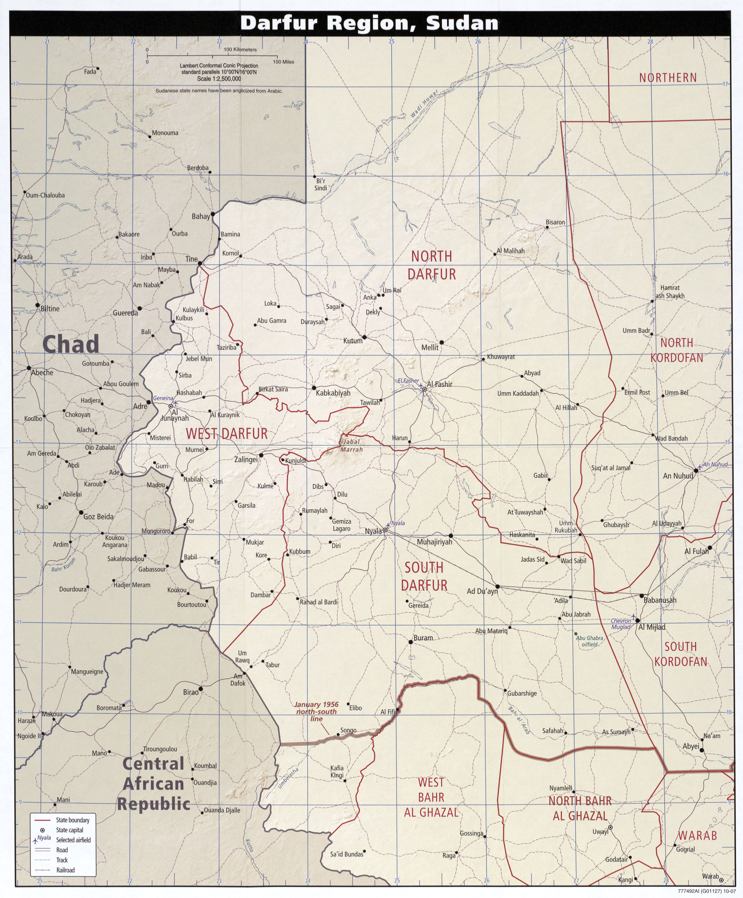
- Darfur Region, Sudan CIA 2007 (1.4MB)
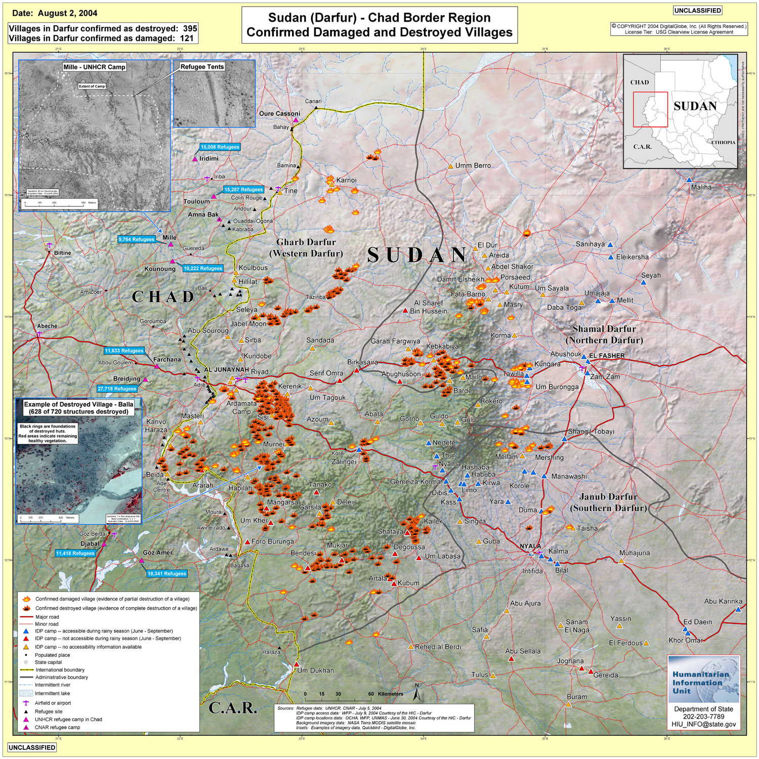
- Sudan (Darfur)/Chad Border Region - Confirmed Damaged and Destroyed Villages Digital Globe, Inc. and Department of State via USAID August 2, 2004 (878KB)
- Sudan (Darfur)/Chad Border Region - Clickable map showing satellite imagery of camps in Chad and Sudan July 31, 2004 Department of State via USAID/Internet Archive
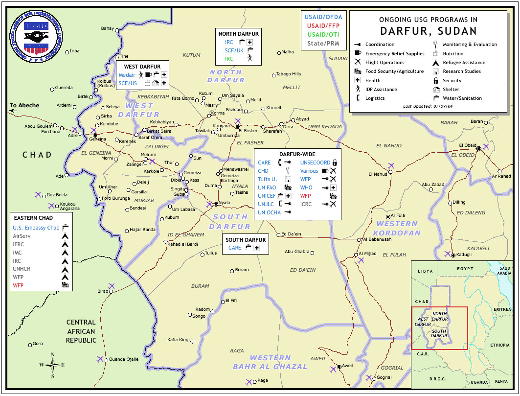
- Sudan (Darfur)/Chad Border Region - Ongoing USG Prgrams in Darfur Digital Globe, Inc. and Department of State via USAID July 16, 2004 (214KB) [PDF format]
- Sudan (Darfur)/Chad Border Region - Ongoing USG Prgrams in Darfur Digital Globe, Inc. and Department of State via USAID July 4, 2004 (224KB)
- Sudan (Darfur)/Chad Border Region - Confirmed Damaged and Destroyed Villages Digital Globe, Inc. and Department of State via USAID June 21, 2004 (2.3MB) [PDF format]
- Destroyed Village near Shataya (129 of 133 structures destroyed) Digital Globe, Inc. and Department of State via USAID June 21, 2004 (1.2MB) [PDF format]
- Destroyed Village near Darurja (180 of 240 structures destroyed) Digital Globe, Inc. and Department of State via USAID June 21, 2004 (767K) [PDF format]
- Farchana - UNHCR Camp Digital Globe, Inc. and Department of State via USAID June 21, 2004 (1.5K)[PDF format]
- Destroyed Village near Fata Barno (278 structures destroyed) Digital Globe, Inc. and Department of State via USAID June 17, 2004 (1.1MB) [PDF format]
- Destroyed Village near Shataya (1300 structures destroyed) Digital Globe, Inc. and Department of State via USAID June 21, 2004 (2MB) [PDF format]
- Destroyed Village near Shataya (206 structures destroyed) Digital Globe, Inc. and Department of State via USAID June 21, 2004 (1.2MB) [PDF format]
- Destroyed Village near Shataya (258 of 269 structures destroyed) Digital Globe, Inc. and Department of State via USAID June 21, 2004 (1.3K) [PDF format]
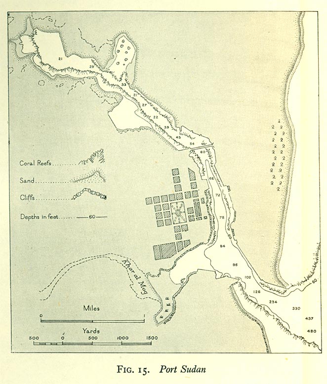
- Port Sudan 1946 From Western Arabia and The Red Sea, Geographical Handbook Series B.R. 527, [U.K.] Naval Intelligence Division, June 1946.
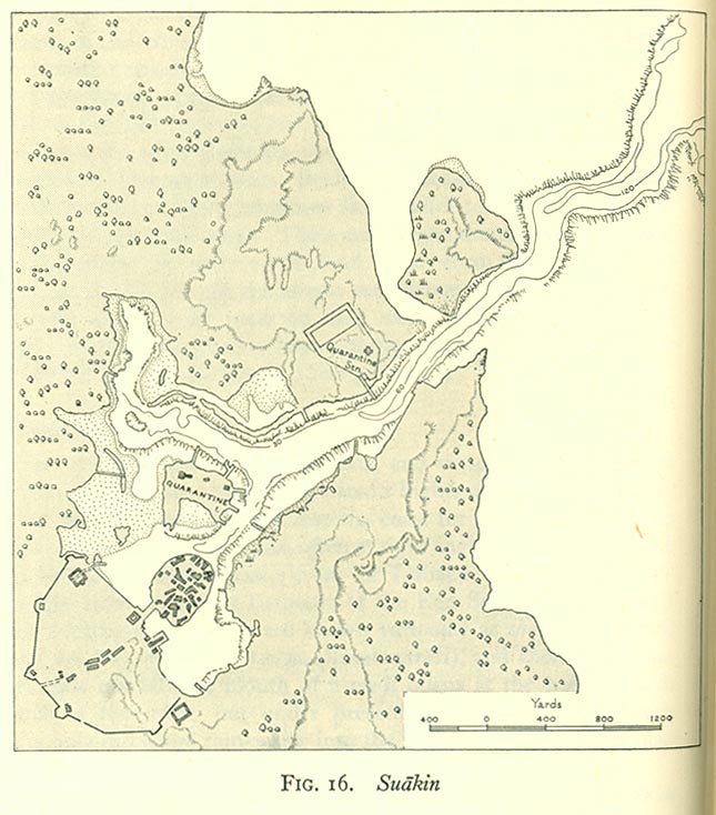
- Suakin 1946 From Western Arabia and The Red Sea, Geographical Handbook Series B.R. 527, [U.K.] Naval Intelligence Division, June 1946.
Sudan Maps on Other Web Sites
- Sudan (United Nations) [PDF]
- Sudan (UniMaps)
- Sudan (WorldAtlas.com)
- Sudan - Languages (Dr. Walter Huffman) [large PDF]
- Sudan Maps (ReliefWeb)
- Sudan Maps (World Health Organization)
- Sudan - Oil and Gas Concessions (2006)
- Sudan - UNAMID Deployment [Darfur] April 2008 (United Nations) [PDF]
- Darfur Conflict Map [2007] (BBC News)
- Darfur Planning Map [2007] (United Nations) [PDF]
- Heglig Oil Fields (BBC News)
- South Sudan Maps (Government of Southern Sudan)