Perry-Castañeda Library
Map Collection
Sierra Leone Maps
The following maps were produced by the U.S. Central Intelligence Agency unless otherwise indicated.
Country Maps
- Sierra Leone (Physiography) 2005 (1.7MB) and pdf format (1.1MB)
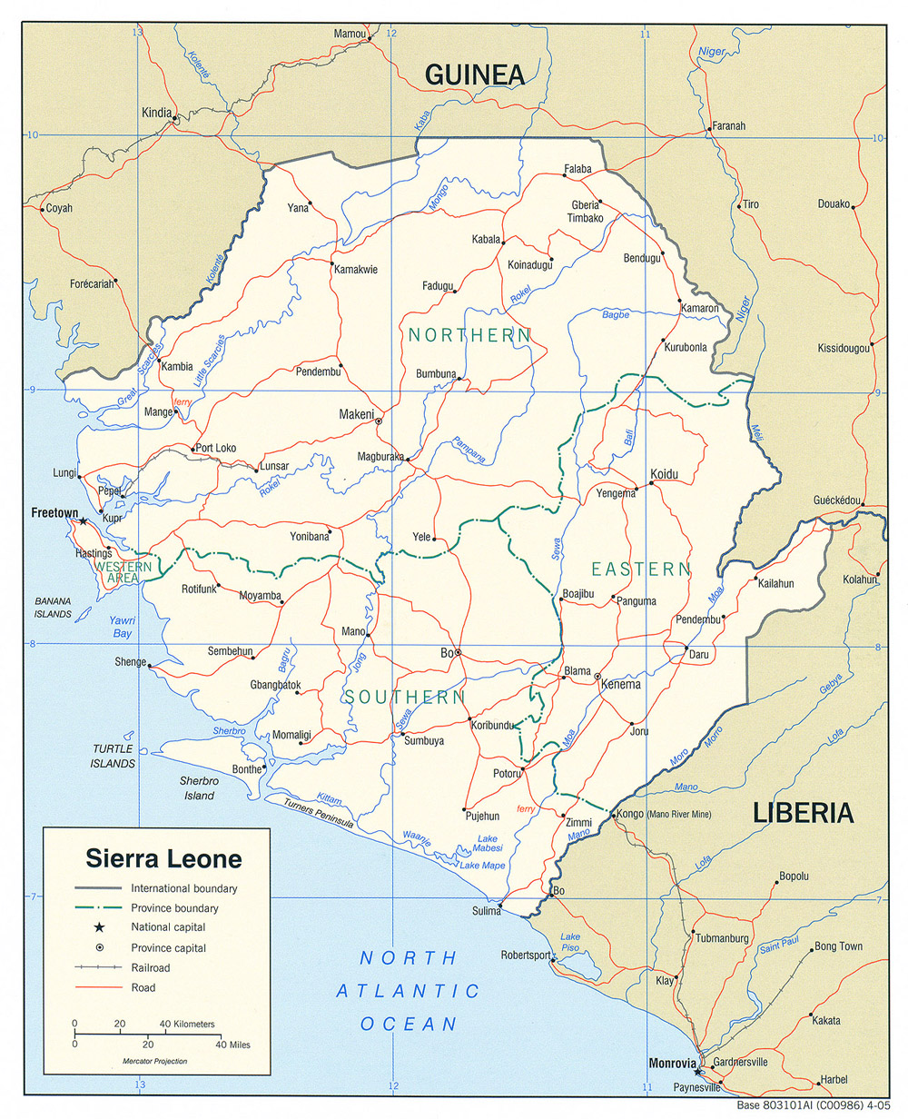
- Sierra Leone (Political) 2005 (702K) and pdf format (719K)
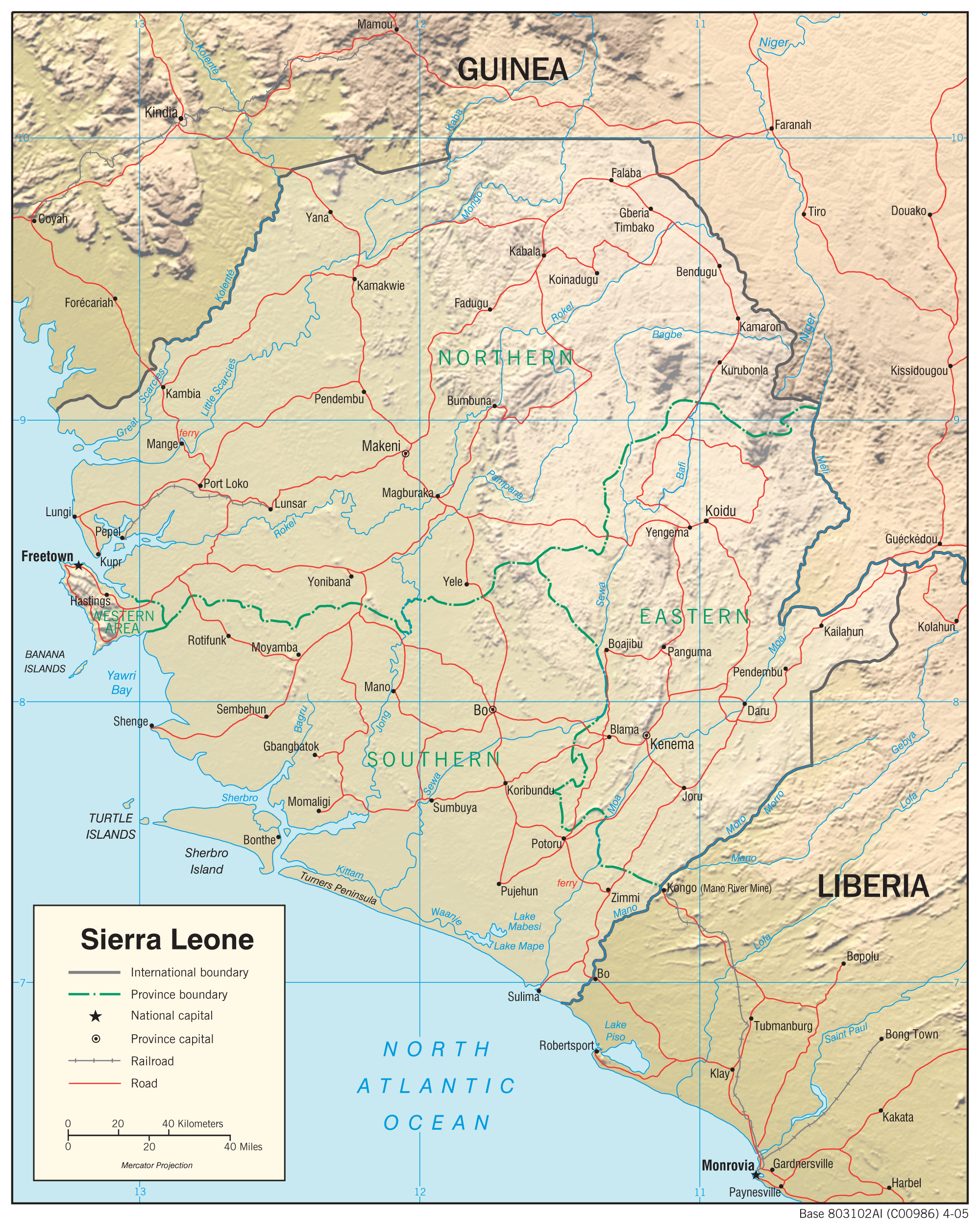
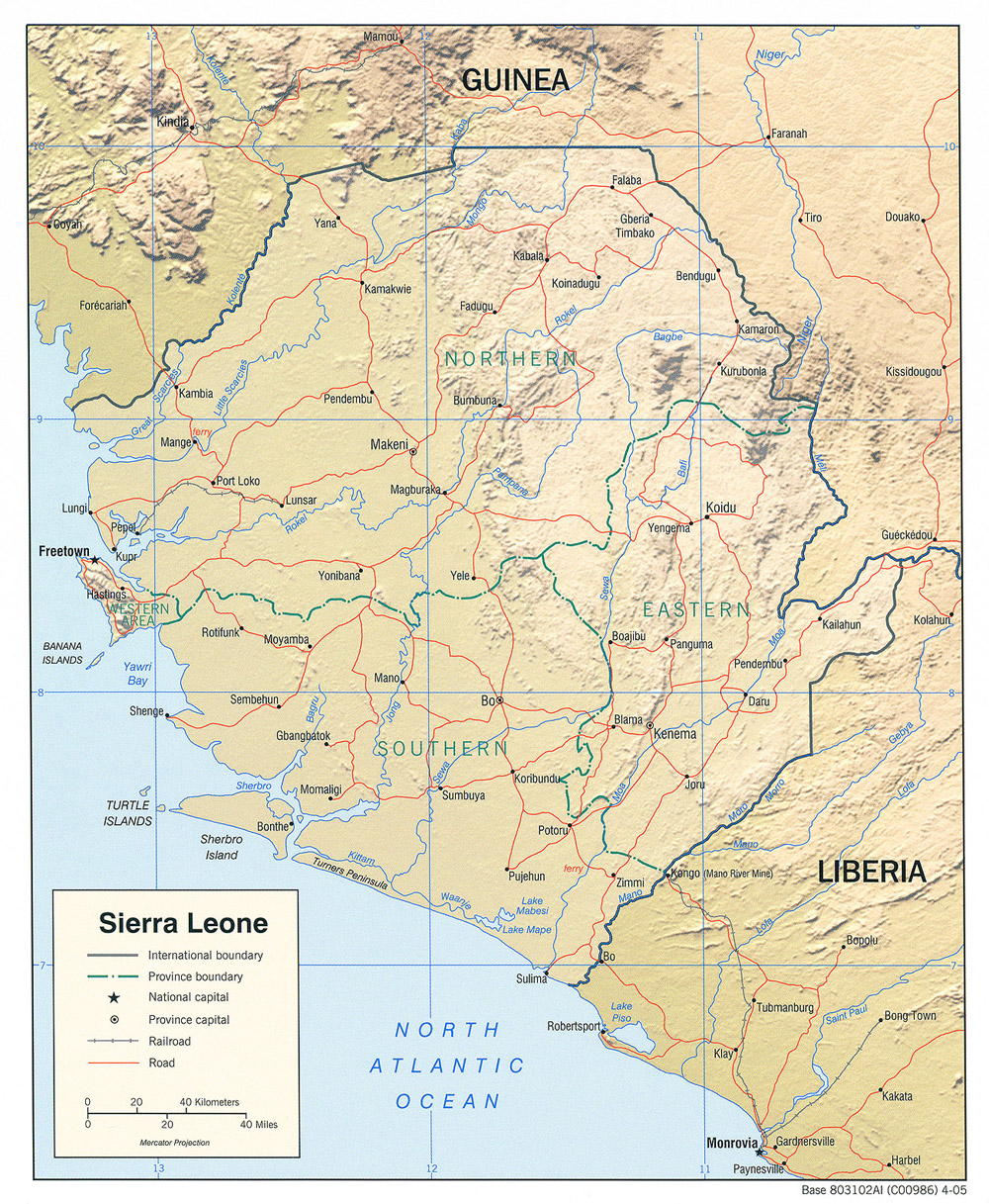
- Sierra Leone (Shaded Relief) 2005 (716K) and pdf format (712K)
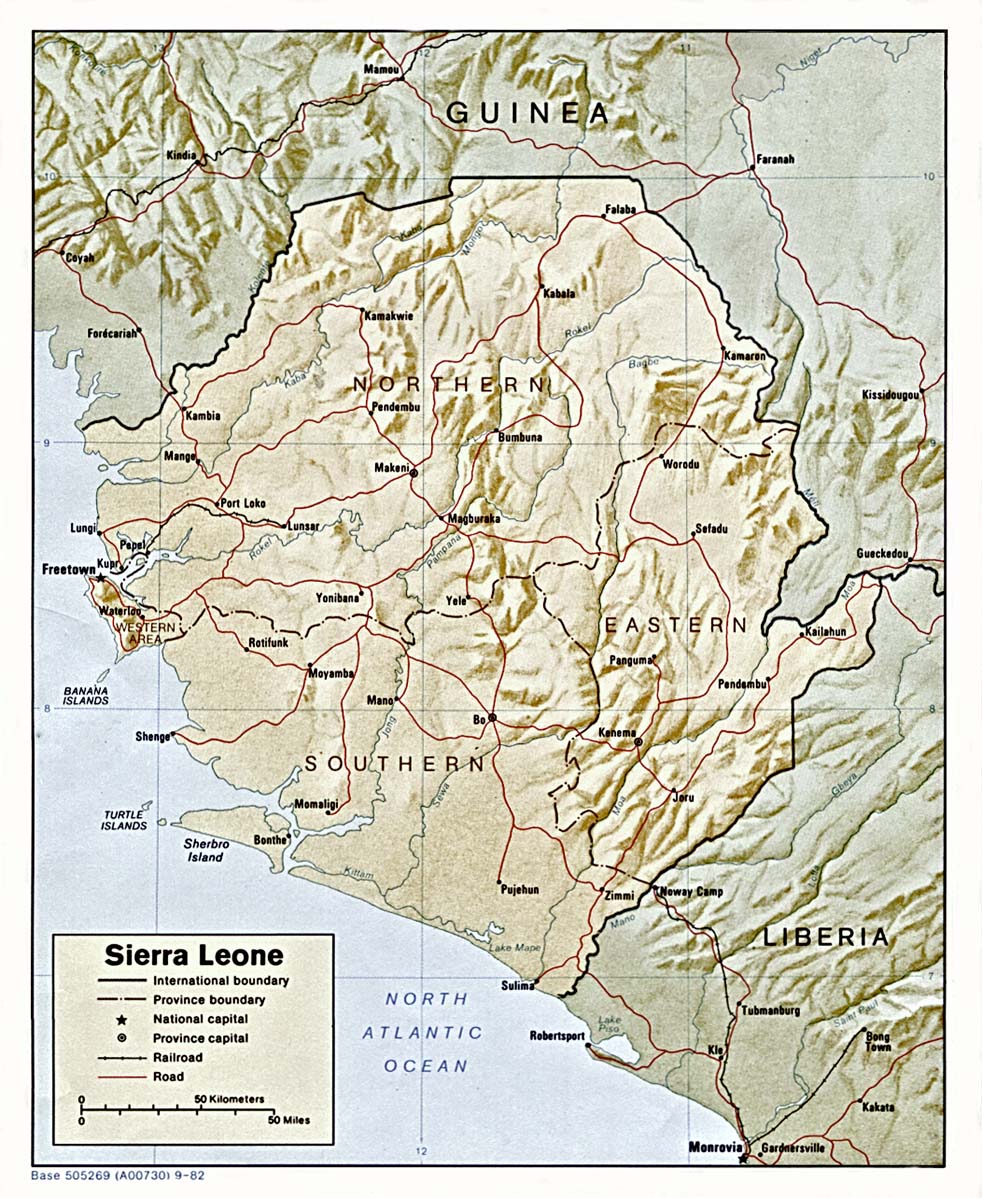
- Sierra Leone (Shaded Relief) 1982 (412K)
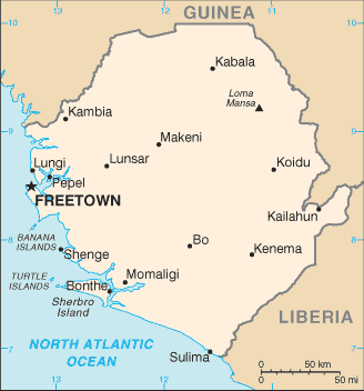
- Sierra Leone (Small Map) 2016 (10.2K)
- Sierra Leone (Transportation) 2005 (1.2MB) and pdf format (1.1MB)
- [Sierra Leone 1:396,000] Sierra Leone and Freetown (Road Map) Shell Sierra Leone, Ltd. 1988 (11.2MB)
- [Freetown 1:14,500 and 1:10,000] Sierra Leone and Freetown (verso) (Street Map) Shell Sierra Leone, Ltd. 1988 (10.3MB)
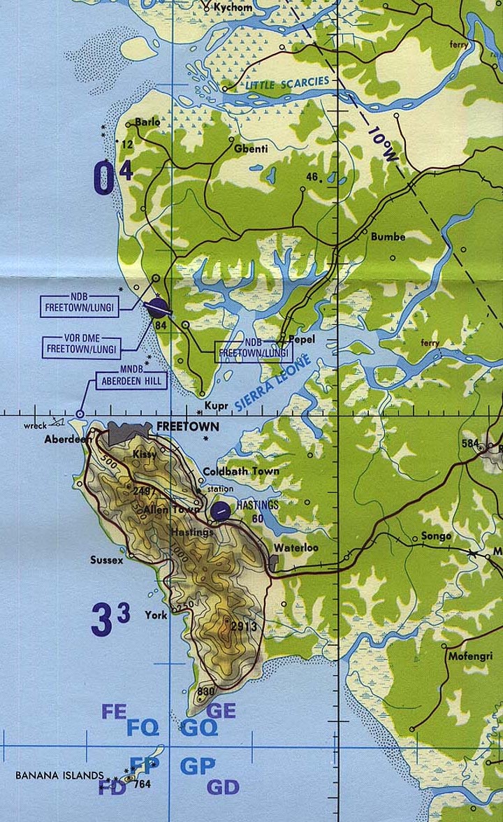
- Freetown Area (Tactical Pilotage Chart) 1:500,000 Portion of Defense Mapping Agency TPC K-1D 1995 (387K) Not for navigational use
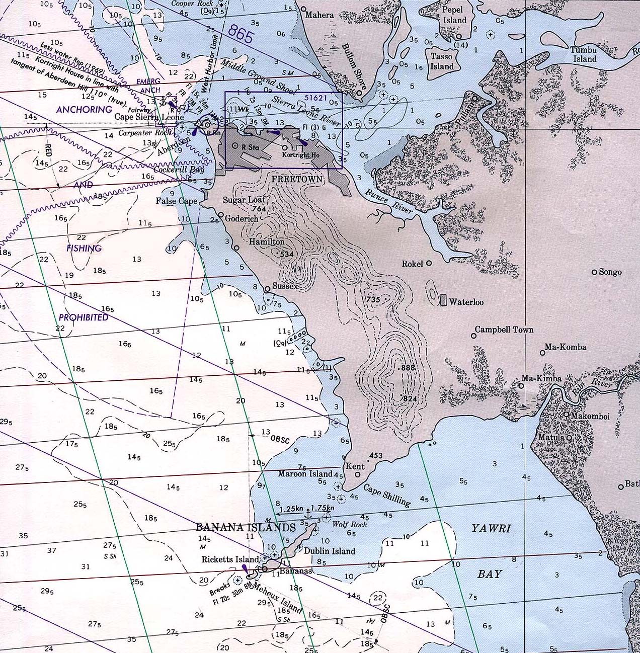
- Freetown (Nautical Chart) 1:297,500 Portion of Defense Mapping Agency "Cape Sierra Leone to Cape Mount" 1983 (581K) Not for navigational use
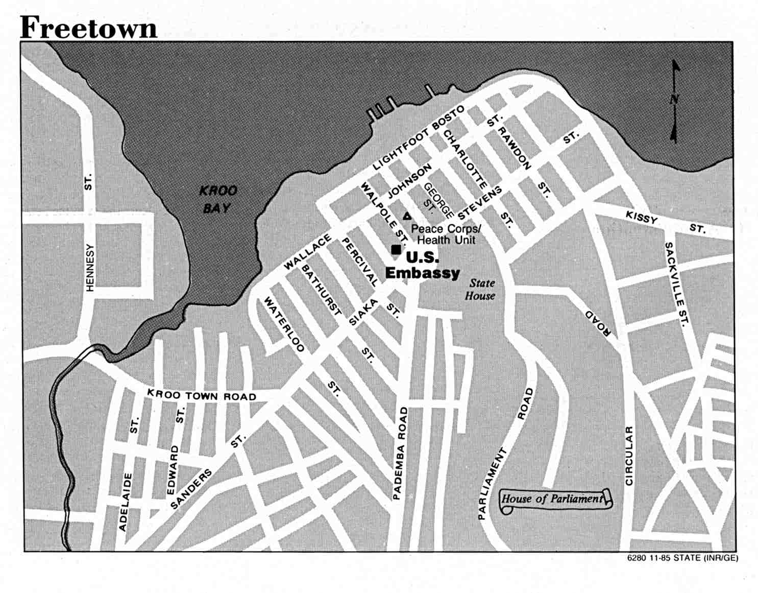
- Freetown, Sierra Leone U.S. Department of State 1985 (100K)
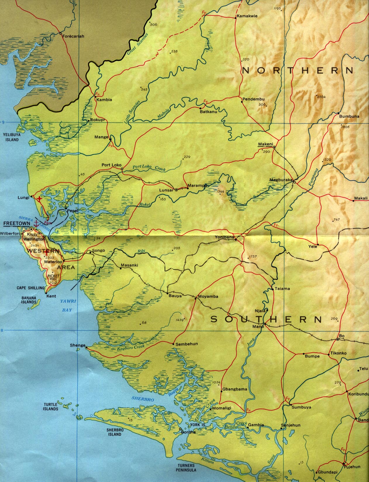
- Western Sierra Leone CIA 1969 (398K)
![[Sierra Leone 1:396,000] Sierra Leone and Freetown (Road Map)](africa/txu-pclmaps-oclc-20901798-sierra_leone-1988.jpg)
![[Freetown 1:14,500 and 1:10,000] Sierra Leone and Freetown (verso) (Street Map)](africa/txu-pclmaps-oclc-20901798-sierra_leone-1988_verso.jpg)
- 1:2,000,000 - Africa Topographic Maps U.S. Defense Mapping Agency, Series 2201
- Sheet 16, compiled in 1978, includes Sierra Leone. Clickable map
- 1:1,000,000 - Operational Navigation Chart Series U.S. Defense Mapping Agency Aerospace Center. Not for navigational use
- Sheets K-1 and L-1 cover all of Sierra Leone
- 1:1,000,000 - International Map of the World U.S. Army Map Service
- This series, printed in the 1960s, covers all of Sierra Leone. Clickable map
- 1:500,000 - Tactical Pilotage Charts U.S. National Imagery and Mapping Agency. Not for navigational use
- This series covers Sierra Leone
- 1:250,000 - Joint Operations Graphic U.S. National Imagery and Mapping Agency, Series 1501 Air Not for navigational use
- This series covers northern and eastern Sierra Leone
- 1:250,000 - West Africa Topographic Maps U.S. Army Map Service, Series N504, 1955-
- This series covers northern and central Sierra Leone
- 1:250,000 - Sierra Leone U.S. Army Map Service, Series G541, 1942-
- This older series covers all of Sierra Leone. Clickable map
- Sheet 16, compiled in 1978, includes Sierra Leone. Clickable map
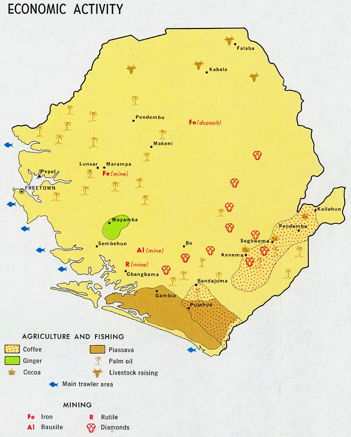
- Sierra Leone - Economic Activity from Map No. 58962 1969 (137K)
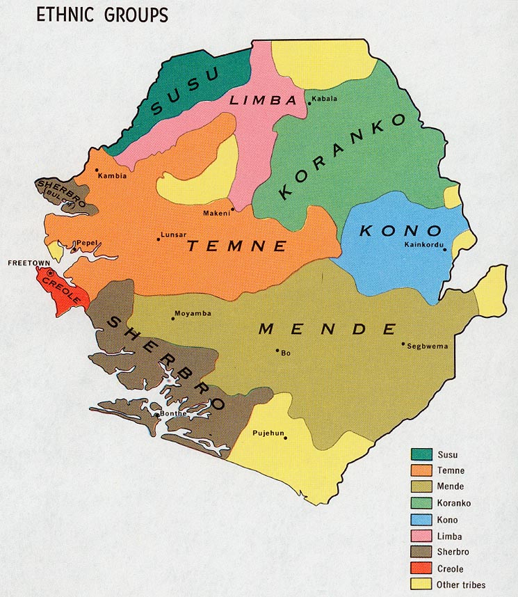
- Sierra Leone - Ethnic Groups from Map No. 58962 1969 (163K)
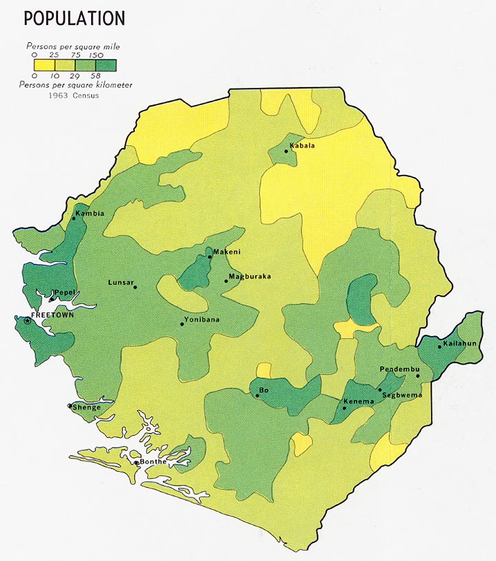
- Sierra Leone - Population from Map No. 58962 1969 (133K)
- Sierra Leone - Vegetation from Map No. 58962 1969 (177K)
- Freetown Area 1958 original scale 1:250,000 Portion of Army Map Service, Corps of Engineers NC 28-16 1958 (582K)
- Freetown original scale 1:6,250 Army Map Service, First Edition AMS-2 1947 (5.8MB)
- Freetown (Central Ward) original scale 1:6,250 Portion of Army Map Service, First Edition AMS-2 1947 (452K)
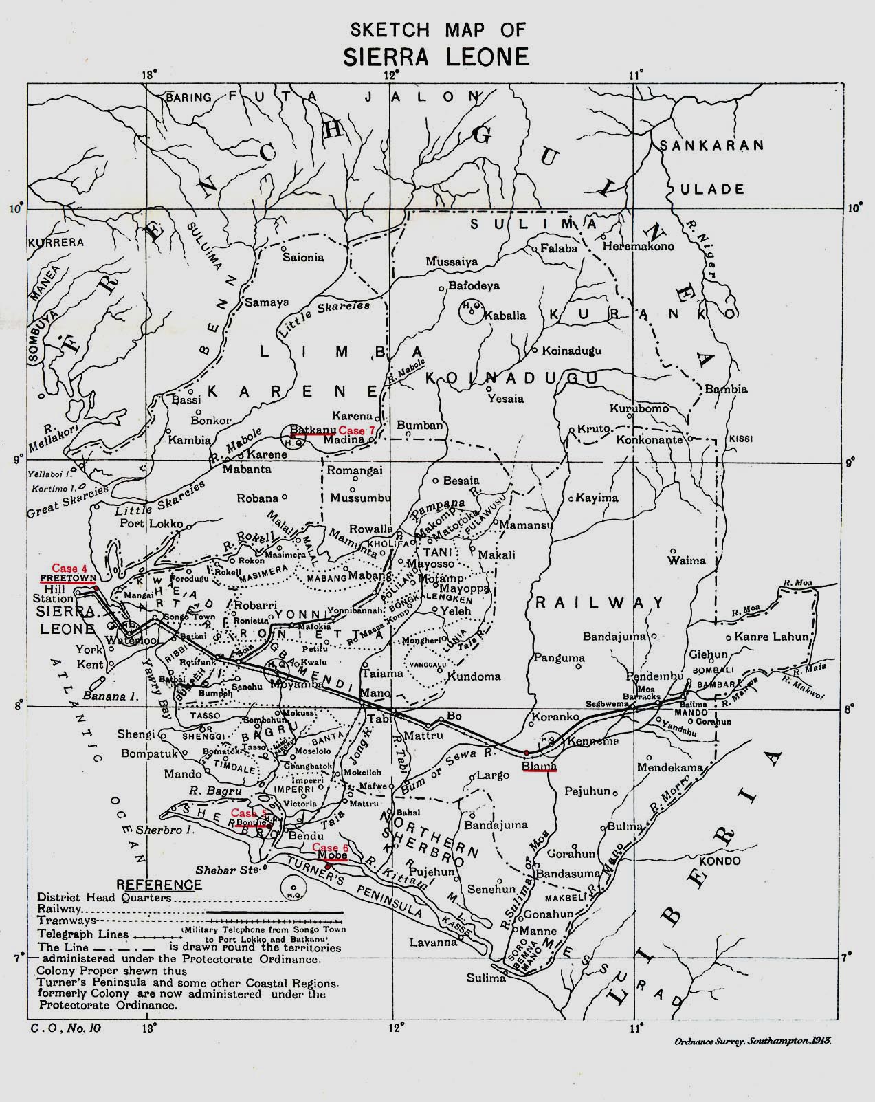
- Sierra Leone 1913 "Sketch Map of Sierra Leone" from Great Britain Parliament House of Commons Sessional Papers, Colonial Reports - Annual. No. 797, 1913. (516K)
- West Africa - Topographic Maps Series N504, 1:250,000, U.S. Army Map Service, 1955-
Maps on Other Web Sites