Perry-Castañeda Library
Map Collection
Philippines Maps
The following maps were produced by the U.S. Central Intelligence Agency, unless otherwise indicated.
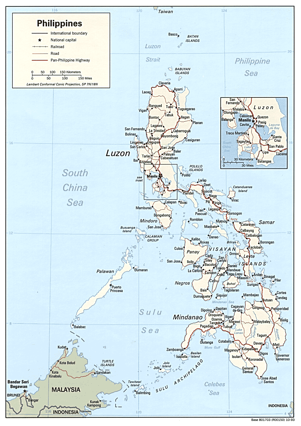
Country Maps- Philippines (Political) 1993 (317K) and pdf format (332K)
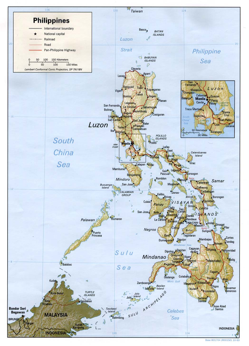
- Philippines (Shaded Relief) 1993 (207K) and pdf format (213K)
- Philippines (Small Map) 2016 (33.3K)
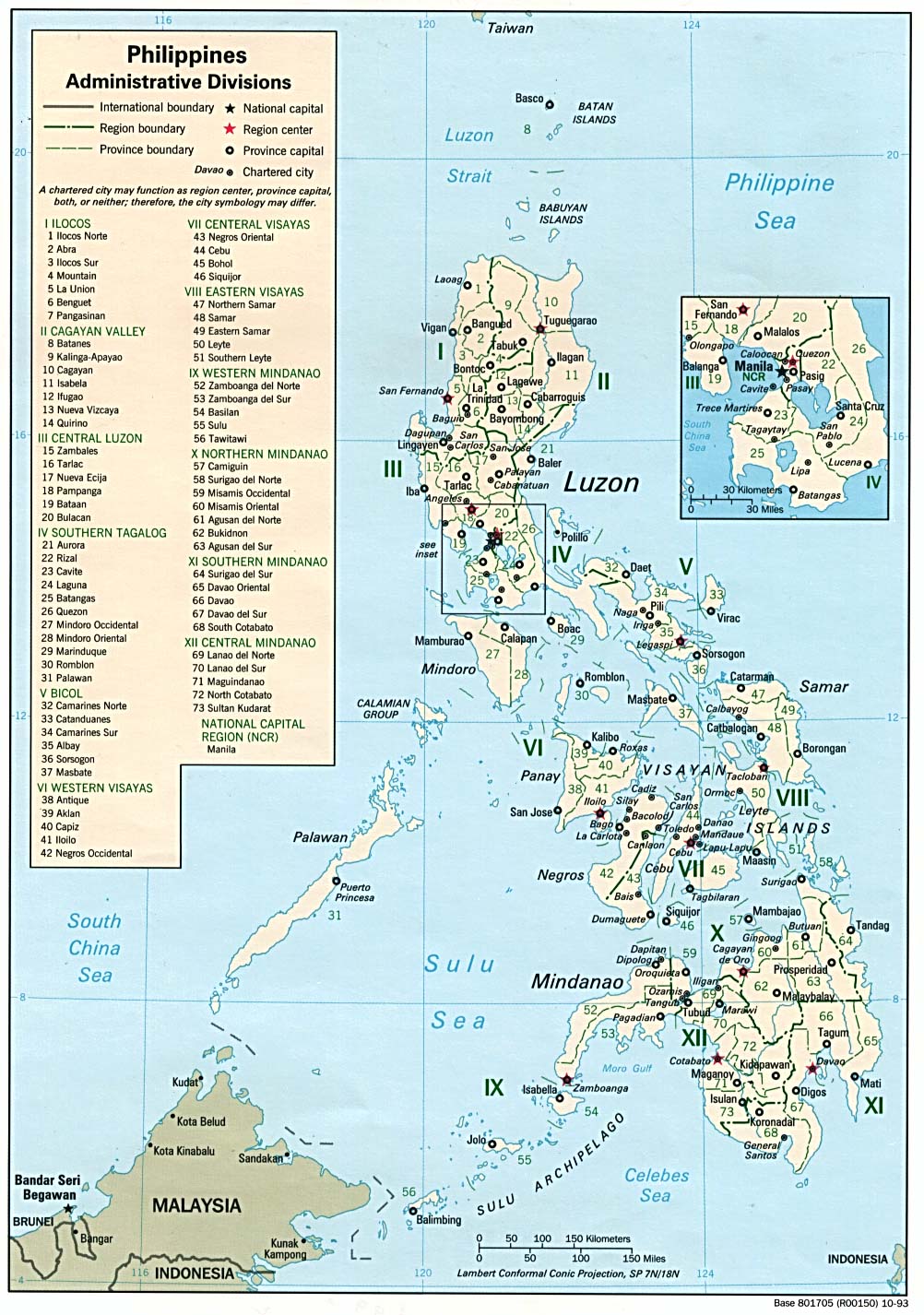
- Philippines Administrative Divisions 1993 (298K)
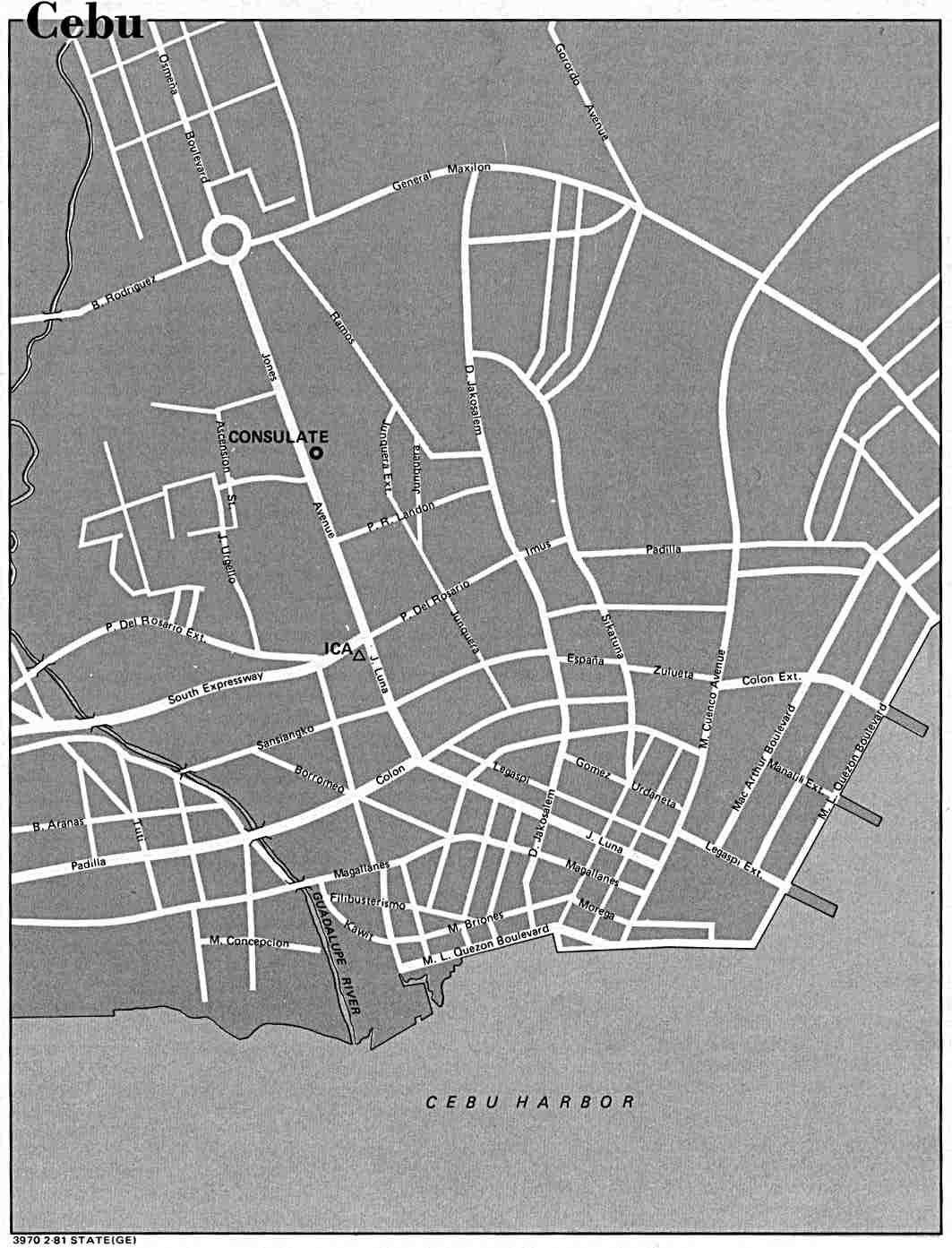
- Cebu U.S. Dept. of State 1981 (94K)
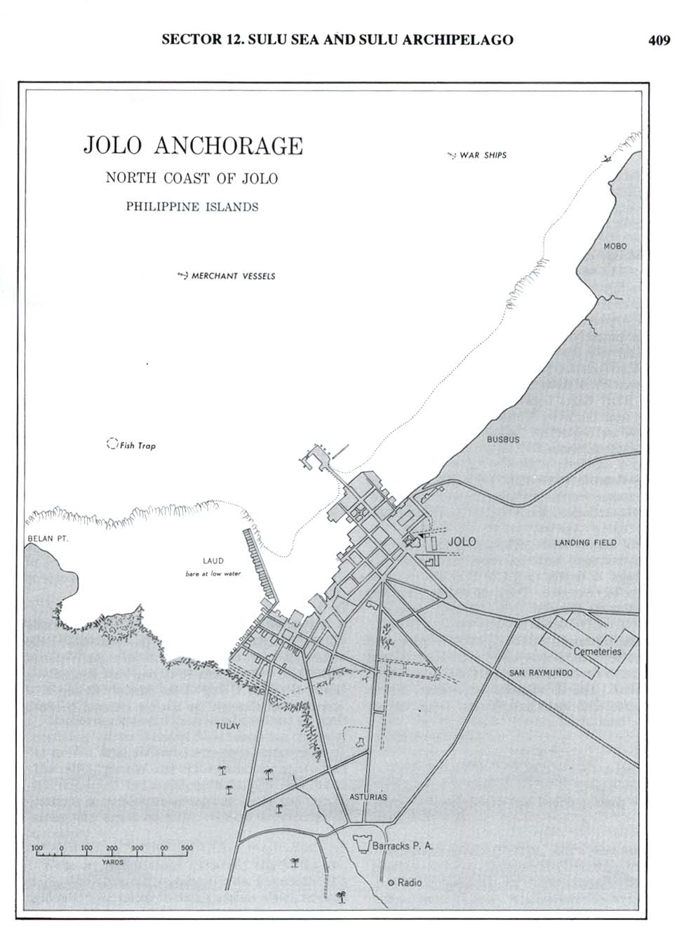
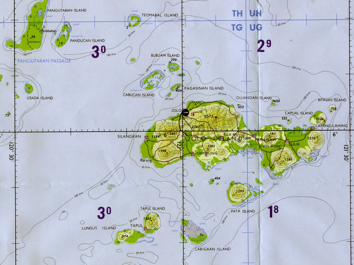
- Jolo from Philippine Islands Sailing Directions (Enroute) published by the U.S. Defense Mapping Agency 1993 (103K)
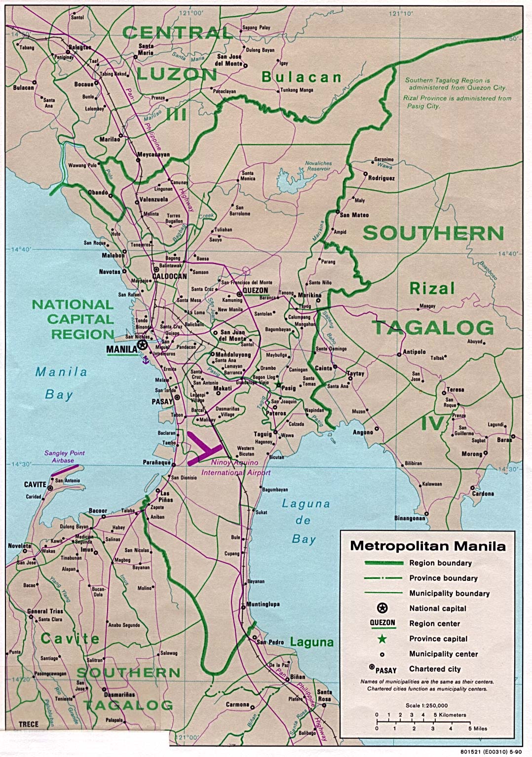
- Manila 1990 CIA (383K)
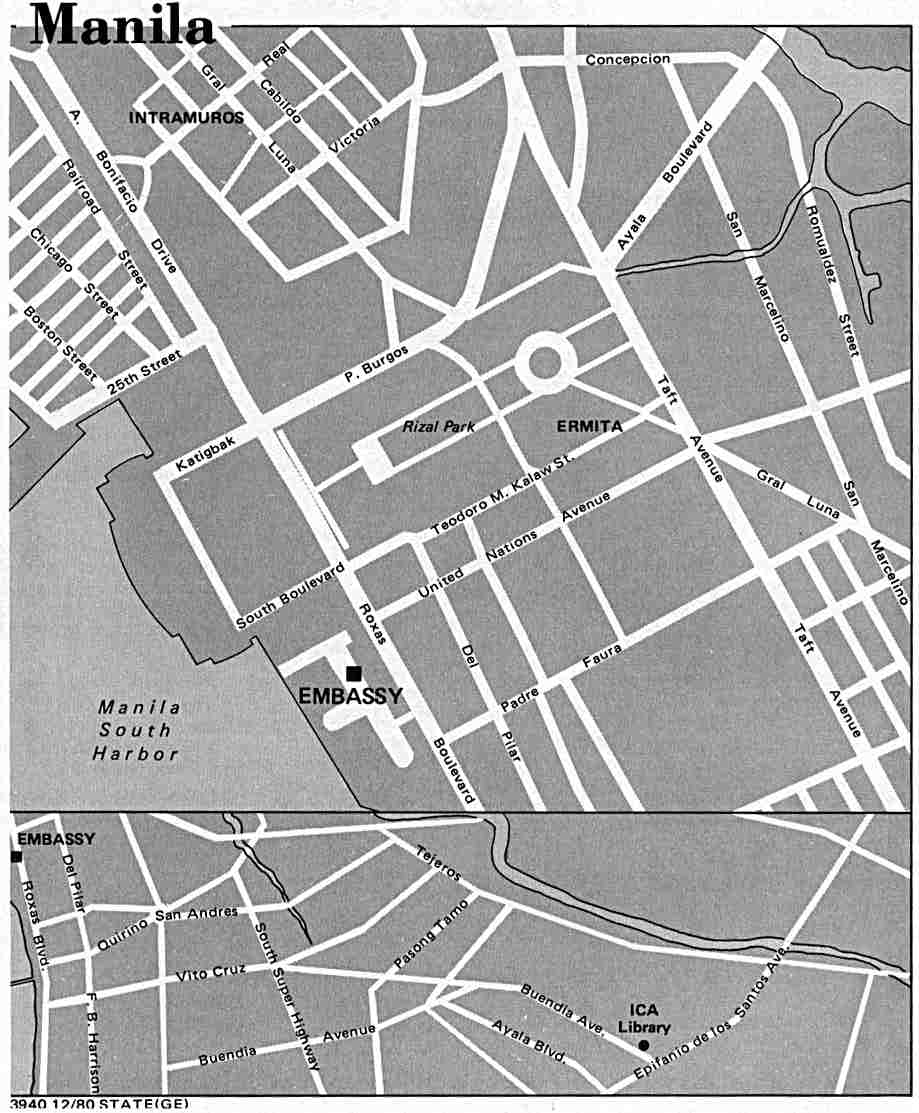
- Manila U.S. Dept. of State 1980 (73K)
- 1:1,000,000 - International Map of the World (Topographic Maps) U.S. Army Map Service
- This series includes all of the Philippines
- 1:1,000,000 - Operational Navigation Chart Series (Aeronautical Charts) U.S. Defense Mapping Agency Aerospace Center Not for navigational use
- This series includes all of the Philippines
- 1:500,000 - Basilan Island (Aeronautical Chart) Portion of Defense Mapping Agency TPC L-12A 1984 (157K) Not for navigational use
- 1:500,000 - Jolo Island (Aeronautical Chart) Portion of Defense Mapping Agency TPC L-12A 1984 (166K) Not for navigational use
- 1:500,000 - Tactical Pilotage Charts U.S. National Imagery and Mapping Agency. Not for navigational use
- This series includes all of the Philippines
- 1:500,000 - Philippine Islands, Series S401(Topographic Maps) U.S. Army Map Service, 1944-
- 1:250,000 - Philippines, Series S501 (Topographic Maps) U.S. Army Map Service, 1954-
- This series includes all of the Philippines
- 1:100,000 - Mindanao, Series S651 (Topographic Maps) U.S. Army Map Service, 1944-
- 1:50,000 - Luzon, Series S711 (Topographic Maps) U.S. Army Map Service, 1964-
- 1:50,000 - Luzon, Series S712 (Topographic Maps) U.S. Army Map Service, 1944-
- 1:25,000 - Central Philippines, Series S831 (Topographic Maps) U.S. Army Map Service, 1944-
- 1:50,000 - Sulu Archipelago, Series S741 (Topographic Maps) U.S. Army Map Service, 1944-
- 1:50,000 - Mindanao, Series S751 (Topographic Maps) U.S. Army Map Service, 1944-
- 1:25,000 - Mindanao, Series S851 (Topographic Maps) U.S. Army Map Service, 1944-
- 1:25,000 - Palawan, Series S821 (Topographic Maps) U.S. Army Map Service, 1944-
- This series includes all of the Philippines
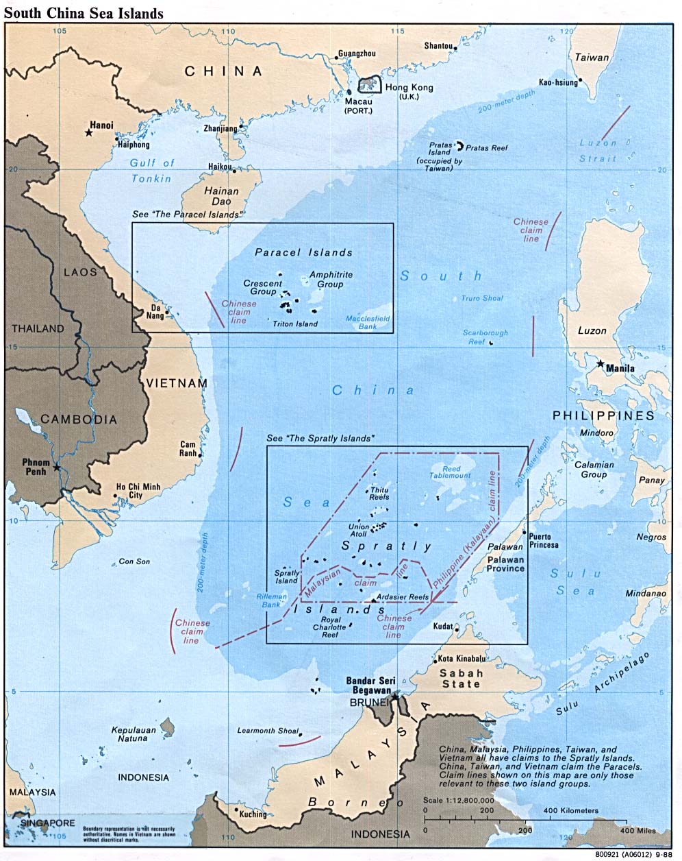
- South China Sea 1988 (229K)
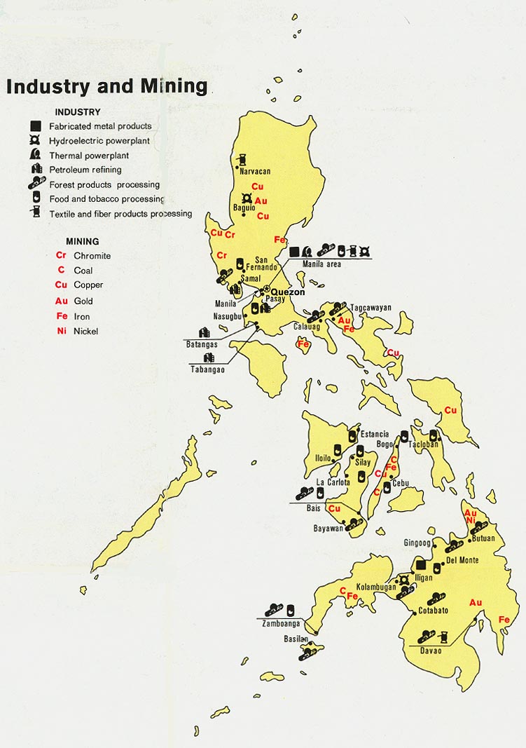
- Philippines - Industry and Mining from Map No. 501475 1973 (137K)
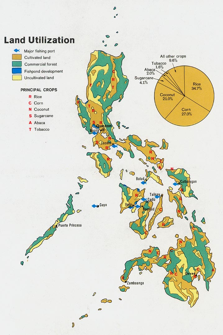
- Philippines - Land Utilization from Map No. 501475 1973 (160K)
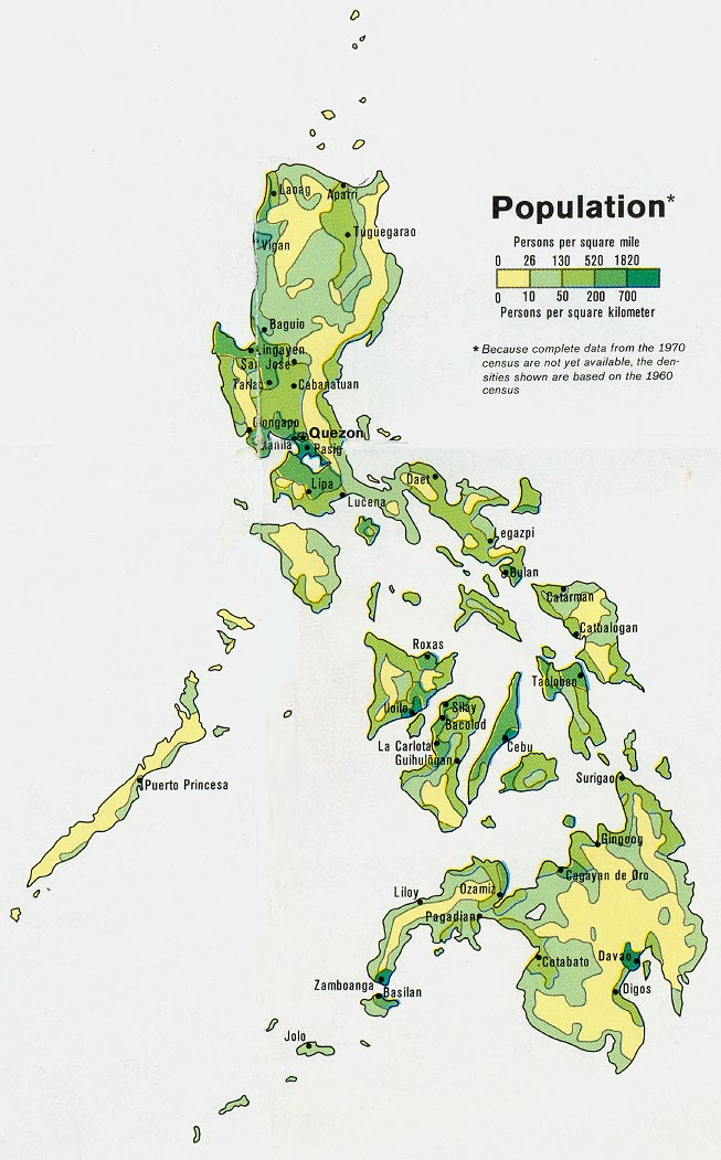
- Philippines - Population from Map No. 501475 1973 (140K)
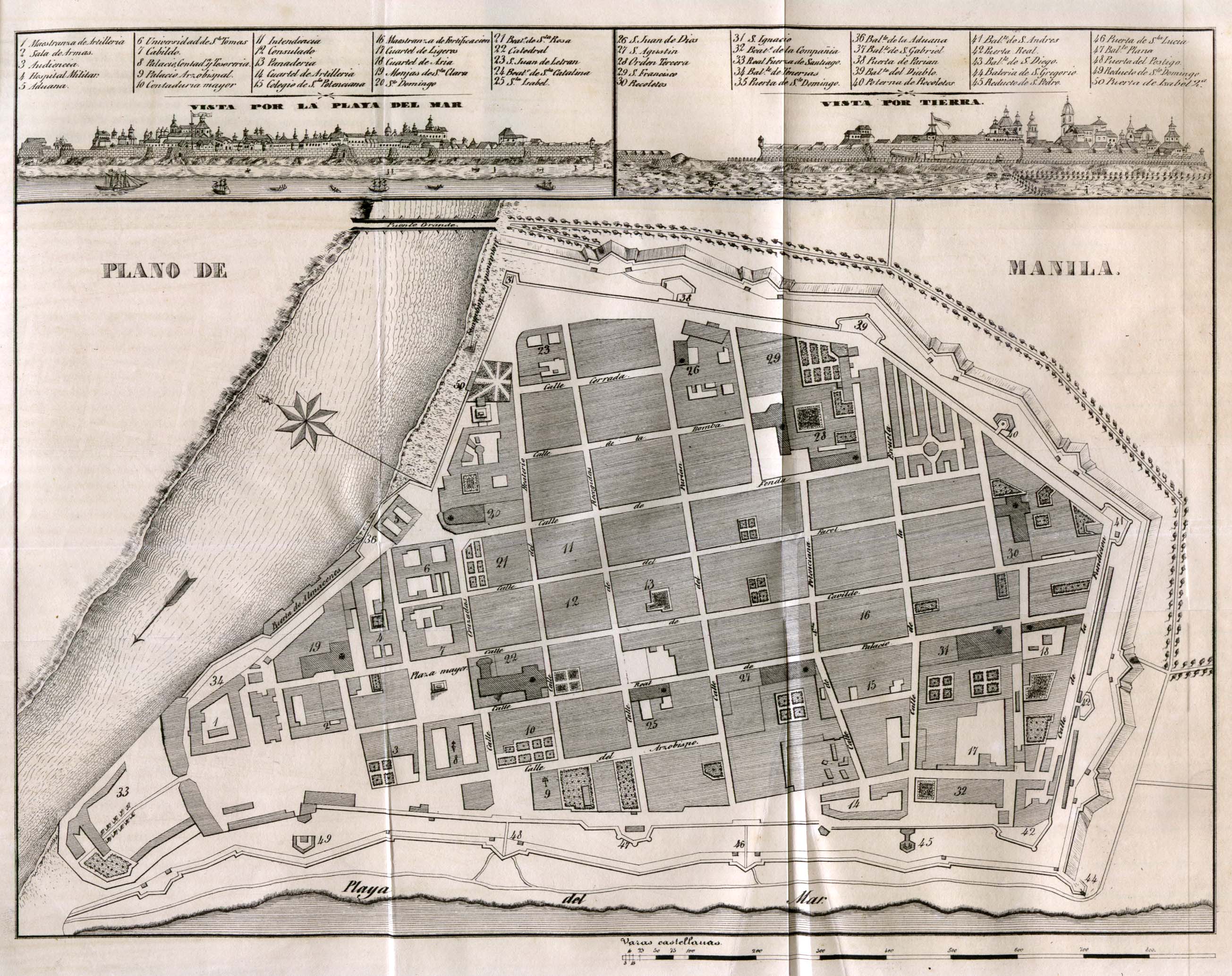
- Manila 1851 (851K)
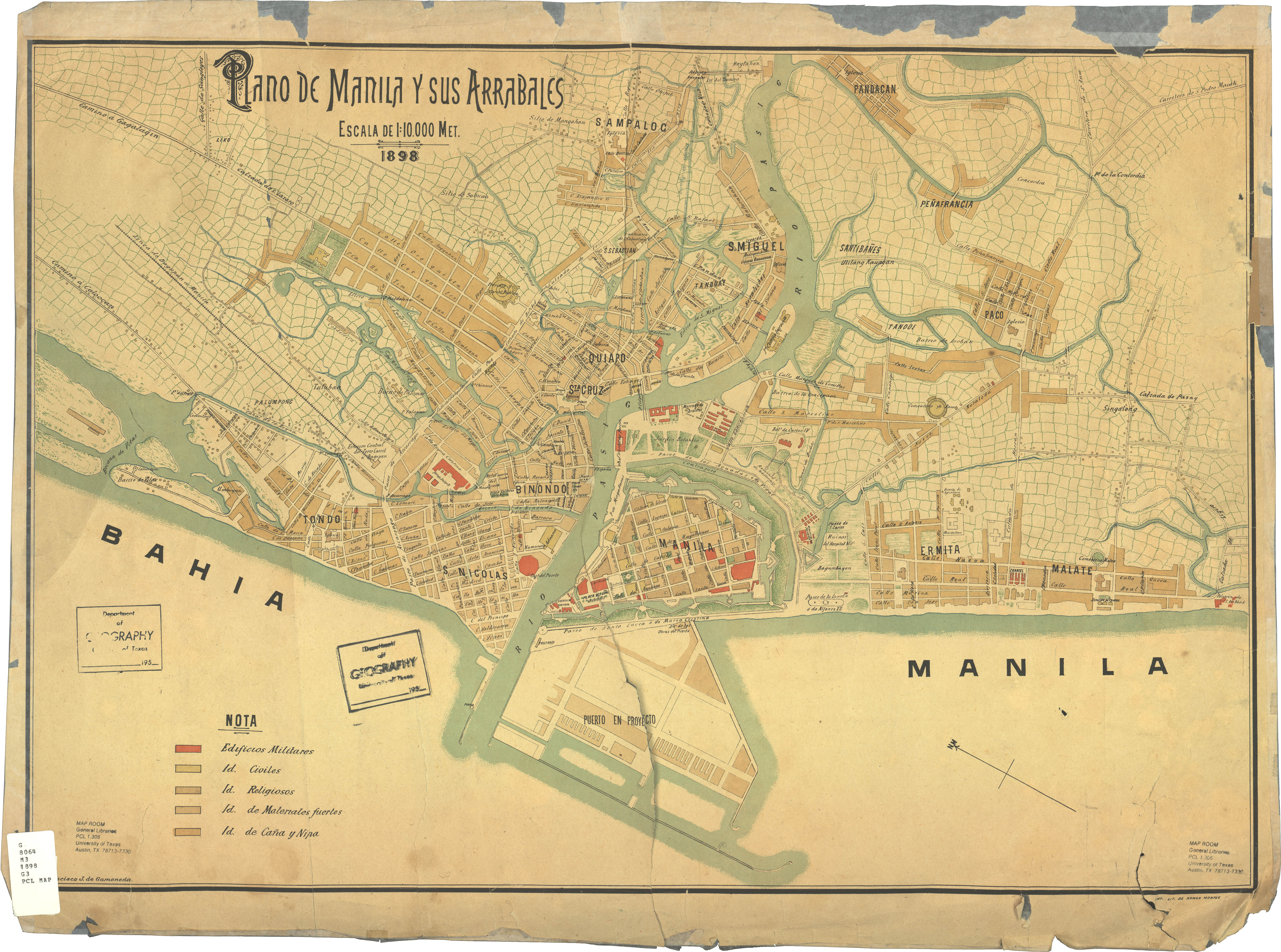
Diccionario Geografico-Estadistico-Historico De Las Islas Filipinas. Madrid 1851. - Manila 1898 (3.8MB)
Plano de Manila y sus Arrables, Francisco J. de Gamoneda ; imp. lit. de Ramon Montes, original scale 1:10,000, 1898. - Philippine Islands 1909 (192K)
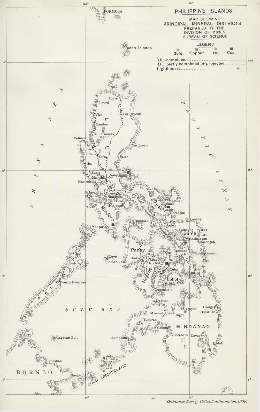
- "Philippine Islands Map Showing Principal Mineral Districts" from Diplomatic and Consular Reports; Annual 4369 - 4387, 1908 Vol. 7; edited at the Foreign Office and the Board of Trade. London 1909.
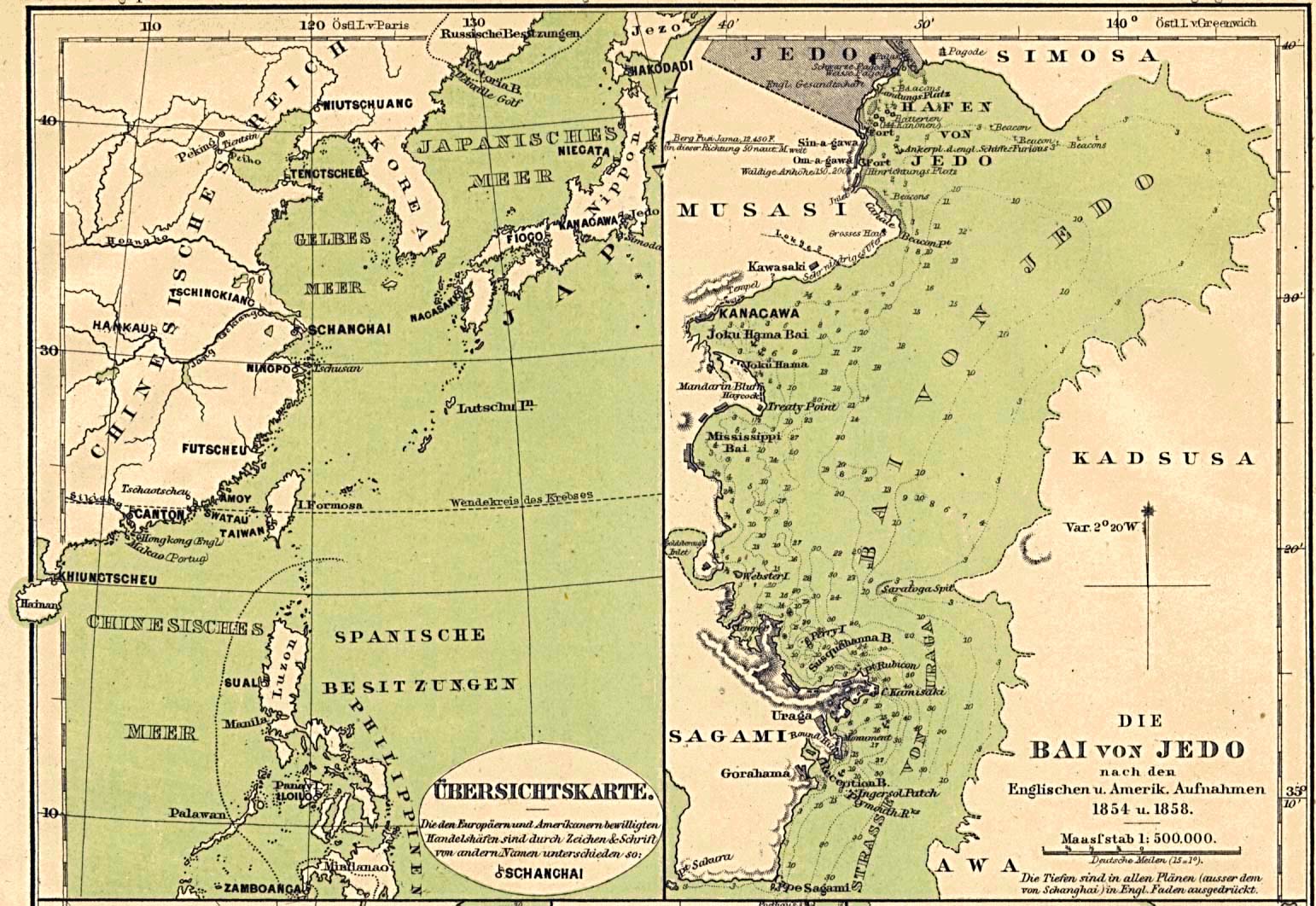
- Ports in China, Japan and the Philippines 1860 Part I (335K)
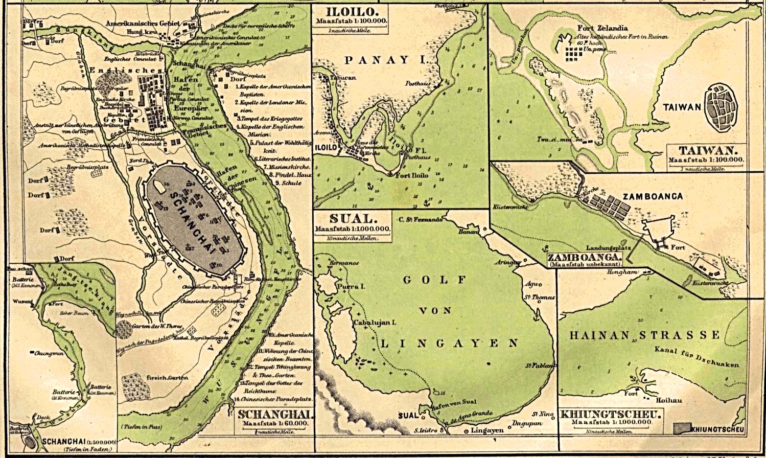
Ports Location Map and Plan of Jedo Bay, [Tokyo/yokohama, Japan] From Mittheilungen aus Justus Perthes' Geographischer Anstalt uber Wichtige Neue Erforschungen auf dem Gesammtgebiete der Geographie von Dr. A. Petermann. Volume 6, 1860.- Ports in China, Japan and the Philippines 1860 Part II (325K)
Plans of Schanghai [Shanghai, China], Iloilo [Philippines], Sual [Port Sual, Philippines], Taiwan [now Tainan, Taiwan], Zamboanga [Philippines], Khiungtscheu [Kiungshan/ch'iung-Shan, China] From Mittheilungen aus Justus Perthes' Geographischer Anstalt uber Wichtige Neue Erforschungen auf dem Gesammtgebiete der Geographie von Dr. A. Petermann. Volume 6, 1860.- Philippines City Plans 1944-1945 U.S. Army Map Service
- 50 city maps
- Jolo Group Terrain Handbook 1944 Allied Geographical Section, Southwest Pacific Area [includes maps and aerial photographs] (36MB)
- Lingayen Terrain Handbook 1944 Allied Geographical Section, Southwest Pacific Area [includes maps and aerial photographs] (298MB)
- Samar Province Terrain Study 1944 Allied Geographical Section, Southwest Pacific Area [includes maps and aerial photographs] (217MB)
- "Philippine Islands Map Showing Principal Mineral Districts" from Diplomatic and Consular Reports; Annual 4369 - 4387, 1908 Vol. 7; edited at the Foreign Office and the Board of Trade. London 1909.
Maps on Other Web Sites