Perry-Castañeda Library
Map Collection
New York Maps
State Maps
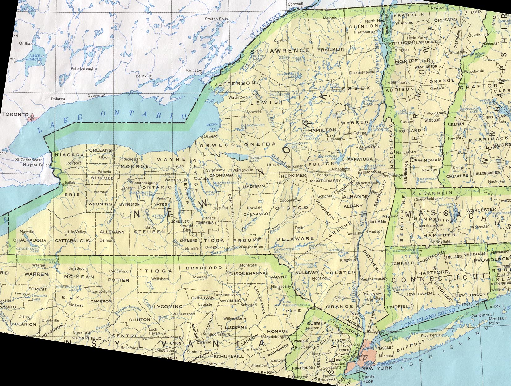
- New York (base map) JPEG format (546K) County boundaries and names, county seats, rivers. Original scale 1:2,500,000 U.S. Geological Survey, 1972 limited update 1990
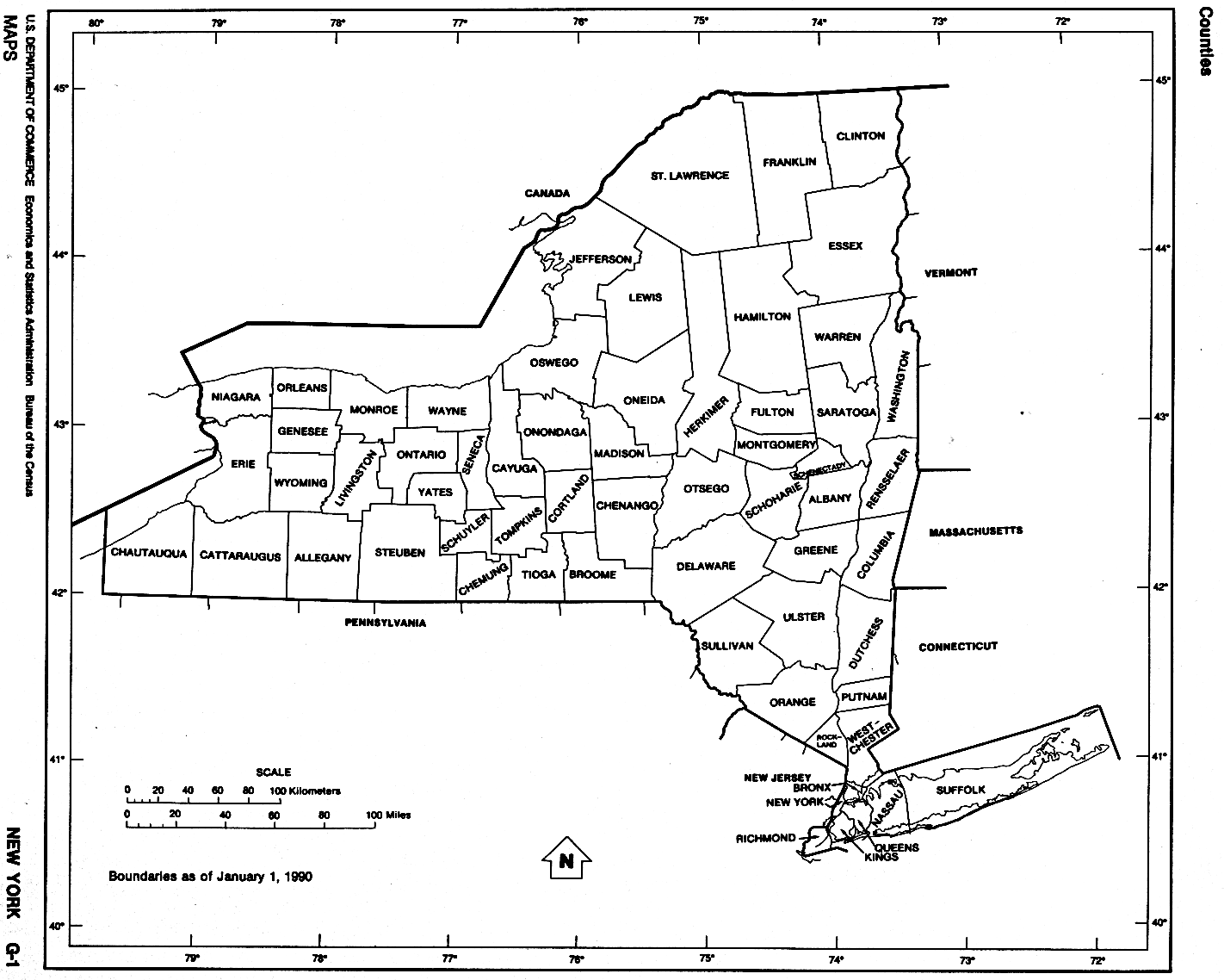
- New York (outline map) JPEG format (81K) County boundaries and names. U.S. Bureau of the Census, 1990
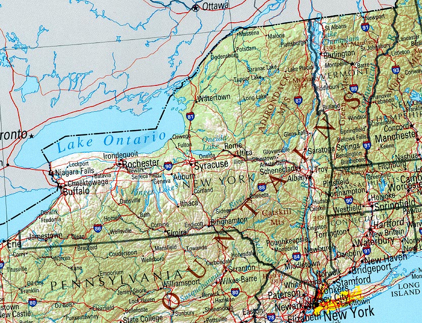
- New York (reference map) JPEG format (370K) Shaded relief map with state boundaries, forest cover, place names, major highways. Portion of "The National Atlas of the United States of America. General Reference", compiled by U.S. Geological Survey 2001, printed 2002
- New York (reference map) PDF format (373K) Shaded relief map with state boundaries, forest cover, place names, major highways. Portion of "The National Atlas of the United States of America. General Reference", compiled by U.S. Geological Survey 2001, printed 2002
- New York - Federal Lands and Indian Reservations PDF format (613K) The National Atlas of the United States of America, U.S. Geological Survey, 2003
City Maps
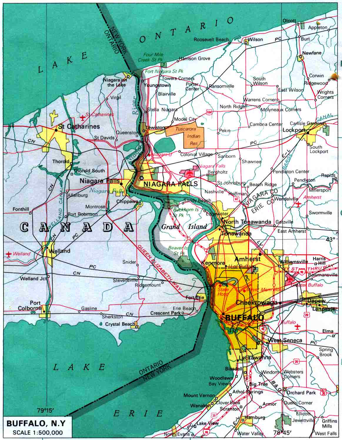
- Buffalo original scale 1:500,000 U.S. National Atlas 1970 (159K)
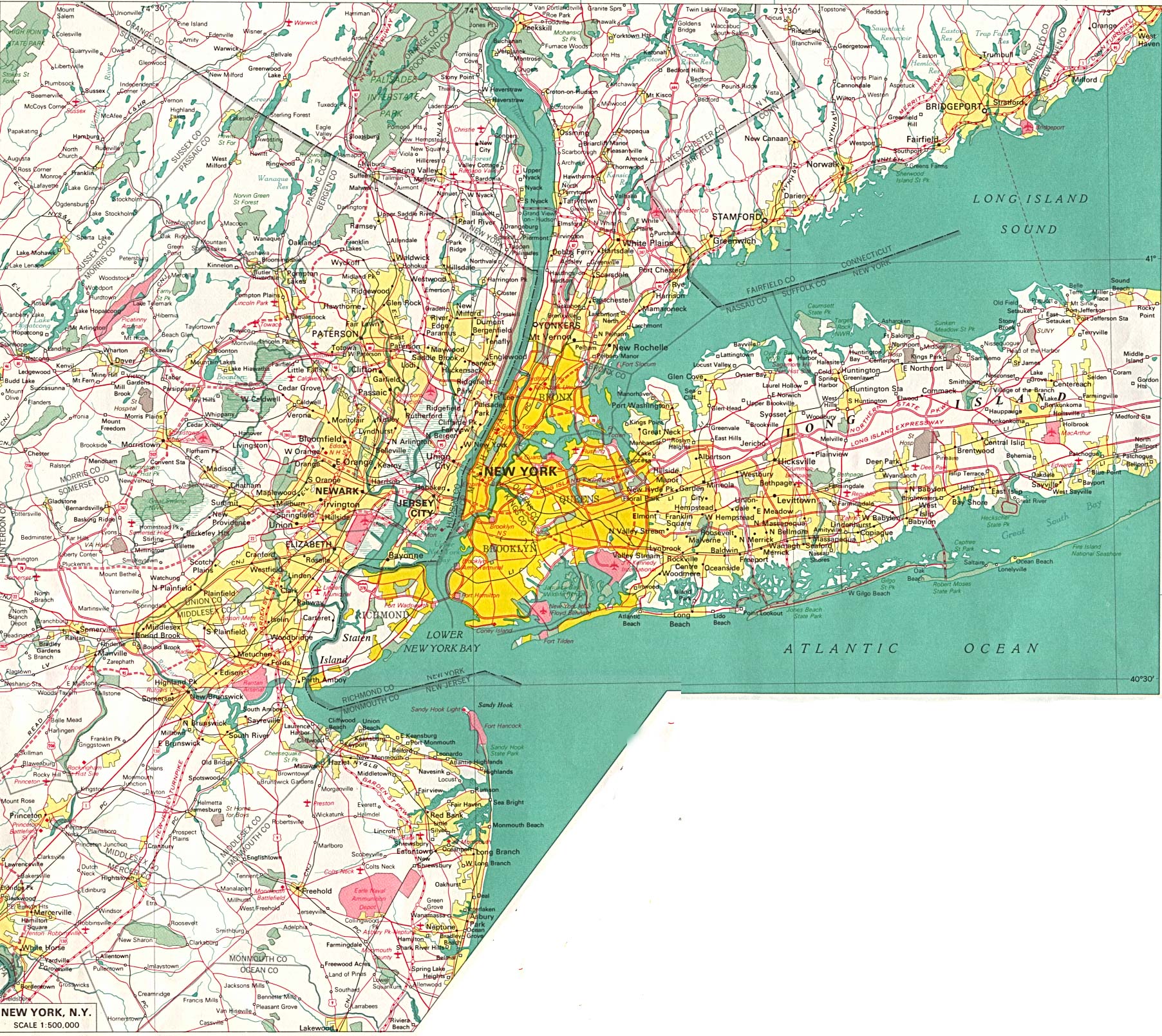
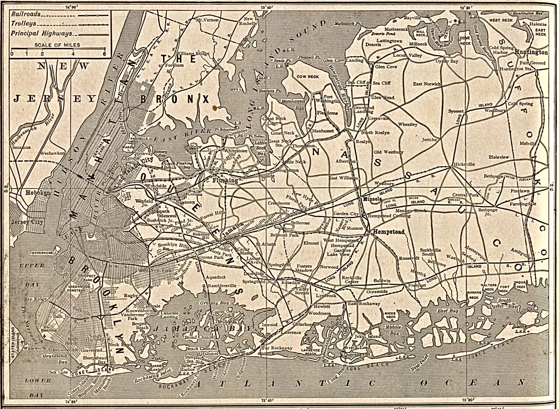
- New York City original scale 1:500,000 U.S. National Atlas 1970 (889K)
Historical Maps
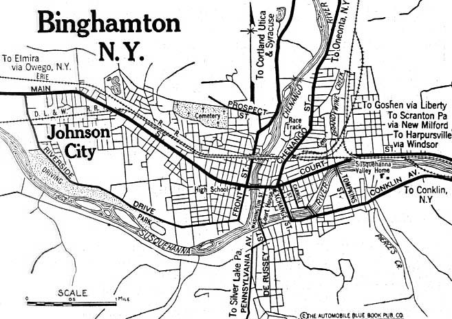
- Binghamton 1920 Automobile Blue Book (117K)
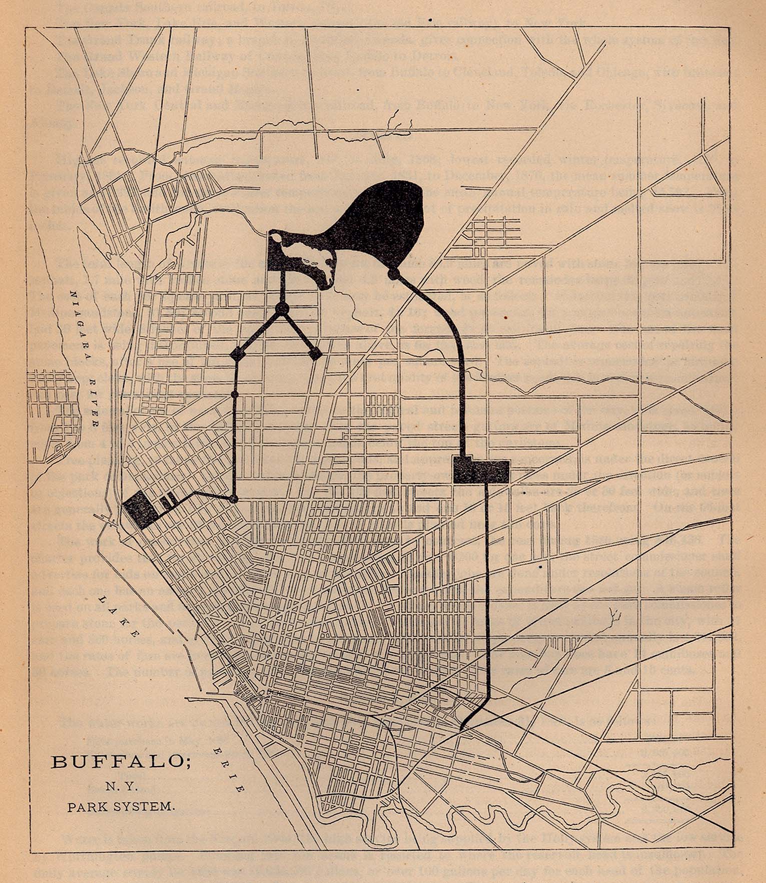
- Buffalo 1880 - Park System From Report on the Social Statistics of Cities, Compiled by George E. Waring, Jr., United States. Census Office, Part I, 1886. (655K)
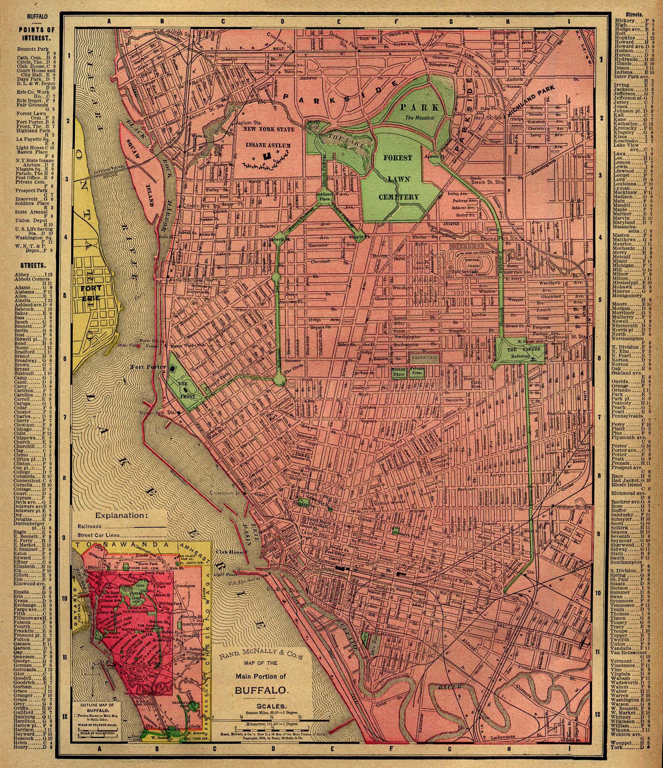
- Buffalo 1896 Rand, McNally & Co.'s Universal Atlas of The World. (1MB)
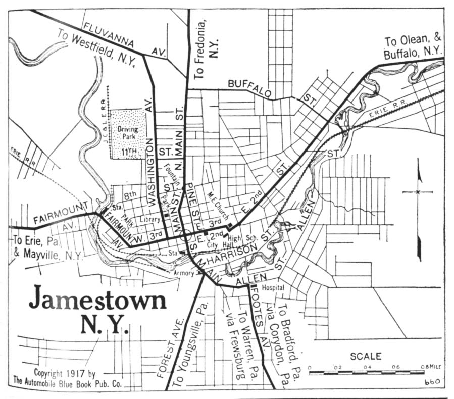
- Jamestown 1917 Automobile Blue Book 1917, Vol. 3 (150K)
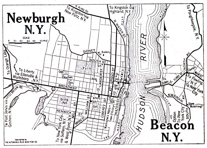
- Newburgh and Beacon 1920 Automobile Blue Book (137K)
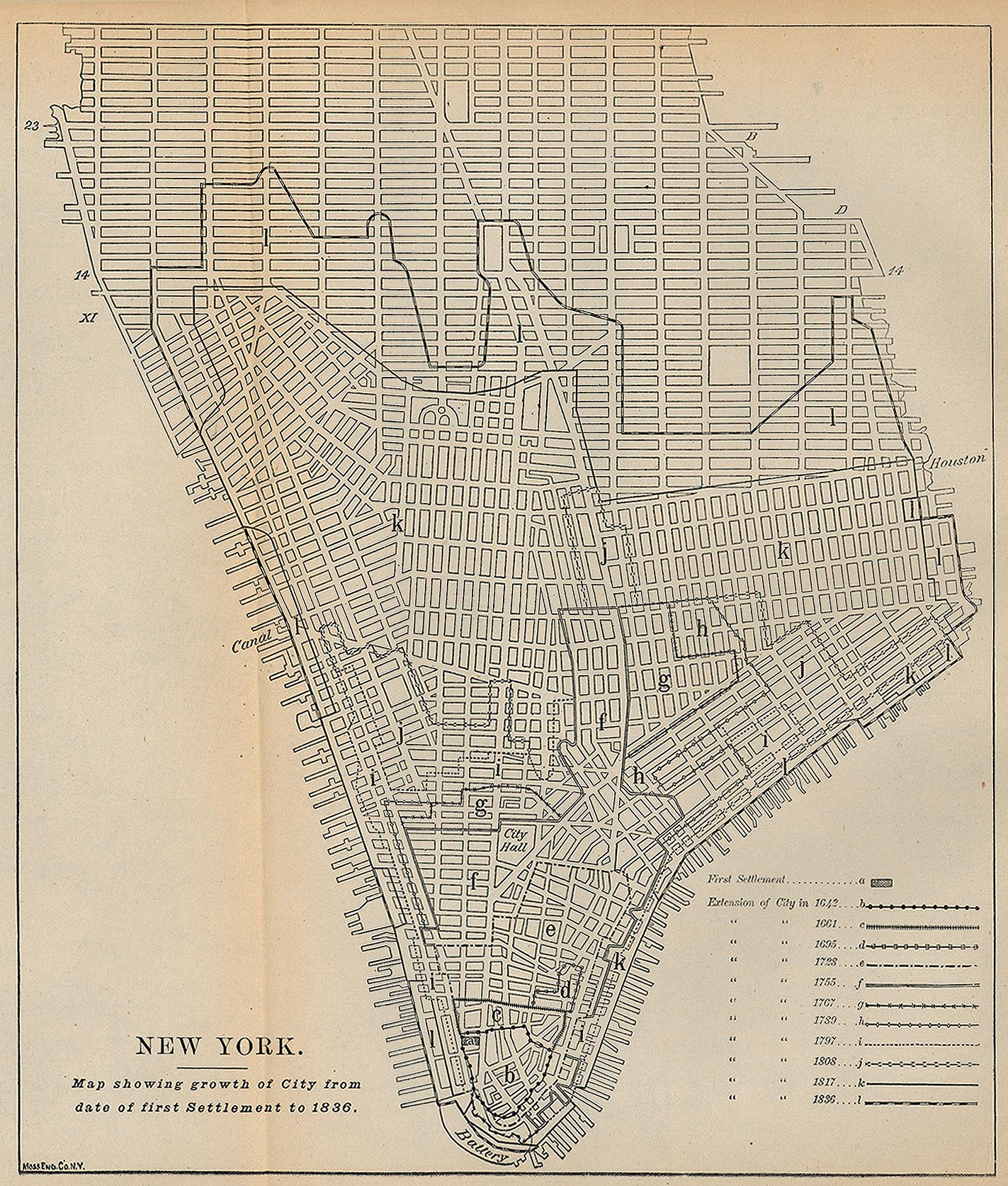
- New York City First Settlement - 1836 [Map overlays streets as of 1880] "Map showing growth of City from date of first Settlement to 1836." From Report on the Social Statistics of Cities, Compiled by George E. Waring, Jr., United States. Census Office, Part I, 1886. (616K)
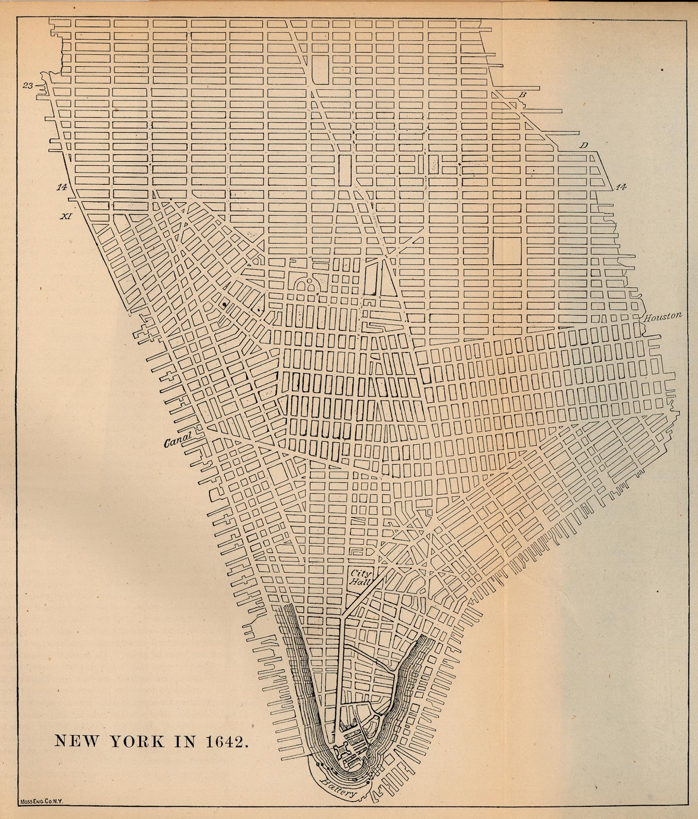
- New York City 1642 [Map overlays streets as of 1880] From Report on the Social Statistics of Cities, Compiled by George E. Waring, Jr., United States. Census Office, Part I, 1886. (542K)
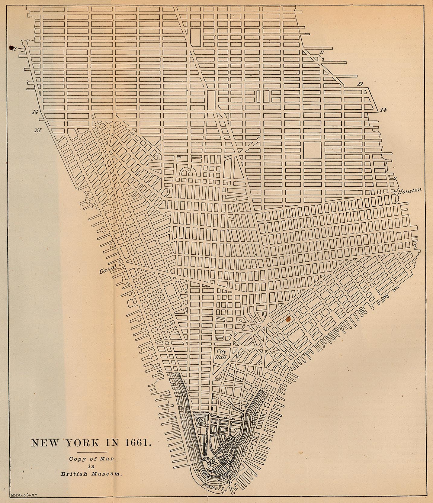
- New York City 1661 [Map overlays streets as of 1880] From Report on the Social Statistics of Cities, Compiled by George E. Waring, Jr., United States. Census Office, Part I, 1886. (541K)
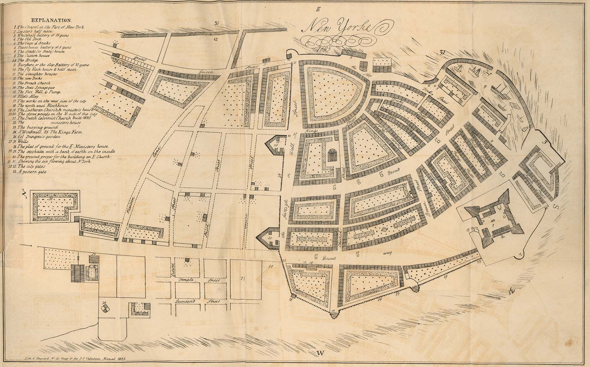
- New York City 1695 From Manual of the Corporation of the City of New York for 1852 by D.T. Valentine, 1852 (381K)
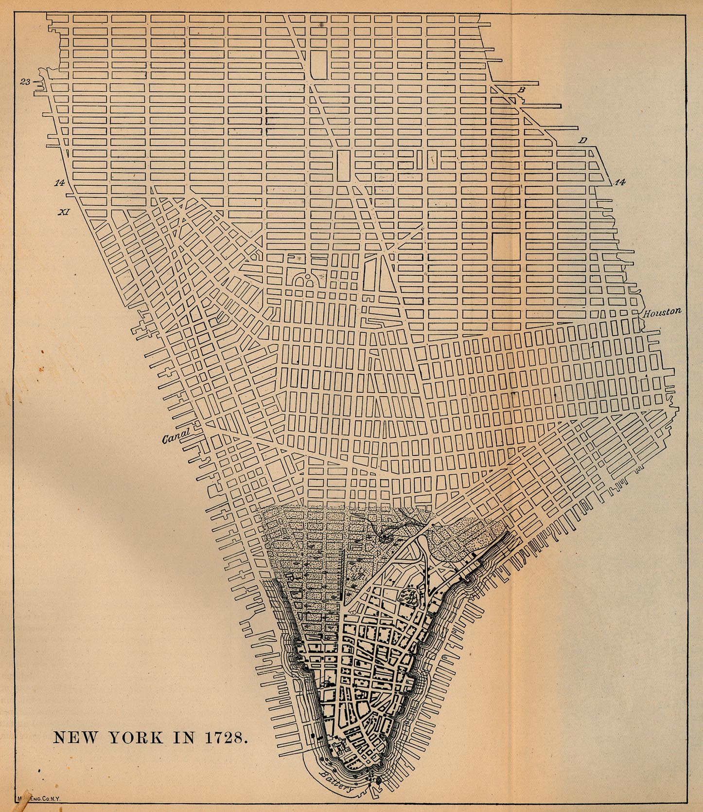
- New York City 1728 [Map overlays streets as of 1880] From Report on the Social Statistics of Cities, Compiled by George E. Waring, Jr., United States. Census Office, Part I, 1886. (597K)
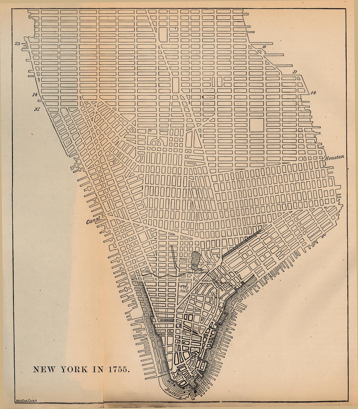
- New York City 1755 [Map overlays streets as of 1880] From Report on the Social Statistics of Cities, Compiled by George E. Waring, Jr., United States. Census Office, Part I, 1886. (570K)
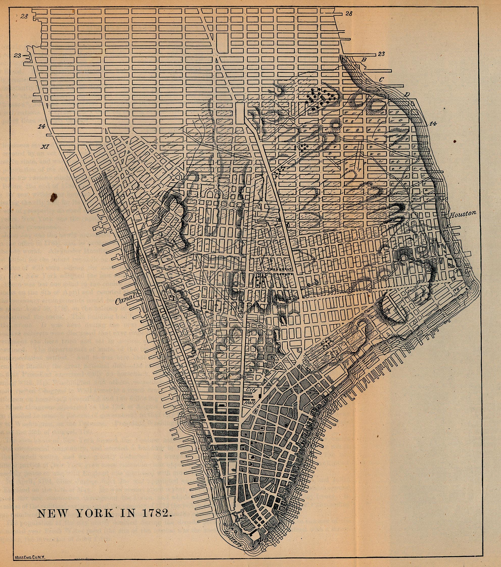
- New York City 1782 [Map overlays streets as of 1880] From Report on the Social Statistics of Cities, Compiled by George E. Waring, Jr., United States. Census Office, Part I, 1886. (1297K)
- New York City Region 1830 The Northern Traveller, and Northern Tour. Fourth Edition. New York: J. & J. Harper 1830 (117K)
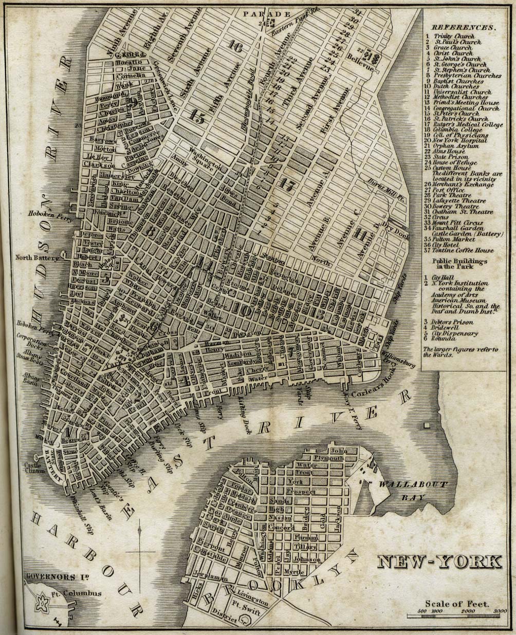
- New York City 1842 "New-York" from Tanner, H.S. The American Traveller; or Guide Through the United States. Eighth Edition. New York, 1842. (396K)
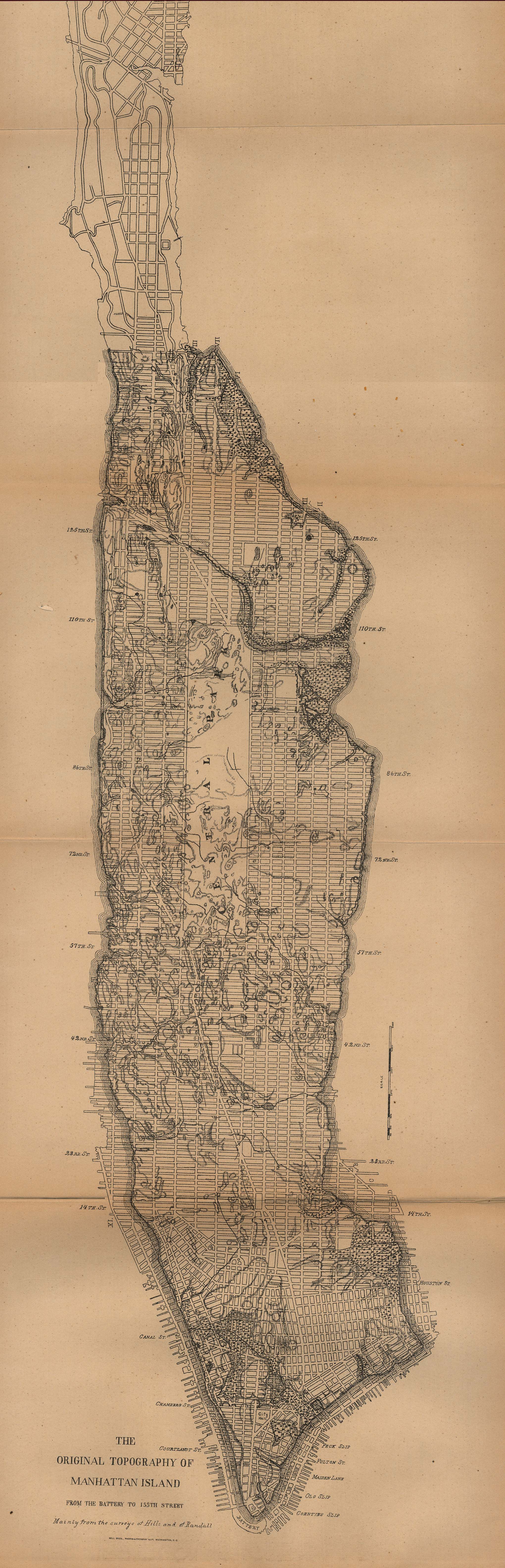
- New York City 1880 [Map overlays streets as of 1880] "The Original Topography of Manhattan Island from the Battery to 155th Street" From Report on the Social Statistics of Cities, Compiled by George E. Waring, Jr., United States. Census Office, Part I, 1886. (542K)
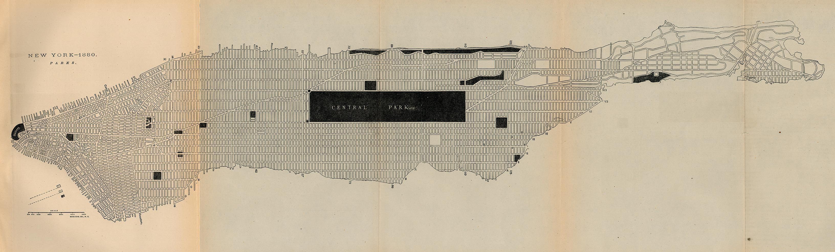
- New York City 1880 - Parks "New York - 1880 Parks" From Report on the Social Statistics of Cities, Compiled by George E. Waring, Jr., United States. Census Office, Part I, 1886. (542K)
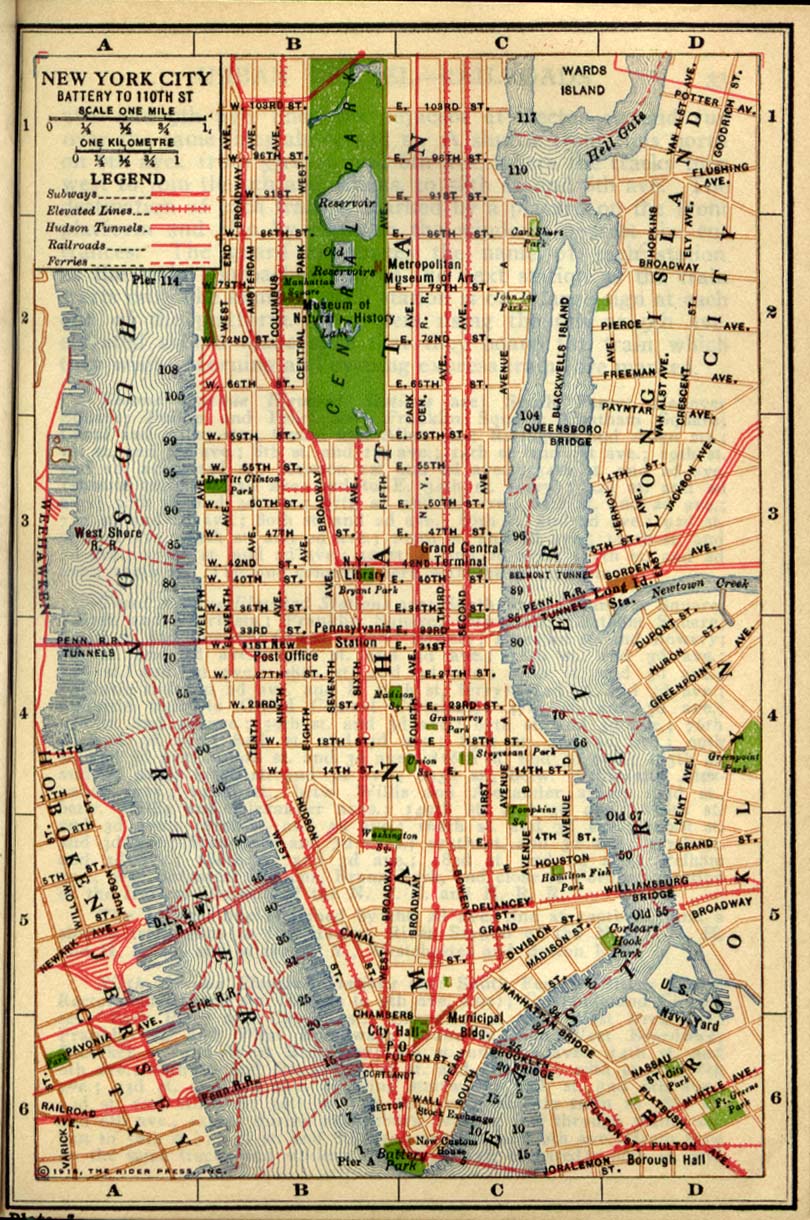
- New York (Battery to 110th Street) 1916 "New York City Battery to 110th Street" from Rider's New York City, Henry Holt and Company, 1916 (386K)
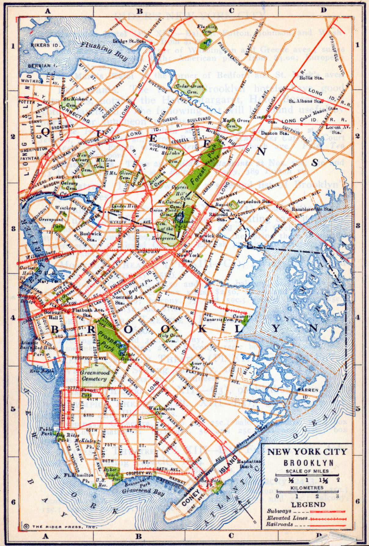
- New York (Brooklyn) 1916 "New York City Brooklyn" from Rider's New York City, Henry Holt and Company, 1916 (1.2MB)
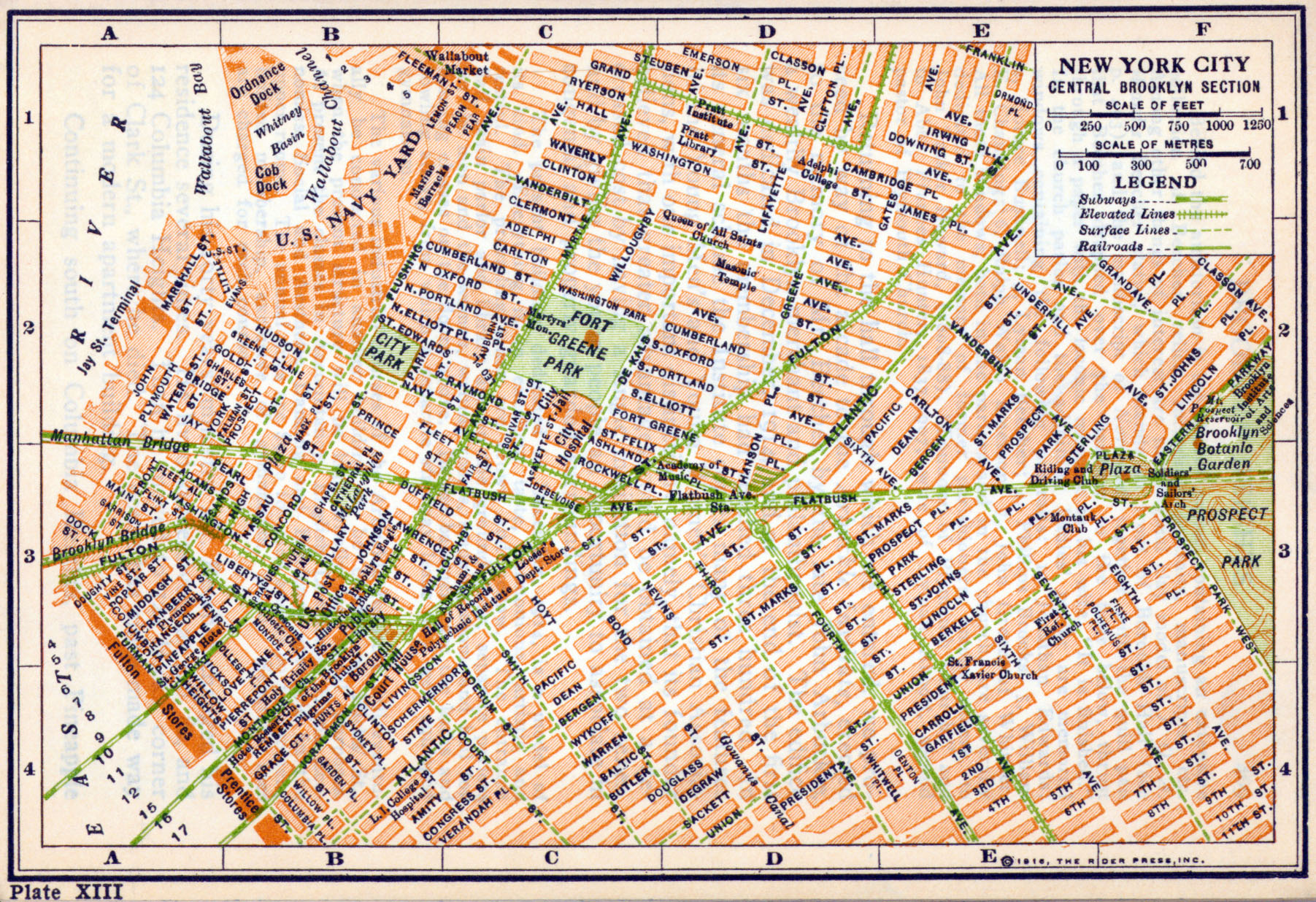
- New York (Central Brooklyn) 1916 "New York City Central Brooklyn Section" from Rider's New York City, Henry Holt and Company, 1916 (1.3MB)
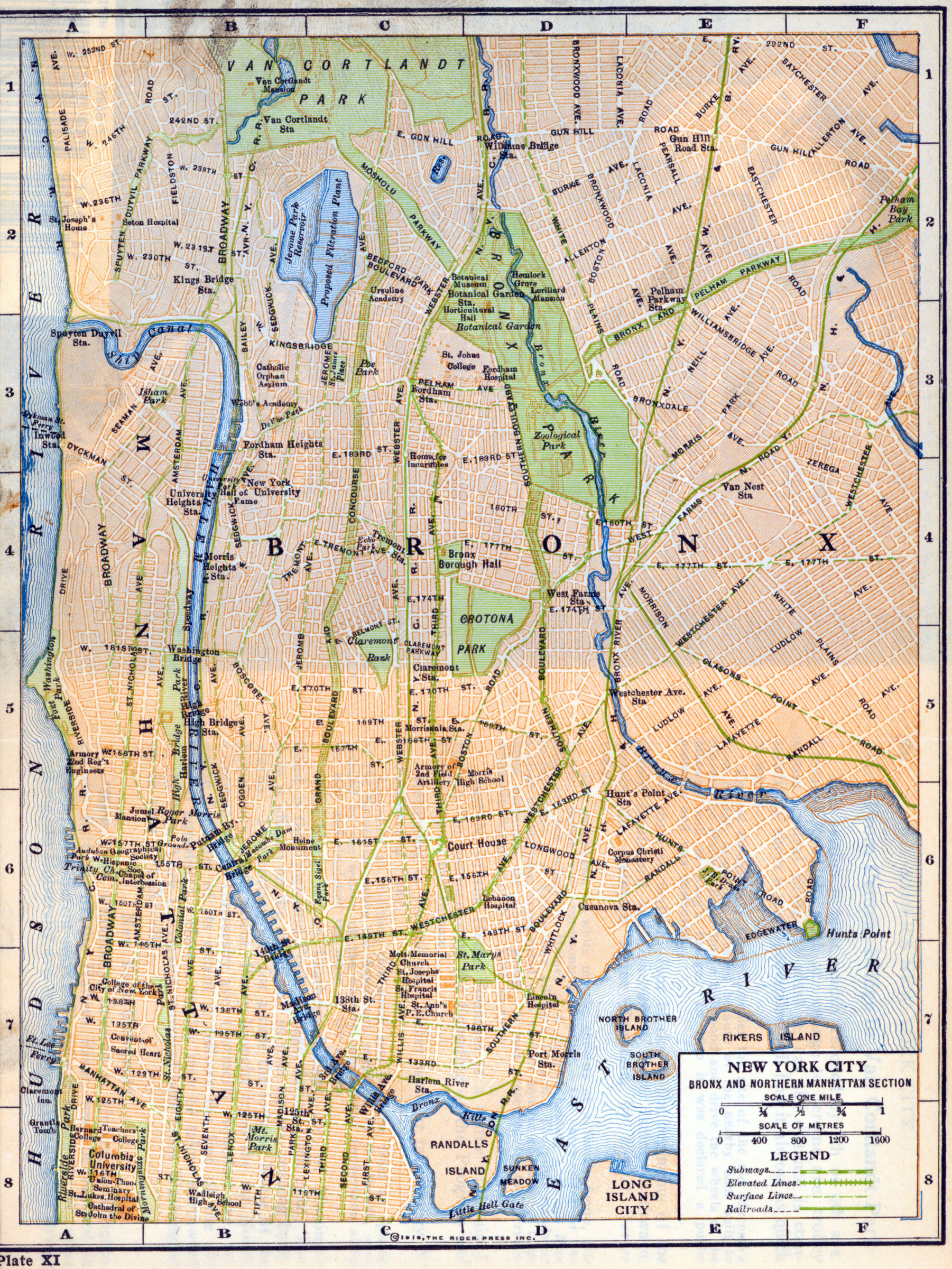
- New York (Bronx and Northern Manhattan) 1916 "New York City Bronx and Northern Manhattan Section" from Rider's New York City, Henry Holt and Company, 1916 (710K)
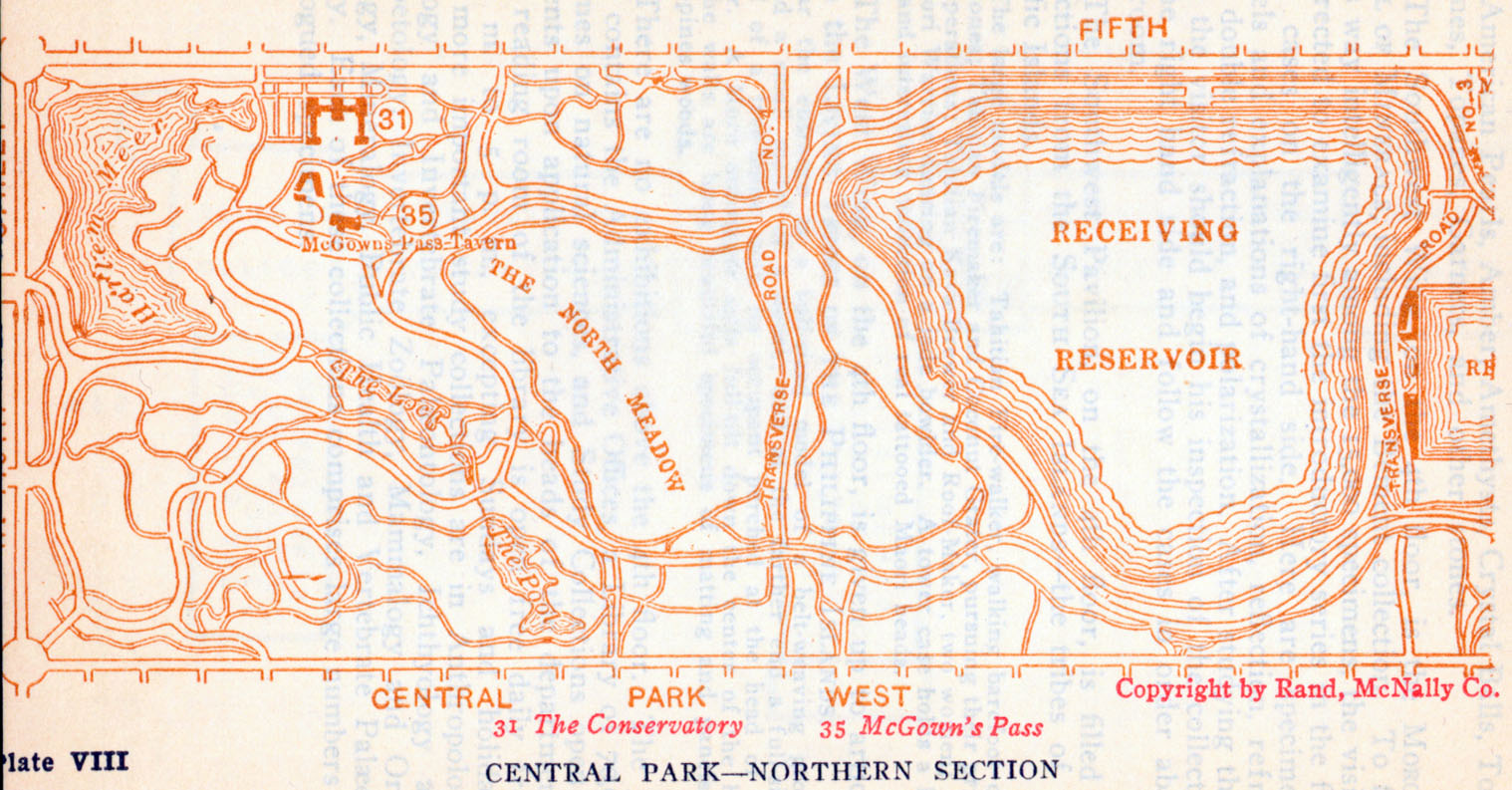
- New York (Northern Central Park) 1916 "Central Park - Northern Section" from Rider's New York City, Henry Holt and Company, 1916 (723K)
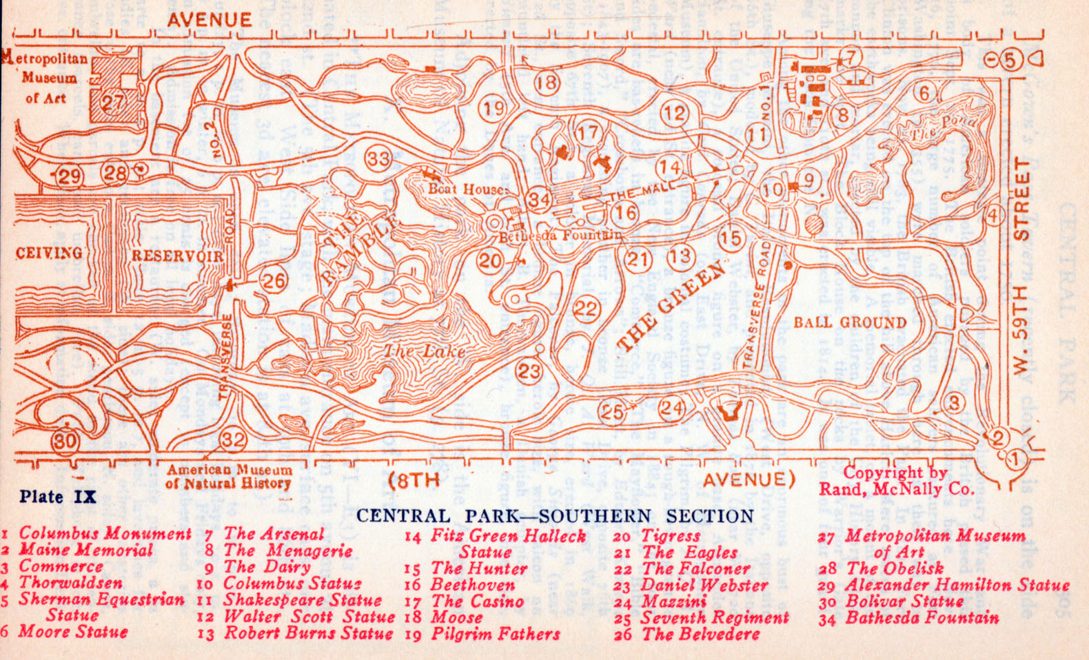
- New York (Southern Central Park) 1916 "Central Park - Southern Section" from Rider's New York City, Henry Holt and Company, 1916 (886K)
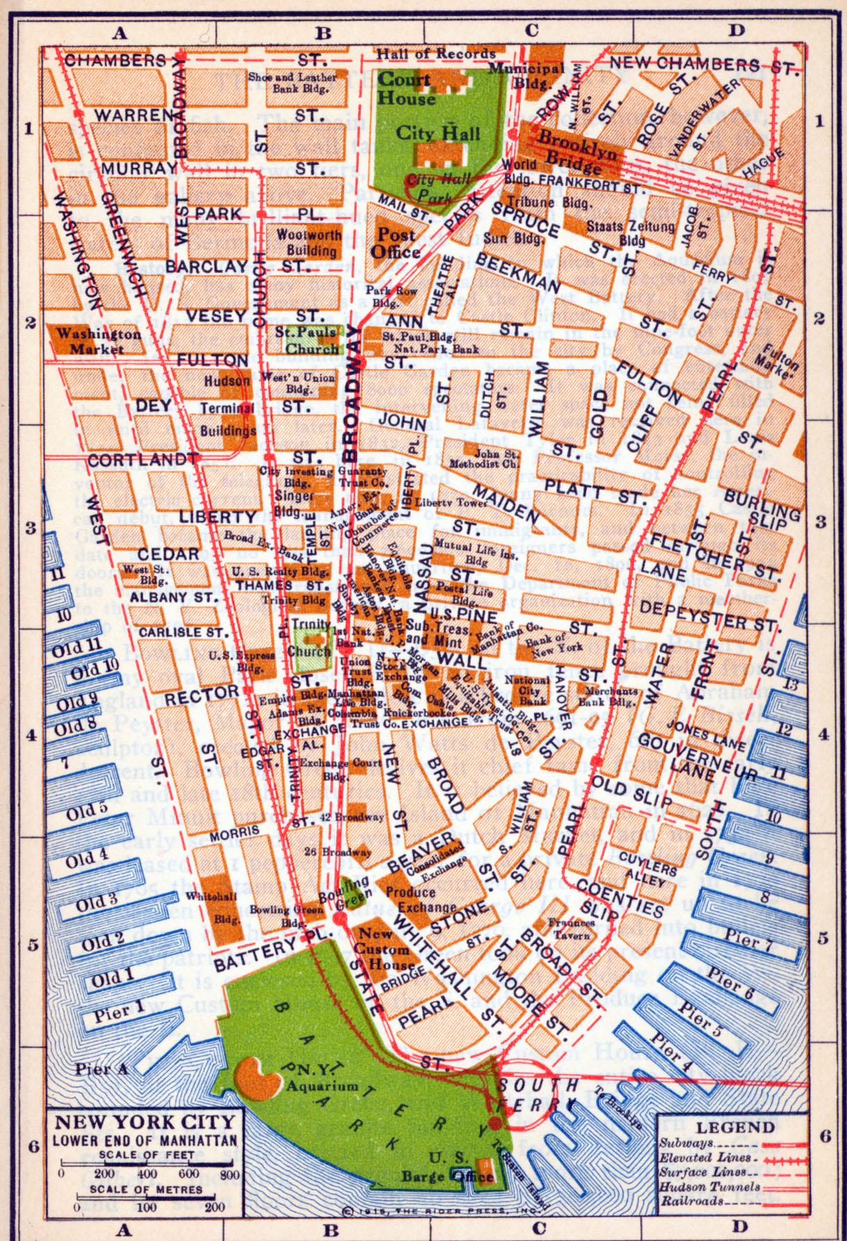
- New York City (Lower End Manhattan) 1916 "Lower End Manhattan" from Rider's New York City, Henry Holt and Company, 1916 (375K)
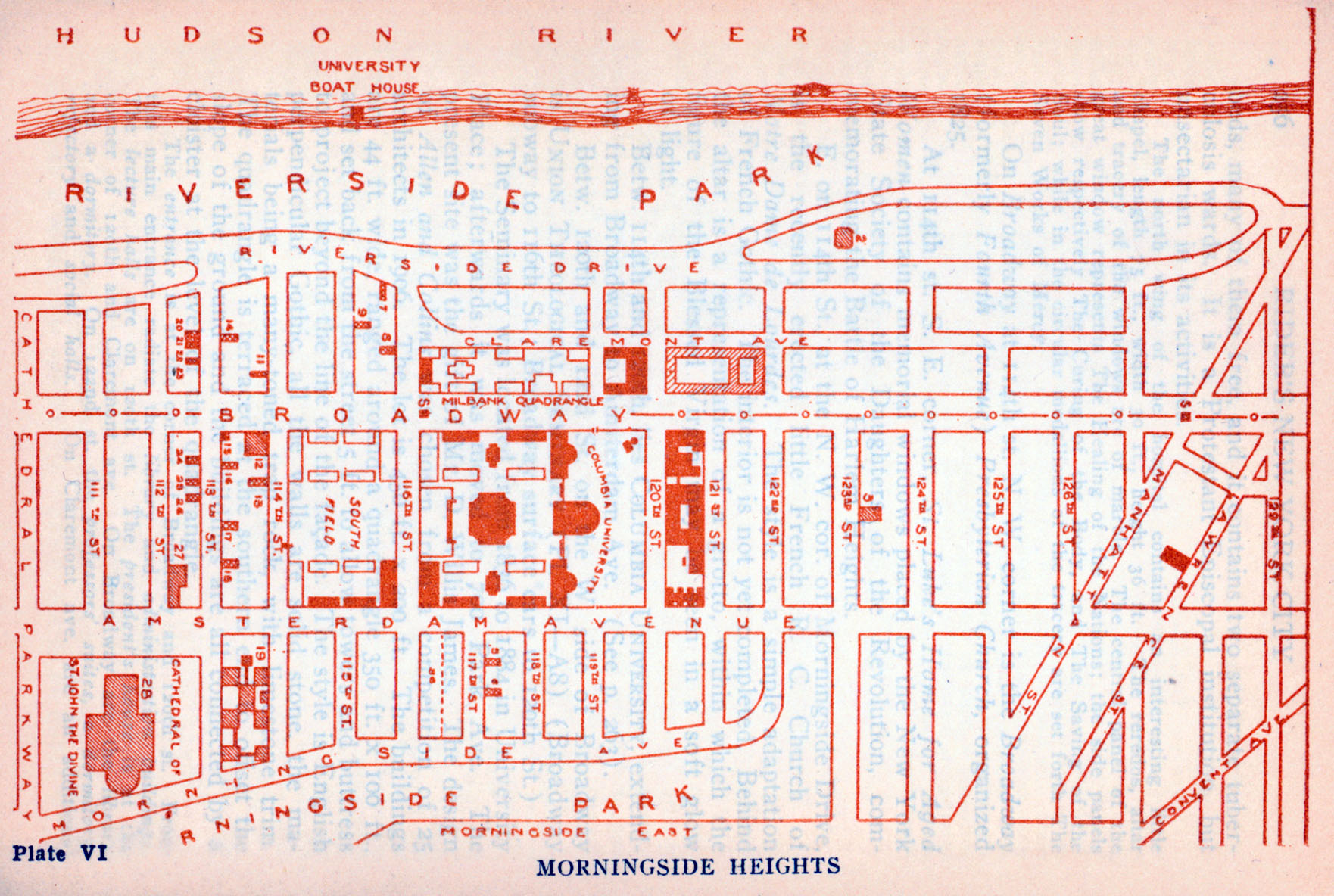
- New York City (Morningside Heights) 1916 "Morningside Heights" from Rider's New York City, Henry Holt and Company, 1916 (215K)
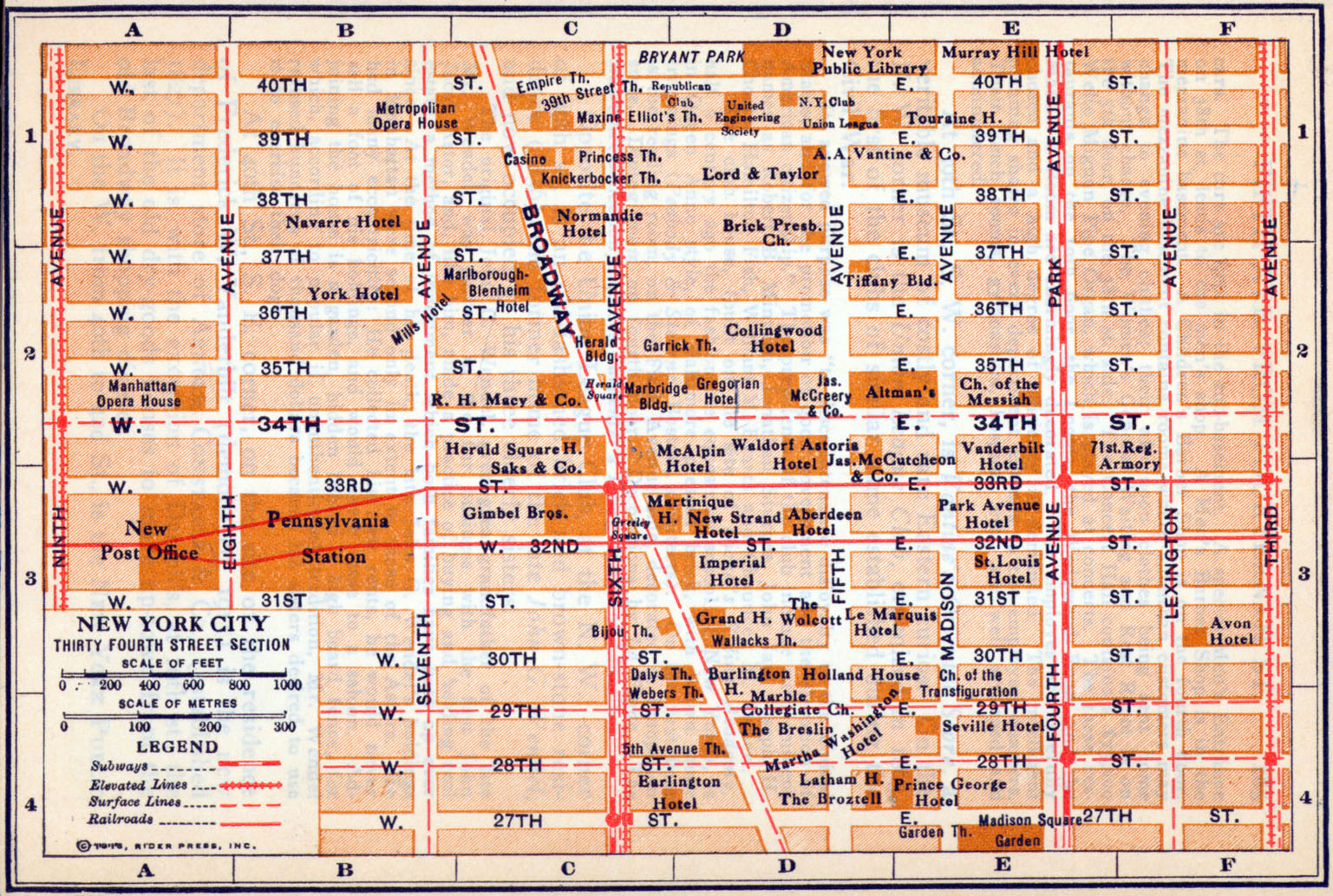
- New York City (Thirty Fourth Street Section) 1916 "Thirty Fourth Street Section" from Rider's New York City, Henry Holt and Company, 1916 (339K)
- New York City 1917 The New Encyclopedic Atlas and Gazetteer of the World. New York: P.F. Collier & Son, 1917 (893K)
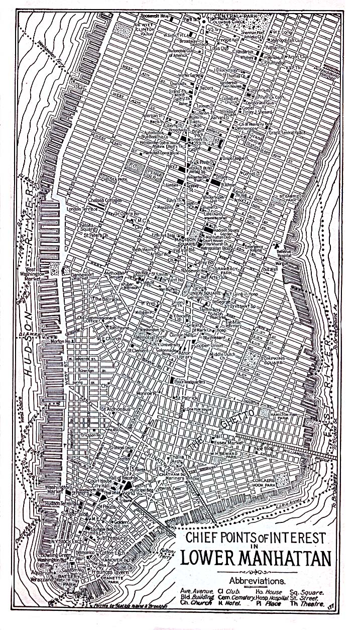
- New York City (Lower Manhattan) 1920 "Chief Points of Interest in Lower Manhattan" from Automobile Blue Book 1920 (488K)
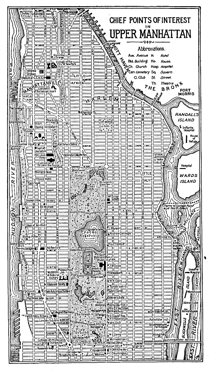
- New York City (Upper Manhattan) 1920 "Chief Points of Interest in Upper Manhattan" from Automobile Blue Book 1920 (429K)
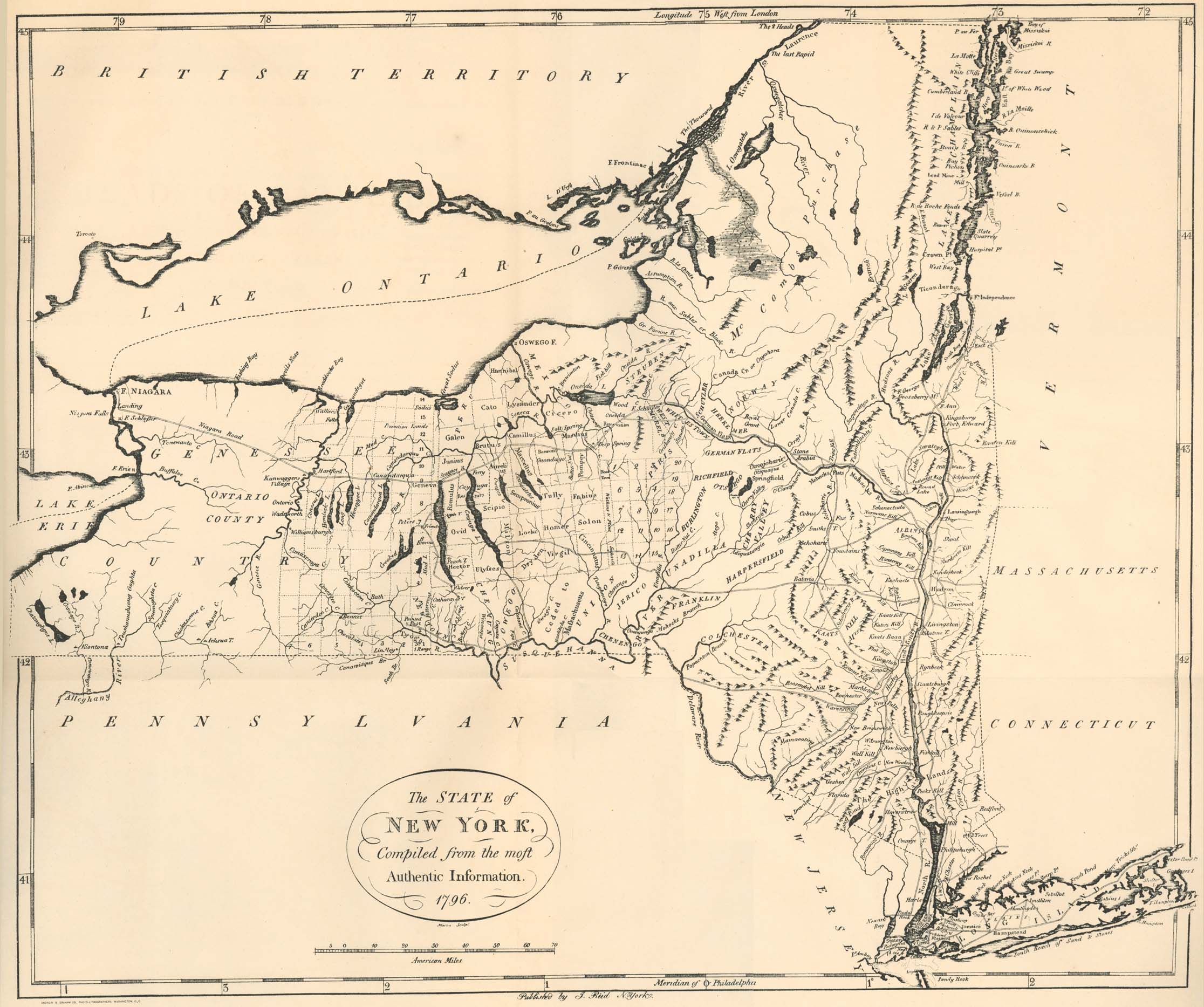
- New York State 1796 From "Heads of Families at the First Census of the United States Taken in the Year 1790: New York." Bureau of the Census, 1908 (502K)
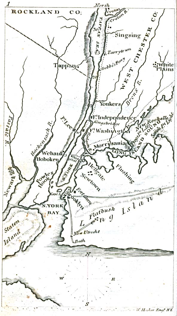
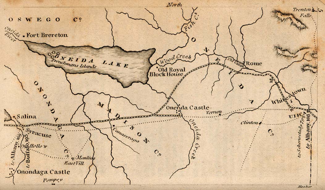
- [The Niagara Frontier] 1830 (156K) From The Northern Traveller, and Northern Tour; with the Routes to The Springs, Niagara, and Quebec, and the Coal Mines of Pennsylvania; also, the Tour of New-England. New York, 1830.
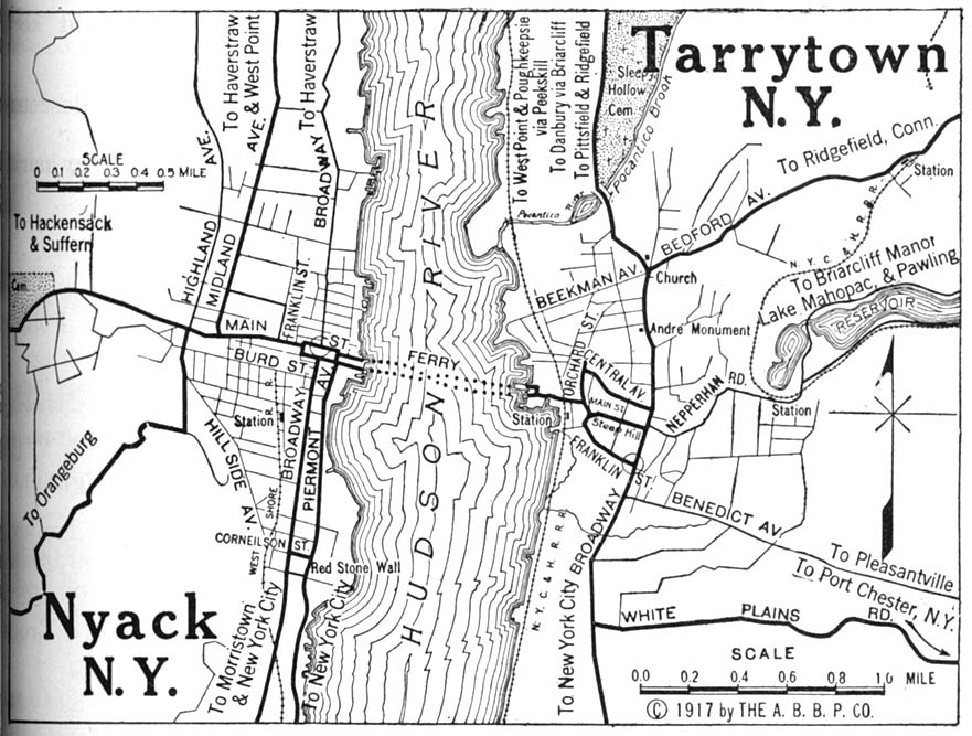
- Nyack and Tarrytown Automobile Blue Book 1917, Vol. 3 (175K)
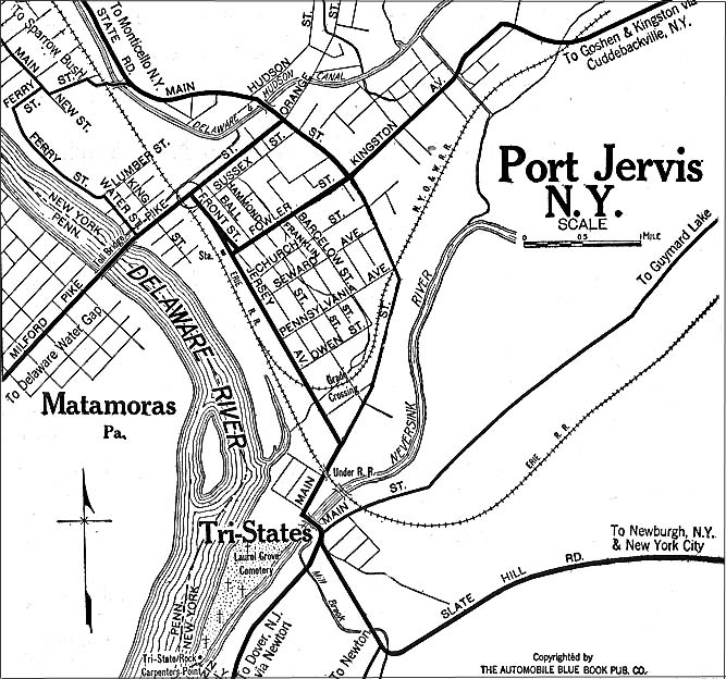
- Port Jervis 1920 Automobile Blue Book (176K)
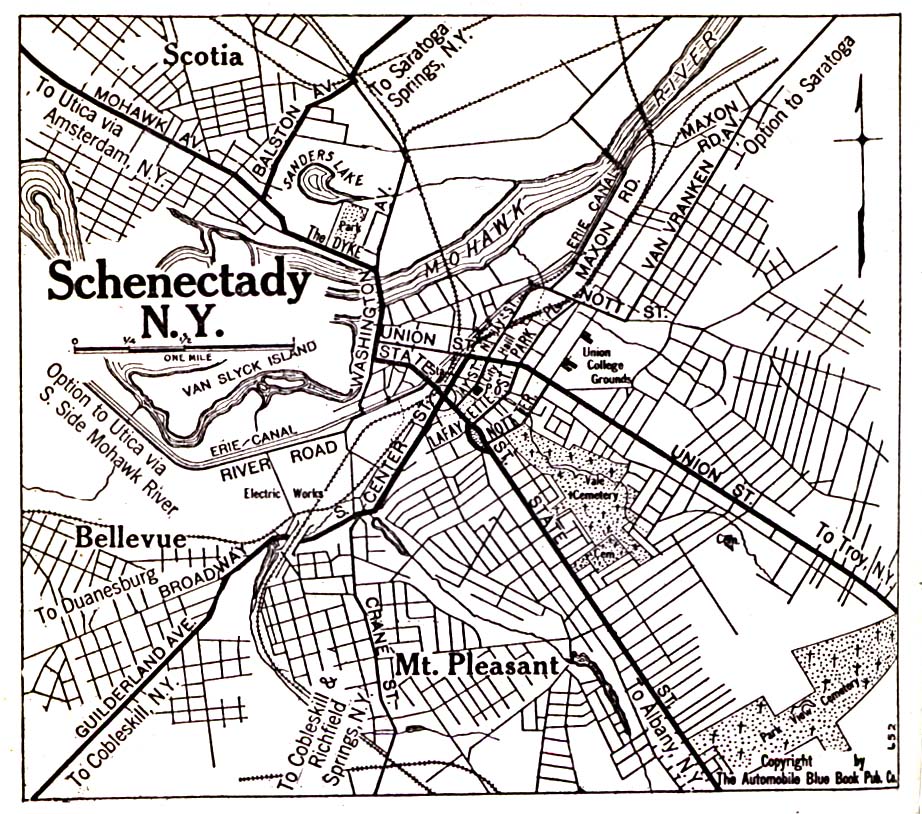
- Schenectady 1920 Automobile Blue Book (323K)
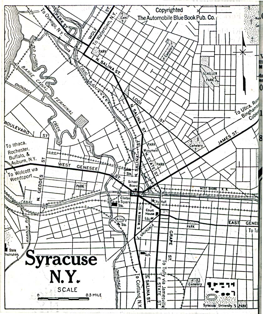
- Syracuse 1920 Automobile Blue Book (323K)
- Utica 1830 (166K) From The Northern Traveller, and Northern Tour; with the Routes to The Springs, Niagara, and Quebec, and the Coal Mines of Pennsylvania; also, the Tour of New-England. New York, 1830.
![[The Niagara Frontier] 1830](historical/niagara_frontier_1830.jpg)
Historical Maps
- New York Historical Topographic Maps (U.S. Geological Survey)
- Pre-1945 maps, scales 1:62,500, 1:31,680 and 1:125,000
- New York 1796 (5.4MB)
- "The State of New York" from Heads of Families First Census of the United States - State of New York, 1908.
- Pre-1945 maps, scales 1:62,500, 1:31,680 and 1:125,000
Maps of National Parks, Monuments, and Historic Sites
The following maps were produced by the U.S. National Park Service unless otherwise noted.
- Fire Island National Seashore (Area Map) 1995 (65K) (PDF Format)
- Fire Island National Seashore (Park Map) 1995 (722K)
- Fort Stanwix National Monument (Area Map) 1995 (917K)
- Fort Stanwix National Monument (Schematic) 1995 (1.7MB)
- Fort Stanwix National Monument - The Oneida Carry 1755 (Detail Map) 1995 (468K)
- Franklin D. Roosevelt National Historic Site (Park Map) 1997 (65K) (PDF Format)
- Gateway National Recreation Area [New York / New Jersey] (Area Map) 1994 (111K)
- Gateway National Recreation Area [New York / New Jersey] (Park Map) 1998 (387K) (PDF Format)
- Gateway National Recreation Area - Jamaica Bay and Breezy Point [New York / New Jersey] (Detail Map) 1994 (801K)
- Gateway National Recreation Area - Sandy Hook [New York / New Jersey] (Detail Map) 1994 (745K)
- Gateway National Recreation Area - Staten Island [New York / New Jersey] (Detail Map) 1994 (631K)
- Sagamore Hill National Historic Site (Park Map) 1997 (65K) (PDF Format)
- Upper Delaware Scenic & Recreation River [Pennsylvania / New York] (Area Map) 1998 (65K) (PDF Format)
- Upper Delaware Scenic & Recreation River [Pennsylvania / New York] (Park Map) 1998 (710K) (PDF Format)
![Gateway National Recreation Area [New York / New Jersey]](national_parks/gate_loc94.jpg)
![Gateway National Recreation Area - Jamaica Bay and Breezy Point [New York / New Jersey]](national_parks/gate94.jpg)
![Gateway National Recreation Area - Sandy Hook [New York / New Jersey]](national_parks/gate_sand94.jpg)
![Gateway National Recreation Area - Staten Island [New York / New Jersey]](national_parks/gate_stat94.jpg)
Maps on Other Web Sites