Perry-Castañeda Library
Map Collection
Maryland Maps
State Maps
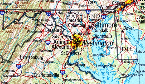
- Maryland (base map) JPEG format (247K) County boundaries and names, county seats, rivers. Original scale 1:2,500,000 U.S. Geological Survey, 1972 limited update 1990
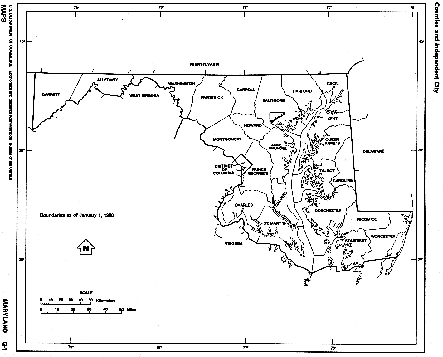
- Maryland (outline map) JPEG format (77K) County boundaries and names. U.S. Bureau of the Census, 1990
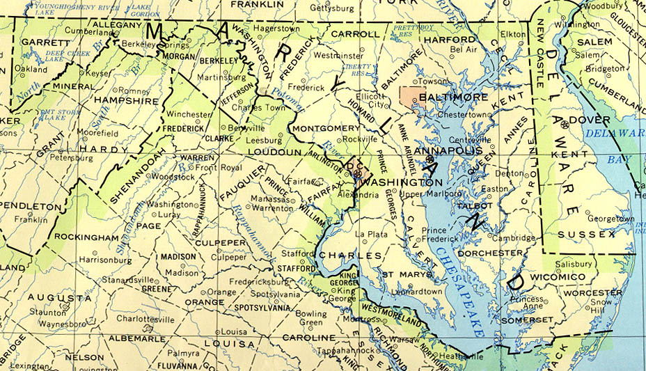
- Maryland (reference map) JPEG format (196K) Shaded relief map with state boundaries, forest cover, place names, major highways. Portion of "The National Atlas of the United States of America. General Reference", compiled by U.S. Geological Survey 2001, printed 2002
- Maryland (reference map) PDF format (144K) Shaded relief map with state boundaries, forest cover, place names, major highways. Portion of "The National Atlas of the United States of America. General Reference", compiled by U.S. Geological Survey 2001, printed 2002
- Maryland - Federal Lands and Indian Reservations PDF format (517K) The National Atlas of the United States of America, U.S. Geological Survey, 2003
City Maps
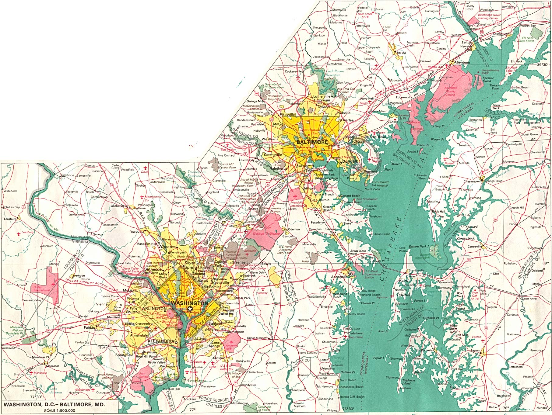
- Baltimore original scale 1:500,000 U.S.National Atlas 1970 (665K)
Detailed Maps
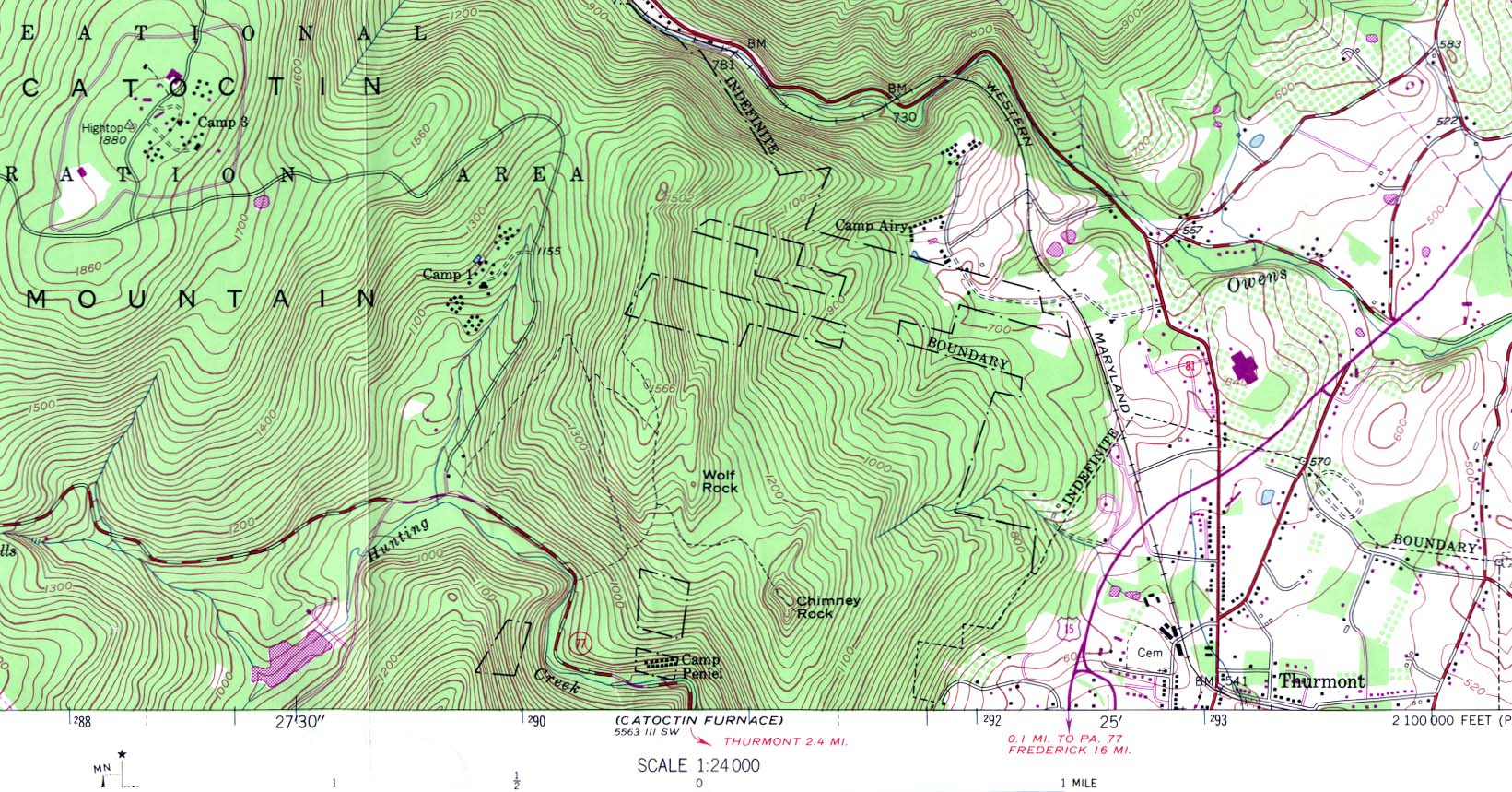
- Camp David (Camp 3) (topographic) original scale 1:24,000 Portion of U.S.G.S. Blue Ridge Summit Md. 1953, photorevised 1971 (321K)
Historical Maps
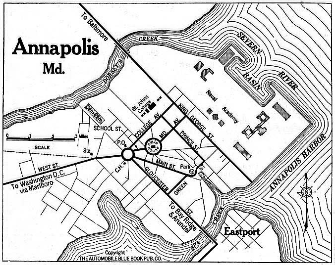
- Annapolis 1920 Automobile Blue Book (156K)
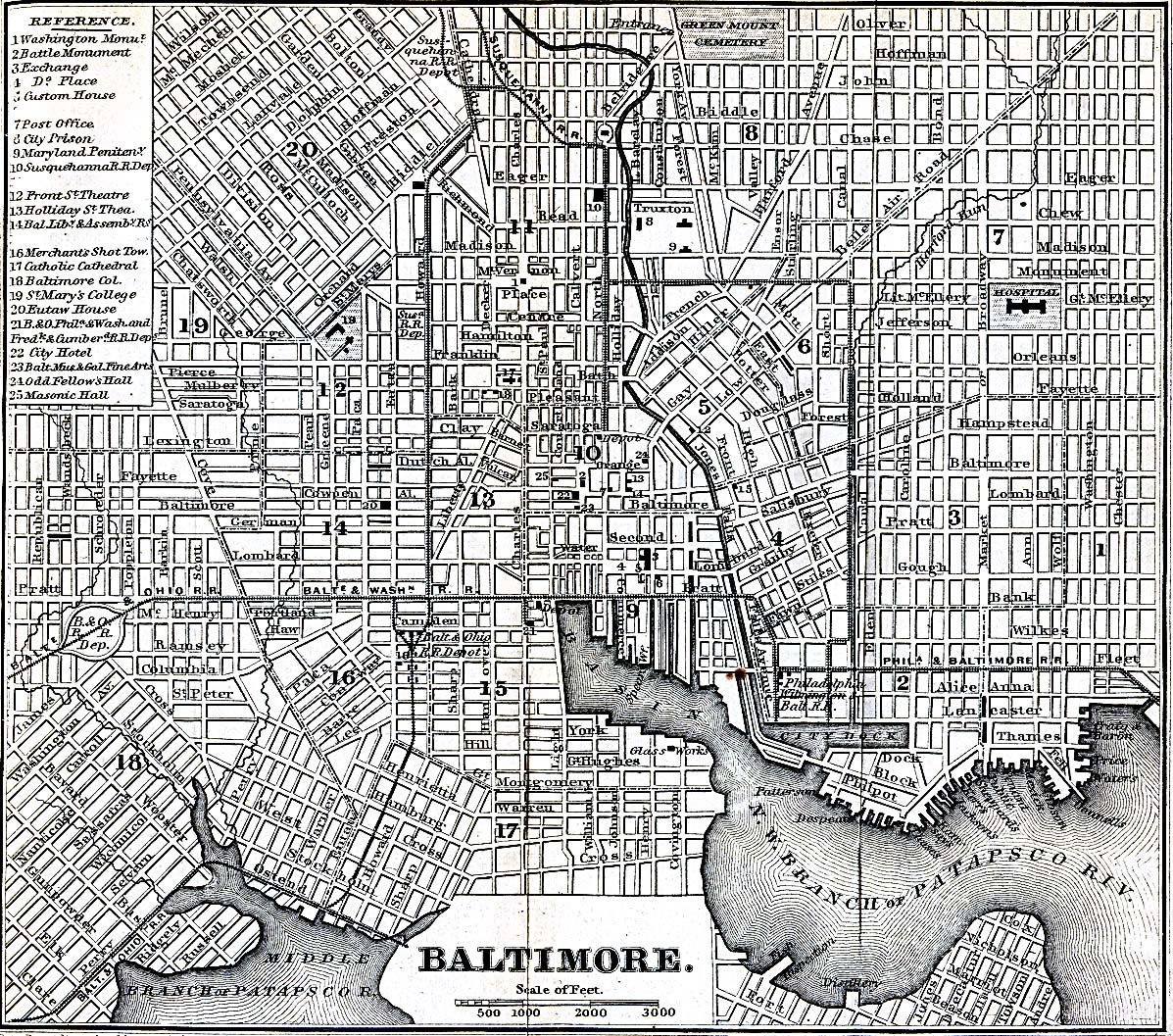
- Baltimore, Maryland 1848 Appletons' Hand-Book of American Travel. New York: D. Appleton and Company, 1869 (723K)
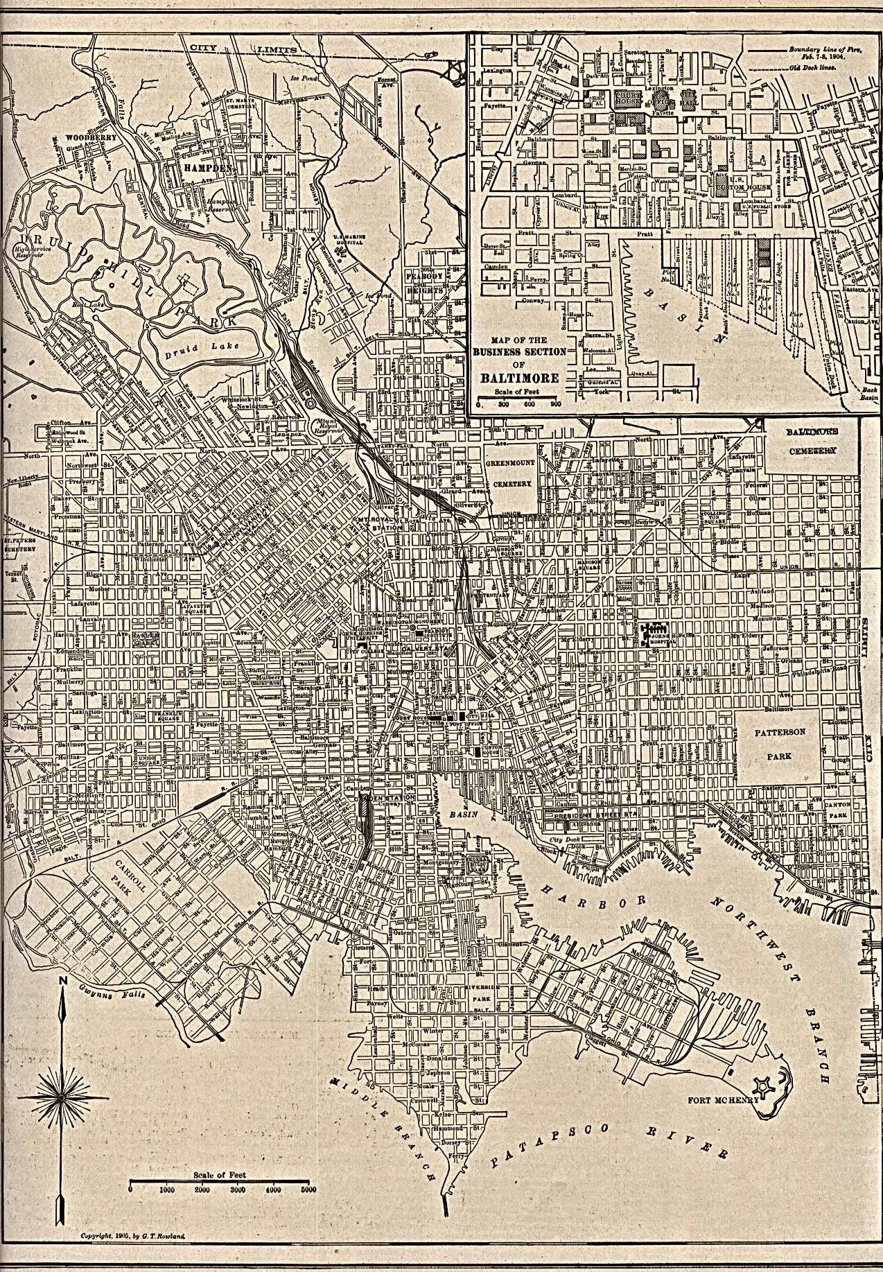
- Baltimore 1905 The New Encyclopedic Atlas and Gazetteer of the World. New York: P.F. Collier & Son. 1917 (968K)
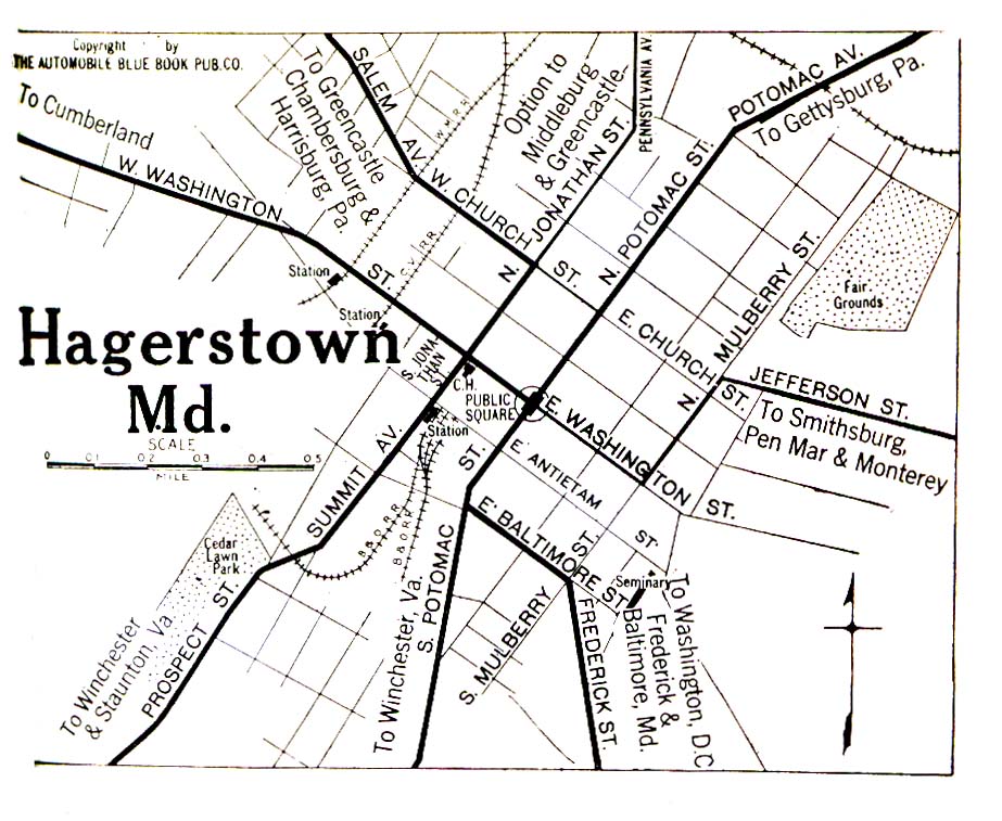
- Hagerstown 1920 Automobile Blue Book (323K)
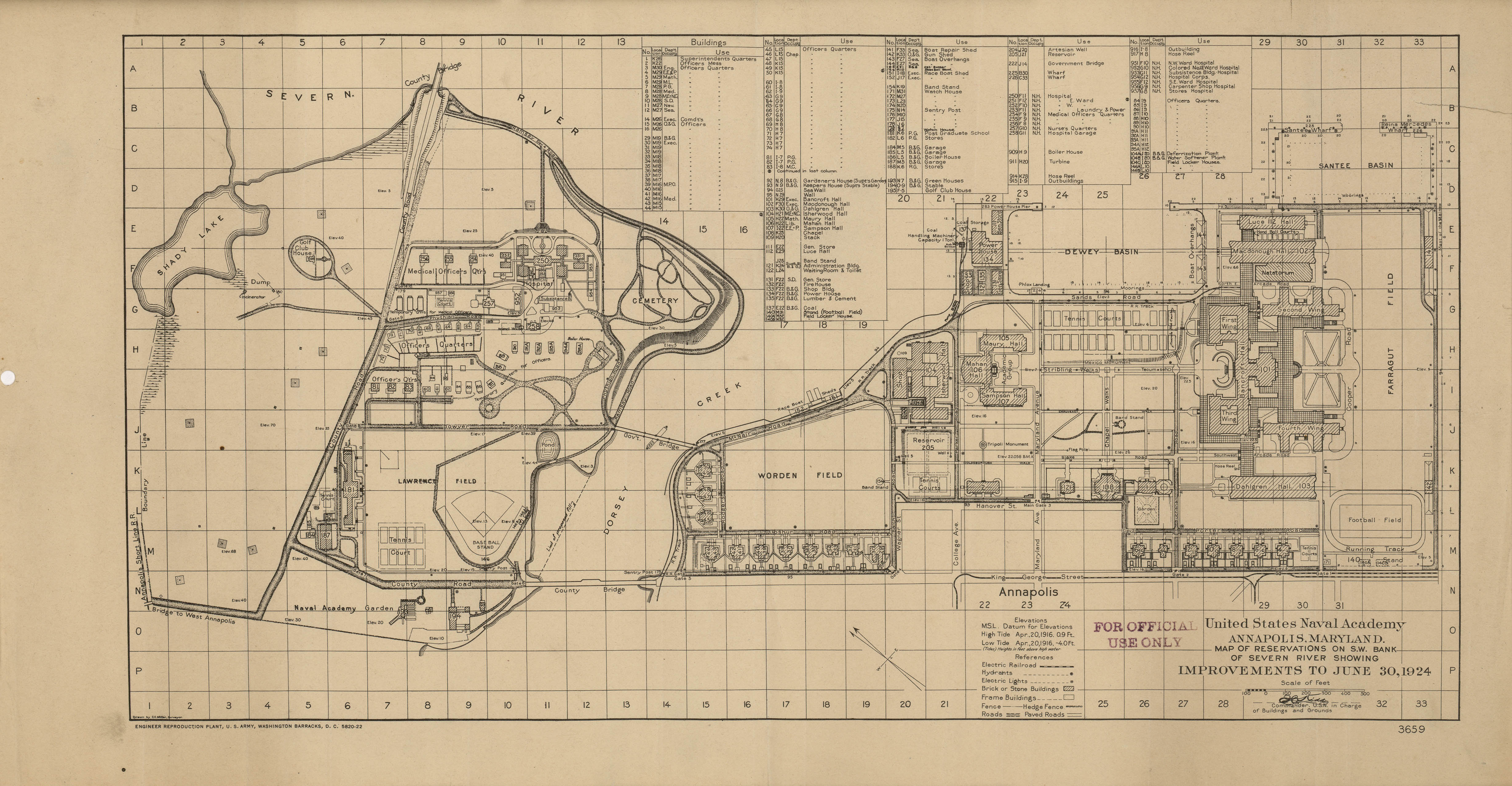
- U.S. Naval Academy 1924 (1.7 MB) "United States Naval Academy, Annapolis, Maryland, Map of Reservations on S.W. Bank of Severn River showing Improvements to June, 1924"
Historical Maps
- Maryland Topographic Maps (U.S. Geological Survey
- Pre-1945 Maps, Scale 1:62,500 <
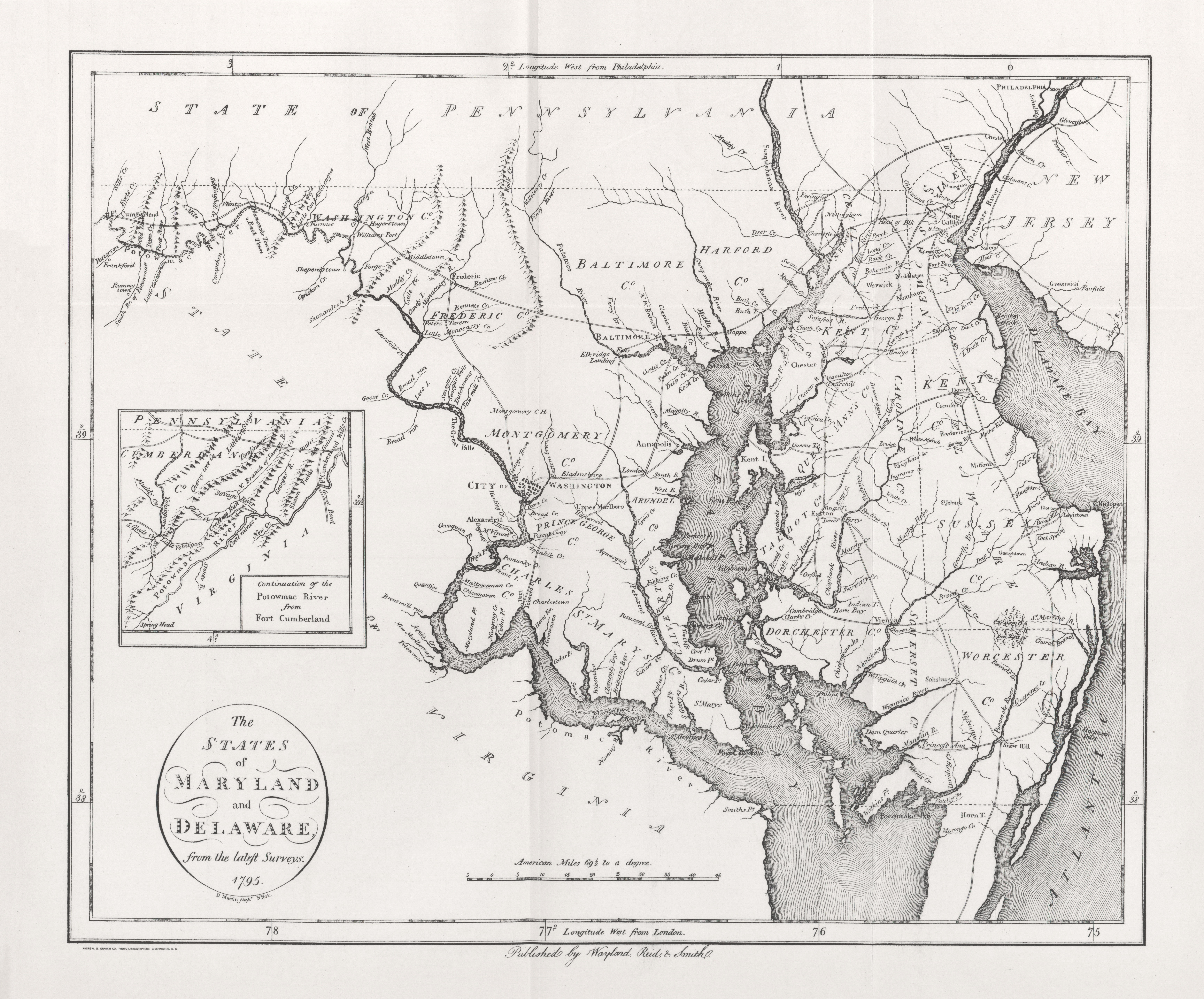
- Maryland and Delaware 1795 (5.7MB)
- "The States of Maryland and Delaware" from Heads of Families First Census of the United States - State of Maryland, 1908.
- Pre-1945 Maps, Scale 1:62,500 <
Maps of National Parks, Monuments, and Historic Sites
The following maps were produced by the U.S. National Park Service unless otherwise noted.
- Antietam National Battlefield (Area Map) 1995 (37K)
- Antietam National Battlefield (Area Map) 1995 (65K) (PDF Format)
- Antietam National Battlefield (Battle Map) (236K)
- Antietam National Battlefield (Battle Map) 1995 (65K) (PDF Format)
- Antietam National Battlefield (Park Map) 1995 (129K) (PDF Format)
- Antietam National Battlefield (Park Map with Battle Maps) 1995 (554K)
- Assateague Island National Seashore (Park Map) 1995 (384K)
- Catoctin Mountain Park (Park Map) 1995 (588K)
- Catoctin Mountain Park (Park Map) 1997 (194K) (PDF Format)
- Chesapeake and Ohio Canal National Historic Park [Maryland / Washington, DC / West Virginia] (Area Map) 1996 (273K)
- Chesapeake and Ohio Canal National Historic Park [Maryland / Washington, DC / West Virginia] (Detail Map) 1999 (258) (PDF Format)
- Chesapeake and Ohio Canal National Historic Park [Maryland / Washington, DC / West Virginia] (Park Map) 1996 (936K)
- George Washington Memorial Parkway [Maryland / Virginia / Washington D.C.] (Park Map) 1998 (258K) (PDF Format)
- Glen Echo Park (Area Map) 1997 (65K) (PDF Format)
- Glen Echo Park (Park Map) 1997 (1.1MB) (PDF Format)
- Greenbelt Park (Park Map) 1997 (129K) (PDF Format)
- Hampton National Historic Site (Park Map) 1997 (65K) (PDF Format)
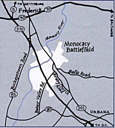
- Monocacy National Battlefield (Area Map) (43K)
- Monocacy National Battlefield (Battle Map) (345K)
![Chesapeake and Ohio Canal National Historic Park [Maryland / Washington, DC / West Virginia]](national_parks/ches_loc96.jpg)
![Chesapeake and Ohio Canal National Historic Park [Maryland / Washington, DC / West Virginia]](national_parks/ches_96.jpg)
Maps on Other Web Sites