Madagascar, Joint Operations Graphic 1:250,000 [Not for navigational use]
U.S. National Imagery and Mapping Agency
Complete list of map images in this collection:
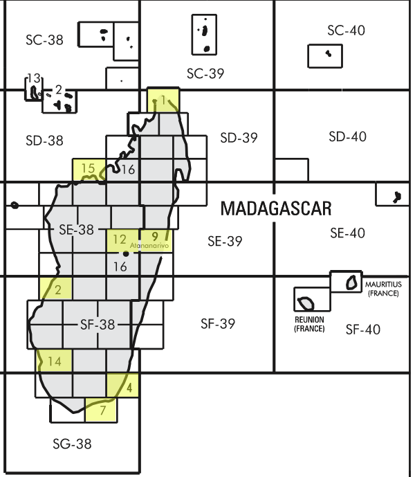
- Index Map
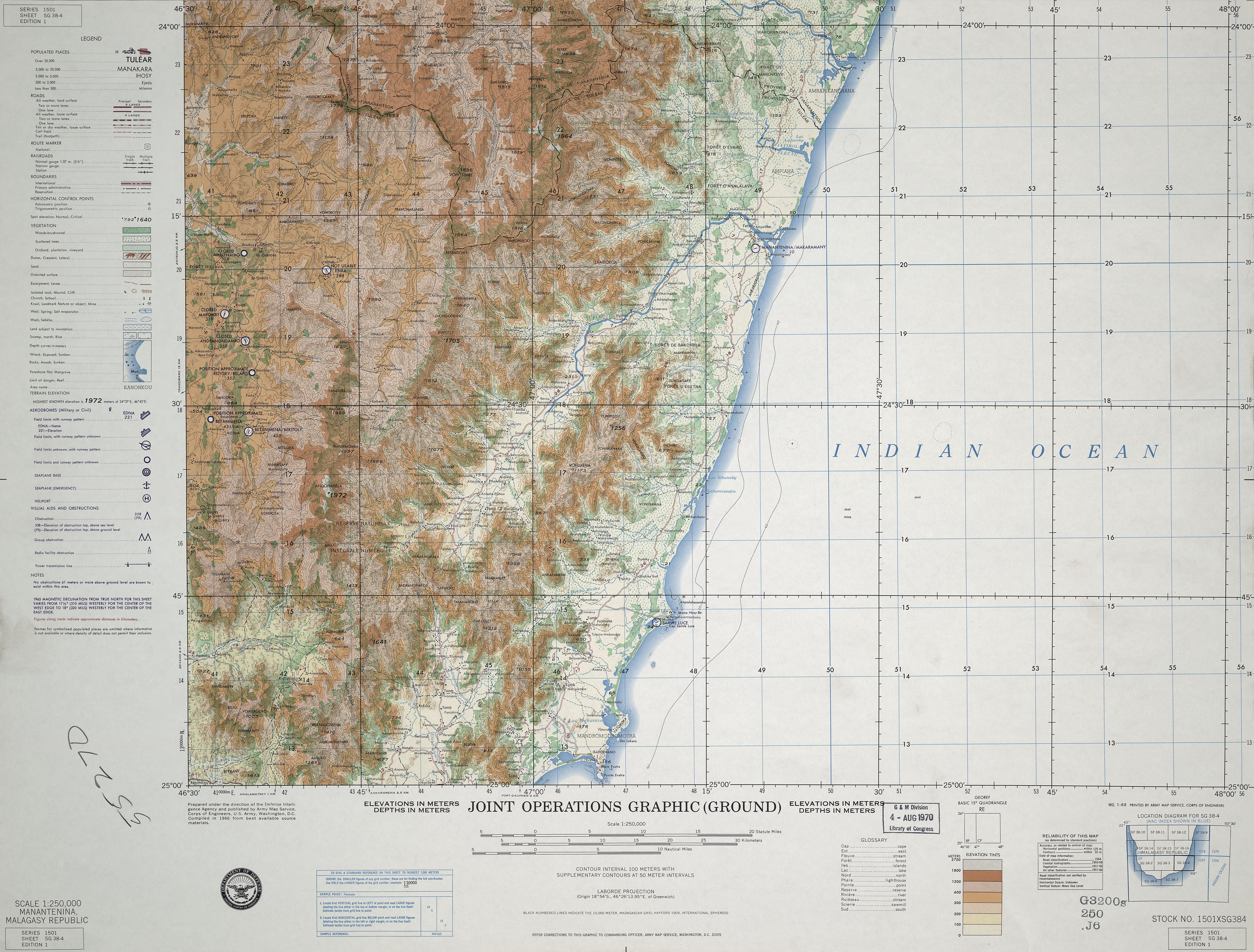
- SG 38-4 Manantenina, Malagasy Republic Army Map Service. This map is from the collection of the Library of Congress, Geography and Map Division (6.6MB) [JPEG]
- SD 38-15 Majunga, Malagasy Republic (4.0MB) [GeoPDF]
- SD 39-1 Diego Suarez, Malagasy Republic (4.9MB) [GeoPDF]
- SE 38-12 Tananarive, Malagasy Republic Army Map Service (9.9MB) [GeoPDF]
- SE 39-9 Tamatave, Malagasy Republic (8.4MB) [GeoPDF]
- SF 38-2 Morondava, Malagasy Republic (5.3MB) [GeoPDF]
- SF 38-14 Tulear, Malagasy Republic (8.0MB) [GeoPDF]
- SG 38-7 Fort Dauphin, Malagasy Republic (4.0MB) [GeoPDF]