Perry-Castañeda Library
Map Collection
Historical World Maps
-
Atlases:
- Cambridge Modern History Atlas (1912)
- Historical Atlas by William Shepherd (1911)
- Historical Atlas by William Shepherd (1923-26)
- Monarch Standard Atlas of the Commercial, Geographical, and Historical World by J. Martin Miller (1906)
- Public Schools Historical Atlas by C. Colbeck (1905) Individual Maps:
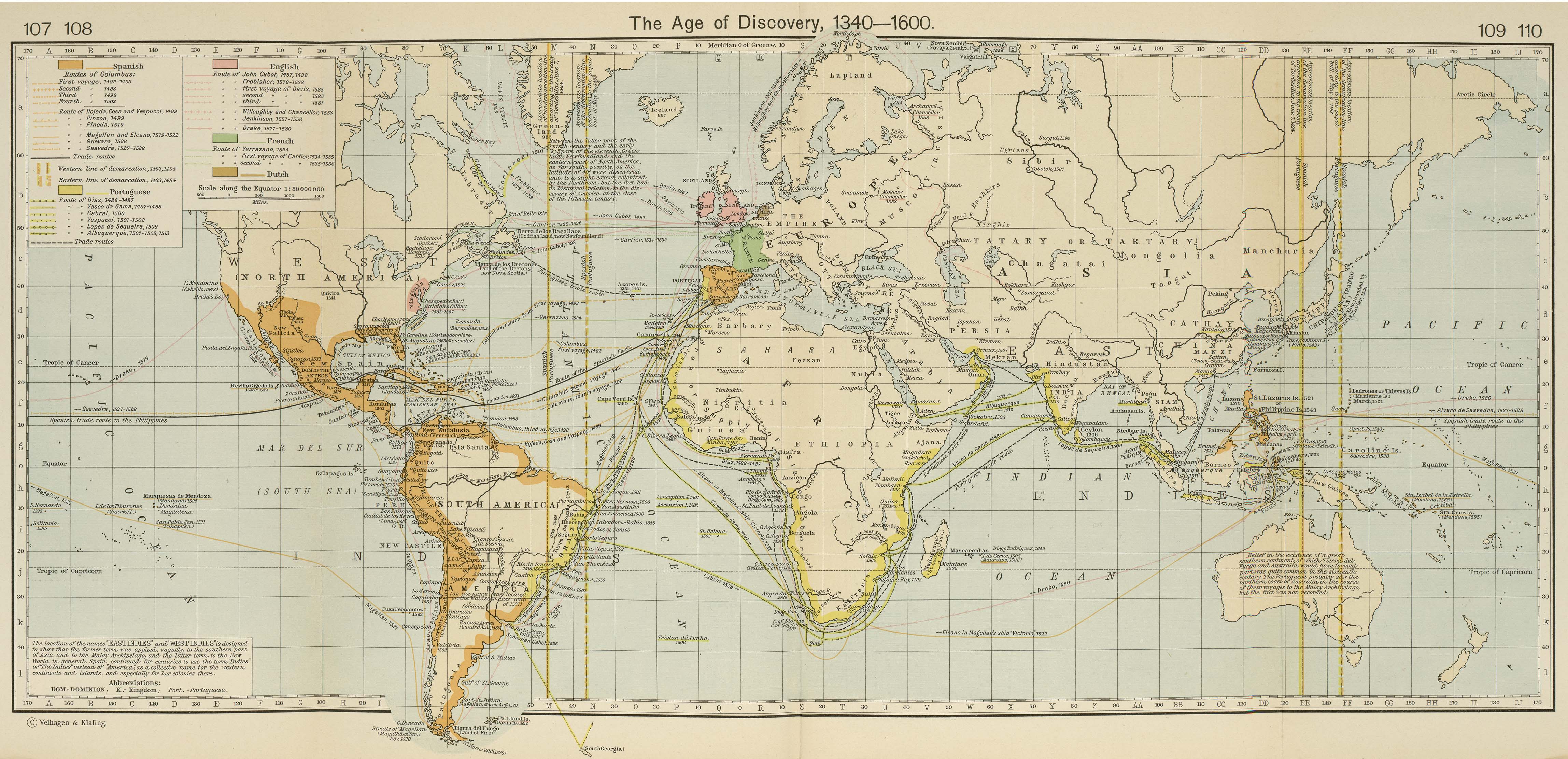
- The Age of Discovery 1340-1600 (1.4 MB)
- Historical Atlas by William Shepherd (1911)
- From Historical Atlas by William R. Shepherd, 1911.
- The World XVI Century (215K)
- From The Public Schools Historical Atlas by C. Colbeck, 1905
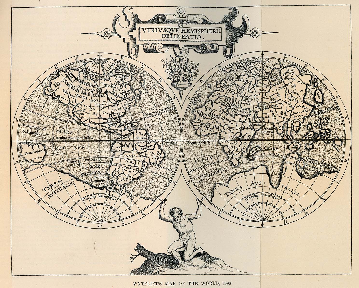
- Wytfliet's Map of the World 1598 (487K)
- From The Scottish Geographical Magazine Vol. XVI, No. 1, 1900.
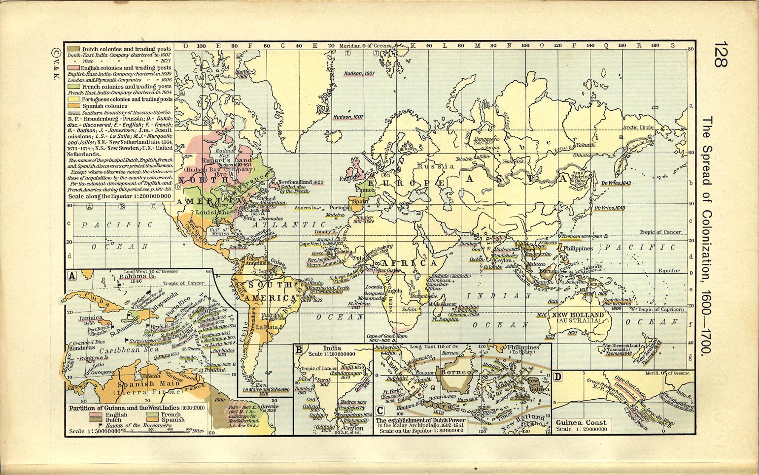
- The Spread of Colonization, 1600-1700 (516K)
- Includes these inset maps: Partition of Guiana and the West Indies 1600-1700; India; The Establishment of Dutch Power in the Malay Archipelago, 1602-1641; and Guinea Coast. From Historical Atlas by William R. Shepherd, 1911.
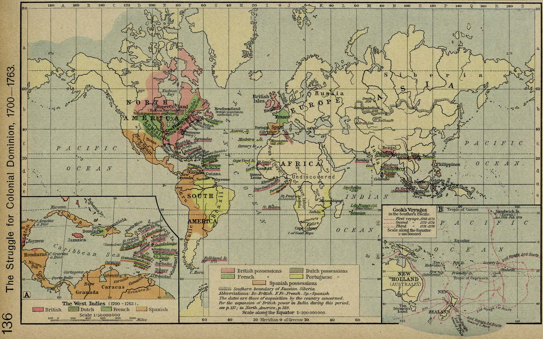
- The Struggle for Colonial Dominion, 1700-1763 (431K)
- Insets: The West Indies, 1700-1763. Cook's Voyages in the Southern Pacific. From Historical Atlas by William R. Shepherd, 1923.
- The World 1772 (290K)
- From The Public Schools Historical Atlas by C. Colbeck, 1905
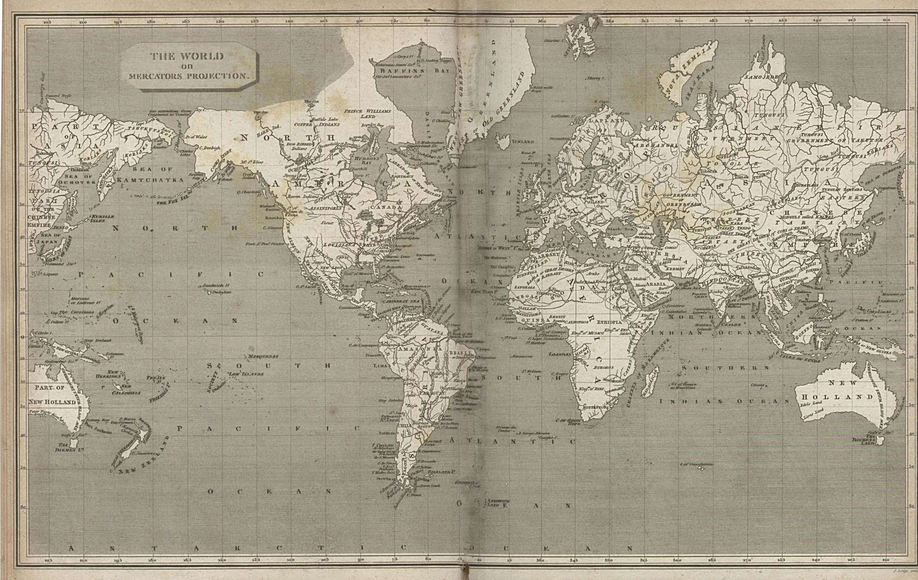
- The World on Mercators Projection 1820 (991K)
- From The Cyclopaedia or, Universal Dictionary of Arts, Sciences, and Literature by Abraham Rees, 1820.
- Maps from the Journal of the Royal Geographical Society 1831-1880
- Maps that accompanied articles in the Journal of the Royal Geographical Society
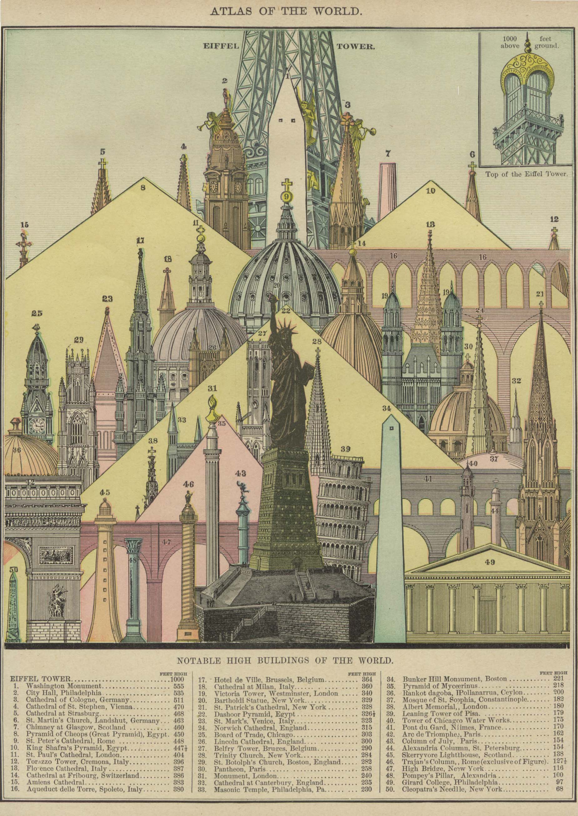
- The Notable High Buildings of the World 1896 (710K)
- From Rand, McNally & Co.'s Universal Atlas of The World. Edition 1896.
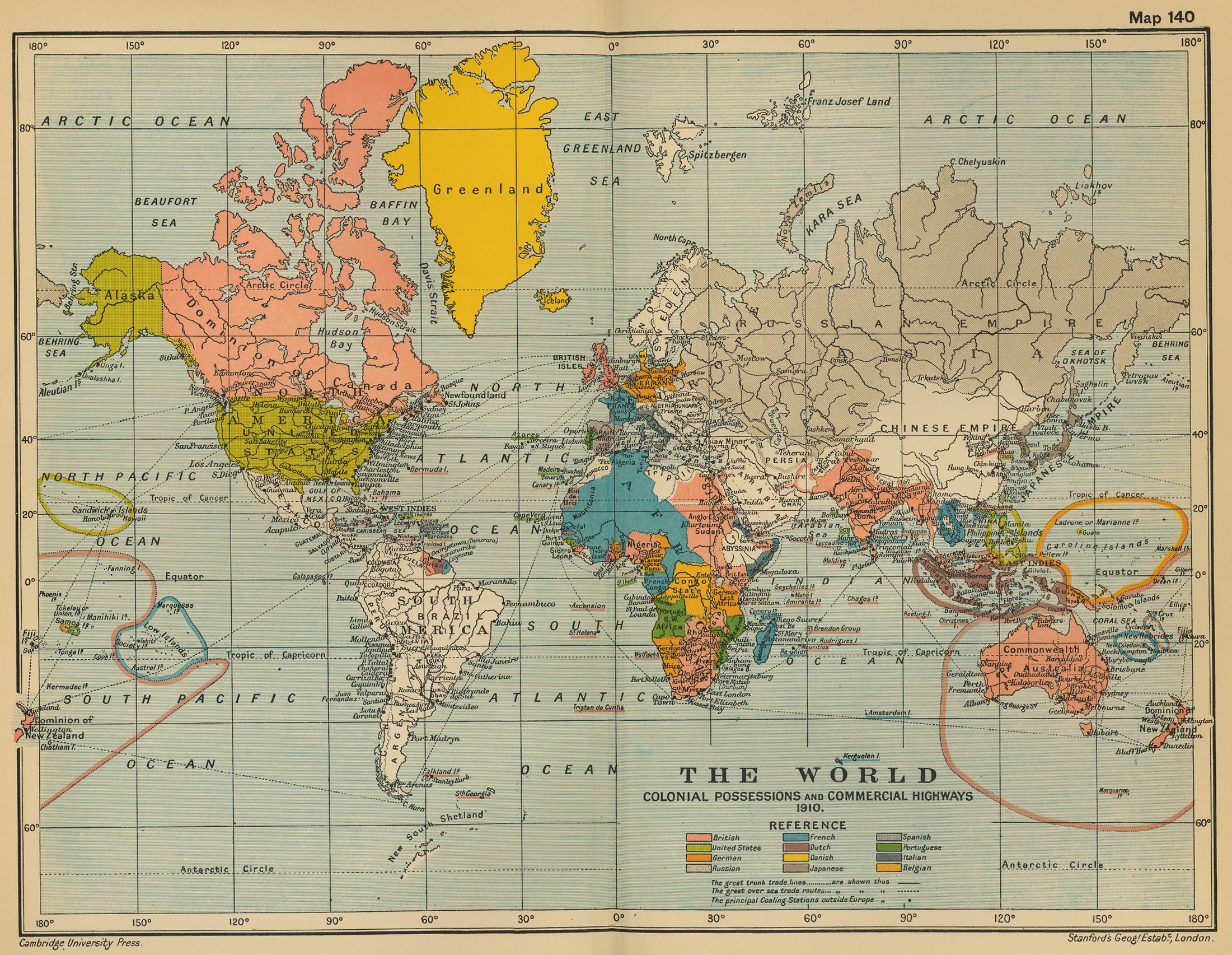
- The World: Colonial Possessions and Commercial Highways 1910 (971K)
- From Cambridge Modern History Atlas, 1912
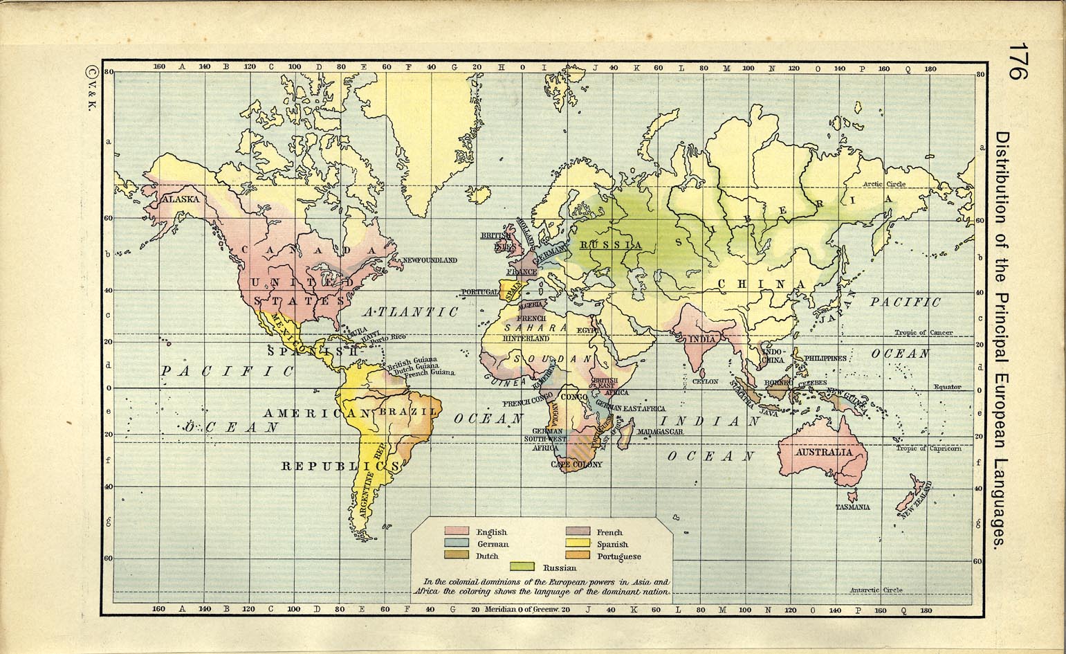
- The Distribution of the Principal European Languages 1911 (332K)
- From Historical Atlas by William R. Shepherd, 1911.
- Present Distribution of Europeans, Chinese, Japanese and Negroes 1911 (366K)
- From Historical Atlas by William R. Shepherd, 1911.
- The World 1914 (12.5MB)
- [Saikin Sekai Zu / Latest World Map], published by Shou Hisou, 1914 (3rd year, Taisho Era). Map of the progress of the war with detailed map of Tsingtao. Our thanks go to Juan Ysidro Tineo Alvarado for providing this map scan and translation.
- Density of Population 1918 (388K)
- From The British Dominions Year Book, 1918
- NATO: The North Atlantic Treaty Organization 1970 (139K)
- From Nuclear Weapons and NATO: Analytical Survey of Literature by United States Department of the Army, 1970.
- World War II Maps
- NATO: The North Atlantic Treaty Organization 1970 (139K)
- From Nuclear Weapons and NATO: Analytical Survey of Literature by United States Department of the Army, 1970.
- Philips' Chamber of Commerce Atlas 1914
- Maps from Philips' Chamber of Commerce Atlas: A Graphic Survey of the World's Trade with a Commercial Compendium and Gazetteer Index by George Philip & Son, London: The London Geographical Institute, Liverpool: Philip, Son & Nephew, 1914.
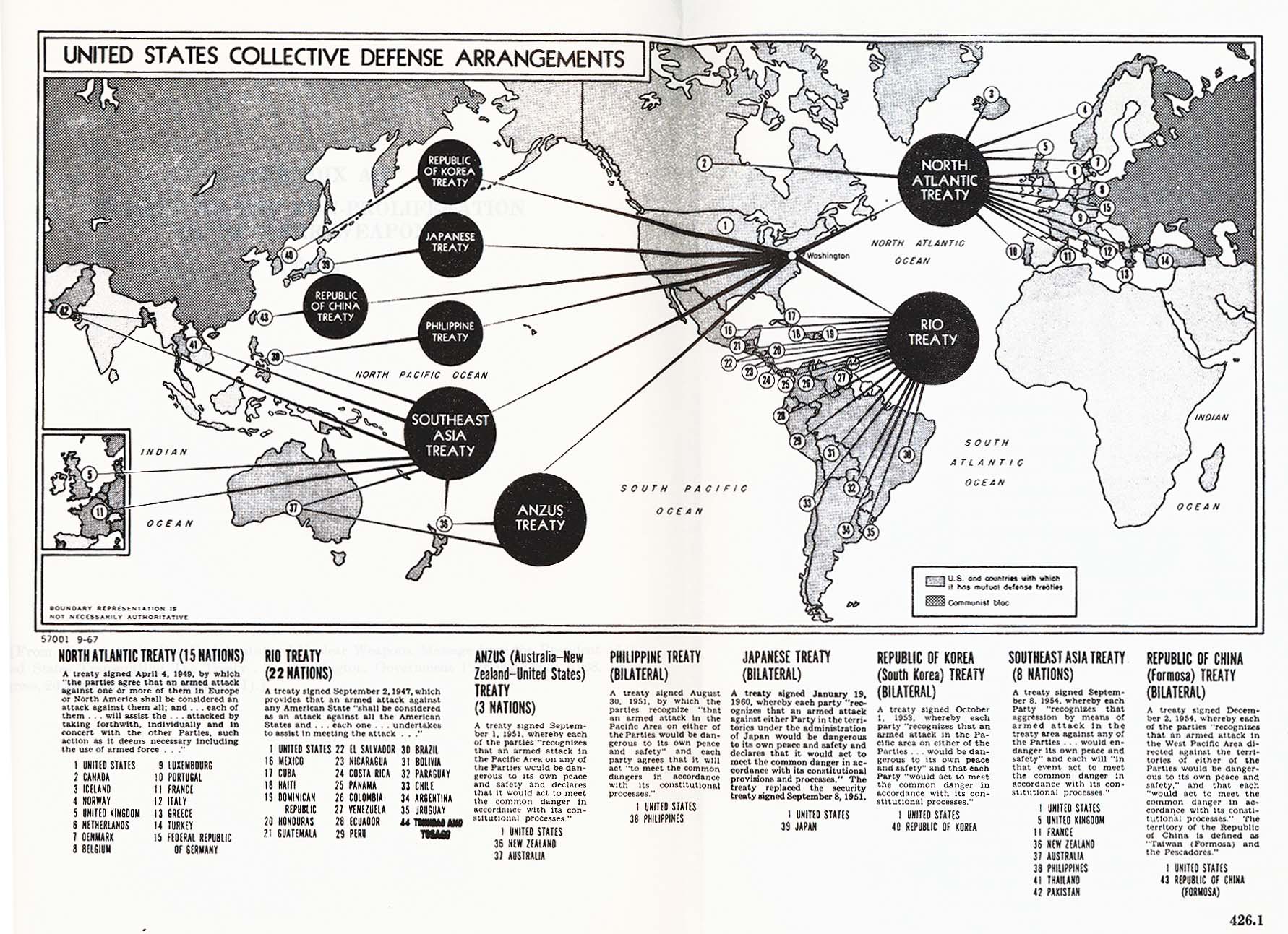
- United States Collective Defense Arrangements 1967 (420K)
- From Nuclear Weapons and NATO: Analytical Survey of Literature by United States Department of the Army, 1970.