Perry-Castañeda Library
Map Collection
The British Dominions Year Book 1918
-
Population Density and Climate
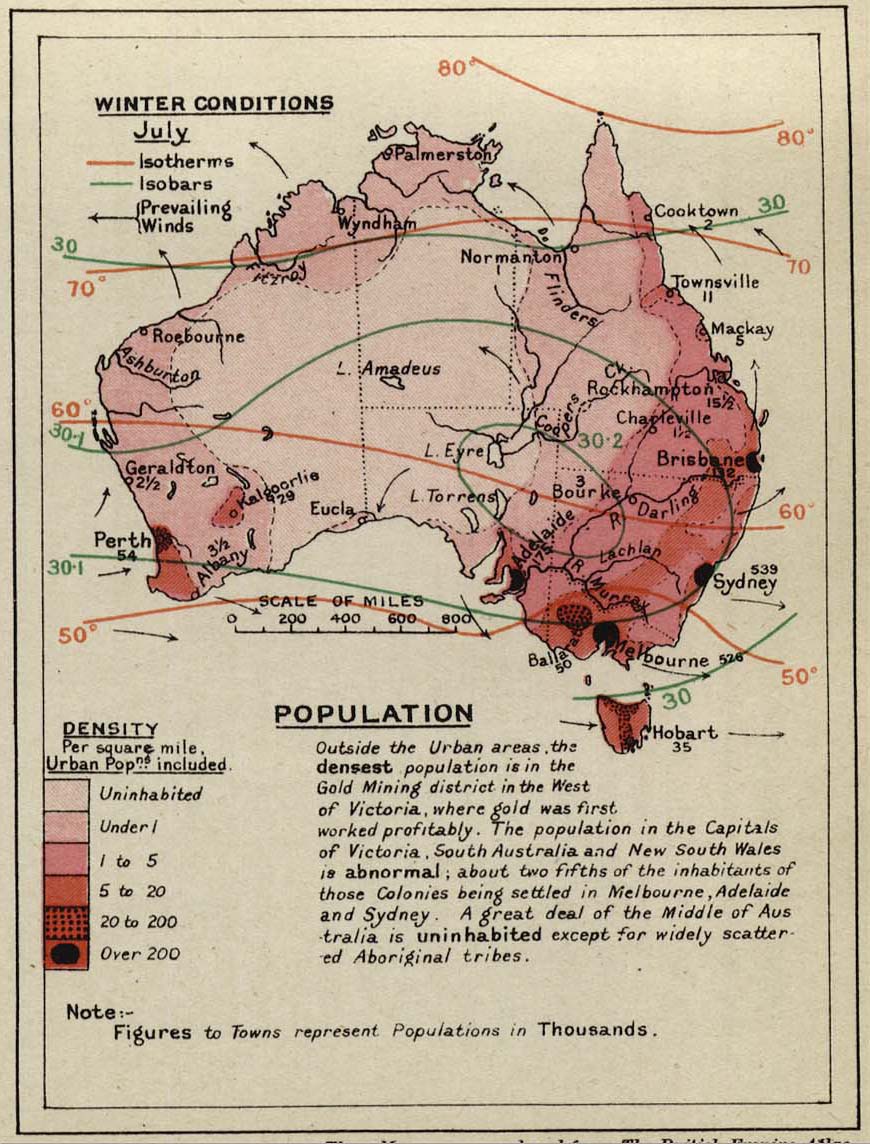
- Australia (208K) [p. 46].
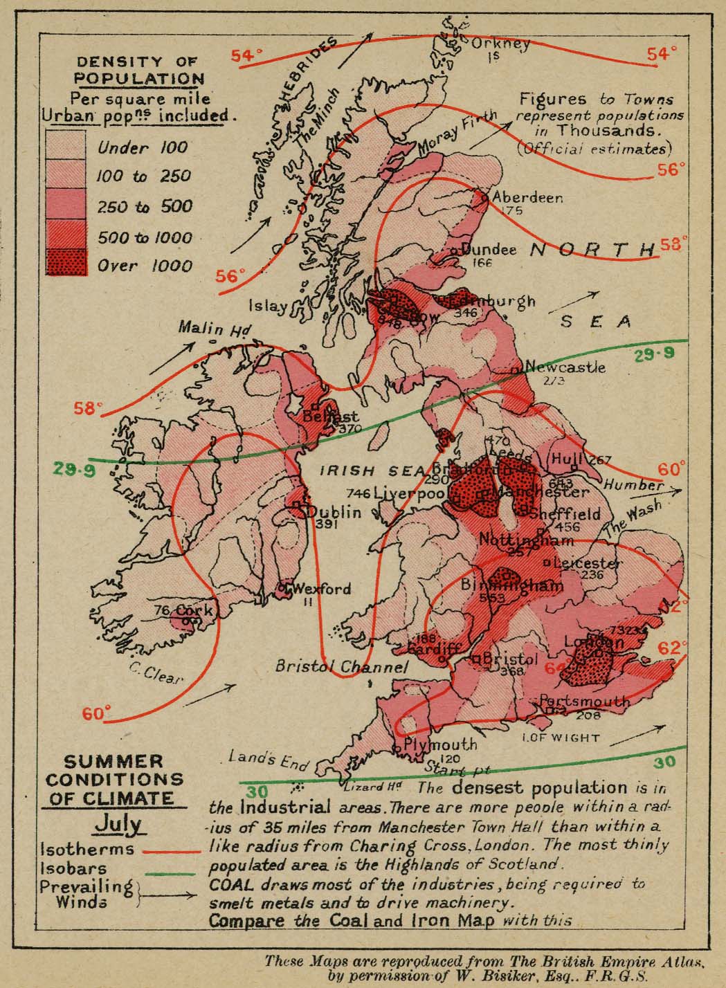
- England, Ireland, and Scotland (285K) [p. 44].
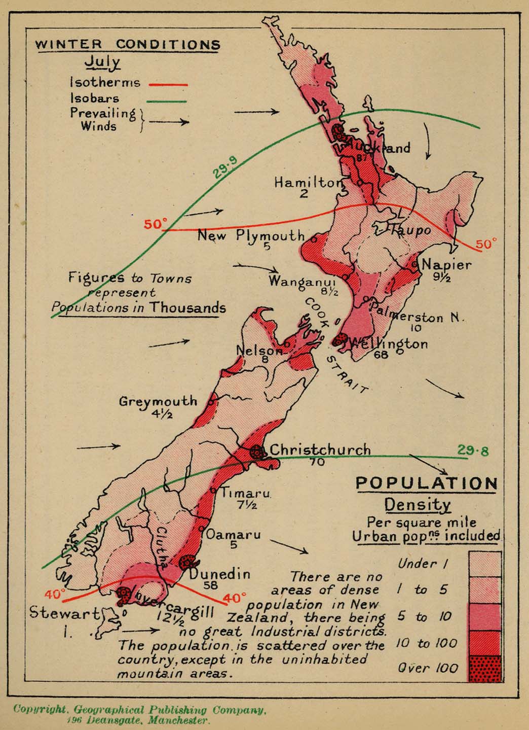
- New Zealand (212K) [p. 48].
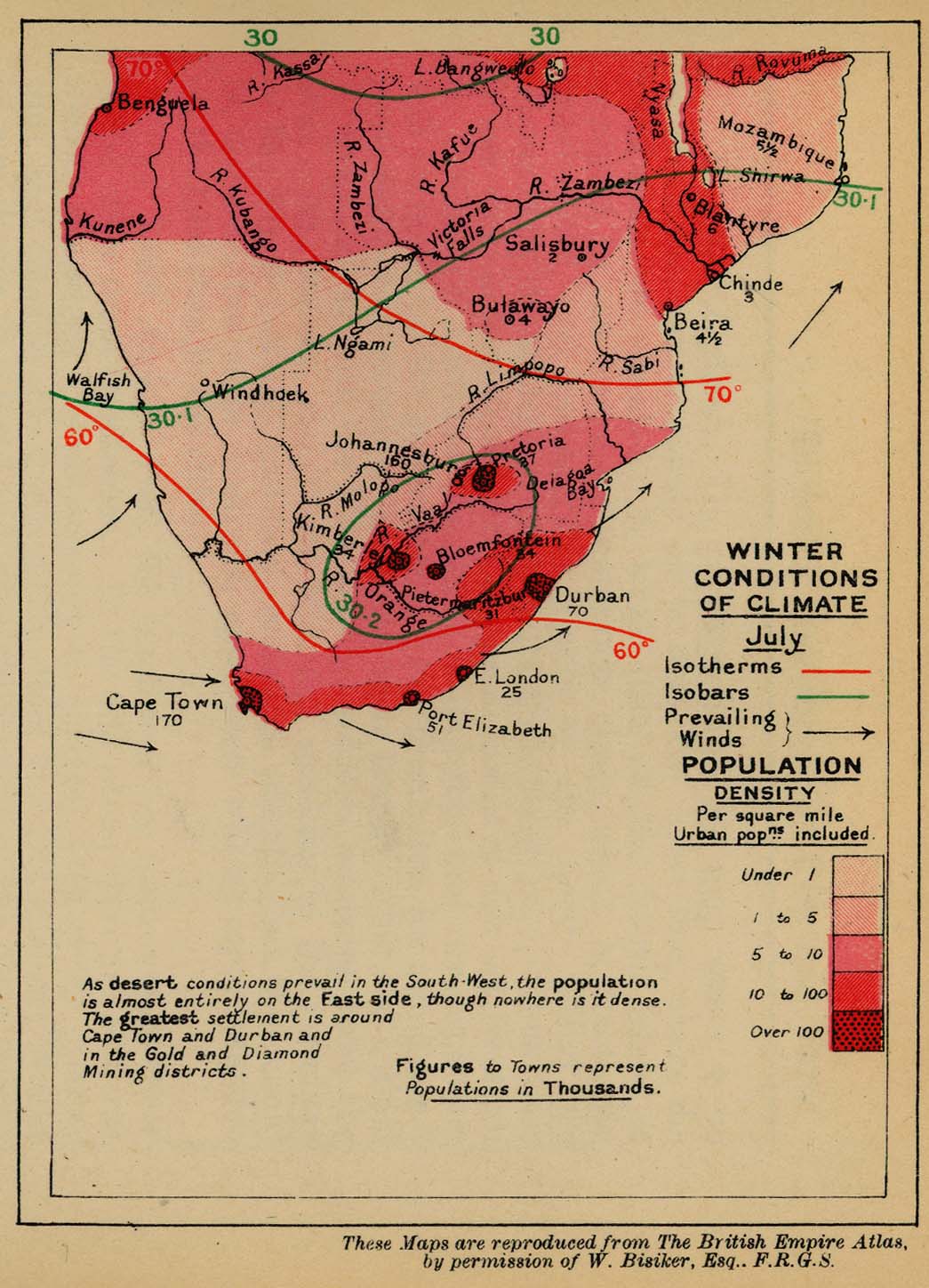
- South Africa (224K) [p. 48].
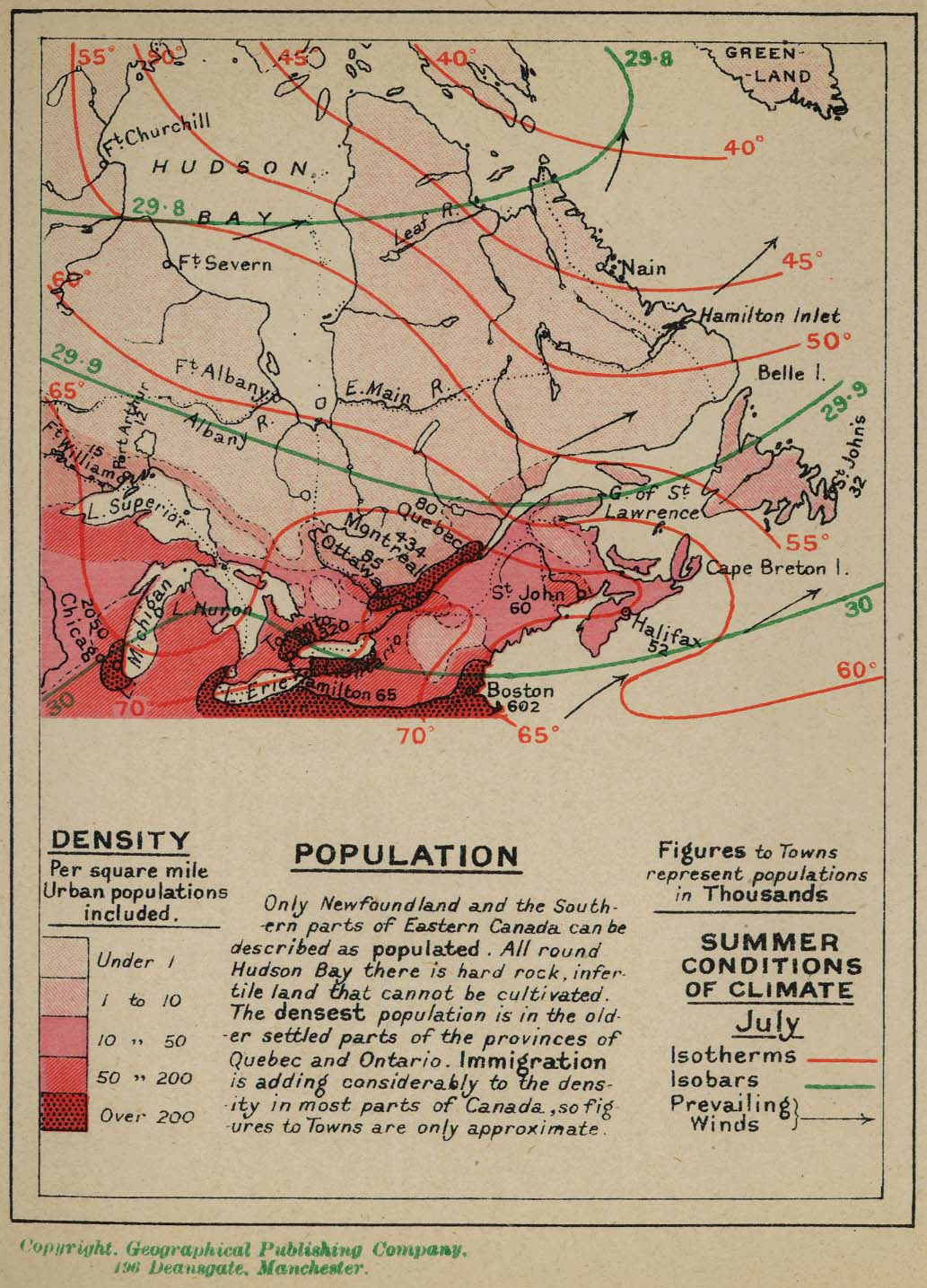
- South East Canada (252K) [p. 44].
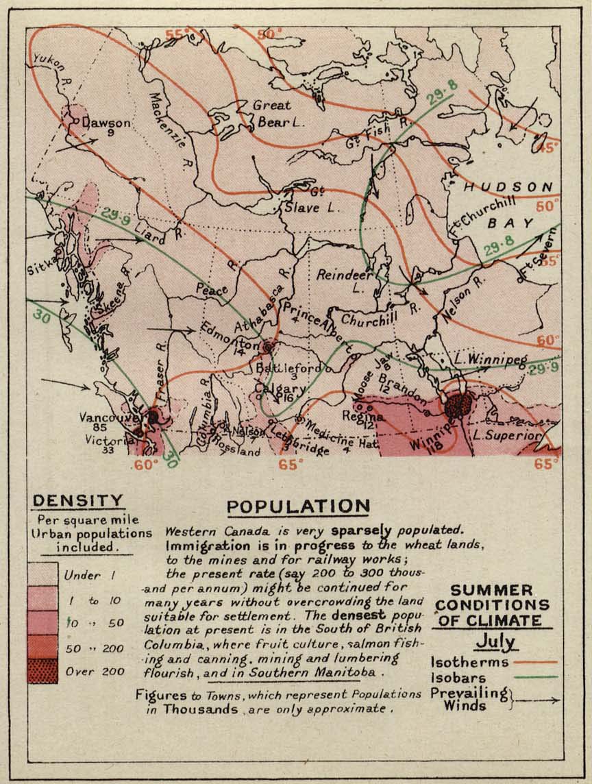
- Western Canada (228K) [p. 46]
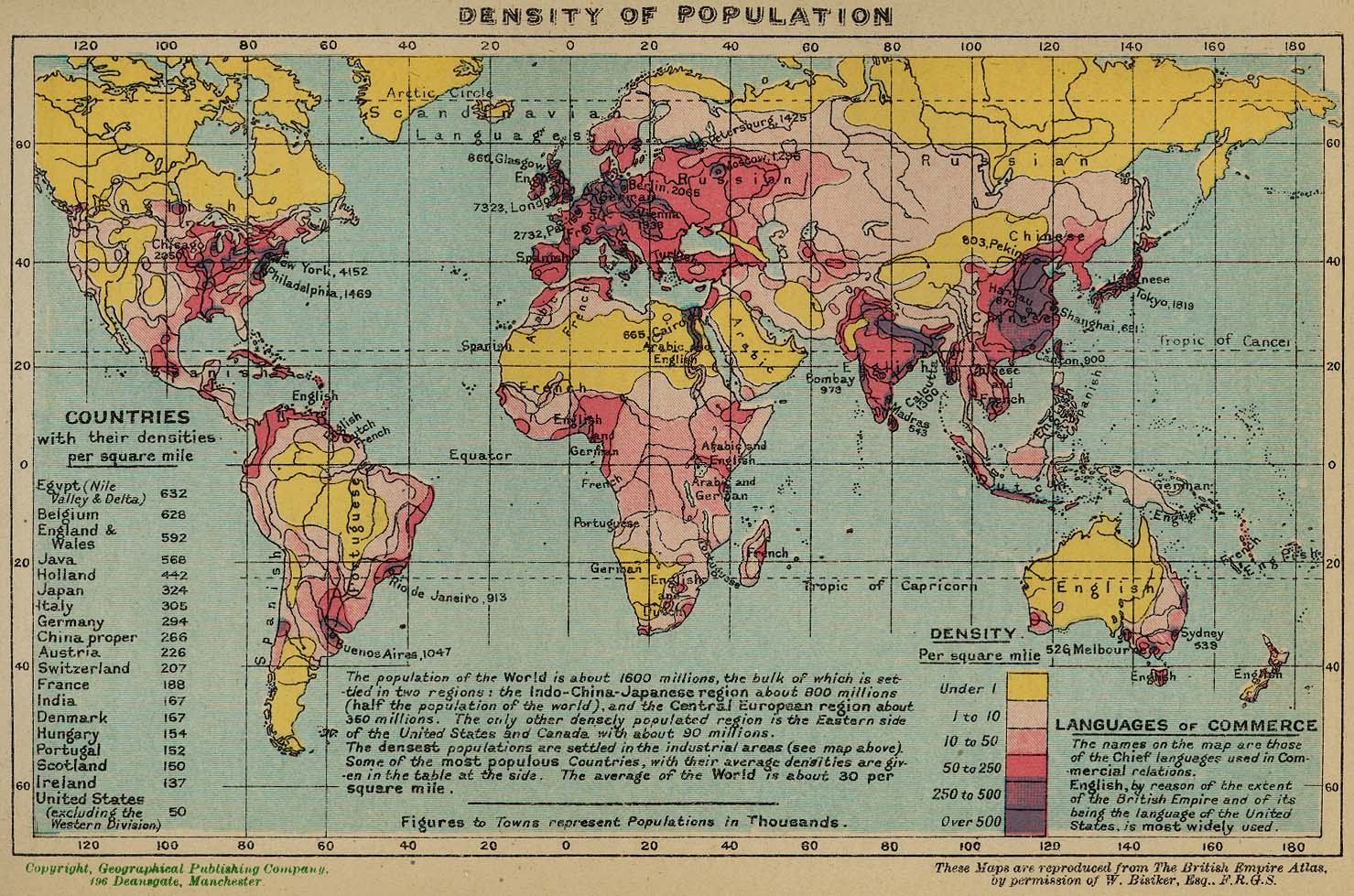
- World Population Density (388K) [p. 42].
- England, Ireland, and Scotland (285K) [p. 44].
-
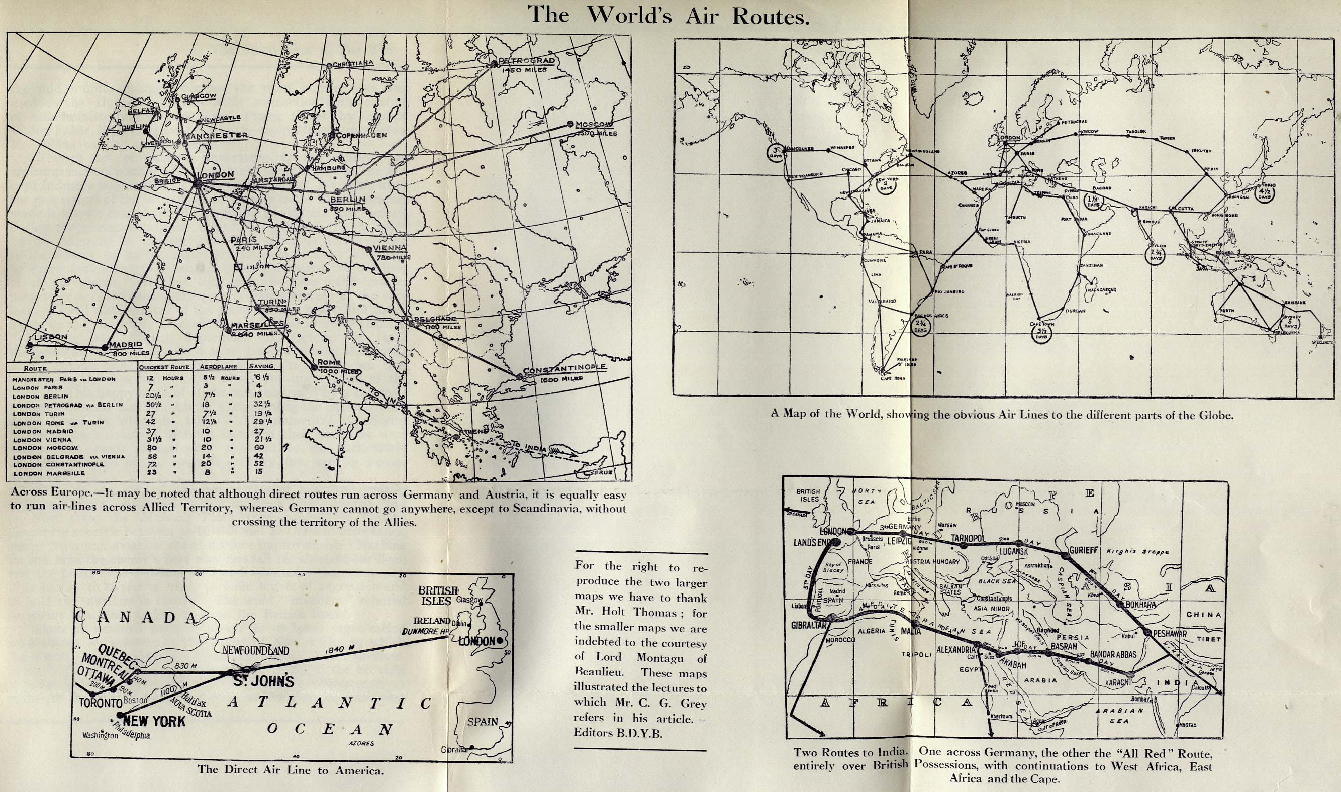
The World's Air Routes [p. 100]
- World's Air Routes (631K)
- Air routes across Europe, to different parts of the globe, direct line to America, and two routes to India.
-
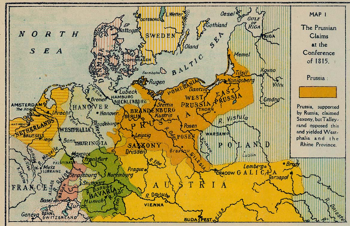
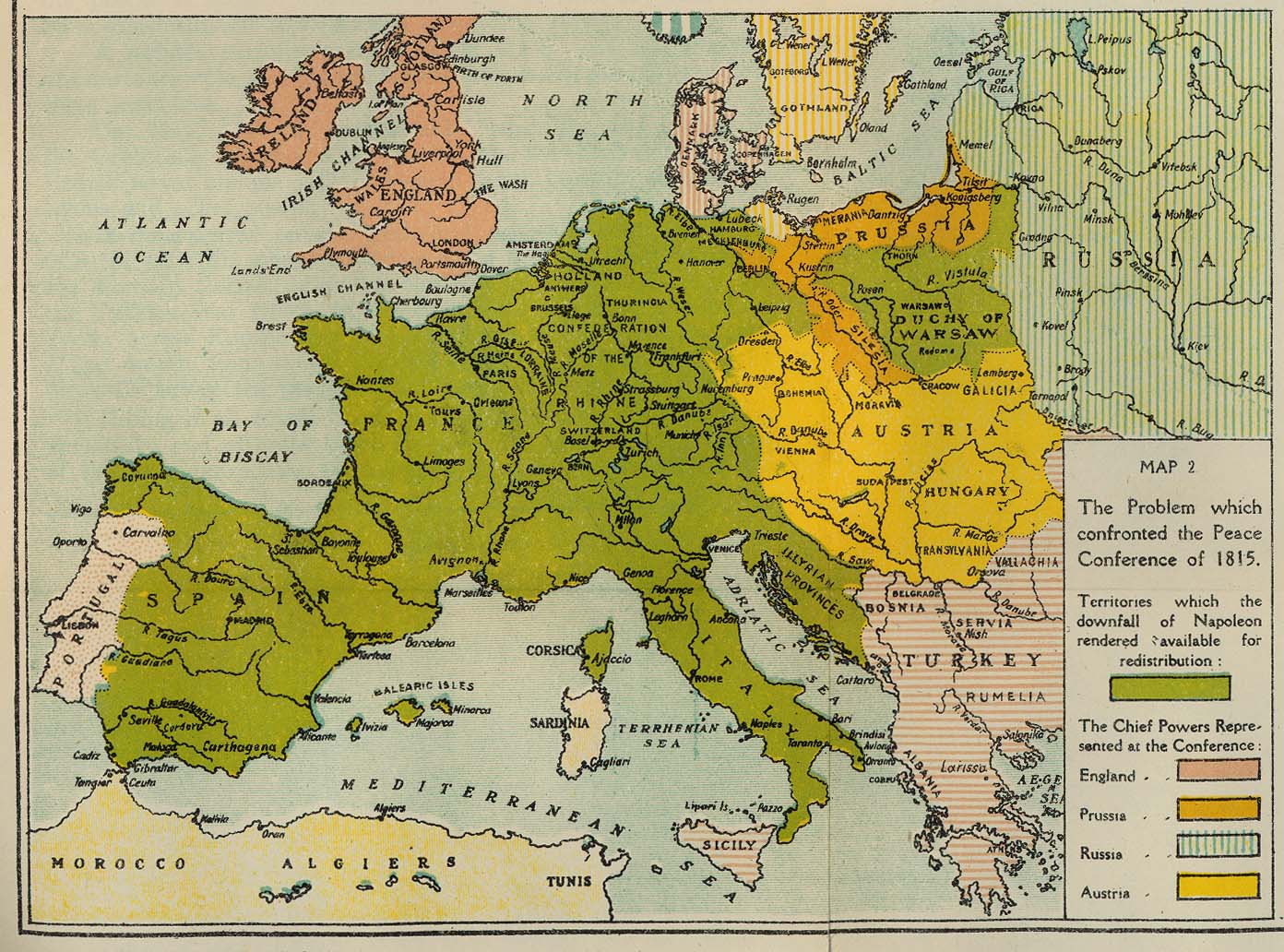
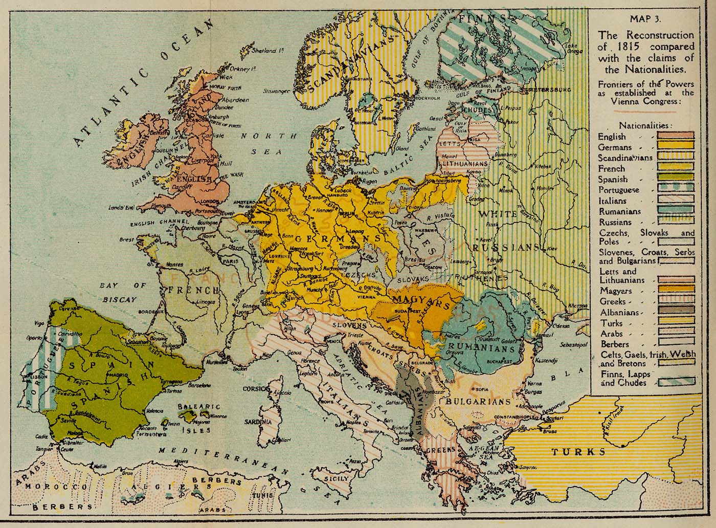
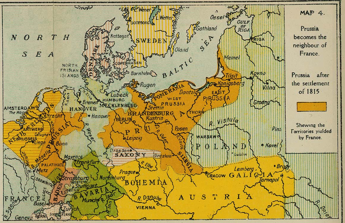
The Last Great European Reconstruction and its errors. Maps 1-4 [p. 116]
- The Prussian Claims at the Conference of 1815 (292K)
- The Problem which confronted the Peace Conference of 1815 (336K)
- The Reconstruction of 1815 compared with the claims of the Nationalities (398K)
- Prussia becomes the neighbour of France (288K)
- The Problem which confronted the Peace Conference of 1815 (336K)
-
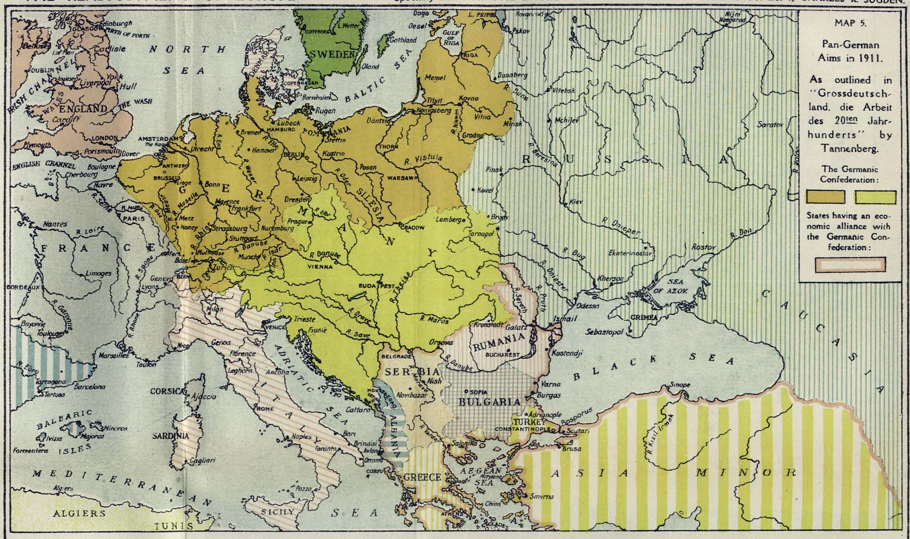
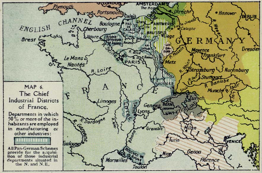
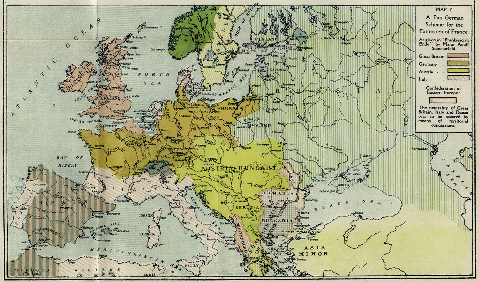
Two Pan-German Schemes and the coveted districts of France. Maps 5-7 [p. 124]
- Pan-German Aims in 1911 (372K)
- As outlined in "Grossdeutschland, die Arbeit des 20ten Jahr-hunderts" by Tannenberg.
- The Chief Industrial Districts of France (144K)
- A Pan-German Scheme for the Extinction of France (366K)
- As given in "Frankreich's Ende" by Major Adolf Sommerfeld.
-
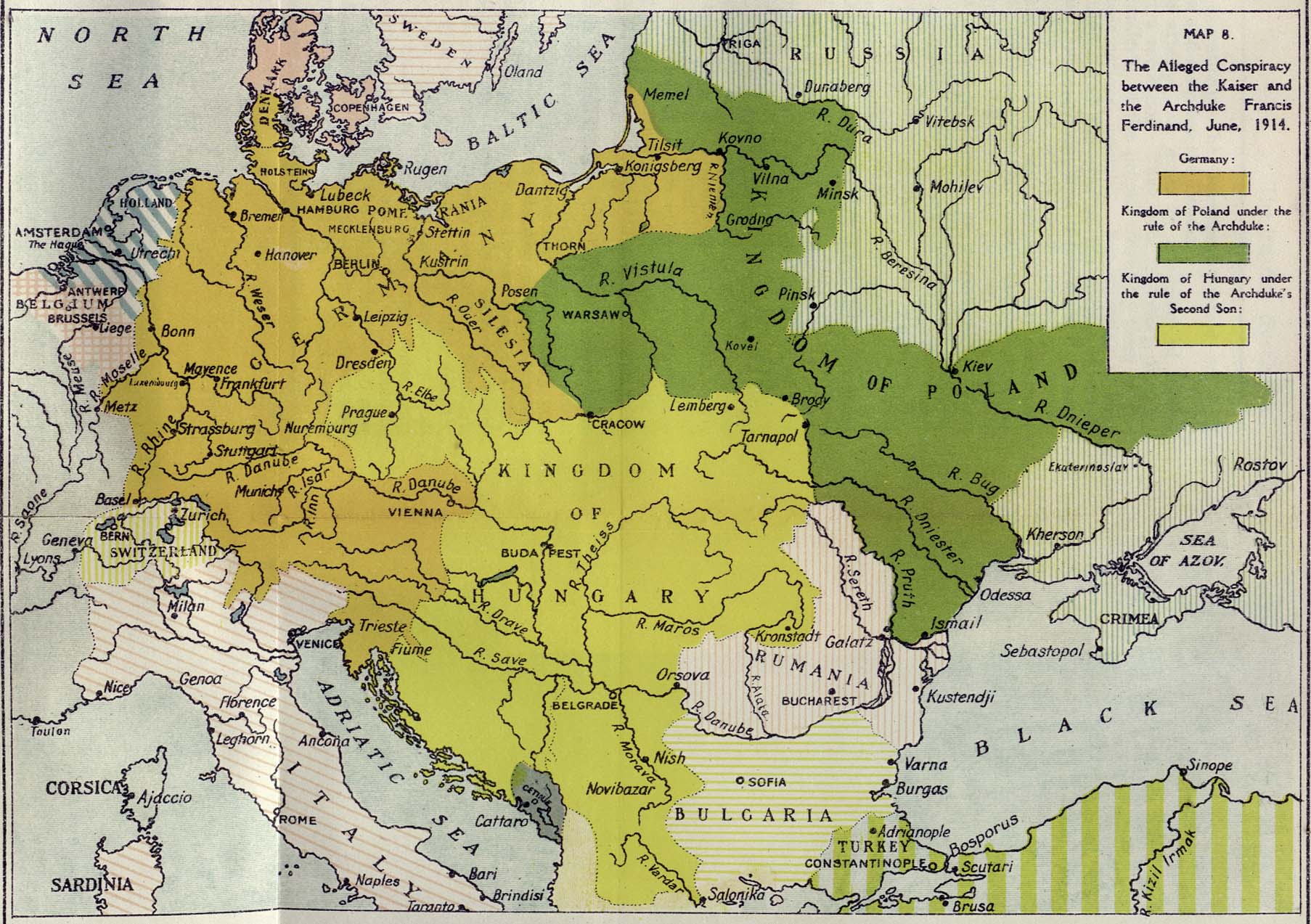
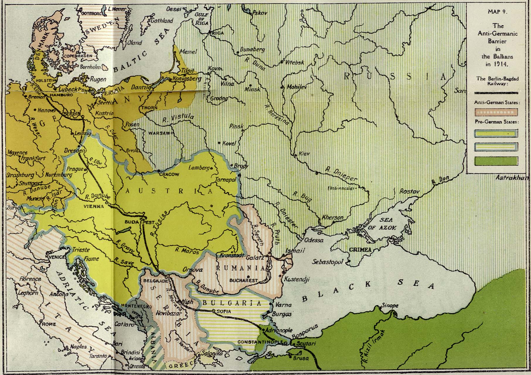
The Conspiracy of Konopisht and the Serb-Rumanian Barrier to Germany's Eastern aims. Maps 8 & 9 [p. 132]
- The Alleged Conspiracy (390K)
- The Alleged Conspiracy between the Kaiser and the Archduke Francis Ferdinand, June, 1914.
- The Anti-Germanic Barrier in the Balkans in 1914 (387K)
-
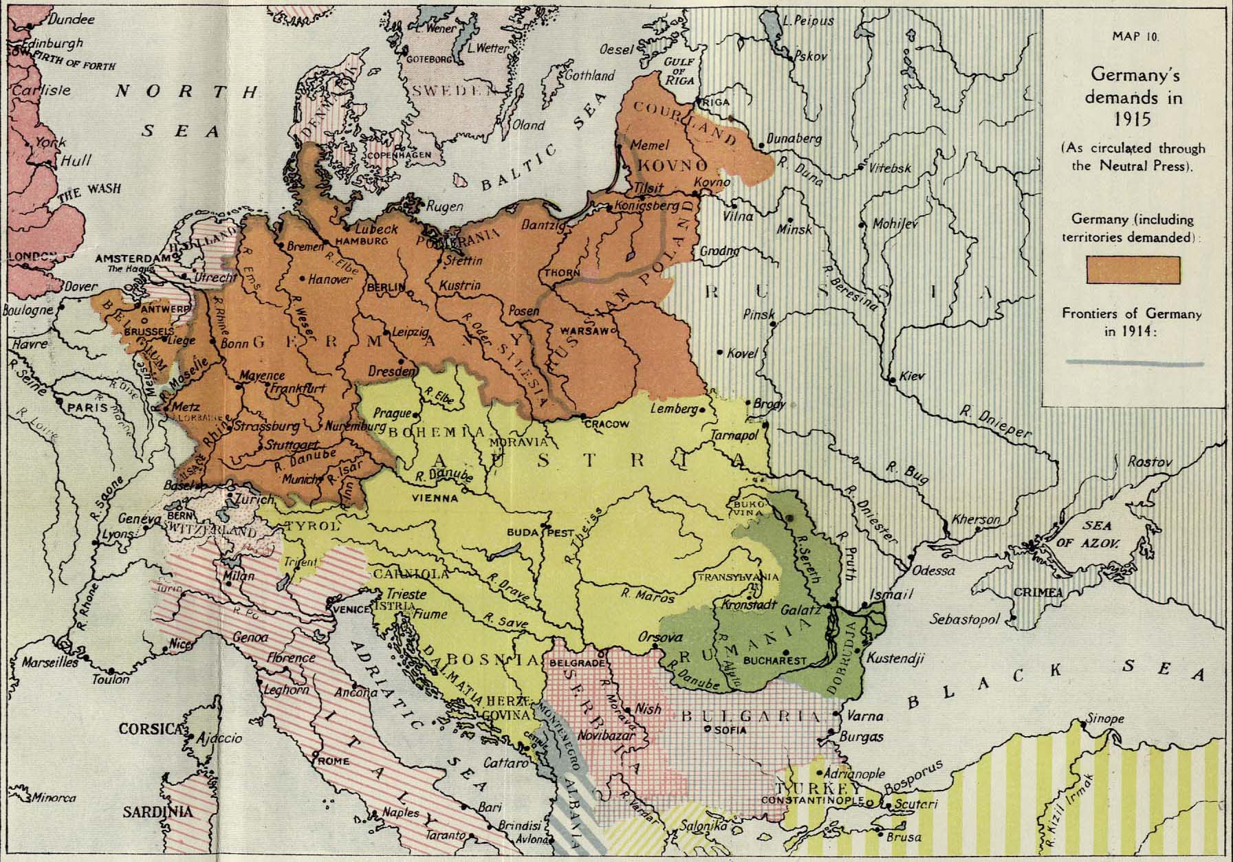
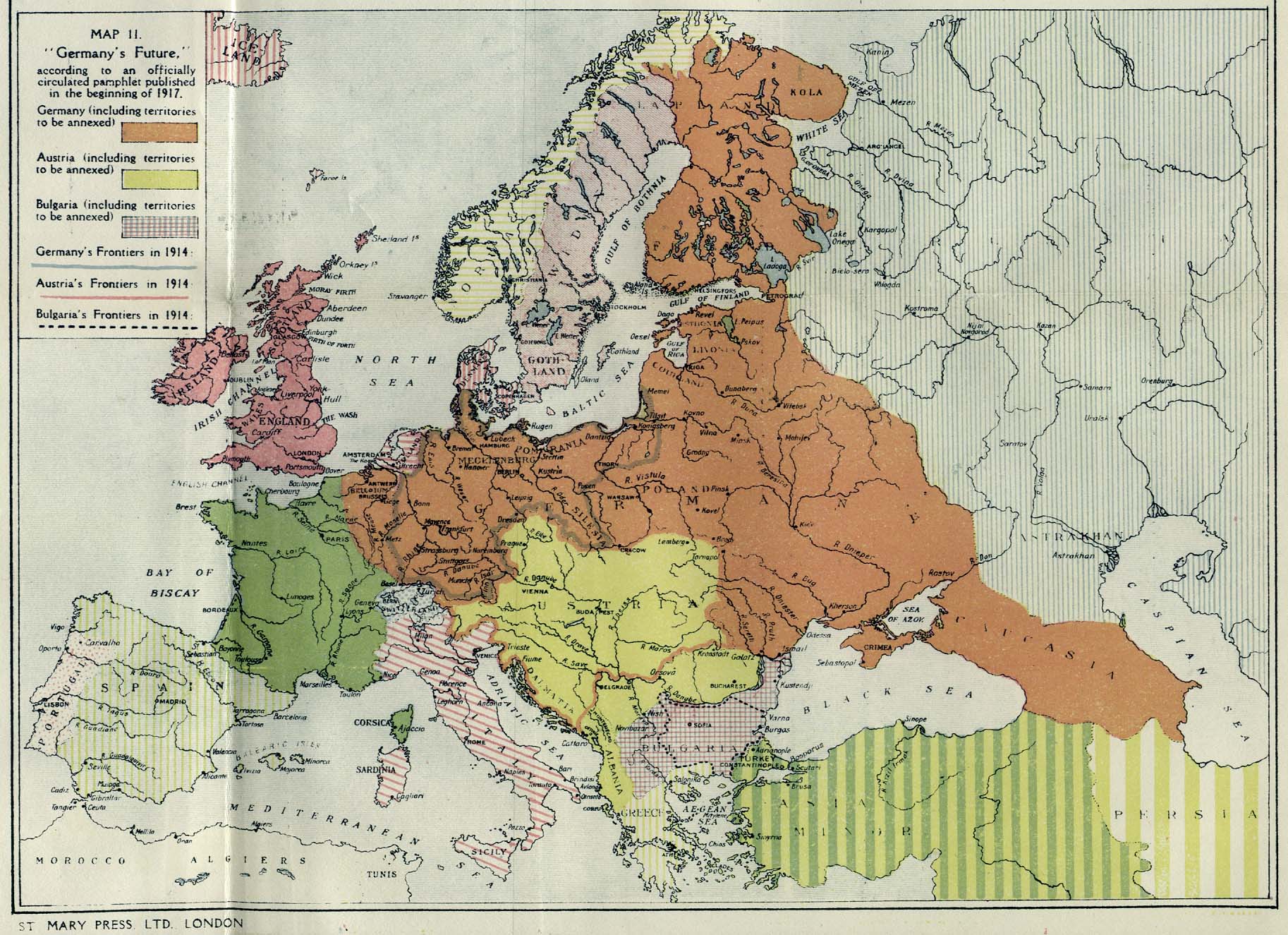
Germany's Unofficial Demands in 1915 & 1917. Maps 10 & 11 [p. 140]
- Germany's Demands in 1915 (406K)
- Germany's Demands in 1915 as circulated through the Neutral Press.
- Germany's Future (150K)
- "Germany's Future" according to an officially circulated pamphlet published in the beginning of 1917.
-
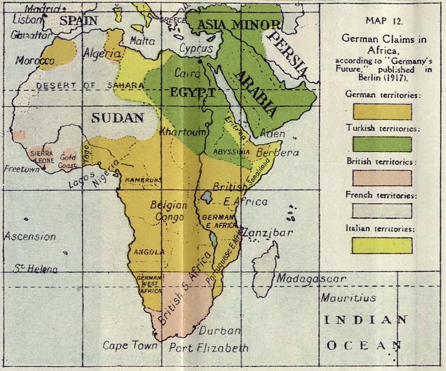
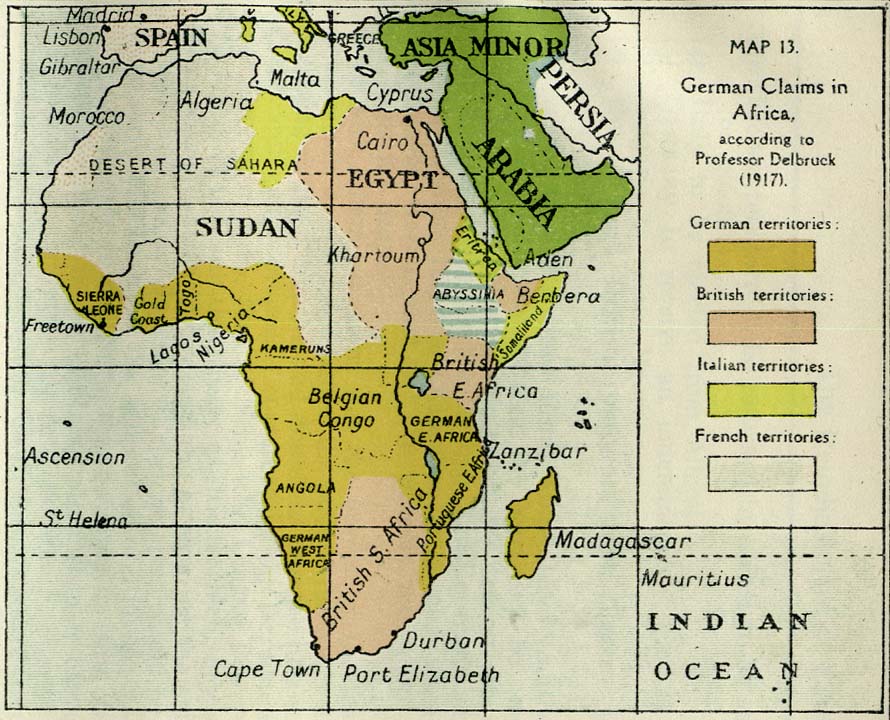
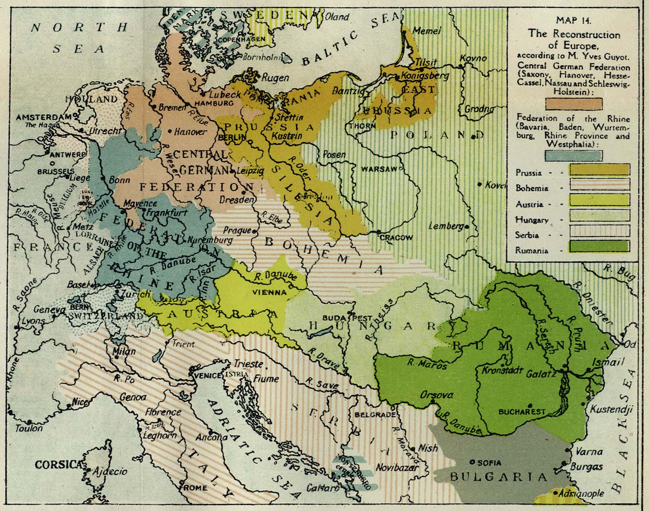
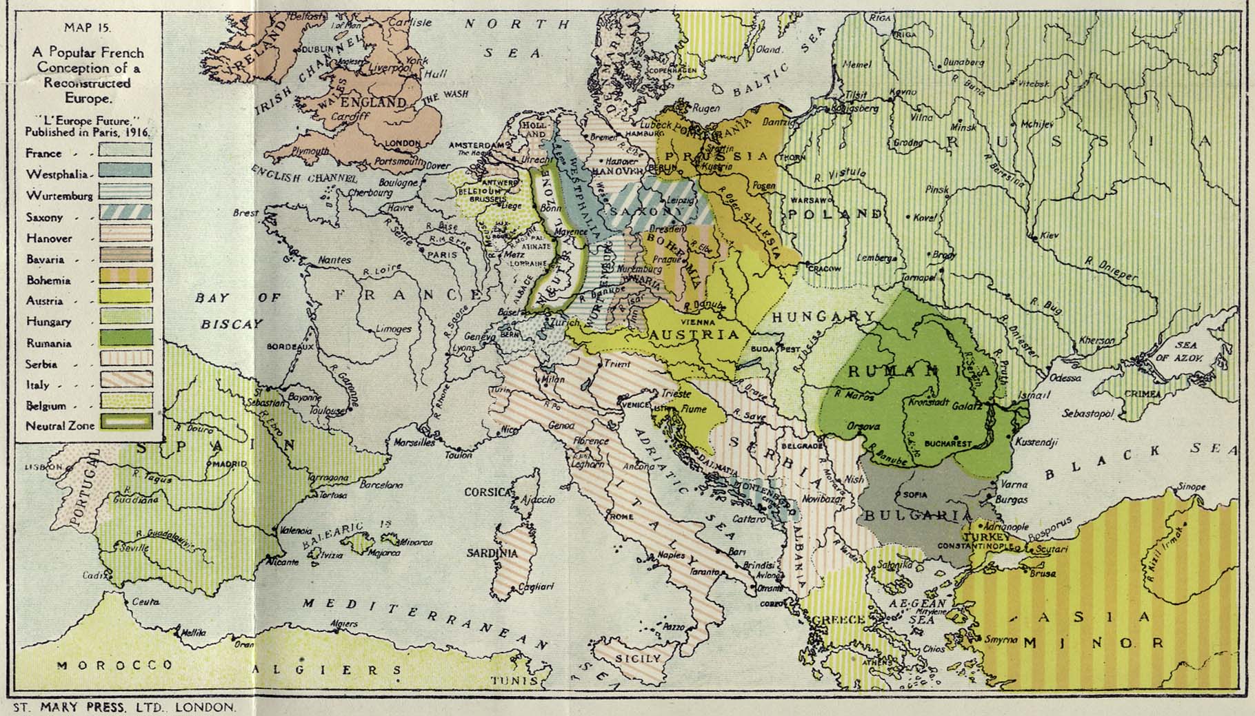
Germany's Claims in Africa and two French Conceptions of the Future of Europe. Maps 12-15 [p. 148]
- German Claims in Africa 1917 (150K)
- German Claims in Africa according to "Germany's Future," published in Berlin, 1917.
- German Claims in Africa 1917 (150K)
- German Claims in Africa according to Professor Delbruck, 1917.
- Europe: The Reconstruction (337K)
- The Reconstruction of Europe according to M. Yves Guyot.
- Europe: Popular French Conception of Reconstructed Europe 1916 (360K)
- According to "L'Europe Future," published in Paris, 1916.
-
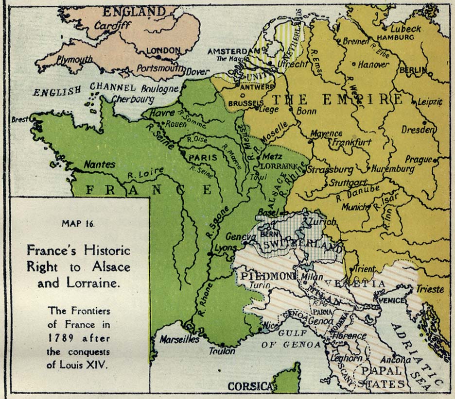
France's Historic Right to Alsace & Lorraine and the Claims of Italy and Serbia. Maps 16-21 [p. 156]
- France's Historic Right to Alsace and Lorraine (186K)
- The Frontiers of France in 1789 after the conquests of Louis XIV.
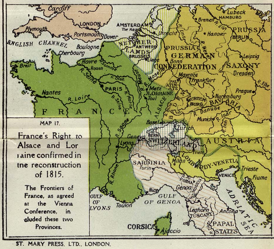
- France's Right to Alsace and Lorraine Confirmed in the Reconstruction of 1815 (195K)
- The Frontiers of France as agreed at the Vienna Conference.
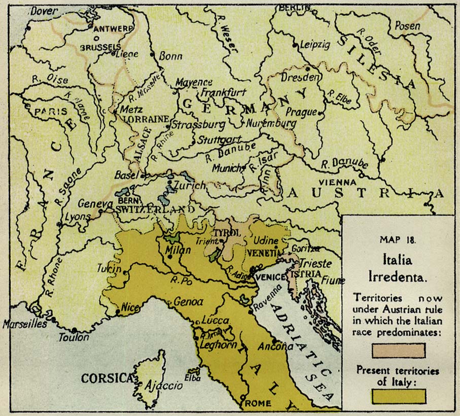
- Italia Irredenta (195K)
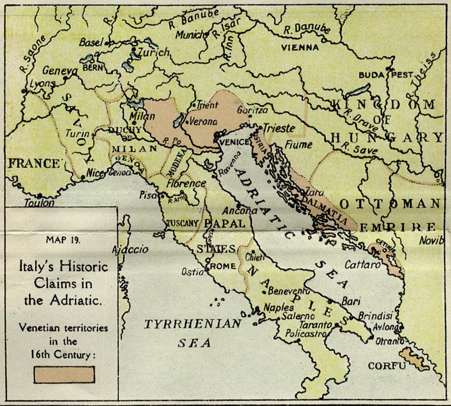
- Italy's Historic Claims in the Adriatic (195K)
- Venetian Territories in the 16th Century.
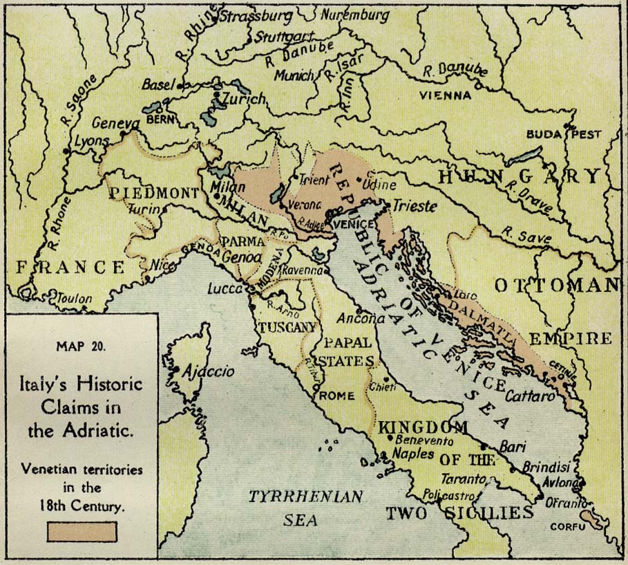
- Italy's Historic Claims in the Adriatic (195K)
- Venetian Territories in the 18th Century.
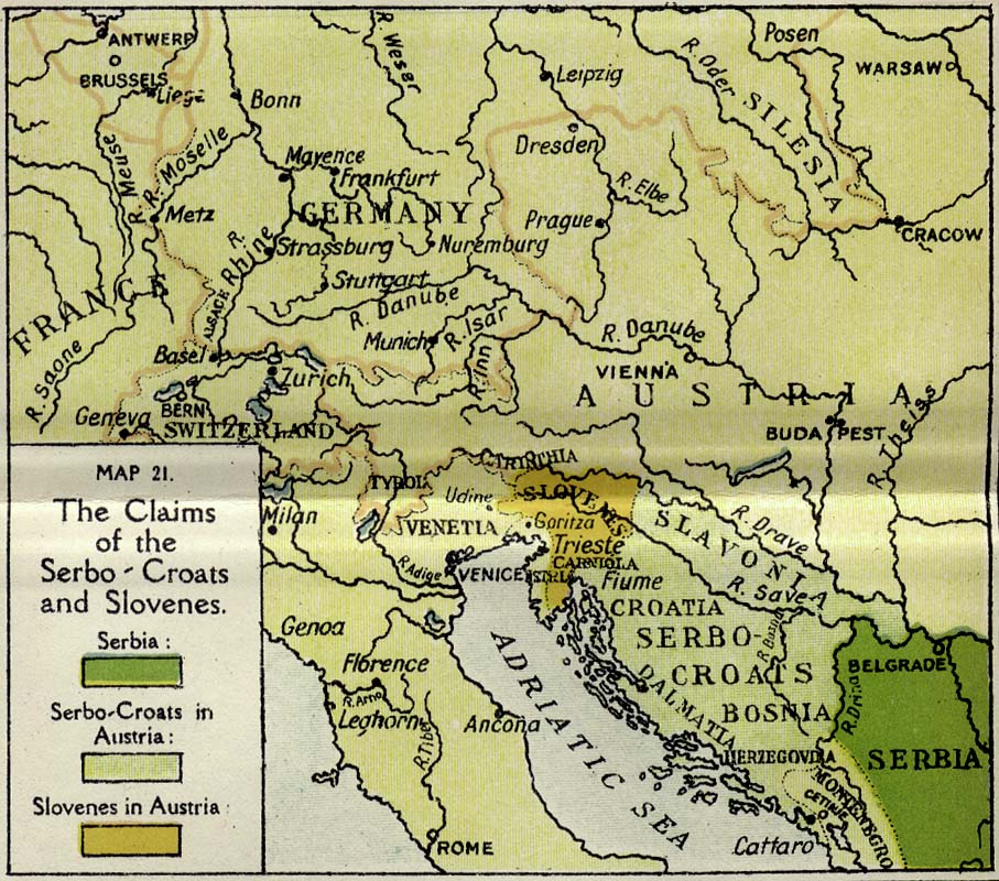
- The Claims of the Serbo-Croats and Slovenes (201K)
-
The Claims of Poland, Rumania and the Czecho-Slovak Race. Maps 22-26 [p. 160]
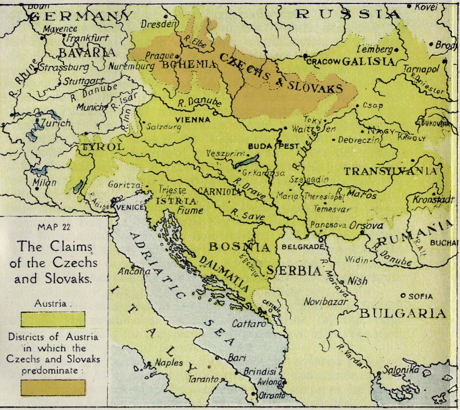
- The Claims of the Czechs and Slovaks (198K)
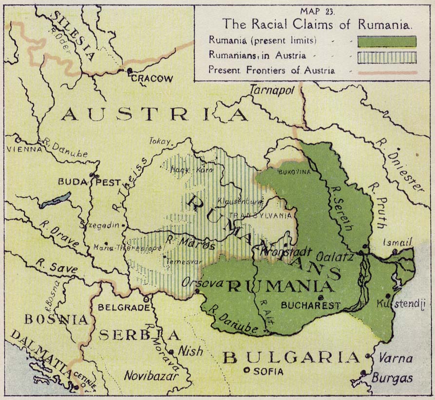
- The Racial Claims of Rumania (172K)
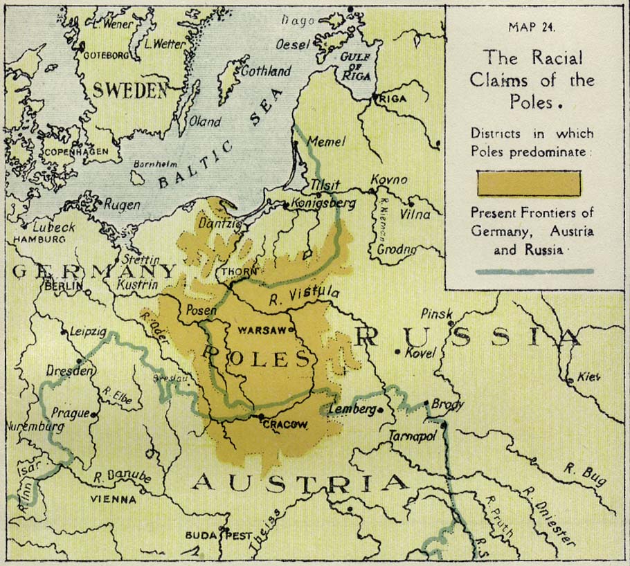
- The Racial Claims of the Poles (180K)
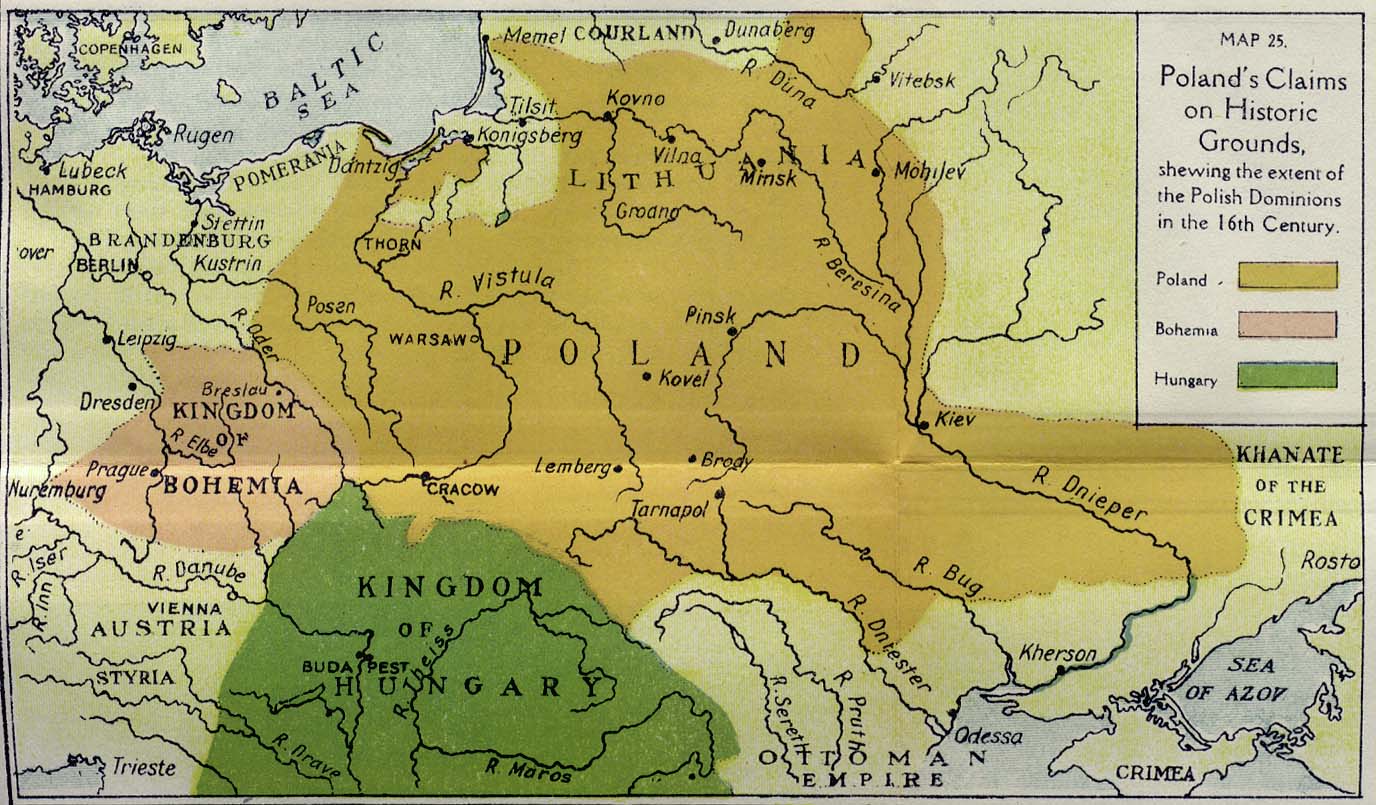
- Poland's Claims on Historic Grounds (196K)
- The Racial Claims of Rumania (172K)
- Showing the extent of the Polish Dominions in the 16th Century.
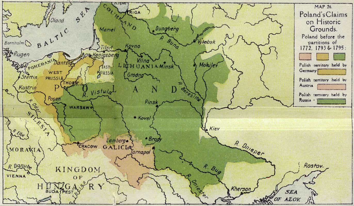
- Poland's Claims on Historic Grounds (187K)
- Poland before the partitions of 1771, 1793 & 1795.
-
The Readjustment of Europe. Map 27 [p.158]
- The Readjustment of Europe (843K)
- As indicated in the Allies' Note to President Wilson, January, 1917.