Perry-Castañeda Library
Map Collection
U.S. Historical City Maps
A, B, C, D, E, F, G, H, I, J, K, L, M, N, O, P, Q, R, S, T, U, V, W, X, Y, Z
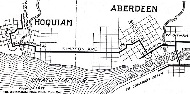
- Aberdeen and Hoquiam, Washington 1917 Automobile Blue Book, 1917, Vol. 8, Section 2 (98K)
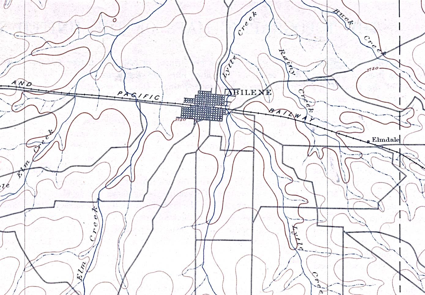
- Abilene, Texas 1892 Original Scale 1:125,000. U.S. Geological Survey. Reprint, 1916 (273K)
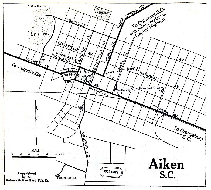
- Aiken, South Carolina 1919 Automobile Blue Book, 1919, Vol. 6 (137K)
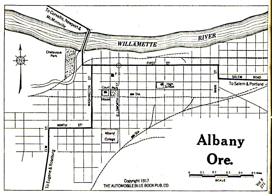
- Albany, Oregon 1917 Automobile Blue Book, 1917, Vol. 8, Section 2 (323K)
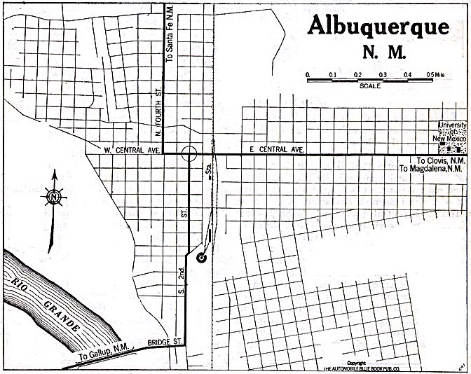
- Albuquerque, New Mexico 1920 Automobile Blue Book (137K)
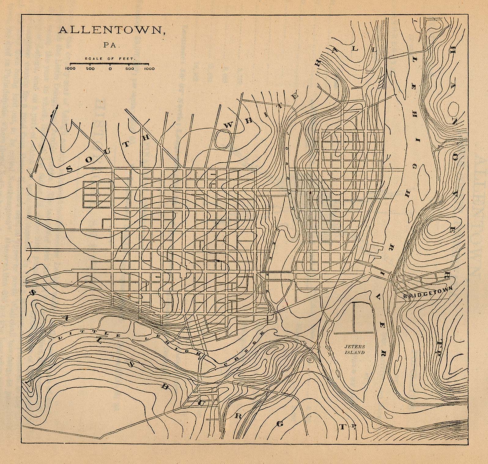
- Allentown, Pennsylvania 1880 From Report on the Social Statistics of Cities, Compiled by George E. Waring, Jr., United States. Census Office, Part I, 1886. (459K)
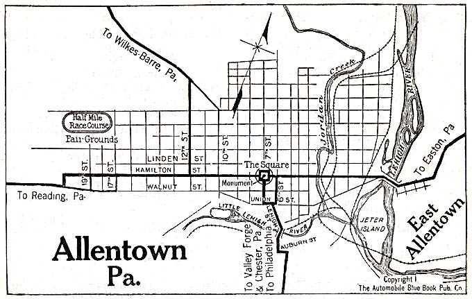
- Allentown, Pennsylvania 1920 Automobile Blue Book, 1920, Vol.3 (117K)
- Amboy, New Jersey 1920 Automobile Blue Book, 1920, Vol. 3 (215K)
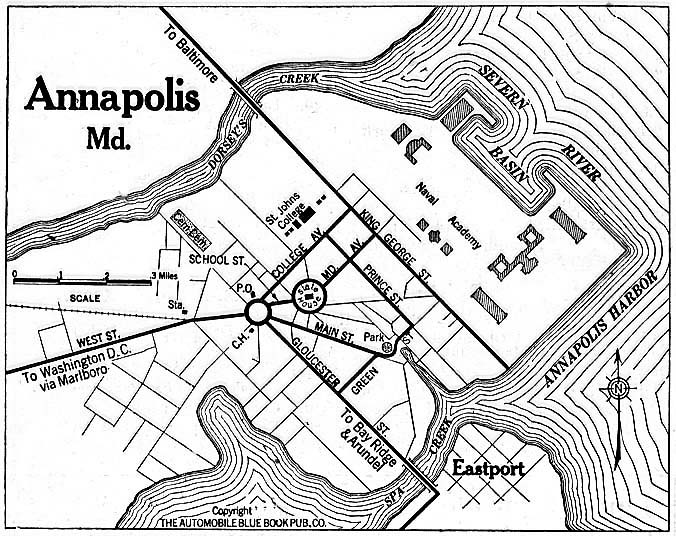
- Annapolis, Maryland 1920 Automobile Blue Book, 1920, Vol. 3 (156K)
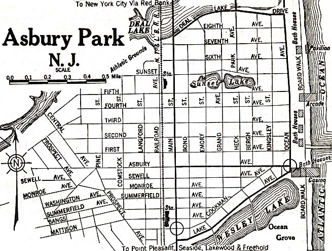
- Asbury Park, New Jersey 1920 Automobile Blue Book, 1920, Vol. 3 (156K)
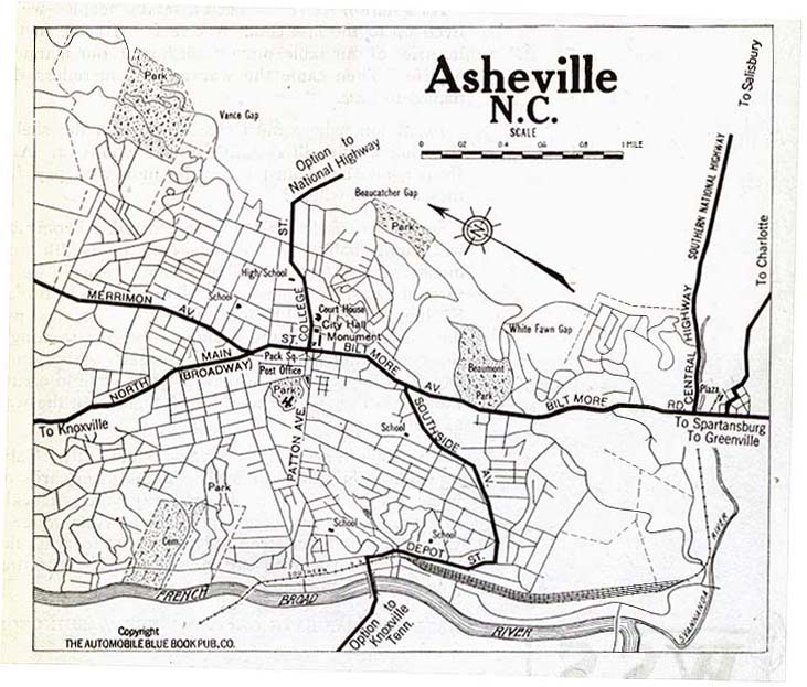
- Asheville, North Carolina 1919 Automobile Blue Book, 1919, Vol. 6 (109K)
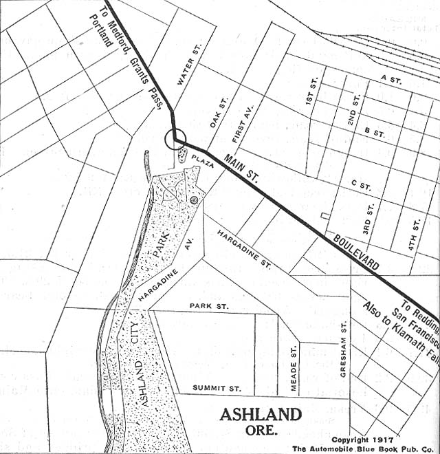
- Ashland, Oregon 1917 Automobile Blue Book, 1917, Vol. 8, Section 2 (117K)
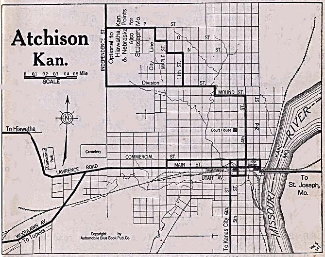
- Atchison, Kansas 1920 Automobile Blue Book, 1920, Vol. 6 (128K)
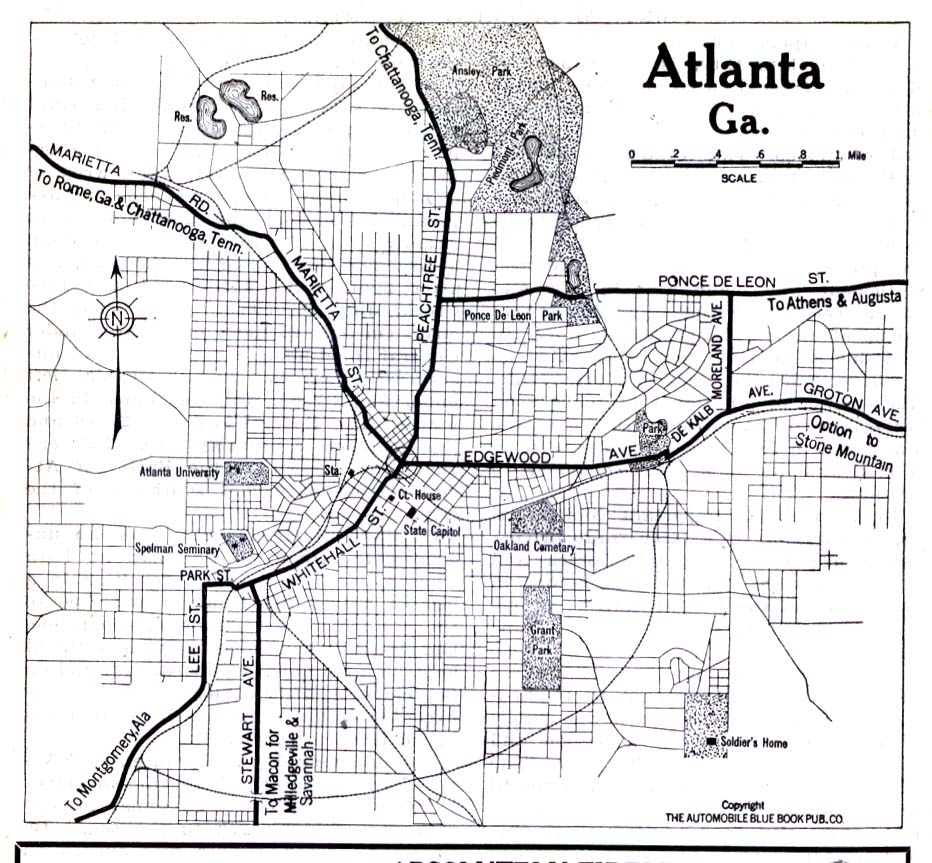
- Atlanta, Georgia 1919 Automobile Blue Book, 1919, Vol. 6 (258K)
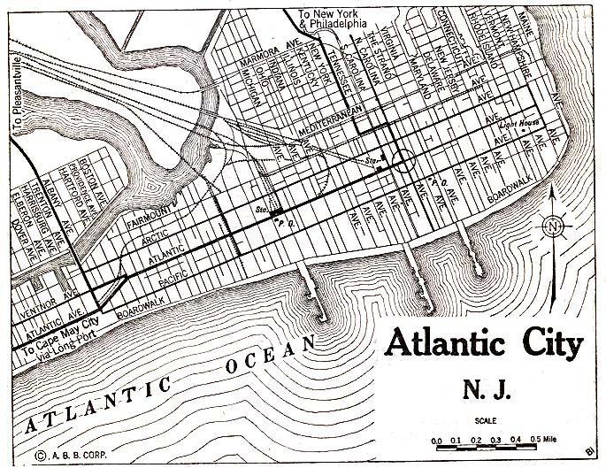
- Atlantic City, New Jersey 1920 Automobile Blue Book, 1920, Vol. 3 (215K)
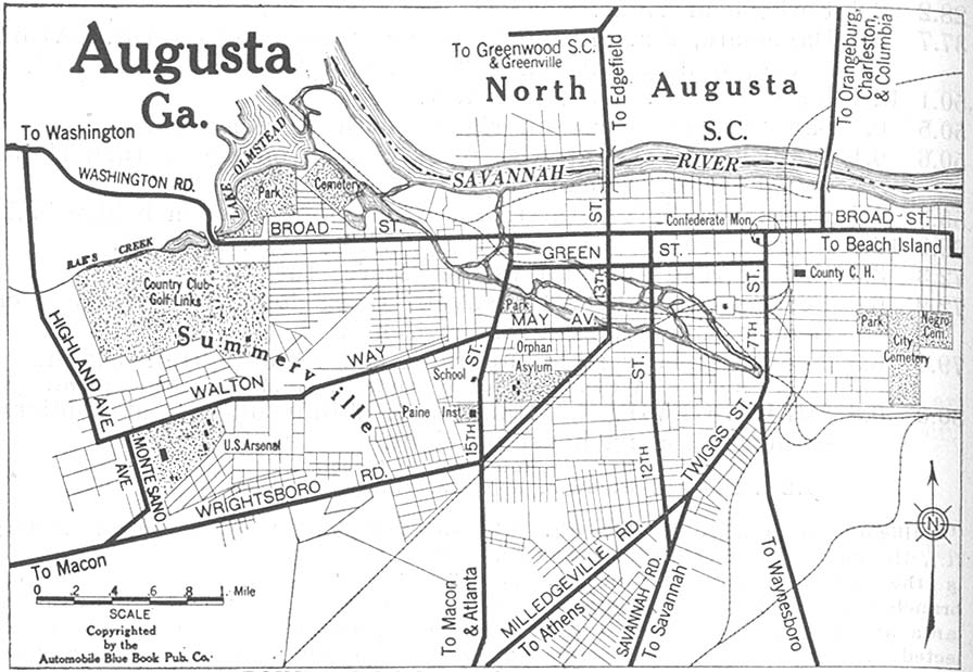
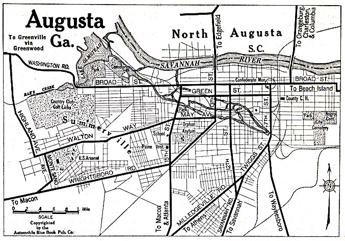
- Augusta, Georgia 1919 Automobile Blue Book, 1919, Vol. 6 (155K)
- Augusta, Georgia 1920 Automobile Blue Book, 1920 (156K)
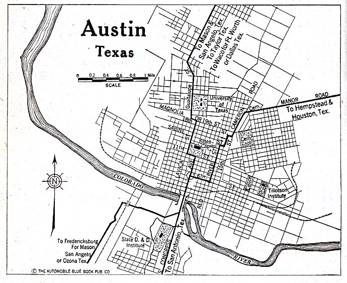
- Austin, Texas 1920 Automobile Blue Book, 1920, Vol. 7 (153K)
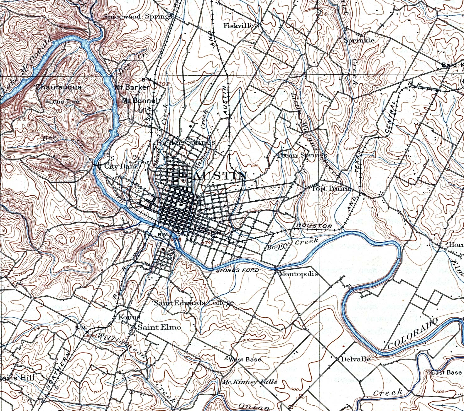
- Austin, Texas 1910 Original Scale 1:125,000. U.S. Geological Survey. Reprint, 1921 (741K)
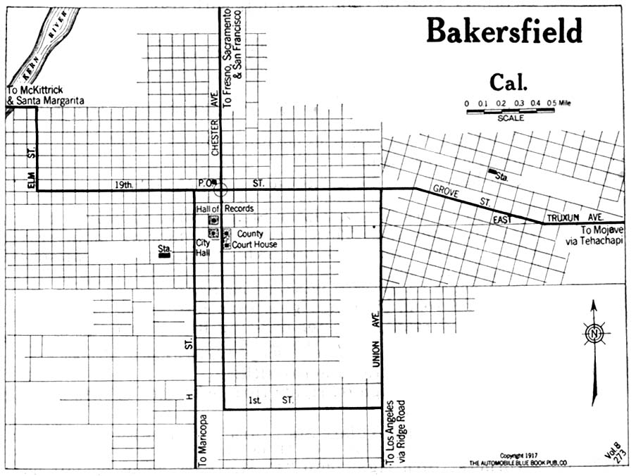
- Bakersfield, California 1917 Automobile Blue Book, 1917, Vol. 8, Section 1 (125K)
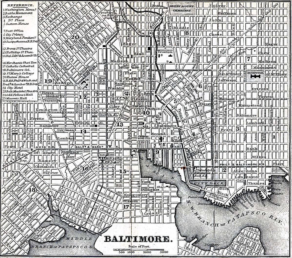
- Baltimore, Maryland 1848 Appletons' Hand-Book of American Travel. New York: D. Appleton and Company, 1869 (723K)
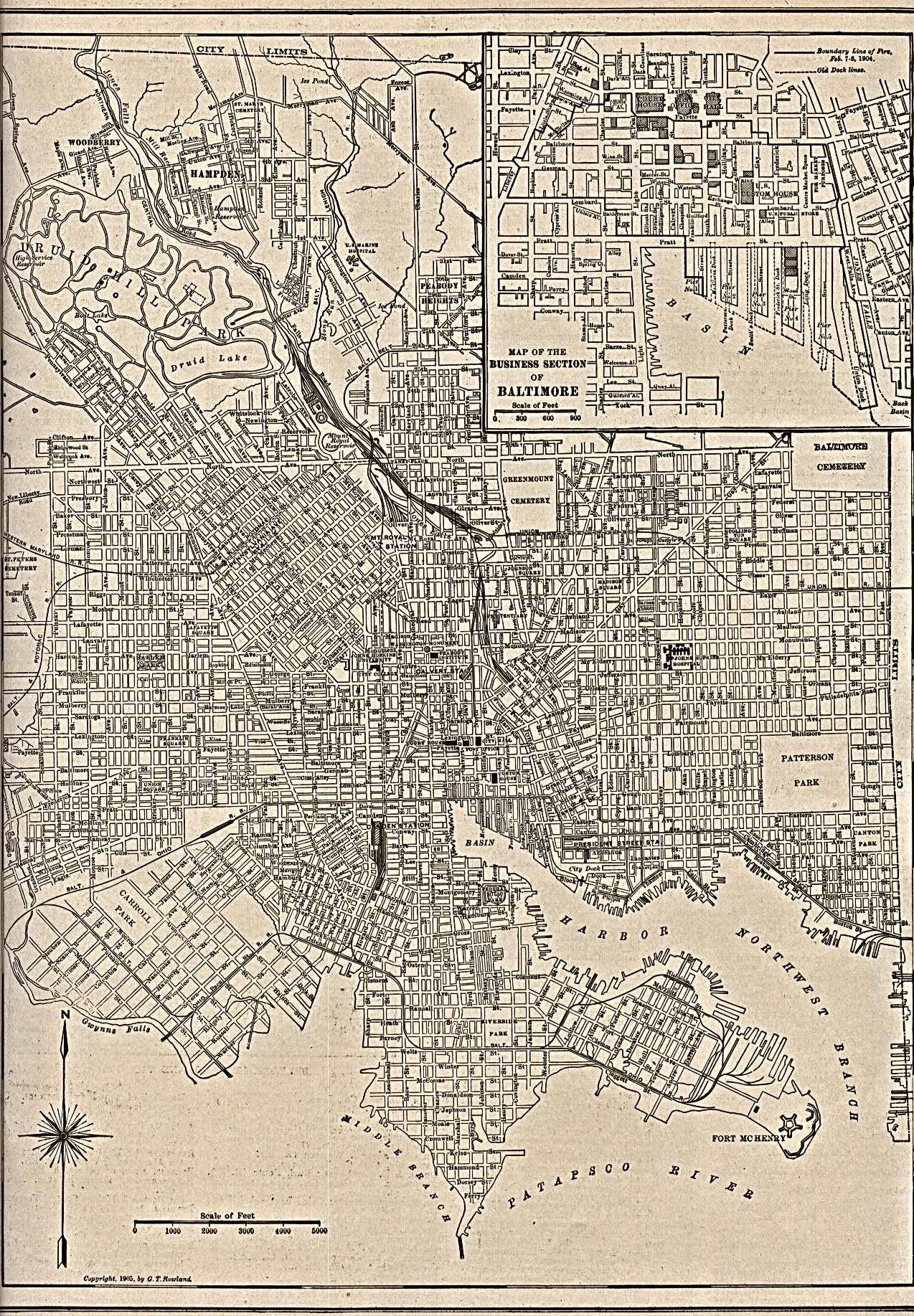
- Baltimore, Maryland 1905 The New Encyclopedic Atlas and Gazetteer of the World. New York: P.F. Collier & Son, 1917 (968K)
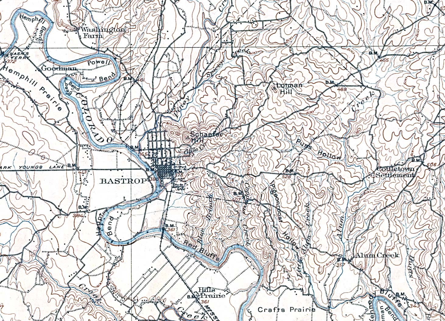
- Bastrop, Texas 1904 Original Scale 1:125,000. U.S. Geological Survey. Reprint, 1929 (566K)
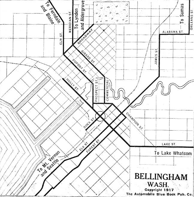
- Bellingham, Washington 1917 Automobile Blue Book, 1917, Vol. 8, Section 2 (147K)
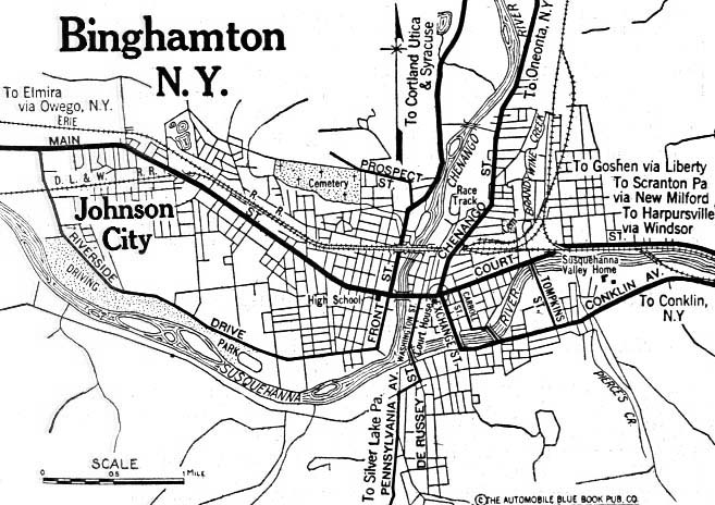
- Binghamton, New York 1920 Automobile Blue Book, 1920, Vol. 1 (117K)
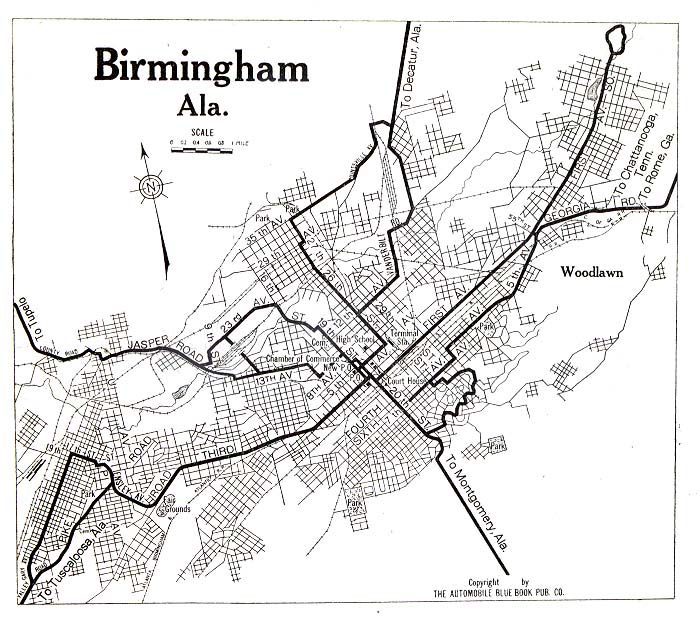
- Birmingham, Alabama 1919 Automobile Blue Book, 1919, Vol. 6 (130K)
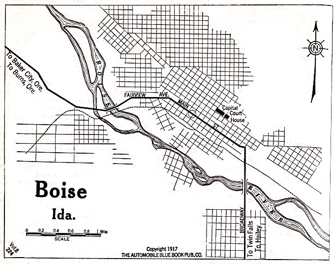
- Boise, Idaho 1917 Automobile Blue Book, 1917, Vol. 8, Section 2 (128K)
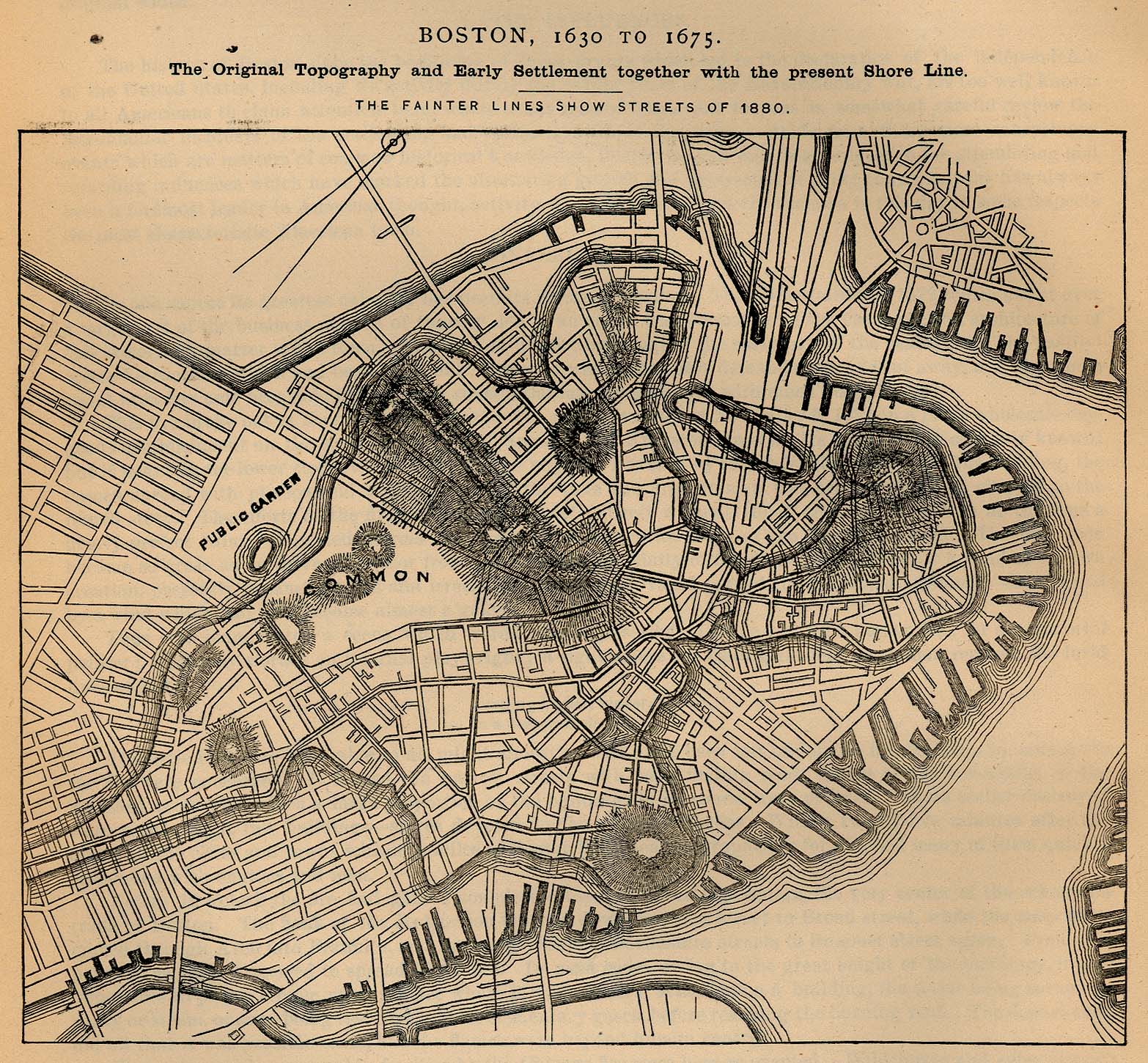
- Boston, Massachusetts 1630-1675 "Boston, 1630 to 1675. The Original Topography and Early Settlement together with the present Shore Line" "The fainter lines show streets of 1880." From Report on the Social Statistics of Cities, Compiled by George E. Waring, Jr., United States. Census Office, Part I, 1886. (648K)
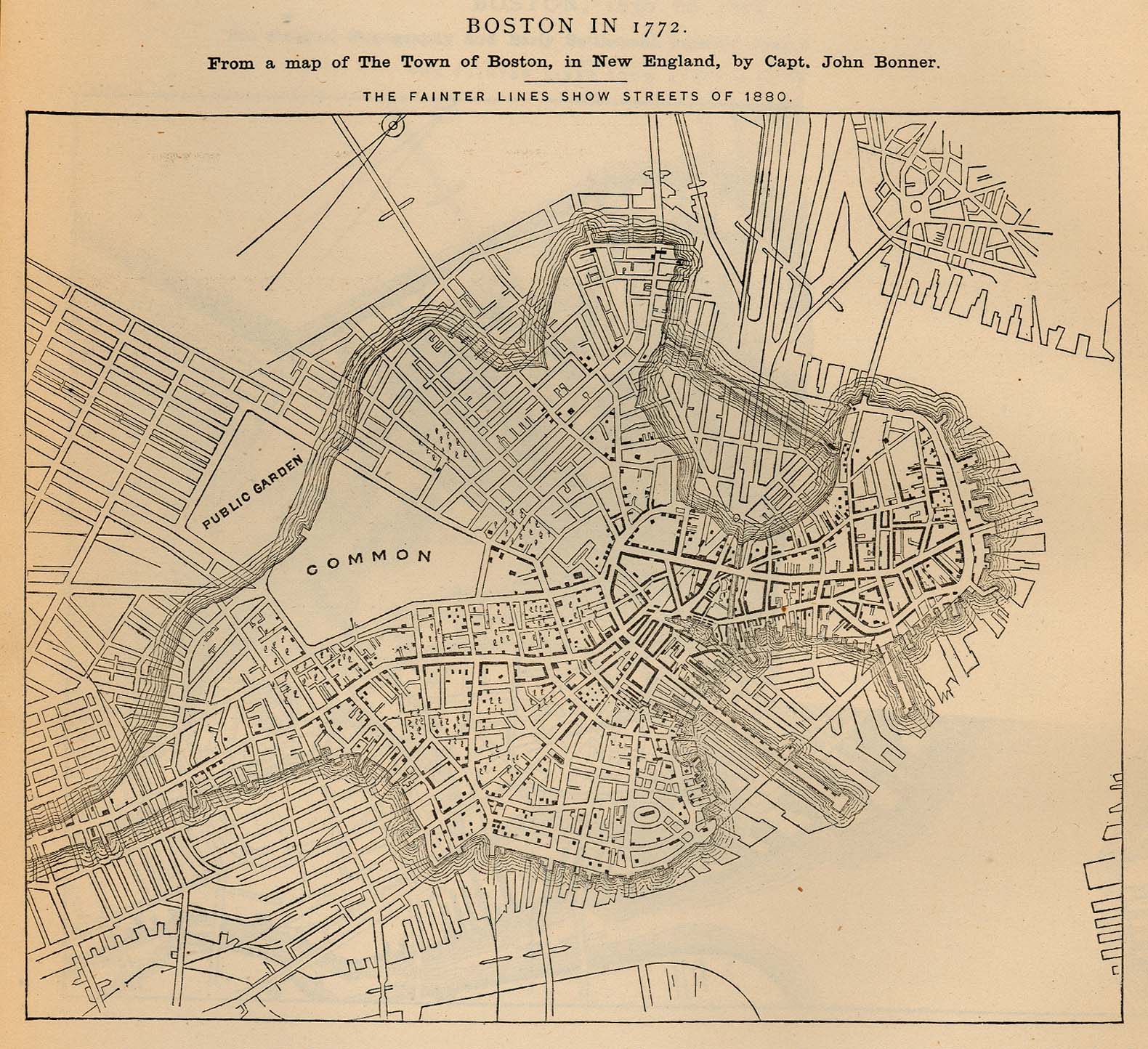
- Boston, Massachusetts 1772 "Boston in 1772. From a map of The Town of Boston, in New England, by Capt. John Bonner" "The fainter lines show streets of 1880." From Report on the Social Statistics of Cities, Compiled by George E. Waring, Jr., United States. Census Office, Part I, 1886. (491K)
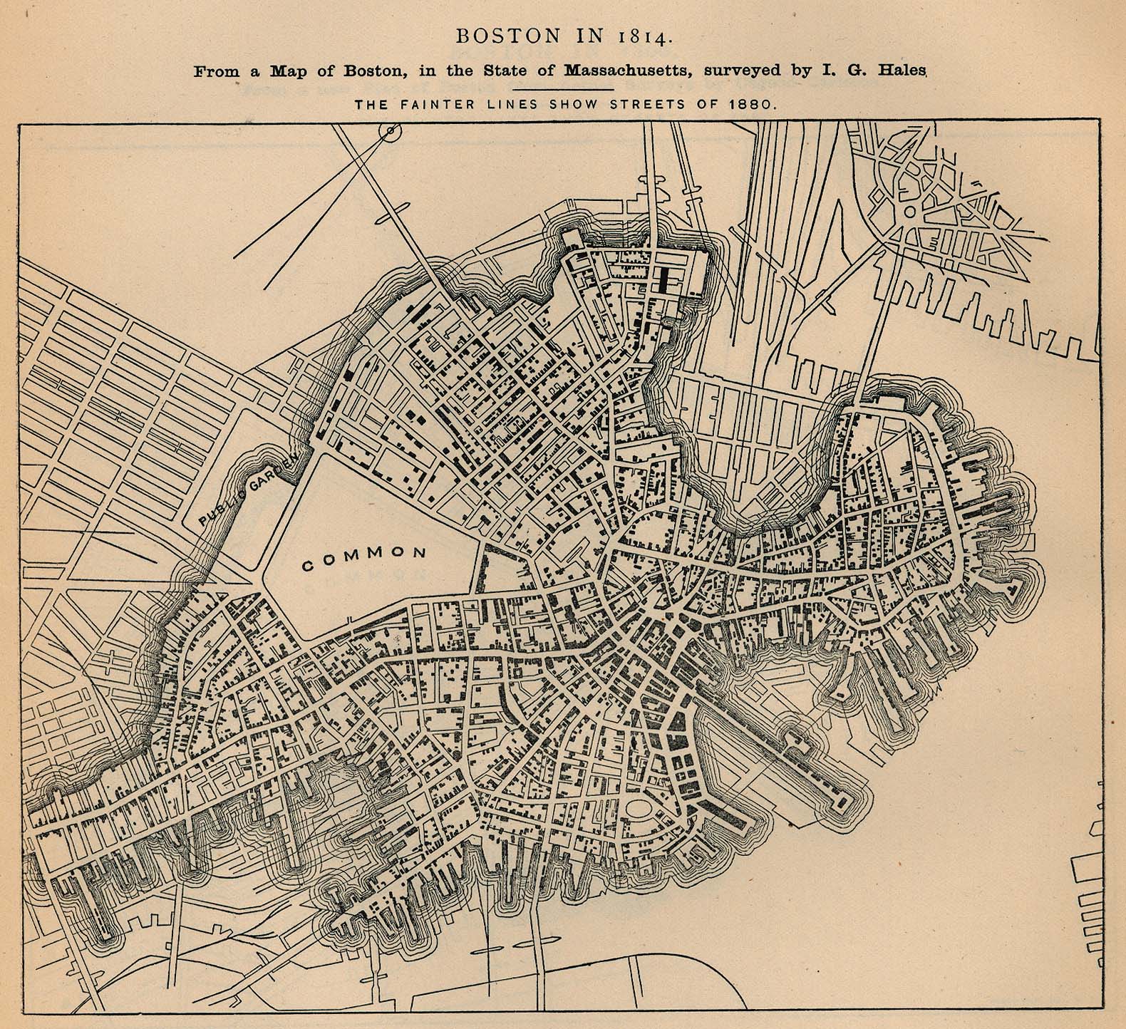
- Boston, Massachusetts 1814 "Boston in 1814. From a map of Boston, in the State of Massachusetts, Surveyed by I.G. Hales" "The fainter lines show streets of 1880." From Report on the Social Statistics of Cities, Compiled by George E. Waring, Jr., United States. Census Office, Part I, 1886. (574K)
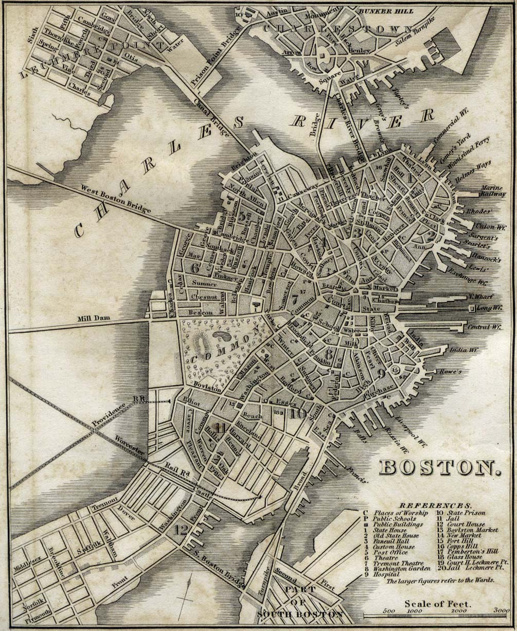
- Boston, Massachusetts 1842 "Boston" from Tanner, H.S. The American Traveller; or Guide Through the United States. Eighth Edition. New York, 1842. (341K)
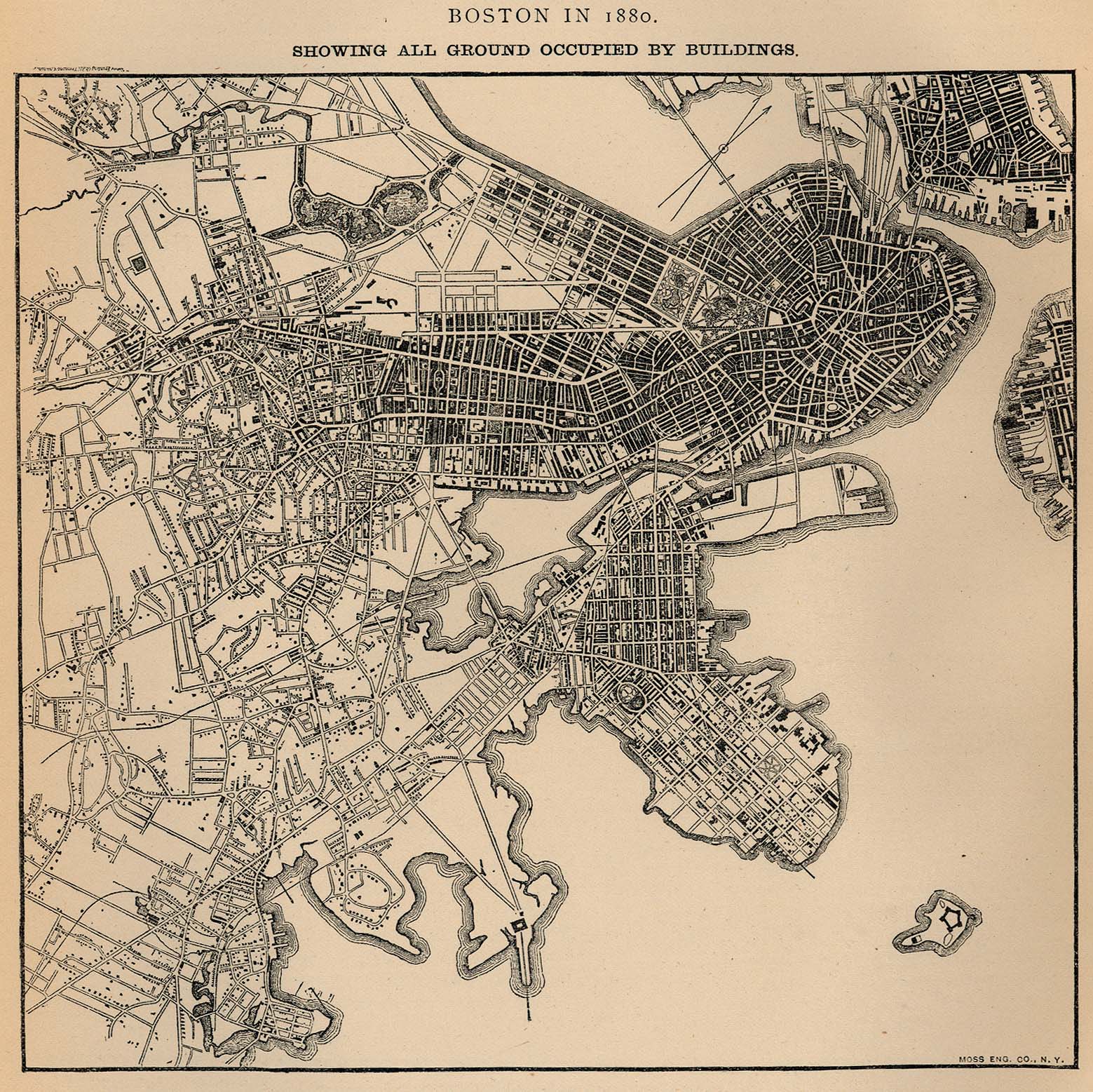
- Boston, Massachusetts 1880 - All Ground Occupied by Buildings "Boston in 1880. Showing All Ground Occupied by Buildings." From Report on the Social Statistics of Cities, Compiled by George E. Waring, Jr., United States. Census Office, Part I, 1886. (611K)
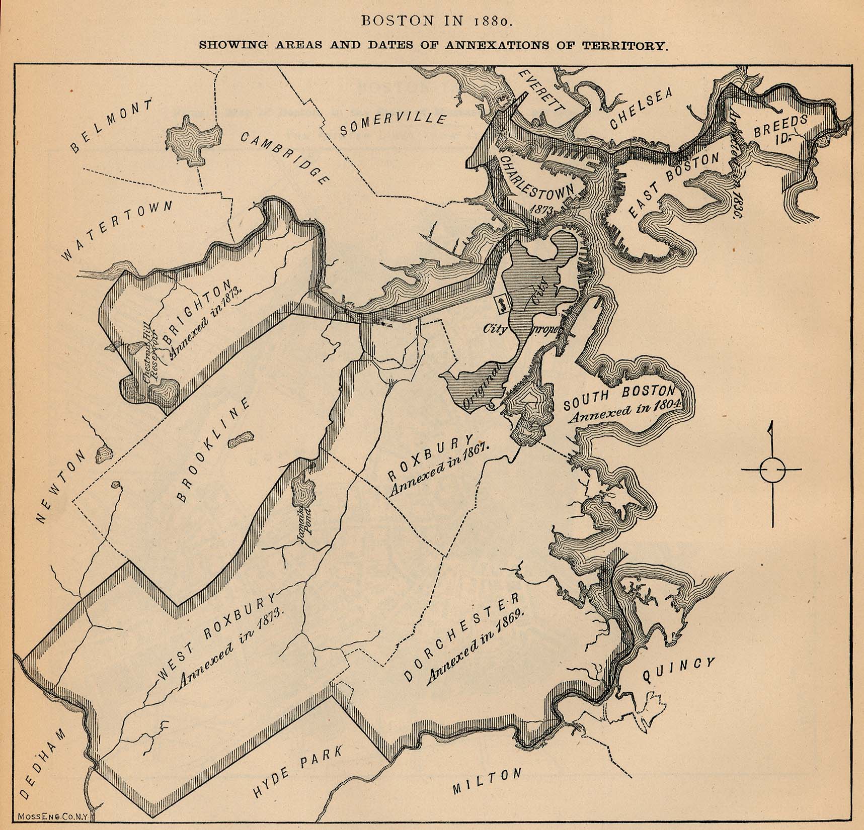
- Boston, Massachusetts 1880 - Areas and Dates of Annexations of Territory "Boston in 1880. Showing Areas and Dates of Annexations of Territory." From Report on the Social Statistics of Cities, Compiled by George E. Waring, Jr., United States. Census Office, Part I, 1886. (429K)
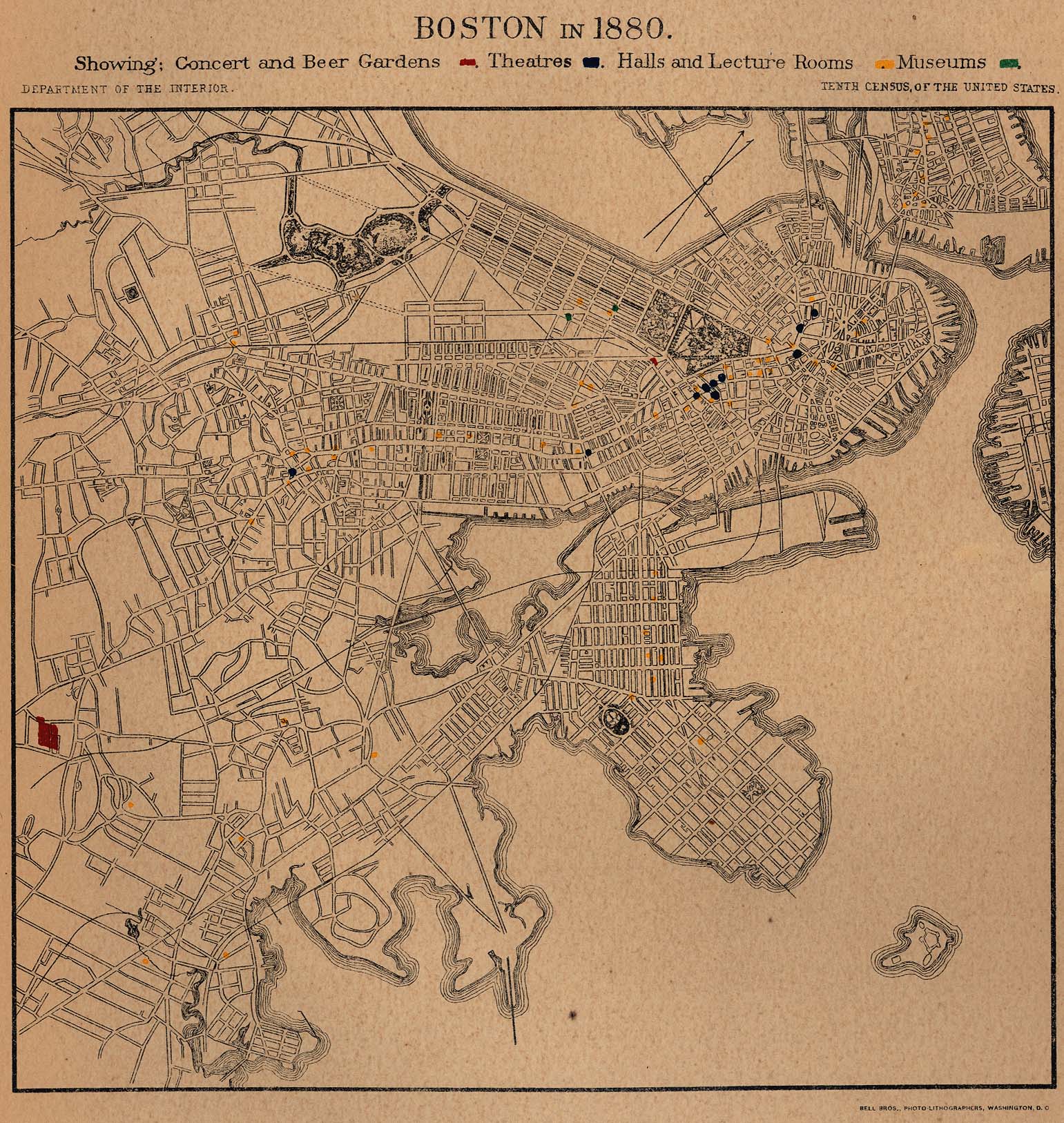
- Boston, Massachusetts 1880 - Concert and Beer Gardens, Theatres, Halls and Lecture Rooms, Museums "Boston in 1880. Showing Concert and Beer Gardens, Theatres, Halls and Lecture Rooms, Museums." From Report on the Social Statistics of Cities, Compiled by George E. Waring, Jr., United States. Census Office, Part I, 1886. (618K)
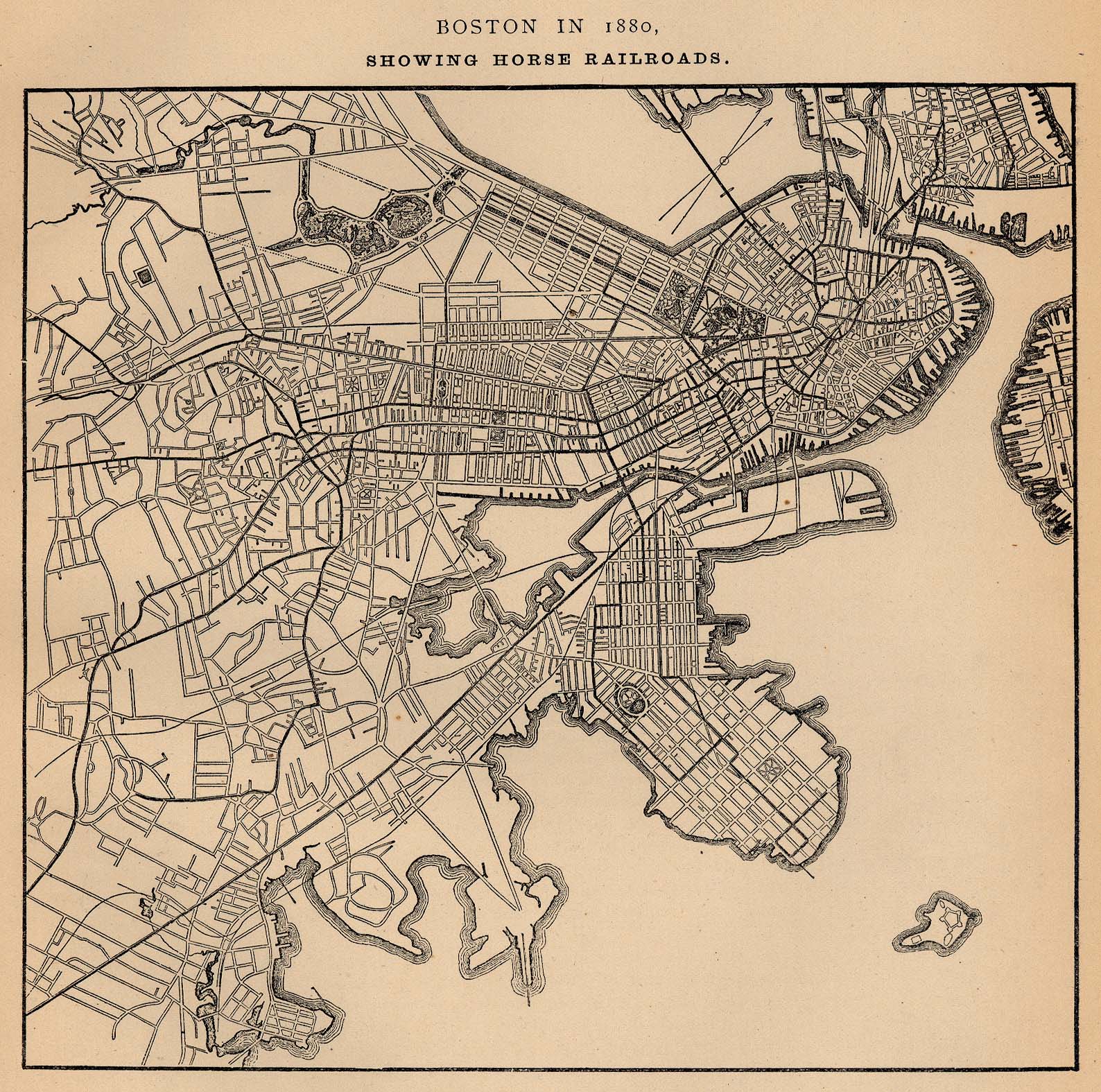
- Boston, Massachusetts 1880 - Horse Railroads "Boston in 1880. Showing Horse Railroads." From Report on the Social Statistics of Cities, Compiled by George E. Waring, Jr., United States. Census Office, Part I, 1886. (661K)
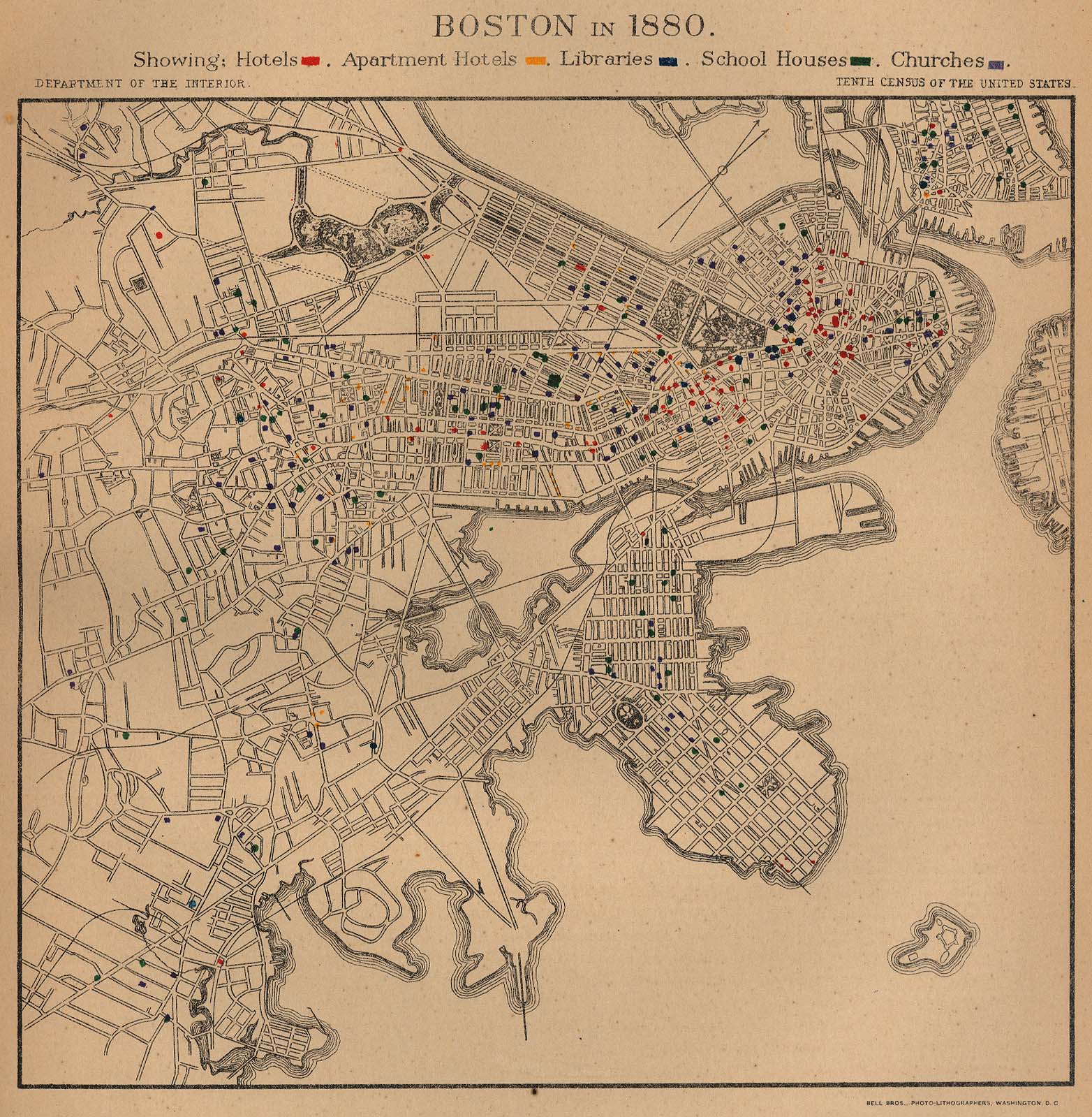
- Boston, Massachusetts 1880 - Hotels, Apartment Hotels, Libraries, School Houses, Churches "Boston in 1880. Showing: Hotels, Apartment Hotels, Libraries, School Houses, Churches." From Report on the Social Statistics of Cities, Compiled by George E. Waring, Jr., United States. Census Office, Part I, 1886. (575K)
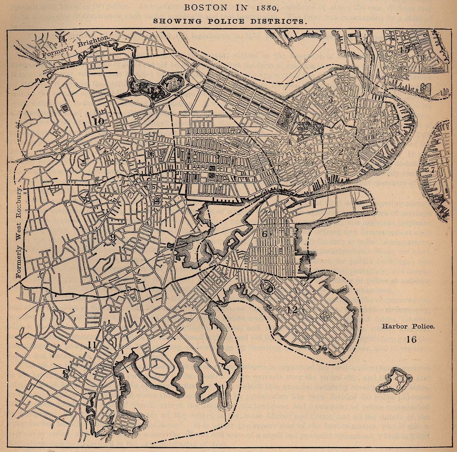
- Boston, Massachusetts 1880 - Police Districts "Boston in 1880. Showing Police Districts." From Report on the Social Statistics of Cities, Compiled by George E. Waring, Jr., United States. Census Office, Part I, 1886. (683K)
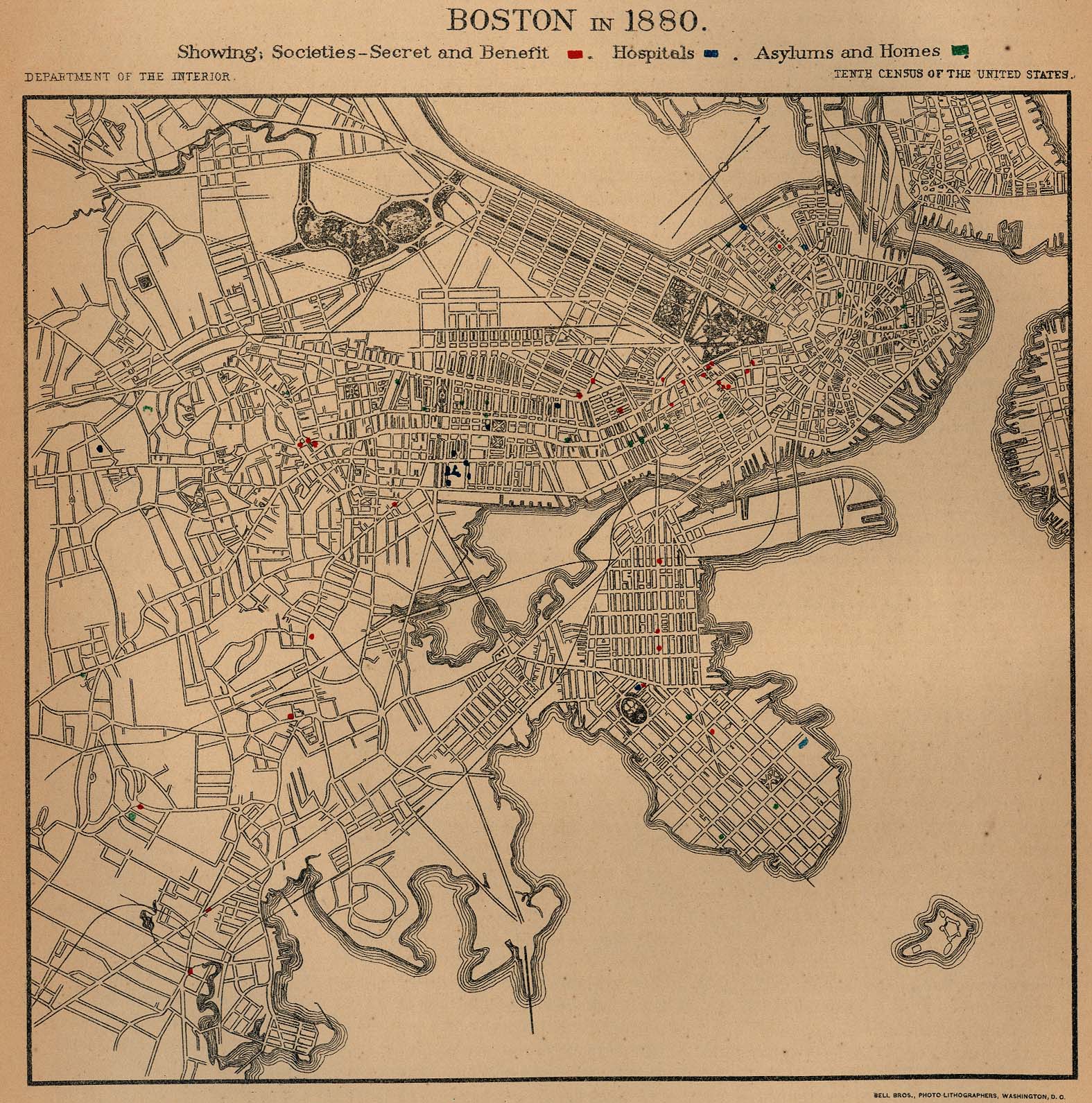
- Boston, Massachusetts 1880 - Societies-Secret and Benefit, Hospitals, Asylums and Homes "Boston in 1880. Showing Societies-Secret and Benefit, Hospitals, Asylums and Homes." From Report on the Social Statistics of Cities, Compiled by George E. Waring, Jr., United States. Census Office, Part I, 1886. (609K)
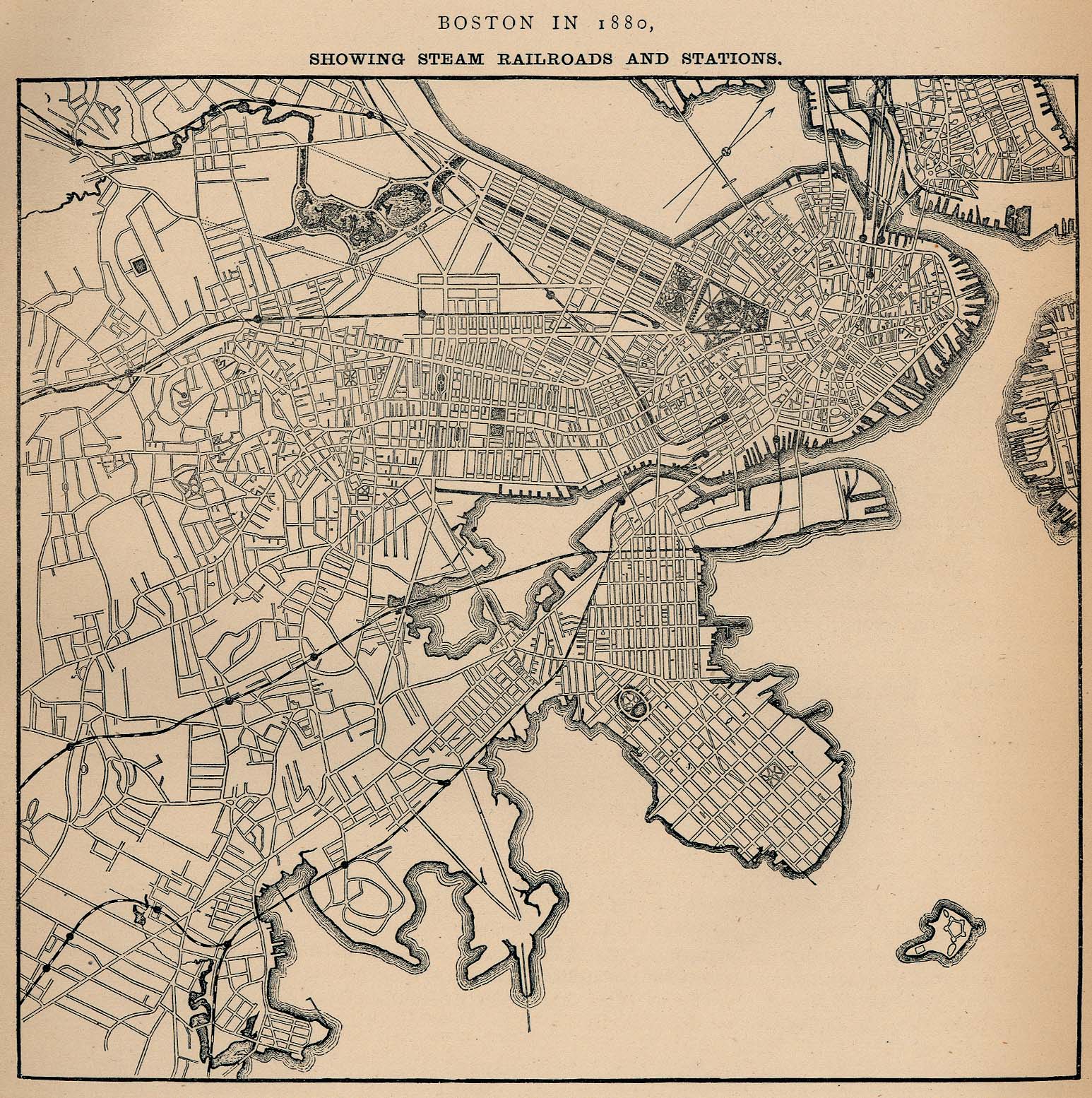
- Boston, Massachusetts 1880 - Steam Railroads and Stations "Boston in 1880. Showing Steam Railroads and Stations." From Report on the Social Statistics of Cities, Compiled by George E. Waring, Jr., United States. Census Office, Part I, 1886. (655K)
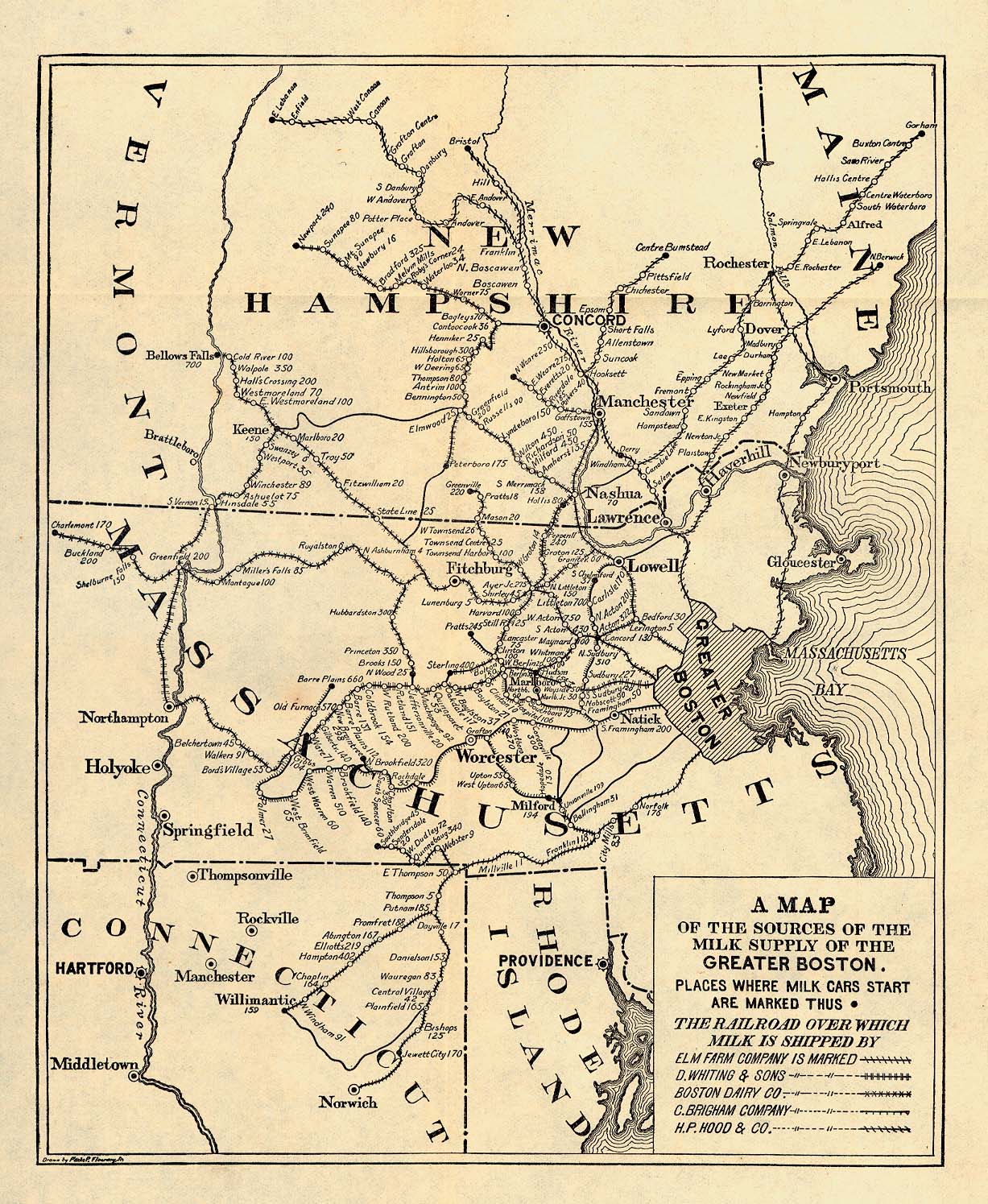
- Boston, Massachusetts 1901 "A Map of the Sources of the Milk Supply of the Greater Boston." From Report of the Industrial Commission on the Distribution of Farm Products. Volume VI of the Commission's Reports. House of Representatives, 1901. (663K)
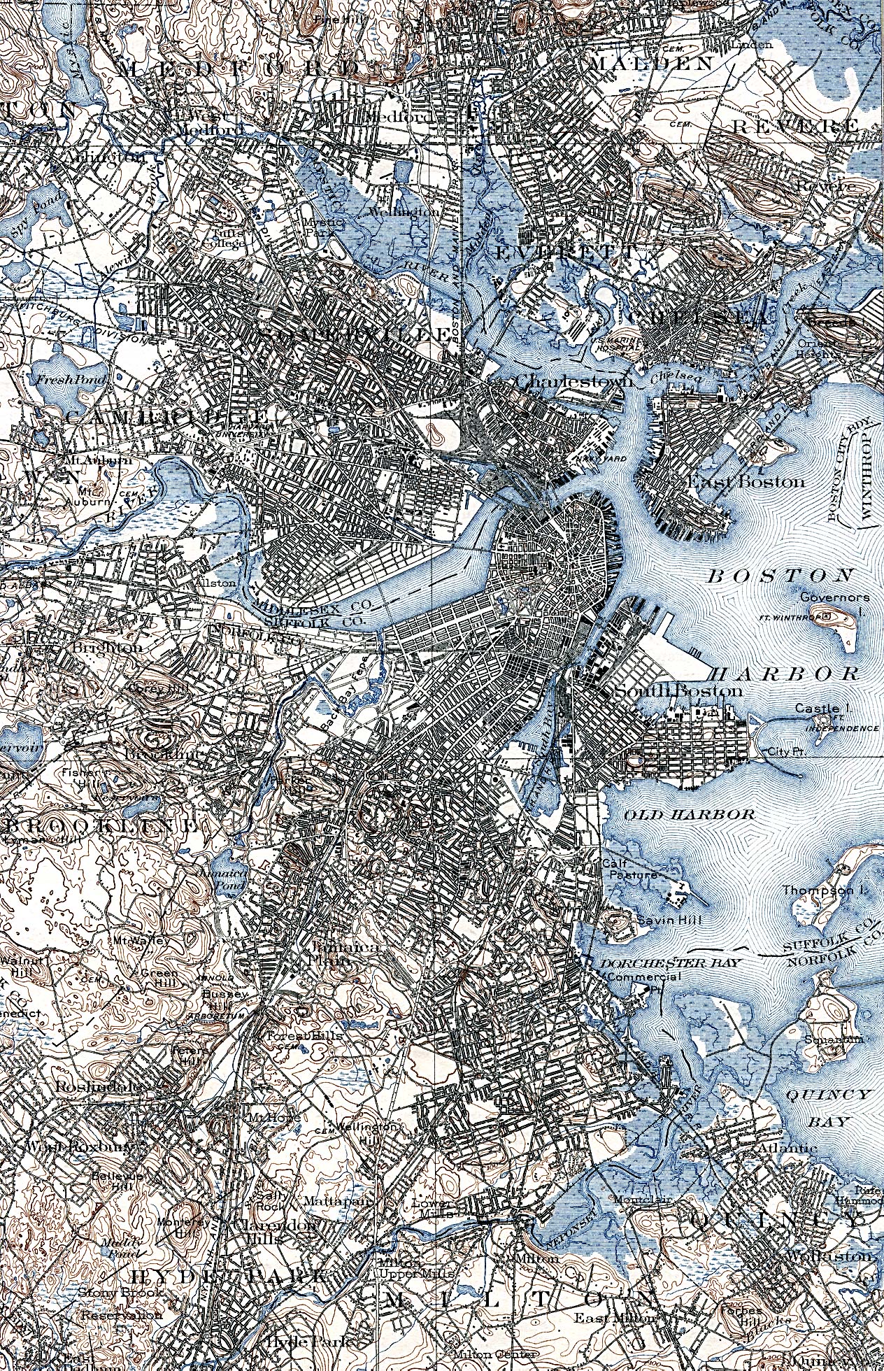
- Boston, Massachusetts 1903 U.S. Geological Survey (1,624K)
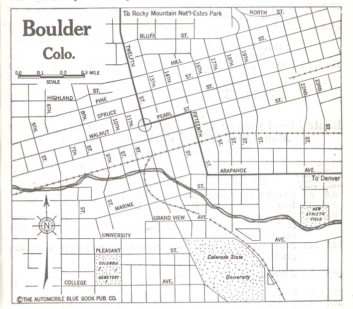
- Boulder, Colorado 1920 Automobile Blue Book, 1920, Vol. 7 (92K)
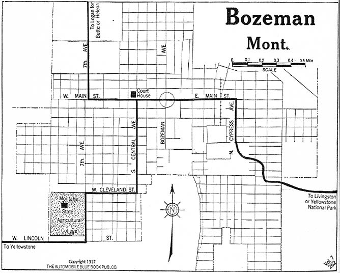
- Bozeman, Montana 1917 Automobile Blue Book, 1917, Vol. 8, Section 2 (153K)
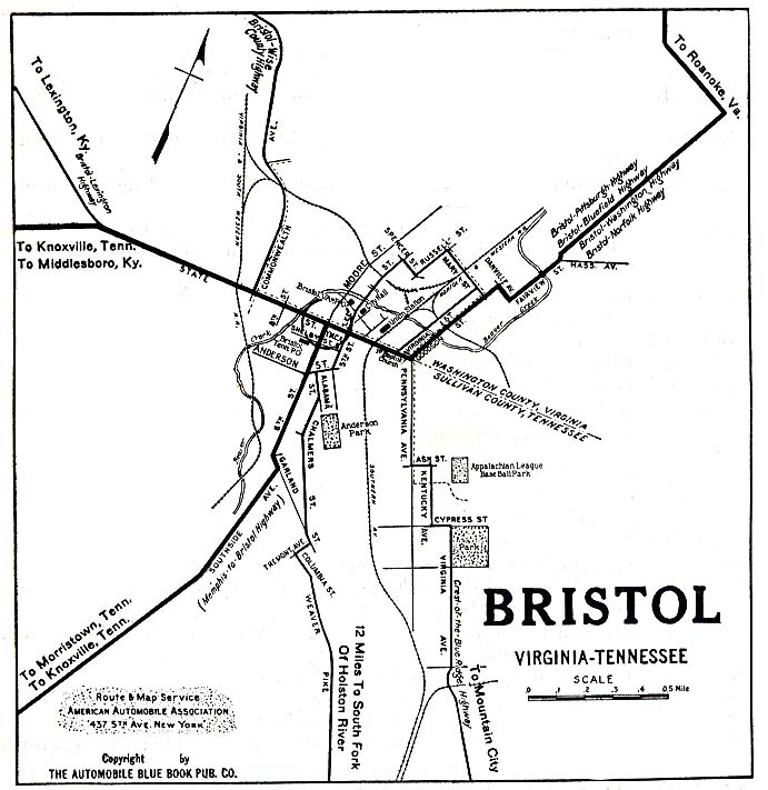
- Bristol, Virginia/Tennessee 1919 Automobile Blue Book, 1919, Vol. 6 (117K)
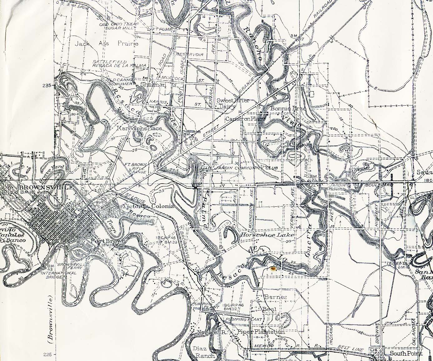
- Brownsville, Texas 1926 Original Scale 1:62,500 Corp of Engineers, U.S. Army, 1926. (374K)
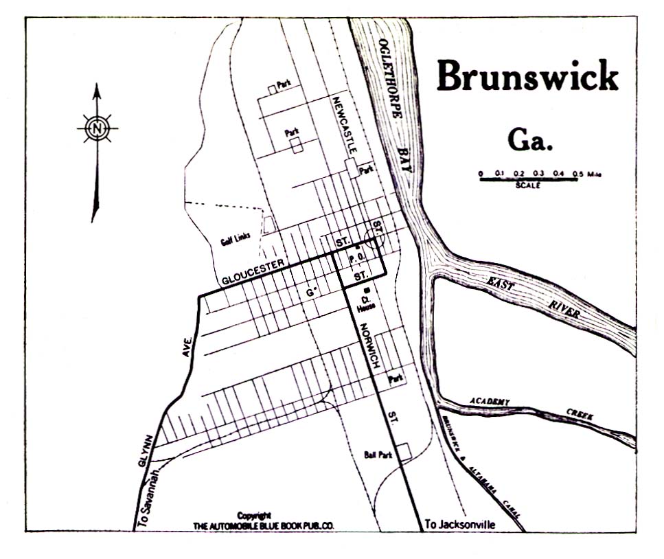
- Brunswick, Georgia 1919 Automobile Blue Book, 1919, Vol. 6 (194K)
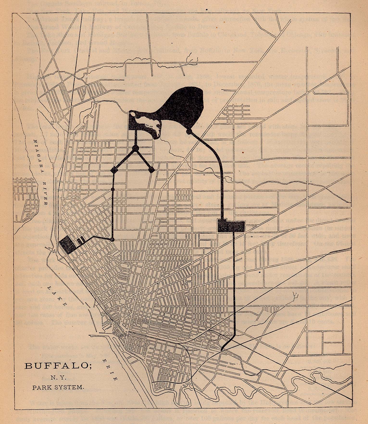
- Buffalo, New York 1880 - Park System From Report on the Social Statistics of Cities, Compiled by George E. Waring, Jr., United States. Census Office, Part I, 1886. (655K)
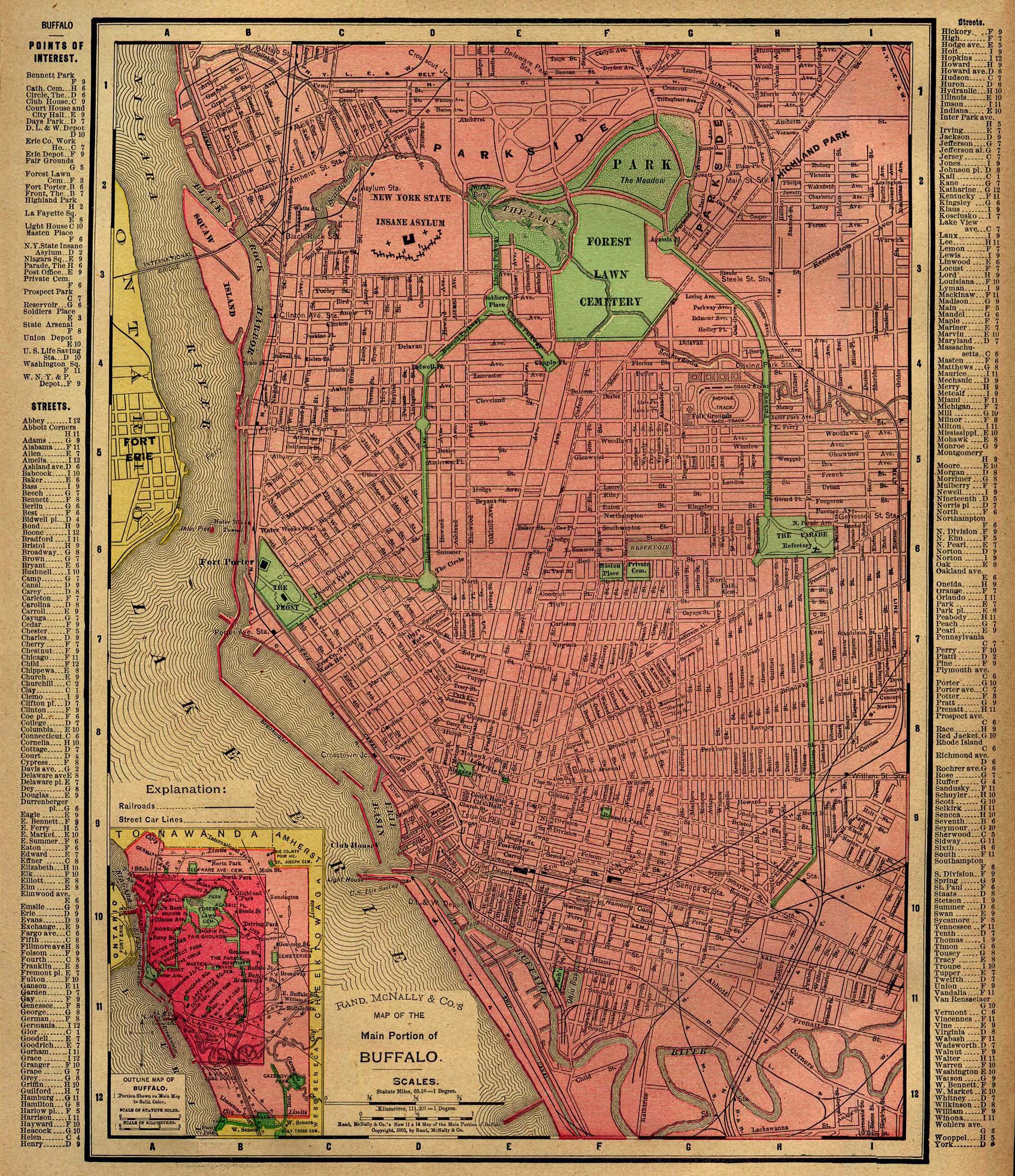
- Buffalo, New York 1896 Rand, McNally & Co.'s Universal Atlas of The World. (1MB)
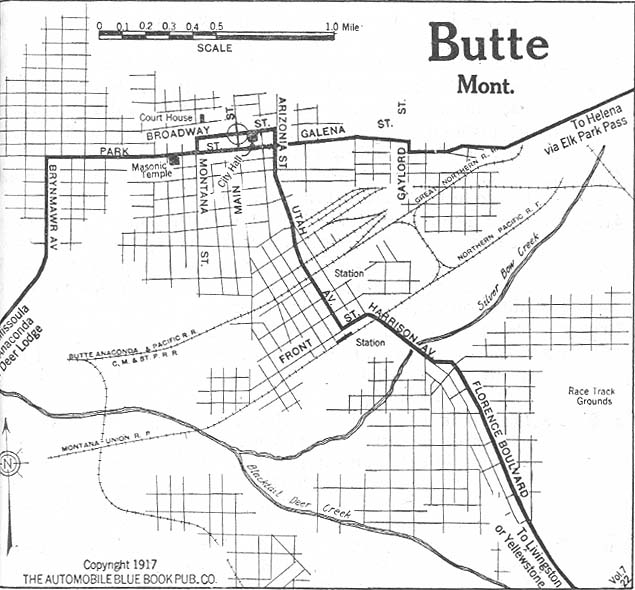
- Butte, Montana 1917 Automobile Blue Book, 1917, Vol. 8, Section 2 (106K)
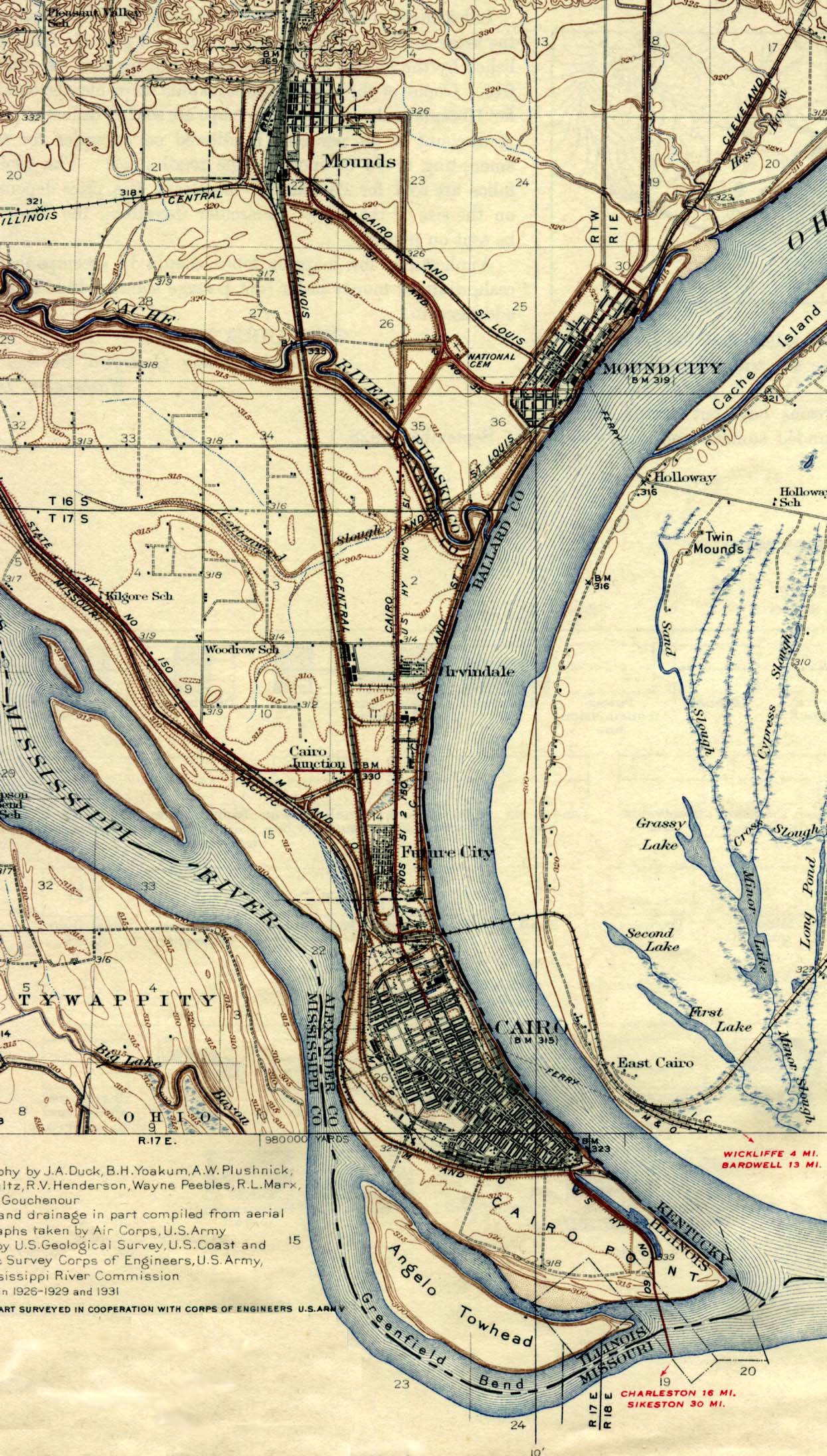
- Cairo, Illinois 1945 U.S. Geological Survey, 1945 (539K)
- [Northern] California Detail Map 1917 Automobile Blue Book, 1917, Vol. 8, Section 2 (497K)
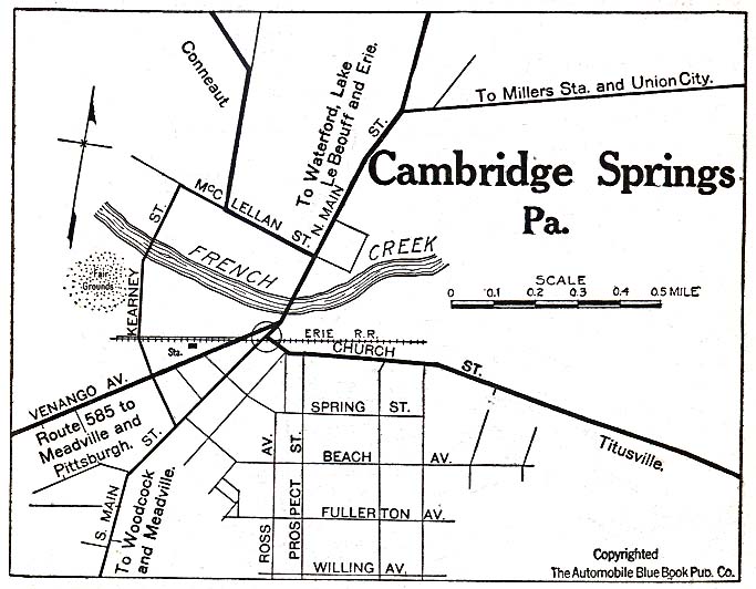
- Cambridge Springs, Pennsylvania 1920 Automobile Blue Book, 1920, Vol. 3 (117K)
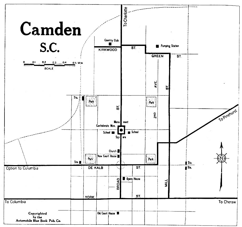
- Camden, South Carolina 1919 Automobile Blue Book, 1919, Vol. 6 (117K)
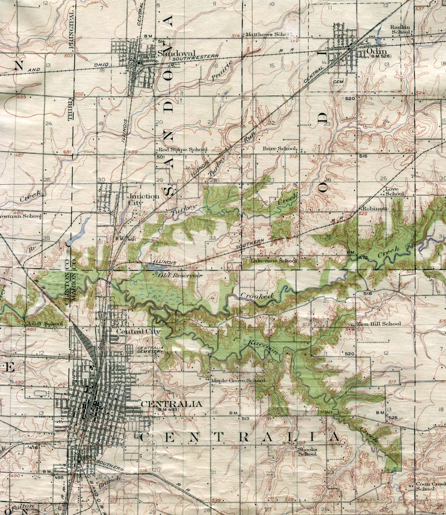
- Centralia, Illinois 1914 U.S. Geological Survey, 1914 (551K)
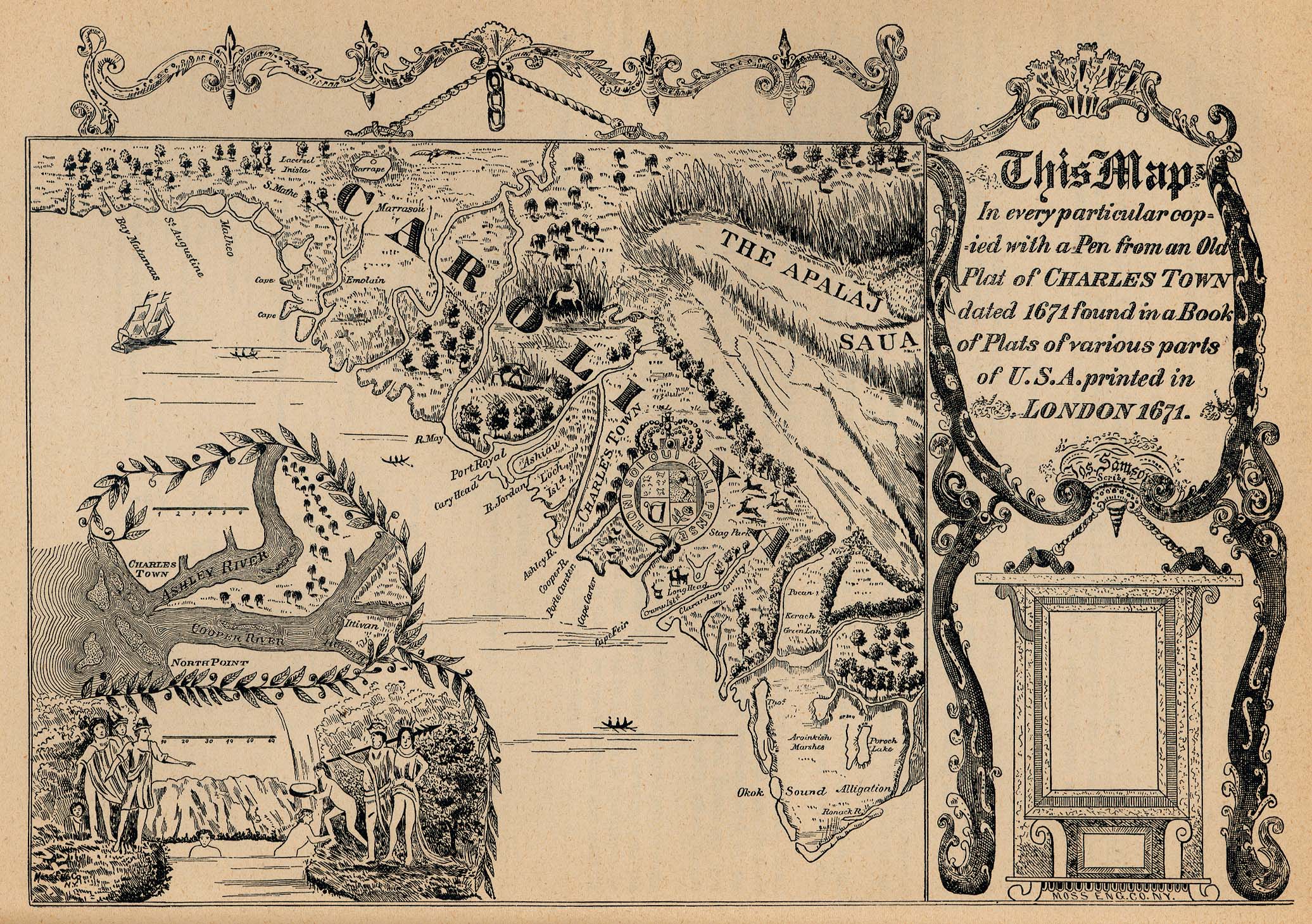
- Charleston, South Carolina 1671 From Report on the Social Statistics of Cities, Compiled by George E. Waring, Jr., United States. Census Office, Part II, 1887. (855K)
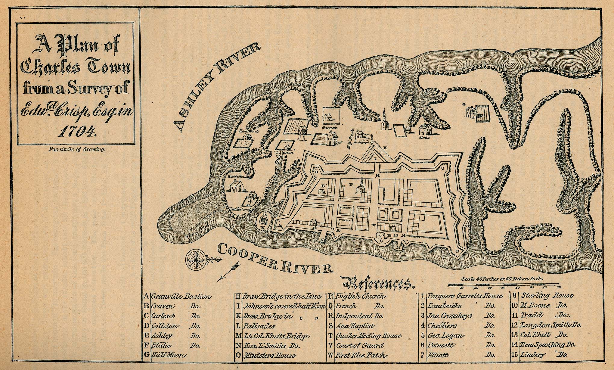
- Charleston, South Carolina 1704 "Plan of Charles Town" From Report on the Social Statistics of Cities, Compiled by George E. Waring, Jr., United States. Census Office, Part II, 1887. (593K)
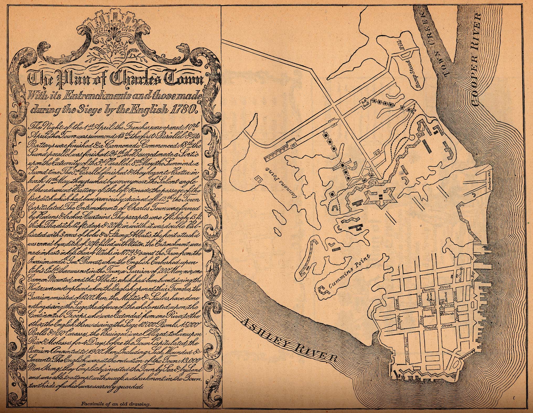
- Charleston, South Carolina 1780 "A Plan of Charles Town with its Entrenchments and those made during the Siege by the English 1780" From Report on the Social Statistics of Cities, Compiled by George E. Waring, Jr., United States. Census Office, Part II, 1887. (983K)
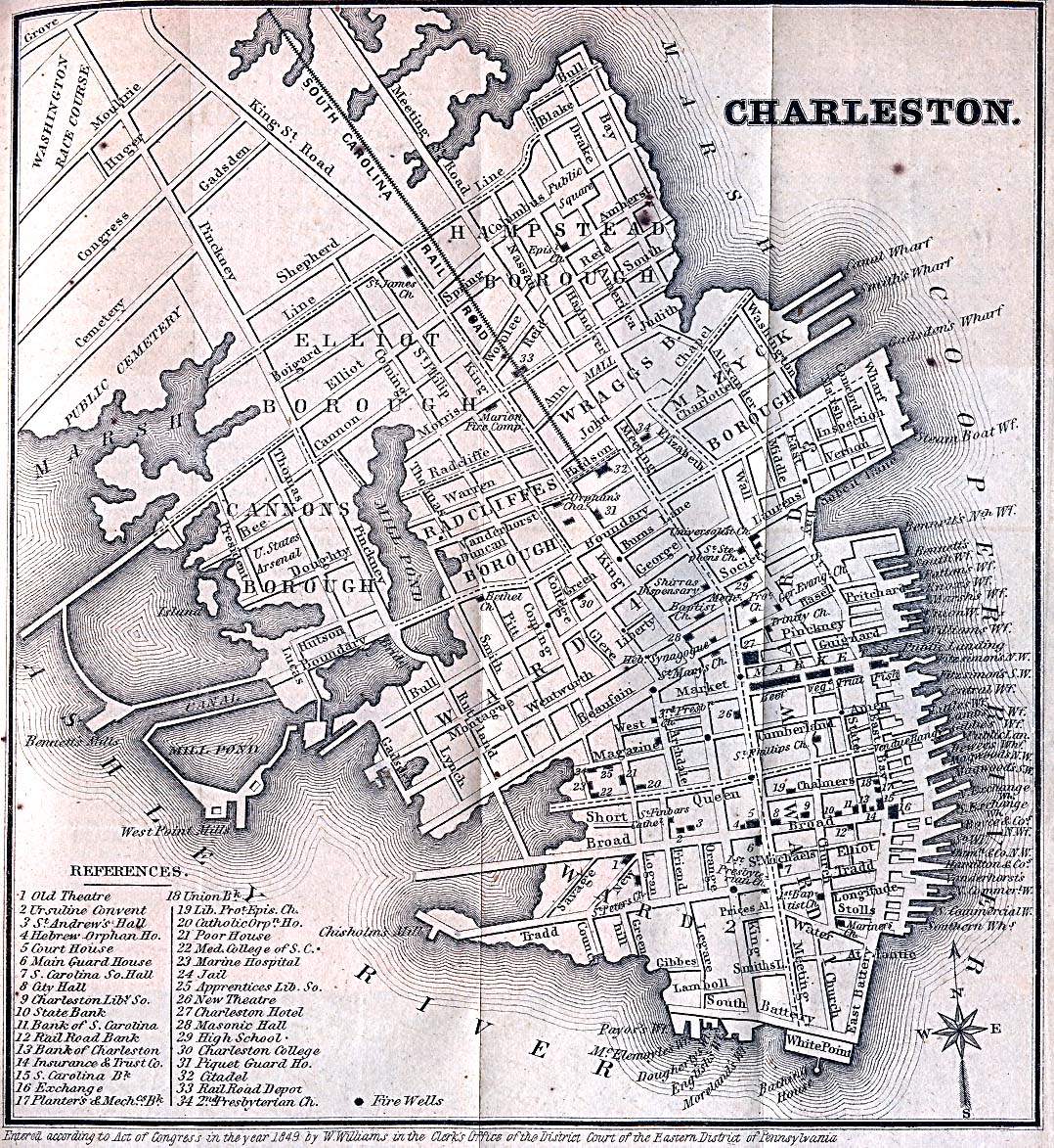
- Charleston, South Carolina 1849 Appletons' Hand-Book of American Travel. New York: D. Appleton and Company. 1869 (629K)
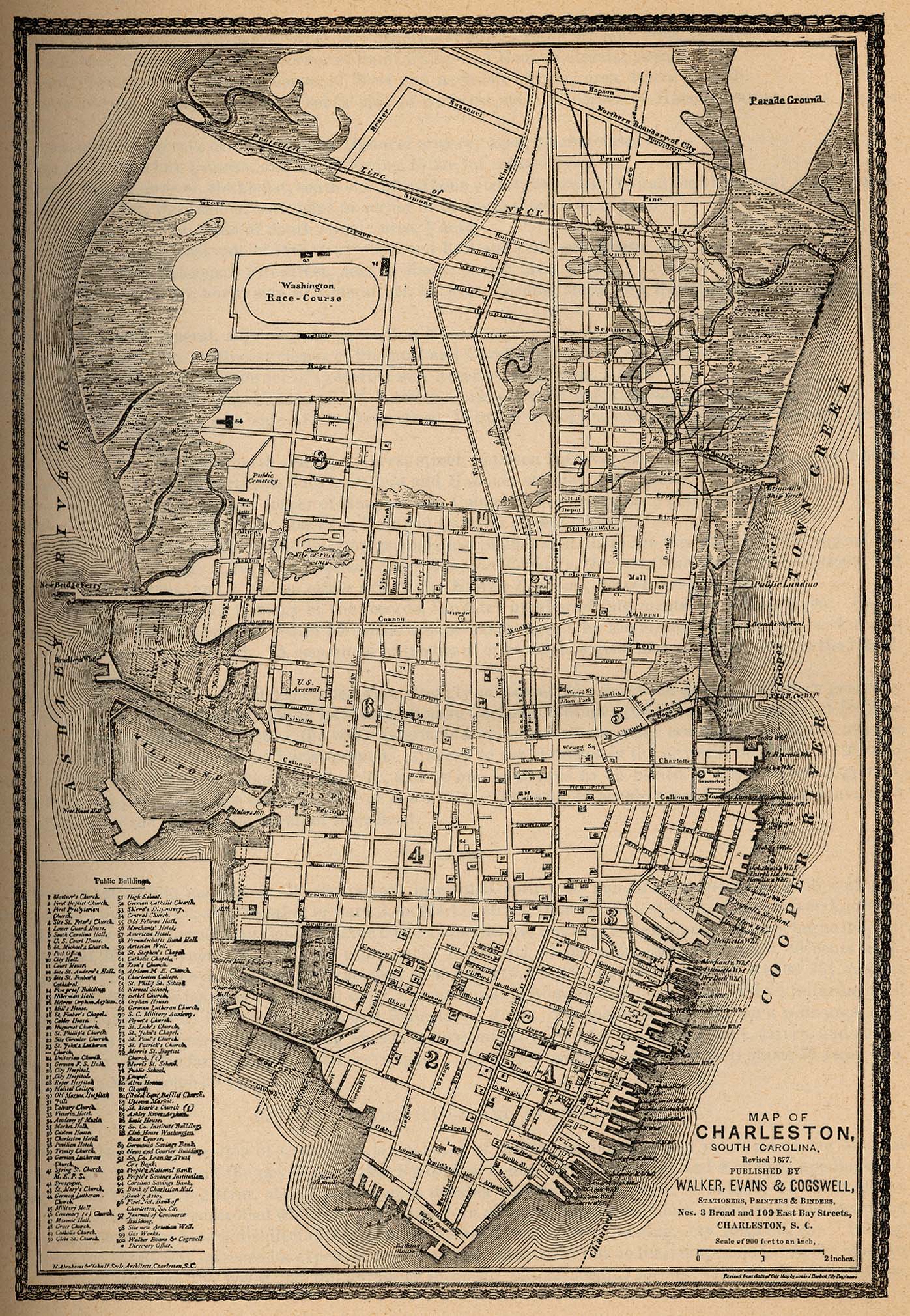
- Charleston, South Carolina 1877 From Report on the Social Statistics of Cities, Compiled by George E. Waring, Jr., United States. Census Office, Part II, 1887. (777K)
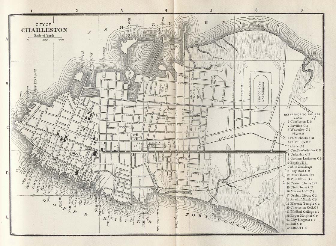
- Charleston, South Carolina 1885 Appletons' General Guide to the United States and Canada. Part II. Western and Southern States. New York: D. Appleton and Company. 1885 (249K)
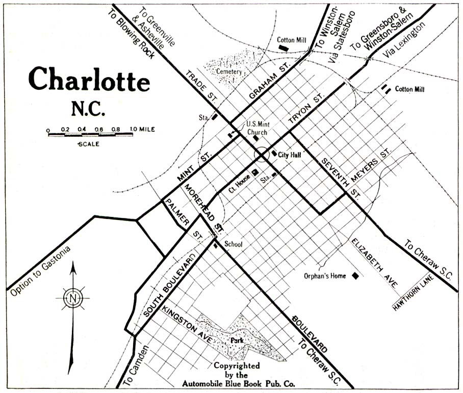
- Charlotte, North Carolina 1919 Automobile Blue Book, 1919, Vol. 6 (258K)
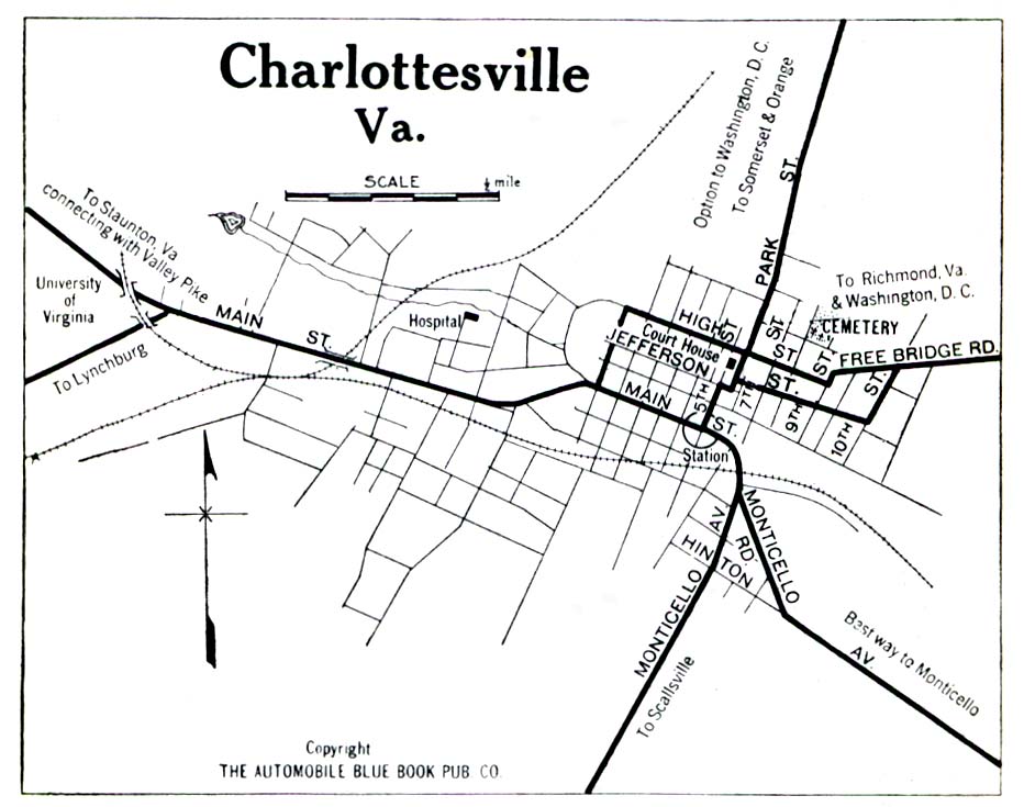
- Charlottesville, Virginia 1919 Automobile Blue Book, 1919, Vol. 6 (194K)
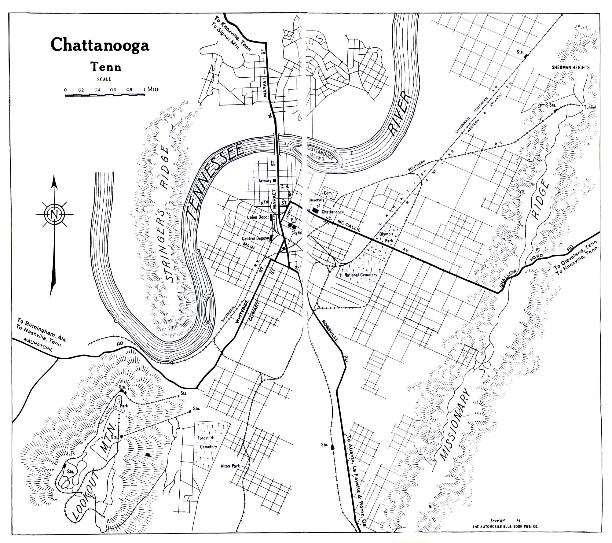
- Chattanooga, Tennessee 1919 Automobile Blue Book, 1919, Vol. 6 (645K)
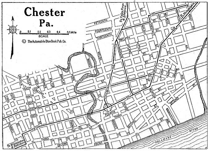
- Chester, Pennsylvania 1920 Automobile Blue Book, 1920, Vol. 3 (176K)
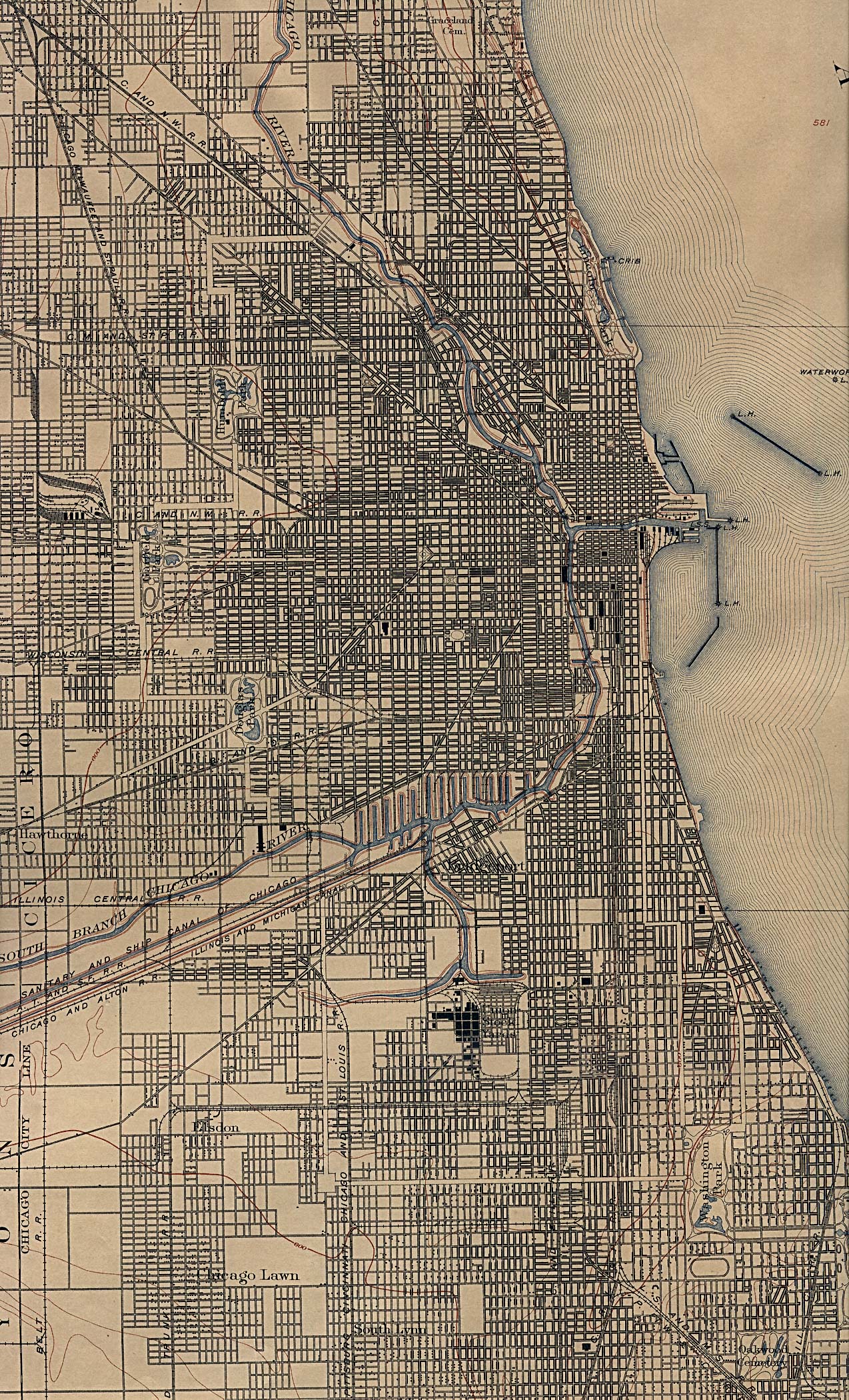
- Chicago, Illinois 1901 U.S. Geological Survey (1,131K)
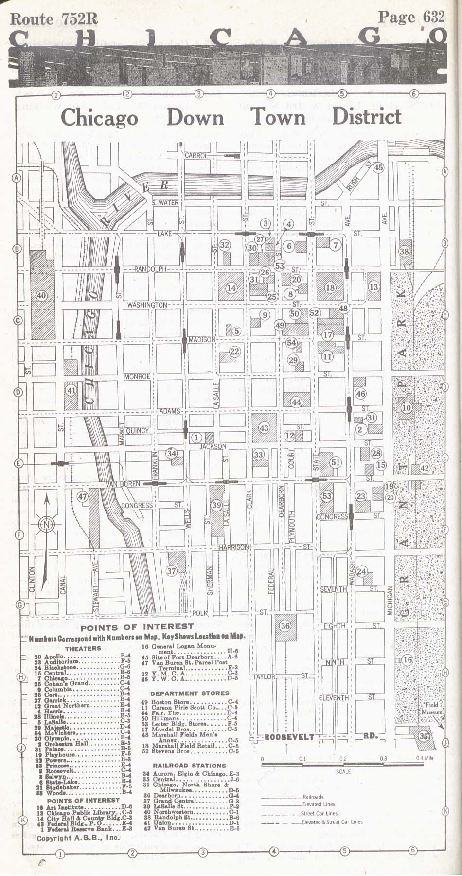
- Chicago, Illinois - Downtown District 1917 Automobile Blue Book, 1917, Vol. 4 (280K)
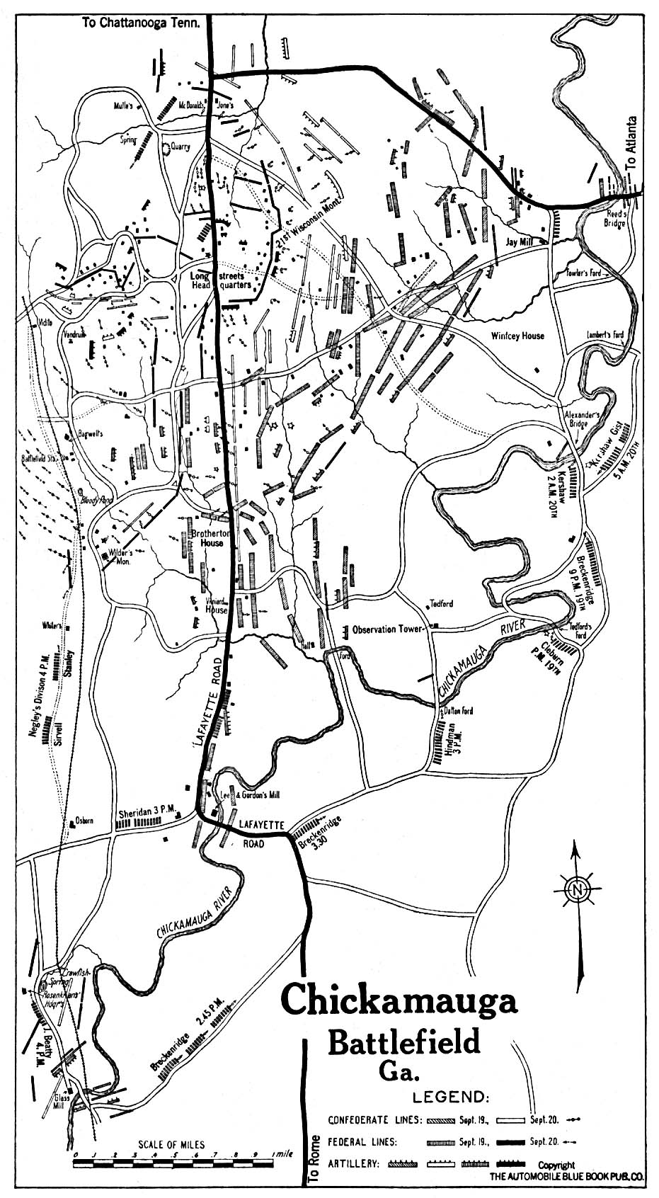
- Chickamauga, Georgia 1919 Automobile Blue Book, 1919, Vol. 6 (387K)
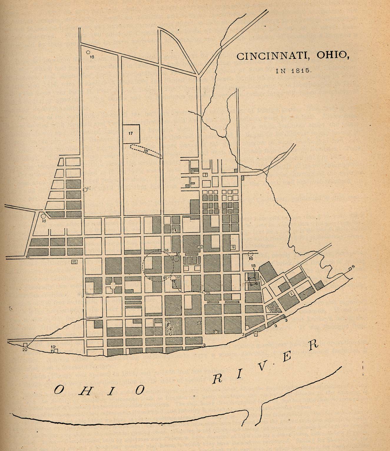
- Cincinnati, Ohio 1815 From Report on the Social Statistics of Cities, Compiled by George E. Waring, Jr., United States. Census Office, Part II, 1887. (286K)
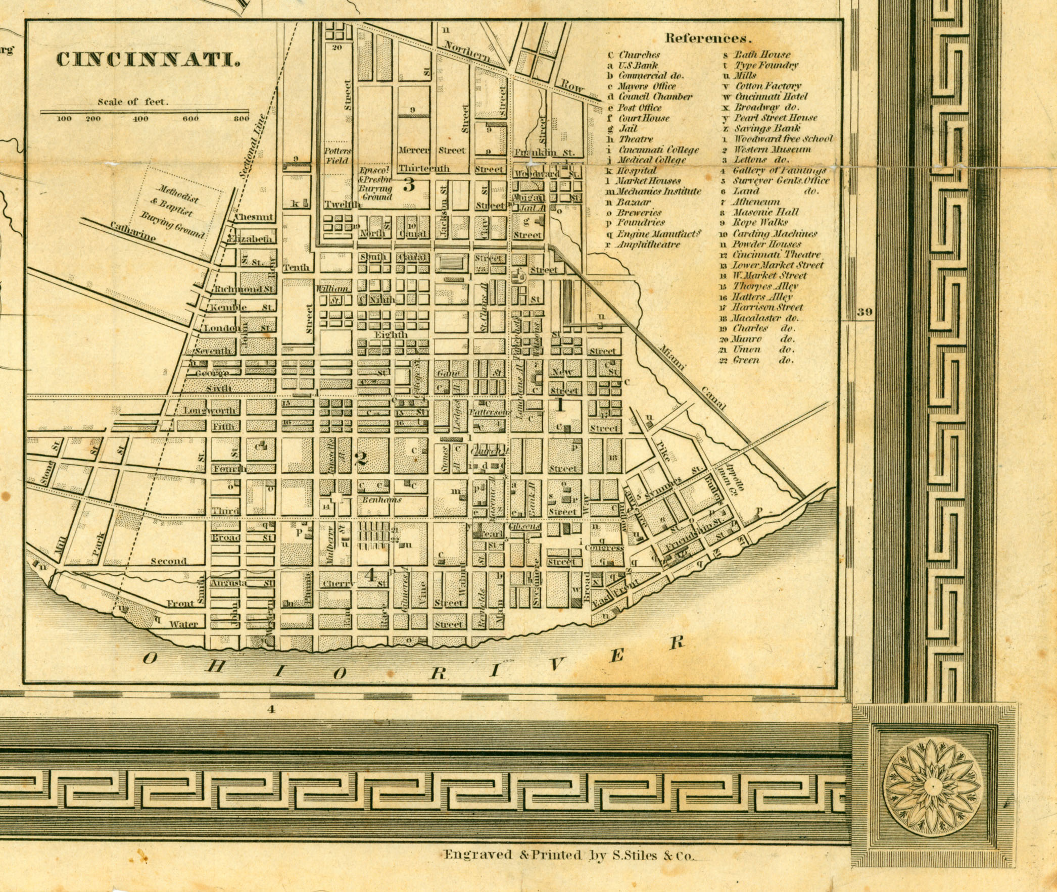
- Cincinnati, Ohio 1846 Inset map from Colton's Map of Ohio, 1846 by David H. Burr. Hartford: J. H. Mather & Co., 1846. Map courtesy Dorothy Sloan-Rare Books, Austin, Texas (1MB)
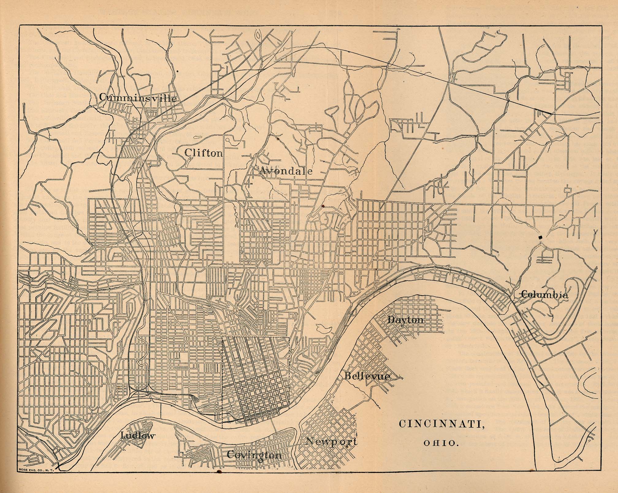
- Cincinnati, Ohio 1880 From Report on the Social Statistics of Cities, Compiled by George E. Waring, Jr., United States. Census Office, Part II, 1887. (642K) and PDF Format (645K)
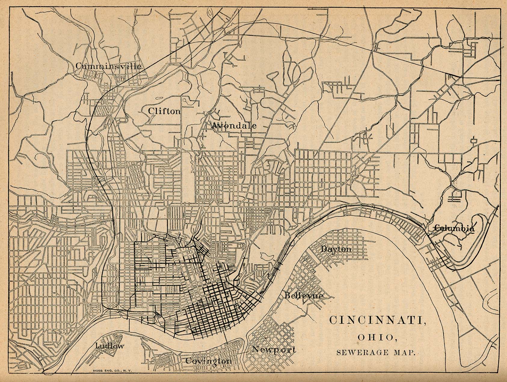
- Cincinnati, Ohio 1880 - Sewerage System From Report on the Social Statistics of Cities, Compiled by George E. Waring, Jr., United States. Census Office, Part II, 1887. (286K)
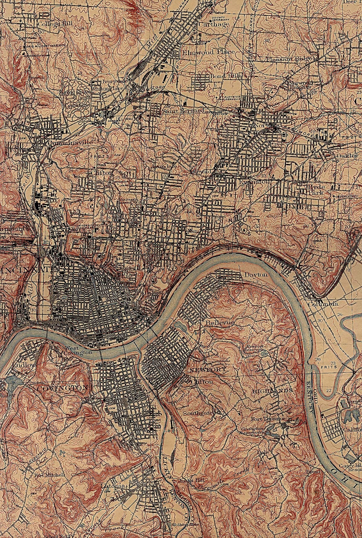
- Cincinnati, Ohio 1914 U.S. Geological Survey (1,454K)
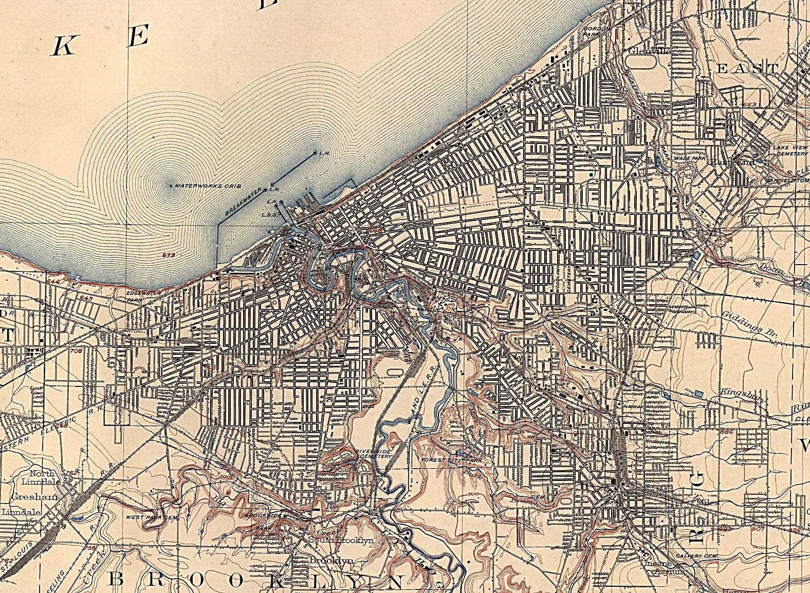
- Cleveland, Ohio 1904 U.S. Geological Survey (893K)
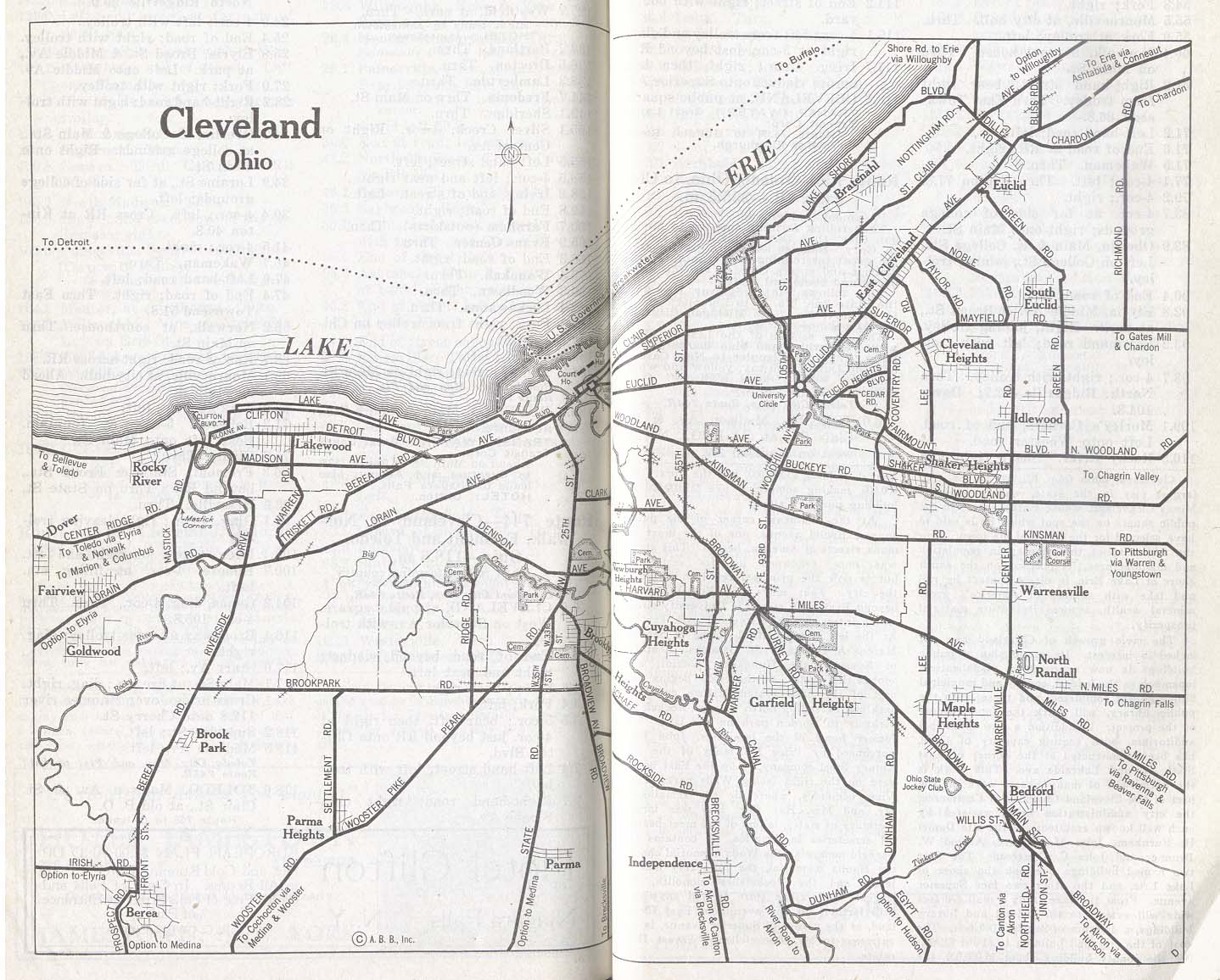
- Cleveland, Ohio 1917 Automobile Blue Book, 1917, Vol. 4 (267K)
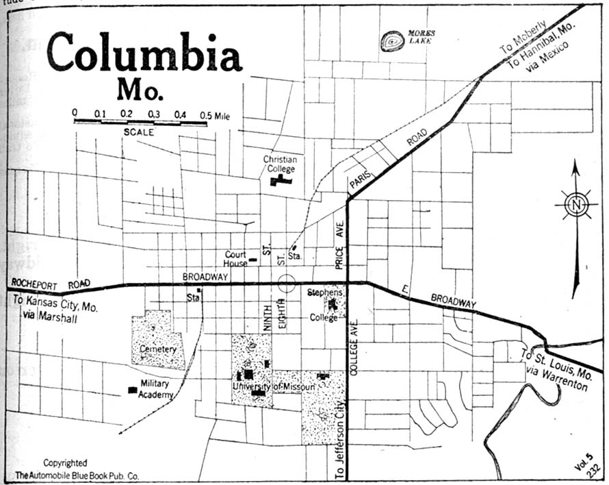
- Columbia, Missouri 1920 Automobile Blue Book, 1920, Vol. 5 (123K)
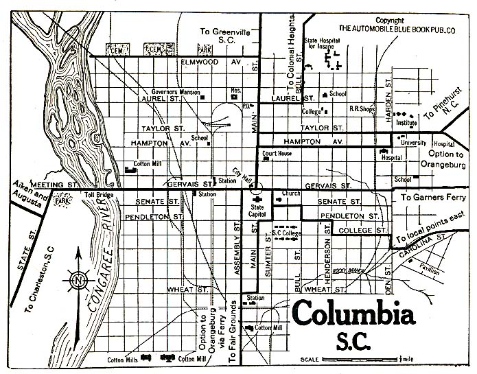
- Columbia, South Carolina 1920 Automobile Blue Book, 1920, Vol. 6 (156K)
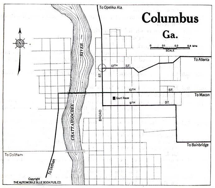
- Columbus, Georgia 1919 Automobile Blue Book, 1919, Vol. 6 (71K)
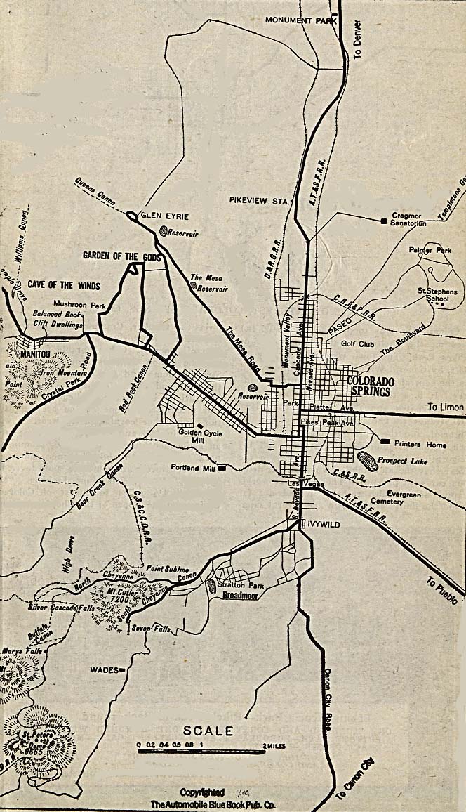
- Colorado Springs, Colorado 1920 Automobile Blue Book, 1920, Vol. 7 (221K)
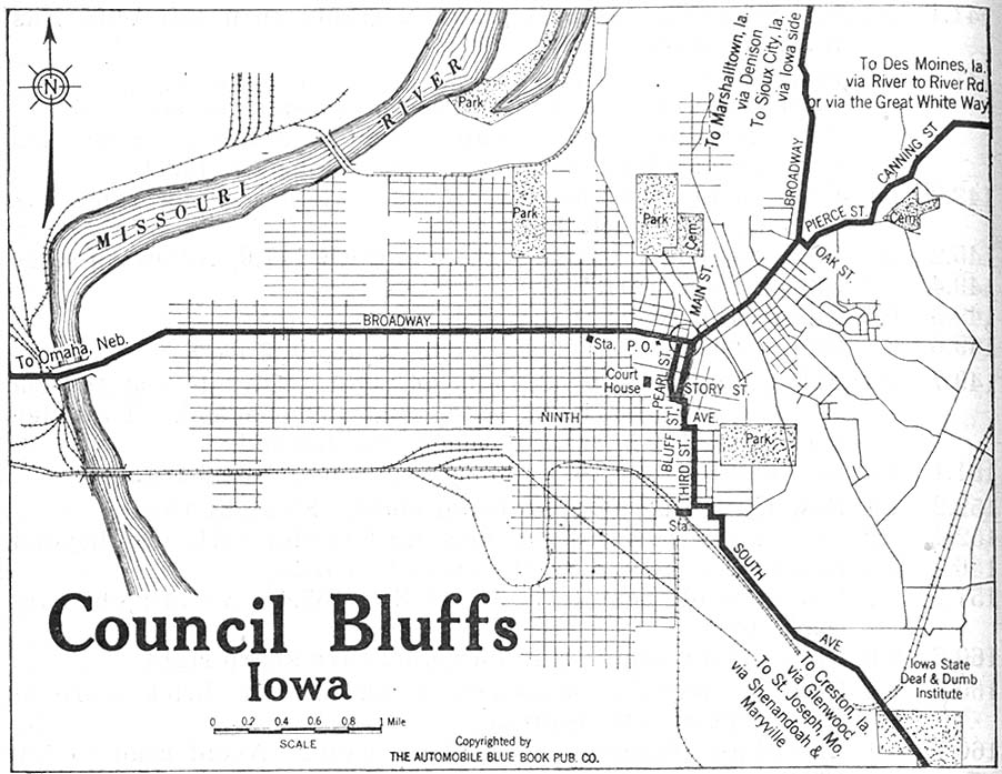
- Council Bluffs, Iowa 1920 Automobile Blue Book, 1920, Vol. 5 (163K)
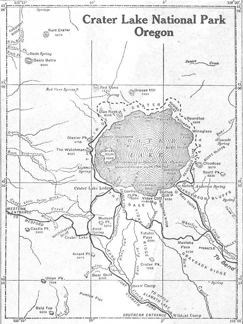
- Crater Lake National Park, Oregon 1917Automobile Blue Book, 1917, Vol. 8, Section 2 (240K)
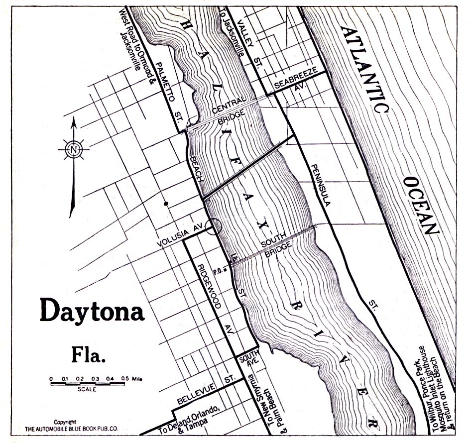
- Daytona, Florida 1919 Automobile Blue Book, 1919, Vol. 6 (323K)
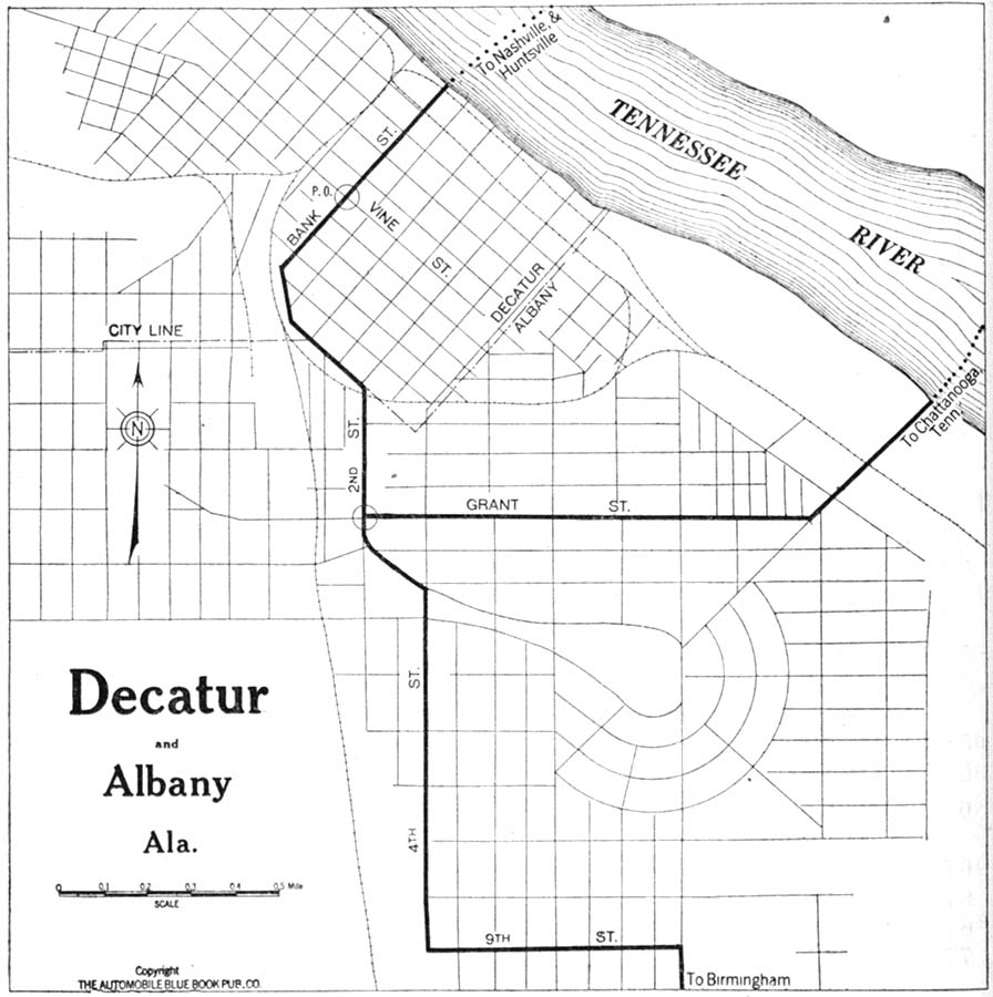
- Decatur, Alabama 1919 Automobile Blue Book, 1919, Vol. 6 (142K)
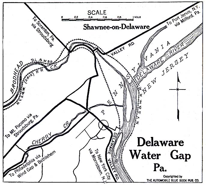
- Delaware Water Gap, Pennsylvania 1920 Automobile Blue Book, 1920, Vol. 3 (137K)
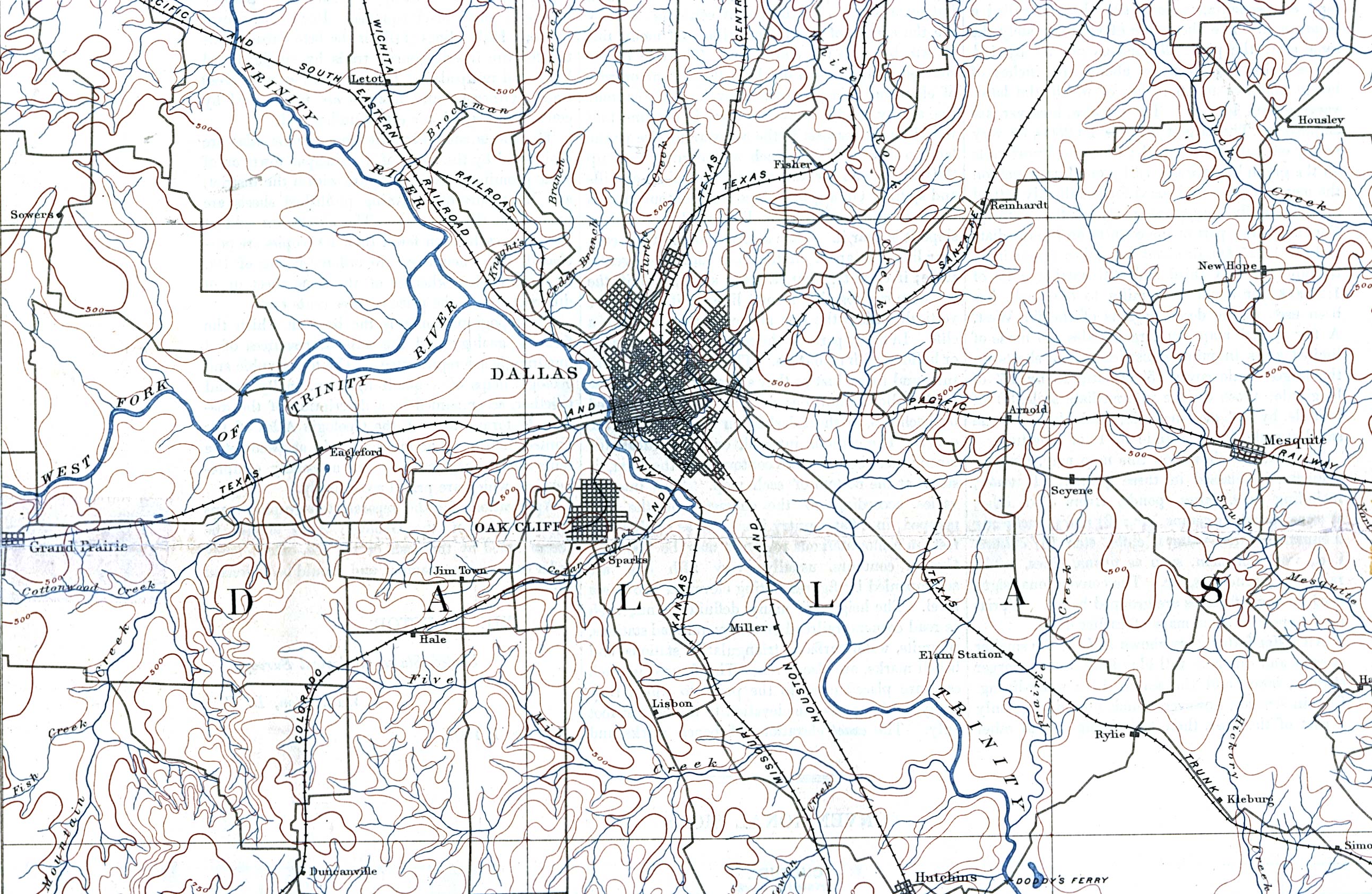
- Dallas, Texas 1893 Original Scale 1:125,000. U.S. Geological Survey. Reprint, 1909 (975K)
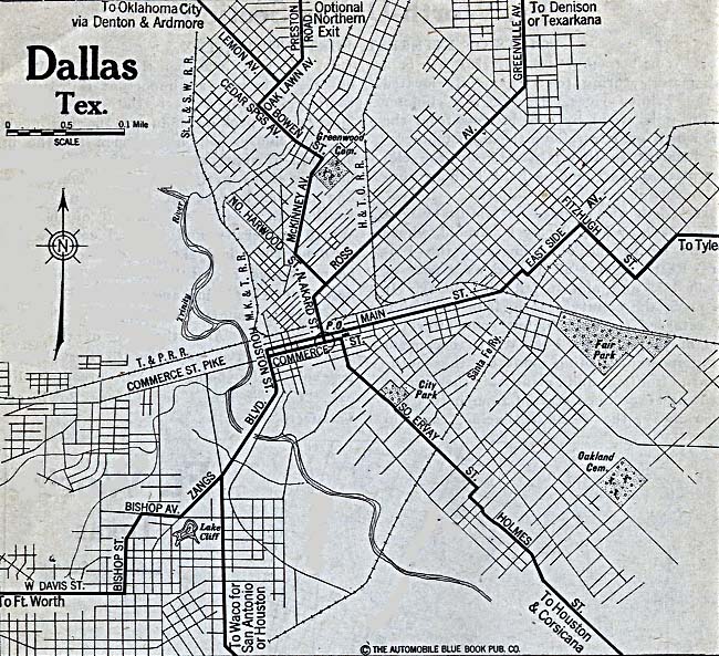
- Dallas, Texas 1920 Automobile Blue Book, 1920, Vol. 7 (187K)
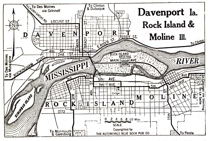
- Davenport, Iowa 1919 [with Rock Island and Moline, Illinois] Automobile Blue Book (137K)
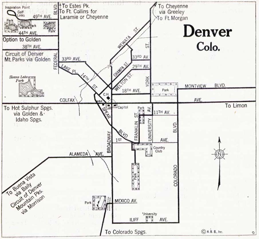
- Denver, Colorado 1917 Automobile Blue Book, 1917, Vol. 8 (90K)
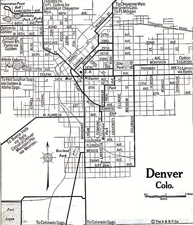
- Denver, Colorado 1920 Automobile Blue Book, 1920, Vol. 7 (179K)
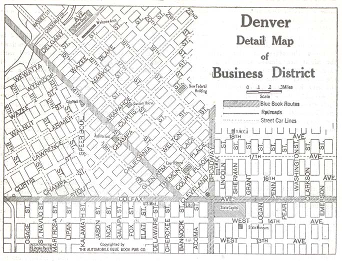
- Denver, Colorado - Business District 1920 Automobile Blue Book, 1920, Vol. 7 (90K)
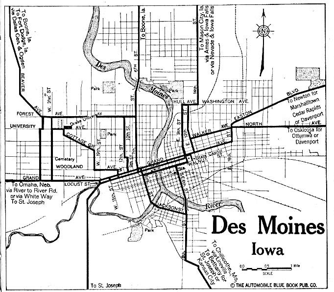
- Des Moines, Iowa 1919 Automobile Blue Book (156K)
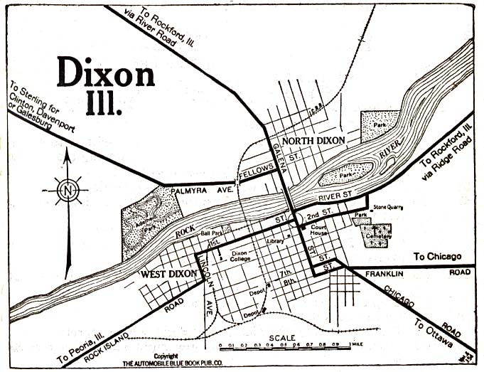
- Dixon, Illinois 1919 Automobile Blue Book (117K)
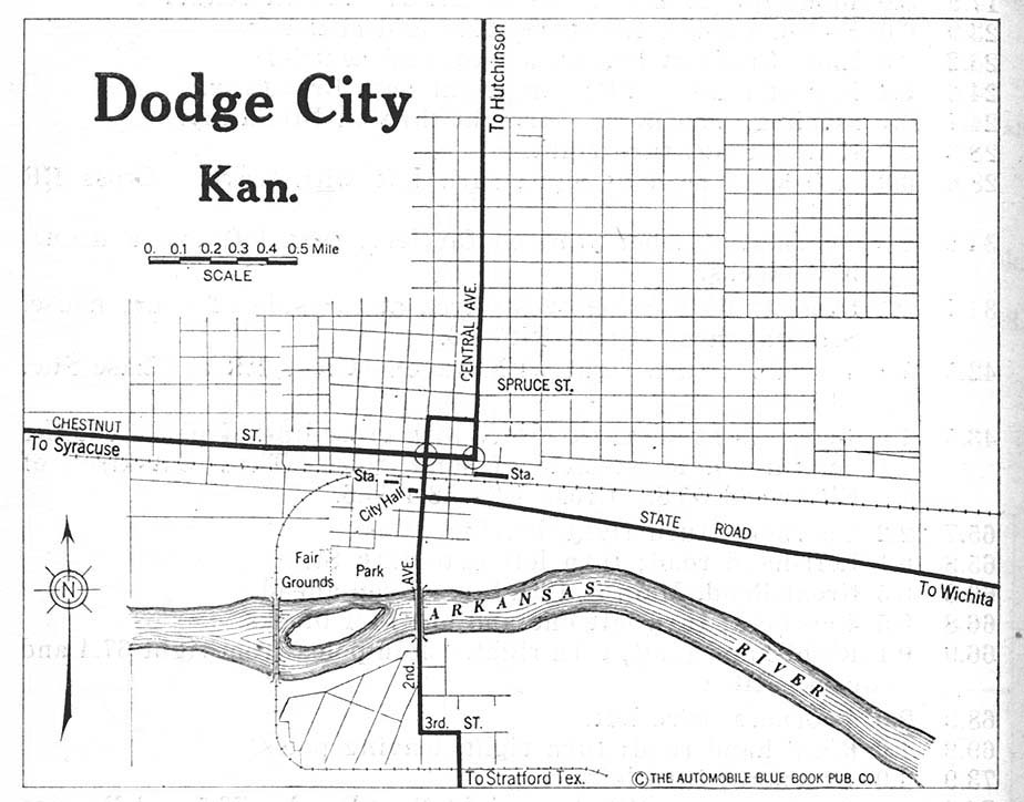
- Dodge City, Kansas 1920 Automobile Blue Book, 1920, Vol. 7 (119K)
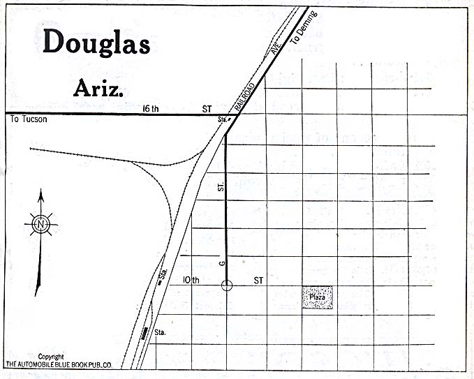
- Douglas, Arizona 1920 Automobile Blue Book, 1920, Vol. 8 (78K)
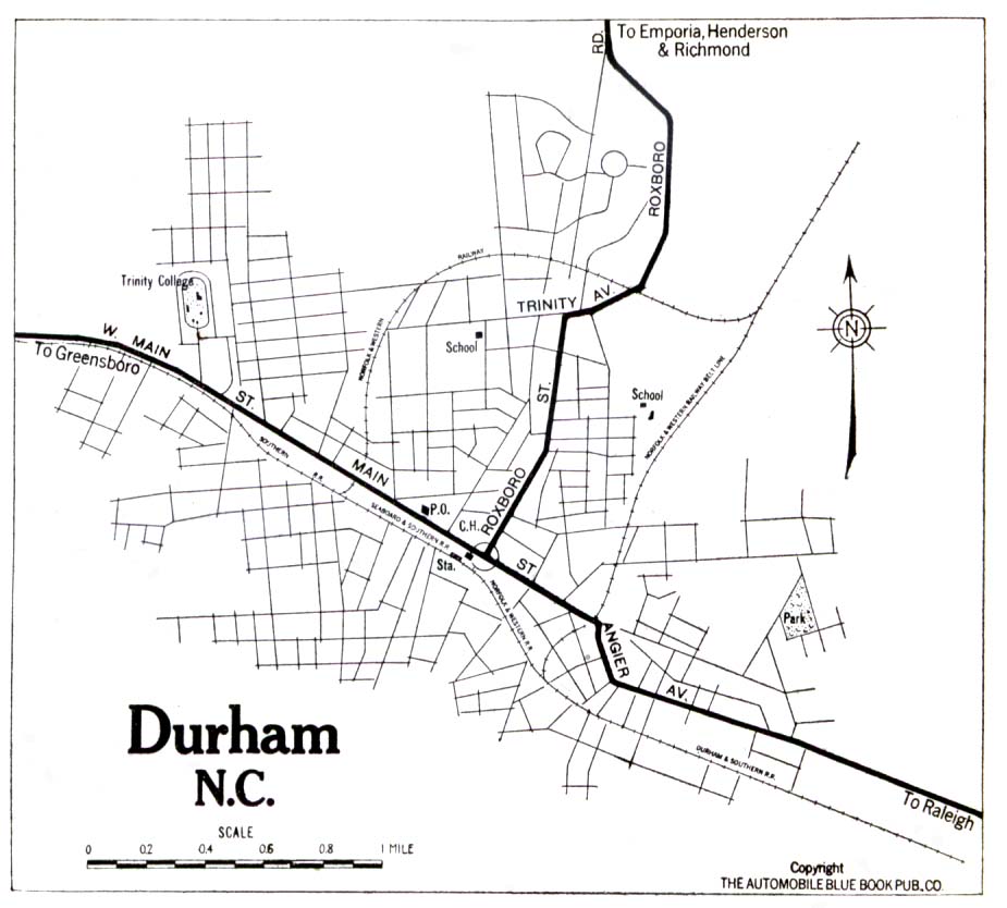
- Durham, North Carolina 1919 Automobile Blue Book, 1919, Vol. 6 (194K)
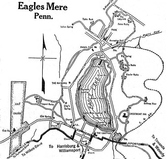
- Eagles Mere, Pennsylvania 1920 Automobile Blue Book, 1920, Vol. 3 (137K)
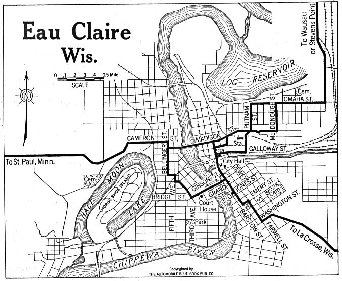
- Eau Claire, Wisconsin 1919 Automobile Blue Book (137K)
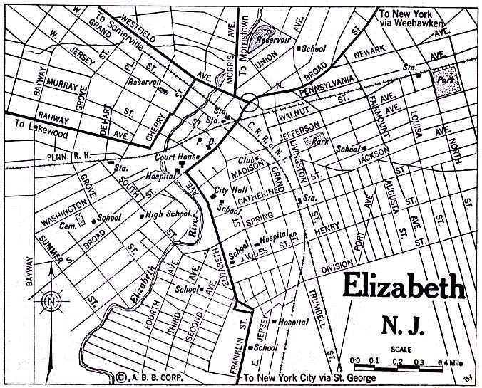
- Elizabeth, New Jersey 1920 Automobile Blue Book, 1920, Vol. 3 (176K)
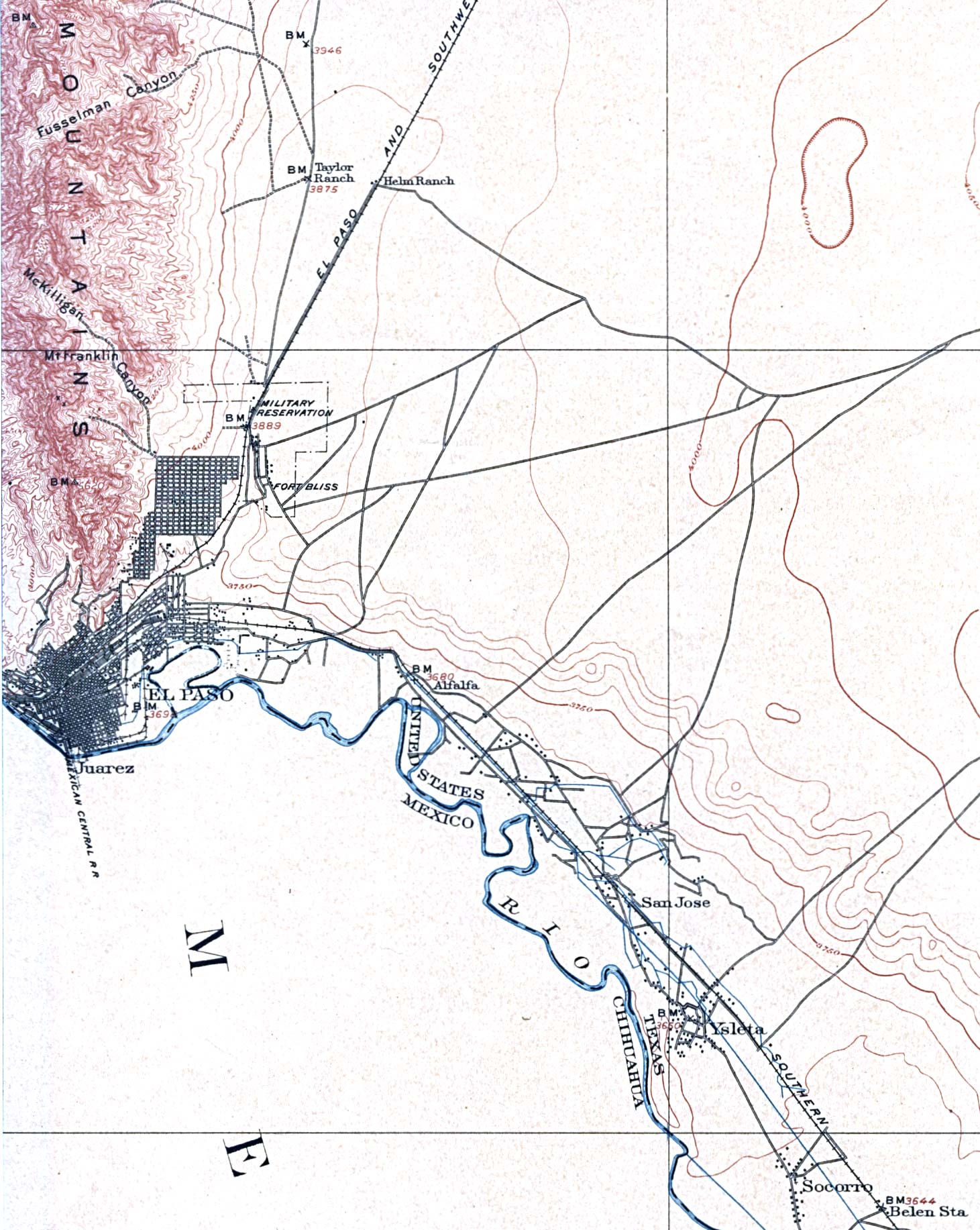
- El Paso, Texas 1908 Original Scale 1:125,000. U.S. Geological Survey (449K)
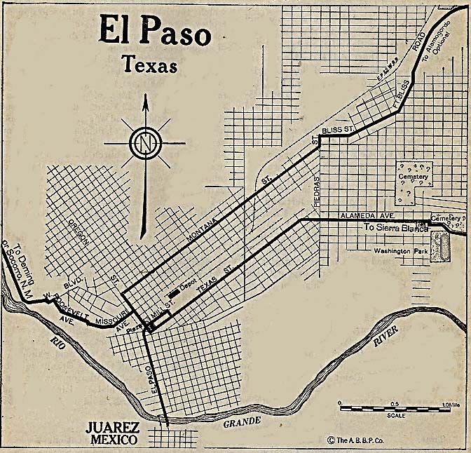
- El Paso, Texas 1920 Automobile Blue Book, 1920, Vol. 7 (187K)
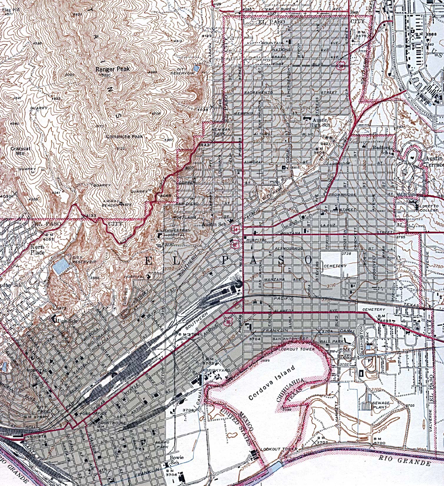
- El Paso, Texas 1943 Original Scale 1:31,680. U.S. Geological Survey (975K)
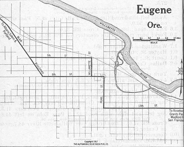
- Eugene, Oregon 1917 Automobile Blue Book, 1917, Vol. 8, Section 2 (91K)
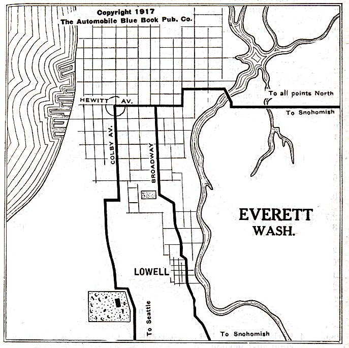
- Everett, Washington 1917 Automobile Blue Book, 1917, Vol. 8, Section 2 (137K)
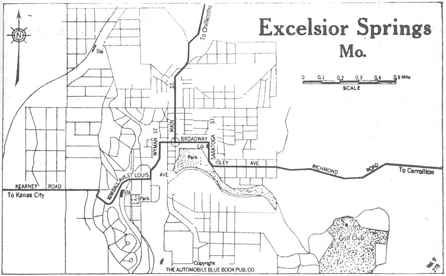
- Excelsior Springs, Missouri 1920 Automobile Blue Book, 1920, Vol. 5 (99K)
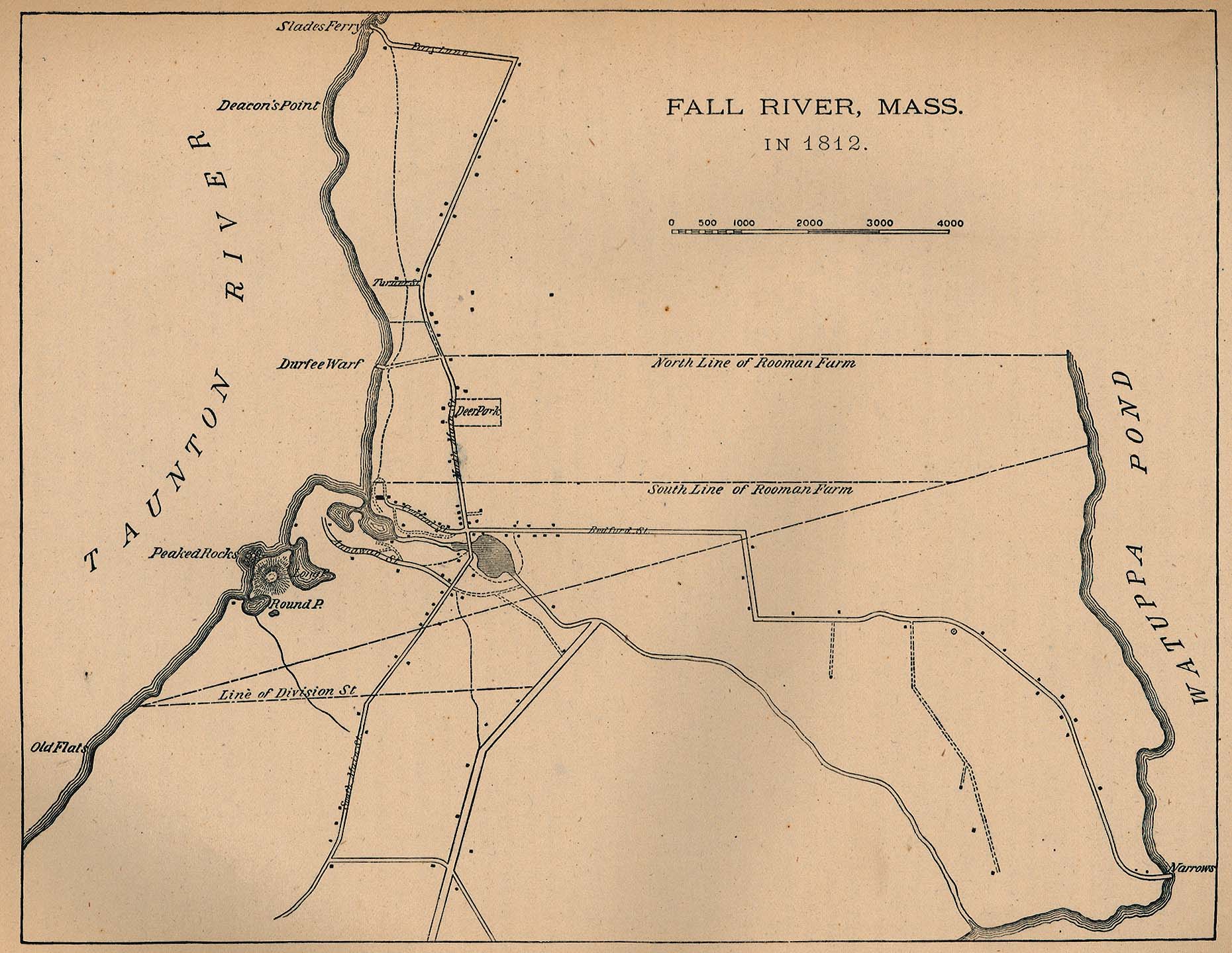
- Fall River, Massachusetts 1812 From Report on the Social Statistics of Cities, Compiled by George E. Waring, Jr., United States. Census Office, Part II, 1887. (323K)
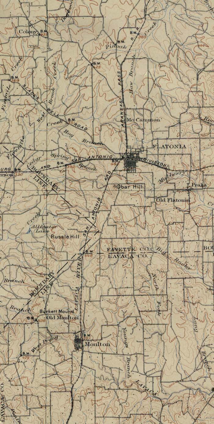
- Flatonia, Texas 1901 Original Scale 1:125,000 U.S. Geological Survey 1901. (205K)
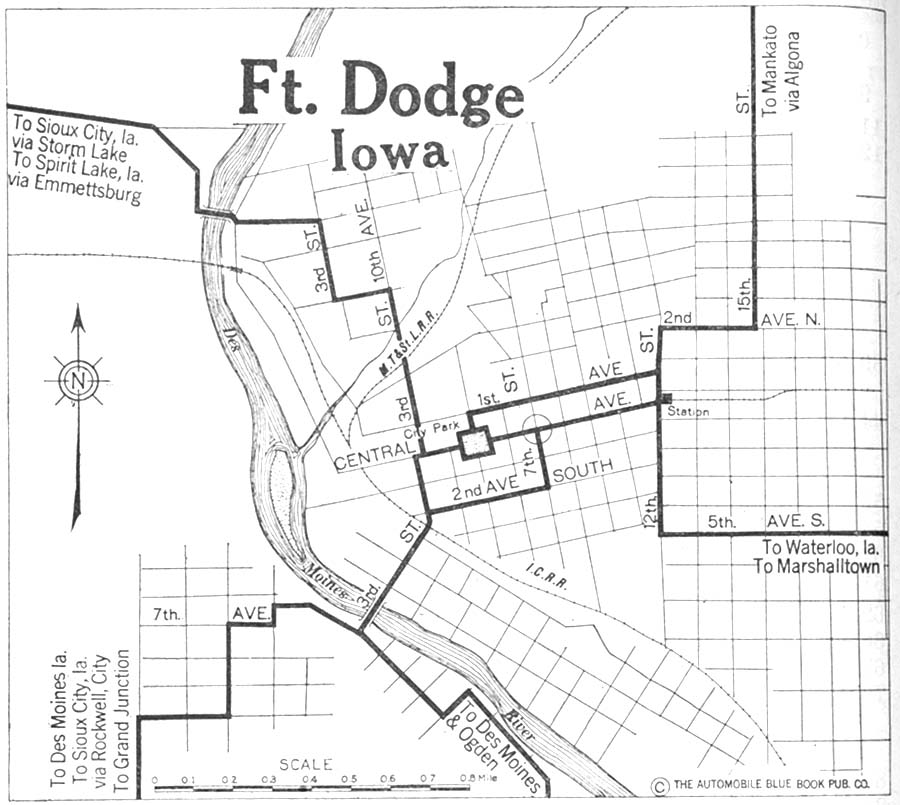
- Fort Dodge, Iowa 1920 Automobile Blue Book, 1920, Vol. 5 (132K)
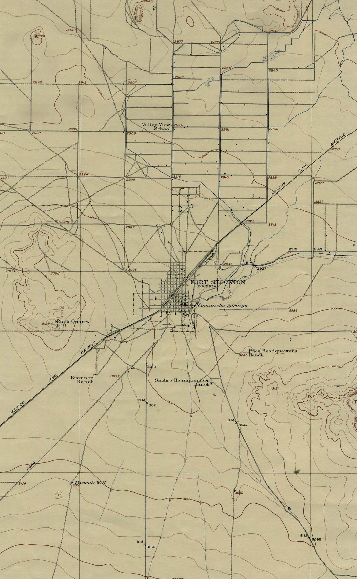
- Fort Stockton, Texas 1945 Original Scale 1:125,000 U.S. Geological Survey 1945. (205K)
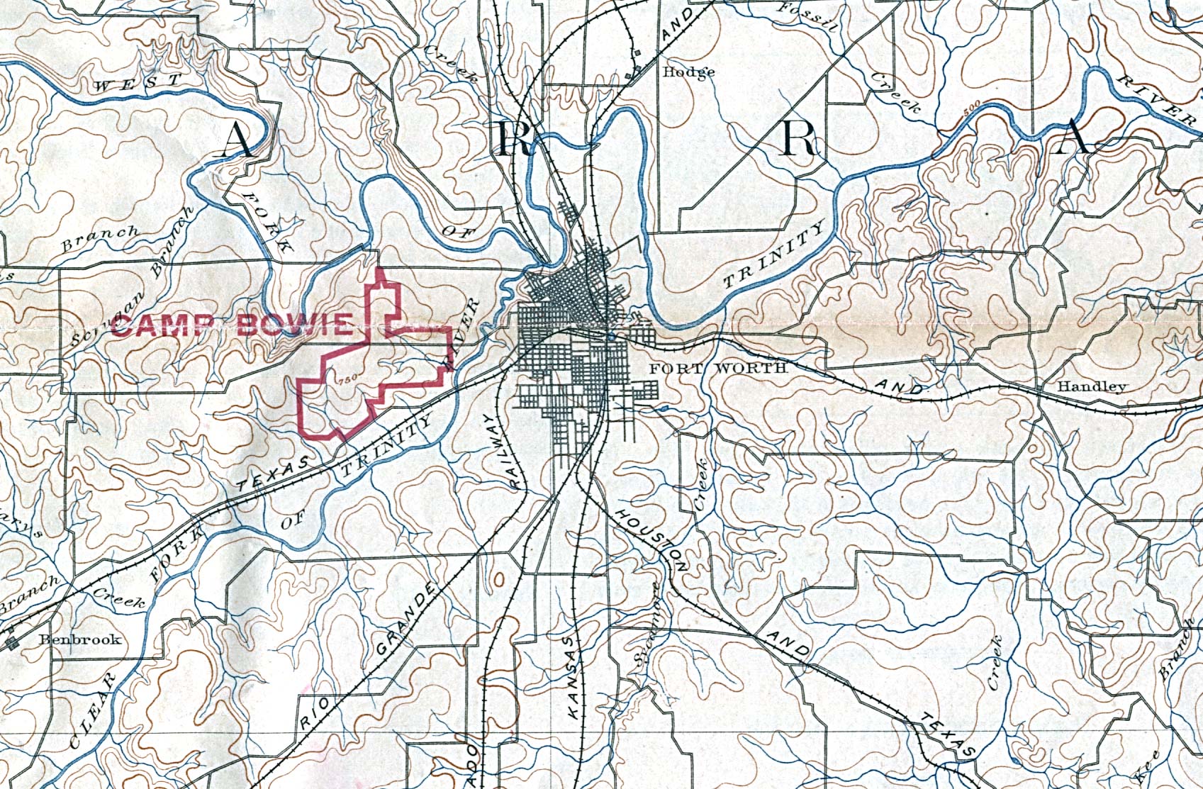
- Fort Worth, Texas 1894 Original Scale 1 : 125,000. U.S. Geological Survey. Reprint, 1918 (546K)
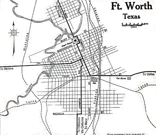
- Fort Worth, Texas 1920 Automobile Blue Book, 1920, Vol. 7 (137K)
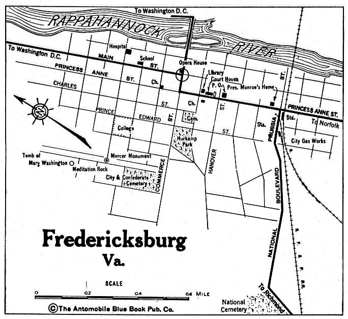
- Fredericksburg, Virginia 1920 Automobile Blue Book, 1920, Vol. 3 (137K)
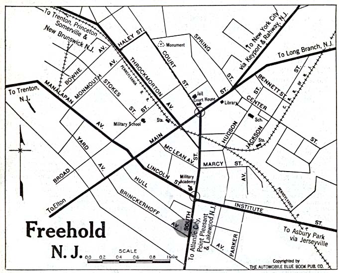
- Freehold, New Jersey 1920 Automobile Blue Book, 1920, Vol. 3 (117K)
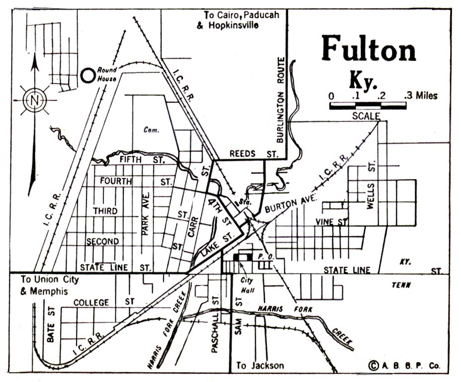
- Fulton, Kentucky 1922 Automobile Blue Book, 1922, Vol. 2 (113K)
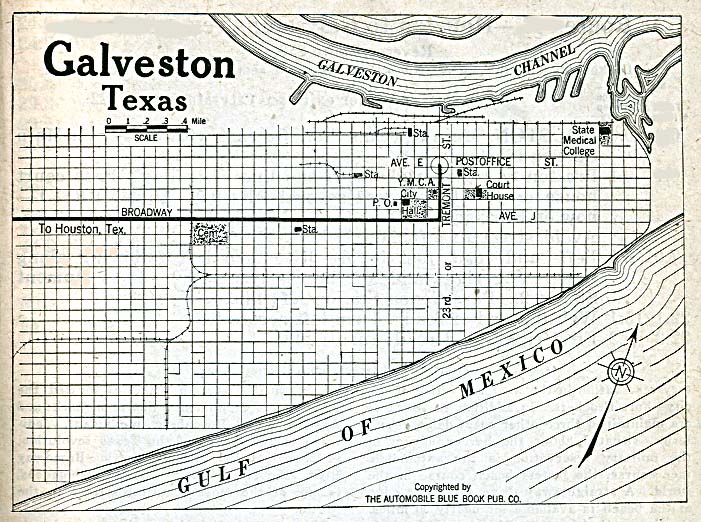
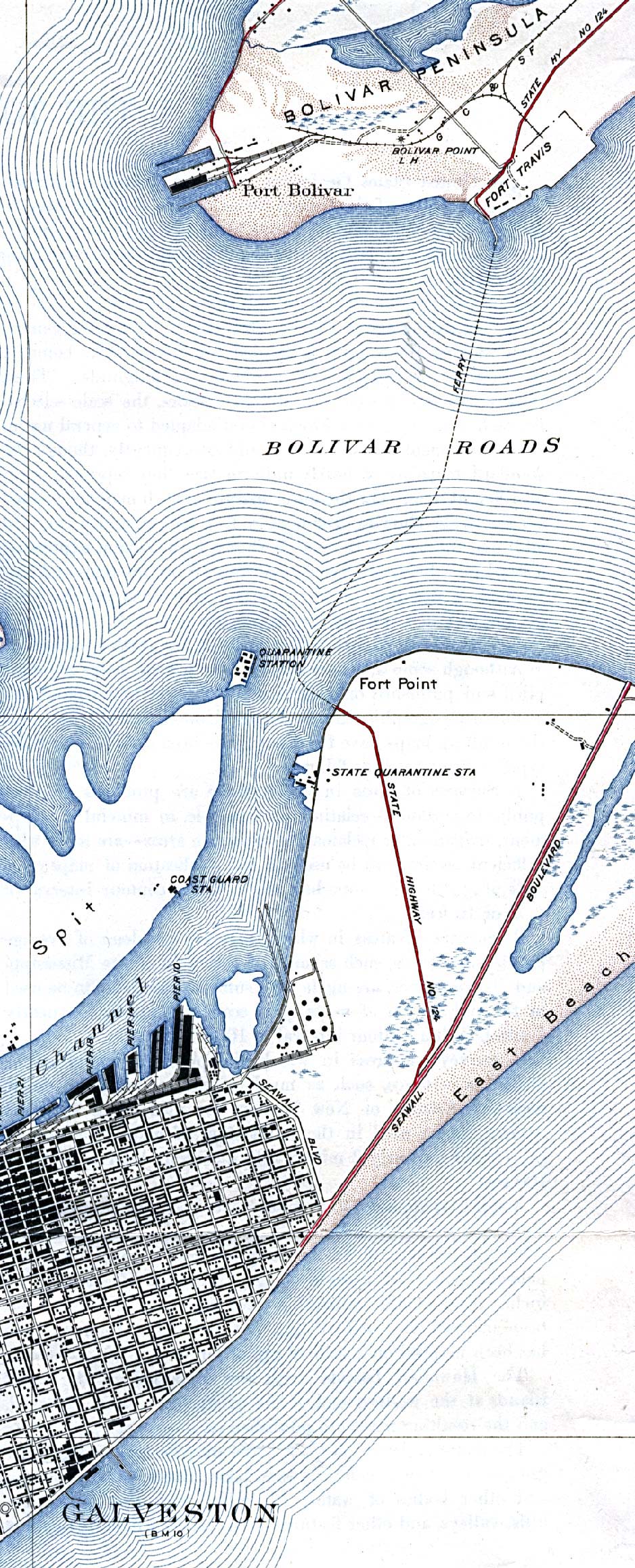
- Galveston, Texas 1920 Automobile Blue Book, 1920, Vol. 7 (162K)
- Galveston - North, Texas 1933 Original Scale 1:31,680. U.S. Geological Survey (683K)
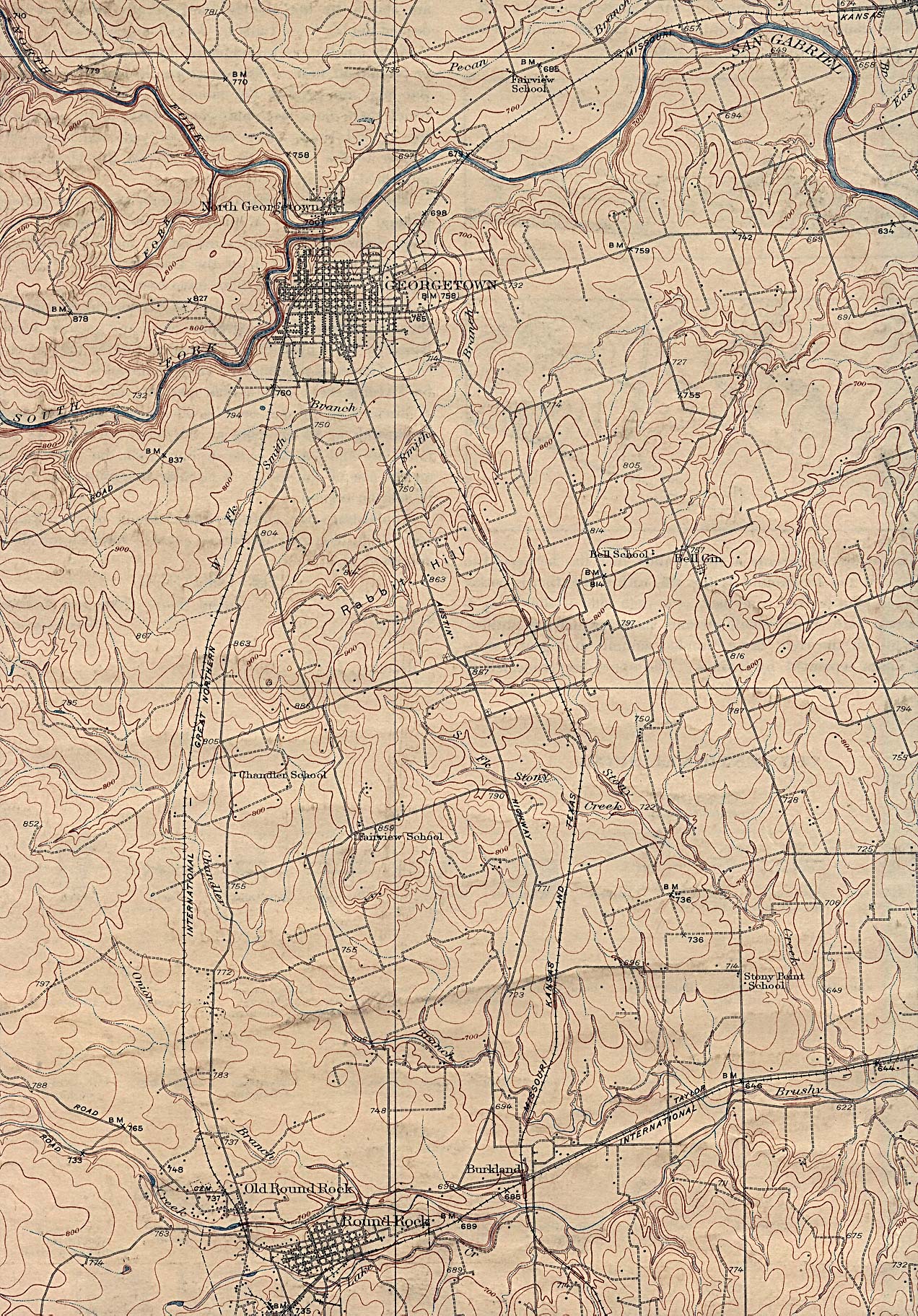
- Georgetown, Texas 1923 U.S. Geological Survey (927K)
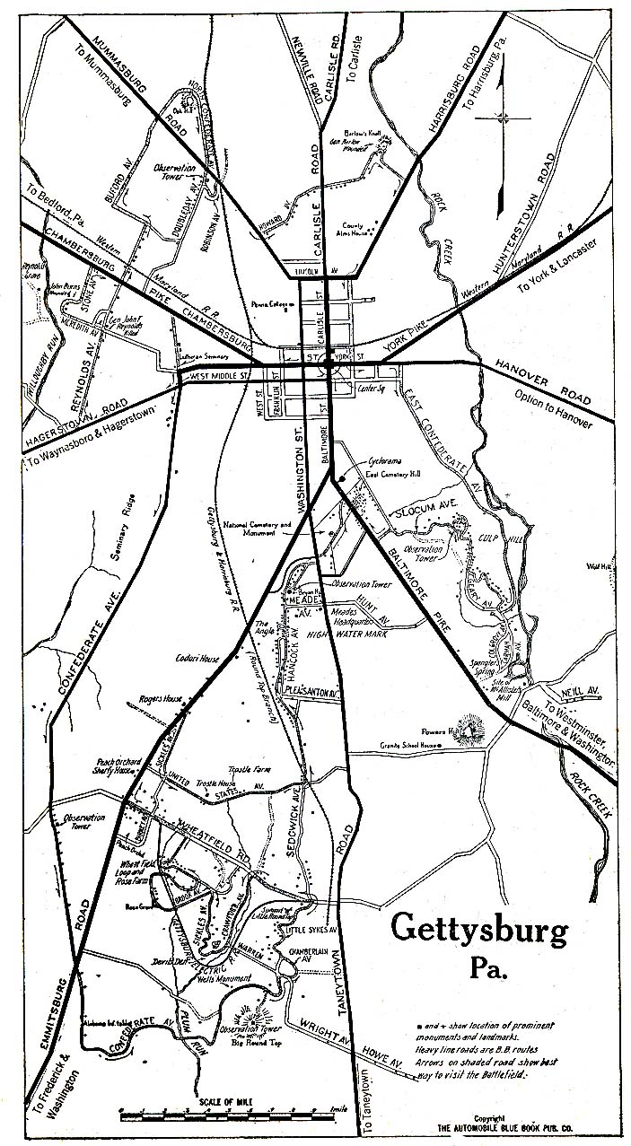
- Gettysburg, Pennsylvania 1920 Automobile Blue Book, 1920, Vol. 3 (273K)
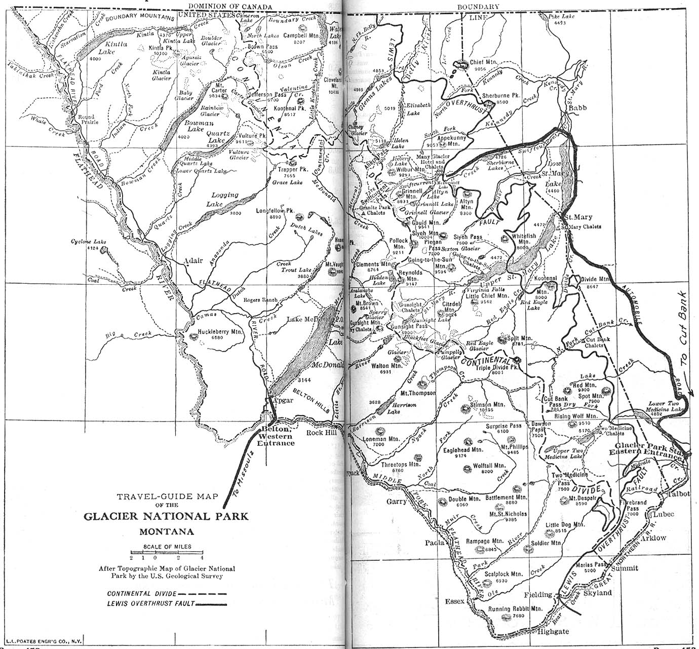
- Glacier National Park, Montana 1917 Automobile Blue Book, 1917, Vol. 8, Section 2 (378K)
- Grand Forks, North Dakota 1920 [with East Grand Forks, Minnesota] Automobile Blue Book, 1920, Vol. 11 (93K)
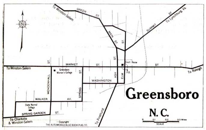
- Greensboro, North Carolina 1919 Automobile Blue Book, 1919, Vol. 6 (44K)
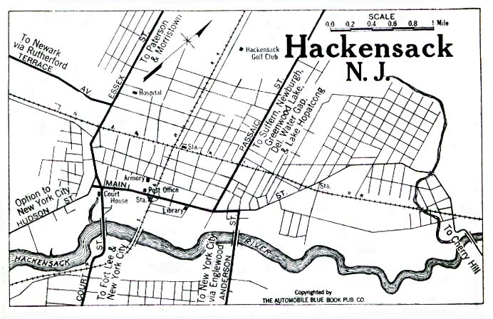
- Hackensack, New Jersey 1922 Automobile Blue Book, 1922, Vol. 2 (149K)
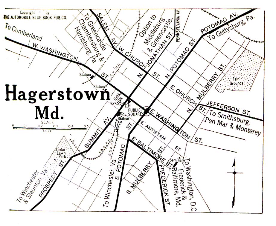
- Hagerstown, Maryland 1920 Automobile Blue Book, 1920, Vol. 3S (323K)
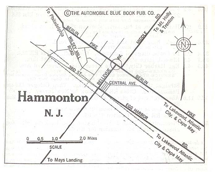
- Hammonton, New Jersey 1920 Automobile Blue Book, 1920, Vol. 3 (61K)
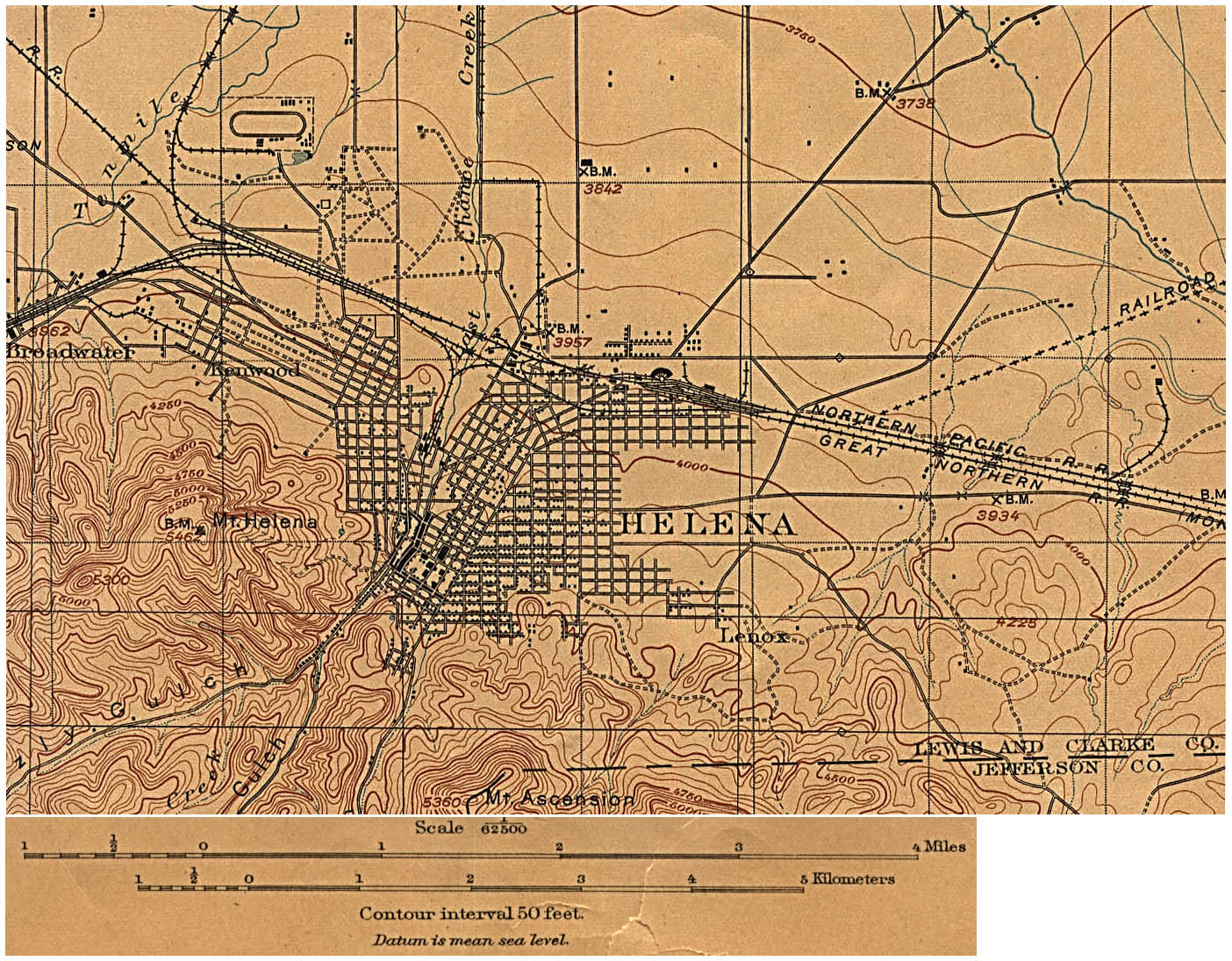
- Helena, Montana 1899 (Topographic) original scale 1:62,500 U.S. Geological Survey edition of 1899, reprinted 1906 (476K)
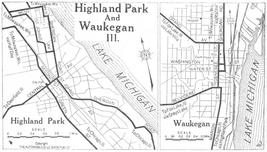
- Highland Park and Waukegan, Illinois 1920 Automobile Blue Book, 1920, Vol. 5 (112K)
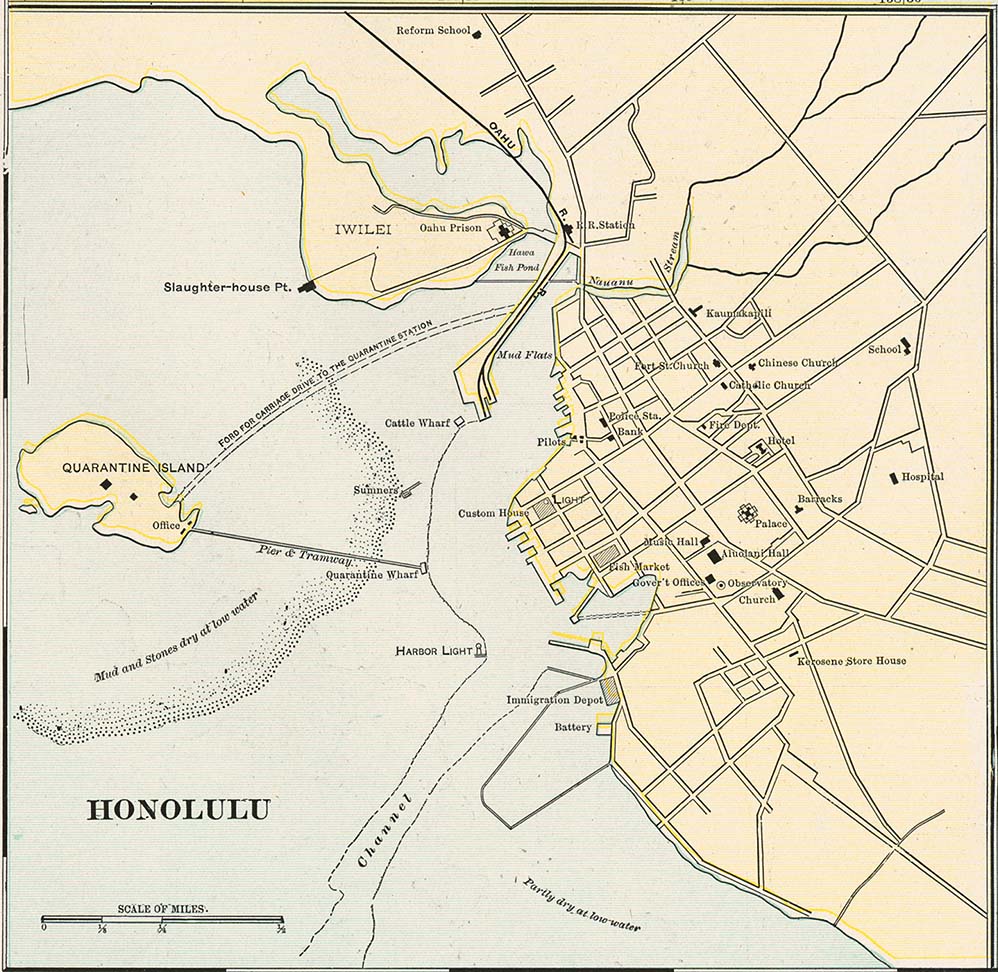
- Honolulu 1901 from Cram's Modern Atlas, 1901 (175K)
- Hoquiam and Aberdeen, Washington 1917 Automobile Blue Book (98K)
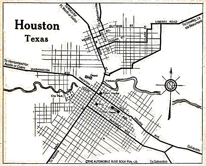
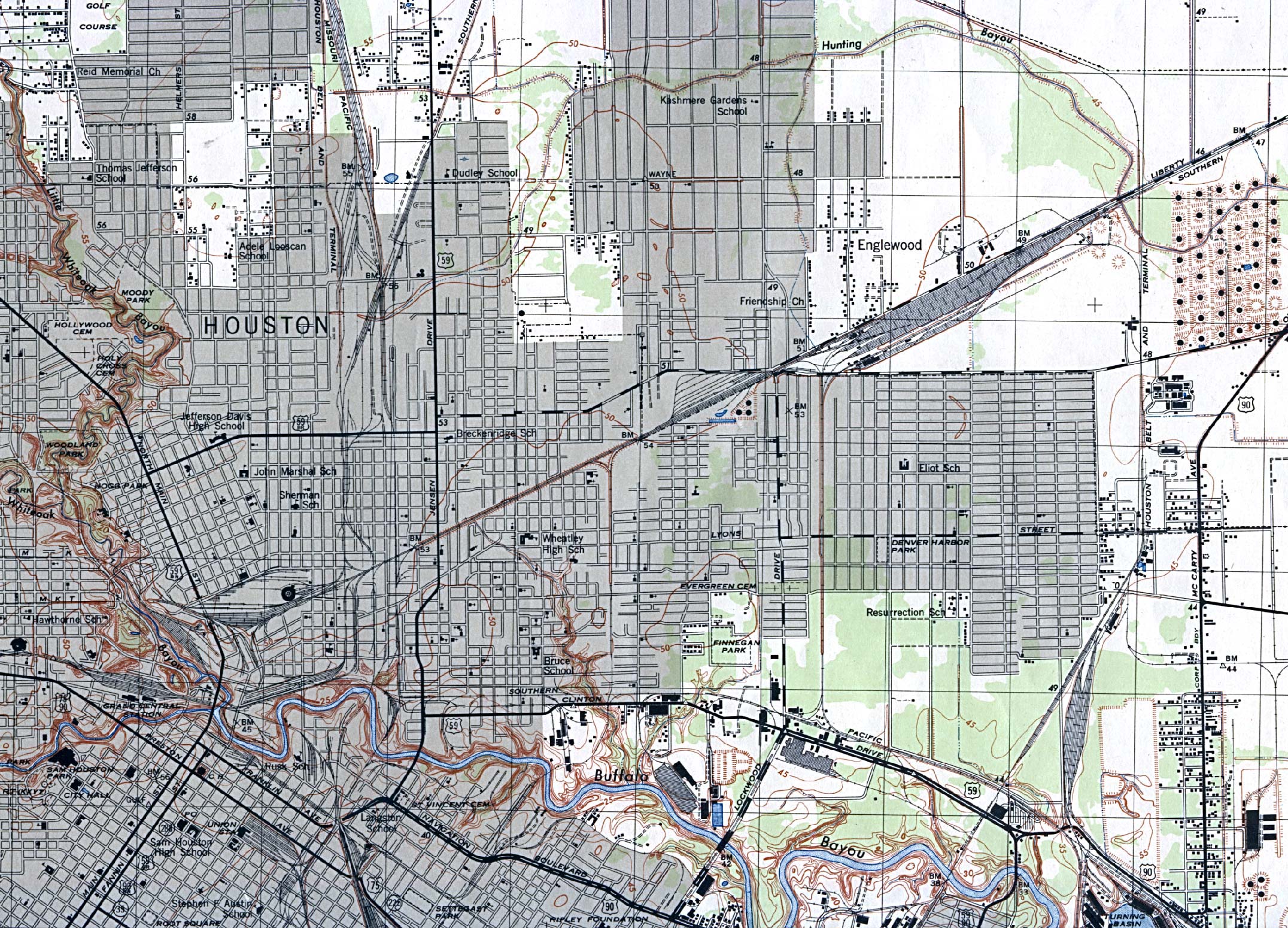
- Houston, Texas 1920 Automobile Blue Book, 1920, Vol. 7 (156K)
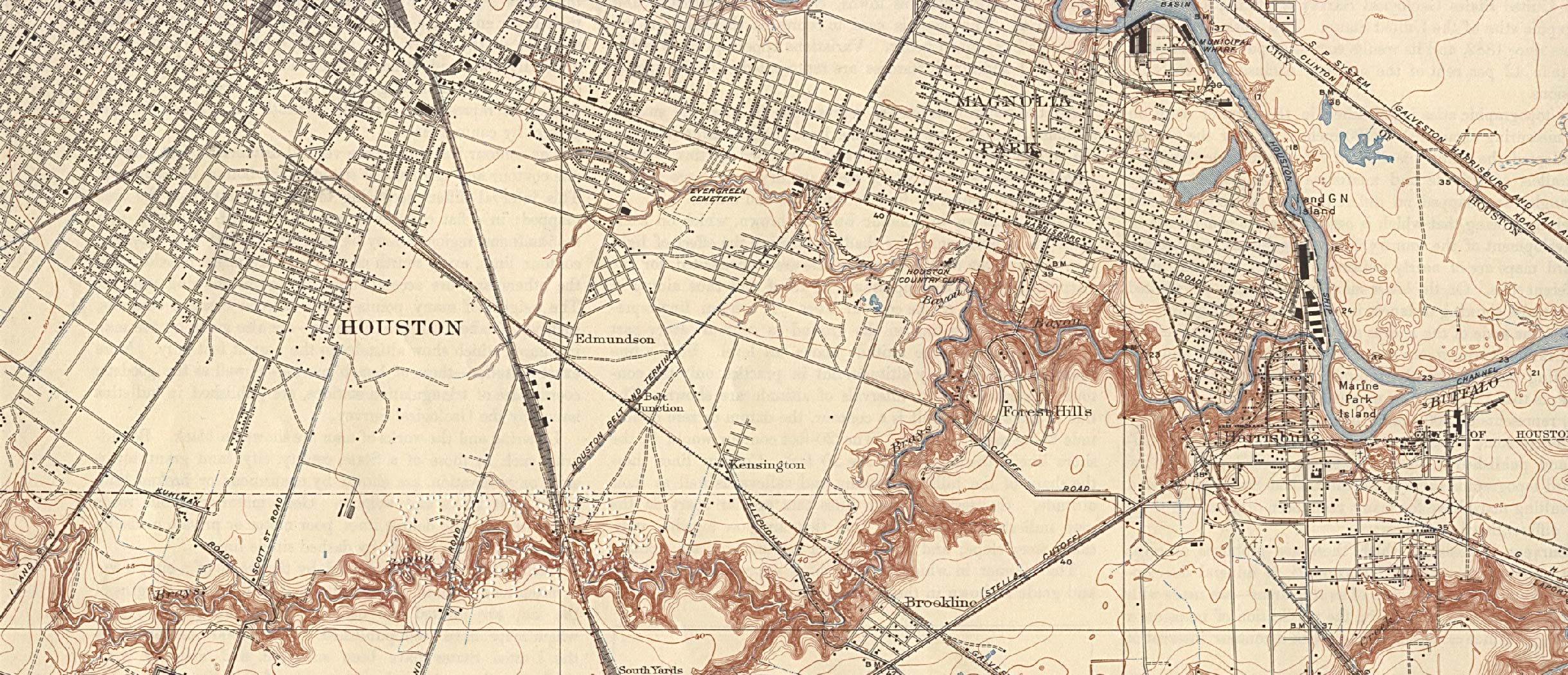
- Houston, Texas (South West) 1921 Original Scale 1:31,680. U.S. Geological Survey (566K)
- Houston, Texas (North East) 1922 Original Scale 1:31,680. U.S. Geological Survey (741K)
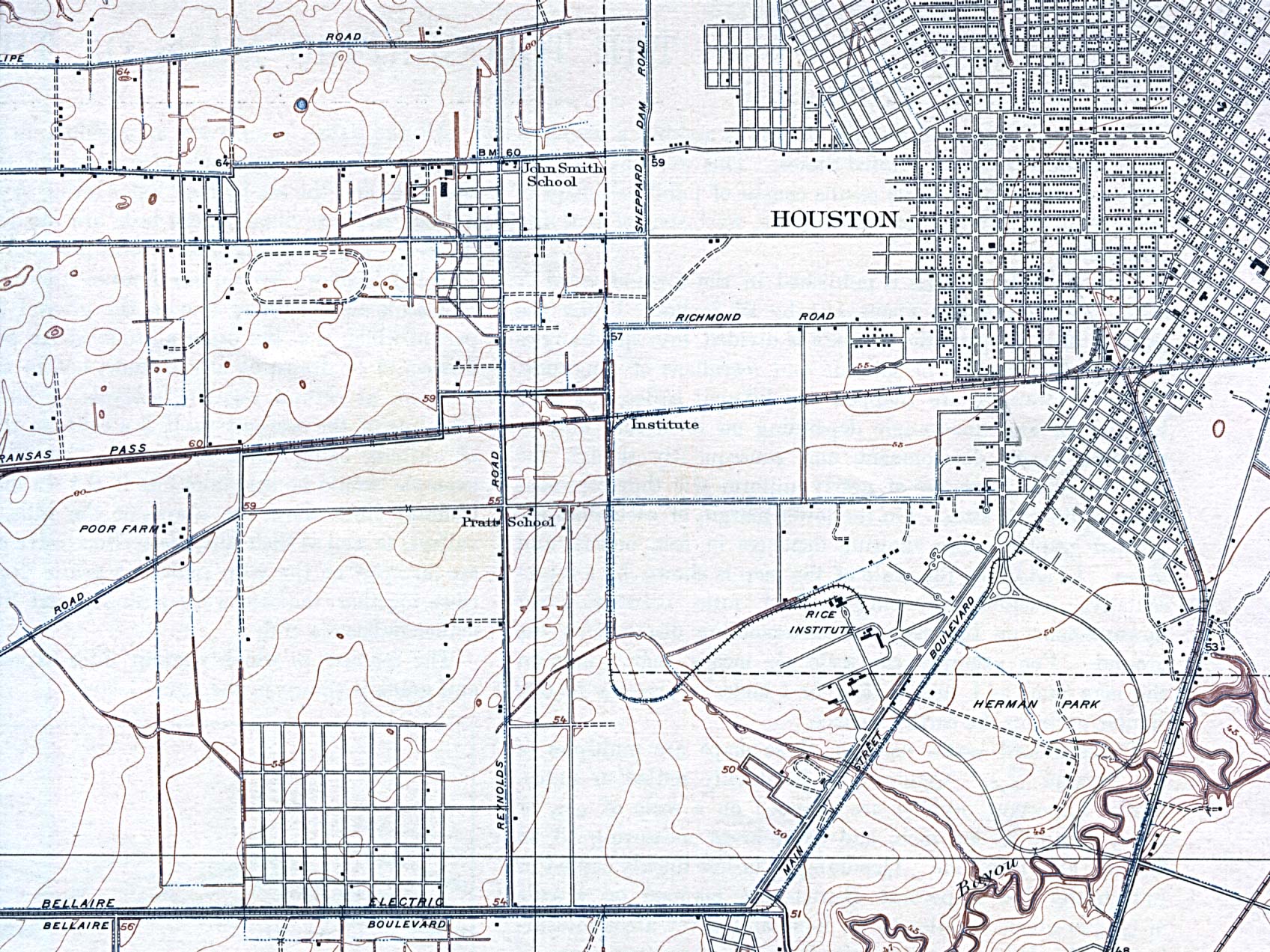
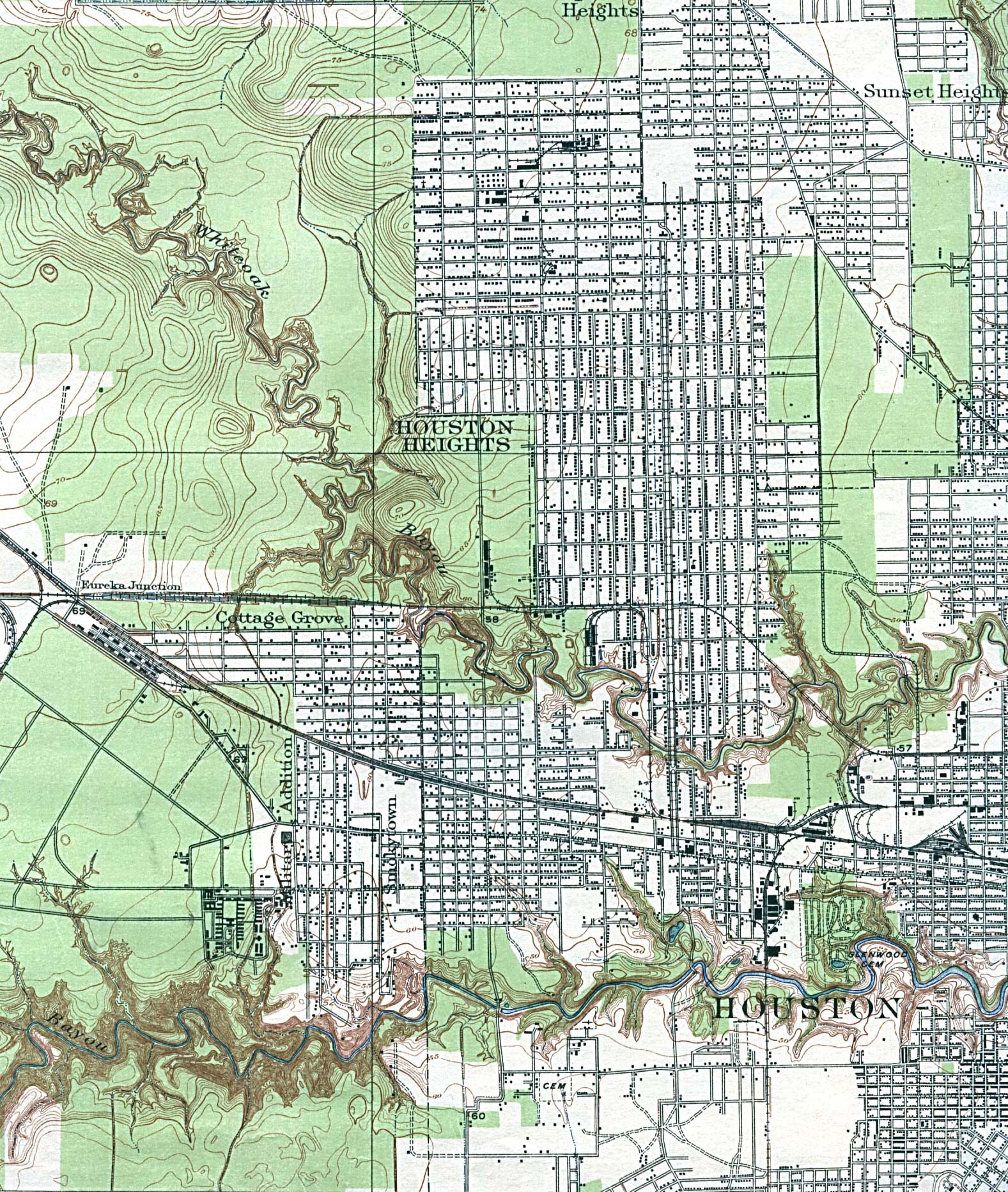
- Houston, Texas (North West) 1922 Original Scale 1:31,680. U.S. Geological Survey (936K)
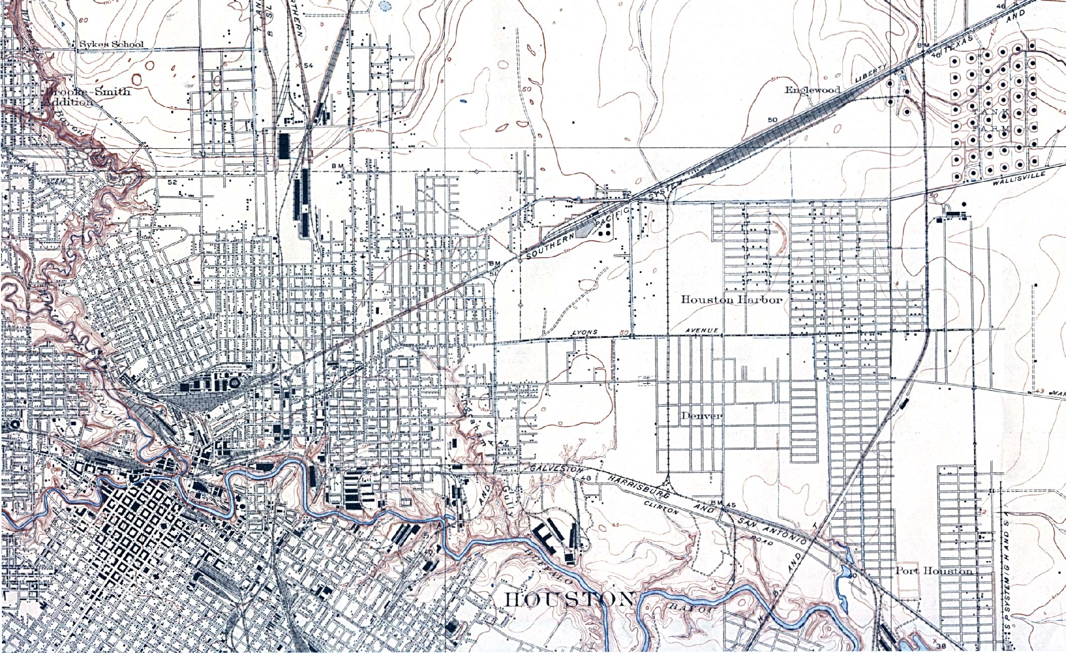
- Houston, Texas (South East) 1922 Original Scale 1:31,680. U.S. Geological Survey. Reprint, 1932 (780K)
- Houston, Texas (North East) 1946 Original Scale 1:31,680. U.S. Geological Survey (995K)
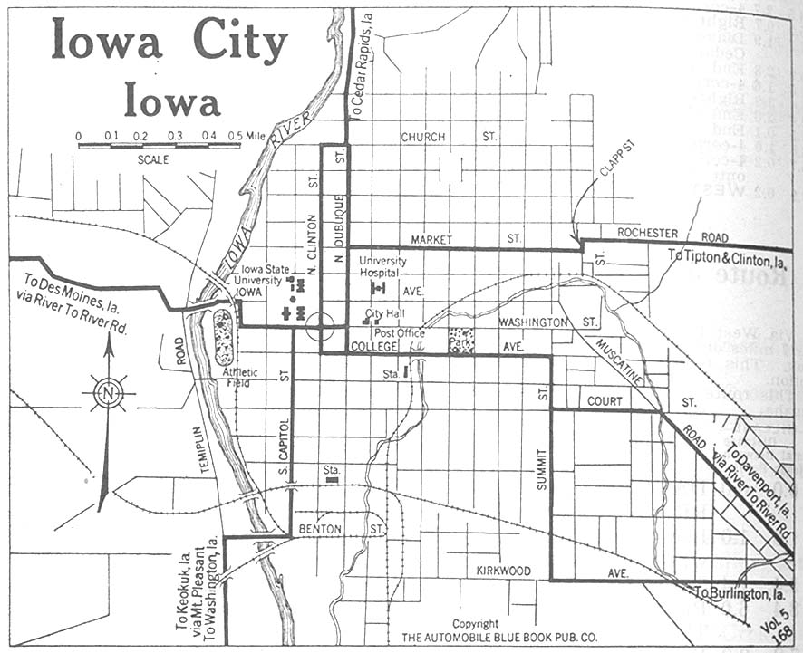
- Iowa City, Iowa 1920 Automobile Blue Book, 1920, Vol. 5 (136K)
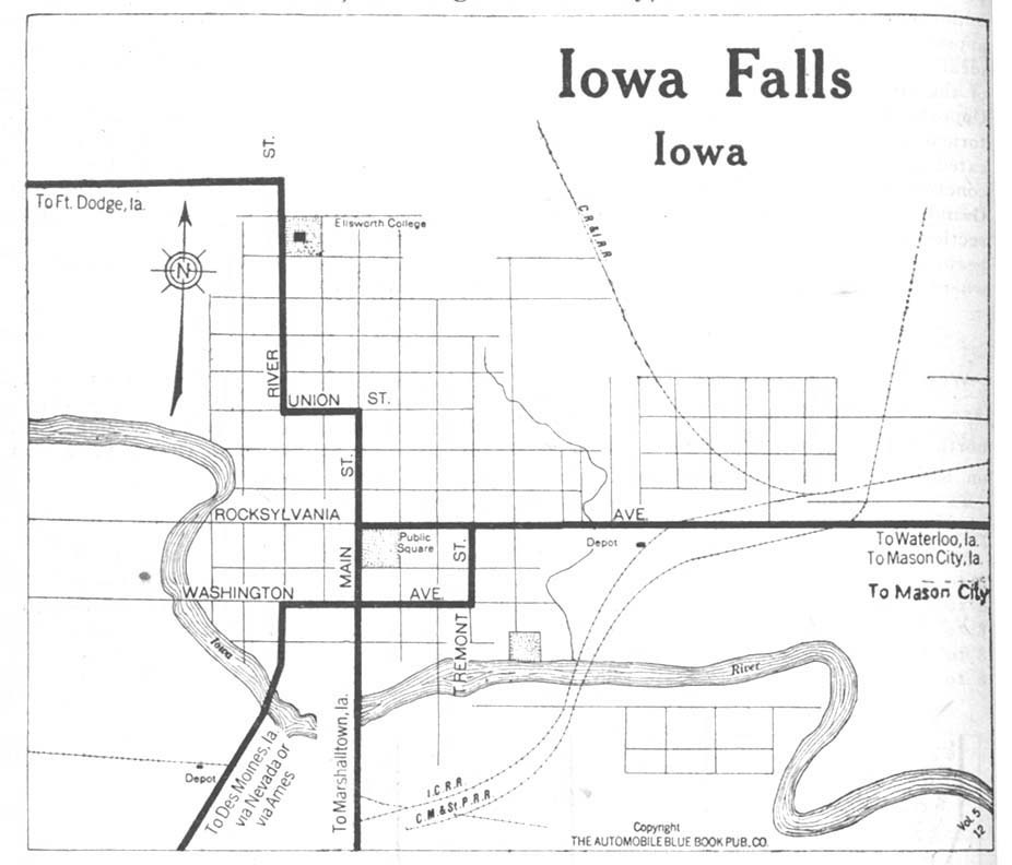
- Iowa Falls, Iowa 1920 Automobile Blue Book, 1920, Vol. 5 (93K)
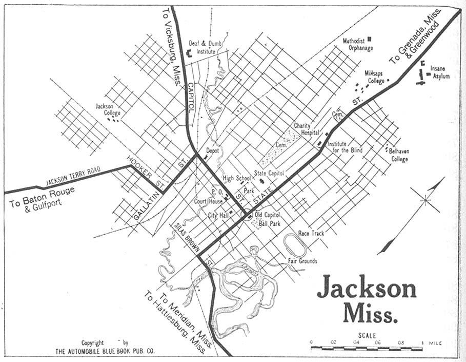
- Jackson, Mississippi 1919 Automobile Blue Book, 1919, Vol. 6 (139K)
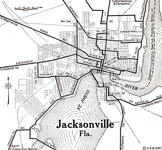
- Jacksonville, Florida 1920 Automobile Blue Book, 1920, Vol. 6 (156K)
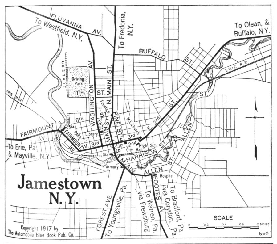
- Jamestown, New York 1917 Automobile Blue Book, 1917, Vol. 3 (150K)
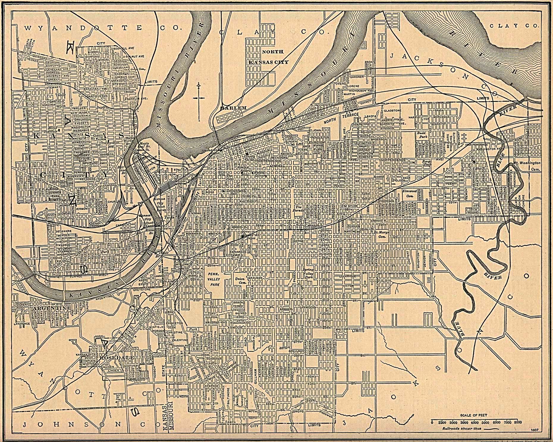
- Kansas City, Kansas and Missouri 1907 From The New Encyclopedic Atlas and Gazetteer of the World, Edited by Francis J. Reynolds, P.F. Collier & Son, New York, 1917 (139K)
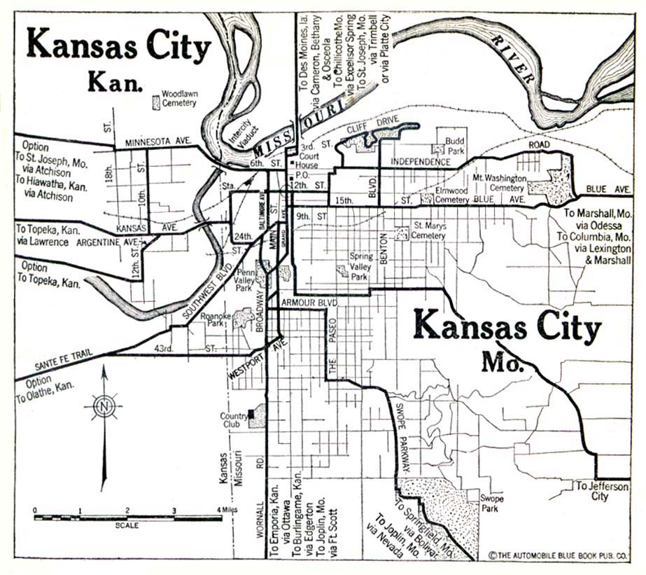
- Kansas City, Kansas and Missouri 1920 Automobile Blue Book, 1920, Vol. 7 (139K)
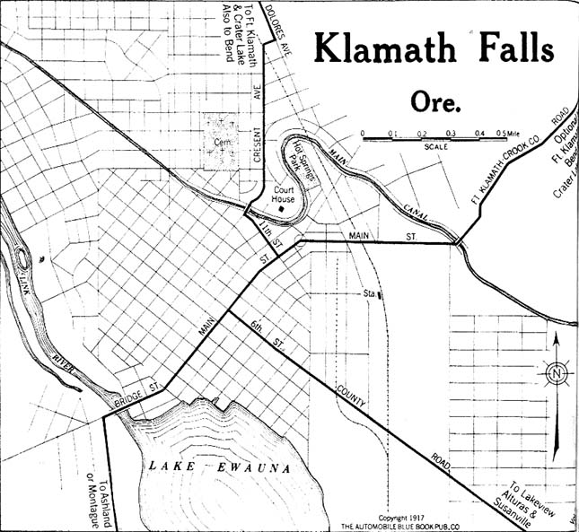
- Klamath Falls, Oregon 1917 Automobile Blue Book, 1917, Vol. 8, Section 2 (122K)
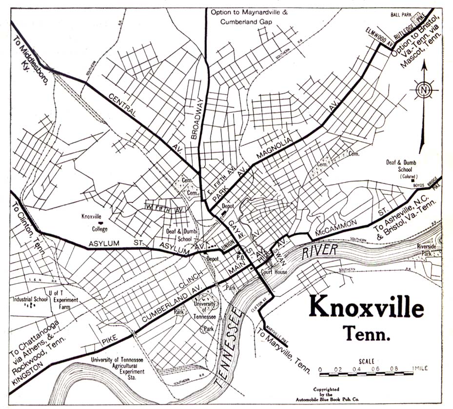
- Knoxville, Tennessee 1919 Automobile Blue Book, 1919, Vol. 6 (323K)
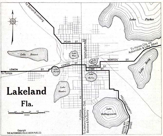
- Lakeland, Florida 1919 Automobile Blue Book, 1919, Vol. 6 (79K)
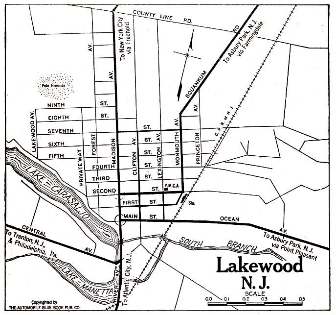
- Lakewood, New Jersey 1920 Automobile Blue Book, 1920, Vol. 3 (137K)
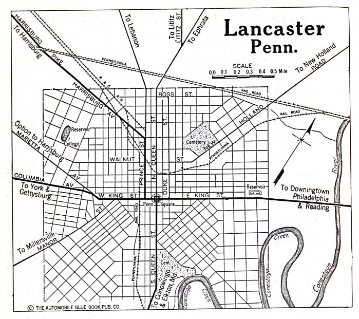
- Lancaster, Pennsylvania 1920 Automobile Blue Book, 1920, Vol. 3 (156K)
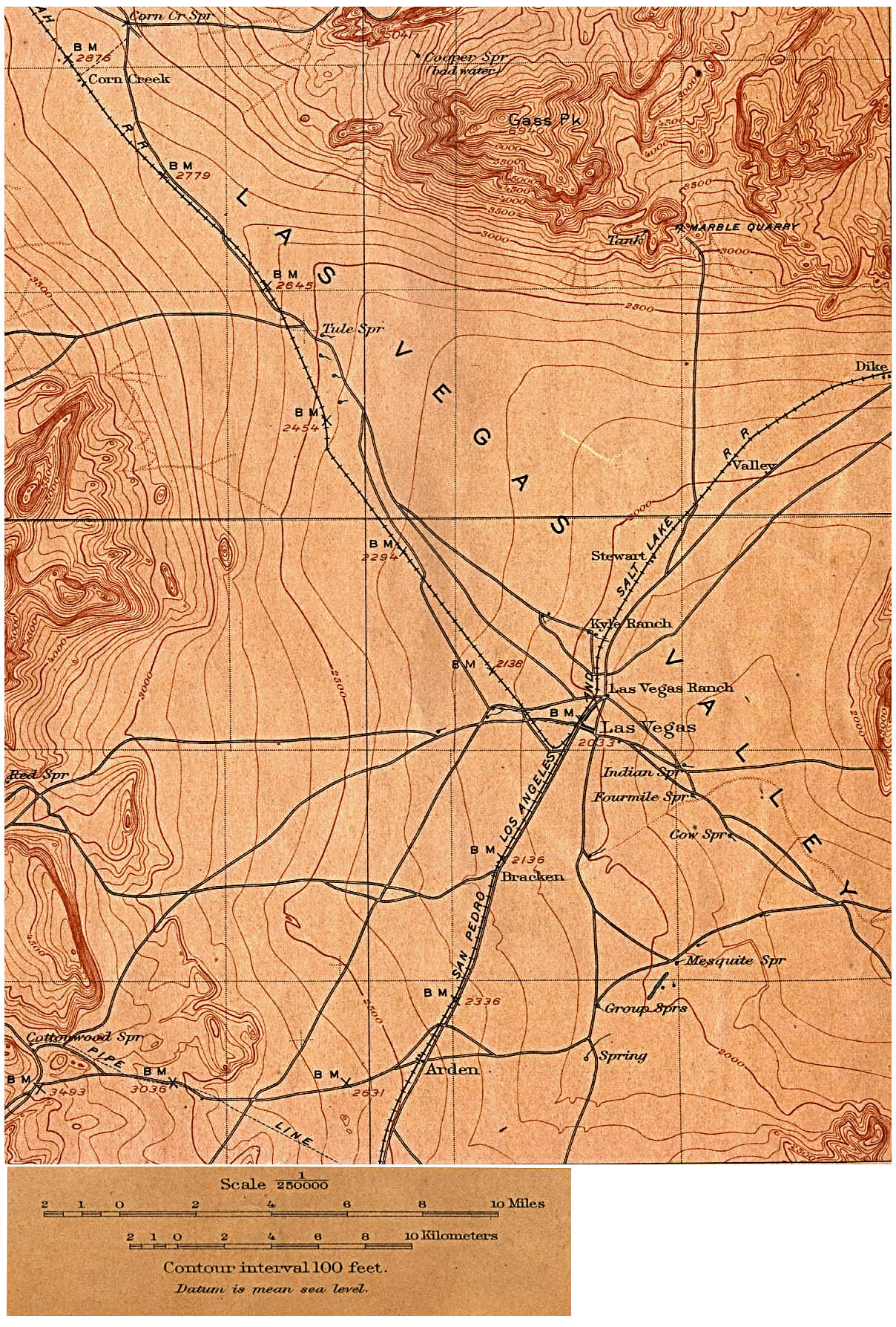
- Las Vegas, Nevada 1908 (Topographic) original scale 1:250,000 U.S. Geological Survey 1908 (655K)
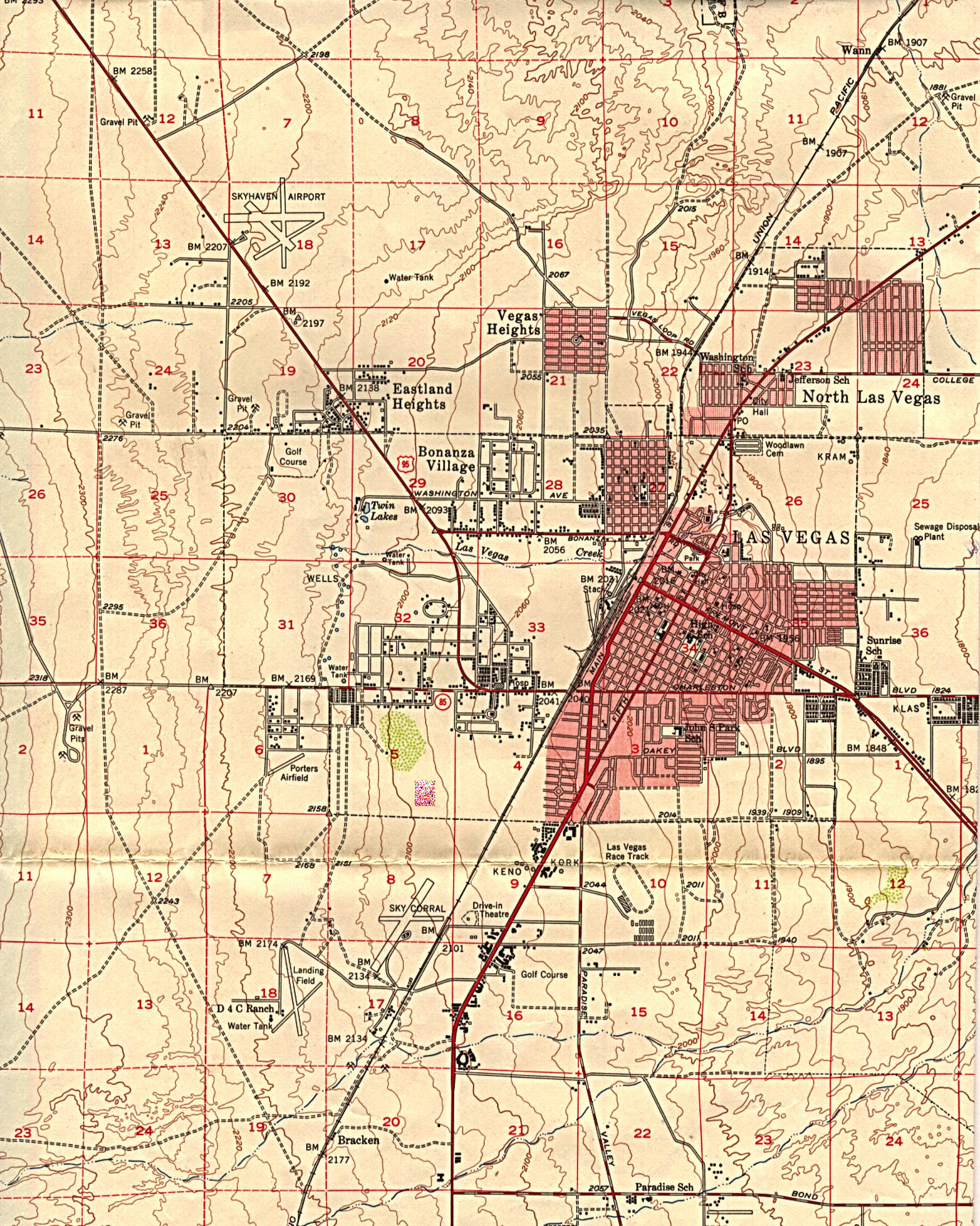
- Las Vegas, Nevada 1952 Original Scale 1:62,500 U.S. Geological Survey 1952 (903K)
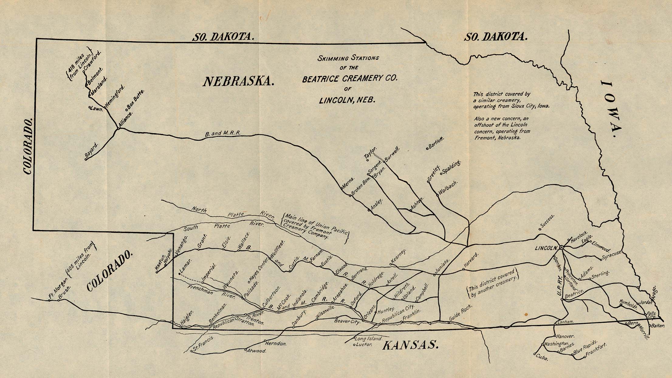
- Lincoln, Nebraska 1901 "Skimming Stations of the Beatrice Creamery Co. of Lincoln, Neb." From Report of the Industrial Commission on the Distribution of Farm Products. Volume VI of the Commission's Reports. House of Representatives, 1901. (508K)
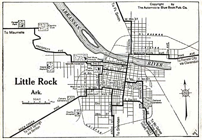
- Little Rock, Arkansas 1920 Automobile Blue Book, 1920, Vol. 5 (117K)
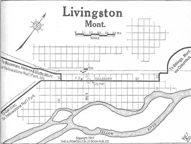
- Livingston, Montana 1917 Automobile Blue Book, 1917, Vol. 8, Section 2 (83K)
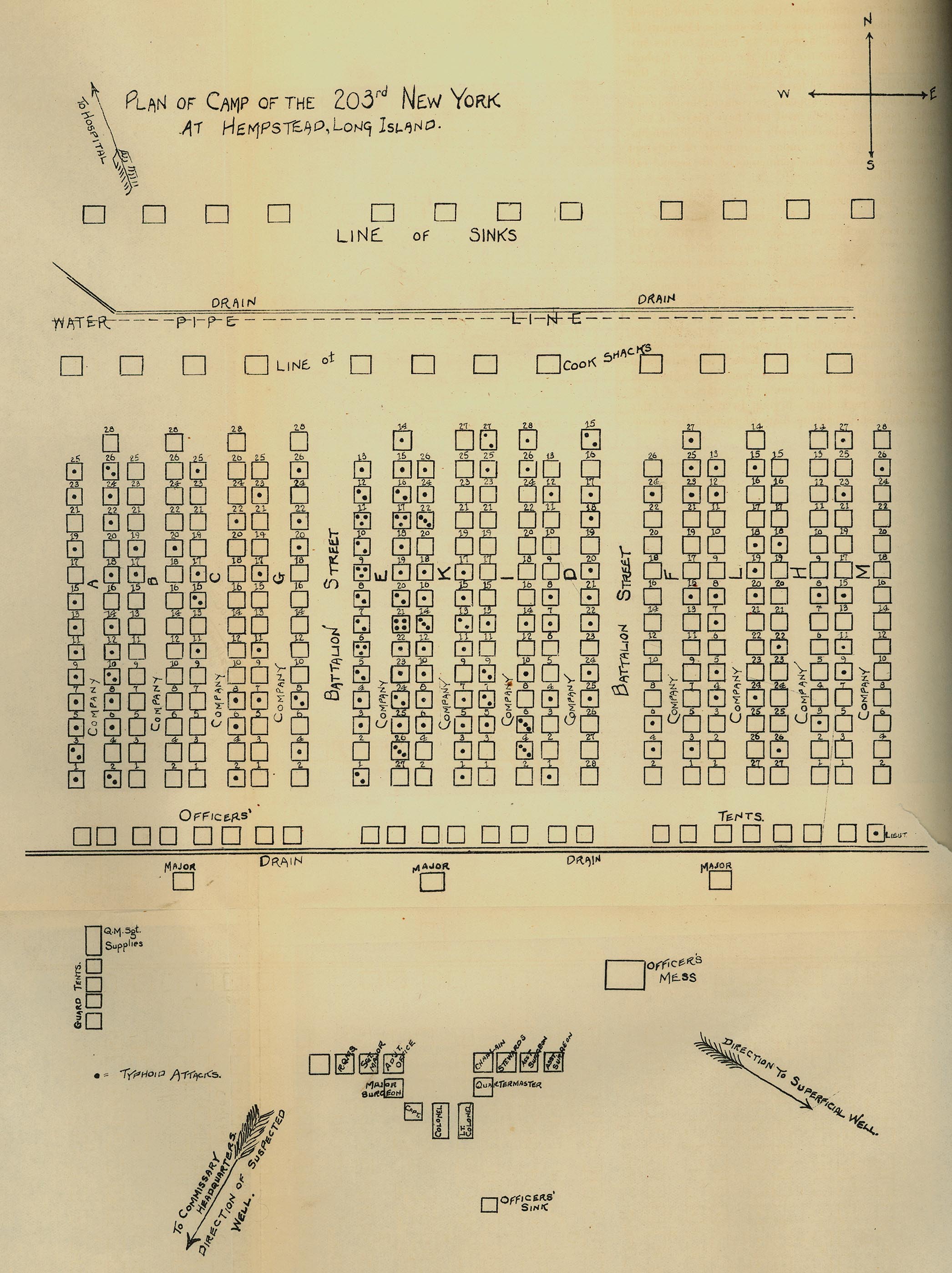
- Long Island, New York 1898 "Plan of Camp of the 203rd New York at Hempstead, Long Island." From Report on the Origin and Spread of Typhoid Fever in U.S. Military Camps During the Spanish War of 1898, Vol. 1 by Walter Reed, Victor C. Vaughan, and Edward O. Shakespeare. Washington: Government Printing Office, 1904. (669K)
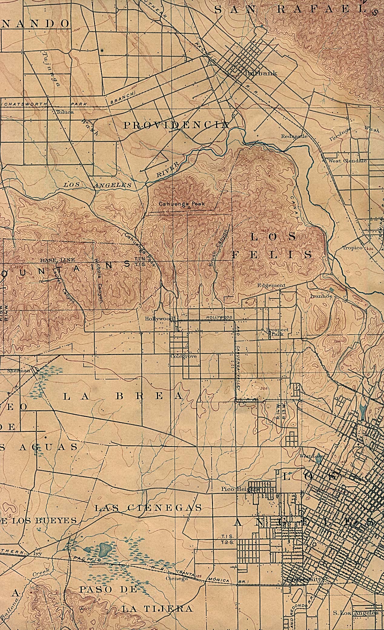
- Los Angeles (East), California 1900 U.S. Geological Survey (1,063K)
- Los Angeles (West), California 1902 U.S. Geological Survey (1,097K)
- Los Angeles, California - Electric Rail Lines 1906 From Los Angeles Herald, July 29, 1906 (1.3MB) [pdf format]
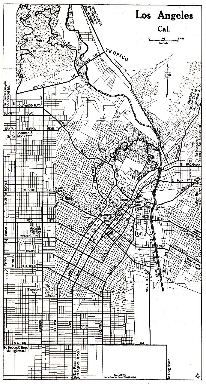
- Los Angeles, California 1917 Automobile Blue Book 1917, Vol. 8, Section 1 (417K)
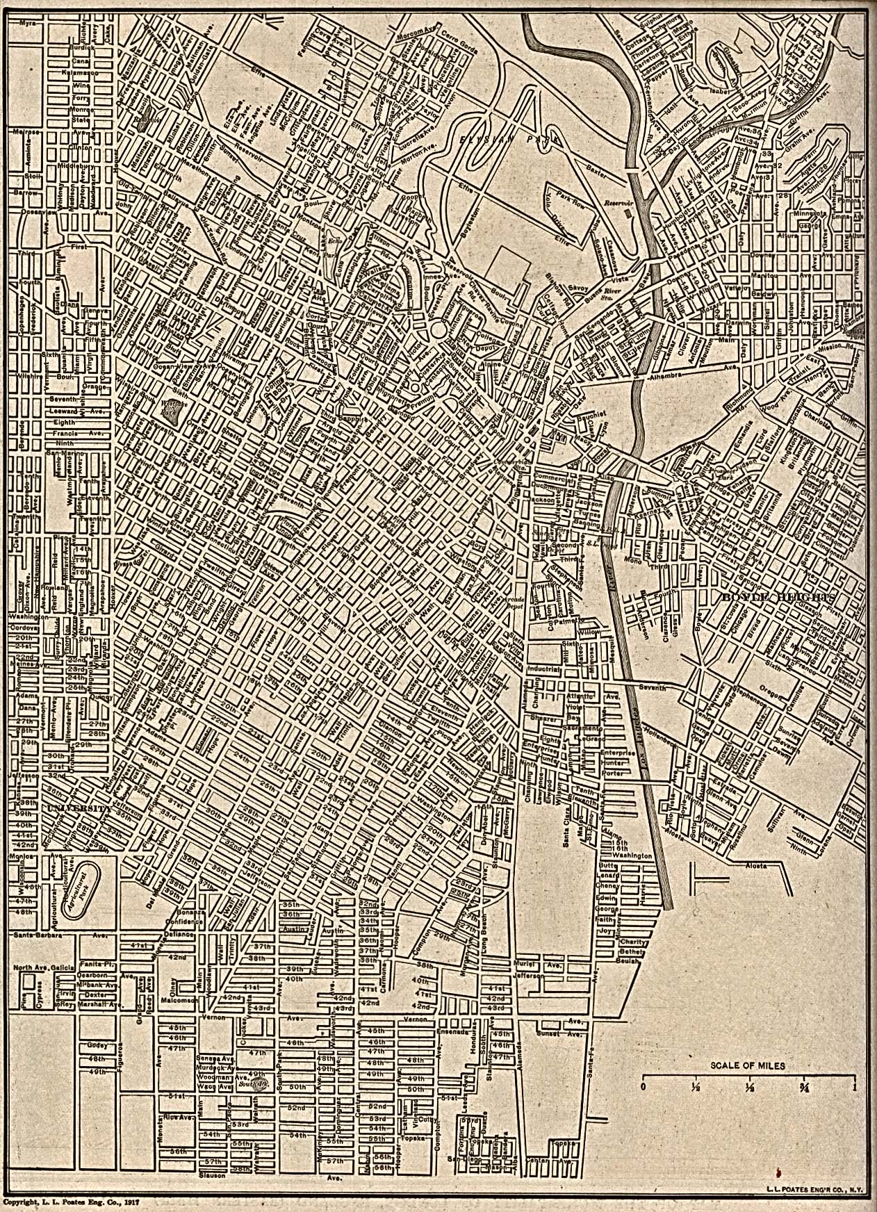
- Los Angeles, California - Central Los Angeles 1917 From The New Encyclopedic Atlas and Gazetteer of the World. New York: P.F. Collier & Son, 1917 (903K)
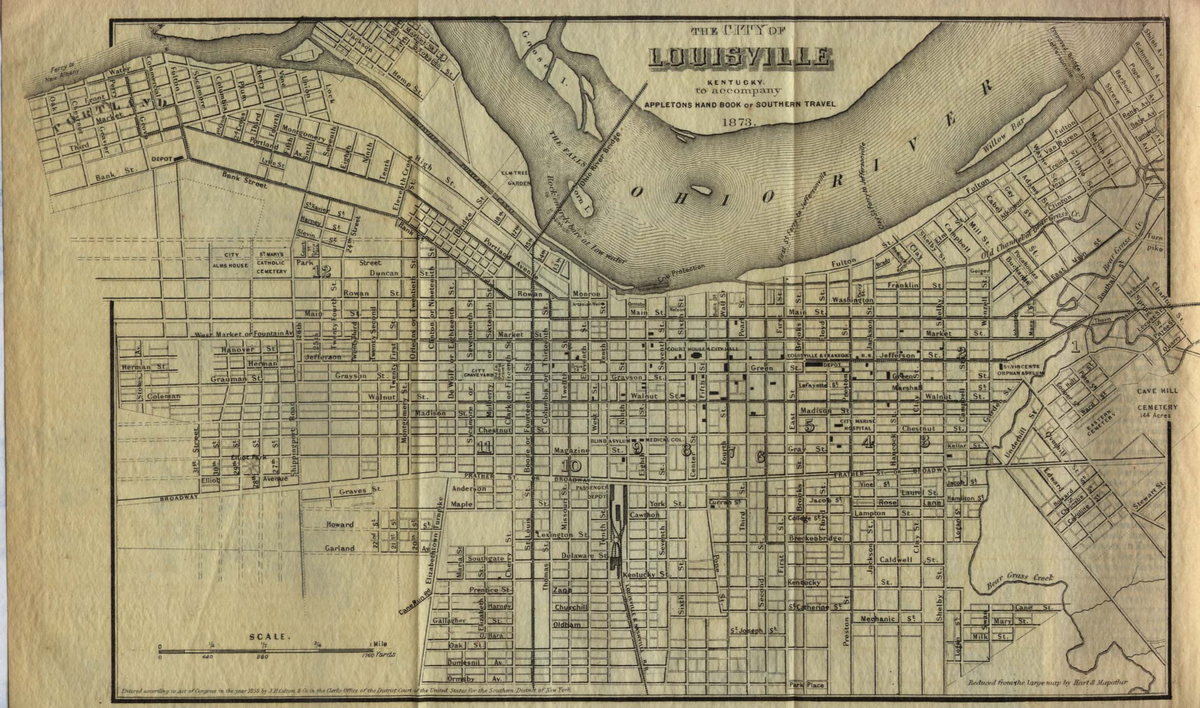
- Louisville, Kentucky 1855 From Appletons' Hand-Book of American Travel, Southern Tour. Compiled and Edited by Charles H. Jones, 1873 (581K)
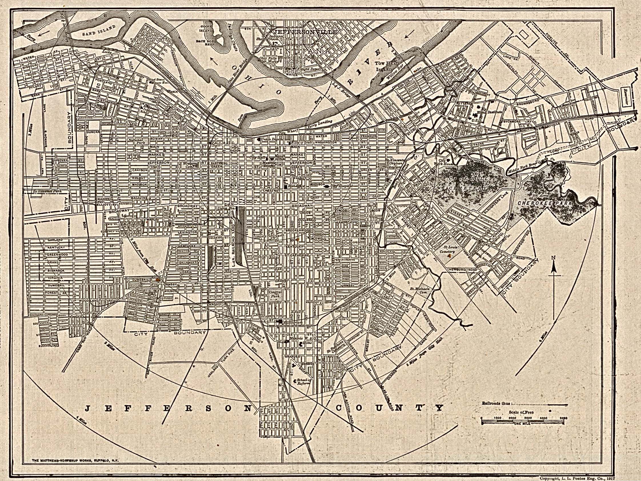
- Louisville, Kentucky 1917 The New Encyclopedic Atlas and Gazetteer of the World. New York: P.F. Collier & Son, 1917 (1MB)
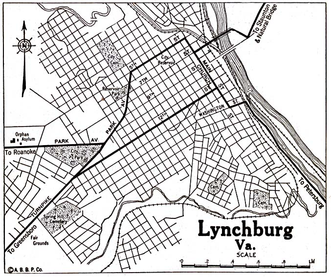
- Lynchburg, Virginia 1920 Automobile Blue Book, 1920, Vol. 3 (176K)
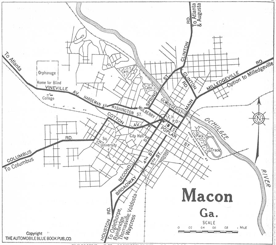
- Macon, Georgia 1919 Automobile Blue Book, 1919, Vol. 6 (145K)
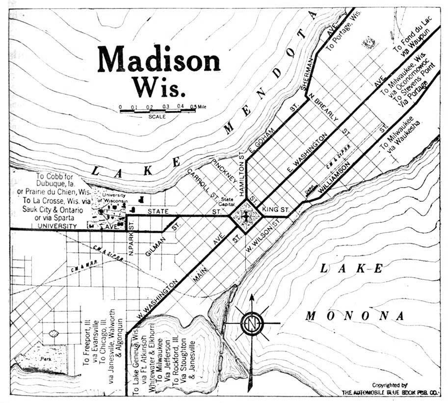
- Madison, Wisconsin 1920 Automobile Blue Book, 1920, Vol. 6 (192K)
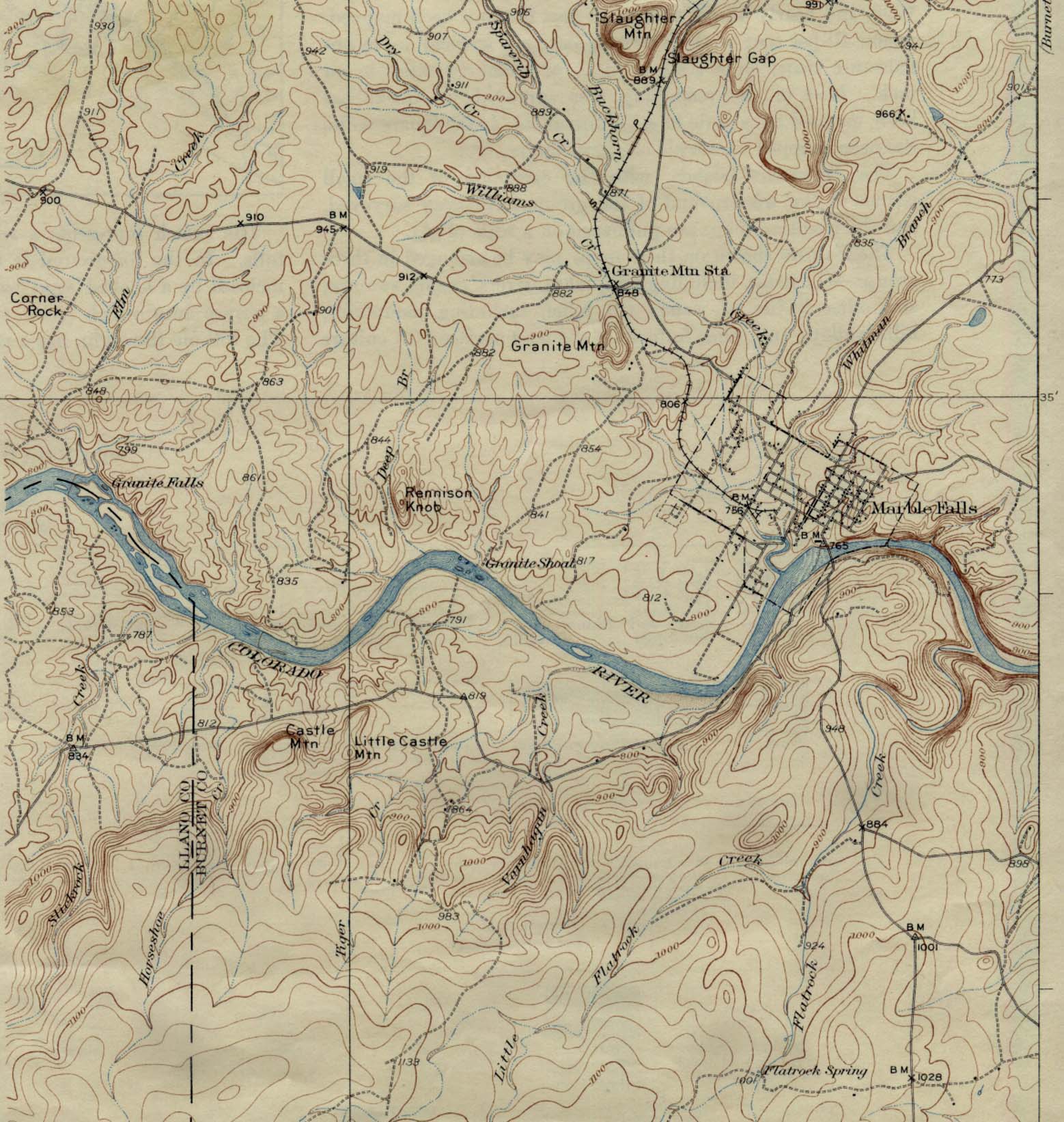
- Marble Falls, Texas 1929 Original Scale 1:62,500 U.S. Geological Survey 1929. (389K)
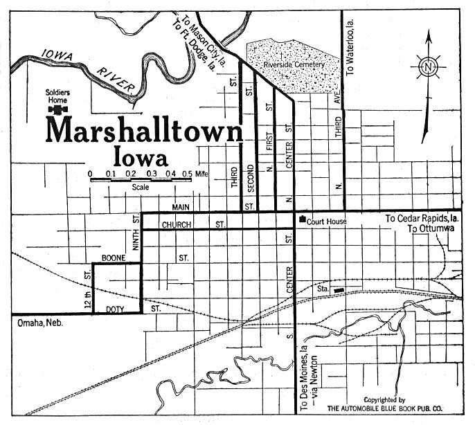
- Marshalltown, Iowa 1919 Automobile Blue Book (117K)
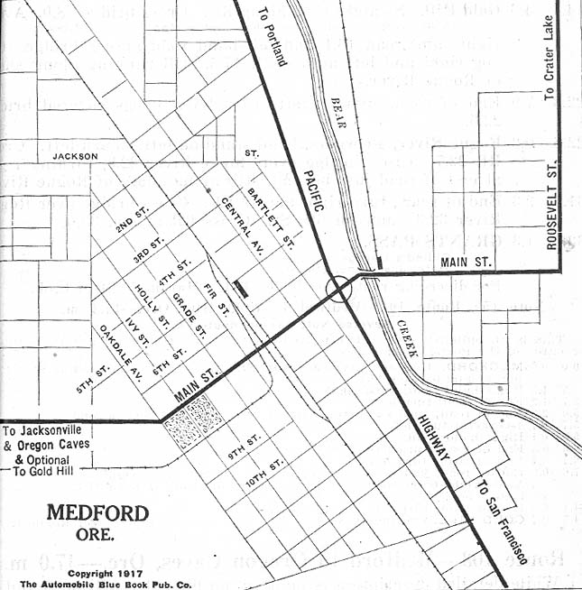
- Medford, Oregon 1917 Automobile Blue Book 1917 Vol. 8, Section 2 (116K)
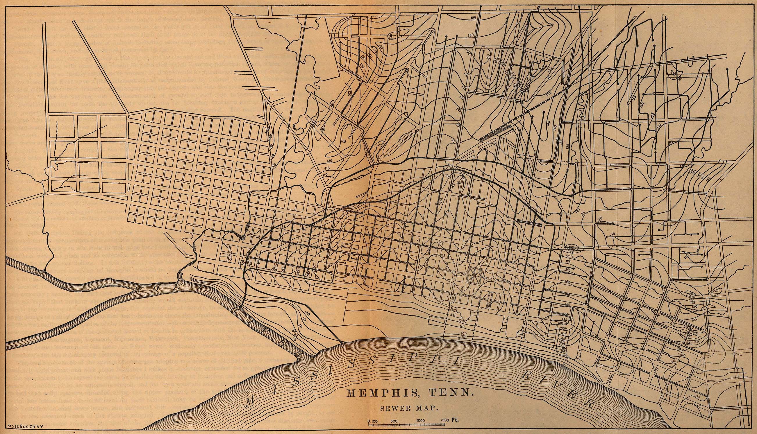
- Memphis, Tennessee 1880 "Memphis, Tenn. Sewer Map." From Report on the Social Statistics of Cities, Compiled by George E. Waring, Jr., United States. Census Office, Part II, 1886. (849K)
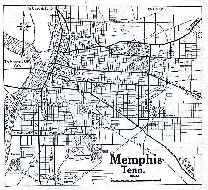
- Memphis, Tennessee 1911 The New Encyclopedic Atlas and Gazetteer of the World. New York: P.F. Collier & Son, 1917 (645K)
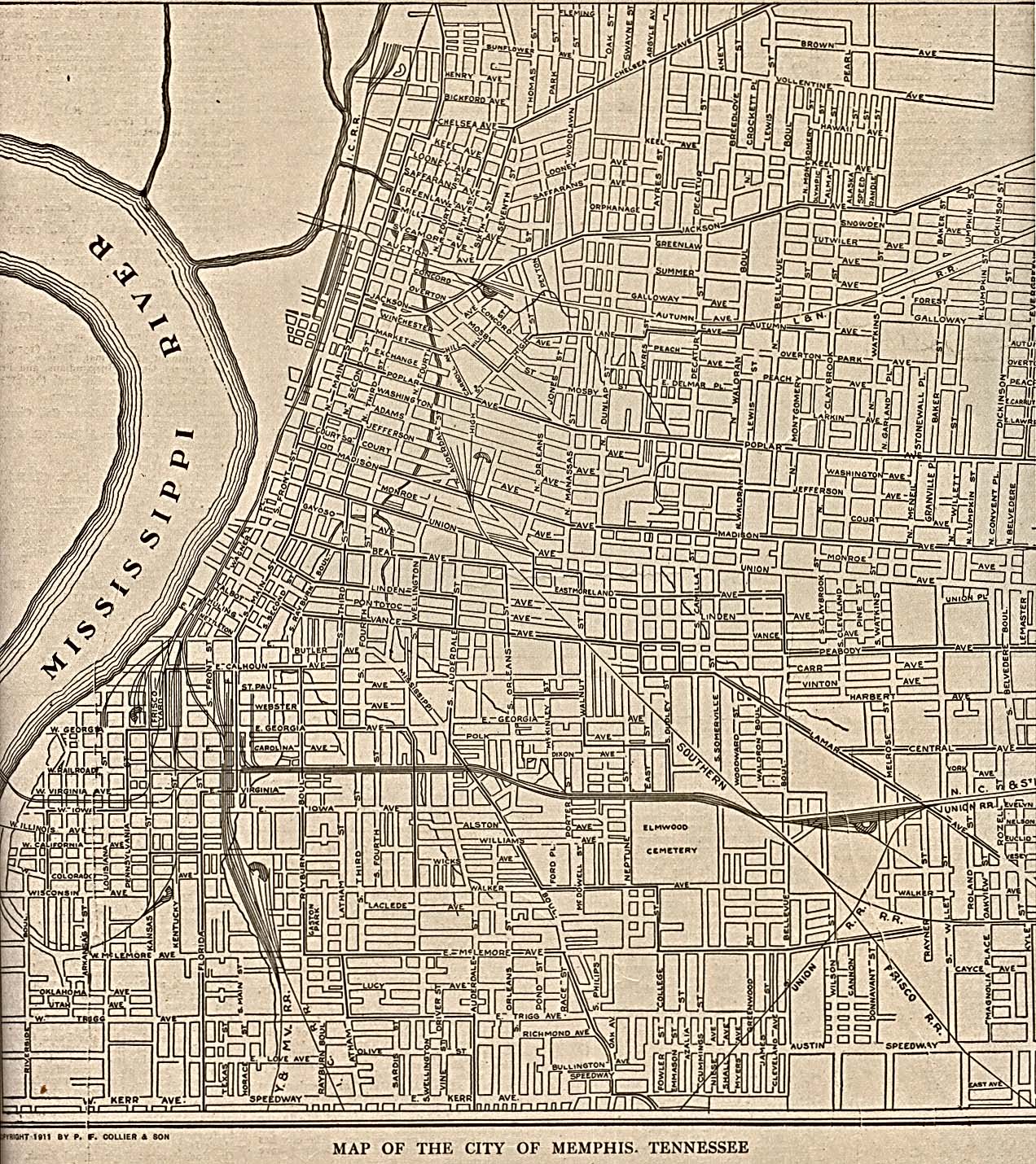
- Memphis, Tennessee 1920 Automobile Blue Book, 1920, Vol. 6 (204K)
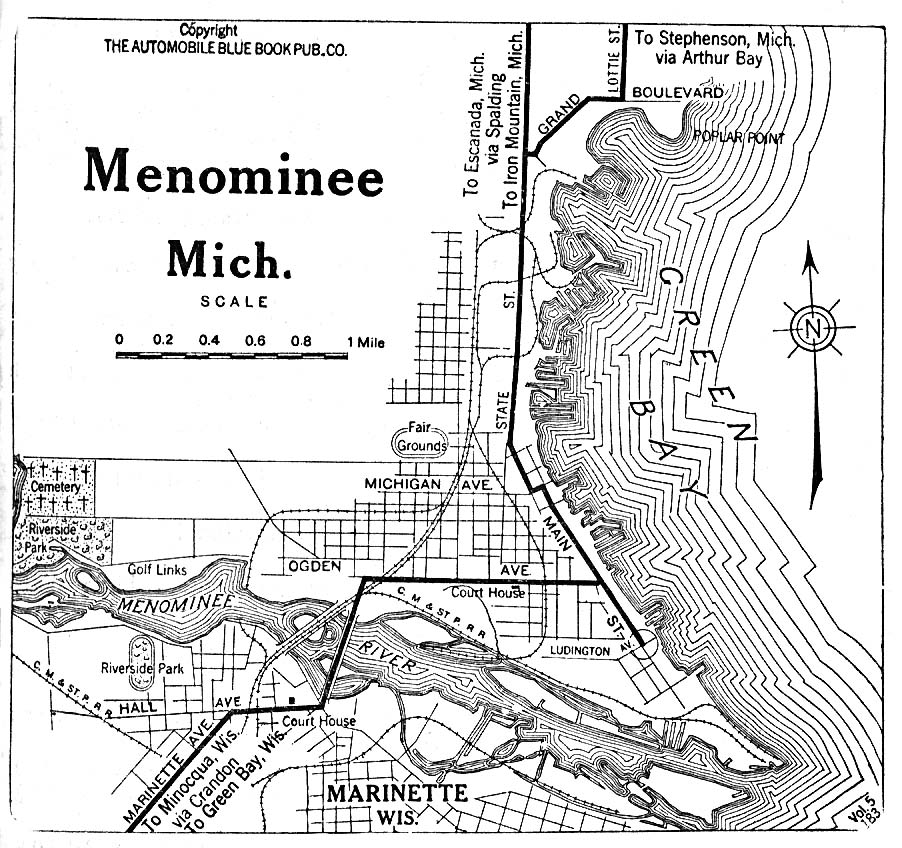
- Menominee, Michigan 1919 Automobile Blue Book (254K)
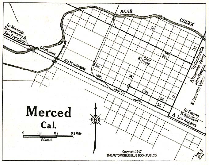
- Merced, California 1917 Automobile Blue Book (128K)
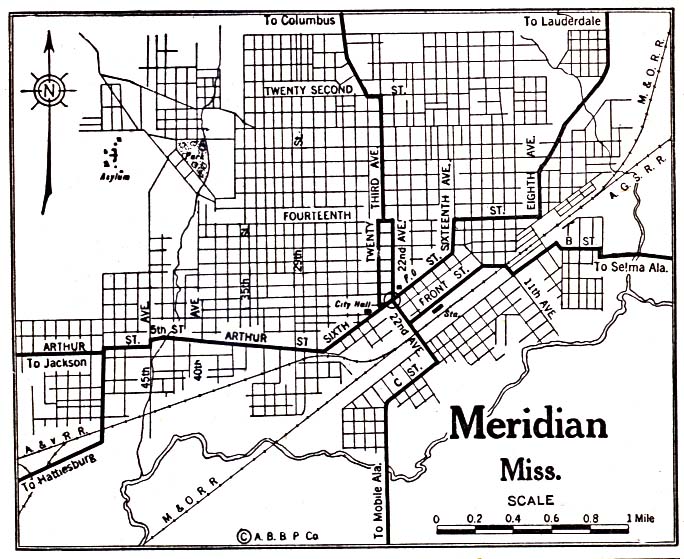
- Meridian, Mississippi 1920 Automobile Blue Book, 1920, Vol. 6 (137K)
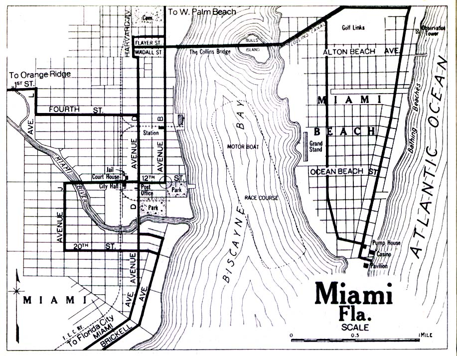
- Miami, Florida 1919 Automobile Blue Book, 1919, Vol. 6 (258K)
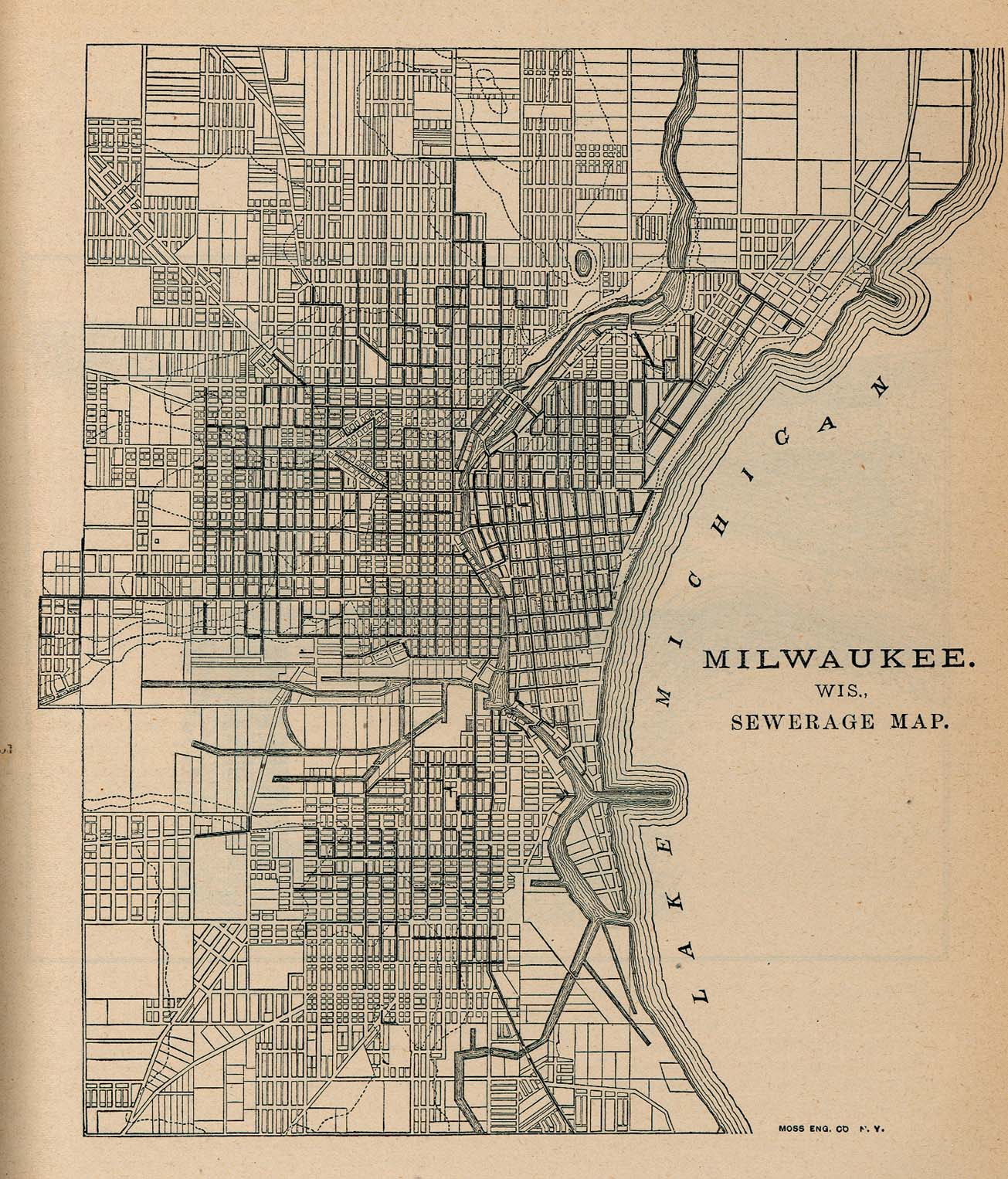
- Milwaukee, Wisconsin 1880 Sewerage Map - From Report on the Social Statistics of Cities, Compiled by George E. Waring, Jr., United States. Census Office, Part I, 1886. (469K)
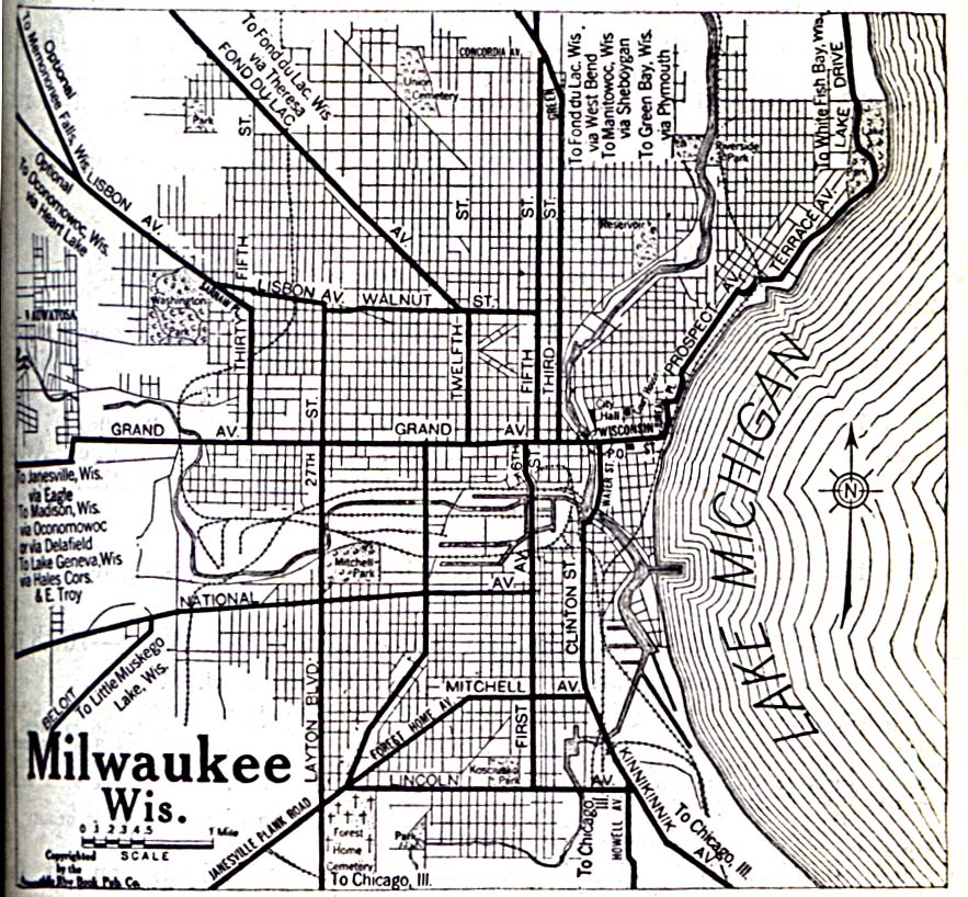
- Milwaukee, Wisconsin 1920 Automobile Blue Book, 1920, Vol. 5 (323K)
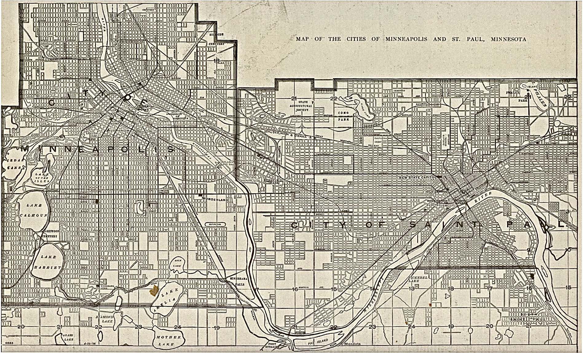
- Minneapolis, 1917 The New Encyclopedic Atlas and Gazetteer of the World. Edited and Revised by Francis J. Reynolds, 1917 (774K)
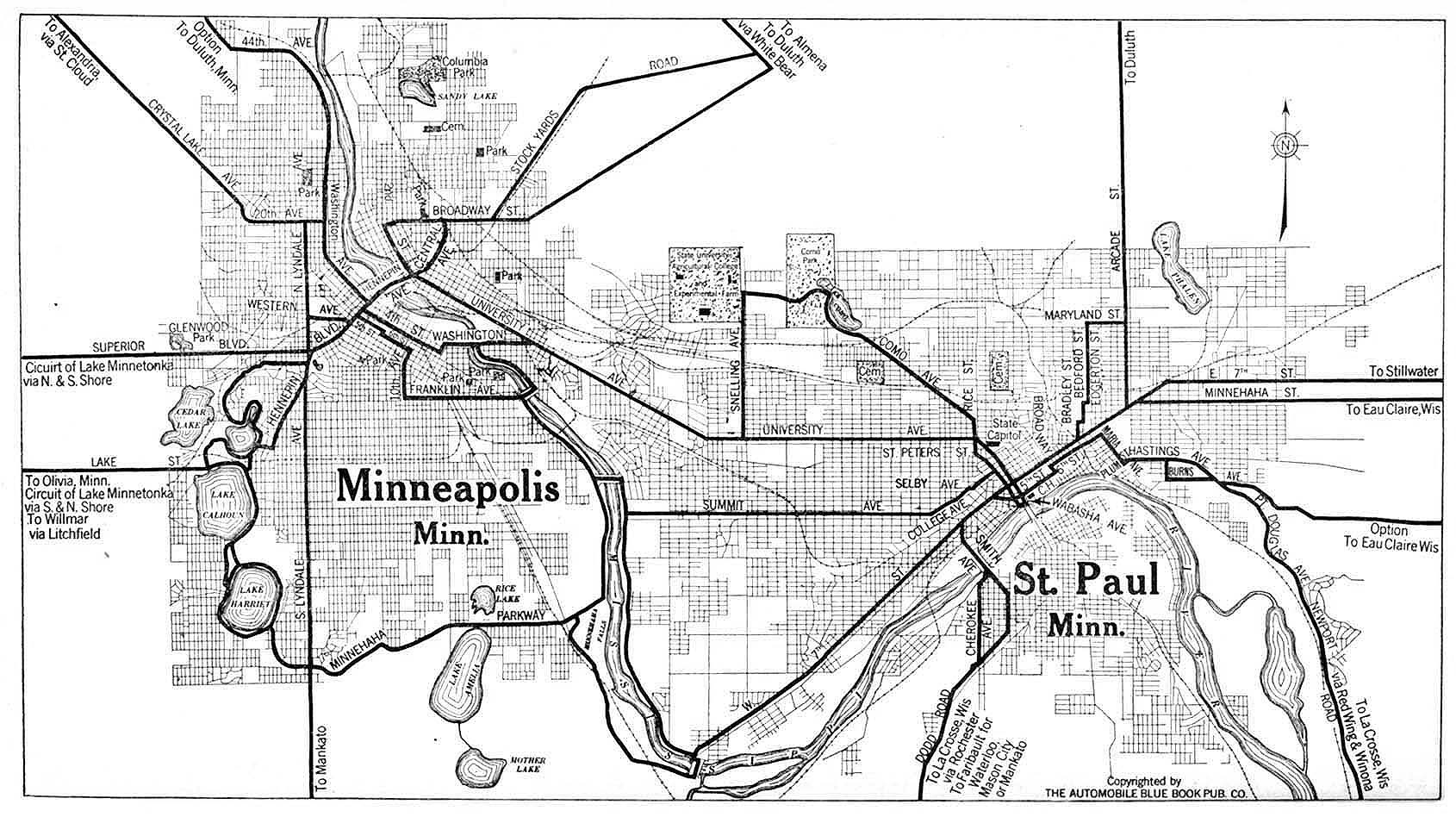
- Minneapolis and Saint Paul, Minnesota 1920 Automobile Blue Book, 1920, Vol. 5 (237K)
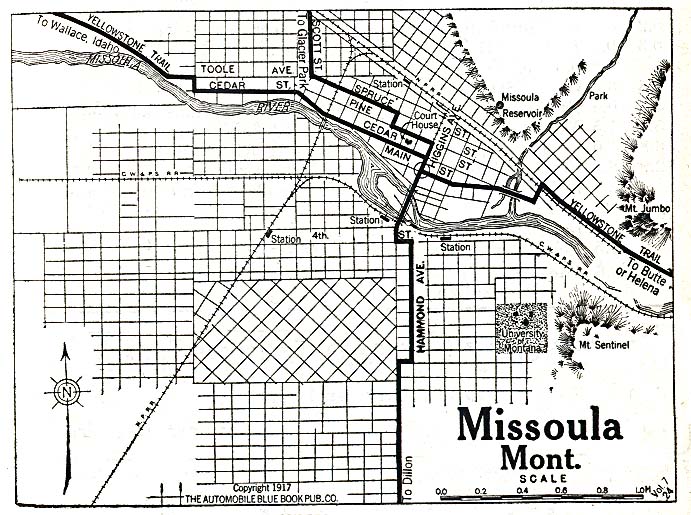
- Missoula, Montana 1917 Automobile Blue Book, 1917, Vol. 8, Section 1 (153K)
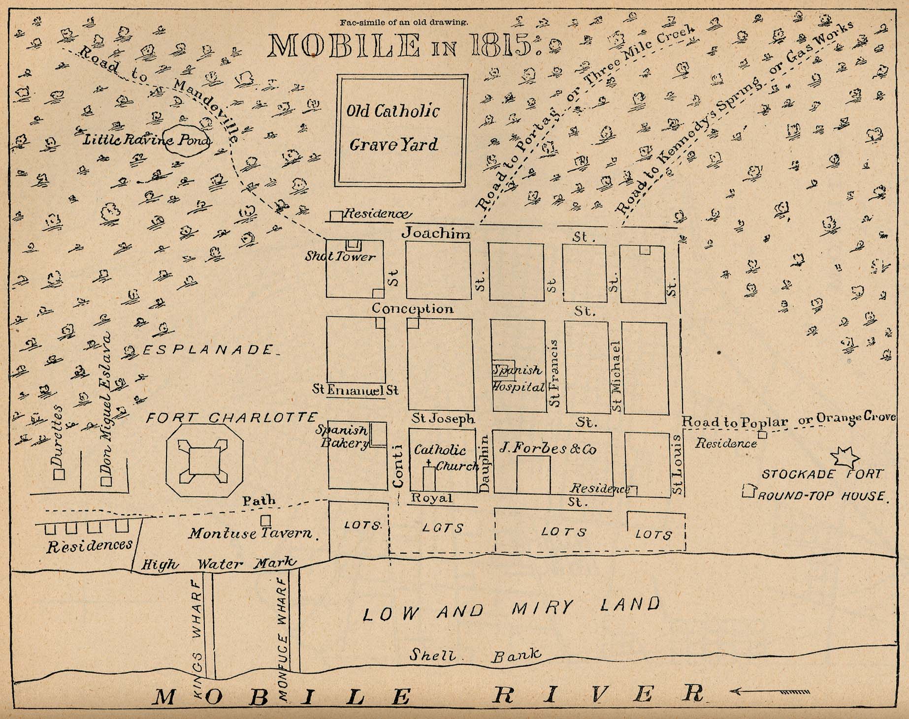
- Mobile, Alabama 1815 "Mobile in 1815" From Report on the Social Statistics of Cities, Compiled by George E. Waring, Jr., United States. Census Office, Part II, 1886. (419K)
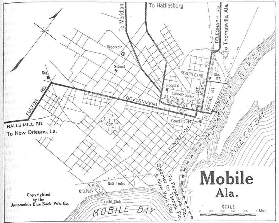
- Mobile, Alabama 1919 Automobile Blue Book, 1919, Vol. 6 (161K)
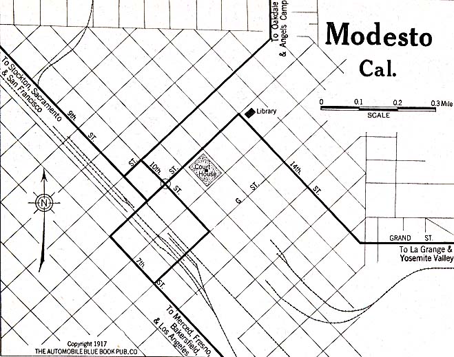
- Modesto, California 1917 Automobile Blue Book, 1917, Vol. 8, Section 1 (119K)
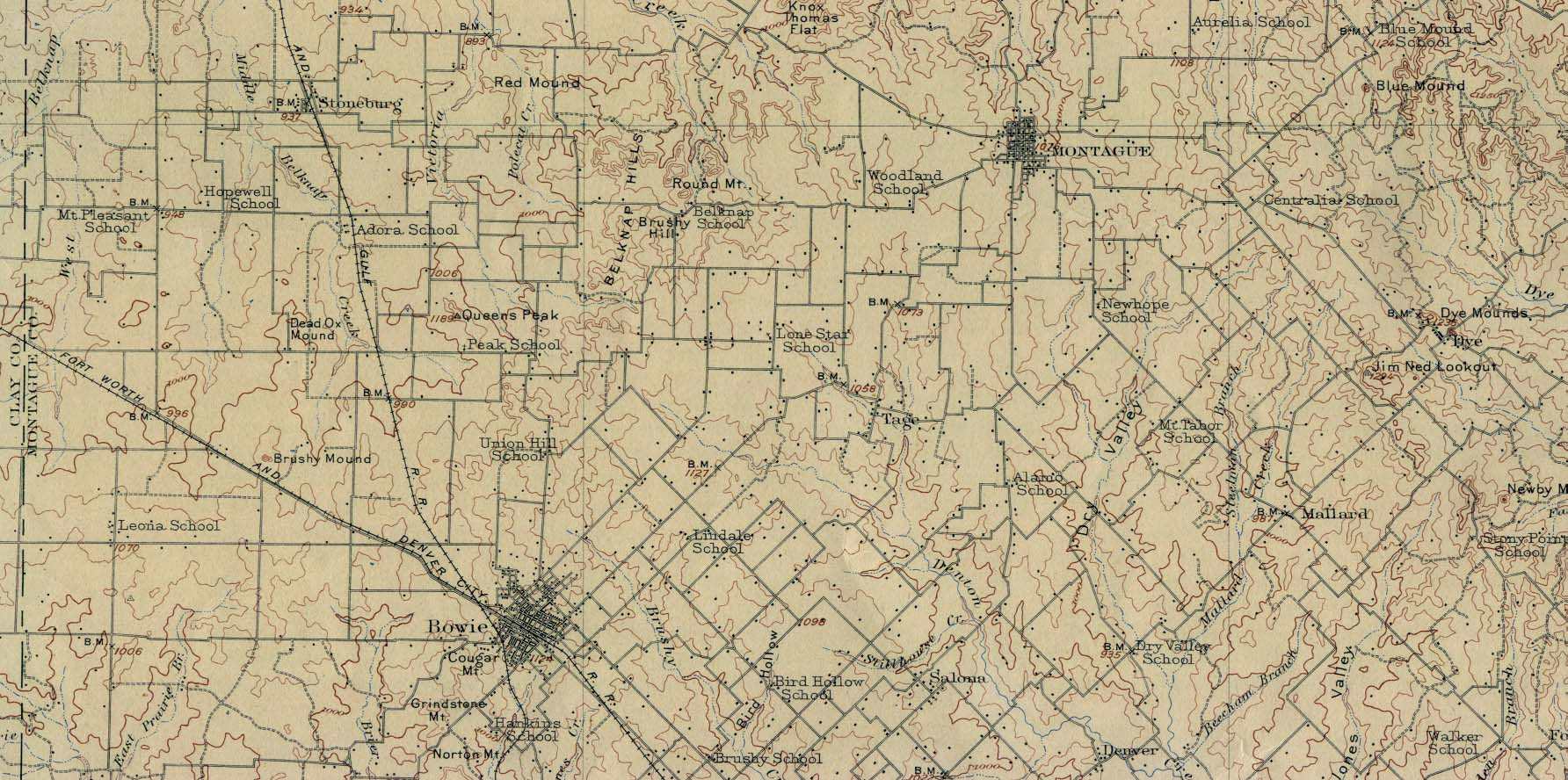
- Montague, Texas 1905 Original Scale 1:125,000 U.S. Geological Survey 1905. (359K)
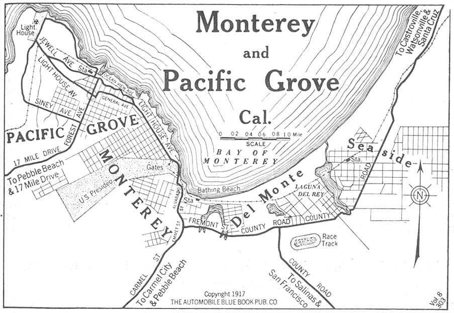
- Monterey and Pacific Grove, California 1917 Automobile Blue Book, 1917, Vol. 8, Section 1 (153K)
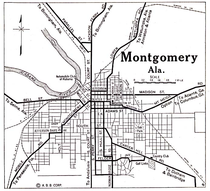
- Montgomery, Alabama 1920 Automobile Blue Book, 1920, Vol. 6 (137K)
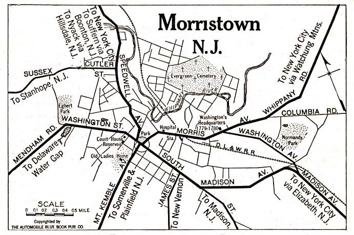
- Morristown, New Jersey 1920 Automobile Blue Book, 1920, Vol. 3 (117K)
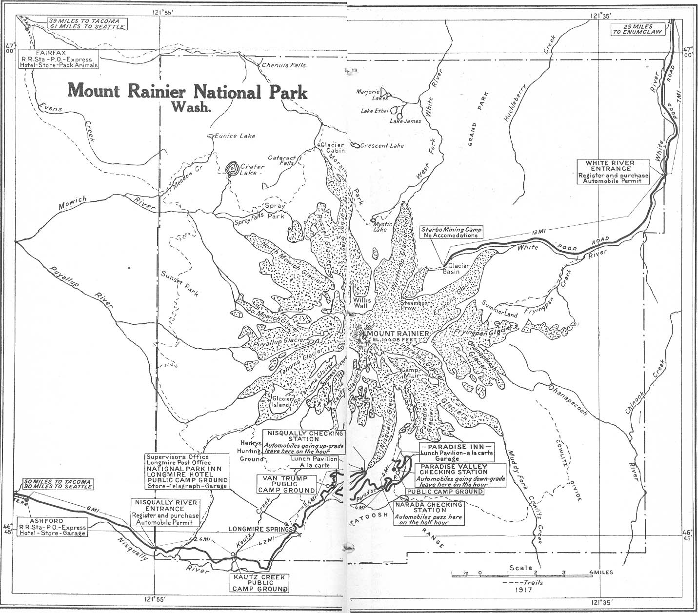
- Mount Rainier National Park, Washington 1917 Automobile Blue Book, 1917, Vol. 8, Section 2 (328K)
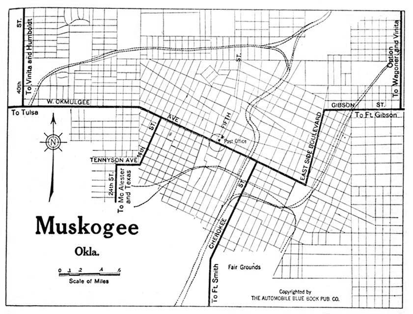
- Muskogee, Oklahoma 1920 Automobile Blue Book, 1920, Vol. 7 (131K)
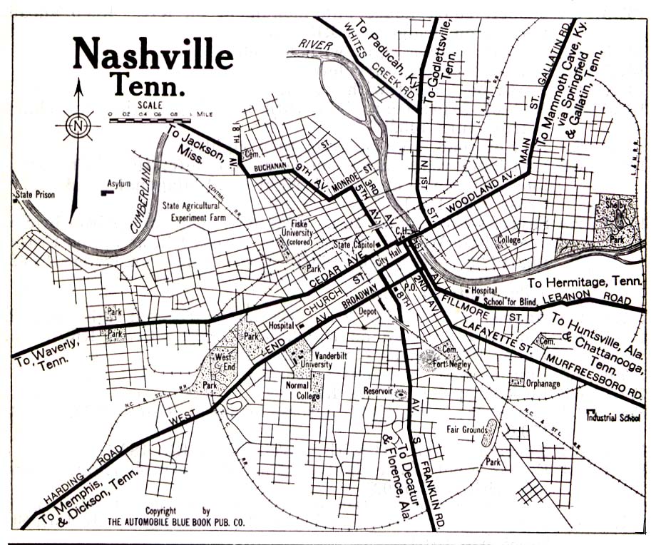
- Nashville, Tennessee 1919 Automobile Blue Book, 1919, Vol. 6 (323K)
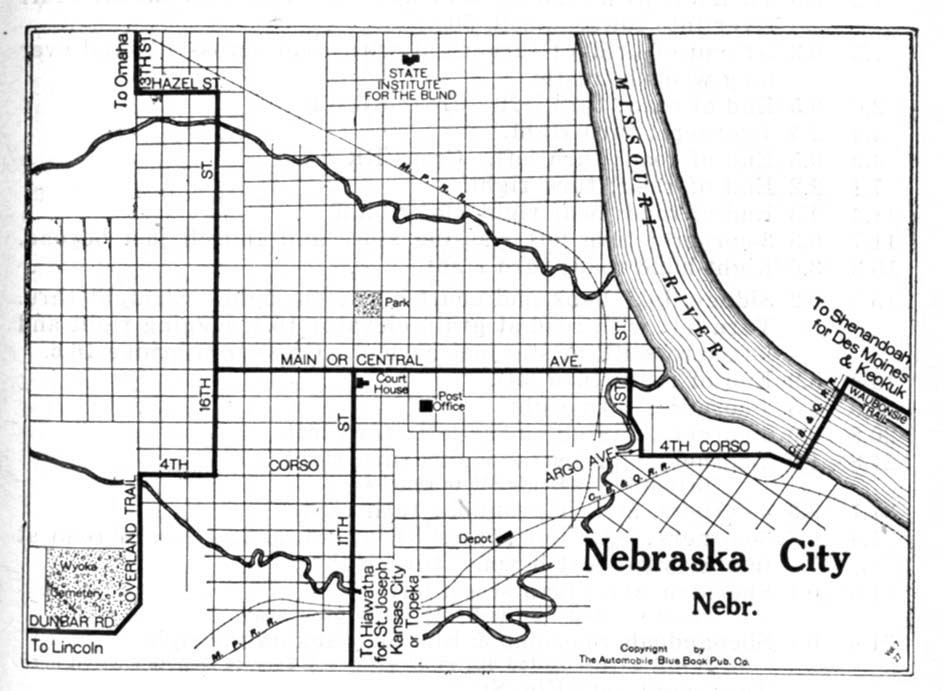
- Nebraska City, Nebraska 1920 Automobile Blue Book, 1920, Vol. 5 (128K)
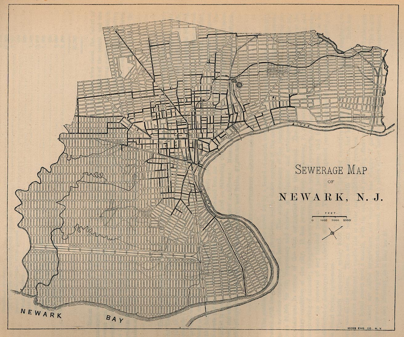
- Newark, New Jersey 1880 Sewerage Map - From Report on the Social Statistics of Cities, Compiled by George E. Waring, Jr., United States. Census Office, Part II, 1887. (369K)
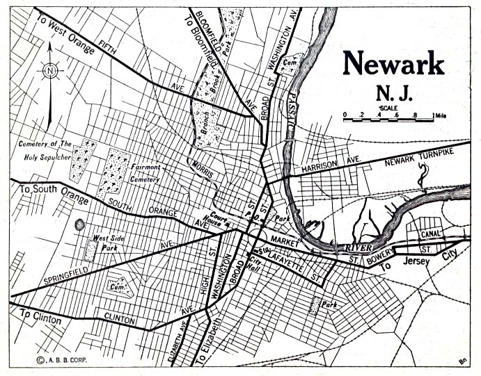
- Newark, New Jersey 1920 Automobile Blue Book, 1920, Vol. 3 (176K)
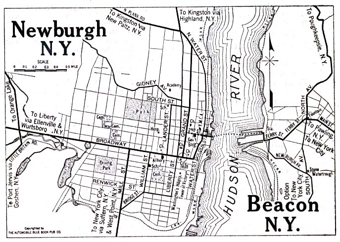
- Newburgh and Beacon, New York 1920 Automobile Blue Book, 1920, Vol. 1 (137K)
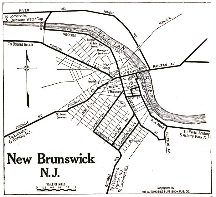
- New Brunswick, New Jersey 1920 Automobile Blue Book, 1920, Vol. 3 (117K)
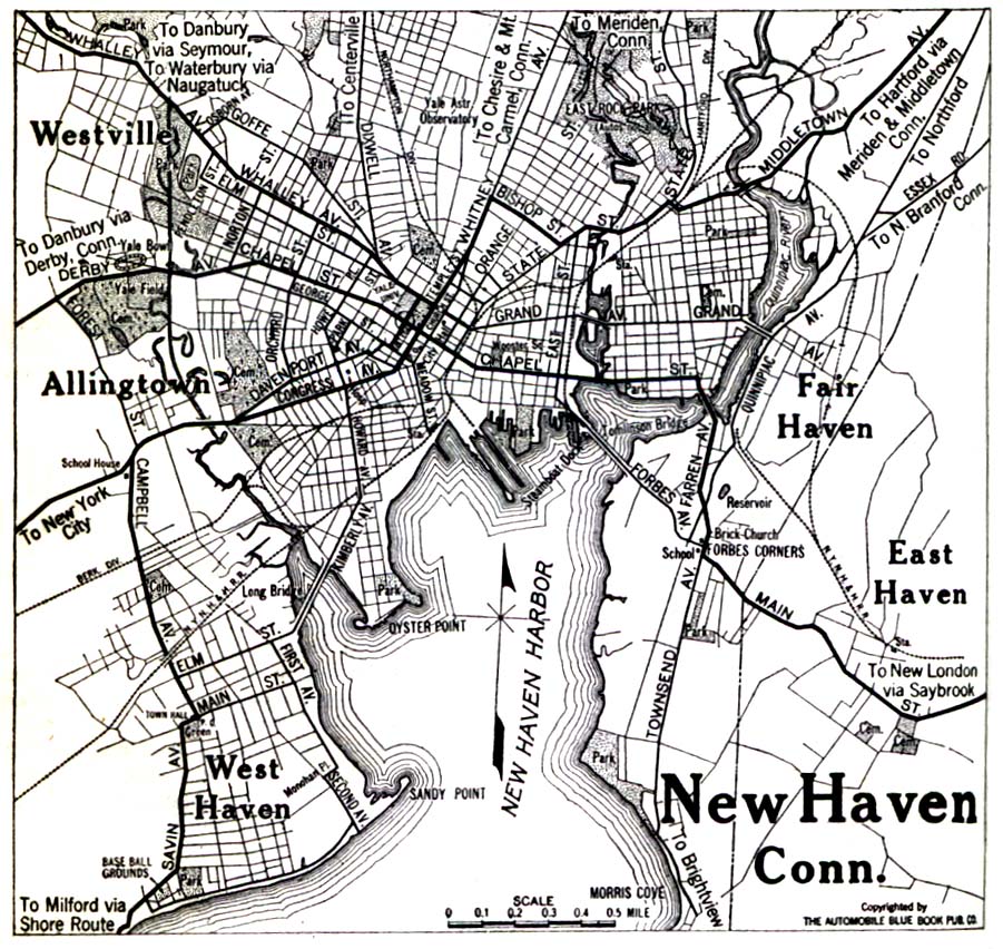
- New Haven, Connecticut 1920 Automobile Blue Book, 1920, Vol. 2 (323K)
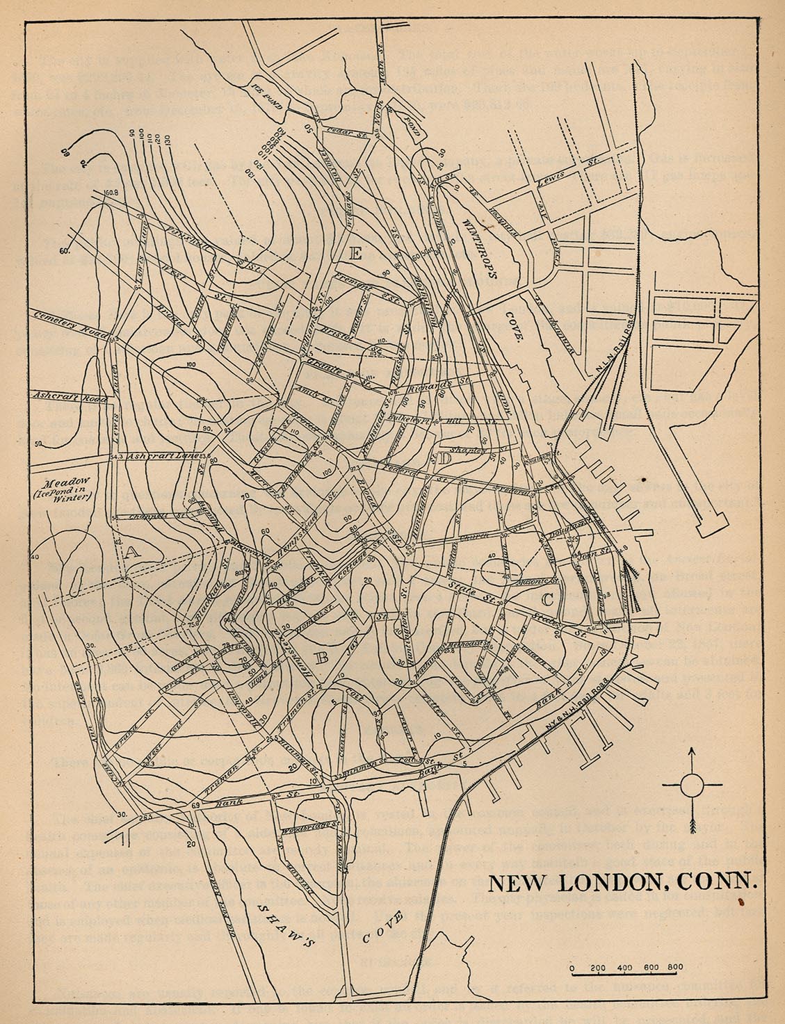
- New London, Connecticut 1880 From Report on the Social Statistics of Cities, Compiled by George E. Waring, Jr., United States. Census Office, Part I, 1886. (388K)
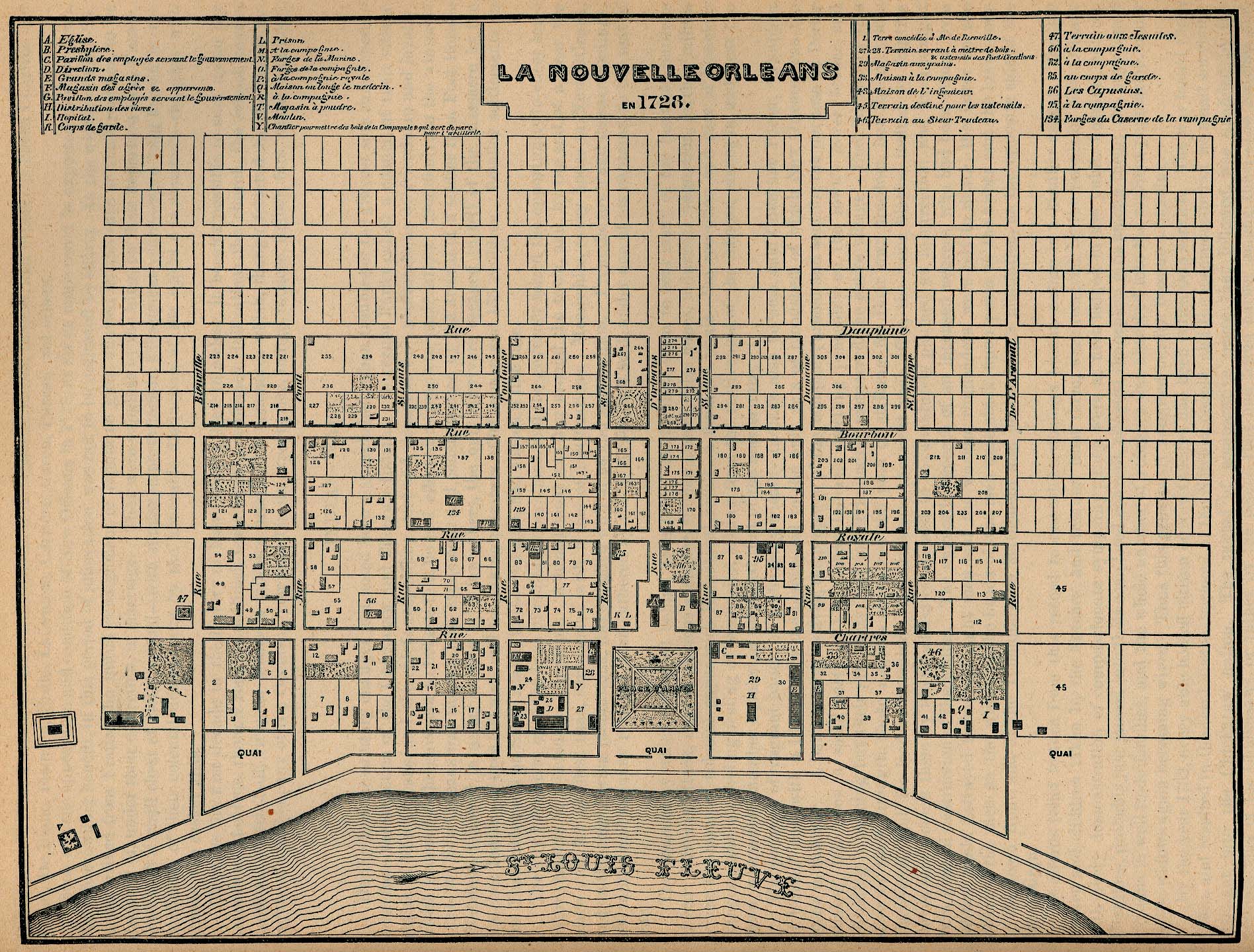
- New Orleans, Louisiana 1728 "La Nouvelle Orleans en 1728." From Report on the Social Statistics of Cities, Compiled by George E. Waring, Jr., United States. Census Office, Part II, 1886. (715K)
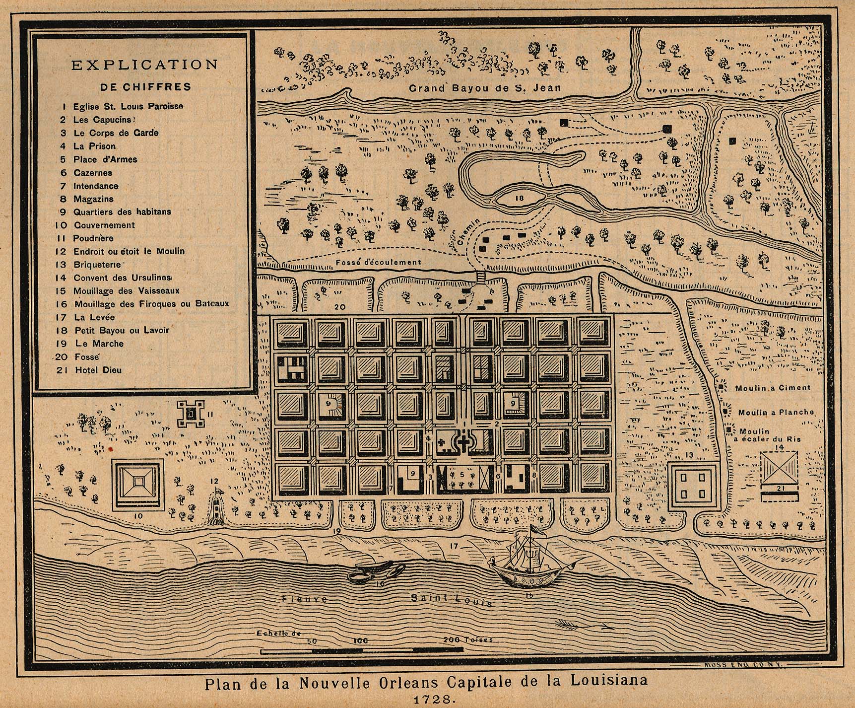
- New Orleans, Louisiana 1728 "Plan de la Nouvelle Orleans Capitale de la Louisiana 1728." From Report on the Social Statistics of Cities, Compiled by George E. Waring, Jr., United States. Census Office, Part II, 1886. (679K)
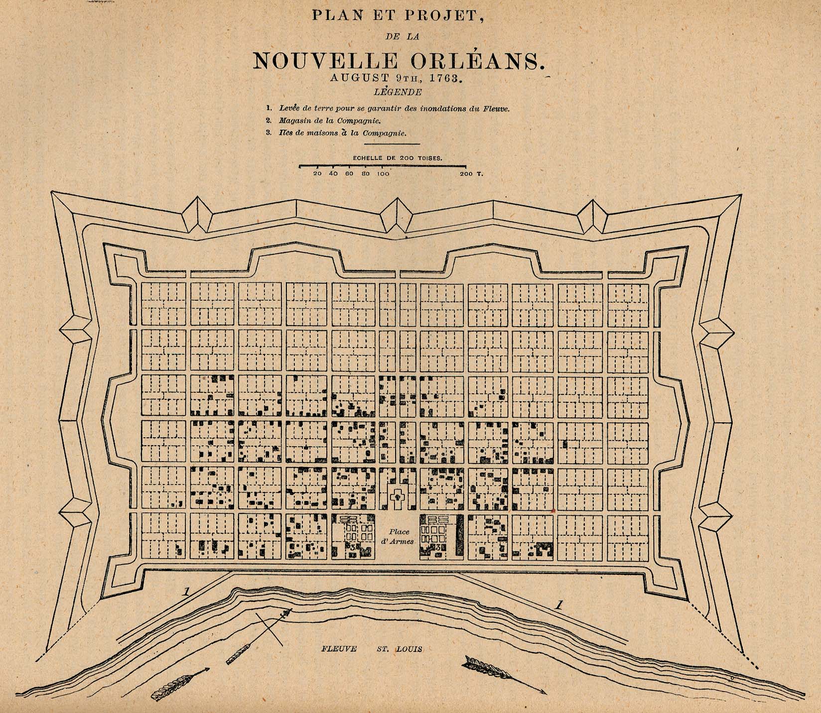
- New Orleans, Louisiana 1763 "Plan et Projet, de la Nouvelle Orléans. August 9, 1763." From Report on the Social Statistics of Cities, Compiled by George E. Waring, Jr., United States. Census Office, Part II, 1886. (441K)
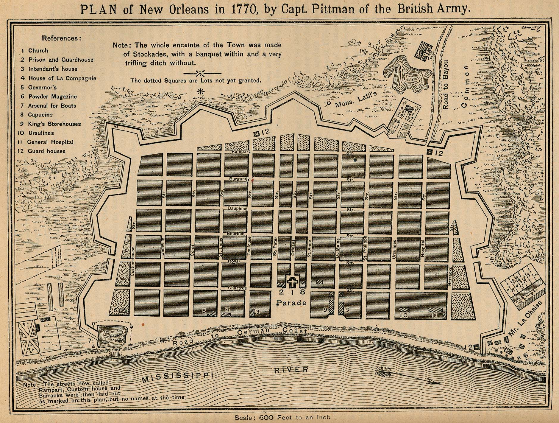
- New Orleans, Louisiana 1770 "Plan of New Orleans in 1770, by Capt. Pittman of the British Army." From Report on the Social Statistics of Cities, Compiled by George E. Waring, Jr., United States. Census Office, Part II, 1886. (736K)
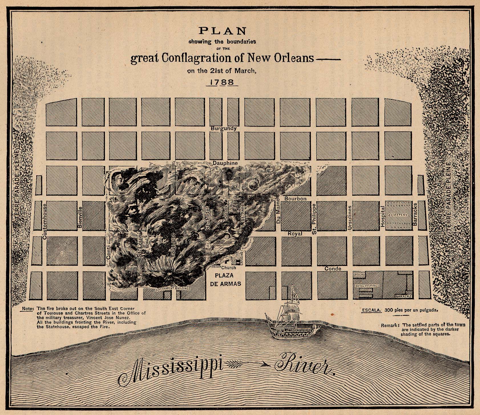
- New Orleans, Louisiana 1788 "Plan showing the boundaries of the great Conflagration of New Orleans on the 21st of March, 1788." From Report on the Social Statistics of Cities, Compiled by George E. Waring, Jr., United States. Census Office, Part II, 1886. (914K)
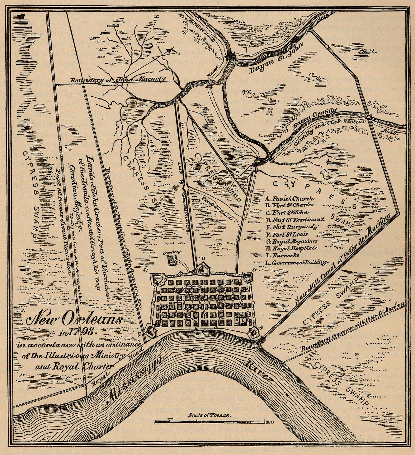
- New Orleans, Louisiana 1798 "New Orleans in 1798 in accordance with an ordinance of the Illustrious Ministry and Royal Charter." From Report on the Social Statistics of Cities, Compiled by George E. Waring, Jr., United States. Census Office, Part II, 1886. (554K)
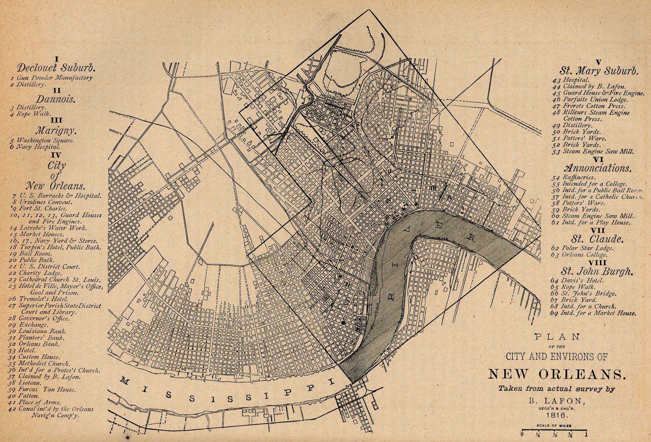
- New Orleans, Louisiana 1816 "Plan of the City and Environs of New Orleans." From Report on the Social Statistics of Cities, Compiled by George E. Waring, Jr., United States. Census Office, Part II, 1886. (815K)
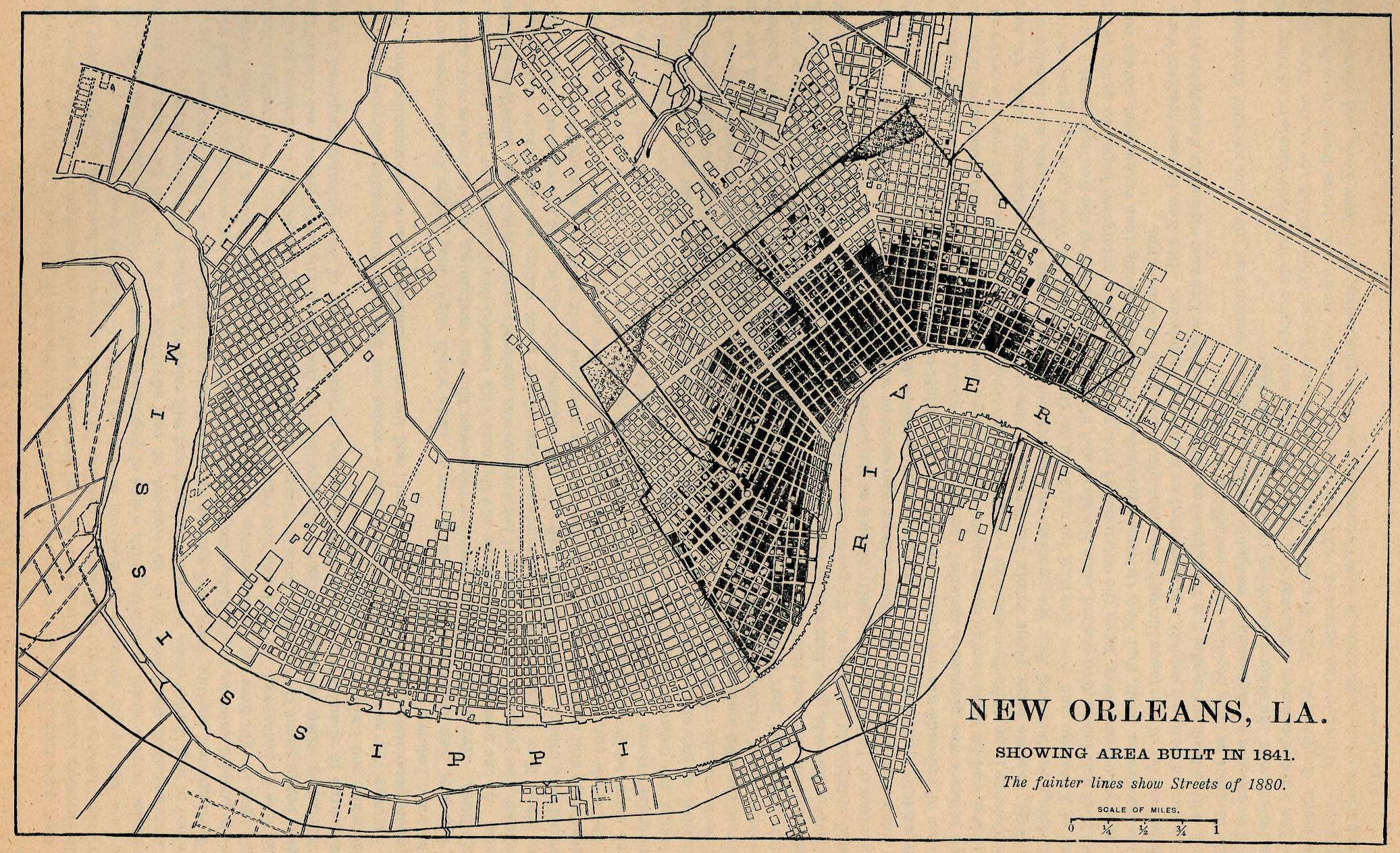
- New Orleans, Louisiana 1841 "New Orleans, La. Showing Area Built in 1841. The fainter lines show Streets of 1880." From Report on the Social Statistics of Cities, Compiled by George E. Waring, Jr., United States. Census Office, Part II, 1886. (741K)
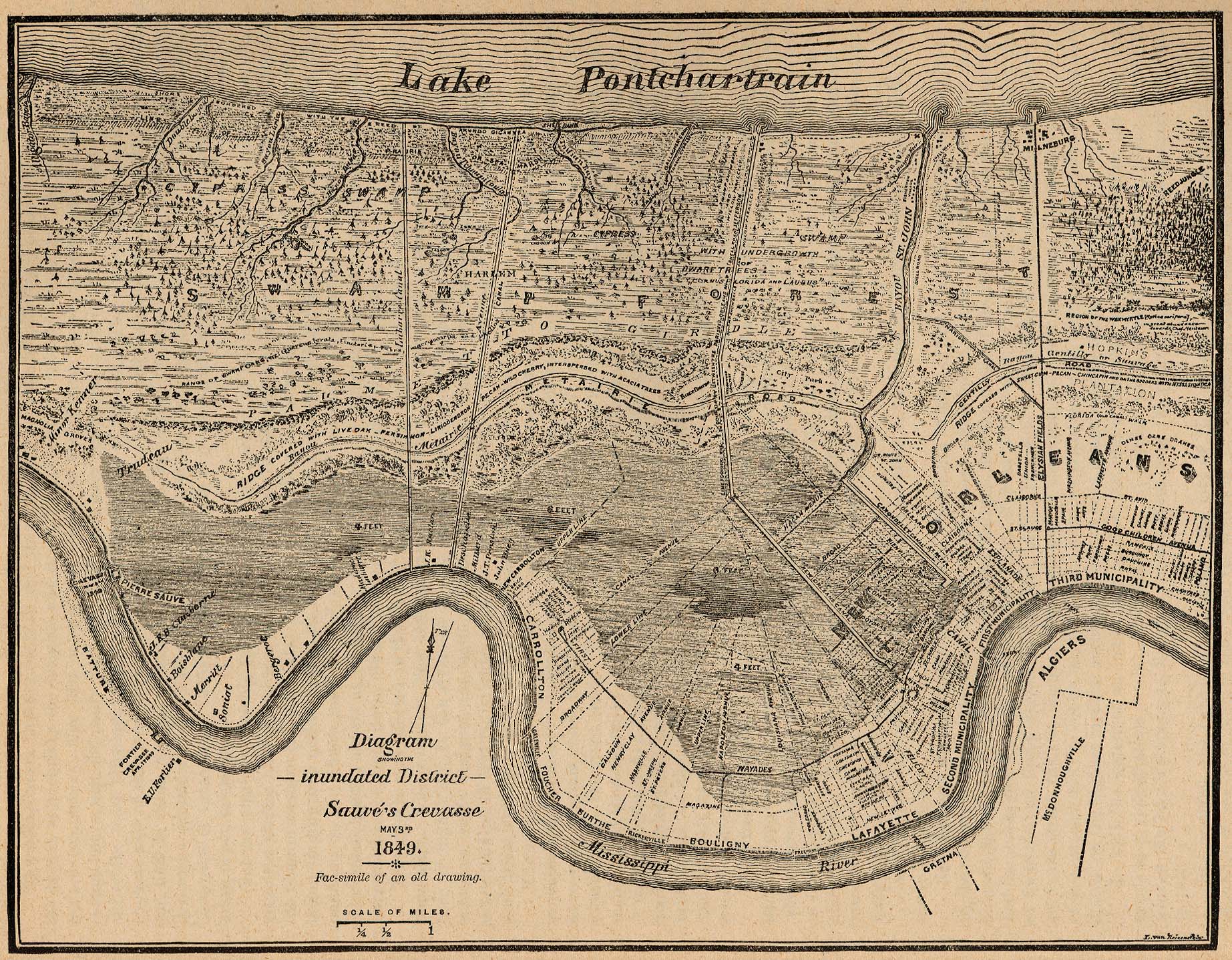
- New Orleans, Louisiana 1849 "Diagram showing the inundated District Sauvé's Crevasse May 3rd 1849. Fac-similie of an old drawing." From Report on the Social Statistics of Cities, Compiled by George E. Waring, Jr., United States. Census Office, Part II, 1886. (917K)
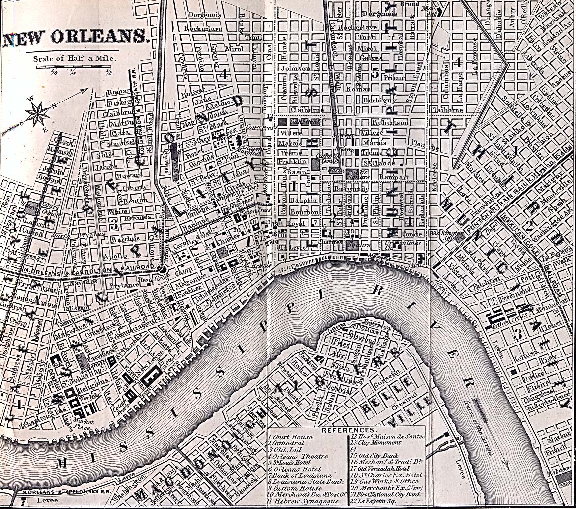
- New Orleans, Louisiana (undated) Appletons' Hand-Book of American Travel. New York: D. Appleton and Company, 1869 (646K)
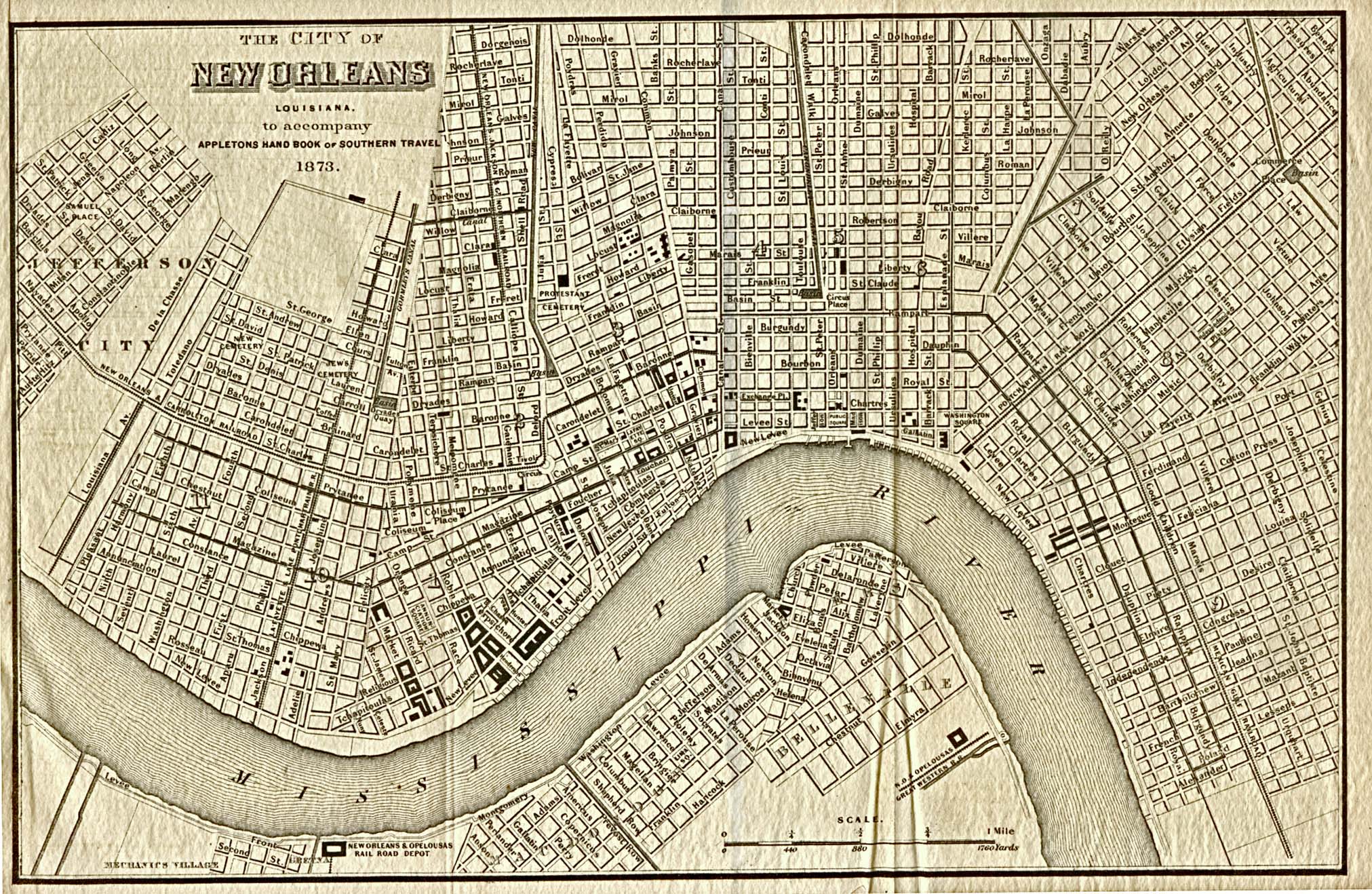
- New Orleans, Louisiana 1873 Appletons' Hand-Book of American Travel, Southern Tour. Compiled and Edited by Charles H. Jones. 1873 (839K)
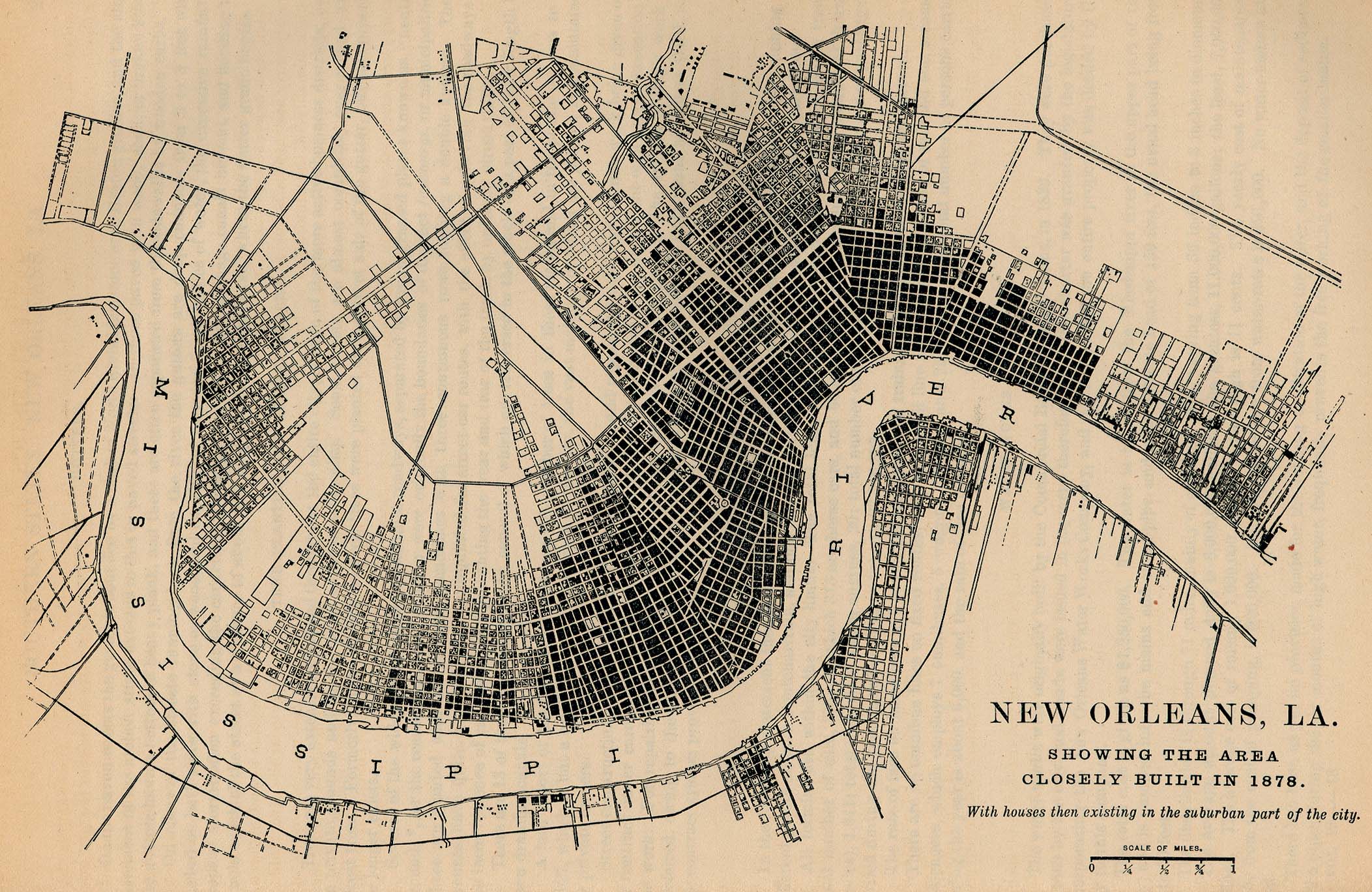
- New Orleans, Louisiana 1878 "New Orleans, La. Showing the Area Closely Built in 1878. With houses then existing in the suburban part of the city." From Report on the Social Statistics of Cities, Compiled by George E. Waring, Jr., United States. Census Office, Part II, 1886. (662K)
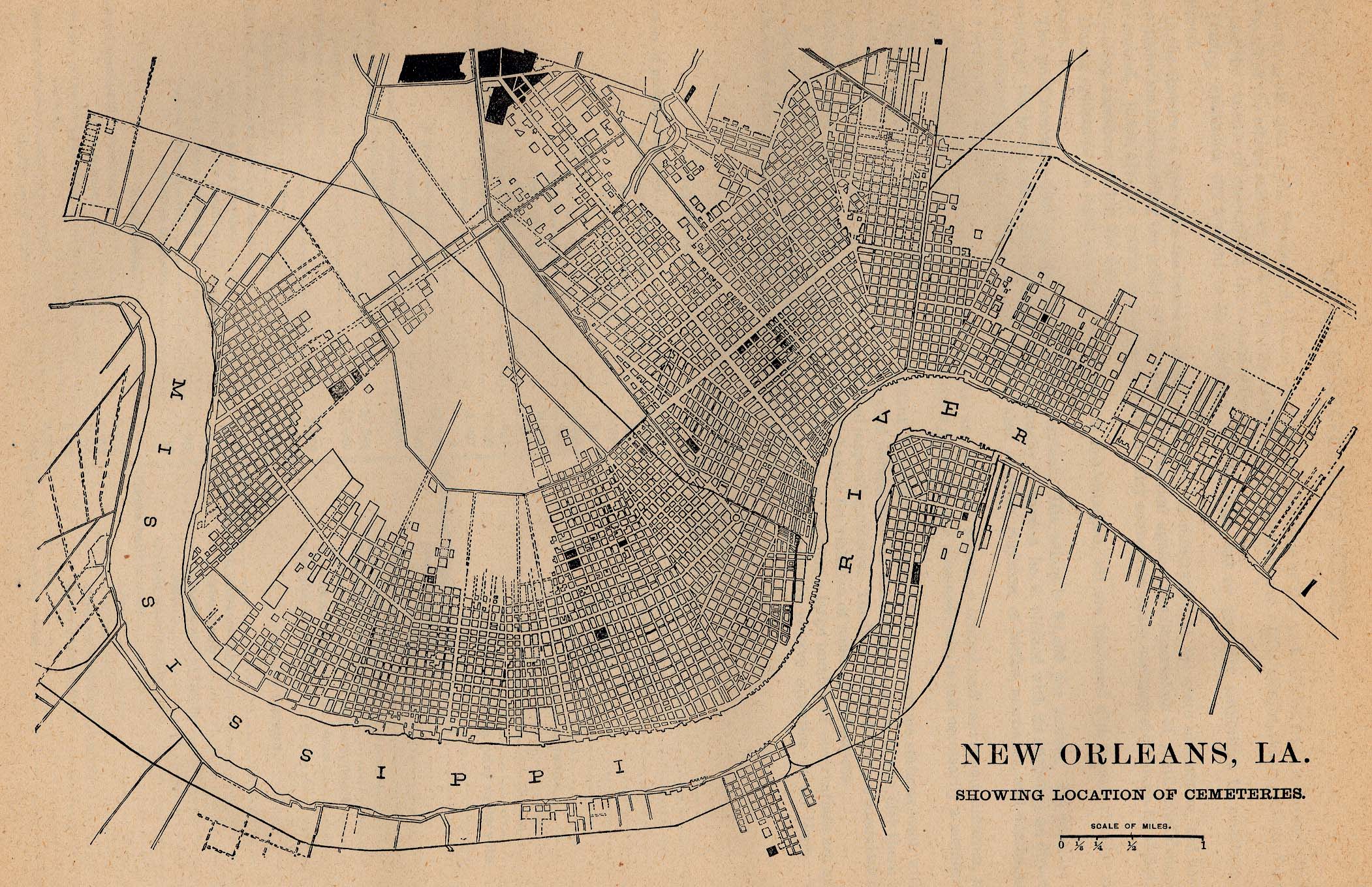
- New Orleans, Louisiana 1880 - Location of Cemeteries "New Orleans, La. Showing Location of Cemeteries." From Report on the Social Statistics of Cities, Compiled by George E. Waring, Jr., United States. Census Office, Part II, 1886. (728K)
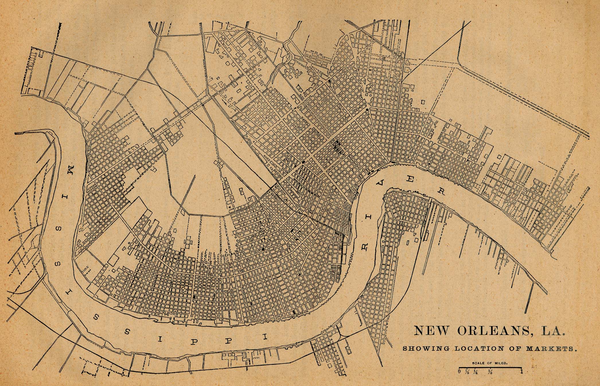
- New Orleans, Louisiana 1880 - Location of Markets "New Orleans, La. Showing Location of Markets." From Report on the Social Statistics of Cities, Compiled by George E. Waring, Jr., United States. Census Office, Part II, 1886. (763K)
- New Orleans, Louisiana 1891 U.S. Geological Survey (740K)
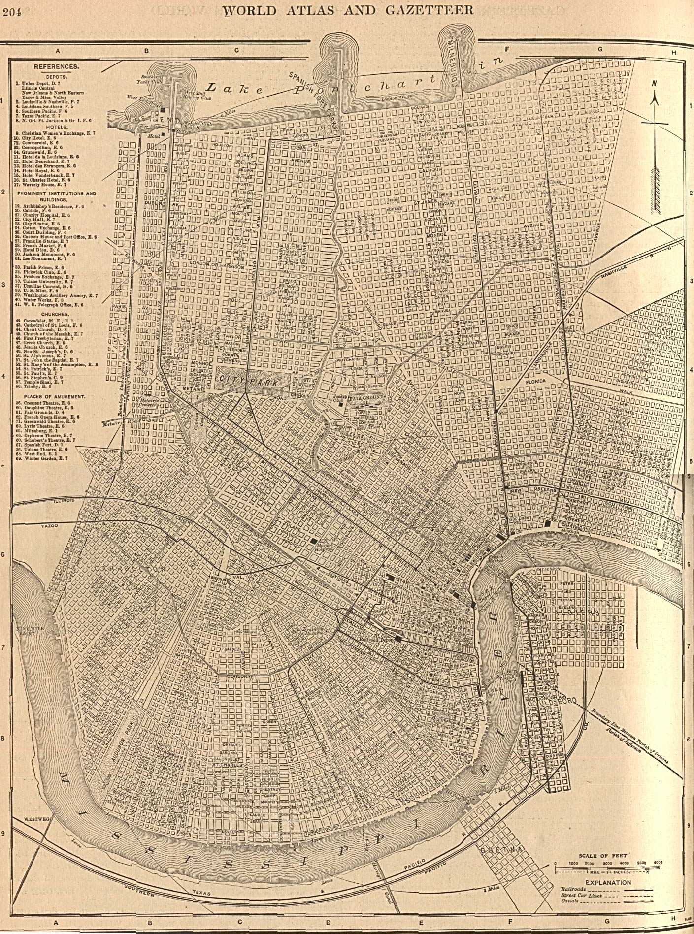
- New Orleans, Louisiana 1908 The New Encyclopedic Atlas and Gazetteer of the World. New York: P.F. Collier & Son, 1917 (945K)
- New Orleans, Louisiana 1917 Automobile Blue Book, 1917, Vol. 4 (170K)
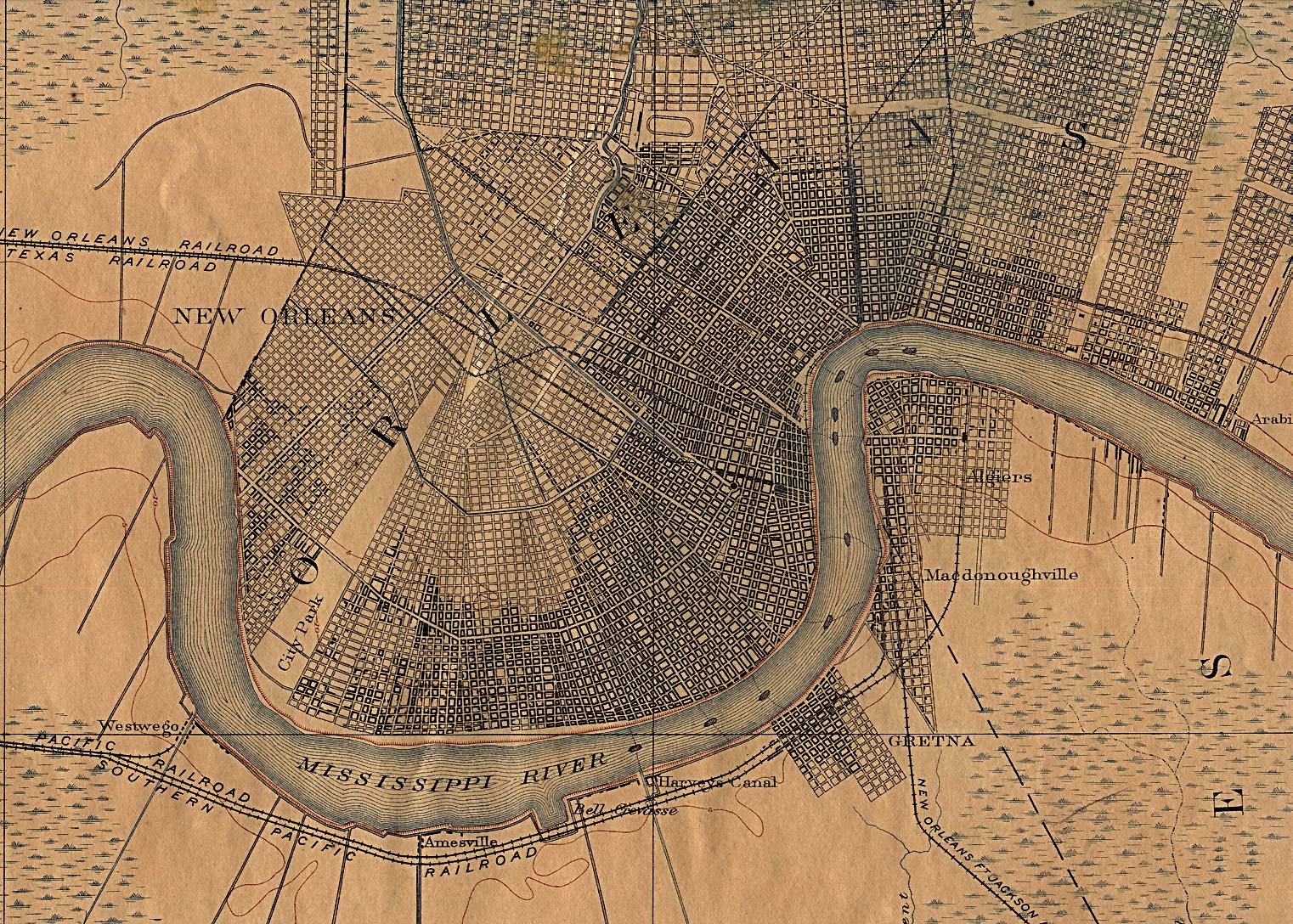
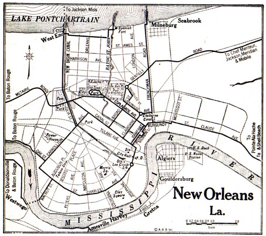
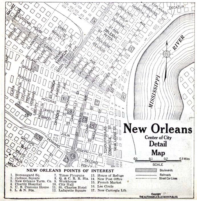
- New Orleans, Louisiana - Detail 1920 Automobile Blue Book, 1920, Vol. 7 (162K)
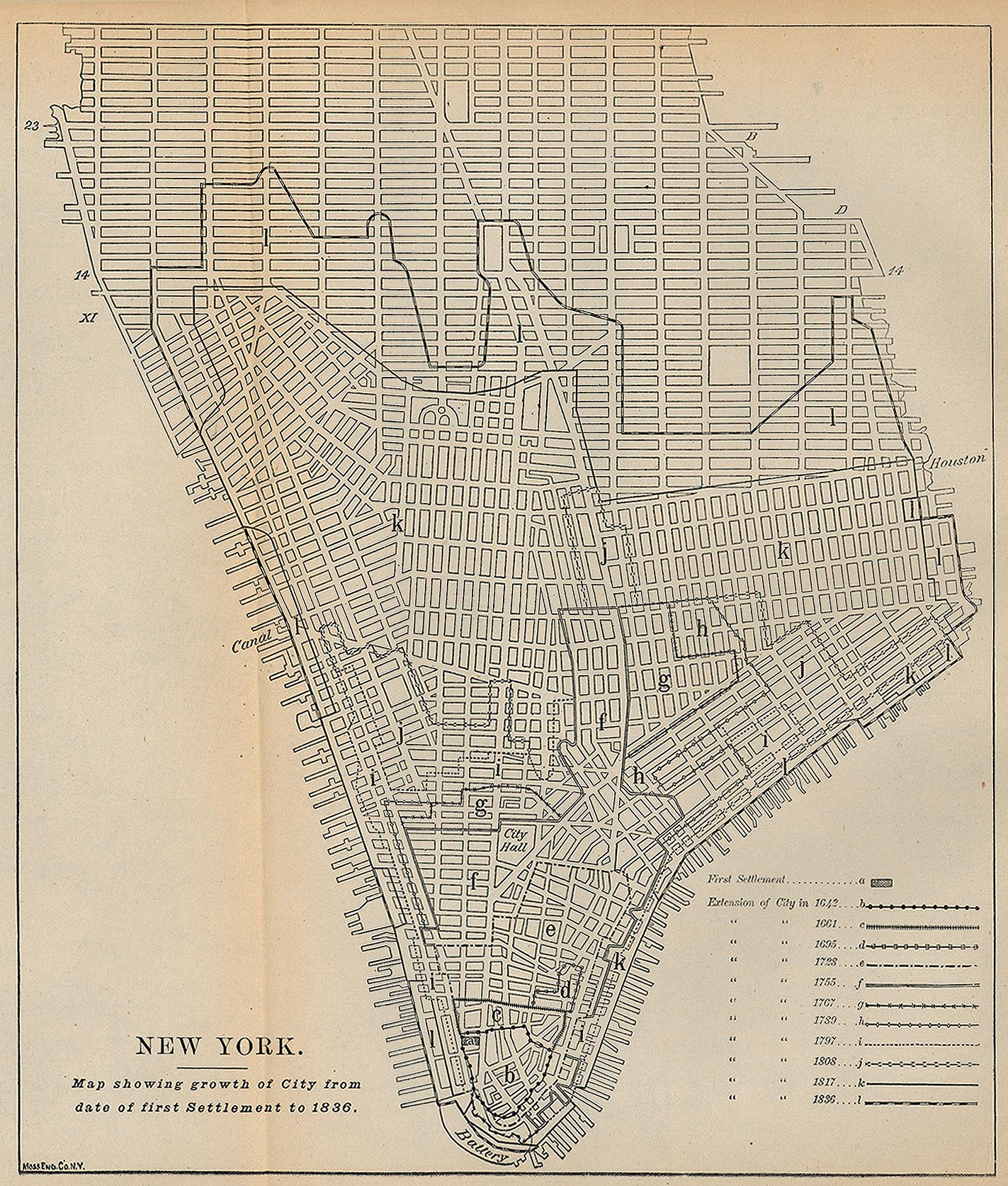
- New York First Settlement - 1836 [Map overlays streets as of 1880] "Map showing growth of City from date of first Settlement to 1836." From Report on the Social Statistics of Cities, Compiled by George E. Waring, Jr., United States. Census Office, Part I, 1886. (616K)
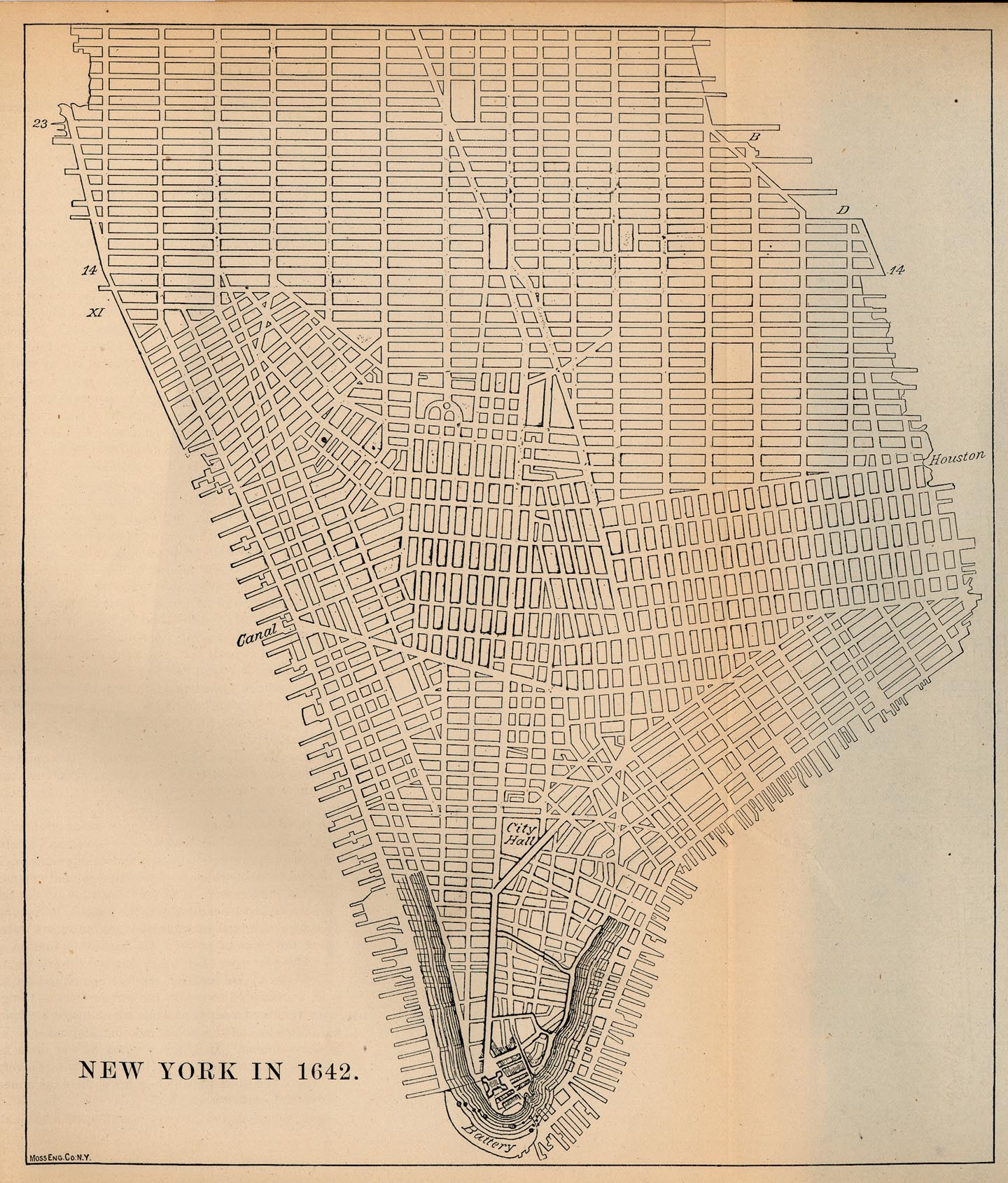
- New York 1642 [Map overlays streets as of 1880] From Report on the Social Statistics of Cities, Compiled by George E. Waring, Jr., United States. Census Office, Part I, 1886. (542K)
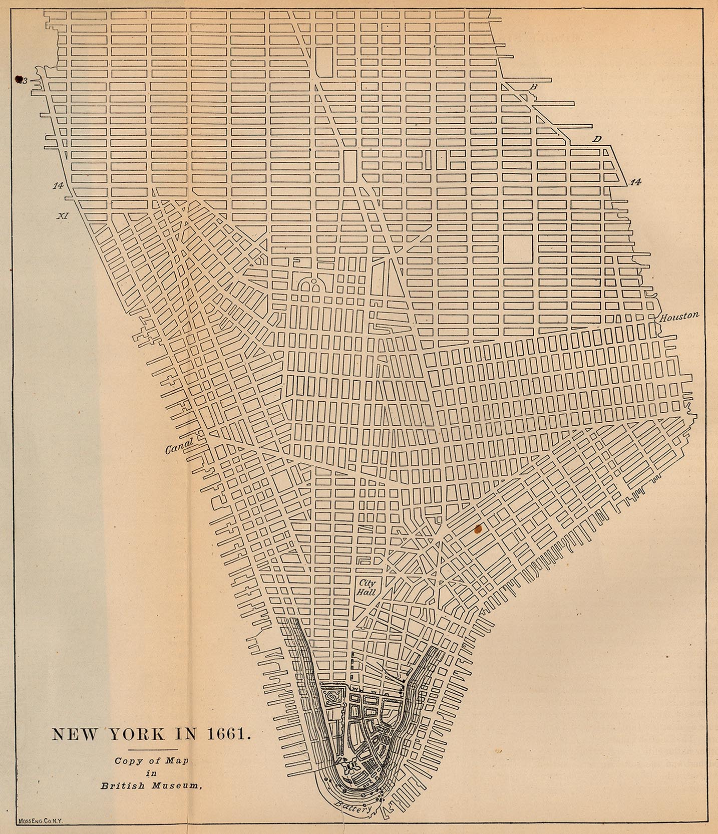
- New York 1661 [Map overlays streets as of 1880] From Report on the Social Statistics of Cities, Compiled by George E. Waring, Jr., United States. Census Office, Part I, 1886. (541K)
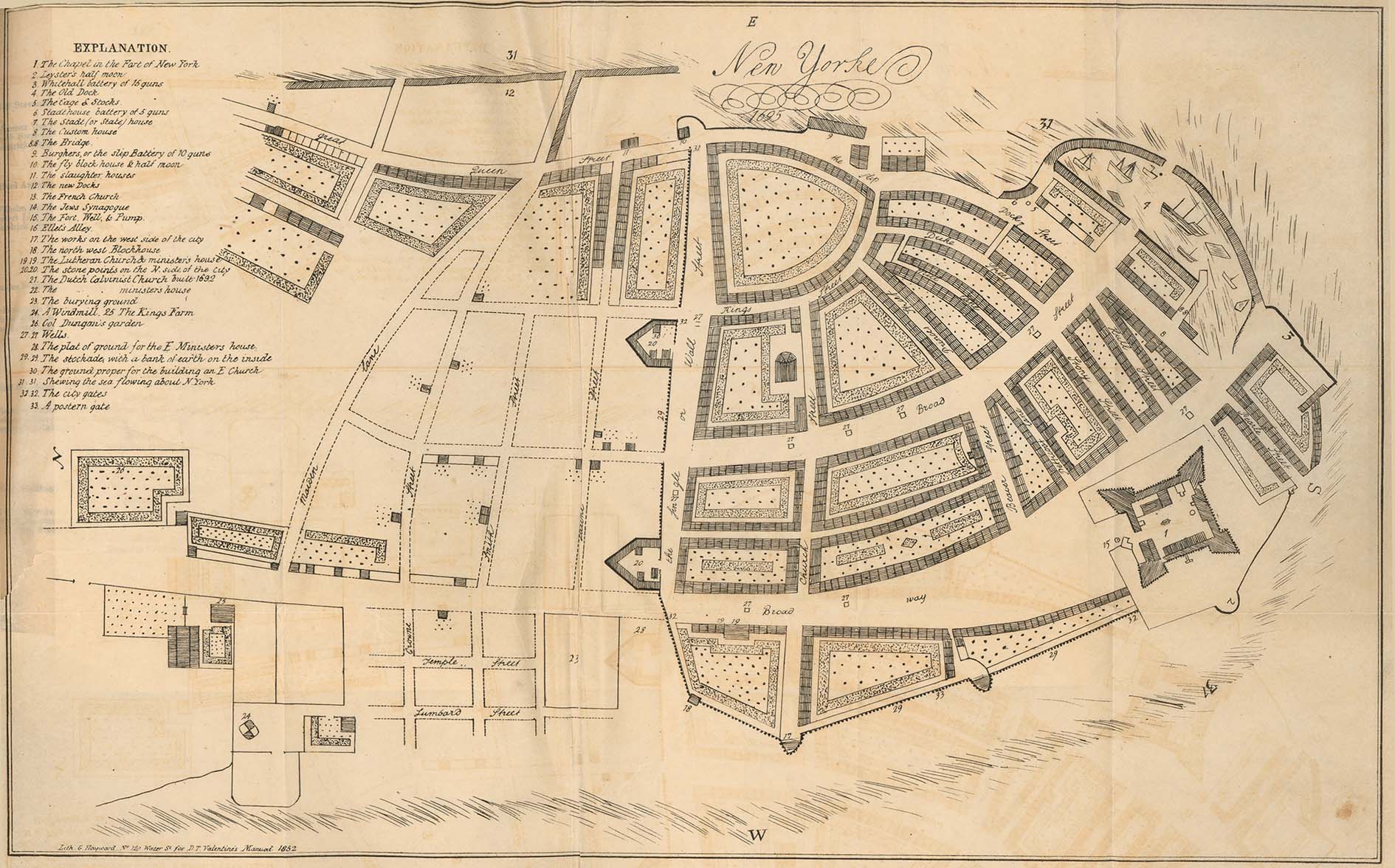
- New York 1695 From Manual of the Corporation of the City of New York for 1852 by D.T. Valentine, 1852 (381K)
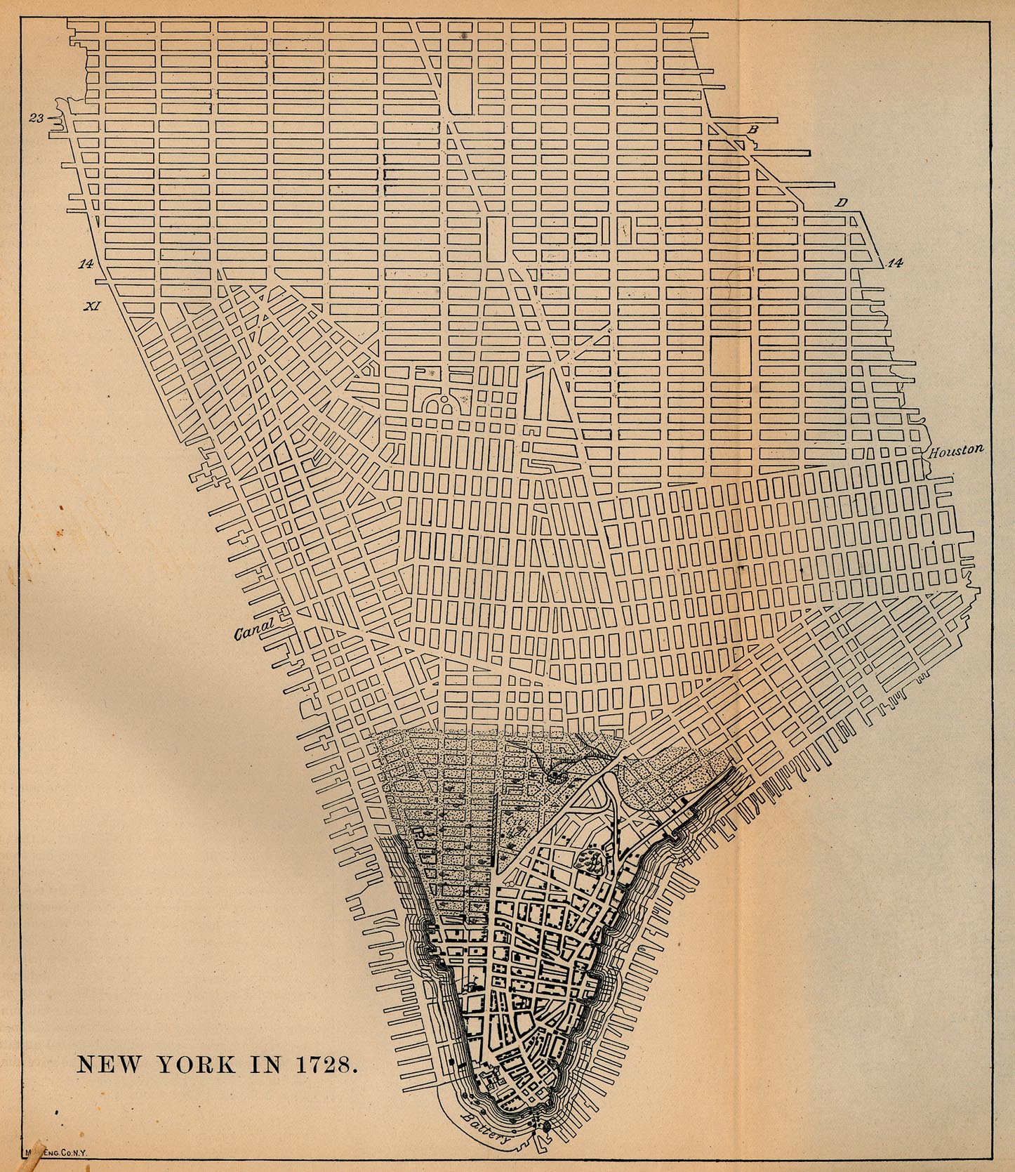
- New York 1728 [Map overlays streets as of 1880] From Report on the Social Statistics of Cities, Compiled by George E. Waring, Jr., United States. Census Office, Part I, 1886. (597K)
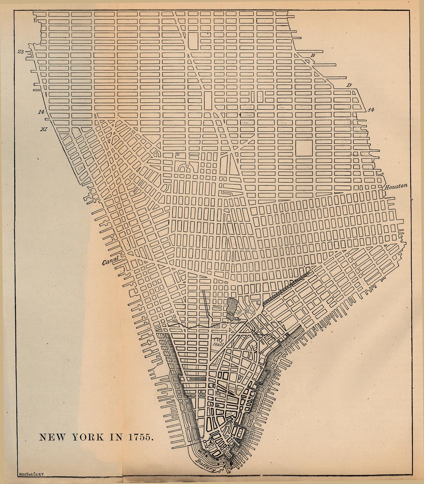
- New York 1755 [Map overlays streets as of 1880] From Report on the Social Statistics of Cities, Compiled by George E. Waring, Jr., United States. Census Office, Part I, 1886. (570K)
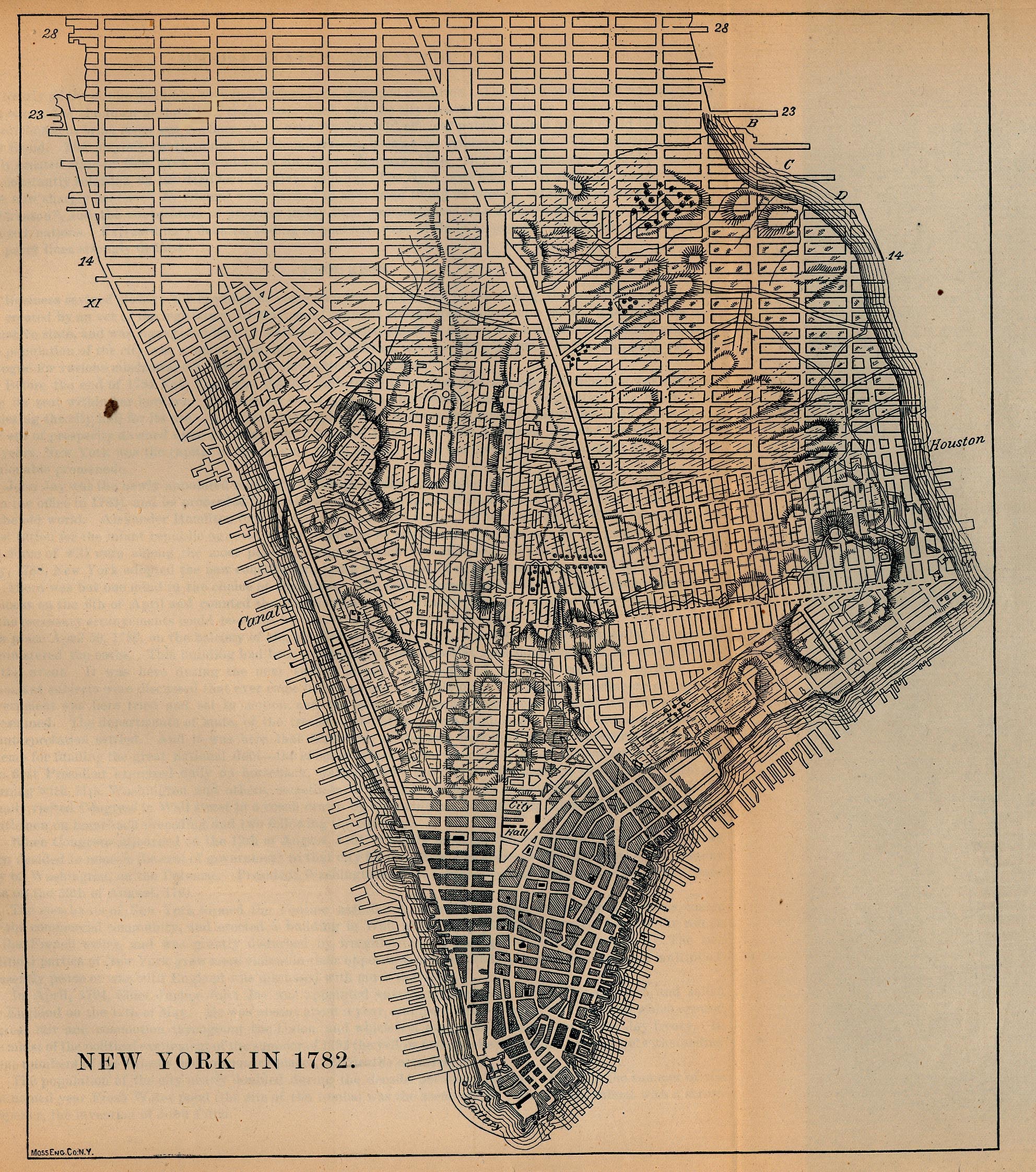
- New York 1782 [Map overlays streets as of 1880] From Report on the Social Statistics of Cities, Compiled by George E. Waring, Jr., United States. Census Office, Part I, 1886. (1297K)
- New York City Region 1830 The Northern Traveller, and Northern Tour. Fourth Edition. New York: J. & J. Harper 1830 (117K)
- New York 1842 "New-York" from Tanner, H.S. The American Traveller; or Guide Through the United States. Eighth Edition. New York, 1842. (396K)
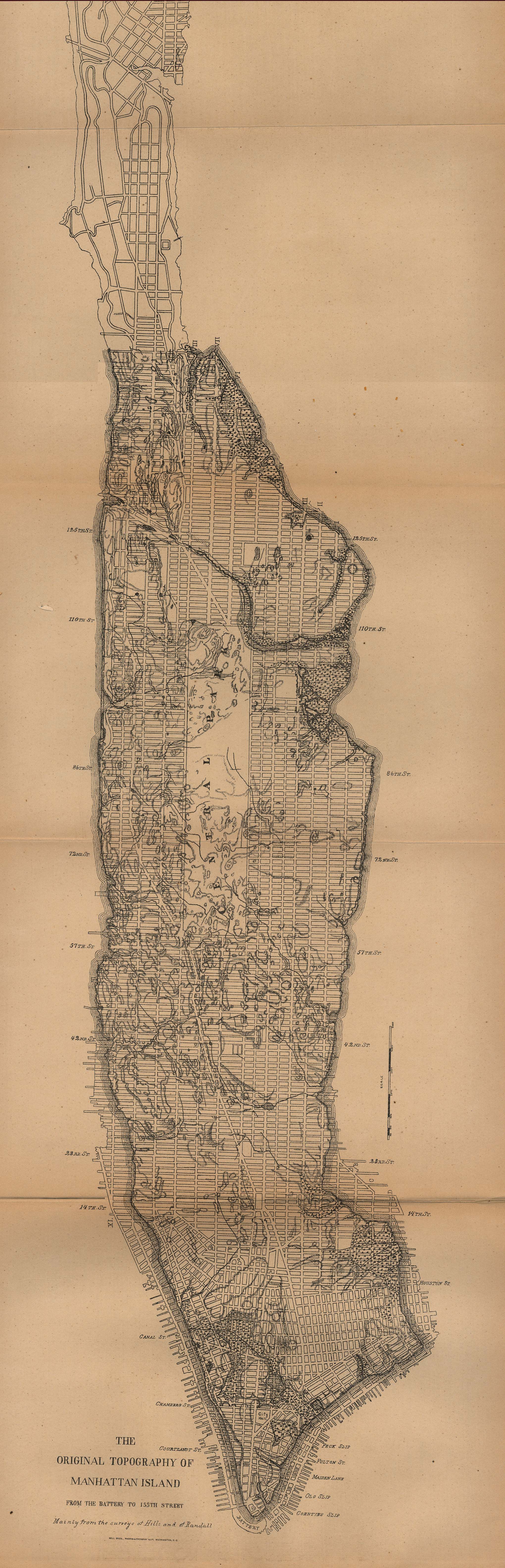
- New York 1880 [Map overlays streets as of 1880] "The Original Topography of Manhattan Island from the Battery to 155th Street" From Report on the Social Statistics of Cities, Compiled by George E. Waring, Jr., United States. Census Office, Part I, 1886. (542K)
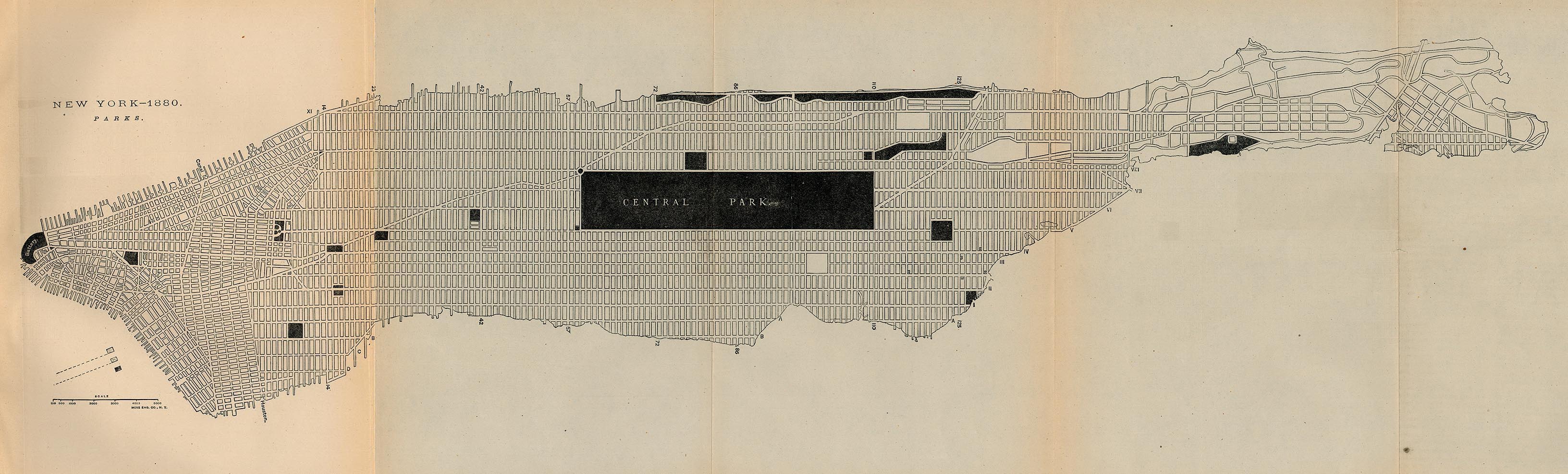
- New York 1880 - Parks "New York - 1880 Parks" From Report on the Social Statistics of Cities, Compiled by George E. Waring, Jr., United States. Census Office, Part I, 1886. (542K)
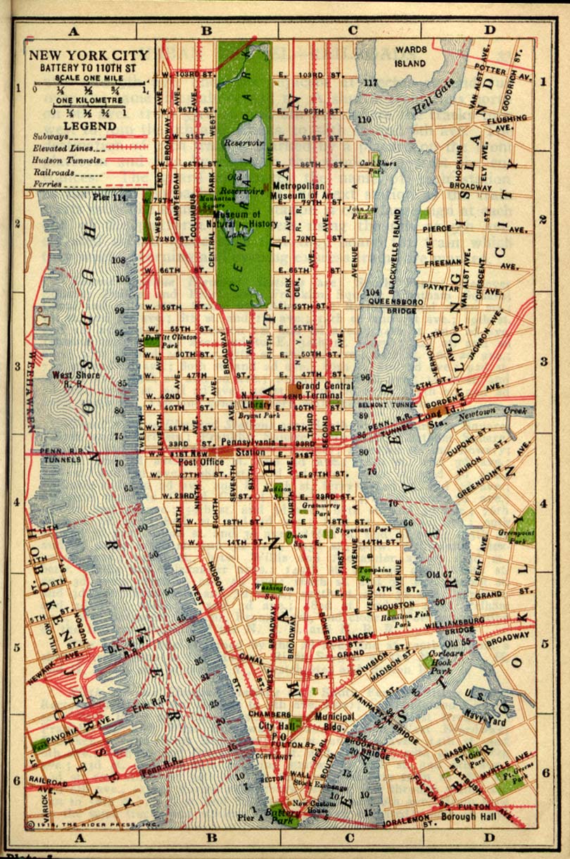
- New York (Battery to 110th Street) 1916 "New York City Battery to 110th Street" from Rider's New York City, Henry Holt and Company, 1916 (386K)
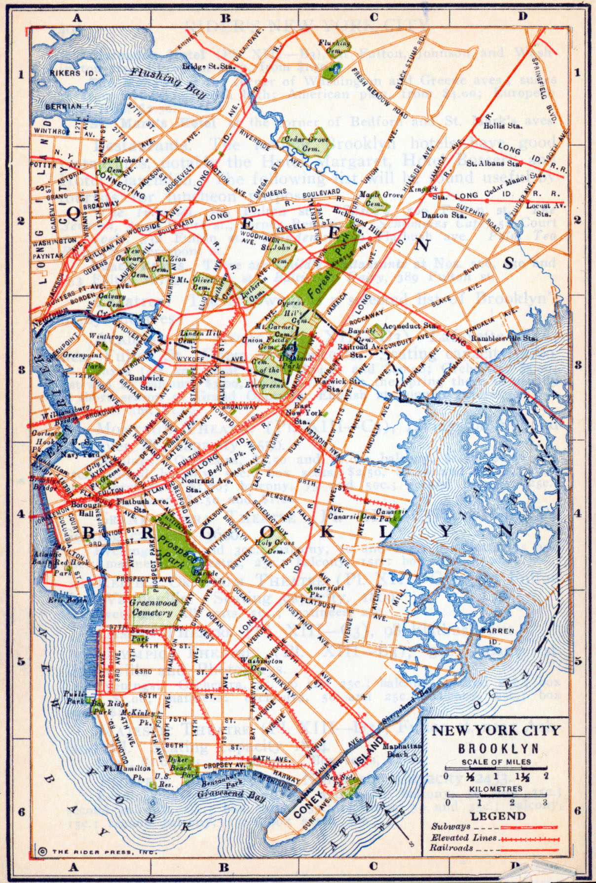
- New York (Brooklyn) 1916 "New York City Brooklyn" from Rider's New York City, Henry Holt and Company, 1916 (1.2MB)
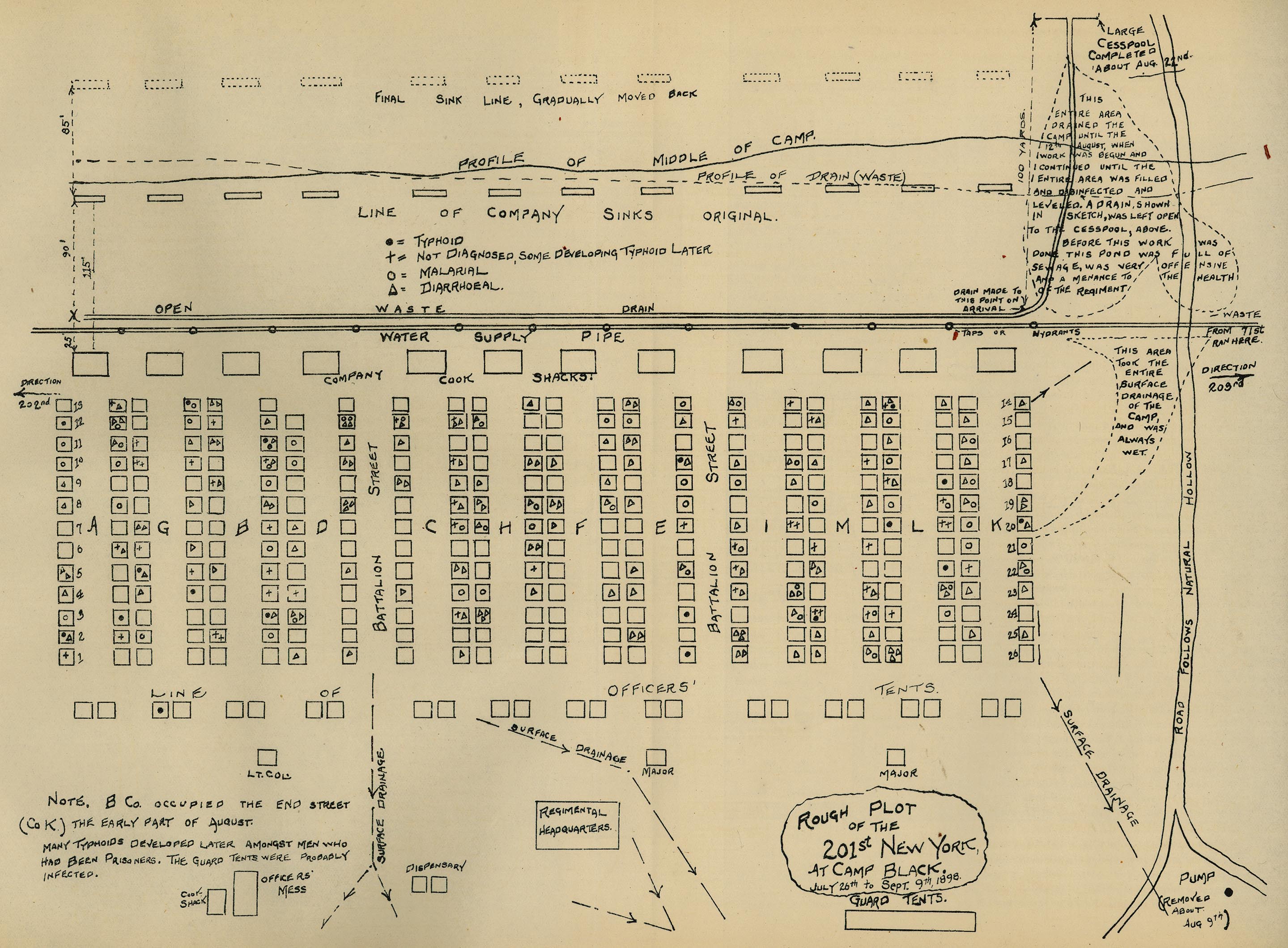
- New York (Camp Black) 1898 "Rough Plot of the 201st New York at Camp Black [Long Island]. July 26th to Sept. 9th, 1898." From Report on the Origin and Spread of Typhoid Fever in U.S. Military Camps During the Spanish War of 1898, Vol. 1 by Walter Reed, Victor C. Vaughan, and Edward O. Shakespeare. Washington: Government Printing Office, 1904. (837K)
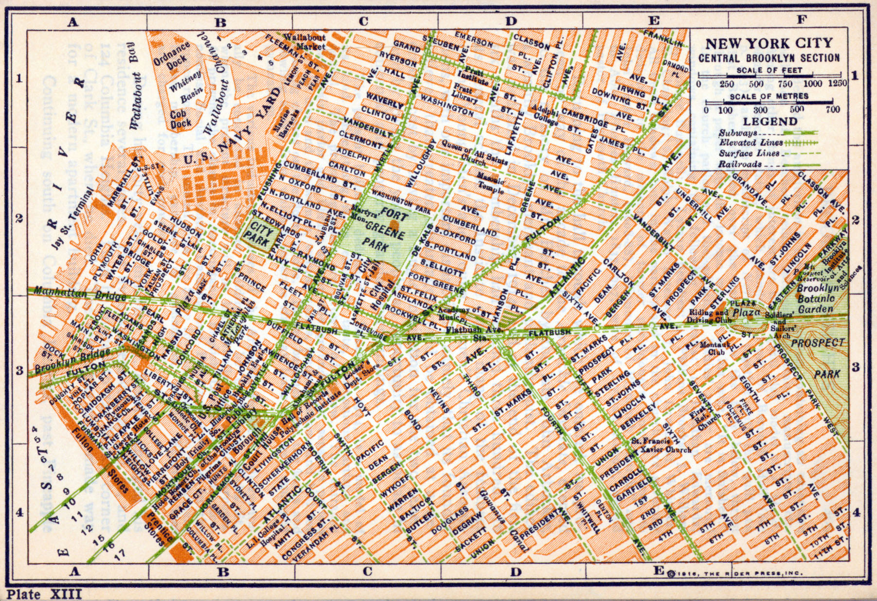
- New York (Central Brooklyn) 1916 "New York City Central Brooklyn Section" from Rider's New York City, Henry Holt and Company, 1916 (1.3MB)
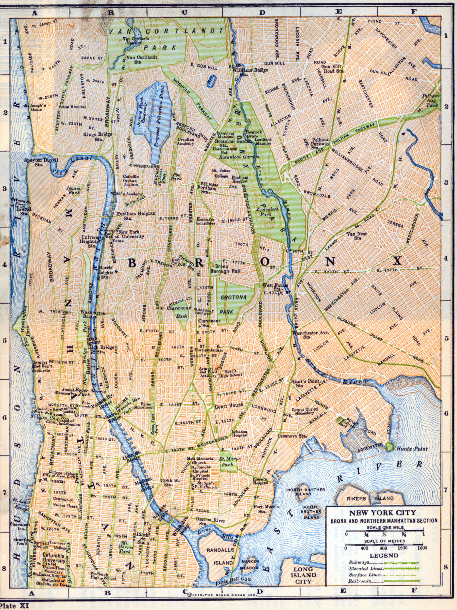
- New York (Bronx and Northern Manhattan) 1916 "New York City Bronx and Northern Manhattan Section" from Rider's New York City, Henry Holt and Company, 1916 (710K)
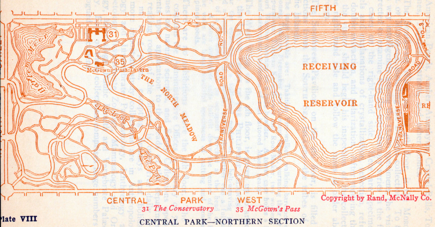
- New York (Northern Central Park) 1916 "Central Park - Northern Section" from Rider's New York City, Henry Holt and Company, 1916 (723K)
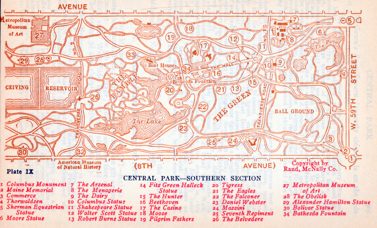
- New York (Southern Central Park) 1916 "Central Park - Southern Section" from Rider's New York City, Henry Holt and Company, 1916 (886K)
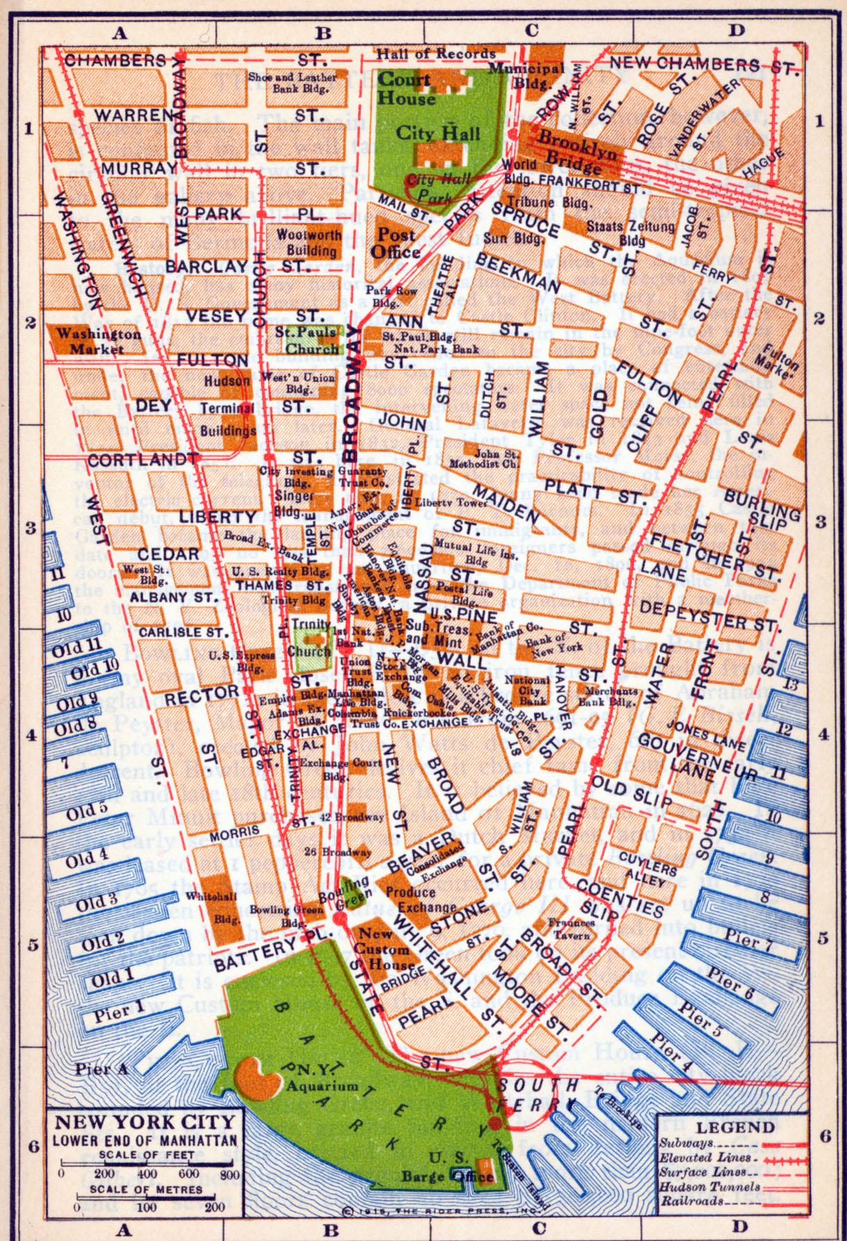
- New York City (Lower End Manhattan) 1916 "Lower End Manhattan" from Rider's New York City, Henry Holt and Company, 1916 (375K)
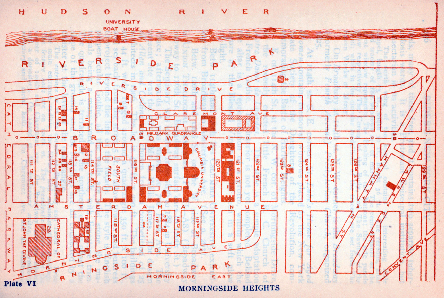
- New York City (Morningside Heights) 1916 "Morningside Heights" from Rider's New York City, Henry Holt and Company, 1916 (215K)
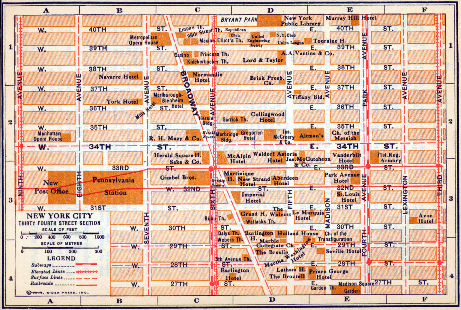
- New York City (Thirty Fourth Street Section) 1916 "Thirty Fourth Street Section" from Rider's New York City, Henry Holt and Company, 1916 (339K)
- New York 1917 The New Encyclopedic Atlas and Gazetteer of the World. New York: P.F. Collier & Son, 1917 (893K)
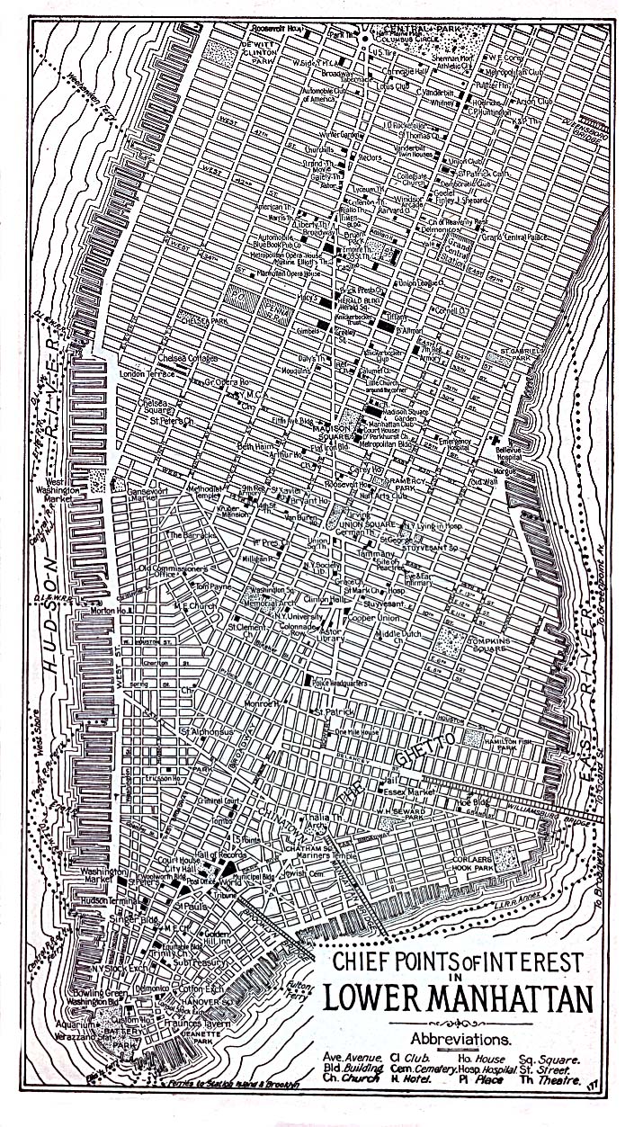
- New York (Lower Manhattan) 1920 "Chief Points of Interest in Lower Manhattan" from Automobile Blue Book, Volume 2, 1920 (488K)
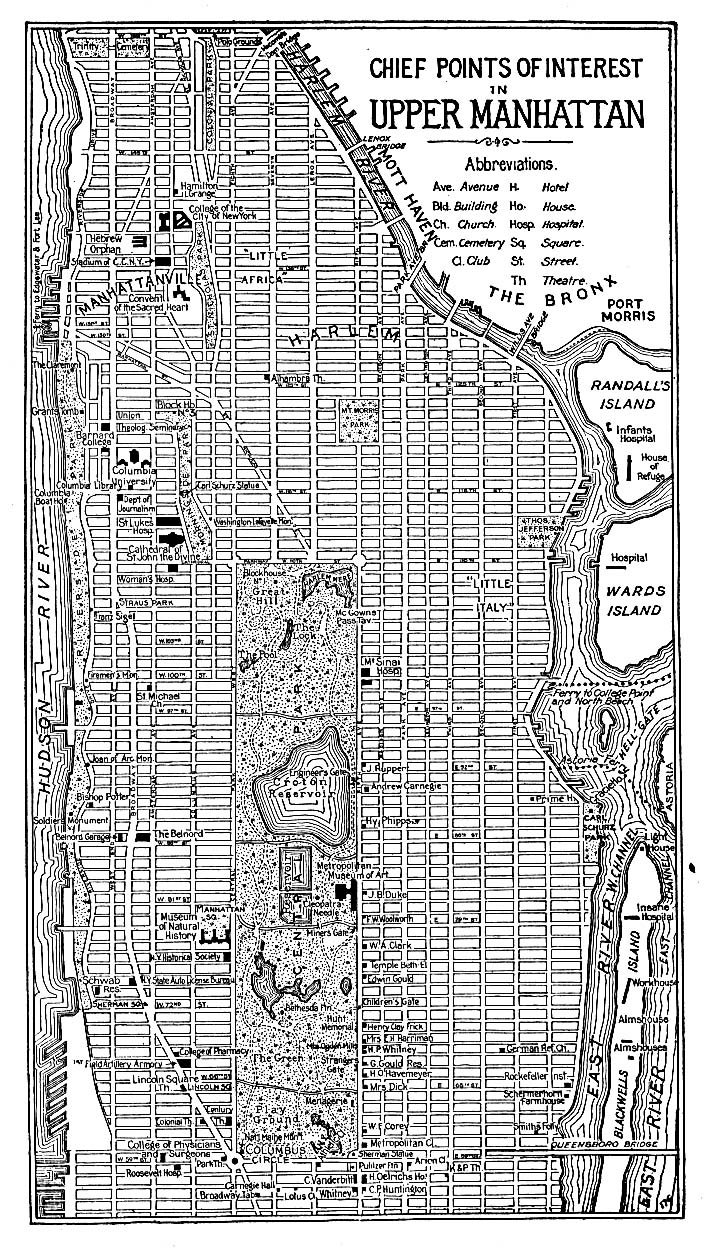
- New York (Upper Manhattan) 1920 "Chief Points of Interest in Upper Manhattan" from Automobile Blue Book, Volume 2, 1920 (429K)
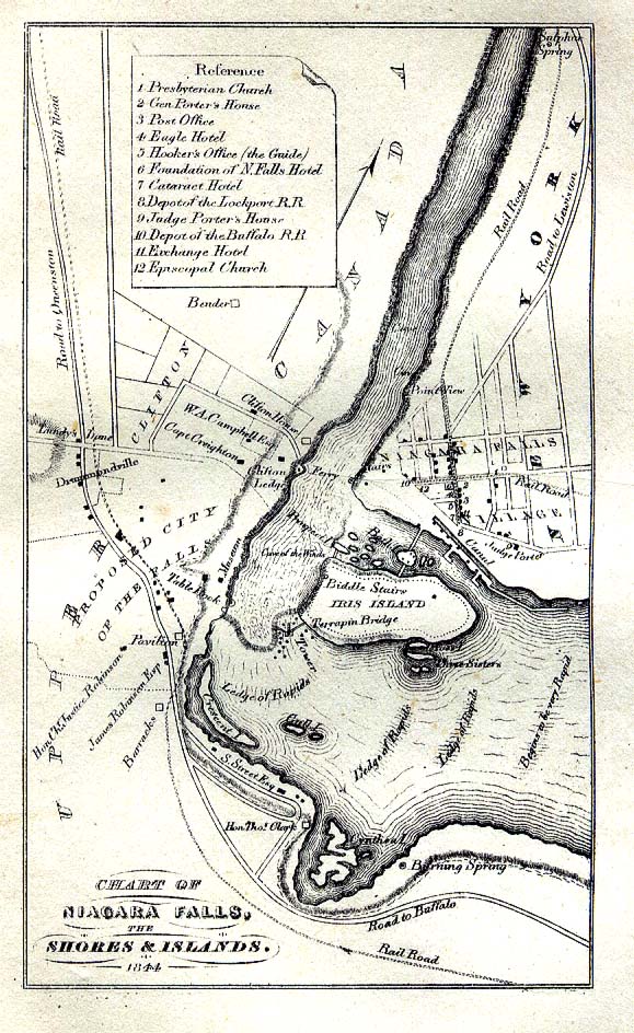
- Niagara Falls, New York/Ontario 1844 "Chart of Niagara Falls the Shores and Islands 1844" from The Picturesque Tourist: Being a Guide Through Northern and Eastern States edited by Orville L. Holley, 1844. (258K)
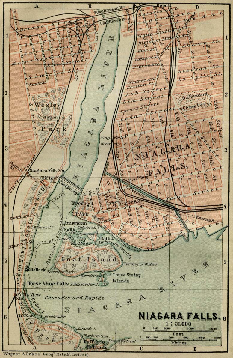
- Niagara Falls, New York/Ontario 1894 "Niagara Falls" from Baedeker, Karl. The Dominion of Canada with Newfoundland and an Excursion to Alaska. Leipsic, 1894. (281K)
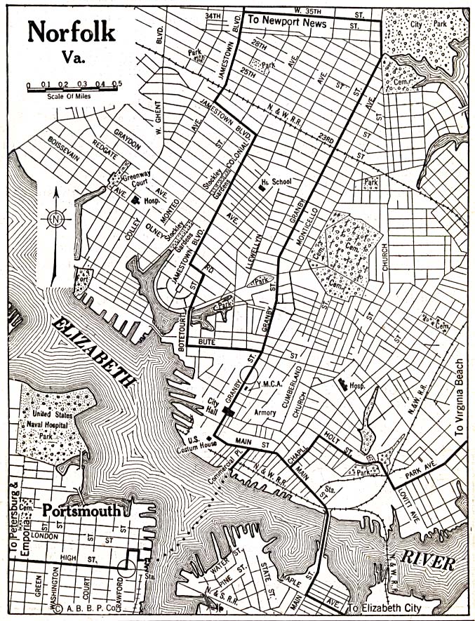
- Norfolk, Virginia 1920 Automobile Blue Book, 1920, Vol. 3 (293K)
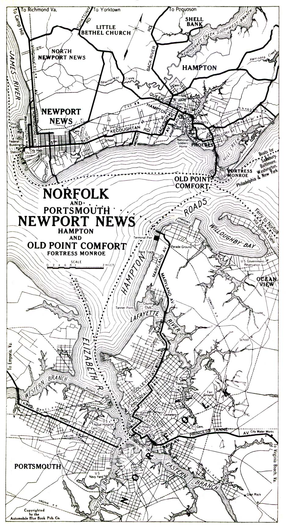
- Norfolk and Portsmouth, Newport News, Hampton and Old Point Comfort, Fortress Monroe 1919 Automobile Blue Book (516K)
- Northern California Detail Map 1917 Automobile Blue Book 1917 Vol. 8, Section 2 (497K)
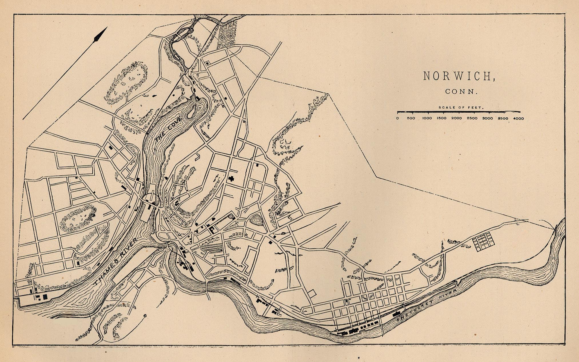
- Norwich, Connecticut 1880 From Report on the Social Statistics of Cities, Compiled by George E. Waring, Jr., United States. Census Office, Part I, 1886. (505K)
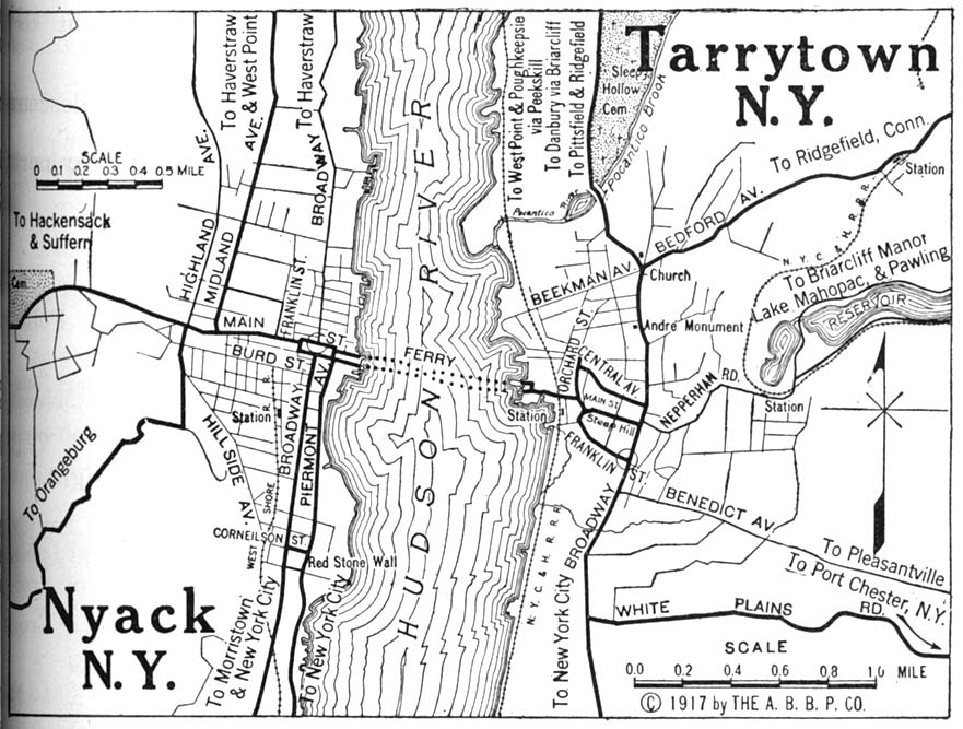
- Nyack and Tarrytown, New York 1917 Automobile Blue Book, 1917, Vol. 3 (175K)
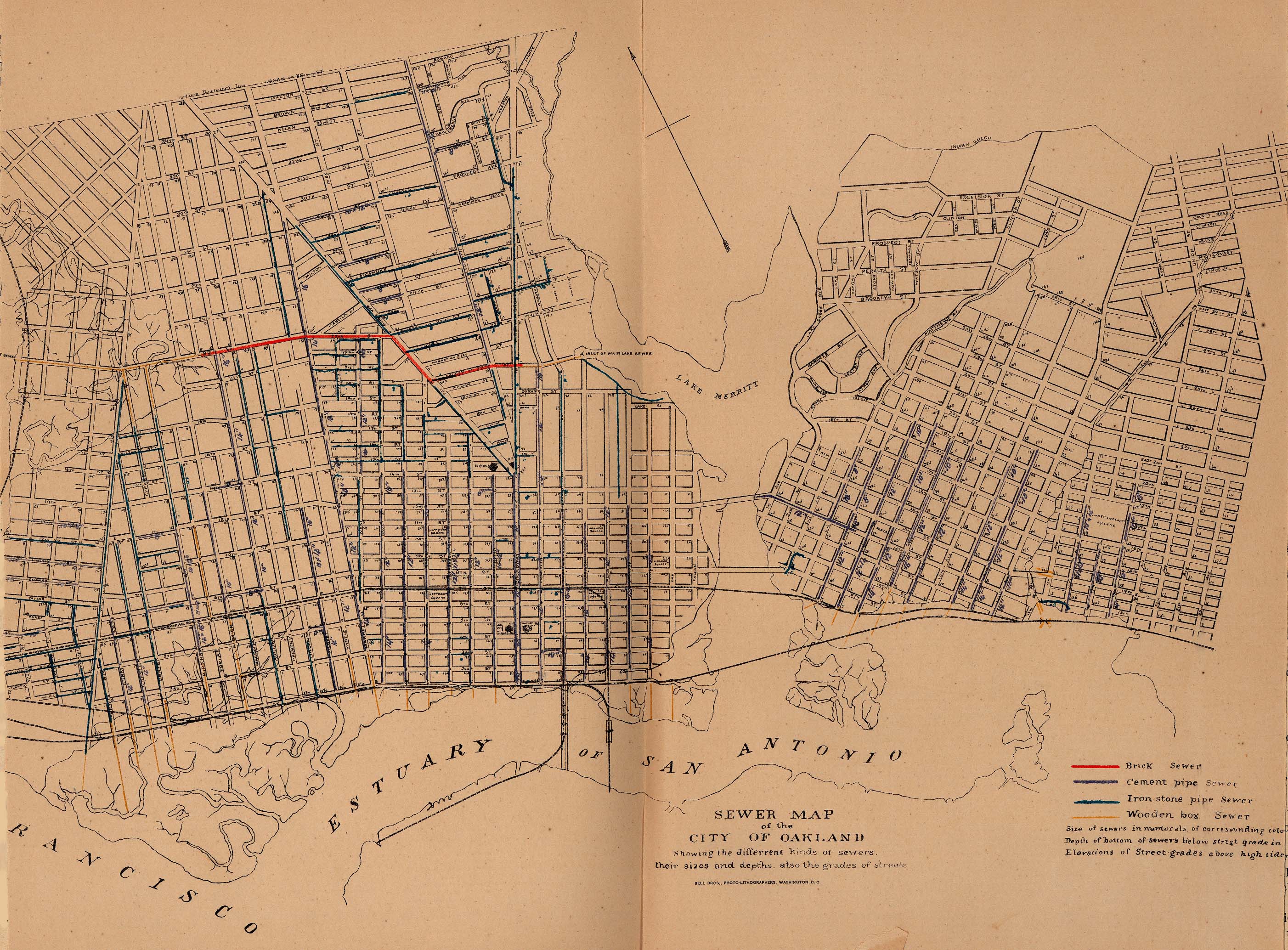
- Oakland, California 1880 "Sewer Map of the City of Oakland, showing their sizes and depths, also the grades of streets." From Report on the Social Statistics of Cities, Compiled by George E. Waring, Jr., United States. Census Office, Part I, 1886. (1,131K)
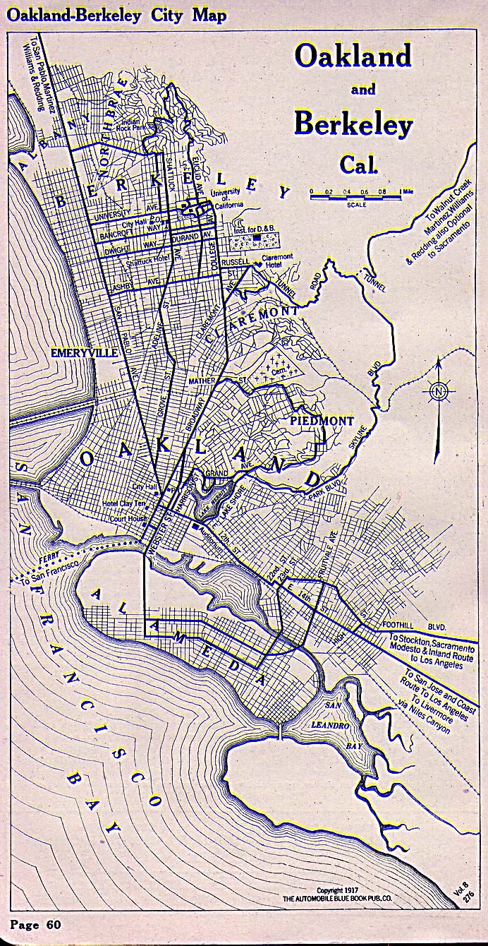
- Oakland, California 1917 Automobile Blue Book, 1917, Vol. 8, Section 1 (451K)
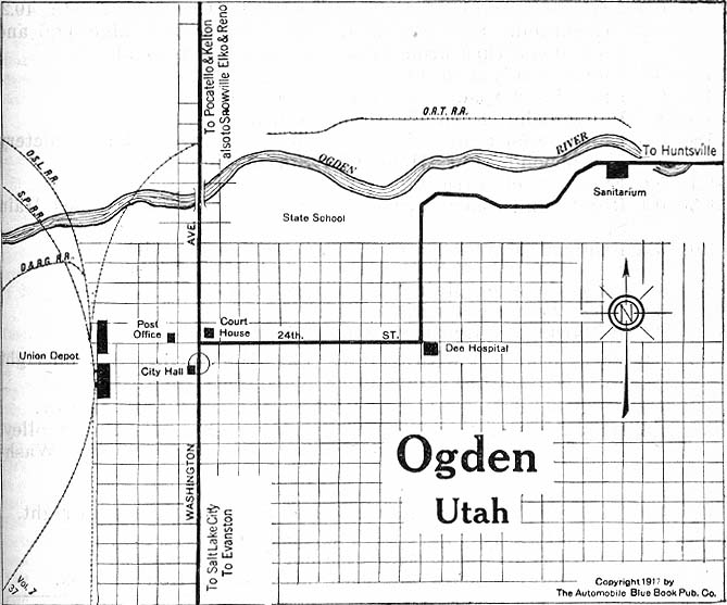
- Ogden, Utah 1917 Automobile Blue Book, 1917, Vol. 8, Section 2 (99K)
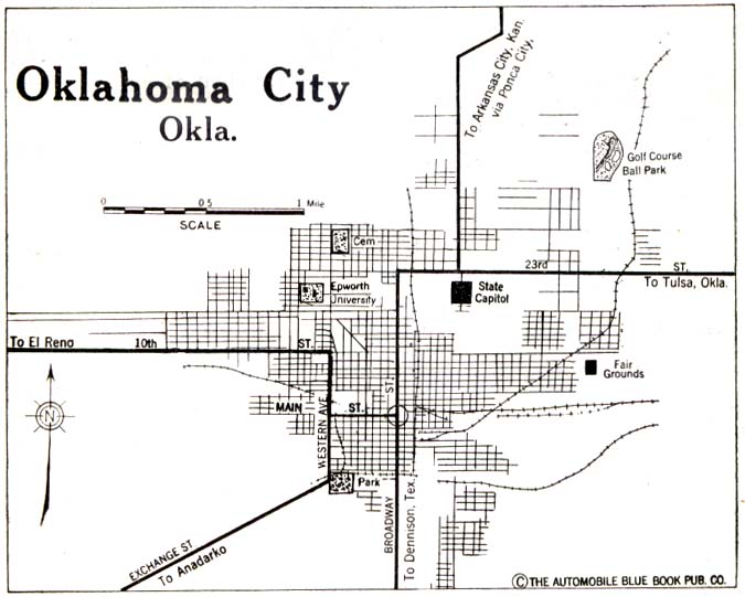
- Oklahoma City, Oklahoma 1920 Automobile Blue Book, 1920, Vol. 7 (59K)
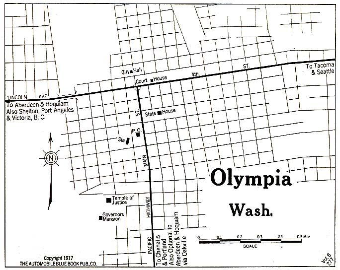
- Olympia, Washington 1917 Automobile Blue Book, 1917, Vol. 8, Section 2 (117K)
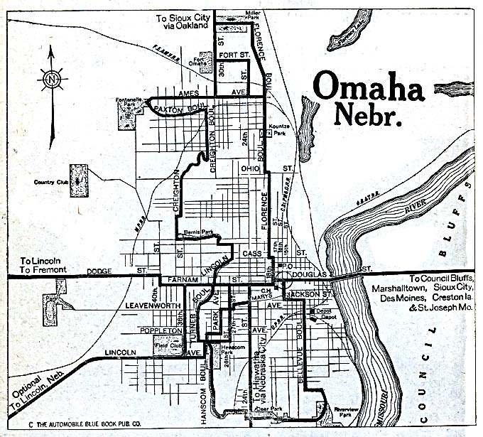
- Omaha, Nebraska 1920 Automobile Blue Book, 1920, Vol. 7 (162K)
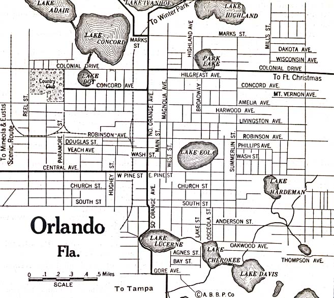
- Orlando, Florida 1920 Automobile Blue Book, 1920, Vol. 6 (137K)
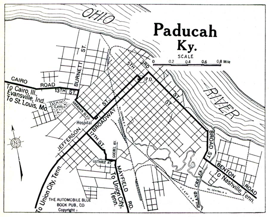
- Paducah, Kentucky 1919 Automobile Blue Book, 1919, Vol. 6 (258K)
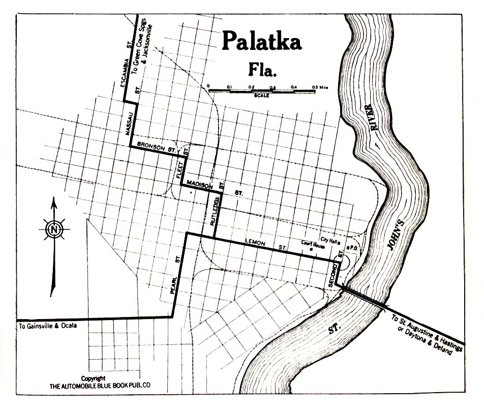
- Palatka, Florida 1919 Automobile Blue Book, 1919, Vol. 6 (258K)
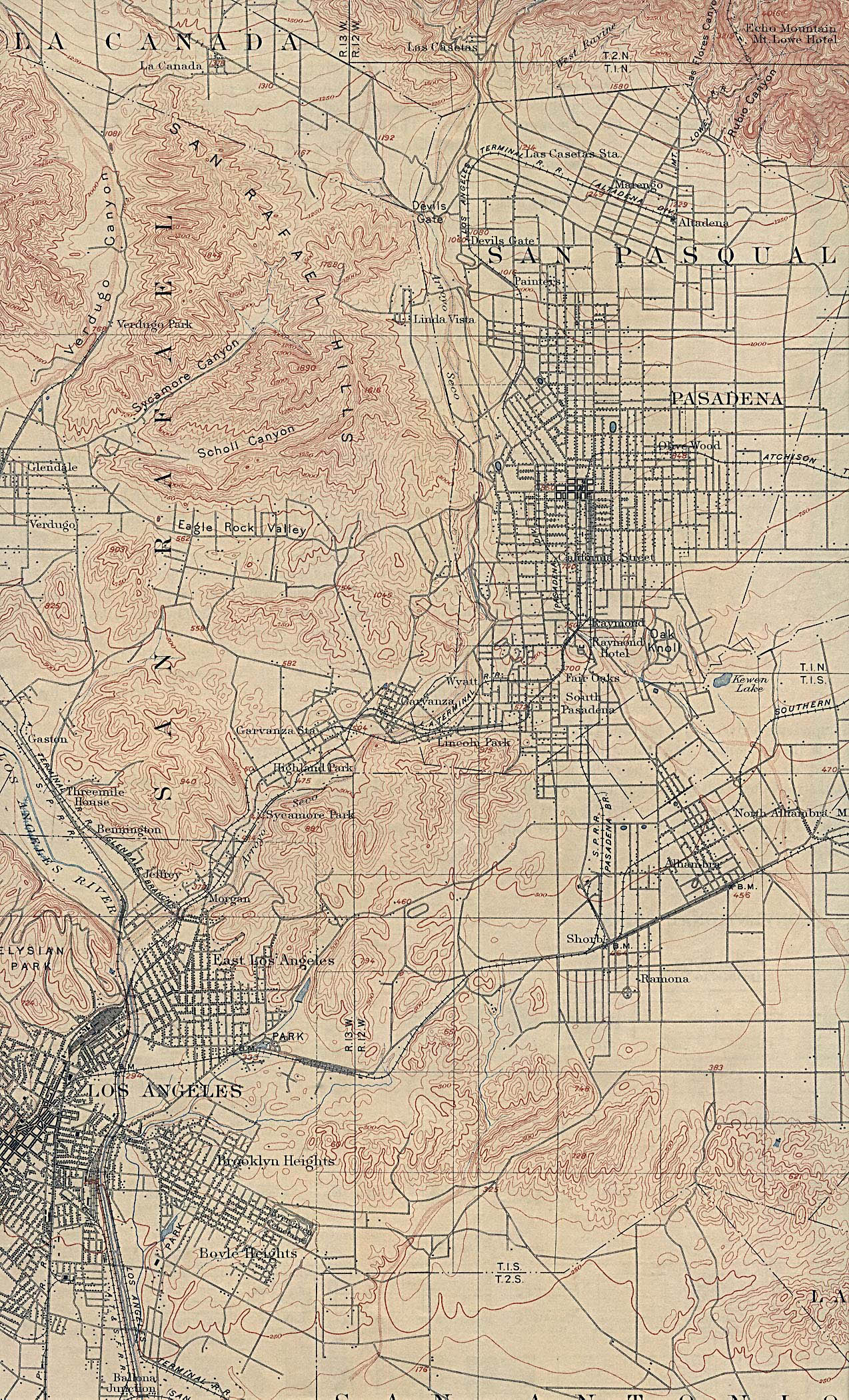
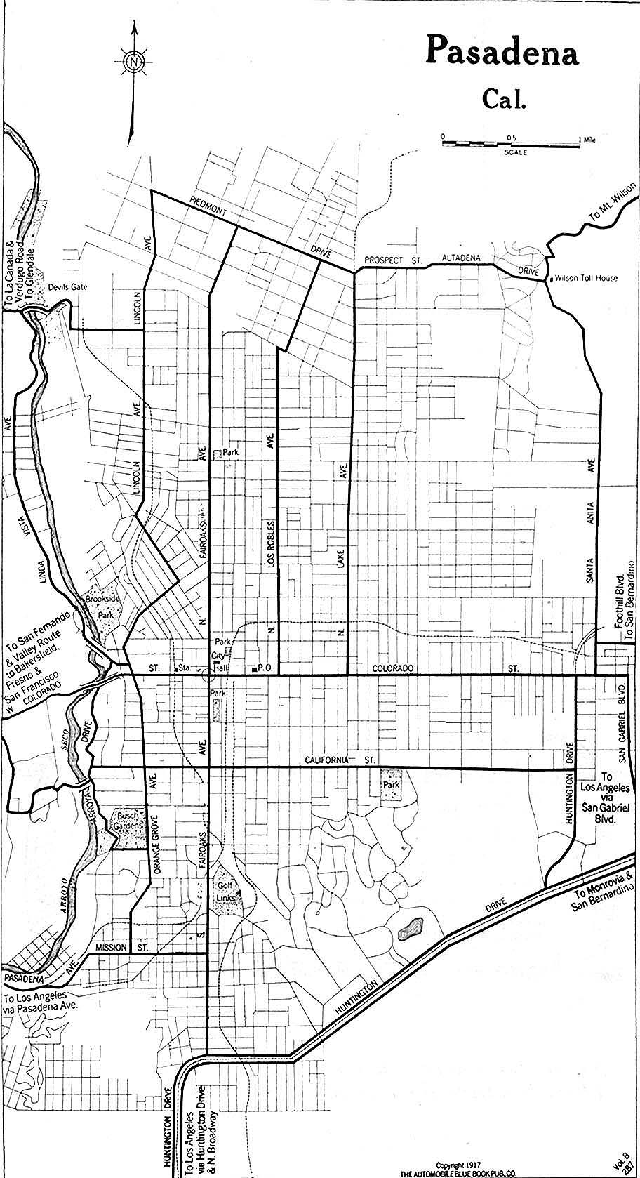
- Pasadena, California 1917 Automobile Blue Book, 1917, Vol. 8, Section 1 (252K)
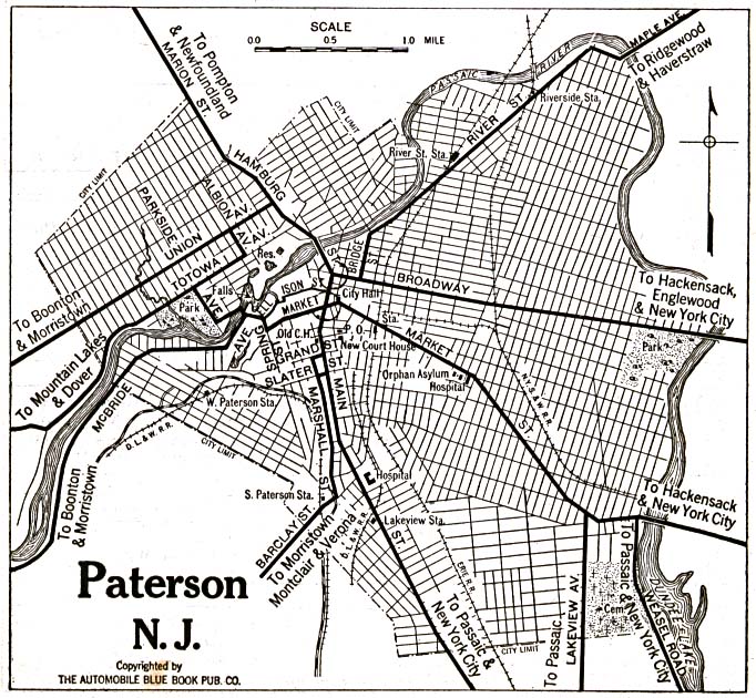
- Paterson, New Jersey 1920 Automobile Blue Book, 1920, Vol. 3 (195K)
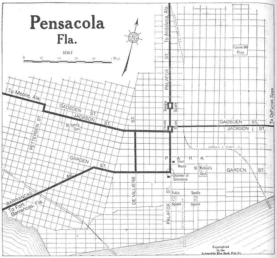
- Pensacola, Florida 1919 Automobile Blue Book, 1919, Vol. 6 (173K)
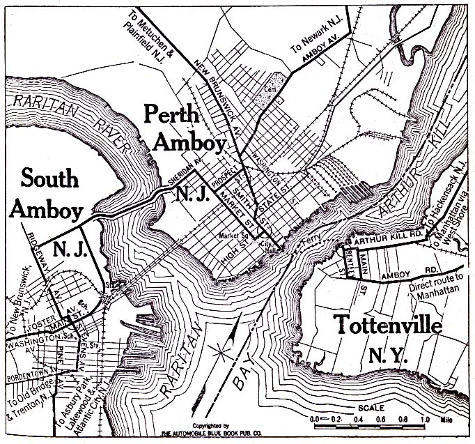
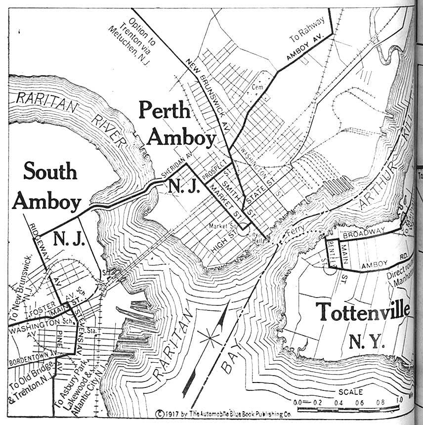
- Perth Amboy and South Amboy, New Jersey with Tottenville, New York 1920 Automobile Blue Book, 1920, Vol. 3 (208K)
- Perth Amboy and South Amboy, New Jersey with Tottenville, New York 1920 Automobile Blue Book, 1920 (208K)
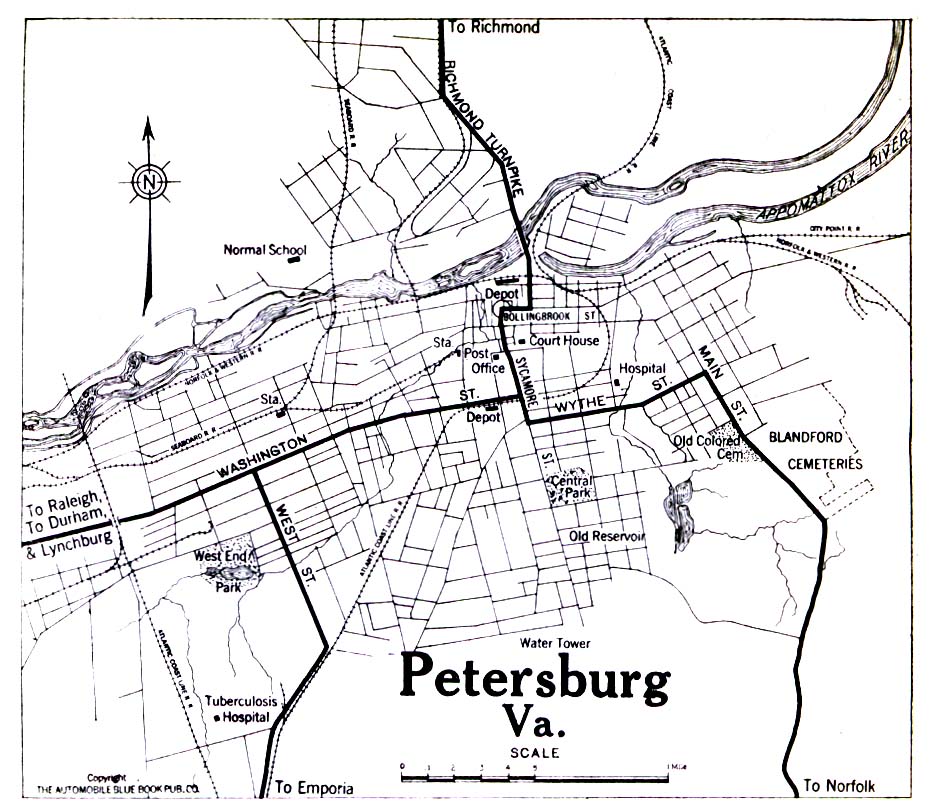
- Petersburg, Virginia 1919 Automobile Blue Book, 1919, Vol. 6 (258K)
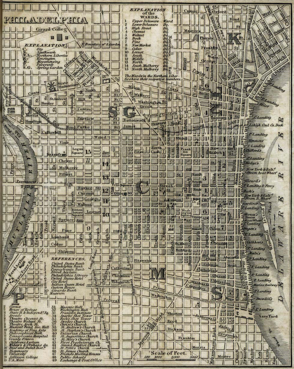
- Philadelphia 1842 "Philadelphia" from Tanner, H.S. The American Traveller; or Guide Through the United States. Eighth Edition. New York, 1842. (341K)
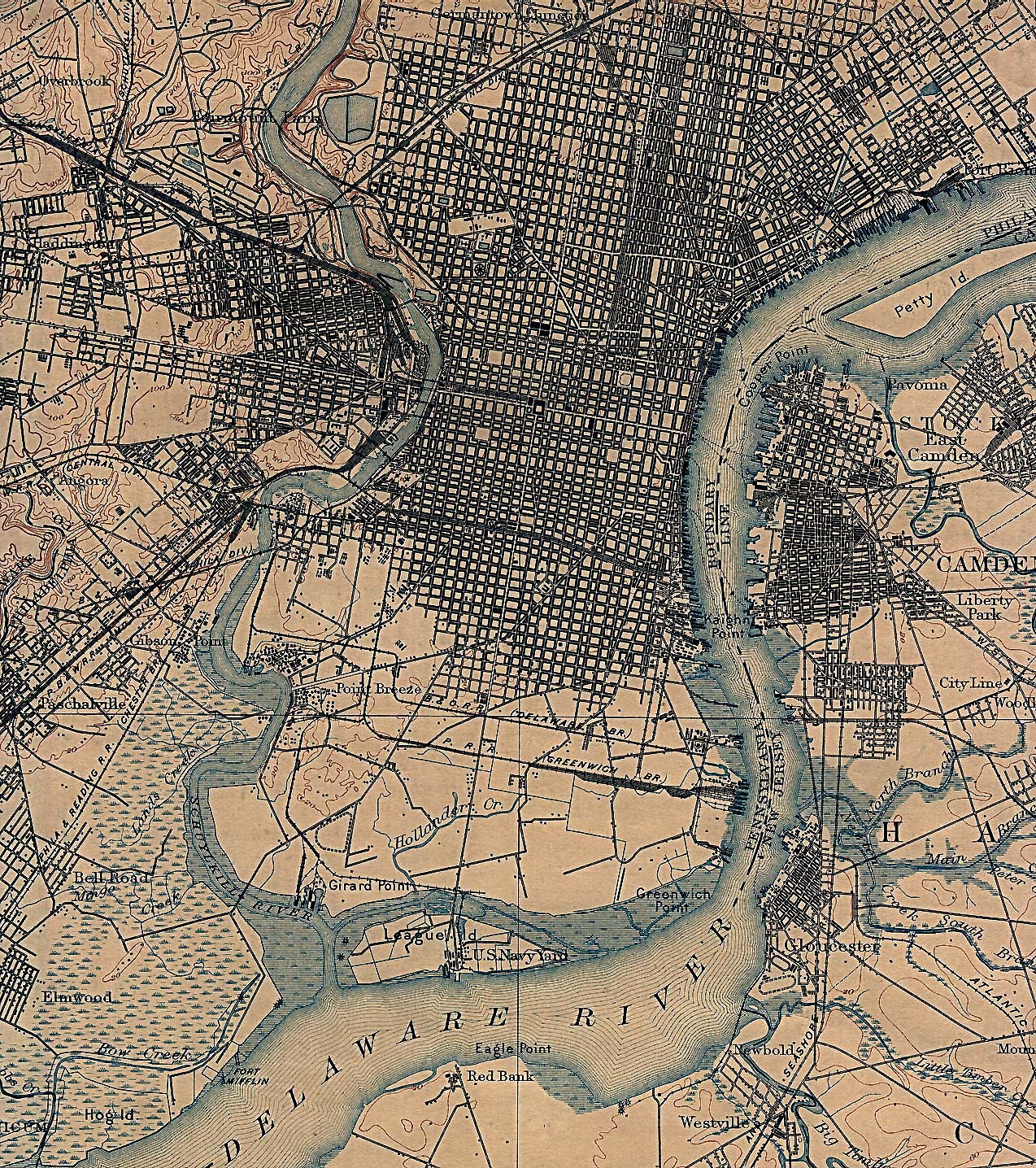
- Philadelphia, Pennsylvania 1898 U.S. Geological Survey (1,029K)
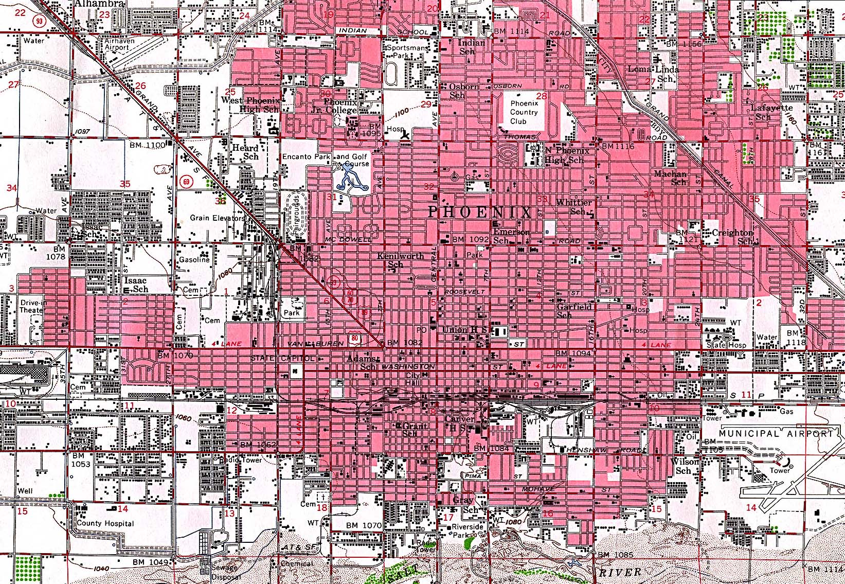
- Phoenix, Arizona 1952 Original Scale 1:62,500 U.S. Geological Survey 1952 (839K)
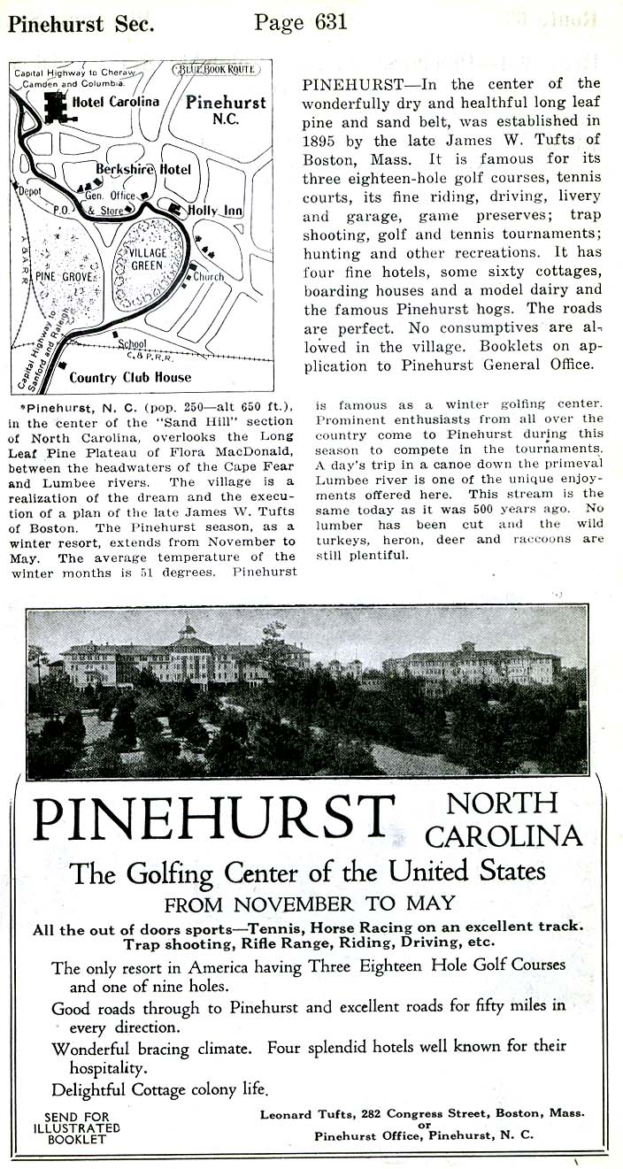
- Pinehurst, North Carolina 1920 Automobile Blue Book, 1920, Vol. 6 (117K)
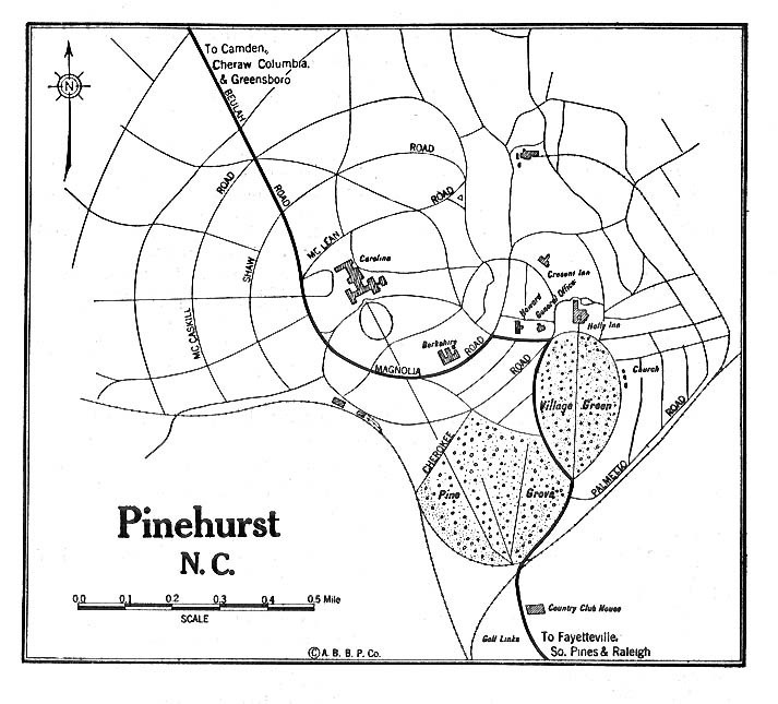
- Pinehurst, North Carolina - Detail 1919 Automobile Blue Book, 1919, Vol. 6 (216K)
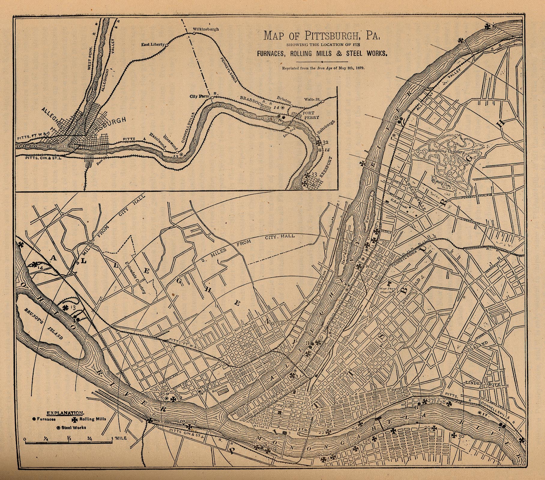
- Pittsburgh, Pennsylvania "Map of Pittsburgh, Pa. Showing the Location of its Furnaces, Rolling Mills and Steel Works. Reprinted from the Iron Age of May 8th, 1879." From Report on the Social Statistics of Cities, Compiled by George E. Waring, Jr., United States. Census Office, Part II, 1887. (433K)
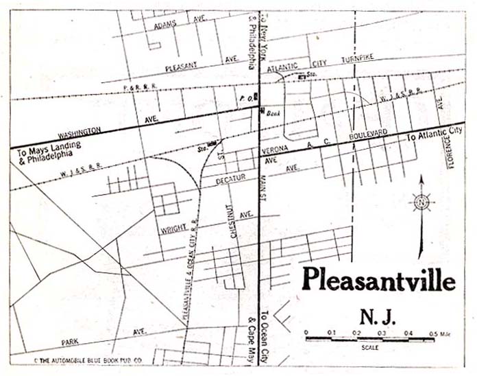
- Pleasantville, New Jersey 1920 Automobile Blue Book, 1920, Vol. 3 (63K)
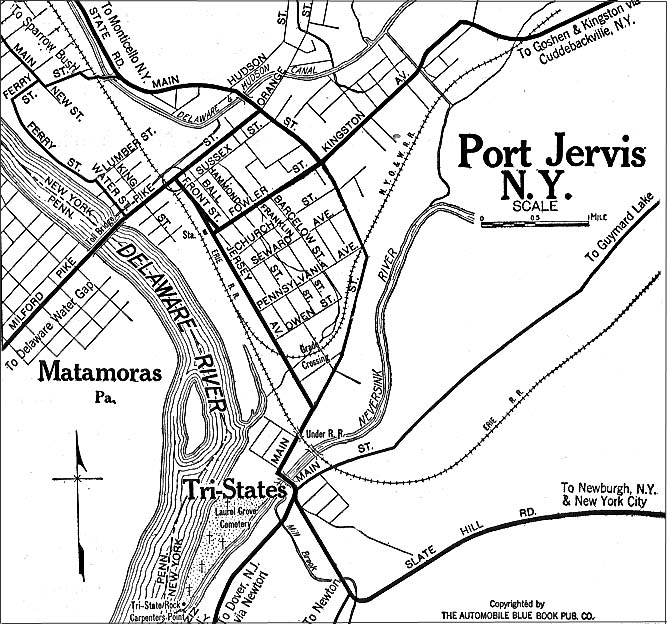
- Port Jervis, New York 1920 Automobile Blue Book, 1920, Vol. 1 (176K)
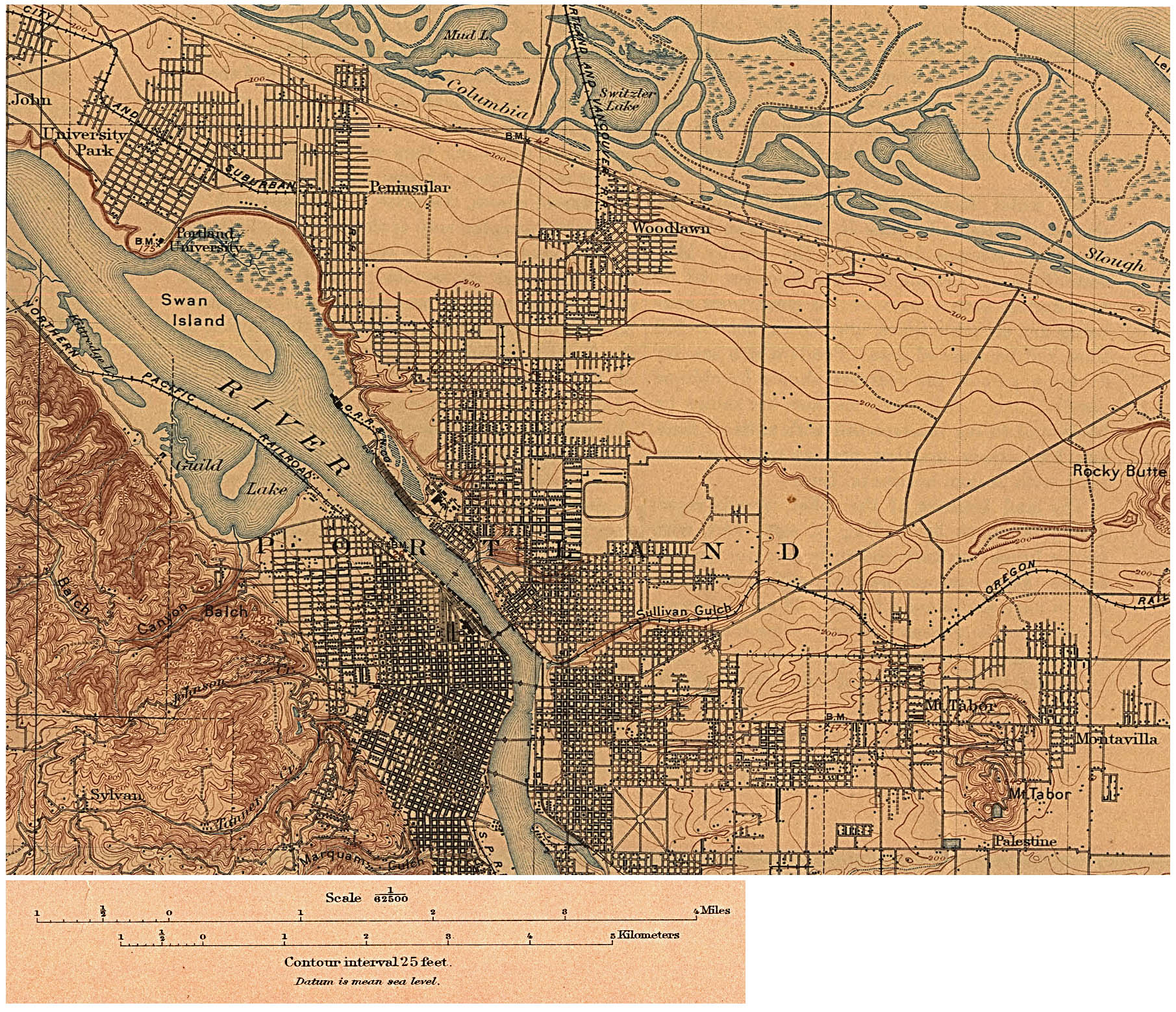
- Portland, Oregon 1897 (Topographic) Original Scale 1:62,500 U.S. Geological Survey 1897 (910K)
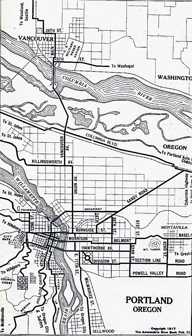
- Portland, Oregon 1917 Automobile Blue Book, 1917, Vol. 8, Section 2 (264K)
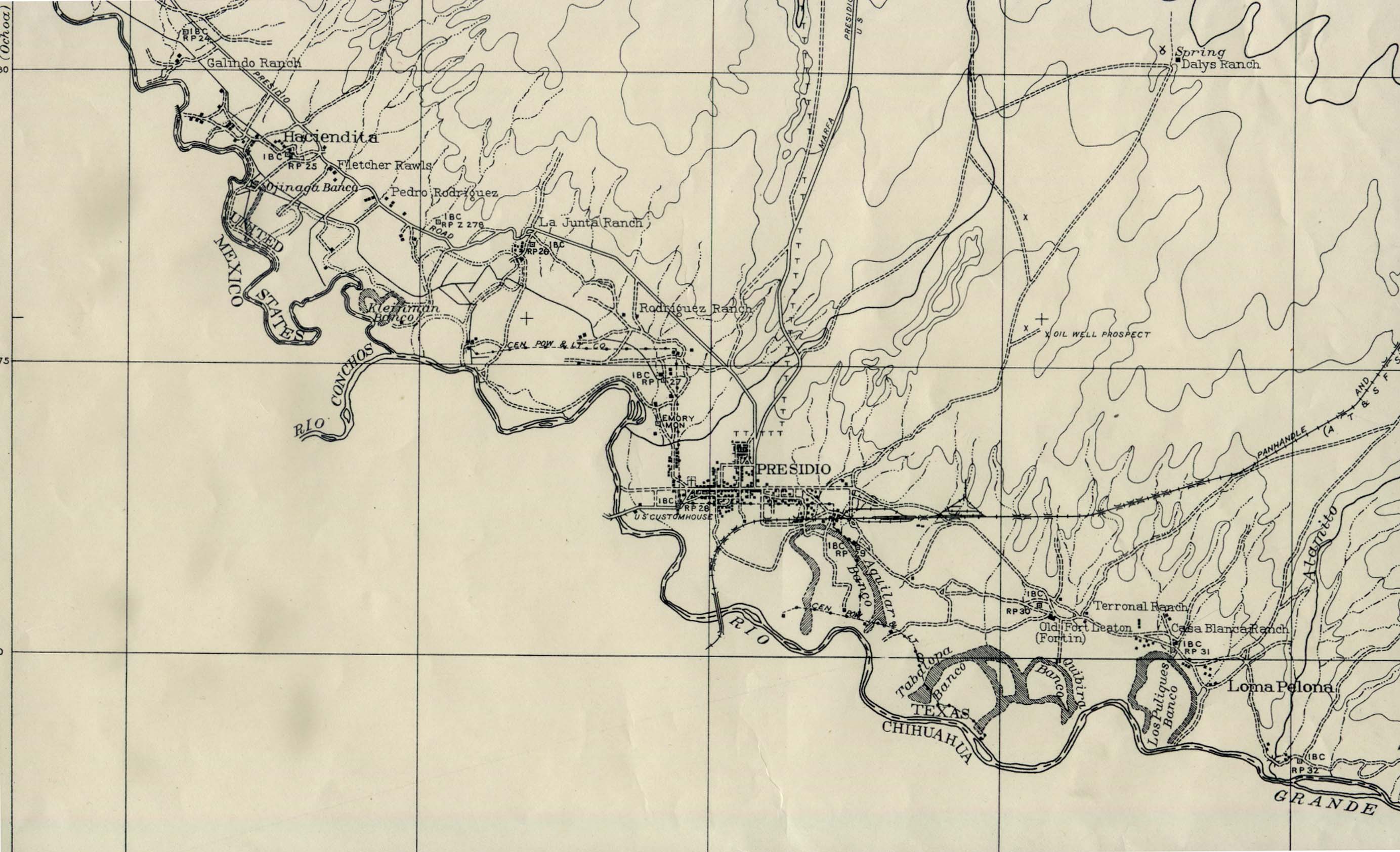
- Presidio, Texas 1932 Original Scale 1:62,500 Corps of Engineers U.S. Army 1932. (418K)
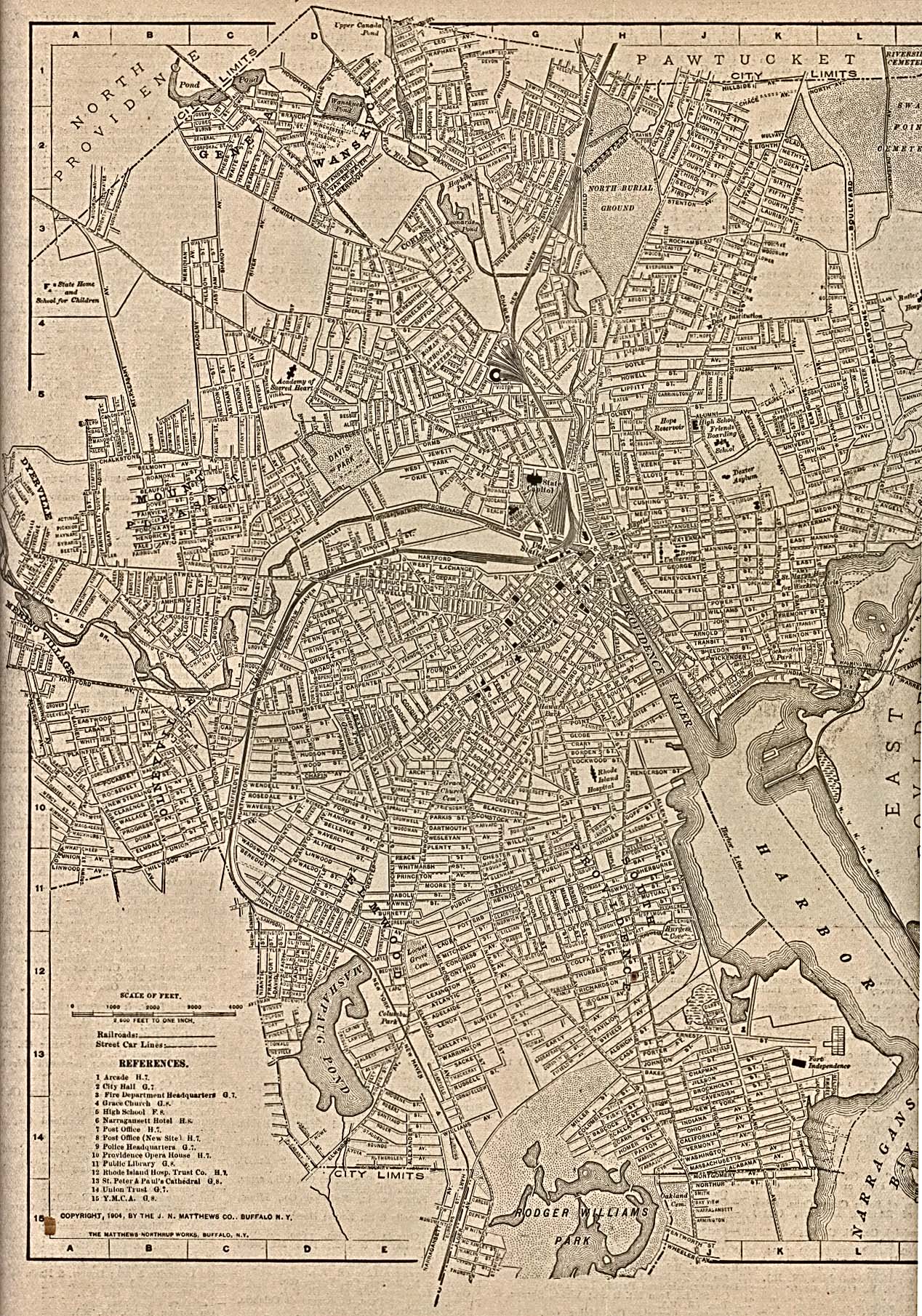
- Providence, Rhode Island The New Encyclopedic Atlas and Gazetteer of the World. Edited and Revised by Francis J. Reynolds, 1917 (903K)
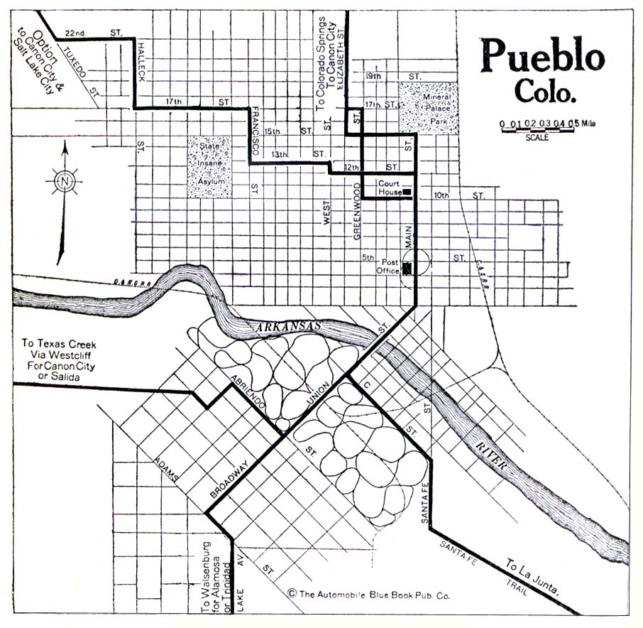
- Pueblo, Colorado 1920 Automobile Blue Book, 1920, Vol. 7 (176K)
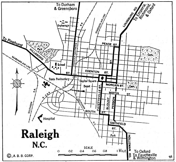
- Raleigh, North Carolina 1920 Automobile Blue Book, 1920, Vol. 6 (137K)
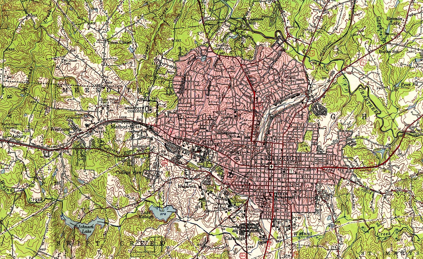
- Raleigh, North Carolina 1951 Original Scale 1:62,500 U.S. Geological Survey, 1951 (839K)
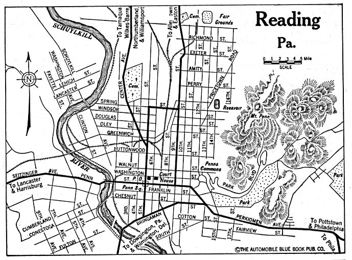
- Reading, Pennsylvania 1920 Automobile Blue Book (156K)
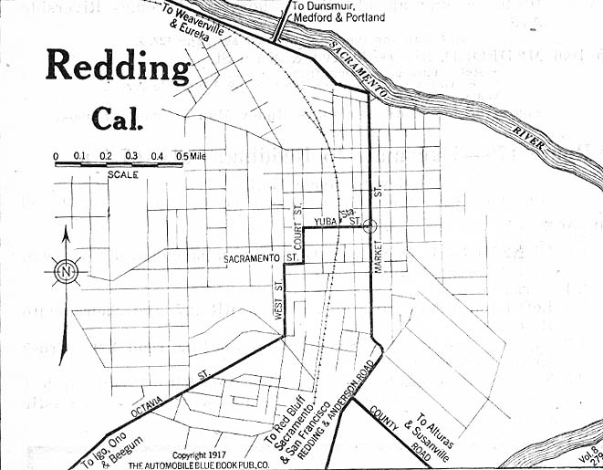
- Redding, California 1917 Automobile Blue Book, 1917, Vol. 8, Section 2 (93K)
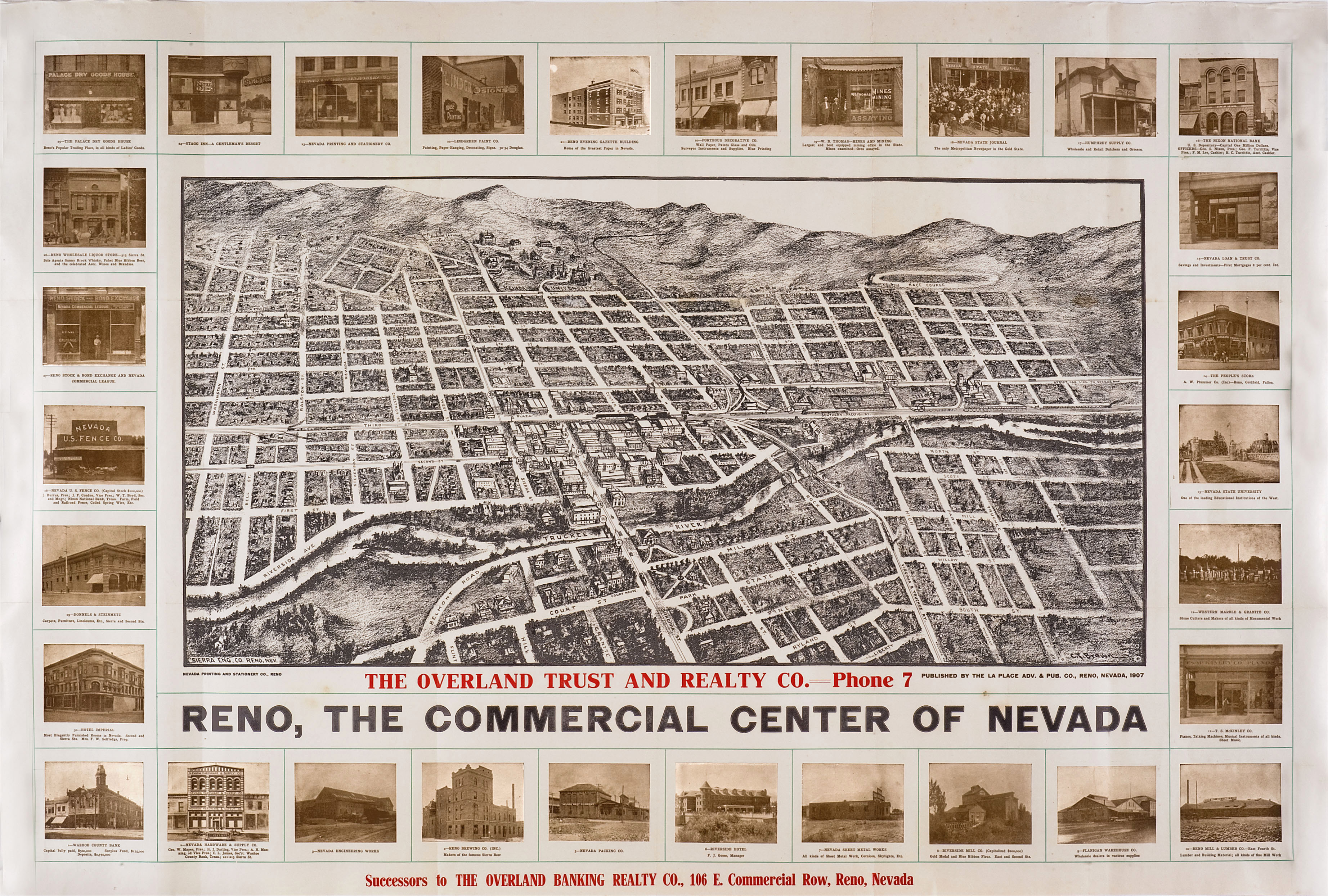
- Reno 1907 (1.9 MB) Reno, The Commercial Center of Nevada, La Place Adv. & Pub. Co., Reno, Nevada, 1907. Map courtesy Dorothy Sloan-Rare Books, Austin, Texas
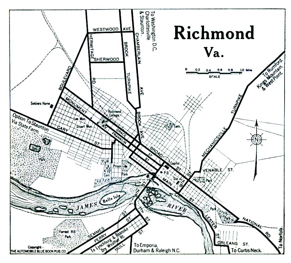
- Richmond, Virginia 1919 Automobile Blue Book, 1919, Vol. 6 (323K)
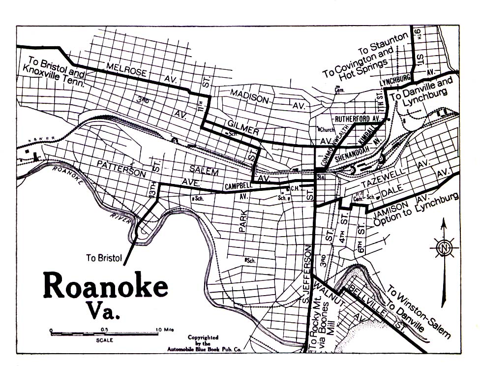
- Roanoke, Virginia 1919 Automobile Blue Book, 1919, Vol. 6 (323K)
- Rock Island and Moline Illinois 1919 [with Davenport, Iowa] Automobile Blue Book (137K)
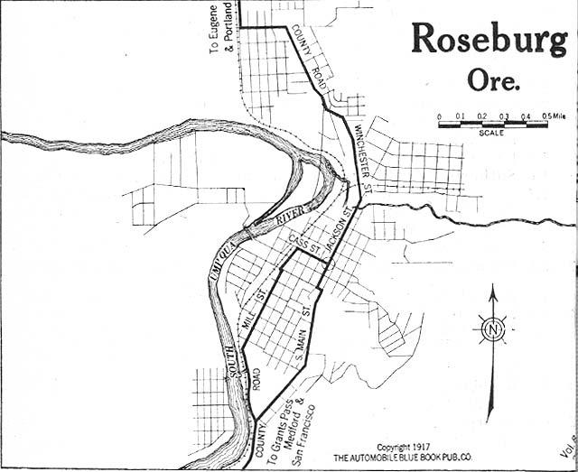
- Roseburg, Oregon 1917Automobile Blue Book, 1917, Vol. 8, Section 2 (79K)
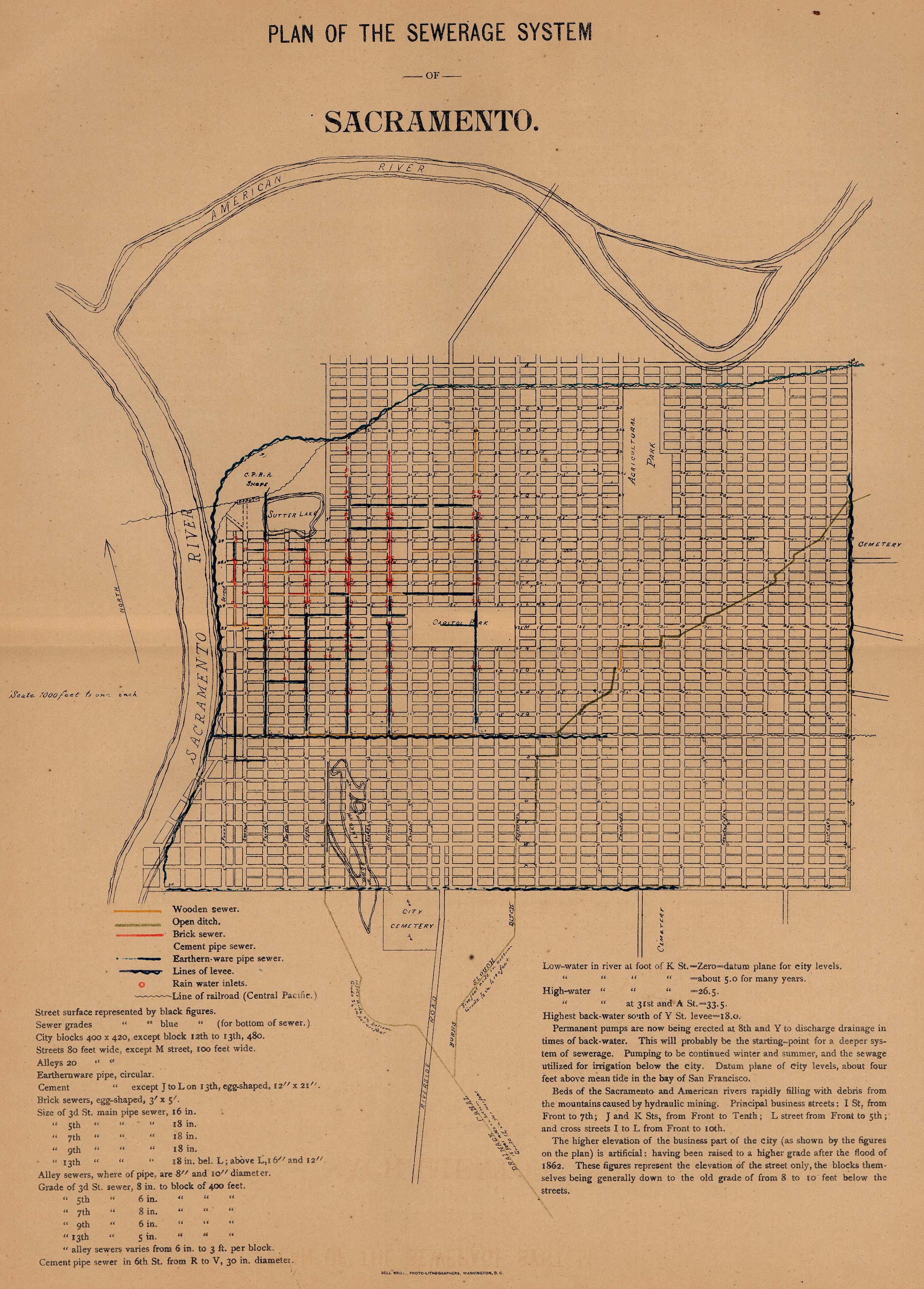
- Sacramento, California 1880 "Plan of the Sewerage System" From Report on the Social Statistics of Cities, Compiled by George E. Waring, Jr., United States. Census Office, Part I, 1886. (148K)
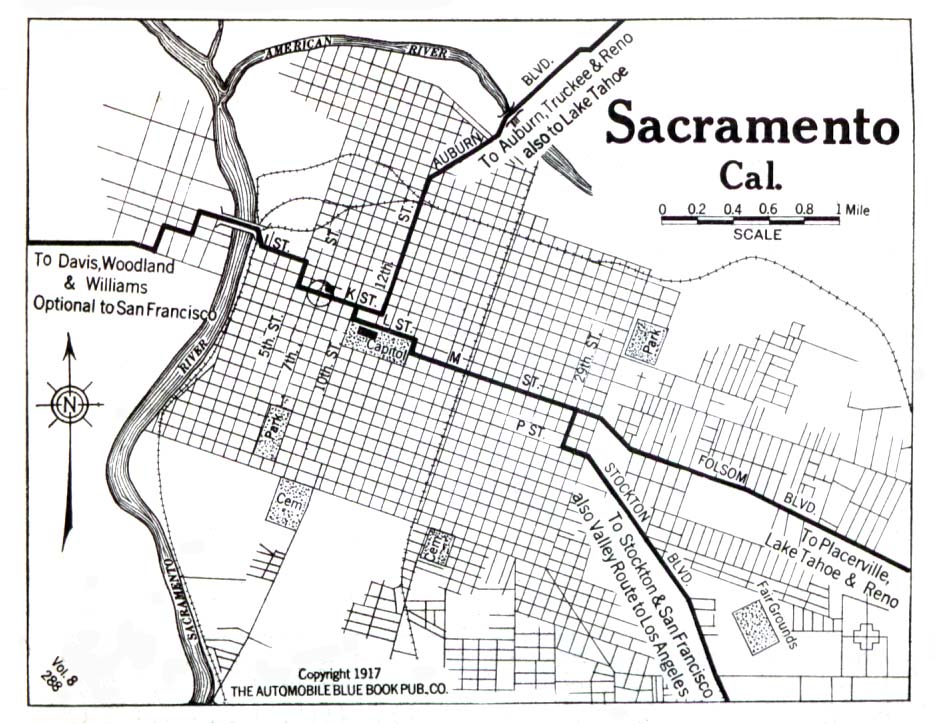
- Sacramento 1917 Automobile Blue Book, Vol. 8 1917 (150K)
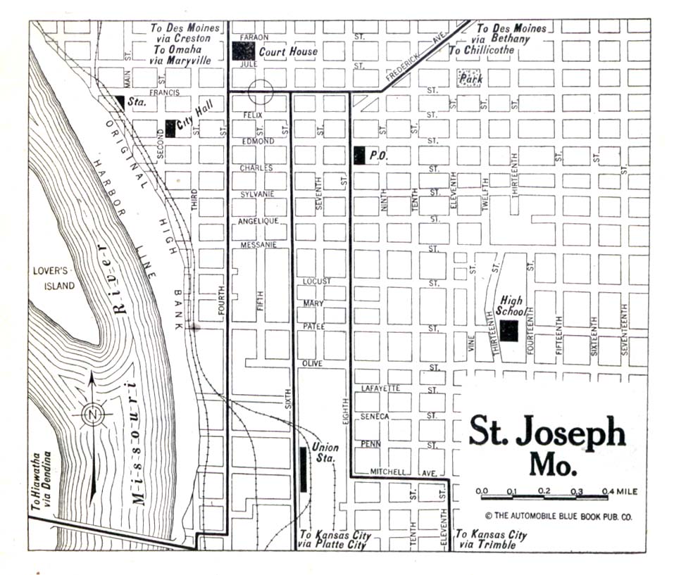
- Saint Joseph, Missouri 1920 Automobile Blue Book, 1920, Vol. 5 (150K)
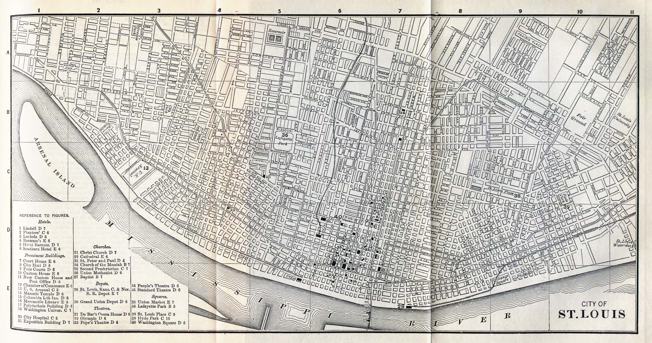
- Saint Louis, Missouri 1885 Appletons' General Guide to the United States and Canada. Part II. Western and Southern States. New York: D. Appleton and Company. 1885 (728K)
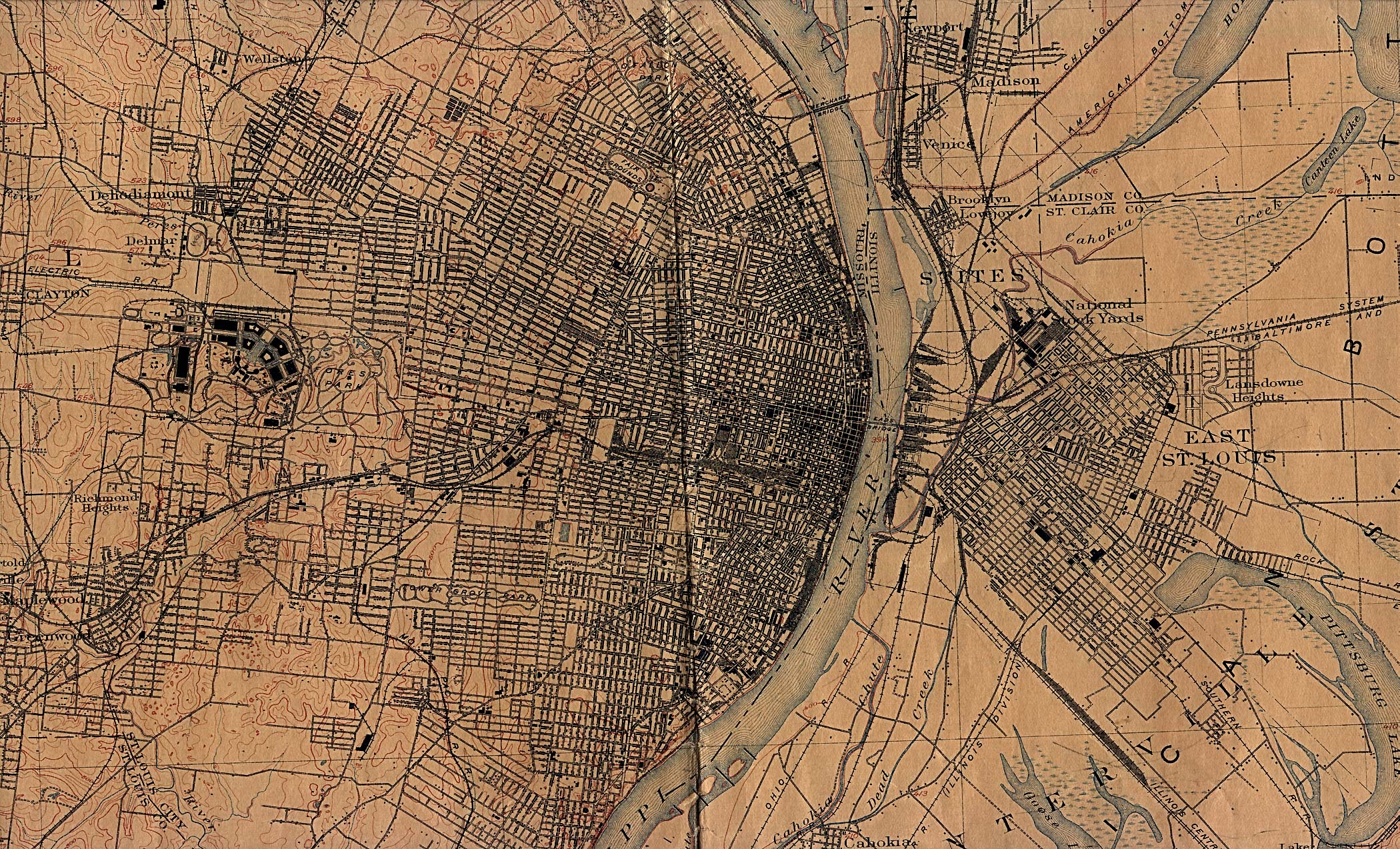
- Saint Louis, Missouri 1912 U.S. Geological Survey (1,241K)
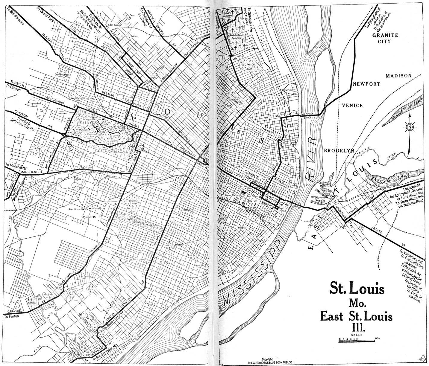
Note: Surveyed in 1903. Edition of April 1904, reprinted Nov. 1912, with corrections. - Saint Louis, Missouri 1920 Automobile Blue Book, 1920, Vol. 7 (493K)
- Saint Paul, Minnesota - Minneapolis and Saint Paul 1920 Automobile Blue Book, 1920, Vol. 5 (237K)
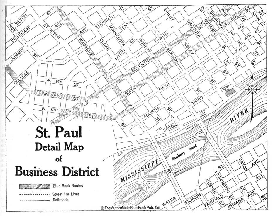
- Saint Paul, Minnesota - Detail 1920 Automobile Blue Book, 1920, Vol. 5 (201K)
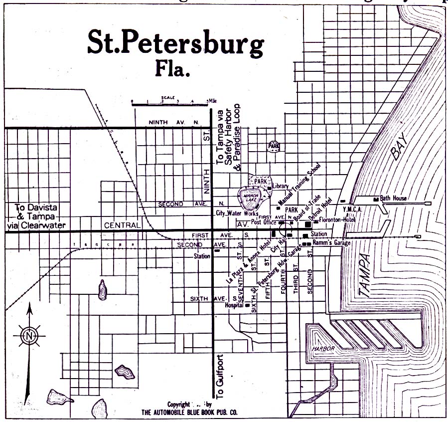
- Saint Petersburg, Florida 1919 Automobile Blue Book, 1919, Vol. 6 (193K)
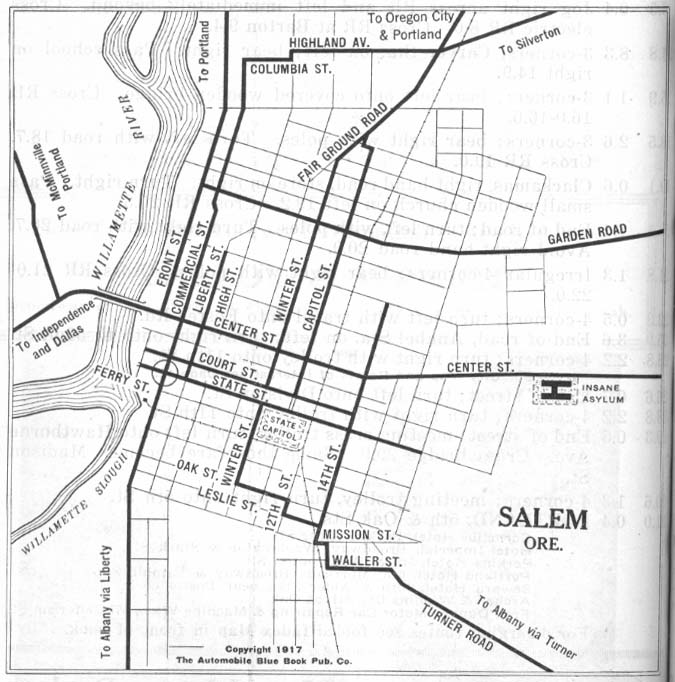
- Salem, Oregon 1917 Automobile Blue Book 1917, Vol. 8, Section 2 (112K)
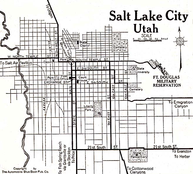
- Salt Lake City, Utah 1920 Automobile Blue Book, 1920, Vol. 8 (137K)
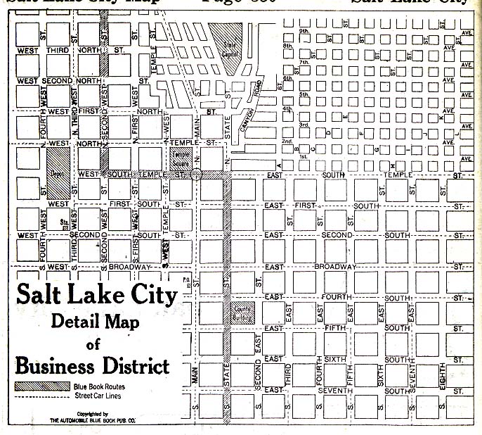
- Salt Lake City, Utah - Business District 1920 Automobile Blue Book, 1920, Vol. 8 (168K)
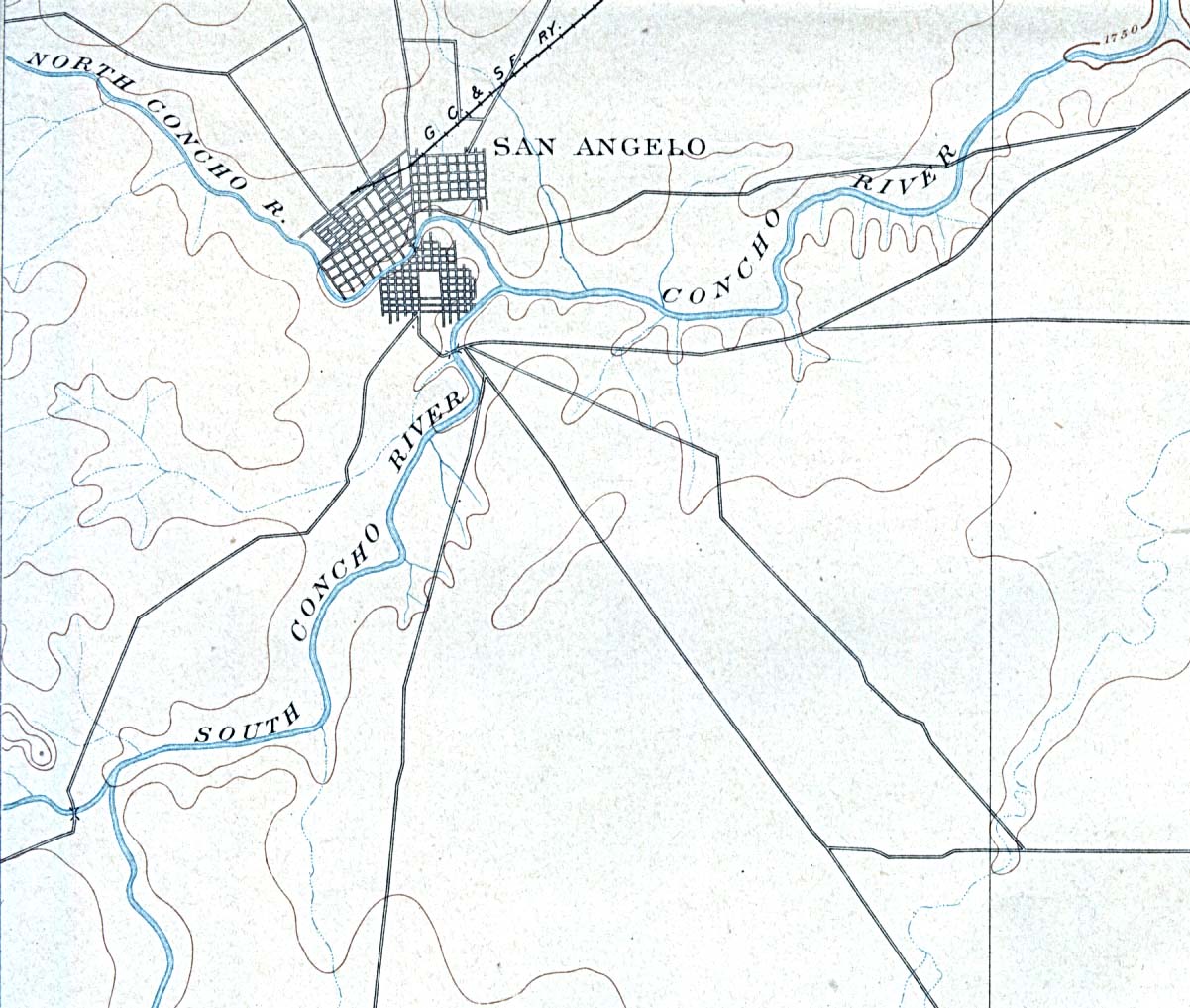
- San Angelo, Texas 1892 Original Scale 1:125,000. U.S. Geological Survey. Reprint, 1898 (234K)
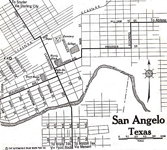
- San Angelo, Texas 1920 Automobile Blue Book, 1920, Vol. 7 (156K)
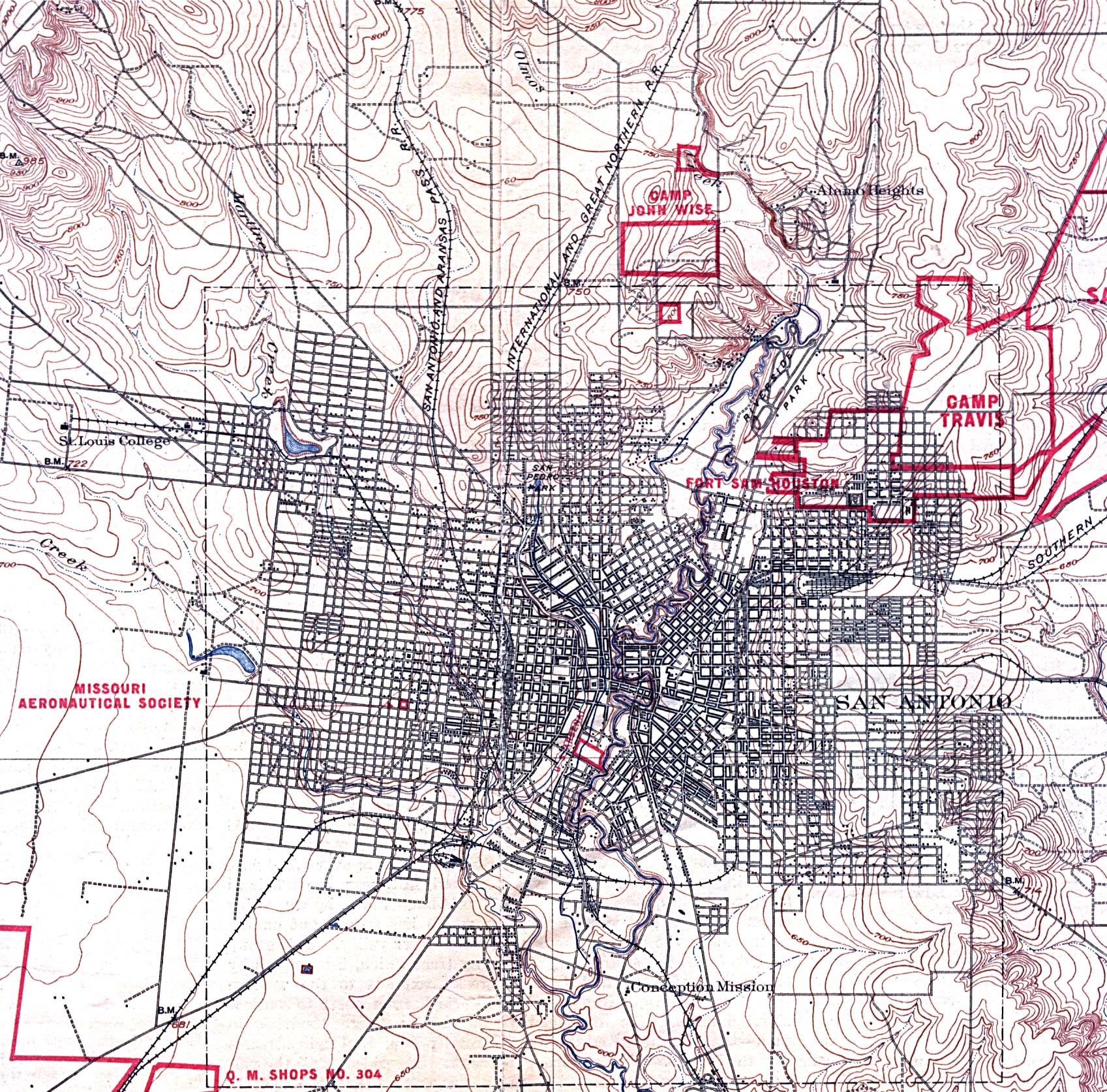
- San Antonio, Texas 1904 Original Scale 1:625,000. U.S. Geological Survey. Reprint, 1918 (975K)
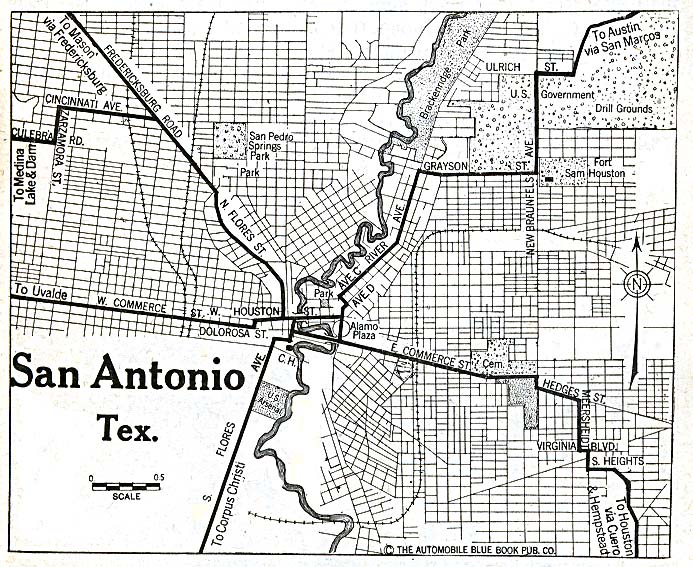
- San Antonio, Texas 1920 Automobile Blue Book, 1920, Vol. 7 (195K)
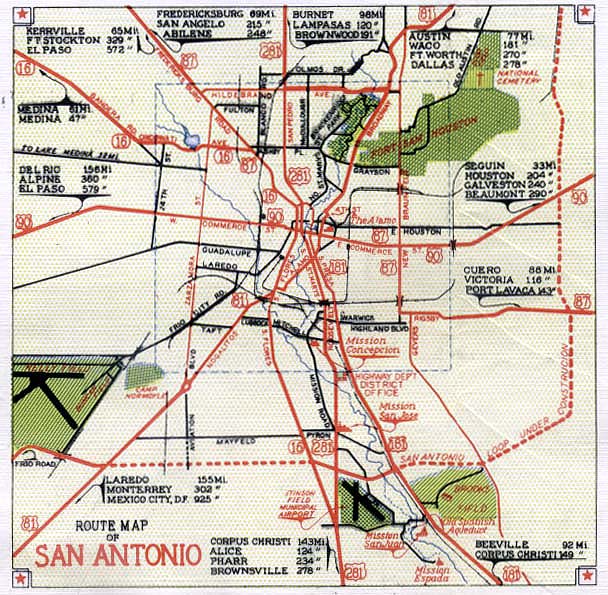
- San Antonio, Texas 1941 from the 1941 Fall Edition Texas Highway Map. Issued by the Texas Highway Department; Corrected to Sept 1, 1941. (120K)
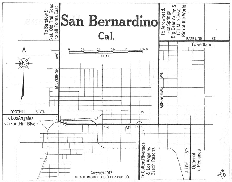
- San Bernadino, California 1917 Automobile Blue Book, 1917, Vol.8, Section 1 (107K)
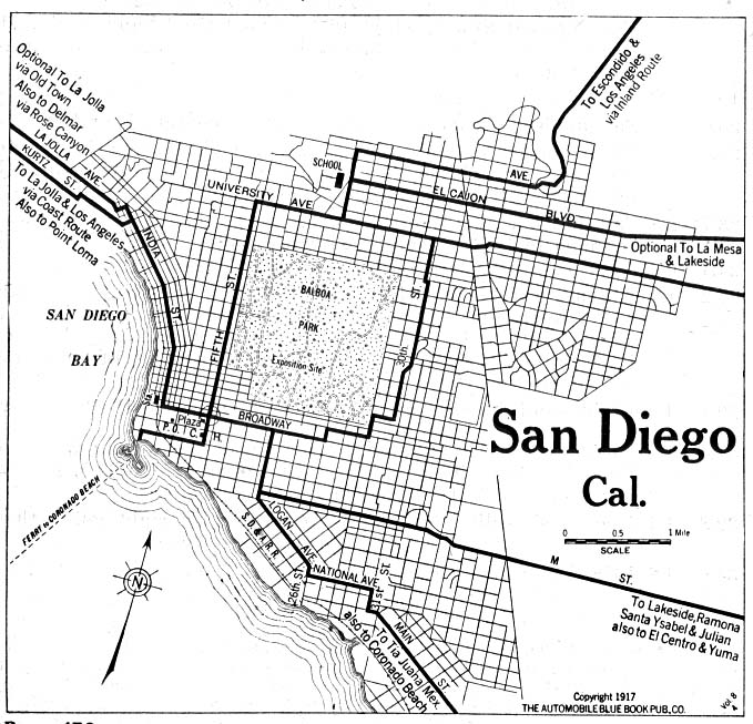
- San Diego, California 1917 Automobile Blue Book, 1917, Vol. 8, Section 1 (153K)
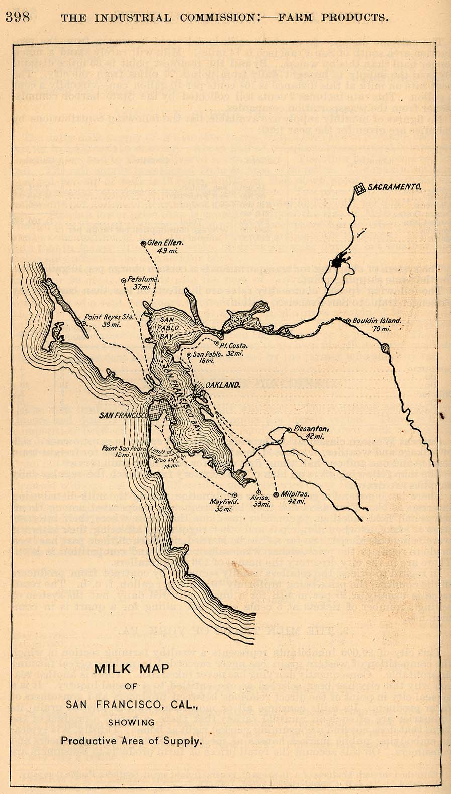
- San Francisco, California 1901 "Milk Map of San Franciso, Cal., Showing Productive Area of Supply." From Report of the Industrial Commission on the Distribution of Farm Products. Volume VI of the Commission's Reports. House of Representatives, 1901. (181K)
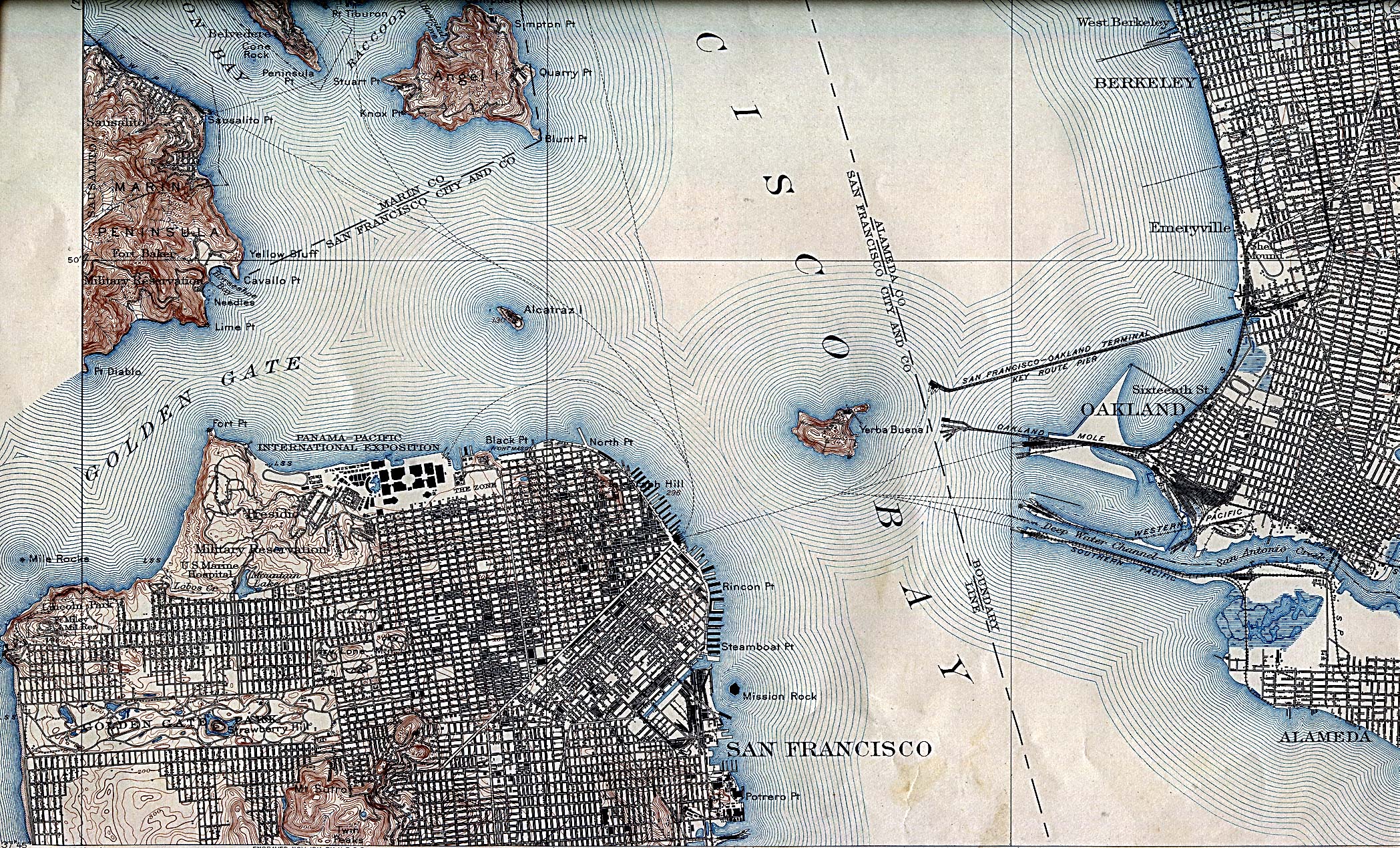
- San Francisco, California 1915 U.S. Geological Survey (1,403K)
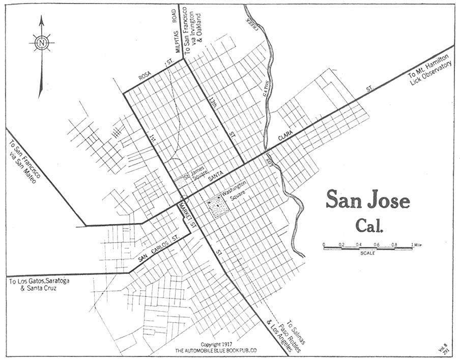
- San Jose, California 1917 Automobile Blue Book, 1917, Vol. 8, Section 1 (128K)
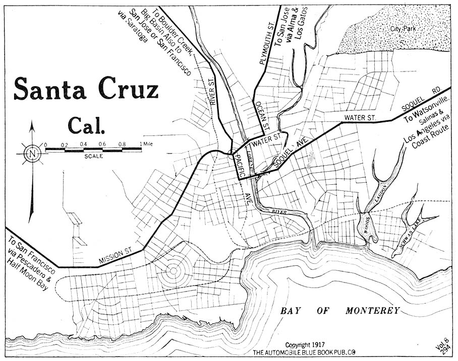
- Santa Cruz, California 1917 Automobile Blue Book, 1917, Vol. 8, Section 1 (181K)
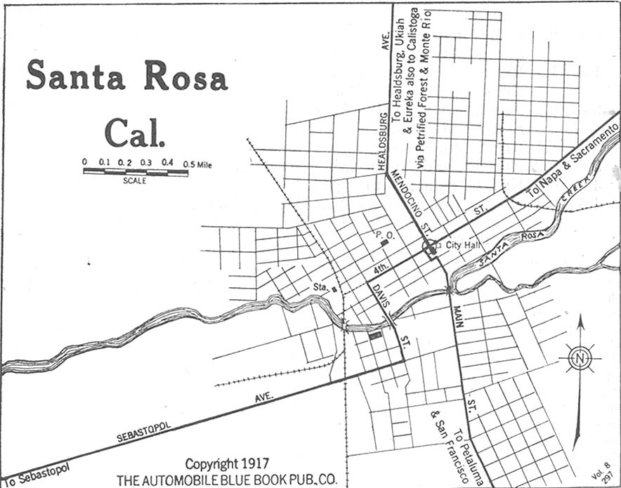
- Santa Rosa, California 1917 Automobile Blue Book, 1917, Vol. 8, Section 1 (117K)
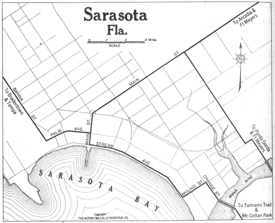
- Sarasota, Florida 1919 Automobile Blue Book, 1919, Vol. 6 (122K)
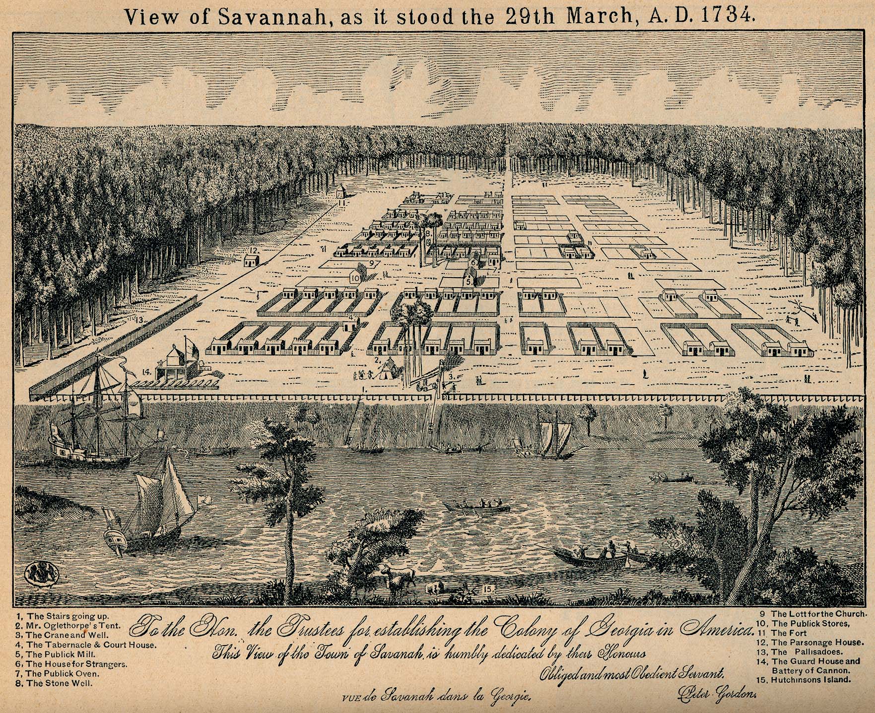
- Savannah, Georgia 1734 "View of Savannah, as it stood the 29th March, A.D. 1734." From Report on the Social Statistics of Cities, Compiled by George E. Waring, Jr., United States. Census Office, Part II, 1886. (940K)
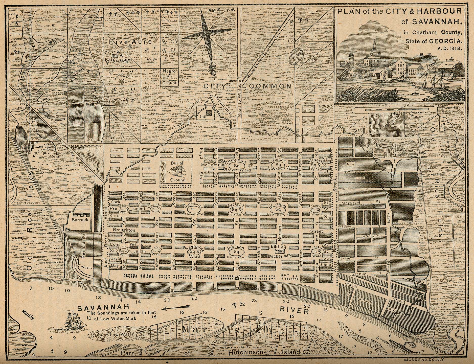
- Savannah, Georgia 1818 "Plan of the City & Harbour of Savannah, in Chatham County. State of Georgia. A.D. 1818." From Report on the Social Statistics of Cities, Compiled by George E. Waring, Jr., United States. Census Office, Part II, 1886. (897K)
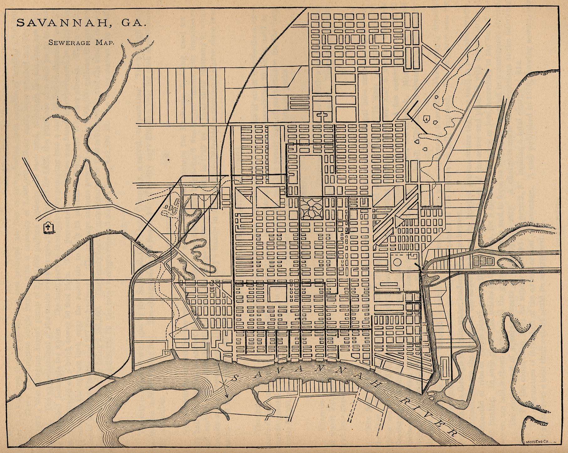
- Savannah, Georgia 1880 "Savannah, Ga. Sewerage Map." From Report on the Social Statistics of Cities, Compiled by George E. Waring, Jr., United States. Census Office, Part II, 1886. (523K)
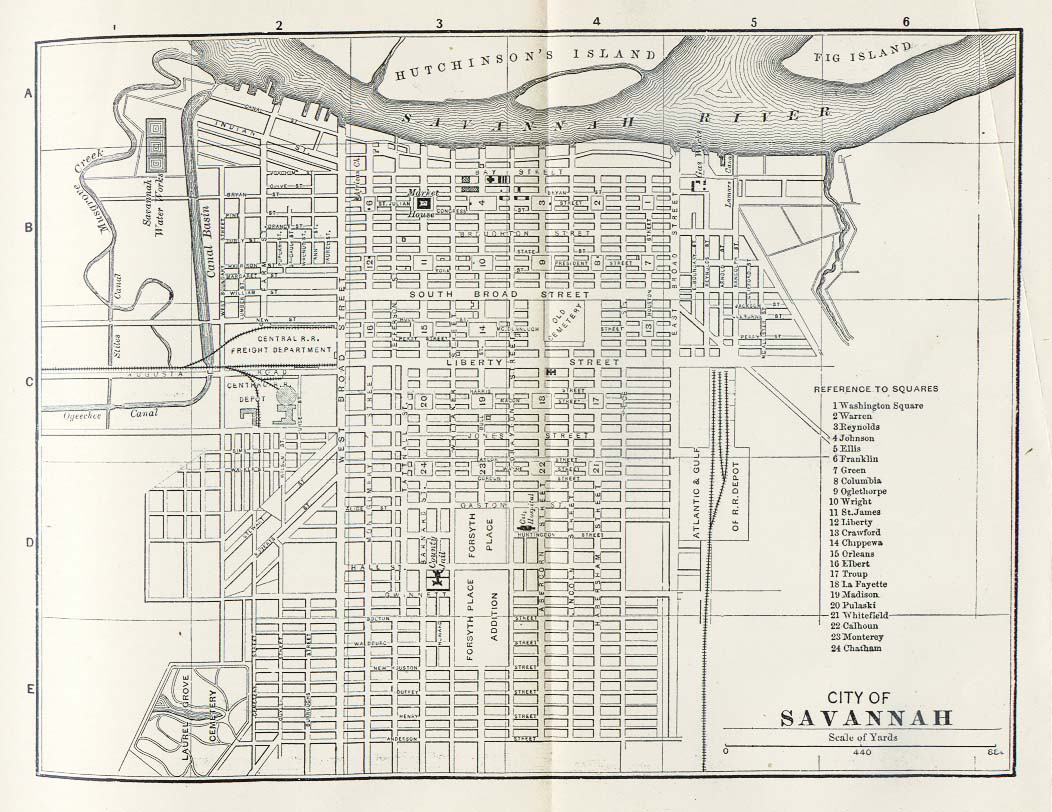
- Savannah, Georgia 1885 Appletons' General Guide to the United States and Canada. Part II. Western and Southern States. New York: D. Appleton and Company. 1885 (206K)
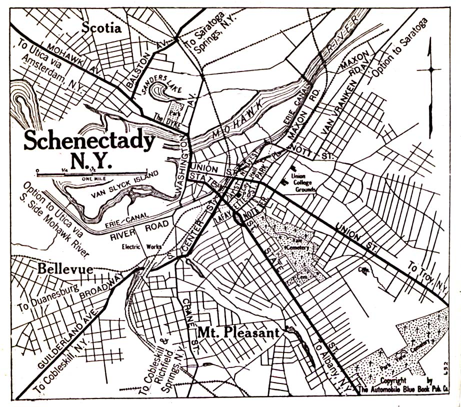
- Schenectady, New York 1920 Automobile Blue Book, 1920, Vol. 1 (323K)
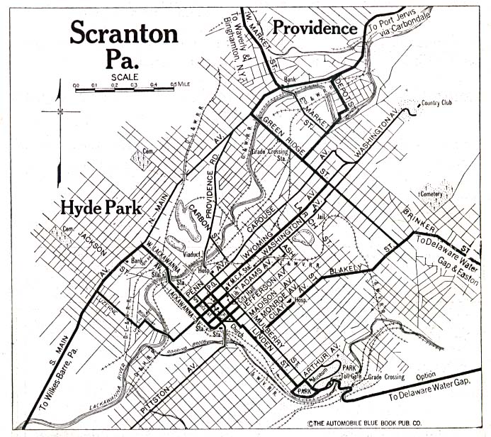
- Scranton, Pennsylvania 1920 Automobile Blue Book, 1920, Vol. 3 (176K)
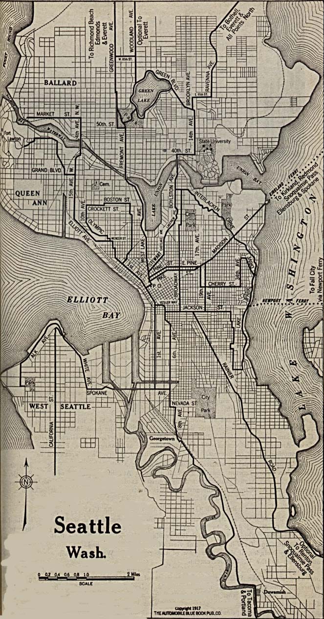
- Seattle, Washington 1917 Automobile Blue Book, 1917, Vol. 8, Section 2 (289K)
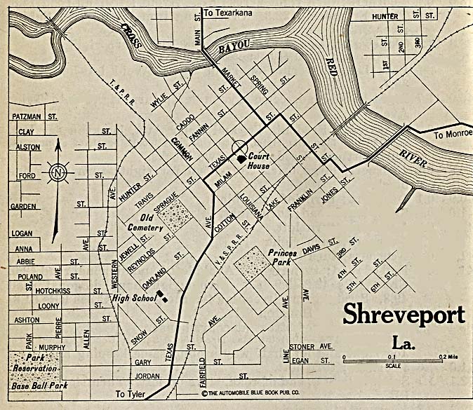
- Shreveport, Louisiana 1920 Automobile Blue Book, 1920, Vol. 7 (162K)
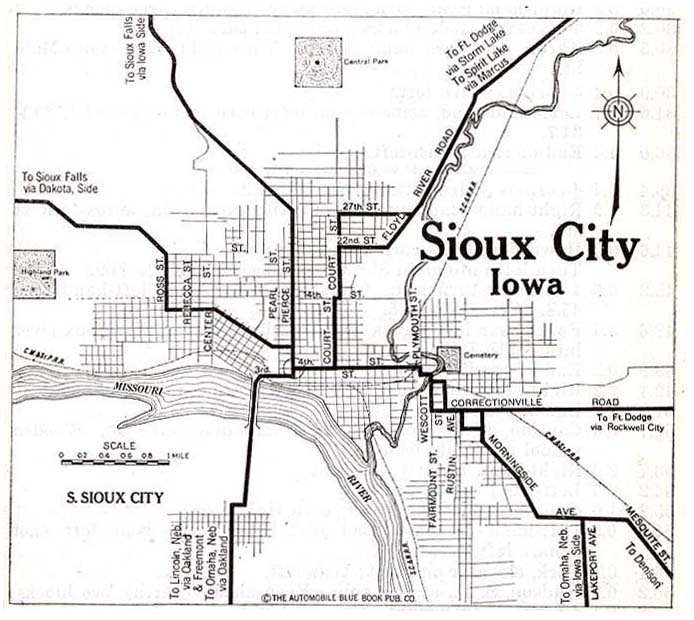
- Sioux City, Iowa 1920 Automobile Blue Book, 1920, Vol. 11 (96K)
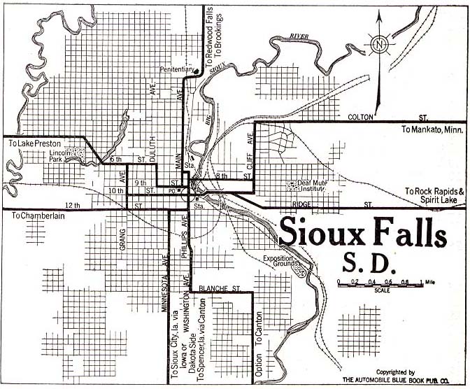
- Sioux Falls, South Dakota 1920 Automobile Blue Book, 1920, Vol. 10 (124K)
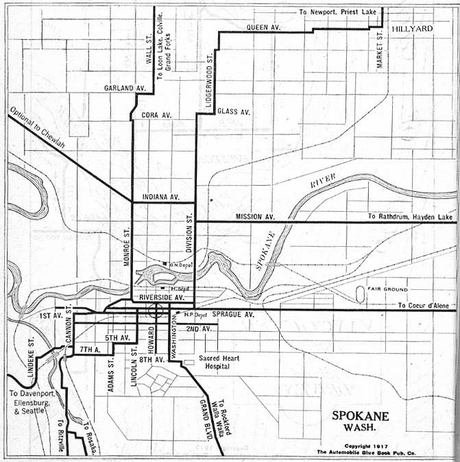
- Spokane, Washington 1917 Automobile Blue Book, 1917, Vol. 8, Section 2 (122K)
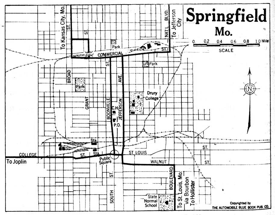
- Springfield, Missouri 1920 Automobile Blue Book, 1920, Vol. 5 (158K)
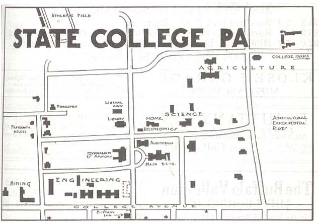
- State College, Pennsylvania 1920 Automobile Blue Book, 1920, Vol. 3 (56K)
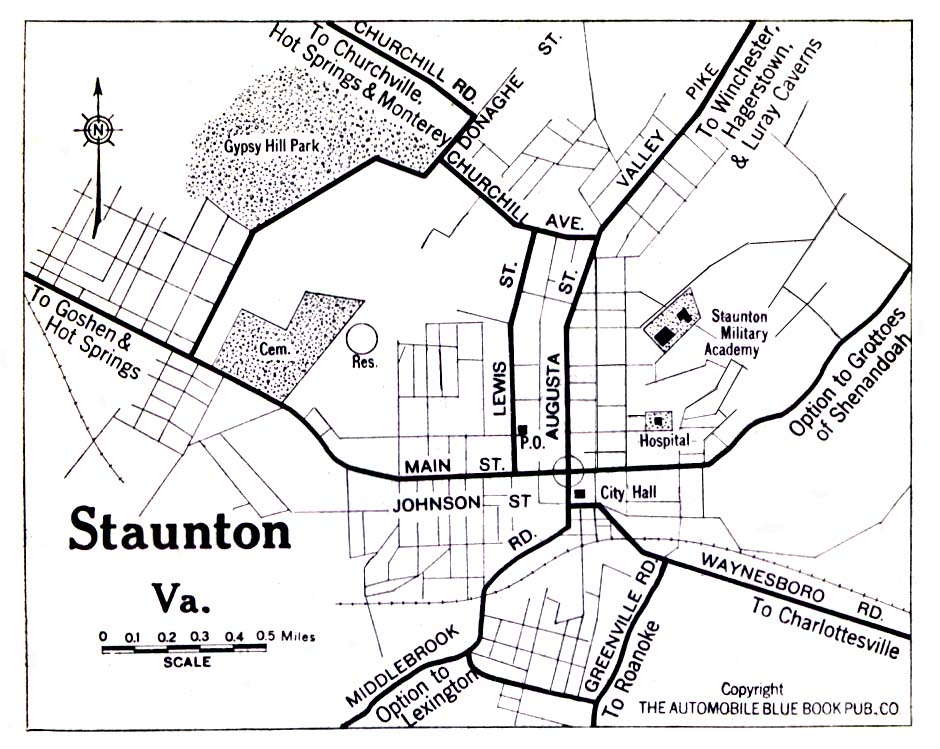
- Staunton, Virginia 1919 Automobile Blue Book, 1919, Vol. 6 (258K)
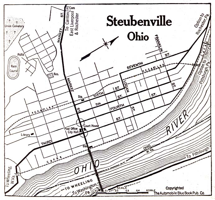
- Steubenville, Ohio 1920 Automobile Blue Book, 1920, Vol. 4 (156K)
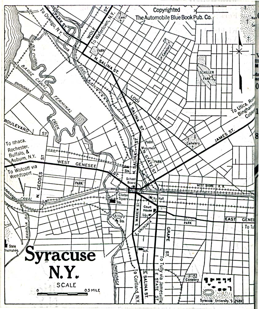
- Syracuse, New York 1920 Automobile Blue Book, 1920, Vol. 1 (323K)
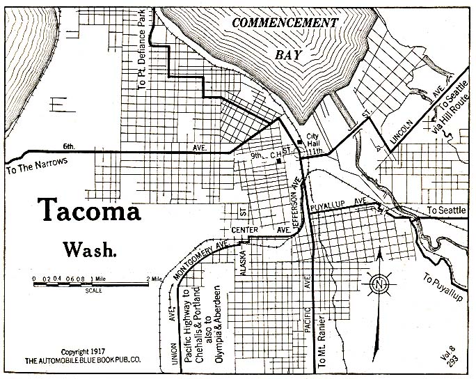
- Tacoma, Washington 1917 Automobile Blue Book, 1917, Vol. 8, Section 2 (176K)
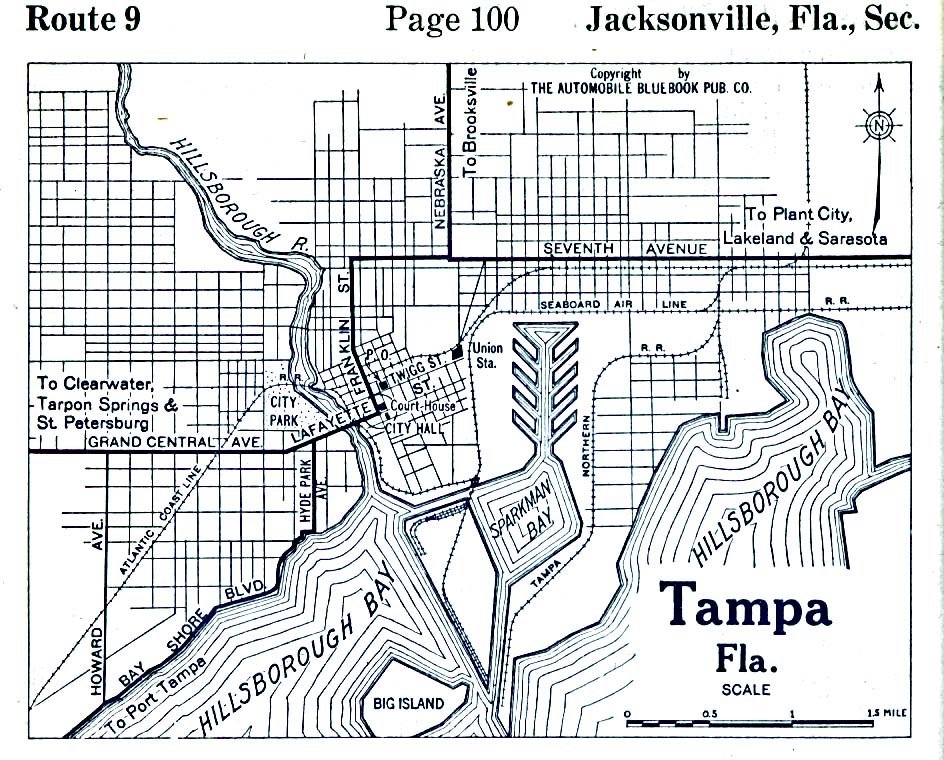
- Tampa, Florida 1919 Automobile Blue Book, 1919, Vol. 6 (193K)
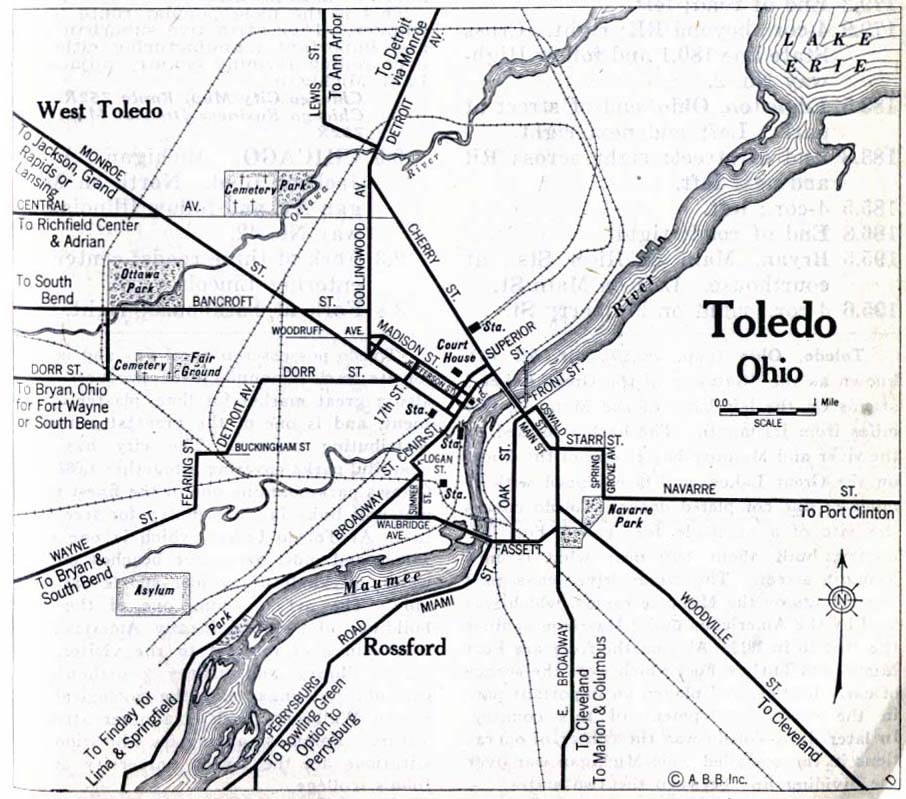
- Toledo, Ohio 1917 Automobile Blue Book, 1917, Vol. 8 (152K)
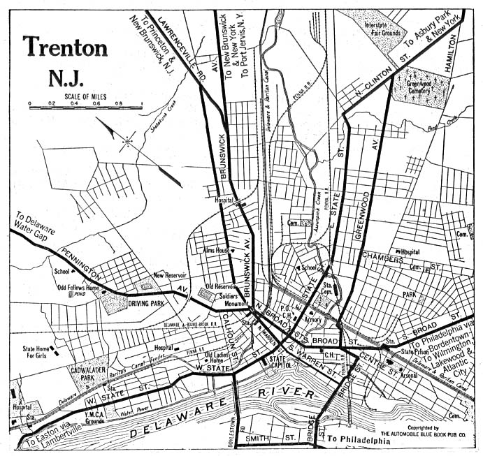
- Trenton, New Jersey 1920 Automobile Blue Book, 1922, Vol. 2 (176K)
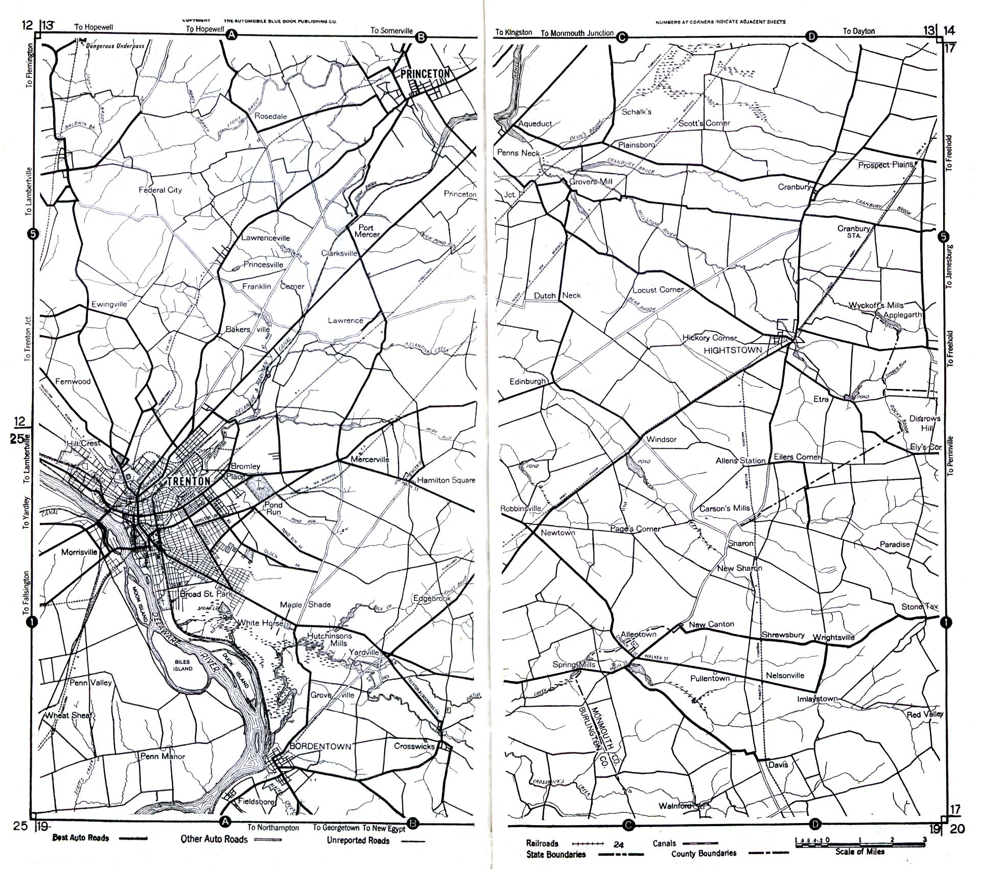
- Trenton Area, New Jersey 1922 Automobile Blue Book (525K)
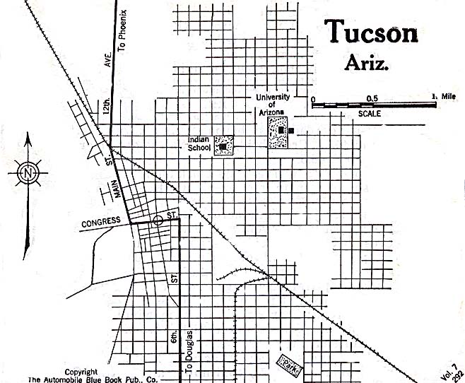
- Tucson, Arizona 1920 Automobile Blue Book, 1920, Vol. 7 (117K)
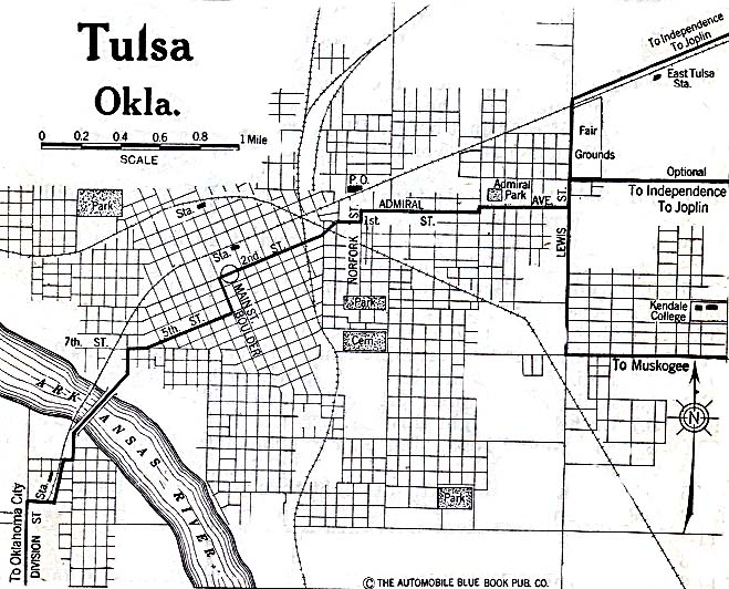
- Tulsa, Oklahoma 1920 Automobile Blue Book, 1920, Vol. 7 (137K)
- Utica, New York 1830 (166K) From The Northern Traveller, and Northern Tour; with the Routes to The Springs, Niagara, and Quebec, and the Coal Mines of Pennsylvania; also, the Tour of New-England. New York, 1830.
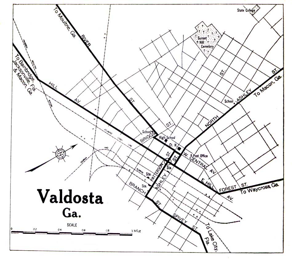
- Valdosta, Georgia 1919 Automobile Blue Book, 1919, Vol. 6 (258K)
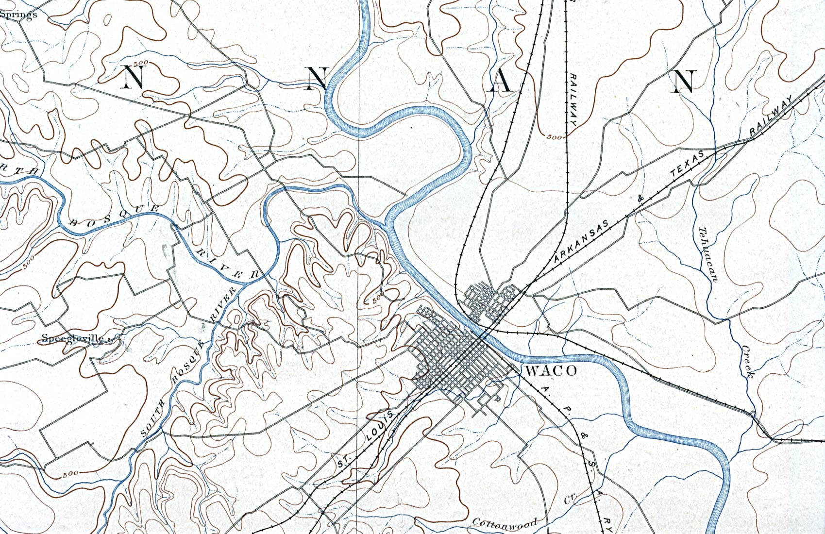
- Waco, Texas 1892 Original Scale 1:125,000. U.S. Geological Survey. Reprint, 1898 (449K)
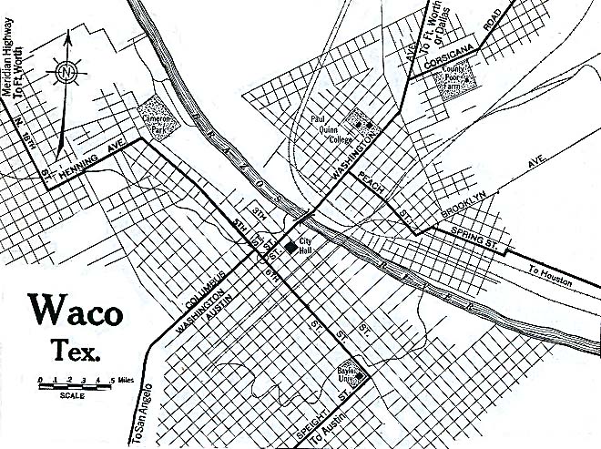
- Waco, Texas 1920 Automobile Blue Book, 1920, Vol. 7 (176K)
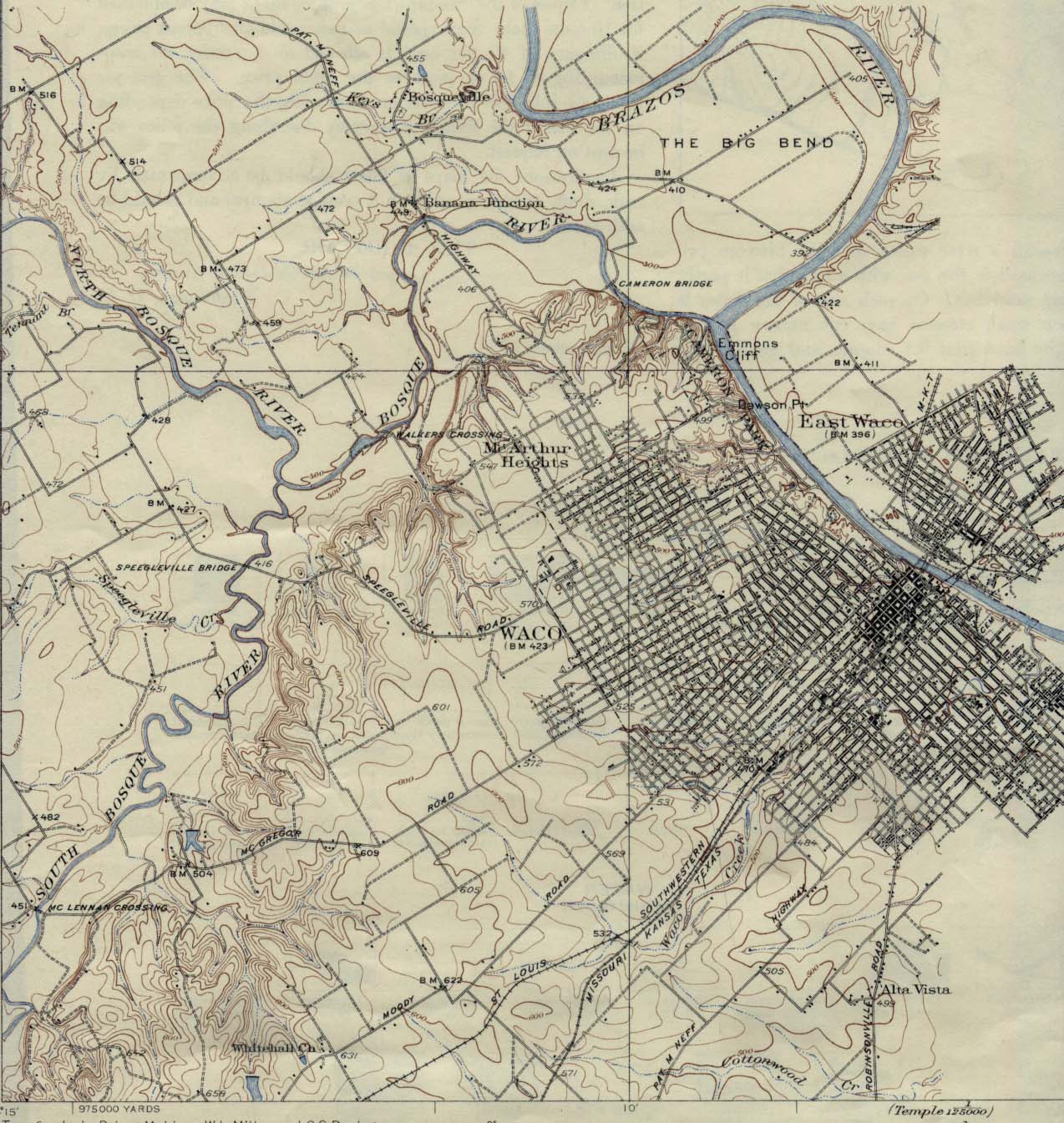
- Waco, Texas 1931 Original Scale 1: 62,500 U.S. Geological Survey 1931. (339K)
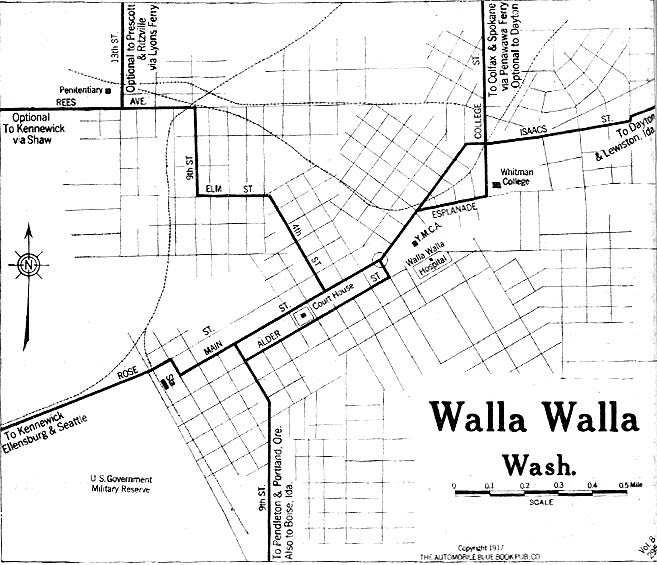
- Walla Walla, Washington 1917 Automobile Blue Book, 1917, Vol. 8, Section 2 (114K)
- Washington D.C. - Western Section with Alexandria, Virginia 1894 U.S. Geological Survey (417K)
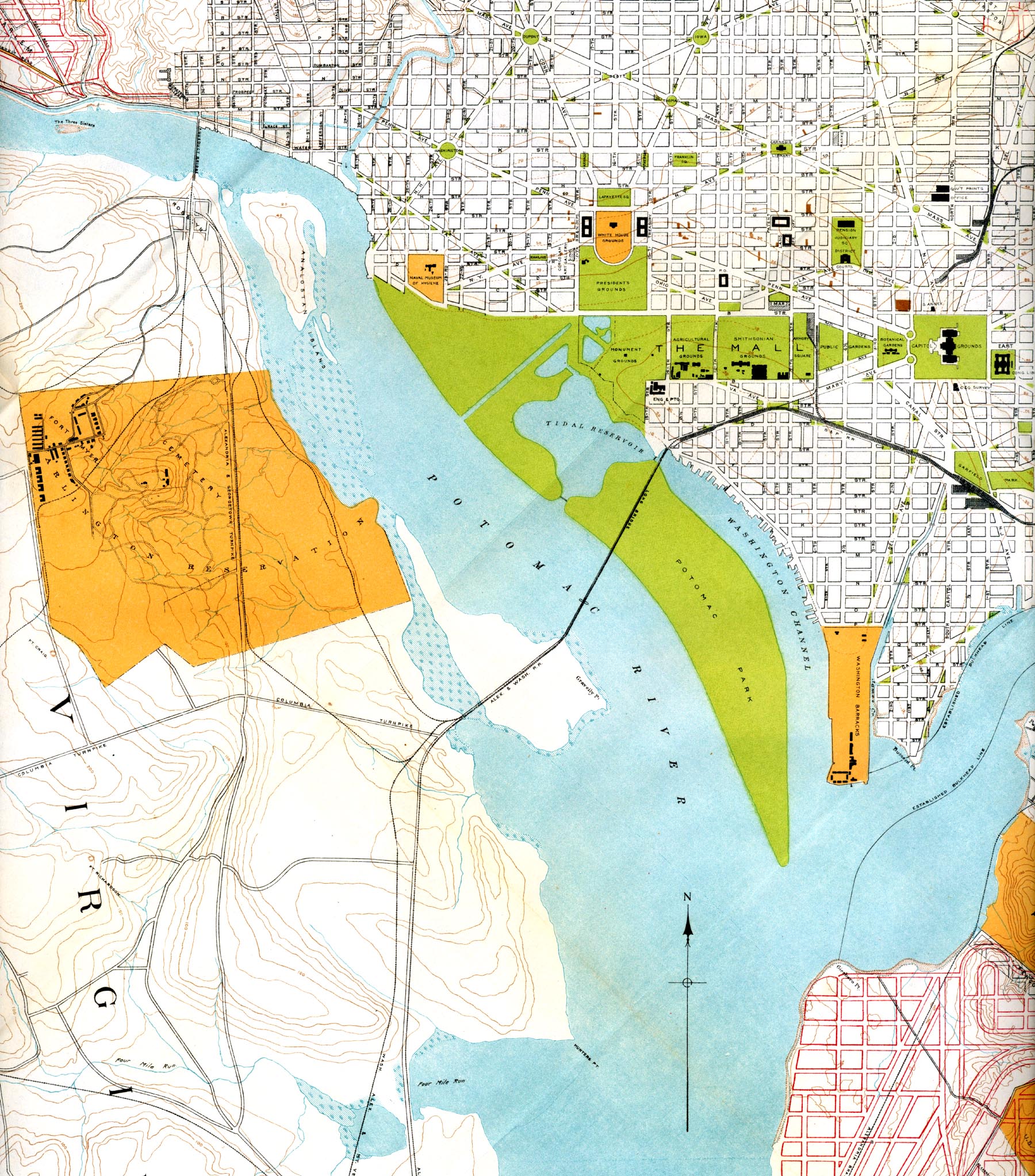
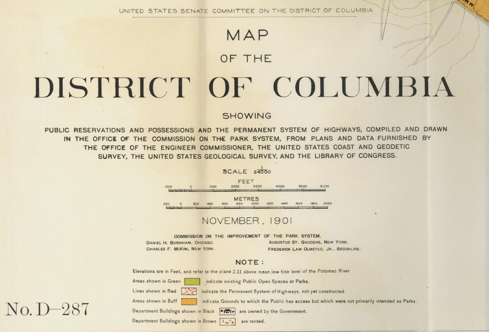
- Washington, D.C. 1901 Portion of "Map of the District of Columbia" No. D-287, Commission on the Improvement of the Park System, 1901 (1MB) and Map Legend (174K)
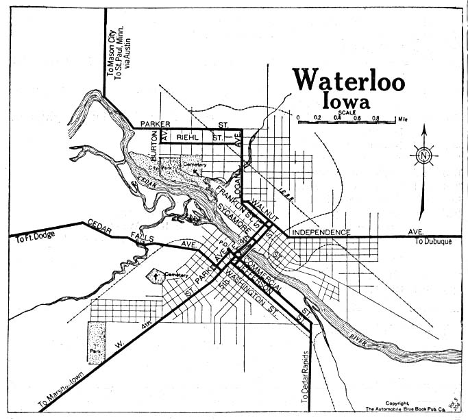
- Waterloo, Iowa 1919 Automobile Blue Book (117K)
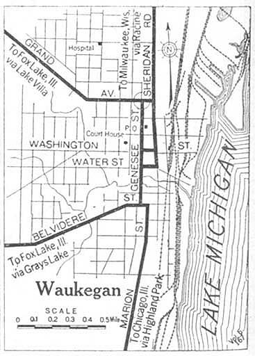
- Waukegan, Illinois 1920 Automobile Blue Book, 1920, Vol. 5 (71K)
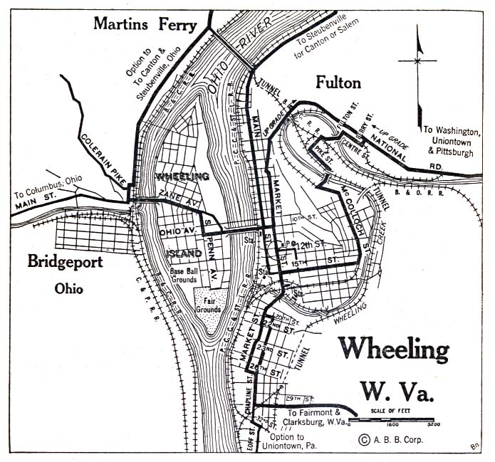
- Wheeling, West Virginia 1920 Automobile Blue Book, 1920, Vol. 3 (156K)
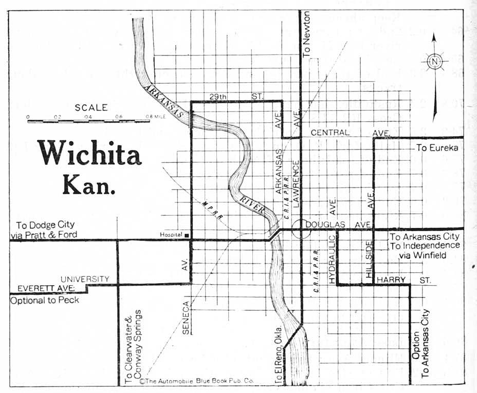
- Wichita, Kansas 1920 Automobile Blue Book, 1920, Vol. 7 (117K)
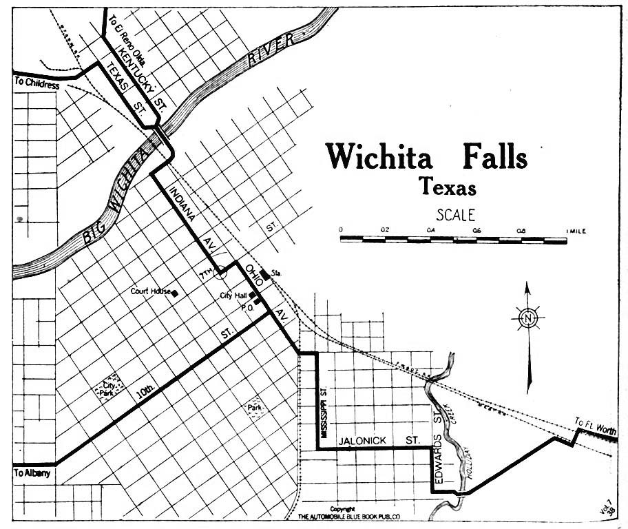
- Wichita Falls, Texas 1920 Automobile Blue Book, 1920, Vol. 7 (176K)
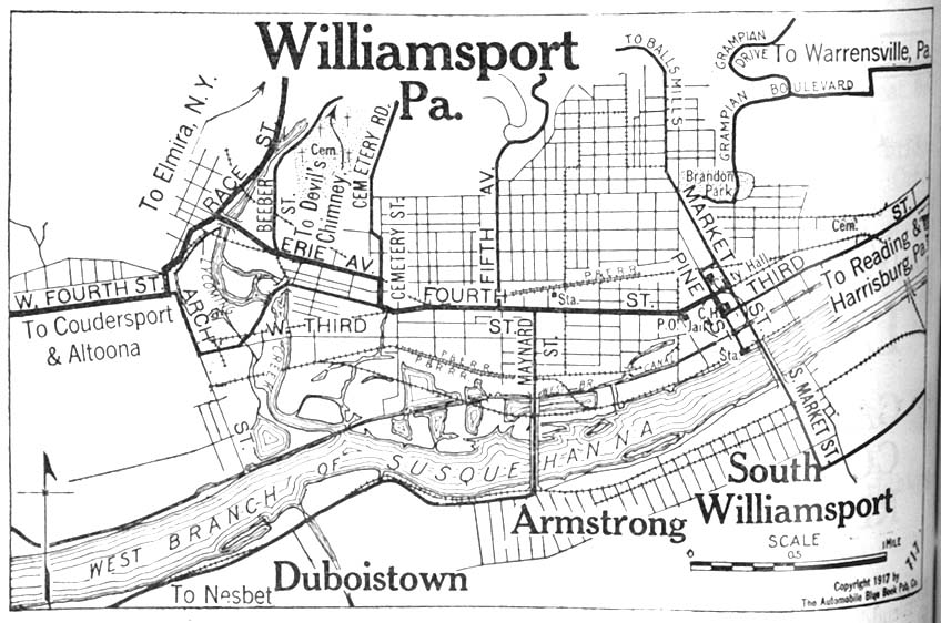
- Williamsport, Pennsylvania 1917 Automobile Blue Book, 1917, Vol. 3 (140K)
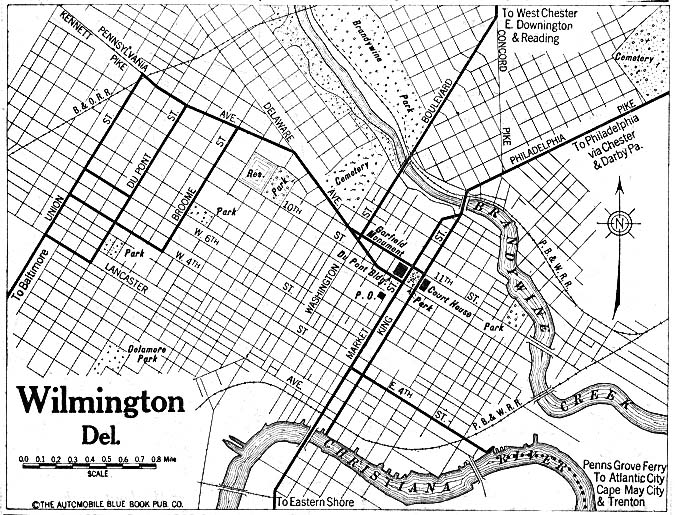
- Wilmington, Delaware 1920 Automobile Blue Book, 1920, Vol. 3 (195K)
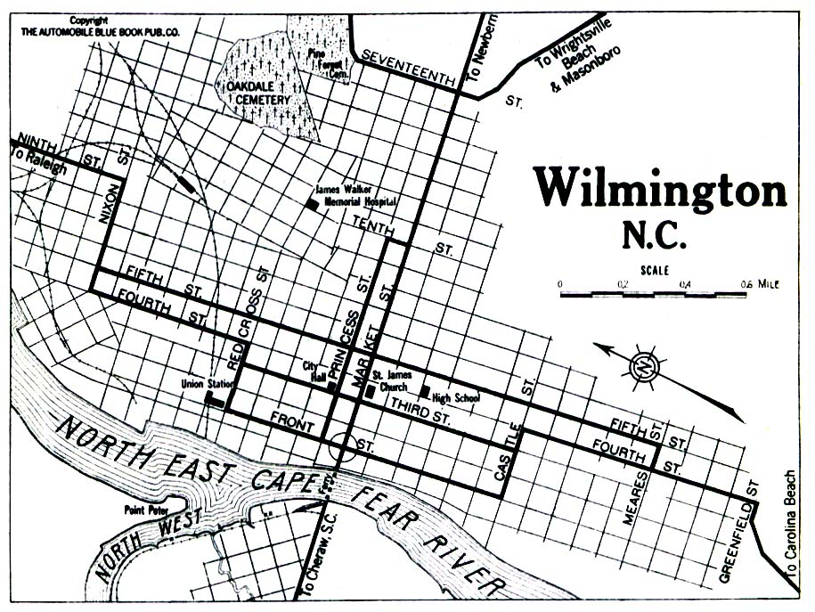
- Wilmington, North Carolina 1919 Automobile Blue Book, 1919, Vol. 6 (258K)
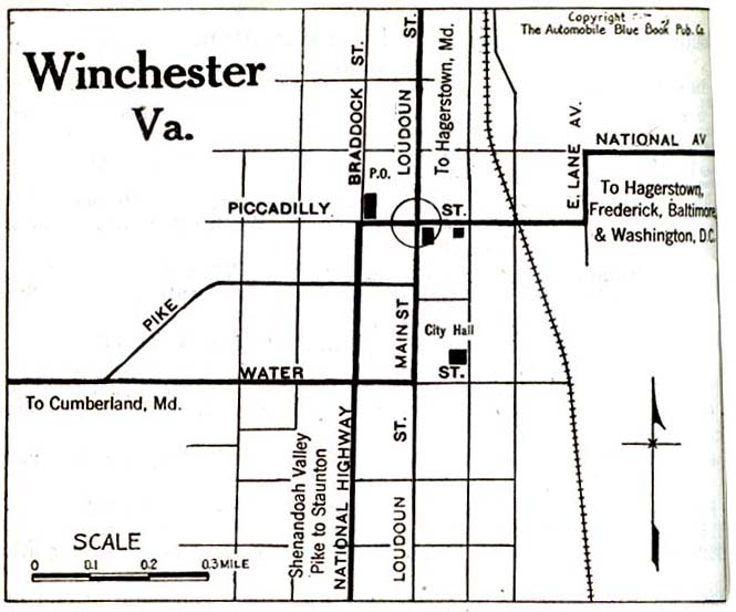
- Winchester, Virginia 1920 Automobile Blue Book, 1920, Vol. 3 (72K)
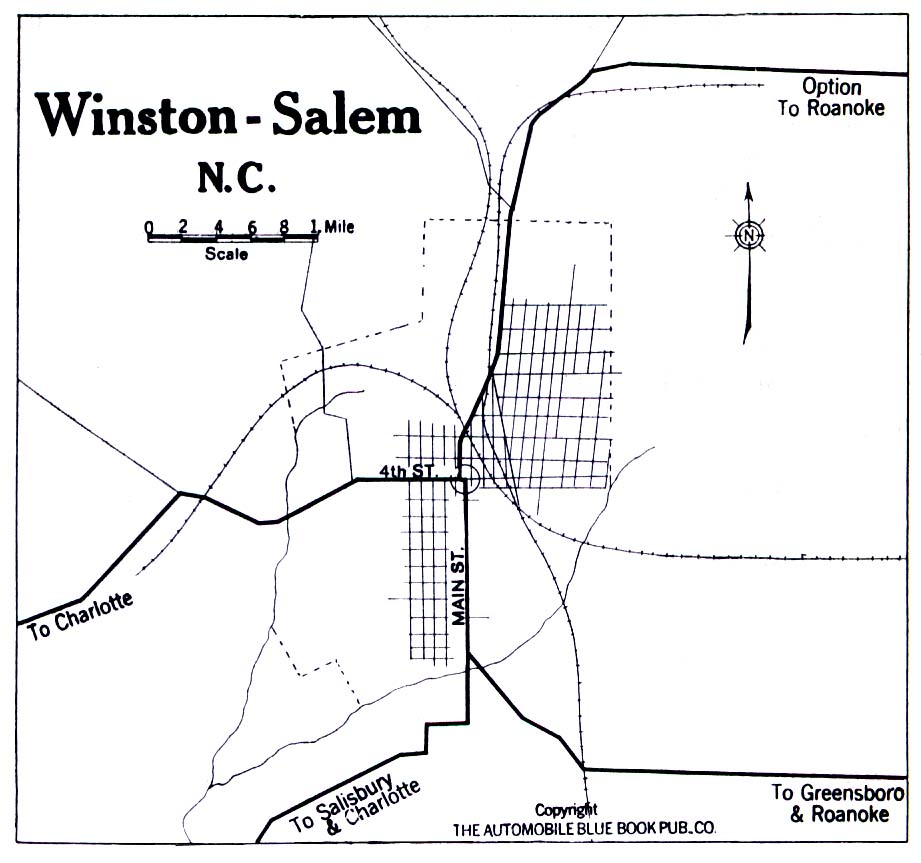
- Winston-Salem, North Carolina 1919 Automobile Blue Book, 1919, Vol. 6 (194K)
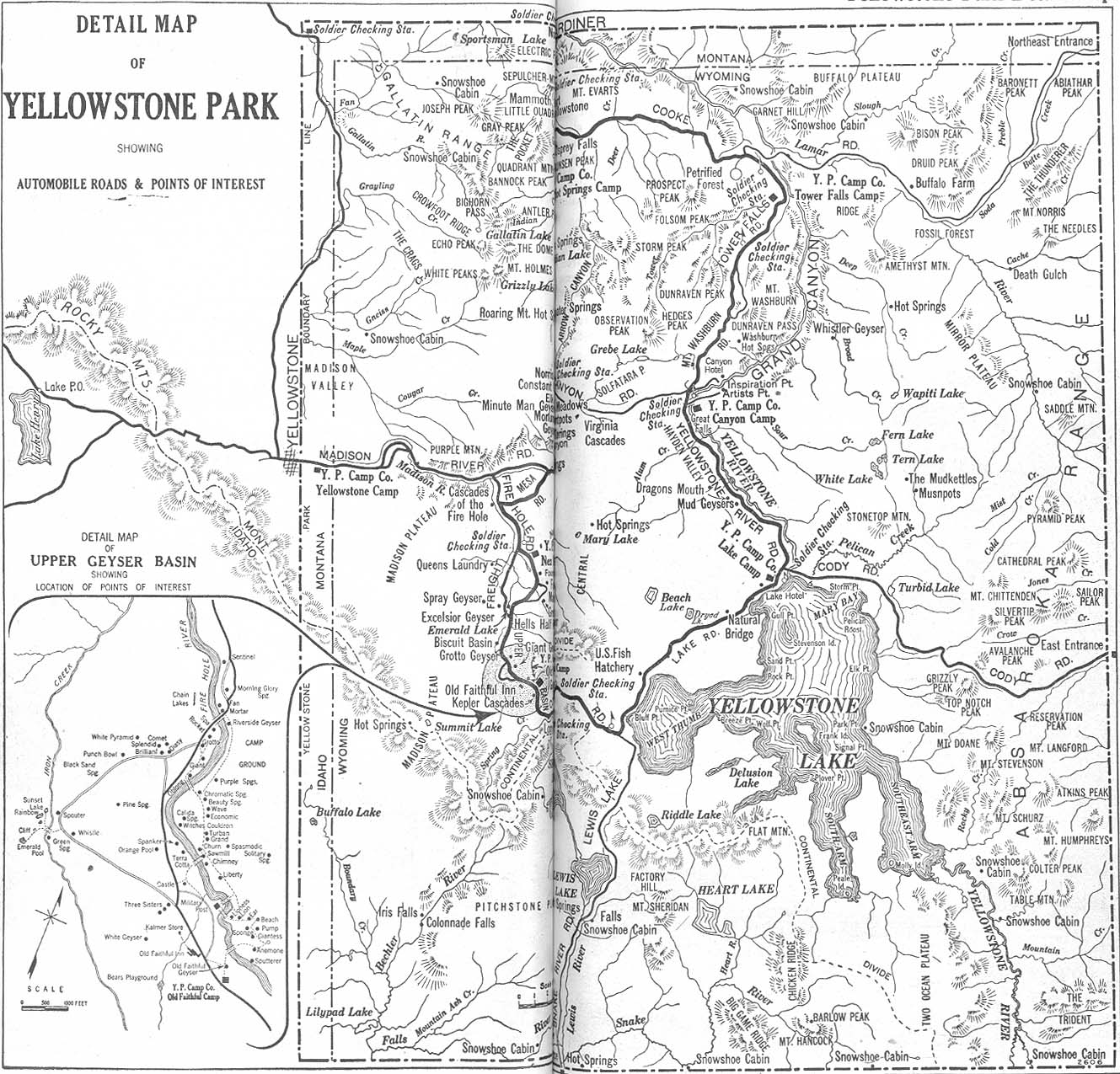
- Yellowstone National Park 1917 Automobile Blue Book, 1917, Vol. 8, Section 2 (589K)
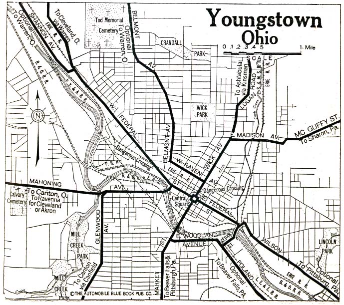
- Youngstown, Ohio 1920 Automobile Blue Book, 1920, Vol. 4 (176K)
![[Northern] California Detail Map 1917](historical/northern_california_detail_1917.jpg)