Perry-Castañeda Library
Map Collection
Gambia Maps
The following maps were produced by the U.S. Central Intelligence Agency, unless otherwise indicated.
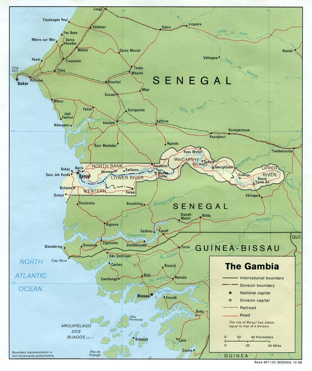
Country Maps- Gambia, The (Political) 1988 (226K) and pdf format (233K)
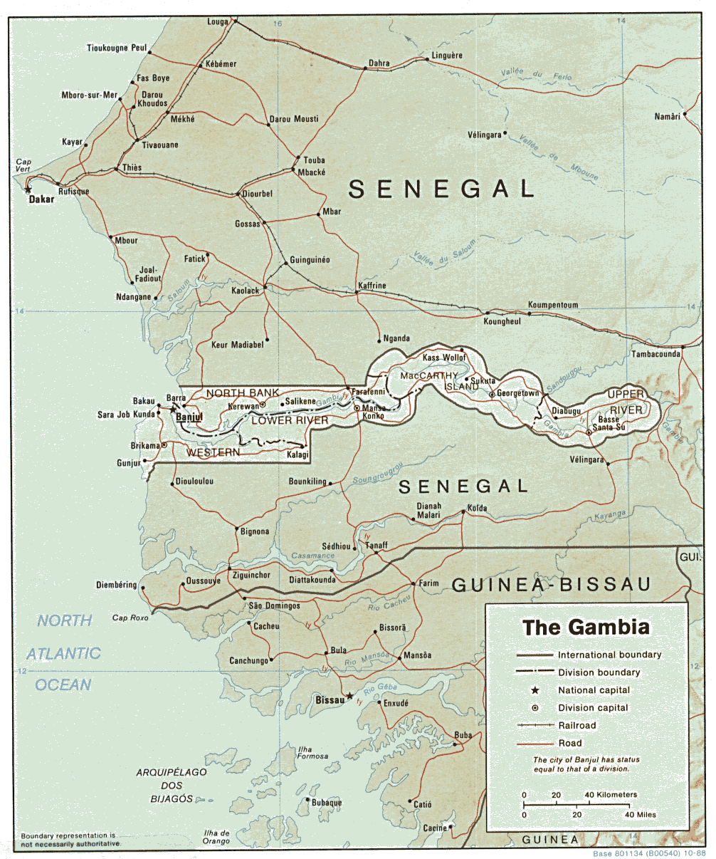
- Gambia, The (Shaded Relief) 1988 (245K) and pdf format (265K)
- Gambia, The (Small Map) 2016 (7.7K)
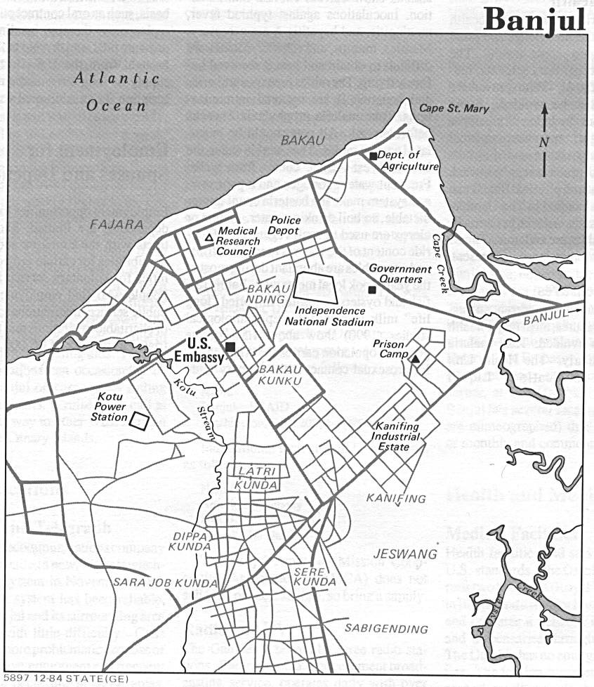
- Banjul (Fajara/Sere Kunda Area) U.S. Dept. of State 1984 (209K)
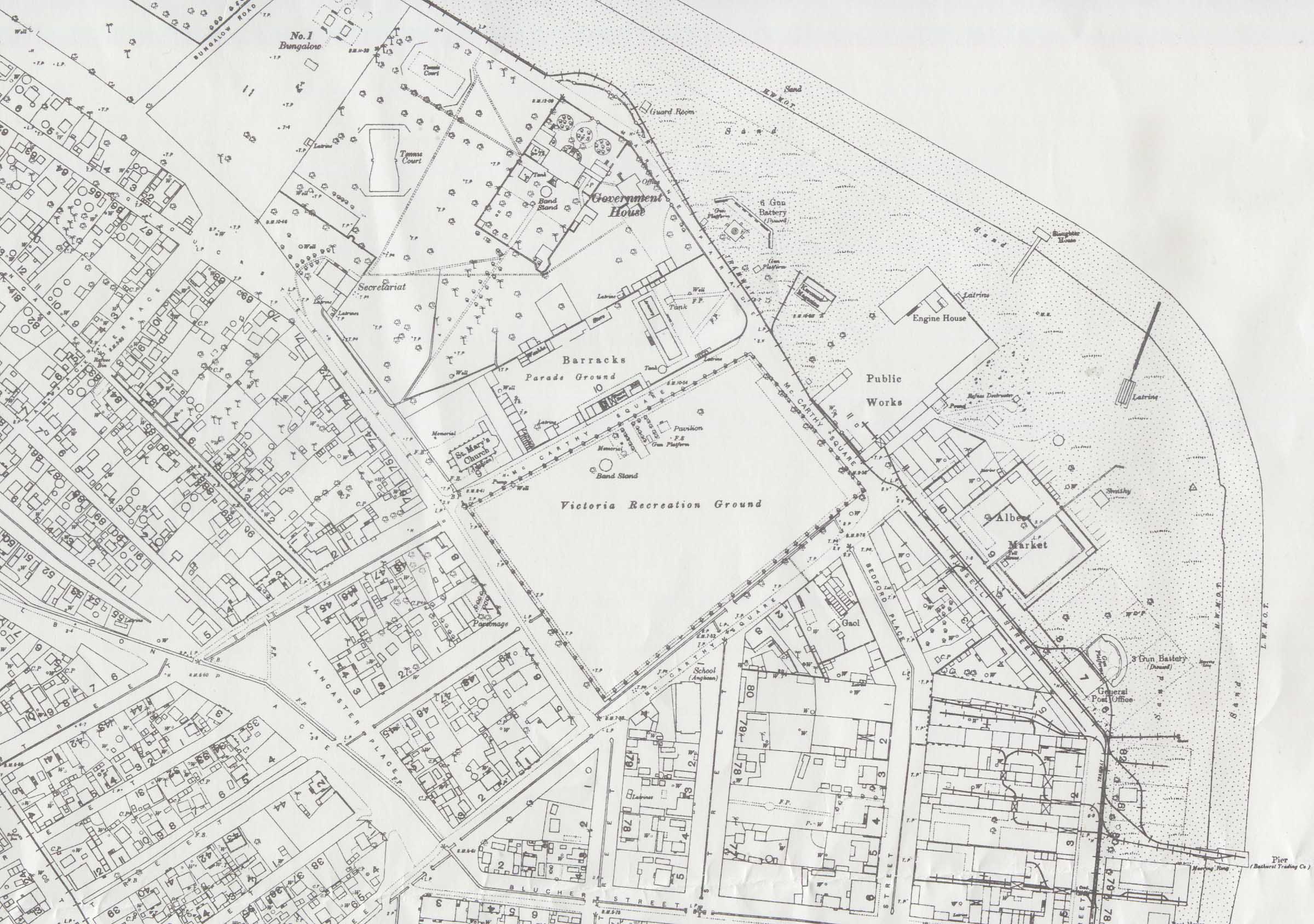
- Bathurst [Banjul] 1:2,500 (6.6 MB) and city center (581K)
- Surveyed in 1910-11 and partly Revised in 1918 by W.F. Crook, reprinted by Engineer Reproduction Plant, U.S. Army War College 1941.
![Bathurst [Banjul]](ams/bathurst/txu-pclmaps-oclc-8321160-bathurst.jpg)
- 1:2,000,000 - Africa Topographic Maps U.S. Army Map Service, Series 2201
- Sheet 11 includes all of The Gambia
- 1:1,000,000 - Operational Navigation Chart Series, Sheet K-1 U.S. Defense Mapping Agency Aerospace Center. Not for navigational use
- Sheets K-1 includes all of The Gambia
- 1:500,000 - Tactical Pilotage Charts U.S. National Imagery and Mapping Agency. Not for navigational use
- This series covers The Gambia
- 1:250,000 - West Africa Topographic Maps U.S. Army Map Service, Series N504
- This series includes all of The Gambia
- 1:250,000 - Joint Operations Graphic U.S. National Imagery and Mapping Agency, Series 1501 Air Not for navigational use
- This series includes all of The Gambia
- 1:200,000 - French West Africa Topographic Maps U.S. Army Map Service, 1940-
- This historical series includes all of The Gambia
- Sheet 11 includes all of The Gambia
Maps on Other Web Sites