Perry-Castañeda Library
Map Collection
East Timor (Timor-Leste) Maps
Country Maps
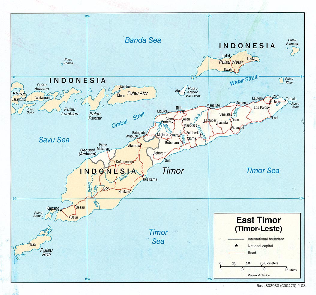
- East Timor (Political) U.S. Central Intelligence Agency 2003 (225K) pdf format (228K)
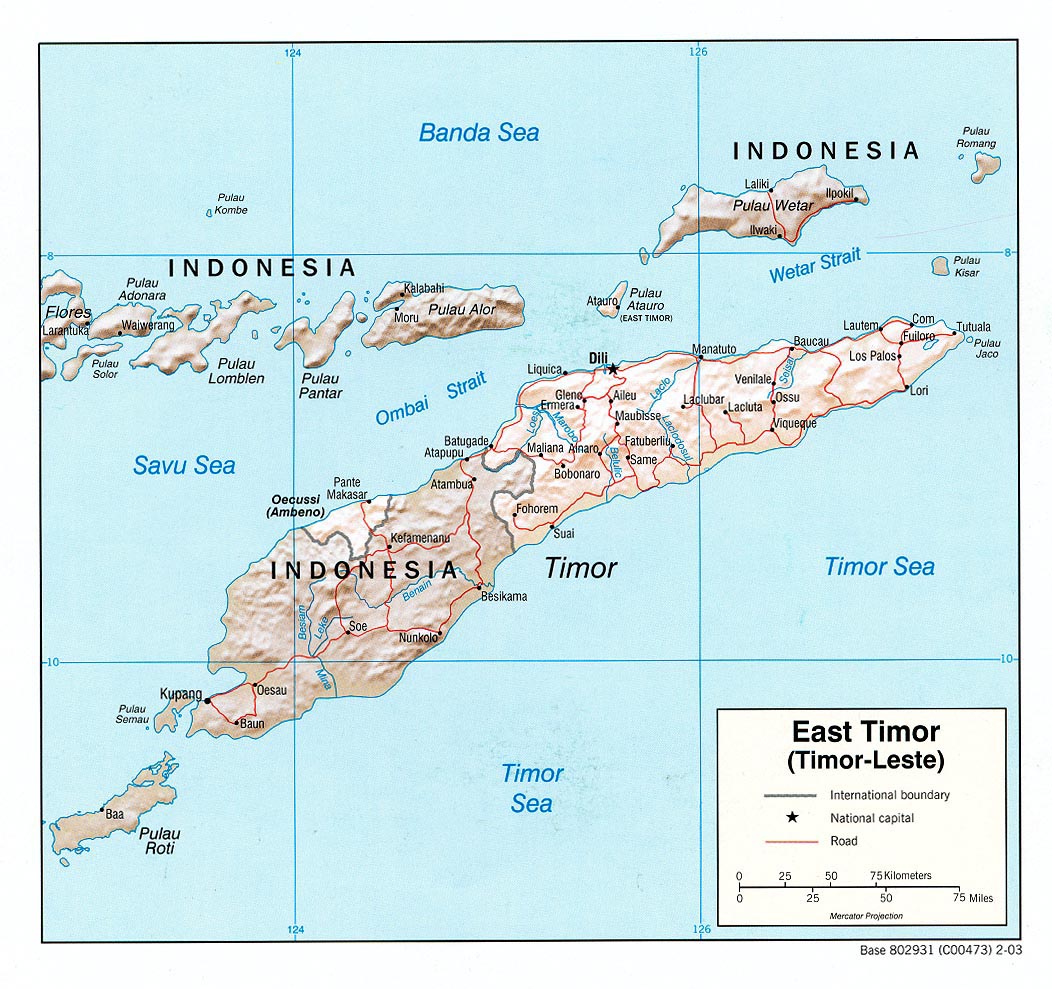
- East Timor (Shaded Relief) U.S. Central Intelligence Agency 2003 (231K) pdf format (234K)
- East Timor (Shaded Relief) U.S. Central Intelligence Agency 2002 (182K) and pdf format (189K)
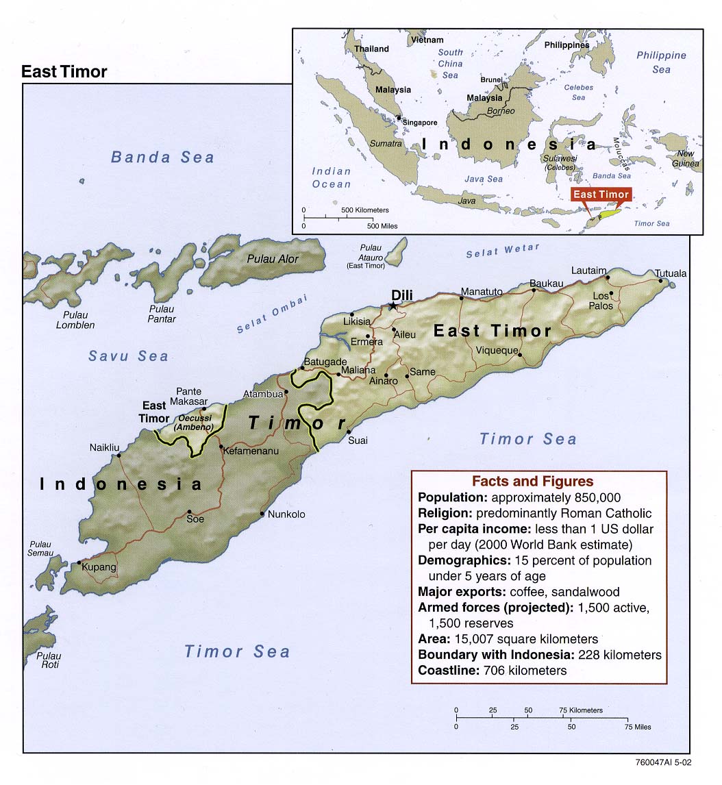
- Timor-Leste (Small Map) U.S. Central Intelligence Agency 2016 (17.3K)
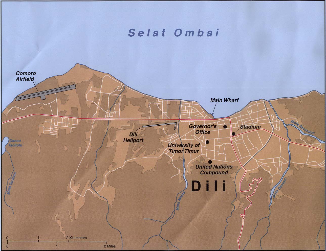
- Dili U.S. Central Intelligence Agency 1999 (181K)
- Timor - Eastern and Central
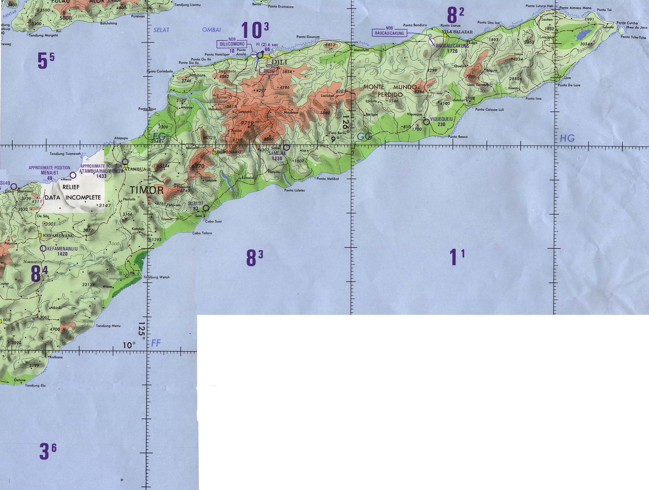
(Operational Navigation Chart) Portion of Defense Mapping Agency ONC N-13, 1989, original scale 1:1,000,000. (304K) Not for navigational use
- 1:500,000 - Tactical Pilotage Charts U.S. National Imagery and Mapping Agency. Not for navigational use
- This series covers East Timor
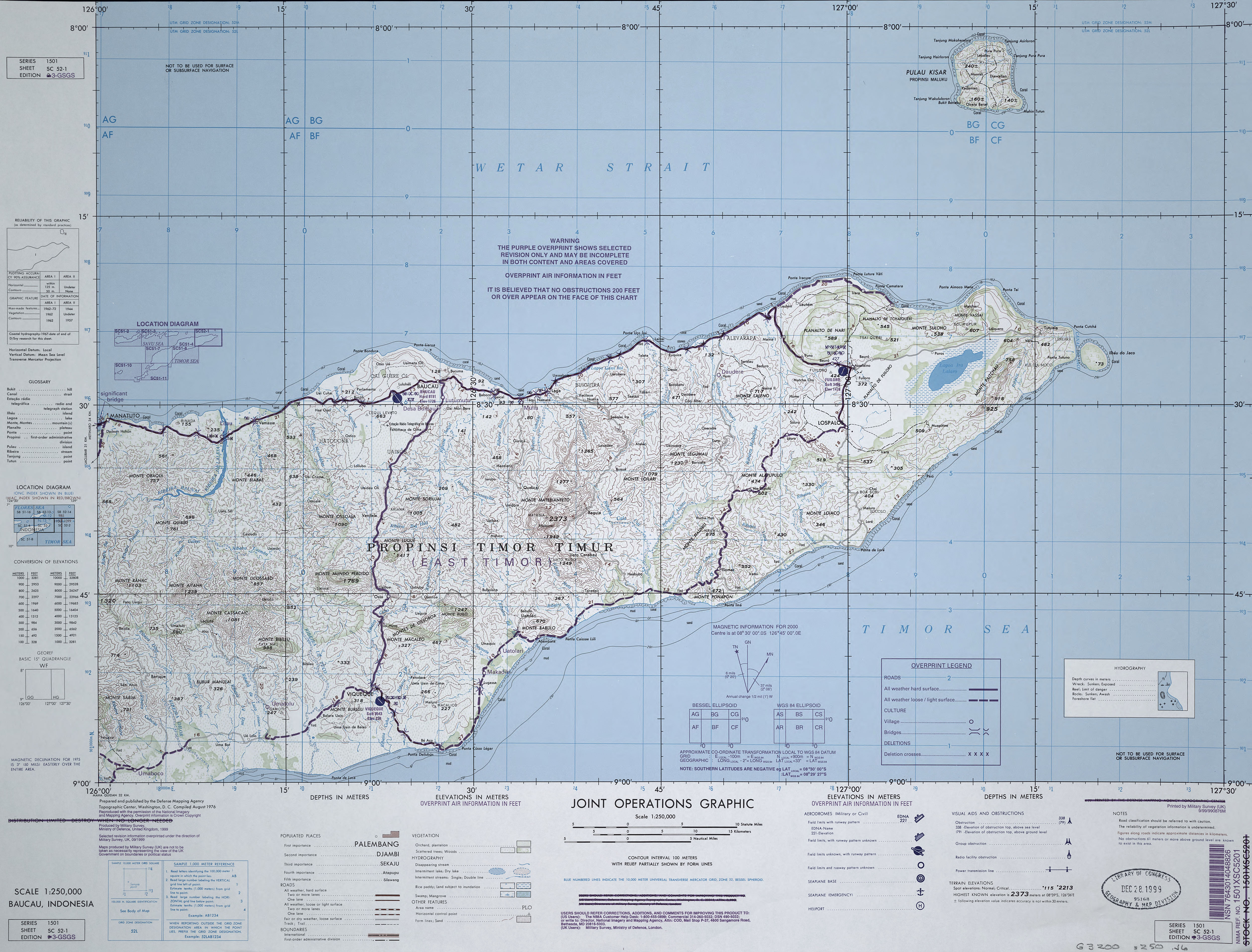
- Baucau, Indonesia (Joint Operations Graphic) Defense Mapping Agency SC 52-1, 1999, original scale 1:250,000 (3.7MB) This map is from the collection of the Library of Congress, Geography and Map Division Not for navigational Use
- This series covers East Timor
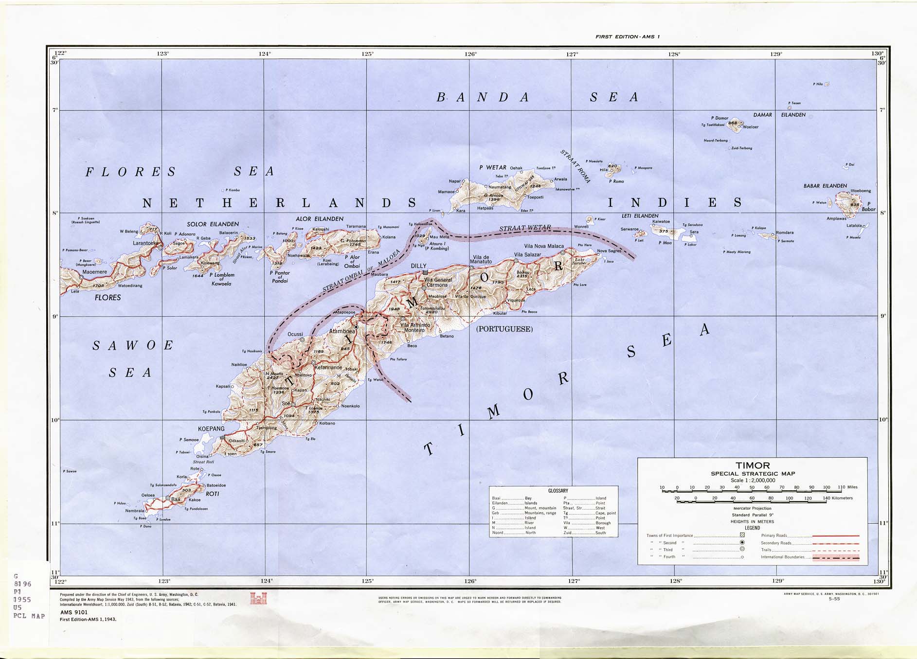
- Timor 1943 (286K)
Portion of "Timor Special Strategic Map" U.S. Army Map Service, AMS 9101, 1943 [May 1955 printing]. Original scale 1:2,000,000.
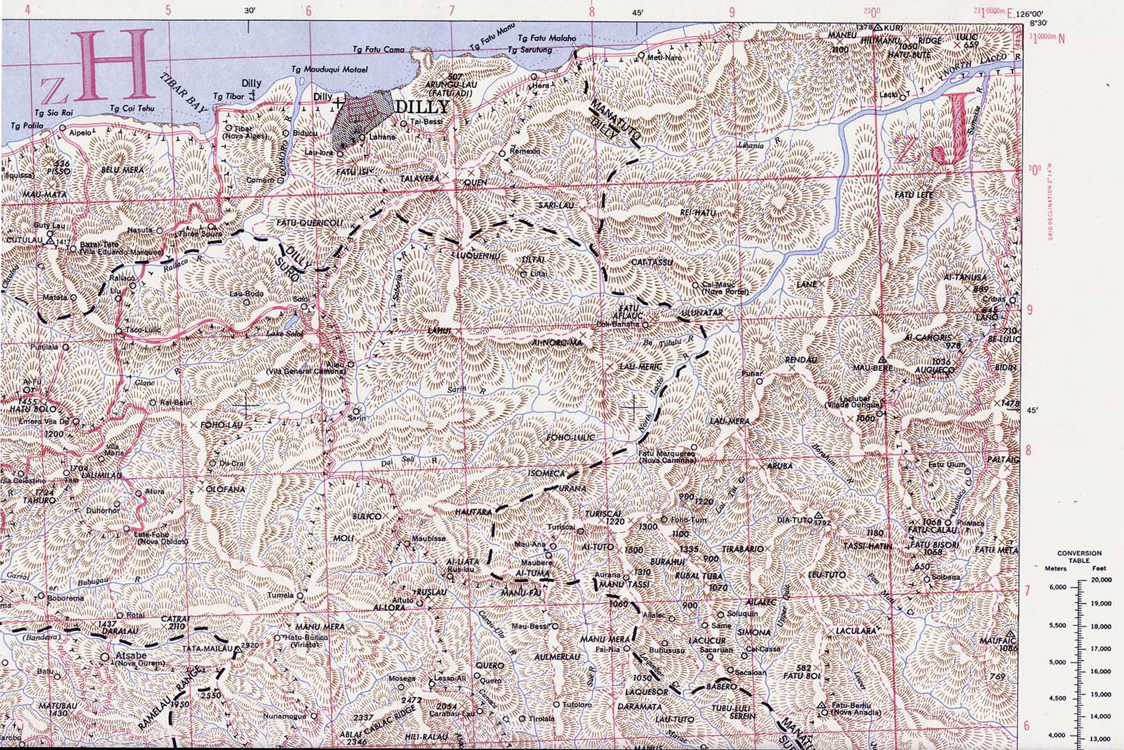
- [Dili] Dilly 1943 Original Scale 1:250,000. U.S. Army Map Service, Series T551, Second Edition, 1943 (3.9MB). Portion of this map: Dilly (553K)
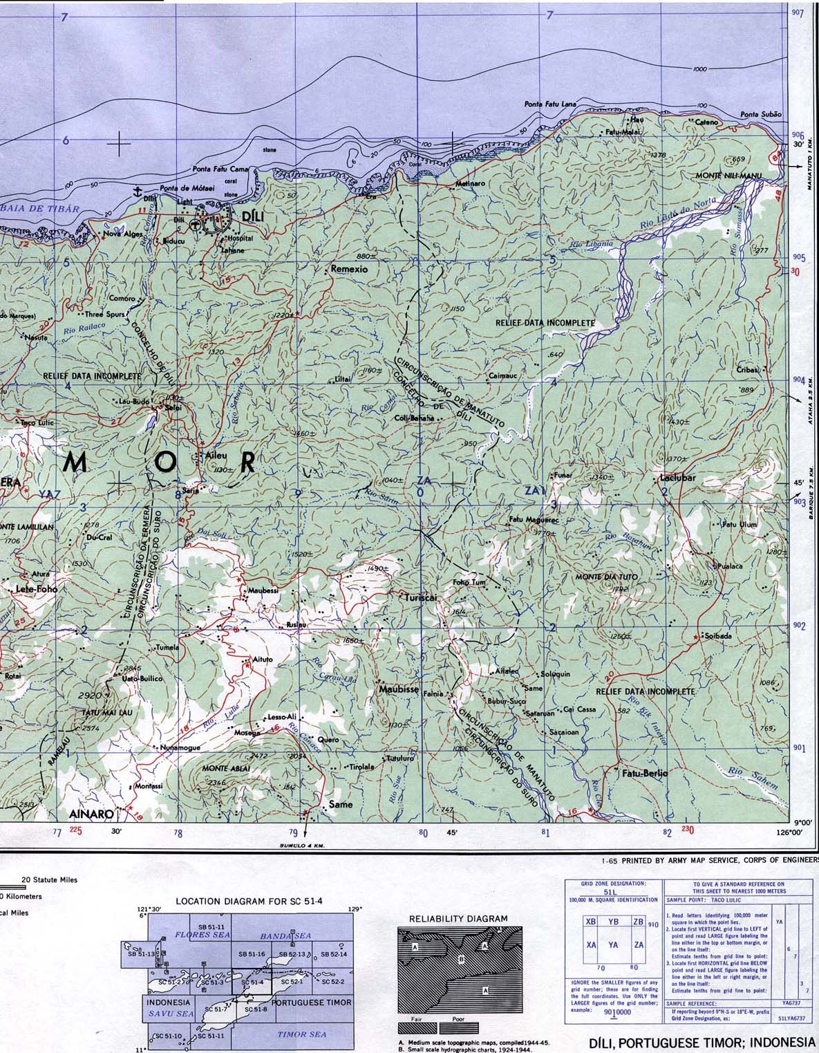
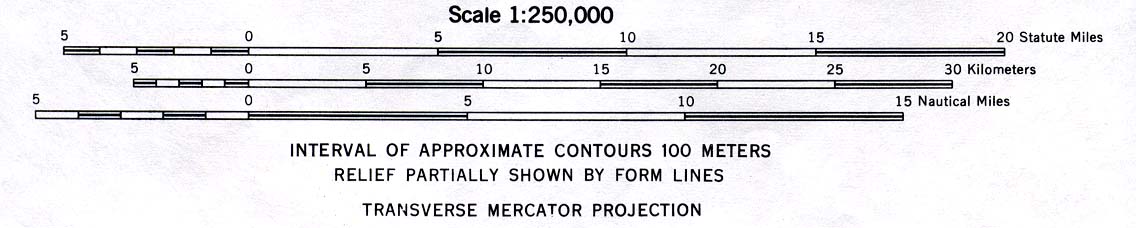
- Dili Area 1965 (415K) and map scale (47K)
Portion of "Dili, Portuguese Timor; Indonesia", U.S. Army Map Service, Series T503, Sheet SC 51-4, 1965. Original scale 1:250,000.
- Central Timor [OMEGA Nautical Chart] 1979 (351K)
Portion of "Timor and Adjacent Islands", Sheet 73004, U.S. Defense Mapping Agency, 1979. From Netherlands Government Surveys to
1927. "Natural Scale 1:500,000 at the Equator." Soundings in fathoms. Not for navigational use
- More Historical Maps of Asia
![[Dili] Dilly 1943](historical/txu-pclmaps-oclc-6595558-Dilly-1943.jpg)
![Central Timor [OMEGA Nautical Chart] 1979](historical/timor_nautical_1979.jpg)
Maps on Other Web Sites