Perry-Castañeda Library
Map Collection
Cote d'Ivoire (Ivory Coast) Maps
The following maps were produced by the U.S. Central Intelligence Agency, unless otherwise indicated.
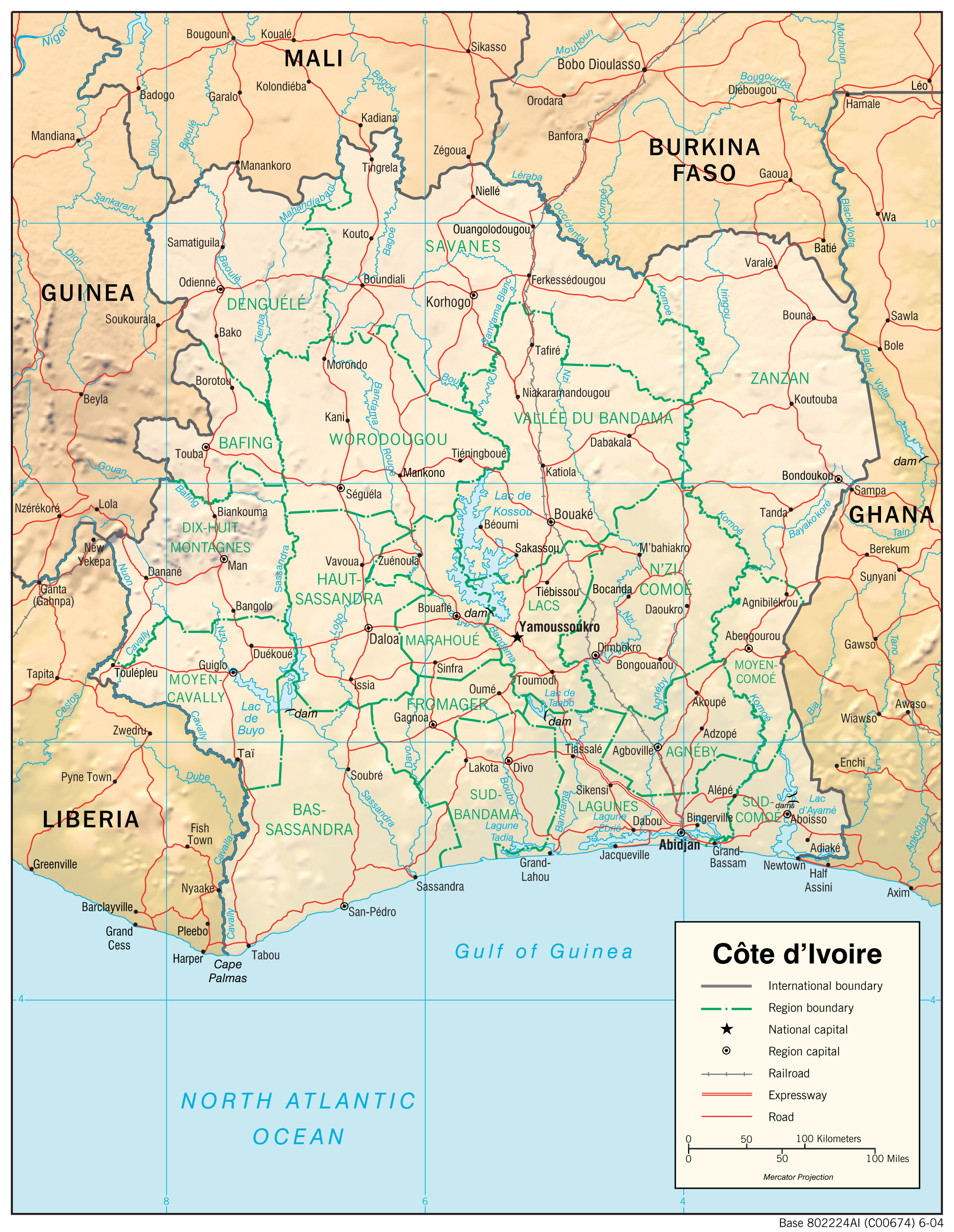
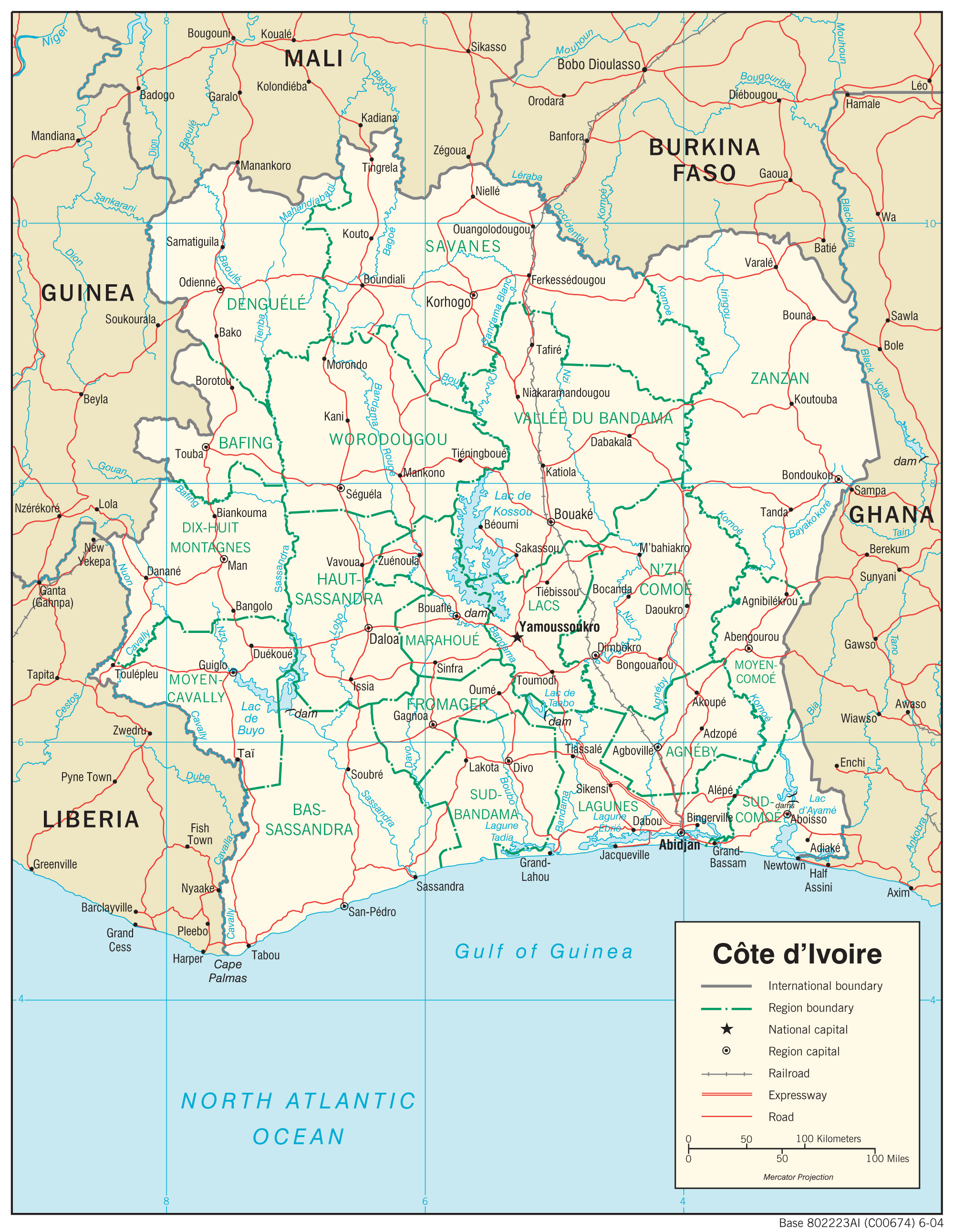
Country Maps- Cote d'Ivoire (Physiography) 2004 (1.9MB) and pdf format (861K)
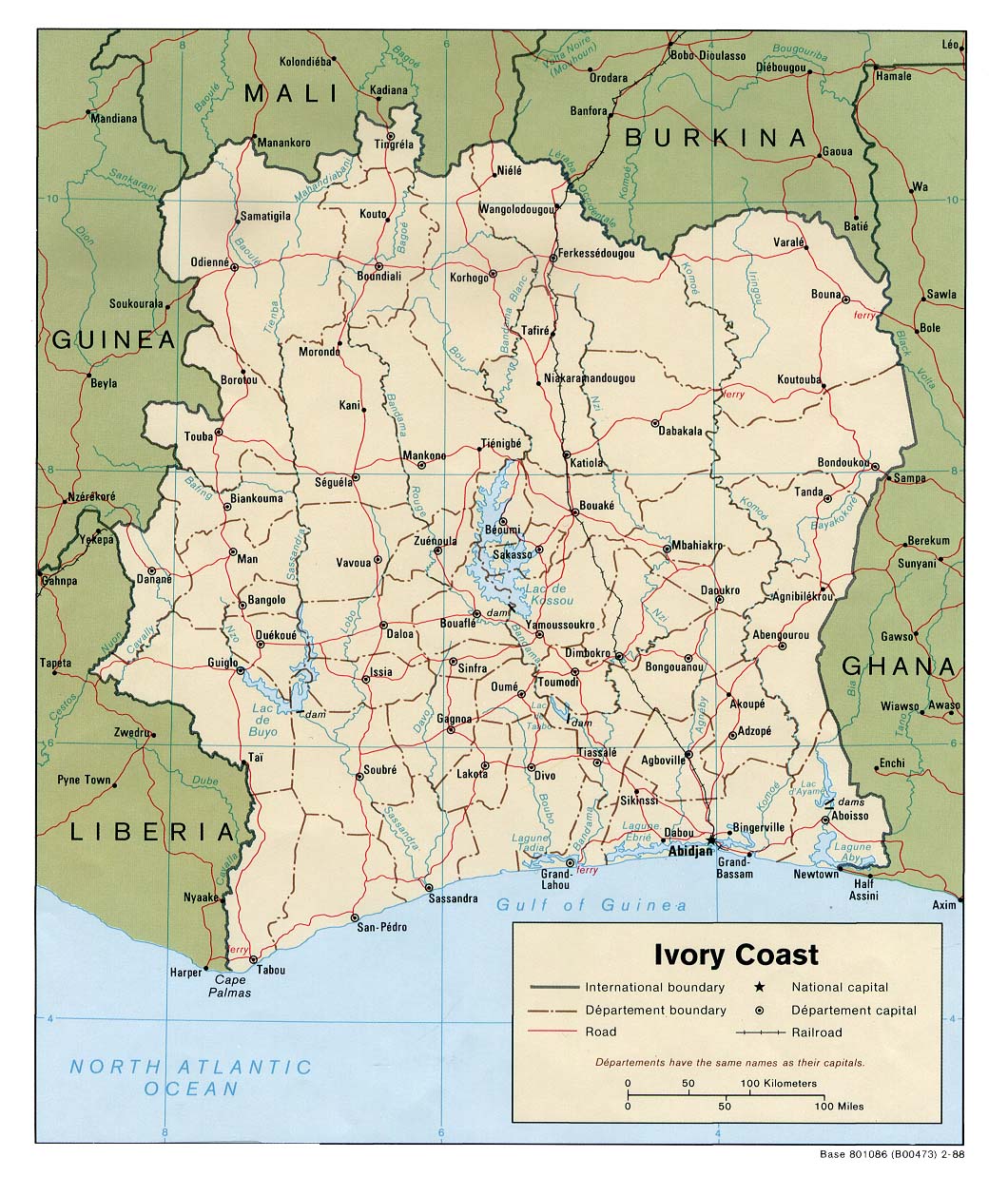
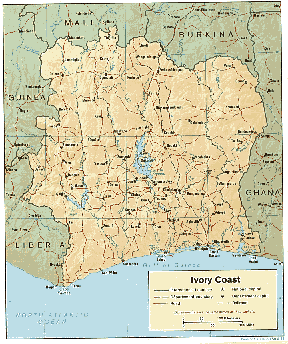
- Cote d'Ivoire (Political) 1988 (259K) and pdf format (267K)
- Cote d'Ivoire (Shaded Relief) 2004 (454K)and pdf format(454K)
- Cote d'Ivoire (Shaded Relief) 1988 (249K)
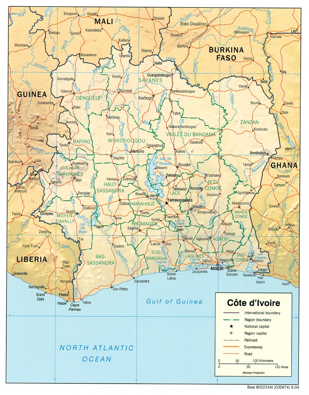
- Cote d'Ivoire (Reference Map) 2004 (457K) and pdf format(459K)
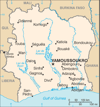
- Cote d'Ivoire (Small Map) 2016 (15.1K)
- Cote d'Ivoire (Transportation) 2004 (1.7MB) and pdf format (357K)
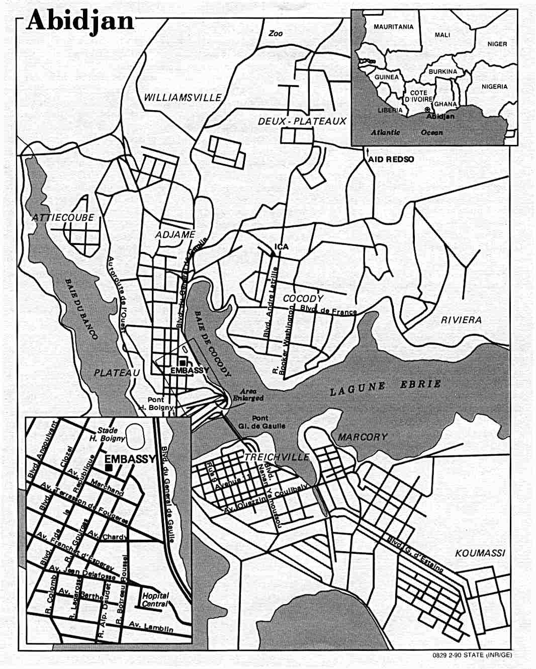
- Abidjan U.S. Dept. of State 1990 (123K)
- 1:2,000,000 - Africa Topographic Maps U.S. Defense Mapping Agency, Series 2201
- Sheets 16 and 17 include all of Cote d'Ivoire
- 1:1,000,000 - International Map of the World U.S. Army Map Service
- This series covers all of Cote d'Ivoire. Clickable Map
- 1:1,000,000 - Operational Navigation Chart Series U.S. Defense Mapping Agency Aerospace Center. Not for navigational use
- Sheets K-1, K-2, L-1 and L-2 include all of Cote d'Ivoire
- 1:1,000,000 - [Cote d'Ivoire - Eastern]
- 1:500,000 - Tactical Pilotage Charts U.S. National Imagery and Mapping Agency. Not for navigational use
- This series covers most of Cote D'Ivoire
- Portion of sheet NB 30 "Abidjan" from Series 1301, Edition 4-AMS, 1959 (1.2MB) See International Map of the World, above, for other maps in the series.
- 1:250,000 - West Africa Topographic Maps U.S. Army Map Service, Series N504
- This series includes most of Cote d'Ivoire
- 1:250,000 - Joint Operations Graphic U.S. National Imagery and Mapping Agency, Series 1501 Air Not for navigational use
- This series covers parts of Cote d'Ivoire
- 1:200,000 - French West Africa Topographic Maps U.S. Army Map Service, 1940-
- This historical series covers parts of Cote d'Ivoire
- Sheets 16 and 17 include all of Cote d'Ivoire
![1:1,000,000 - [Cote d'Ivoire - Eastern]](africa/abidjan_1959.jpg)
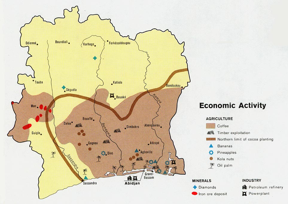
- Ivory Coast - Economic Activity from Map No. 500455 1972 (147K) Map shows cocoa and coffee growing areas and locations for other agricultural products, minerals and industries.
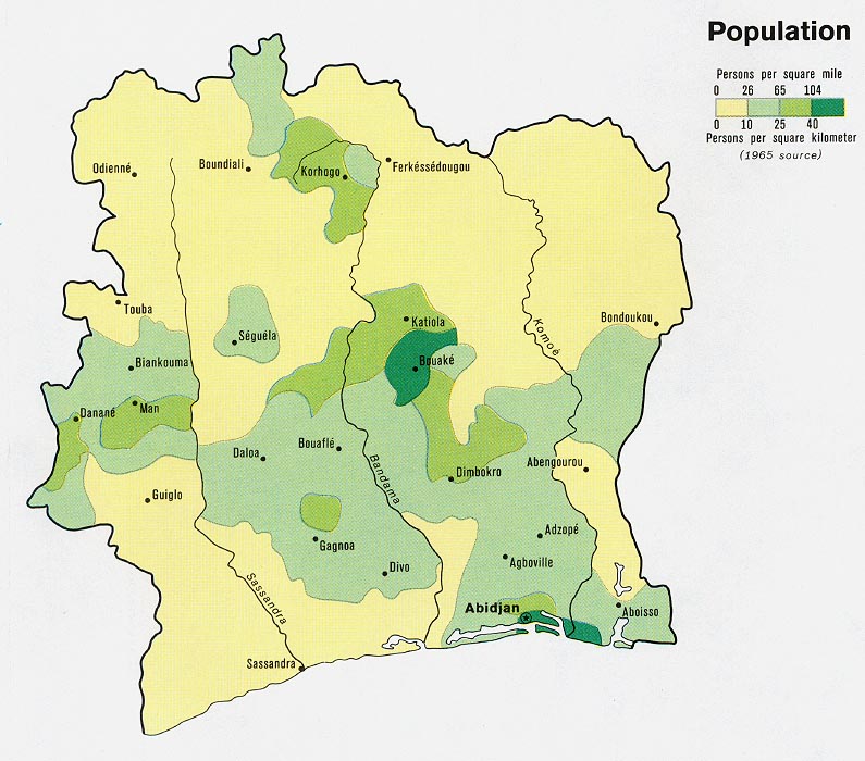
- Ivory Coast - Population from Map No. 500455 1972 (147K)
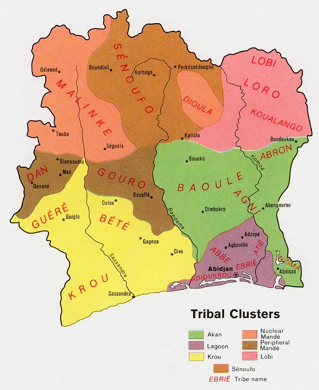
- Ivory Coast - Tribal Clusters from Map No. 500455 1972 (152K)
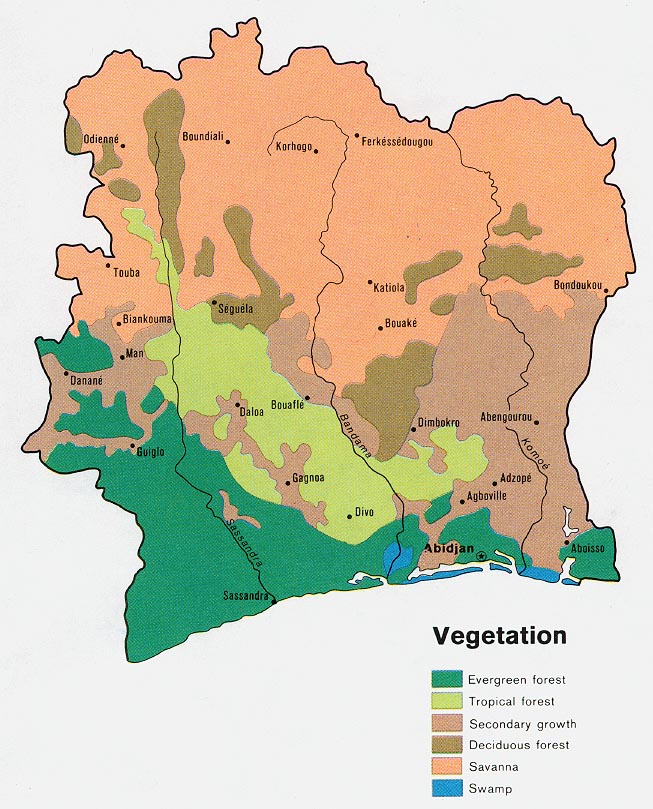
- Ivory Coast - Vegetation from Map No. 500455 1972 (154K)
- 1:2,000,000 - Africa Topographic Maps U.S. Defense Mapping Agency, Series 2201
- Sheets 16 and 17 include all of Cote d'Ivoire
- 1:1,000,000 - International Map of the World U.S. Army Map Service
- This series covers all of Cote d'Ivoire. Clickable Map
- 1:1,000,000 - [Cote d'Ivoire - Eastern]
- Portion of sheet NB 30 "Abidjan" from Series 1301, Edition 4-AMS, 1959 (1.2MB) See International Map of the World, above, for other maps in the series.
- 1:250,000 - West Africa Topographic Maps U.S. Army Map Service, Series N504
- This series includes most of Cote d'Ivoire
- 1:250,000 - Joint Operations Graphic U.S. National Imagery and Mapping Agency, Series 1501 Air Not for navigational use
- This series covers parts of Cote d'Ivoire
- 1:200,000 - French West Africa Topographic Maps U.S. Army Map Service, 1940-
- This historical series covers parts of Cote d'Ivoire
- Sheets 16 and 17 include all of Cote d'Ivoire
Maps on Other Web Sites