Perry-Castañeda Library
Map Collection
Comoros Maps
The following maps were produced by the U.S. Central Intelligence Agency, unless otherwise indicated.
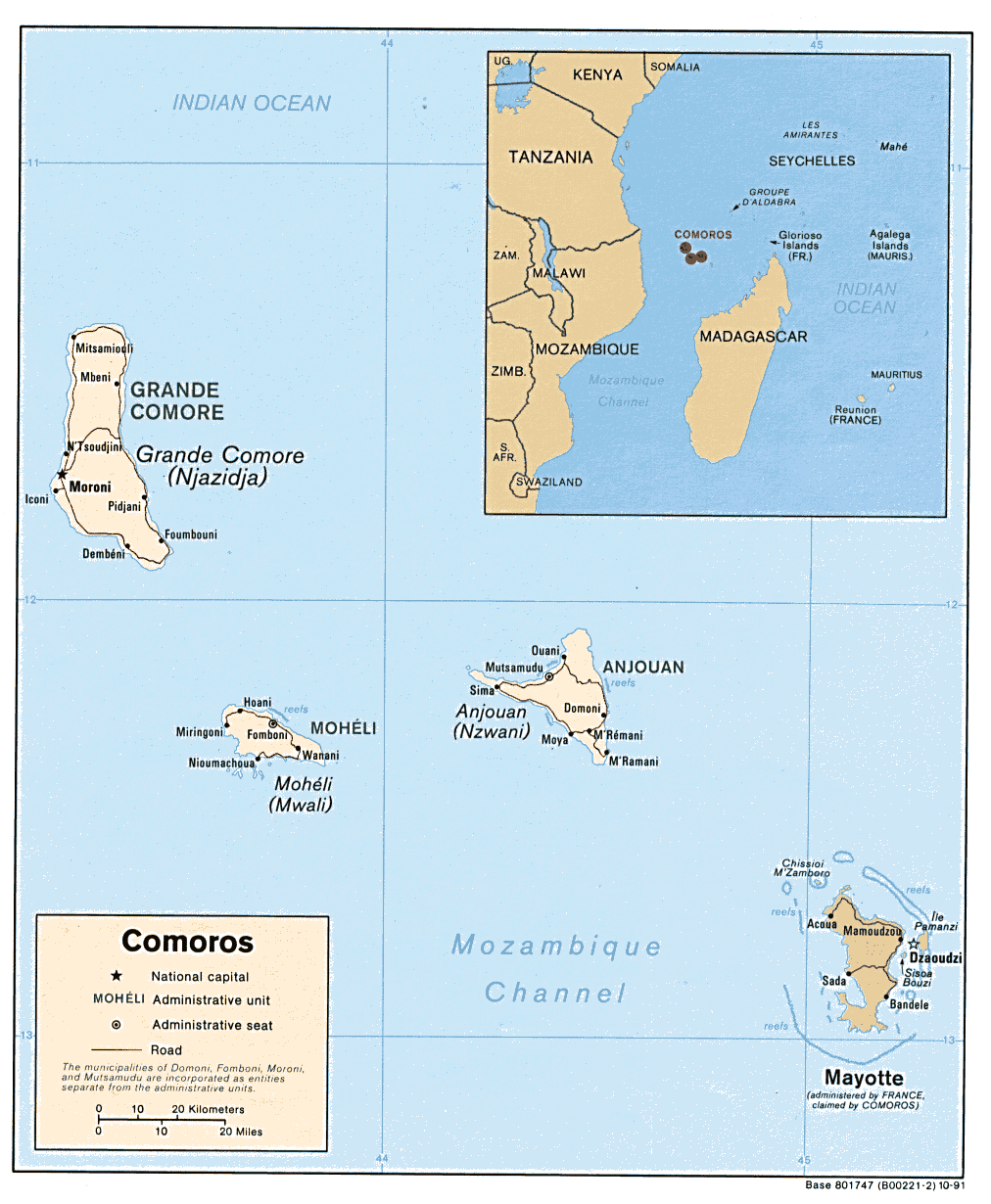
Country Maps- Comoros (Political) 1991 (212K) and pdf format (224K)
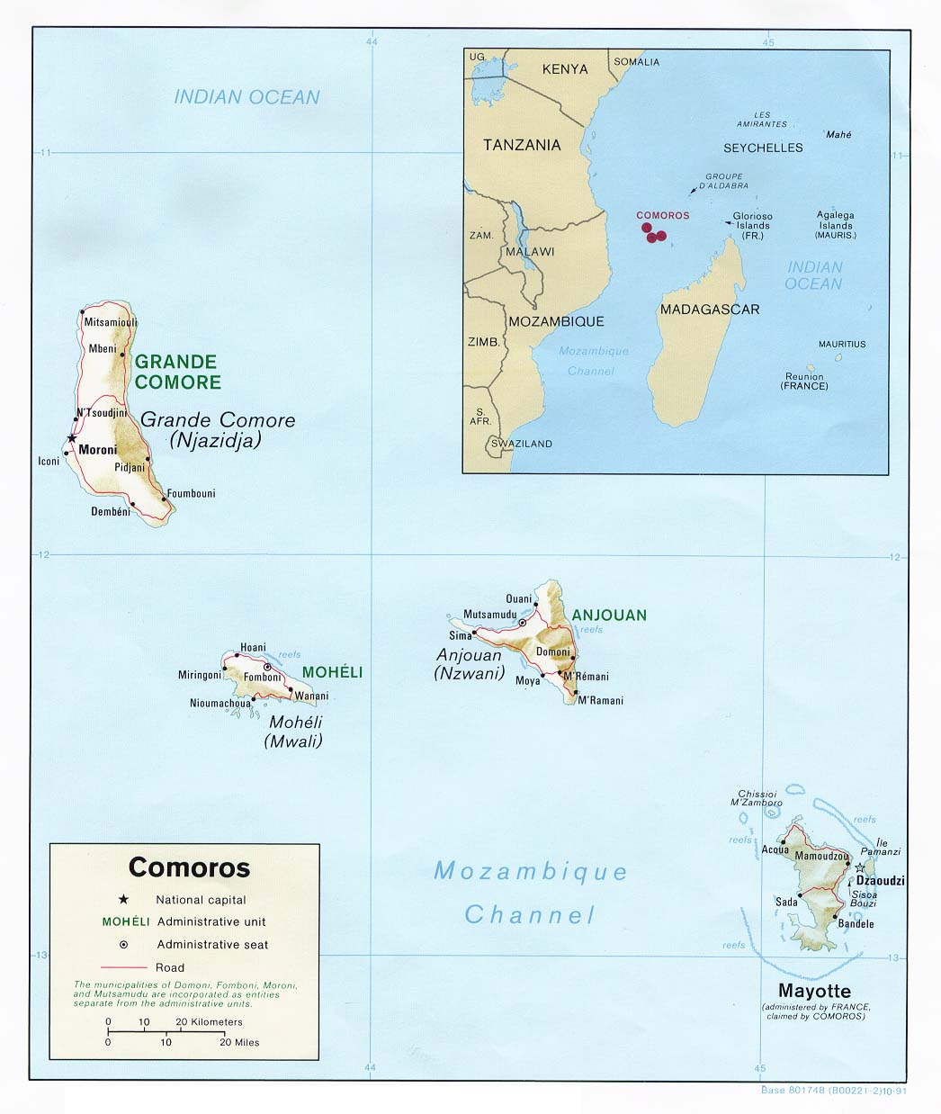
- Comoros (Shaded Relief) 1991 (119K) and pdf format (126K)
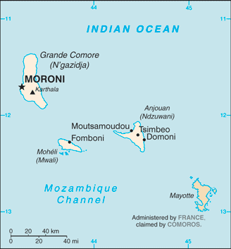
- Comoros (Small Map) 2016 (11.6K)
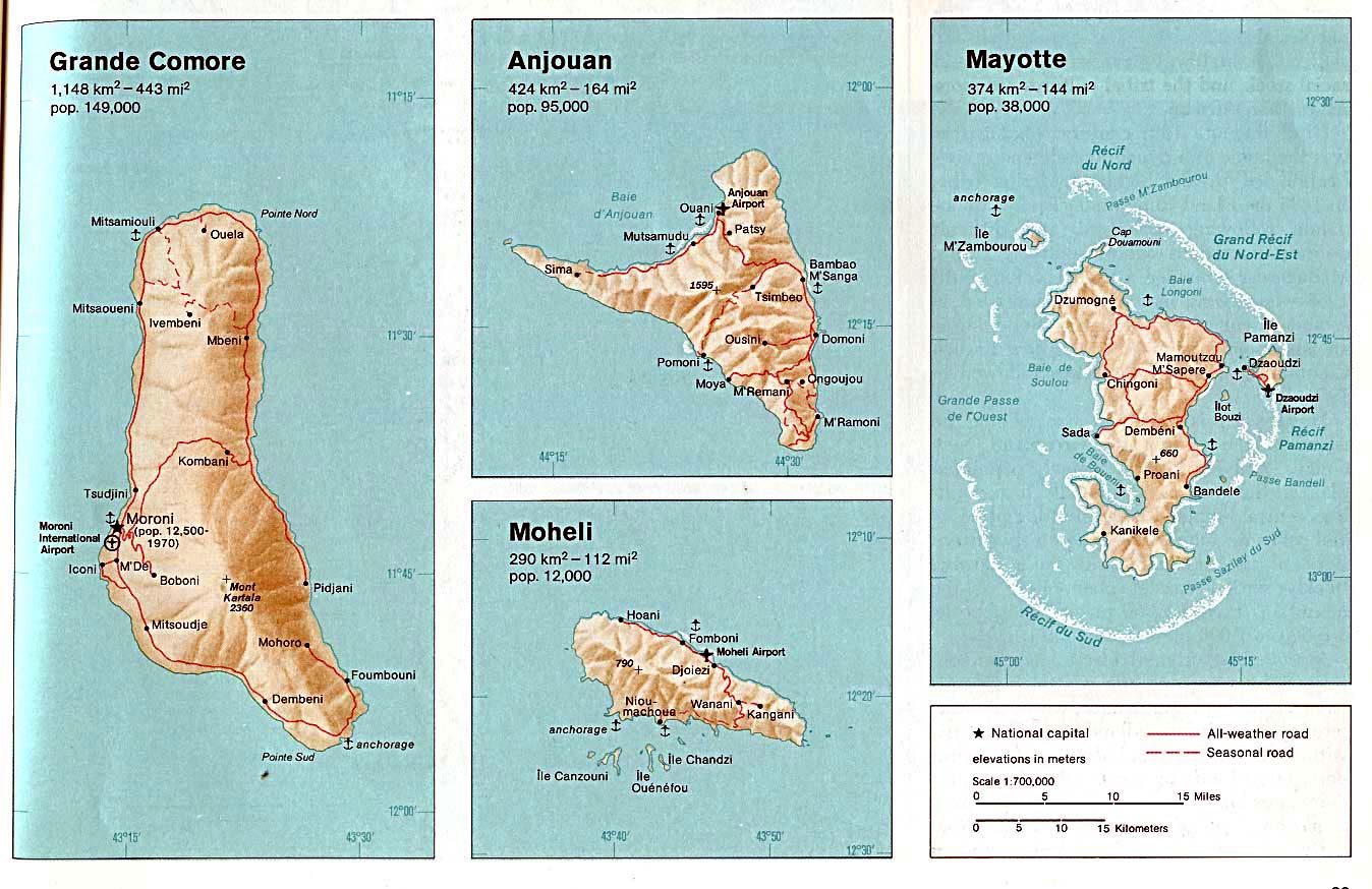
- Comoros (Grande Comore, Anjouan, Moheli, Mayotte) From The Indian Ocean Atlas, 1976 (198K)
- Comoros - Operational Navigation Chart Series 1:1,000,000. U.S. Defense Mapping Agency Aerospace Center. Not for navigational use This map includes Comoros, Southern Seychelles and Northern Madagascar (7.2MB)
- 1:500,000 - Tactical Pilotage Charts U.S. National Imagery and Mapping Agency. Not for navigational use
- This series covers Comoros
- Mayotte (Small Map) 2010 (17K)
- This series covers Comoros