Perry-Castañeda Library
Map Collection
Chechenya (Chechen Republic) Maps
The following maps were produced by the U.S. Central Intelligence Agency, unless otherwise indicated.
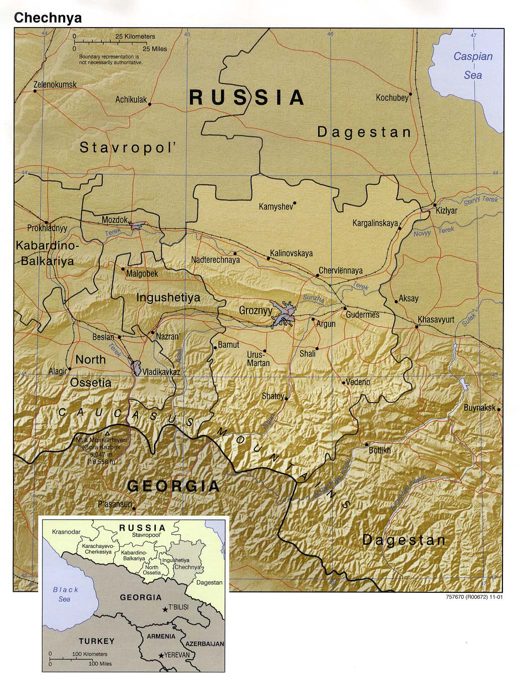
Chechnya Maps- Chechnya (Shaded Relief) 2001 (271K) and pdf format (277K)
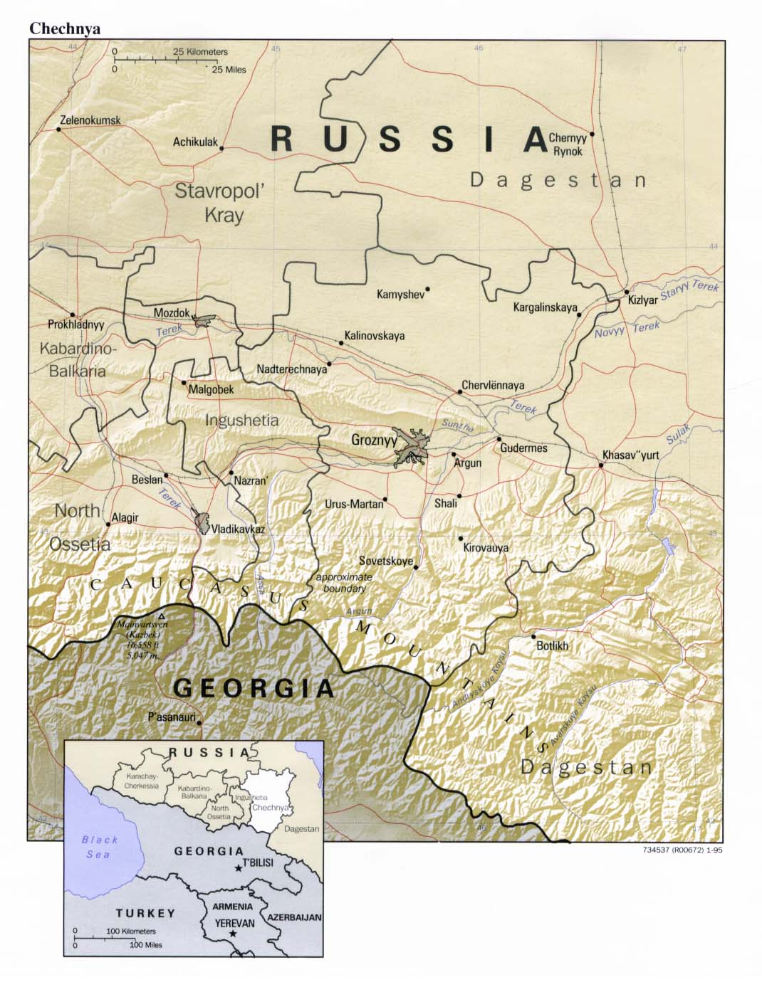
- Chechnya (Shaded Relief) 1995 (193K)
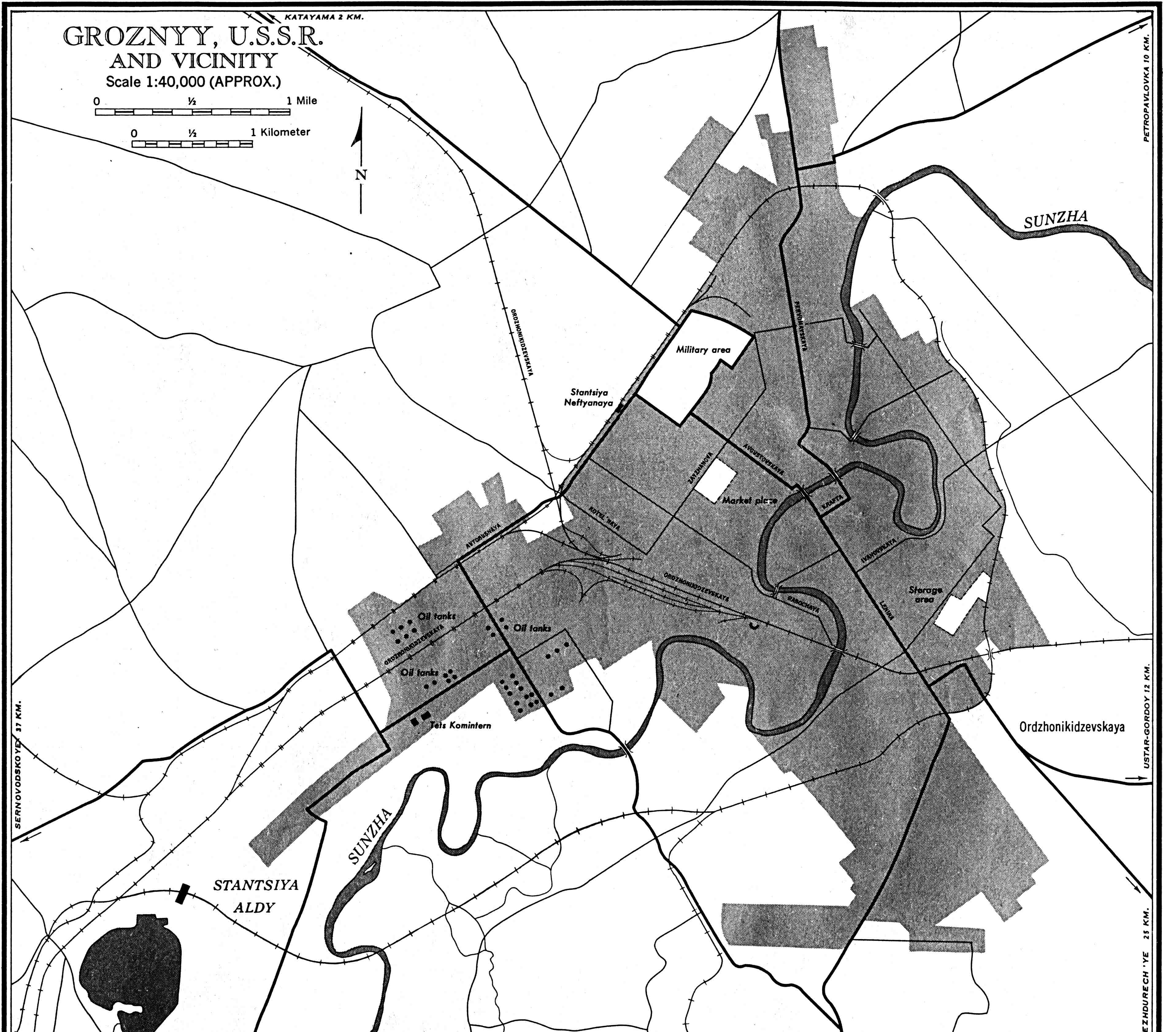
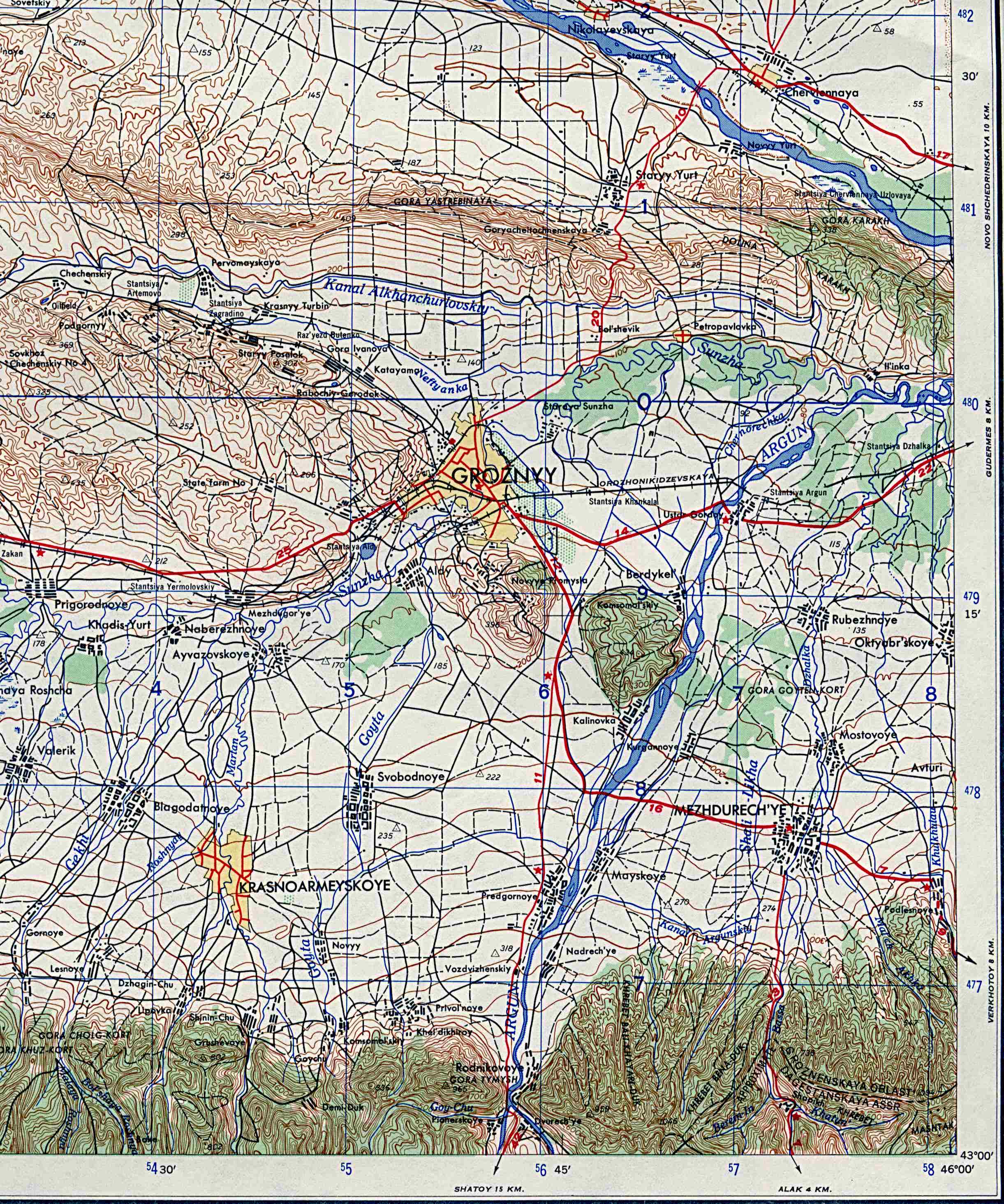
- Grozny (city map) 1:40,000 U.S. Army Map Service 1959 (827K)
- 1:1,000,000 - Operational Navigation Charts Series U.S. Defense Mapping Agency Aerospace Center Not for navigational use
- This series includes Chechen Republic on sheet F-4
- 1:500,000 - Grozny (Tactical Pilotage Chart) Portion of U.S. Defense Mapping Agency 1980 (521K) Not for navigational use
- 1:250,000 - Eastern Europe Topographic Maps U.S. Army Map Service Series N501, 1954-
- This series includes Chechen Republic
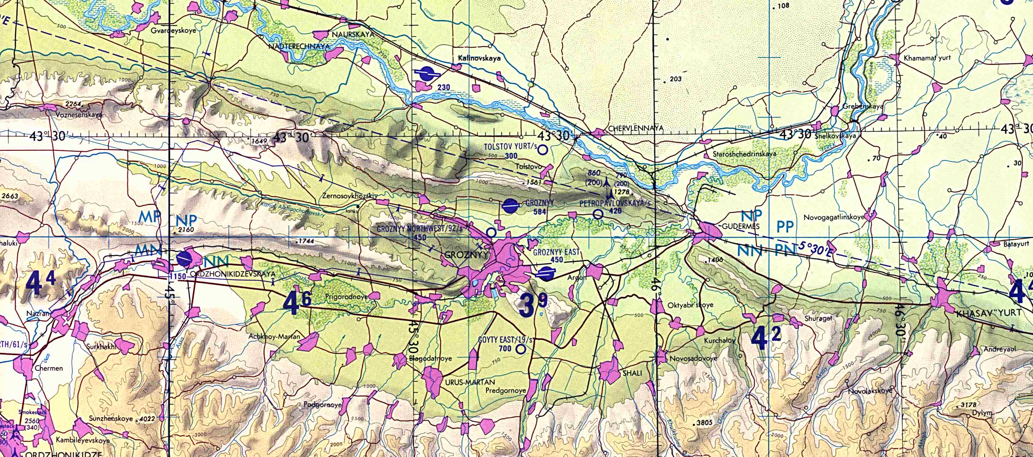
- 1:250,000 - Grozny (Topographic Map) 1:250,000 U.S. Army Map Service, Portion of sheet NK 38-2, 1959 from the Eastern Europe series above (883K)
- 1:250,000 - Joint Operations Graphic U.S. National Imagery and Mapping Agency Not for navigational use
- This series includes most of Chechen Republic. Grozny is on sheet NK 38-2
- This series includes Chechen Republic on sheet F-4
- Dagestan Maps
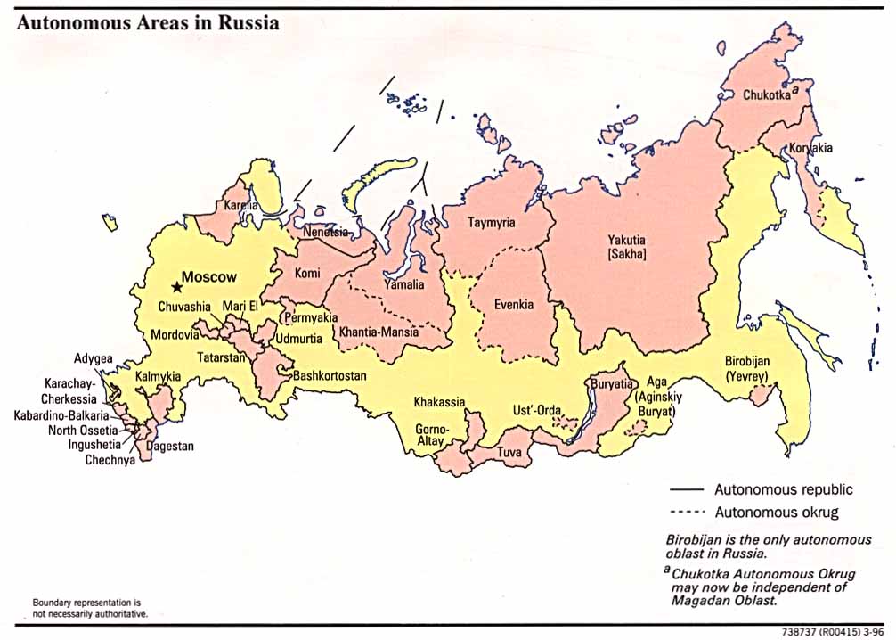
- Russia: Autonomous Areas 1996 (83K)
- Other Maps of Russia and the Former Soviet Republics
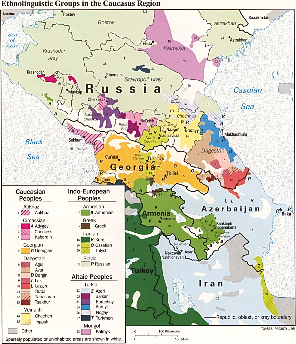
- Caucasus Region: Ethnolinguistic Groups 1995 (255K)
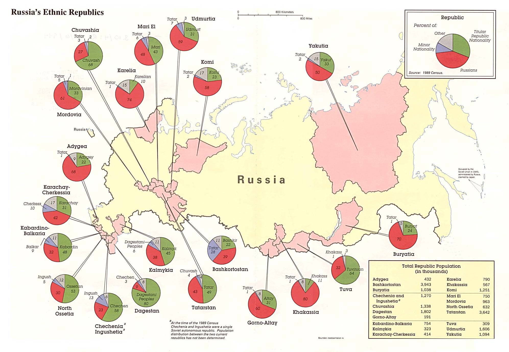
- Russia's Ethnic Republics 1994 (312K)
Maps on Other Web Sites