Perry-Castañeda Library
Map Collection
Cambodia Maps
The following maps were produced by the U.S. Central Intelligence Agency, unless otherwise indicated.
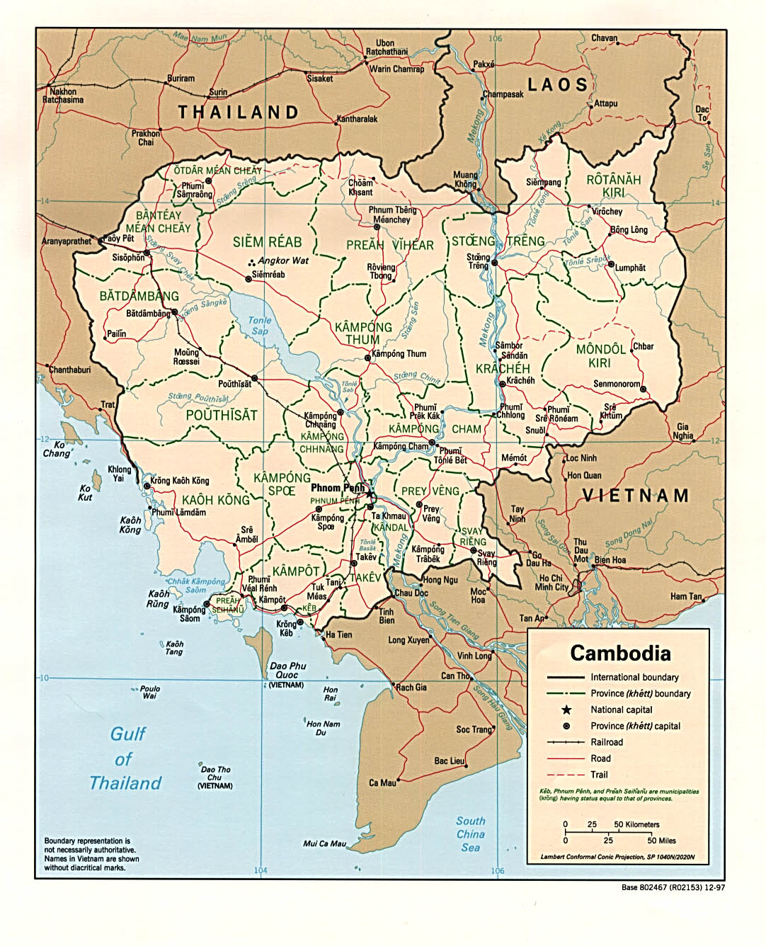
Country Maps- Cambodia (Political) 1997 (323K) and pdf format (352K)
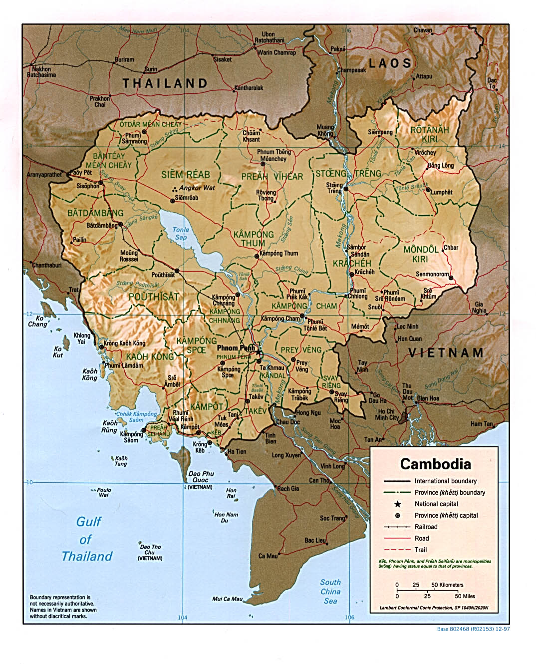
- Cambodia (Shaded Relief) 1997 (332K) and pdf format (348K)
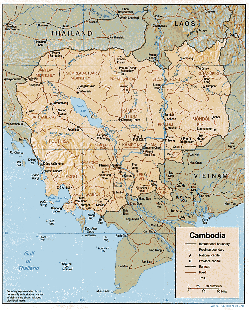
- Cambodia (Shaded Relief) 1991 (323K) and pdf format (336K)
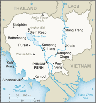
- Cambodia (Small Map) 2016 (23.5K)
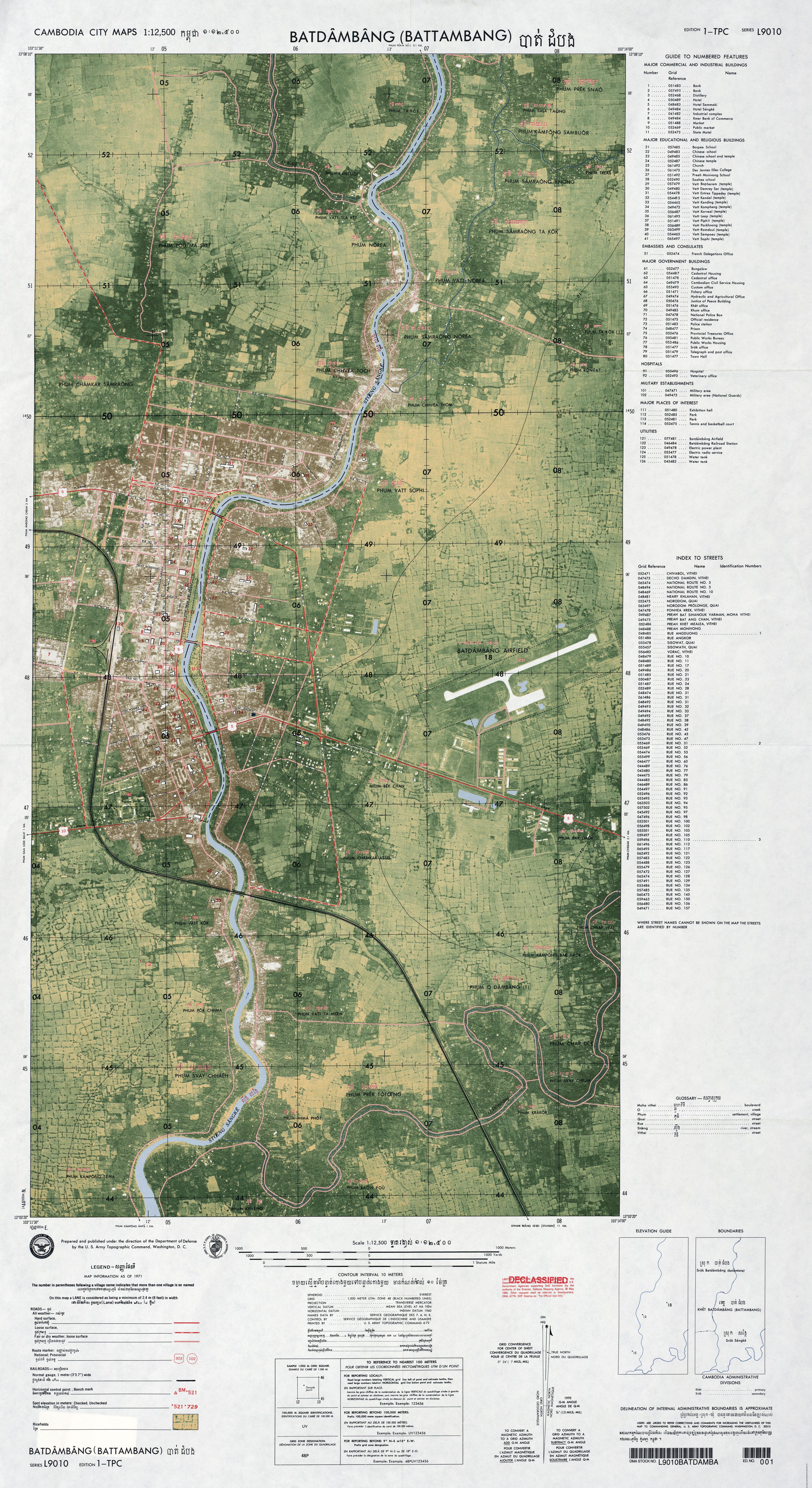
- Batdambang (Battambang) original scale 1:12,500, Edition 1-TPC, Series L9010. U.S. Army Topographic Command, 1971 (6.1MB)
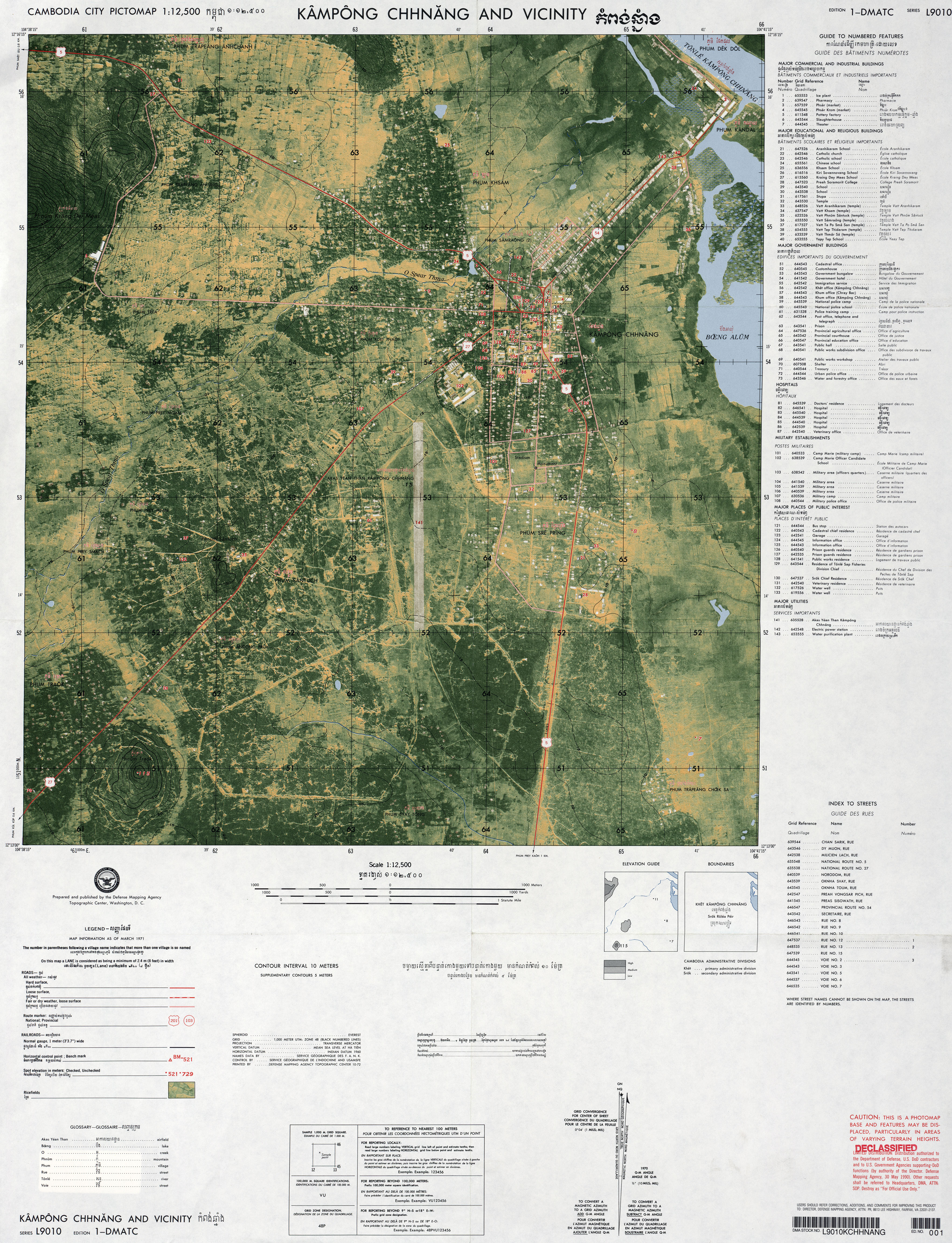
- Kampong Chhnang and Vicinity original scale 1:12,500, Edition 1-DMATC, Series L9010. U.S. Defense Mapping Agency Topographic Center, Pictomap, 1971 (4.4MB)
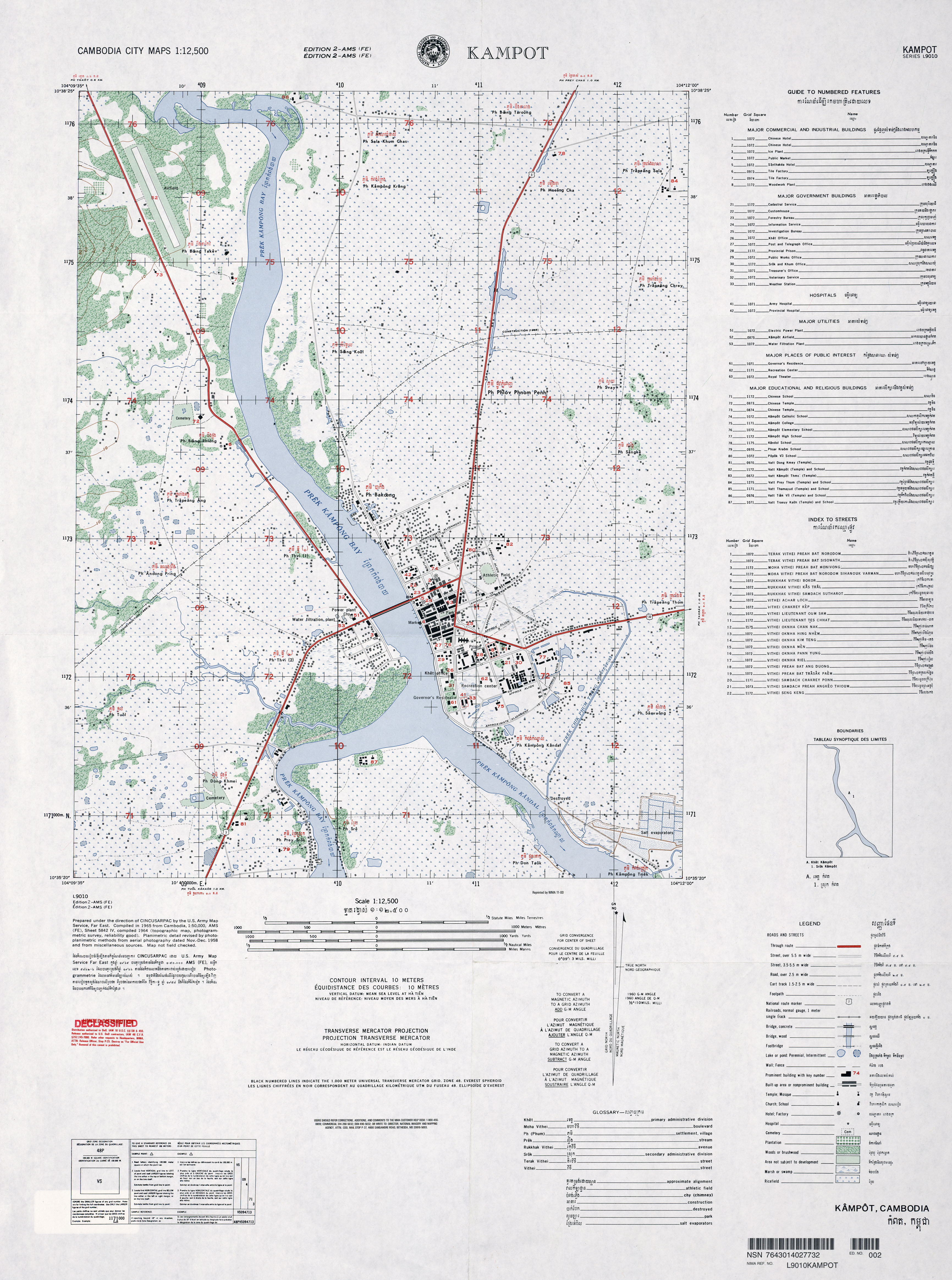
- Kampot original scale 1:12,500, Edition 2-AMS (FE), Series L9010. U.S. Army Mapping Service, Far East (3.3MB)
- [Phnom Penh] Phnum Penh original scale 1:12,500, Edition 3-DMA, Series L9010. U.S. Defense Mapping Agency, 1971 (9.3MB)
![[Phnom Penh] Phnum Penh](middle_east_and_asia/txu-oclc-232579784-phnum_penh-1971.jpg)
- [Cambodia] 1967 - 3 and 4 Corps Zones 1967 from American Military History, United States Army Center of Military History, 1989 (387K)
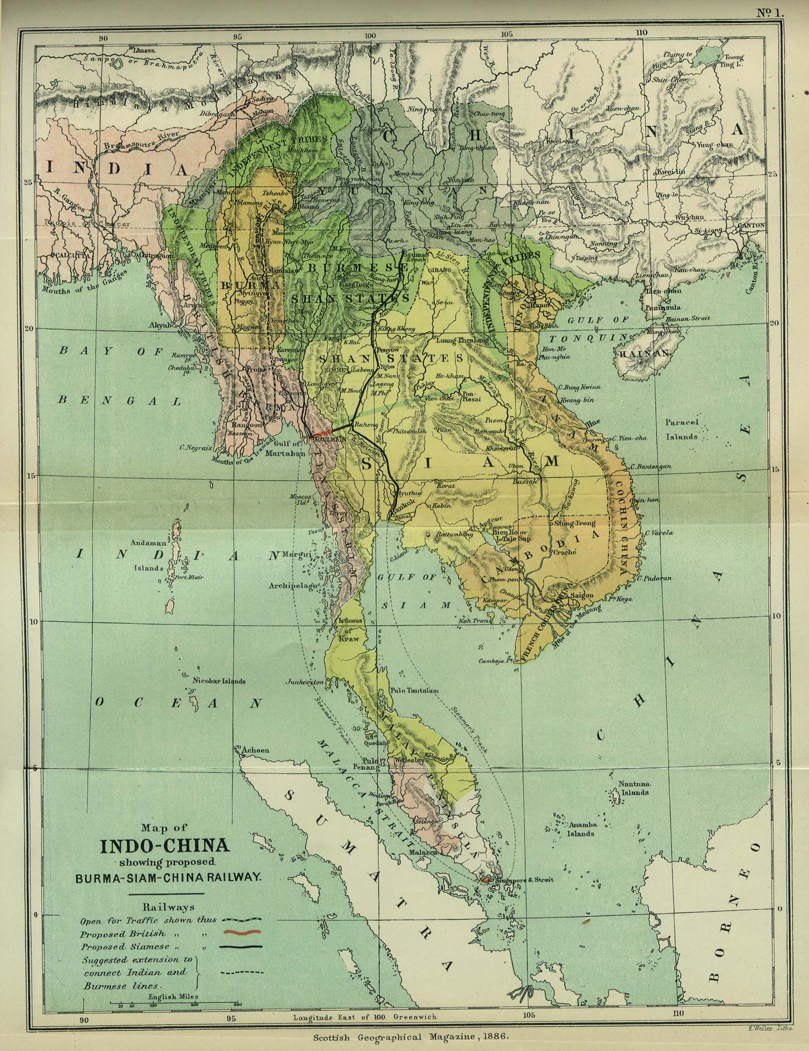
- Indo-China 1886 "Map of Indo-China showing proposed Burma-Siam-China Railway" from the Scottish Geographical Magazine. Published by the Scottish Geographical Society and edited by Hugh A. Webster and Arthur Silva White. Volume II, 1886. (533K)
- Indochina and Thailand, Series L509 (Topographic Maps) 1:250,000, U.S. Army Map Service, 1954-
- Indochina Atlas 1970
![[Cambodia] 1967 - 3 and 4 Corps Zones 1967](historical/corps_zones_3-4_1967.jpg)
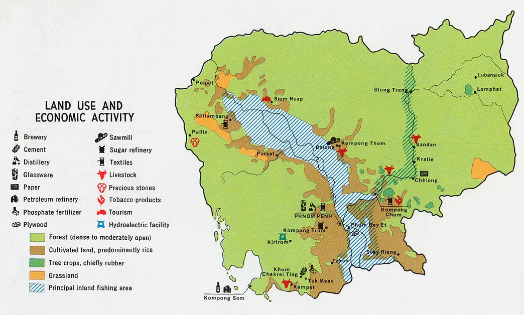
- Cambodia - Economic Activity and Land Use from Map No. 77967 1972 (192K)
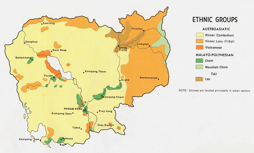
- Cambodia - Ethnolinguistic Groups from Map No. 77967 1972 (169K)
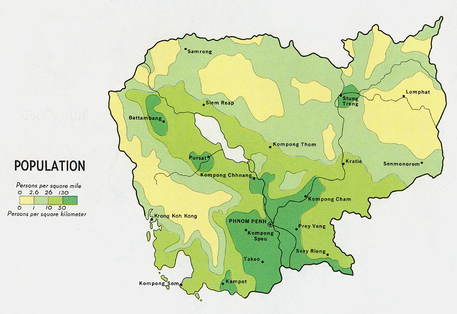
- Cambodia - Population from Map No. 77967 1972 (133K)
- Indochina Atlas 1970
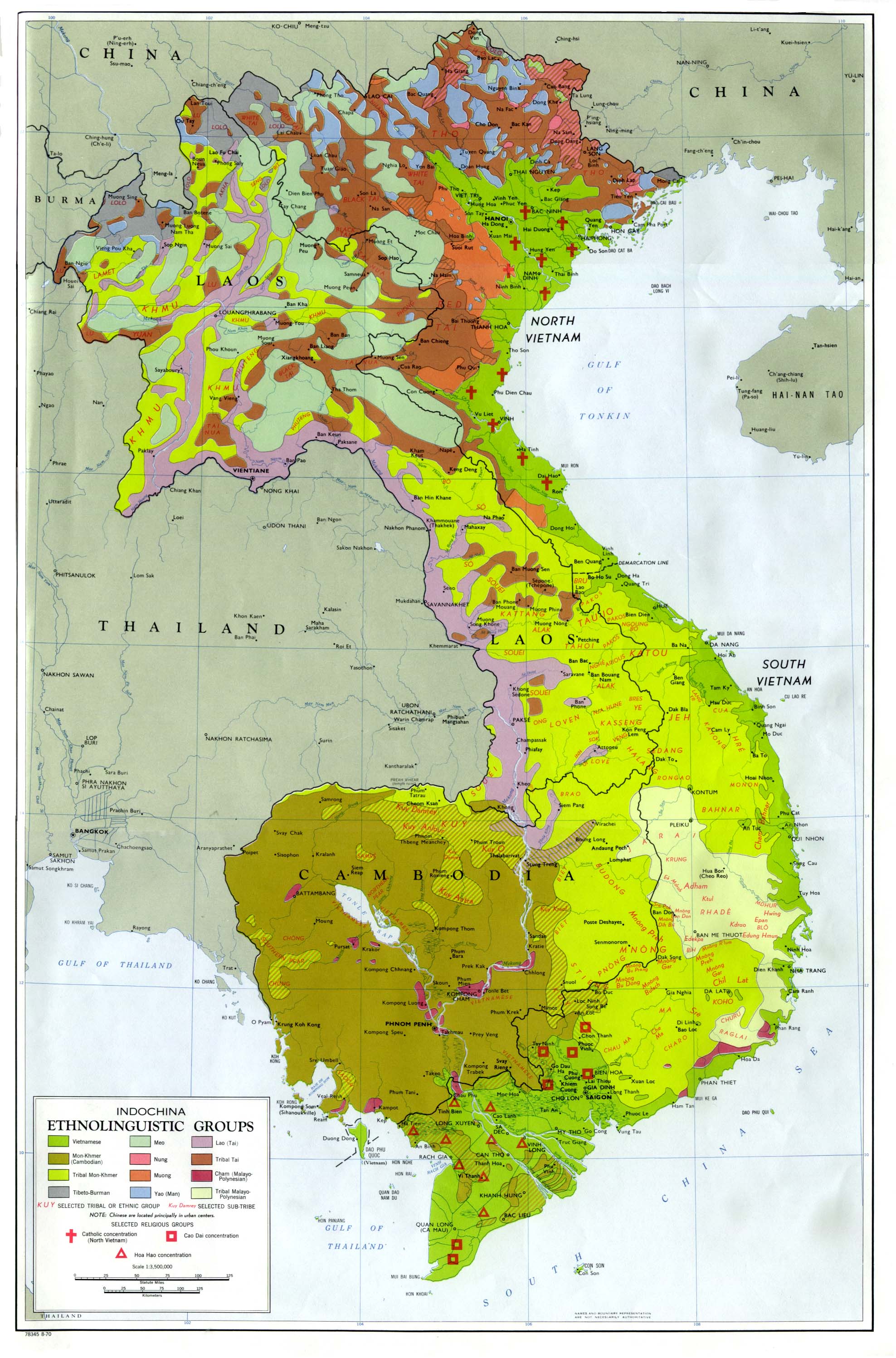
- Indochina Ethnolinguistic Groups from Indochina Atlas, 1970 (654K)
- 1:1,000,000 - Operational Navigation Chart Series U.S. Defense Mapping Agency Aerospace Center. Not for navigational use
- Sheets K-9 and K-10 cover all of Cambodia
- 1:1,000,000 - International Map of the World U.S. Army Map Service [1950s]
- Clickable Index Map)
- This series covers all of Cambodia
- 1:500,000 - Tactical Pilotage Charts U.S. National Imagery and Mapping Agency. Not for navigational use
- This series covers Cambodia
- 1:250,000 - Vietnam, Laos, and Cambodia - Joint Operations Graphic Series (Aeronautical Charts) U.S. Defense Mapping Agency, 1966-1998. [GeoPDF] Not for navigational use
- This series covers all of southern Vietnam and most of northern Vietnam
- 1:50,000 - Cambodia Topographic Maps U.S. National Imagery and Mapping Agency, Series L7015
- This incomplete series covers parts of Cambodia
- Sheets K-9 and K-10 cover all of Cambodia
Maps on Other Web Sites