Perry-Castañeda Library
Map Collection
Bangladesh Maps
The following maps were produced by the U.S. Central Intelligence Agency, unless otherwise indicated.
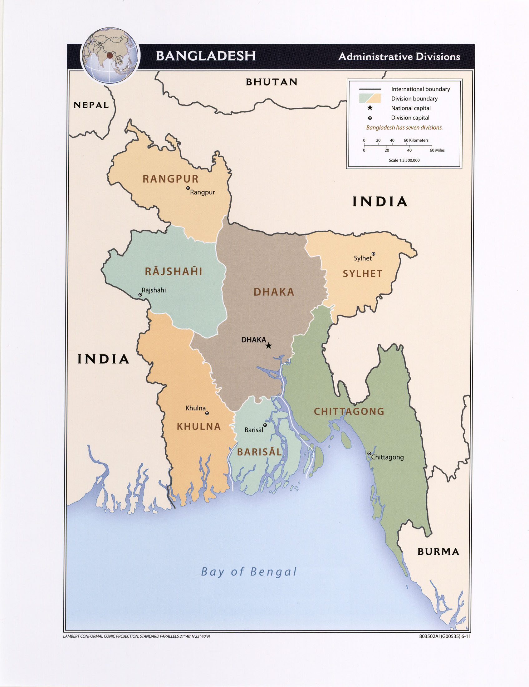
Country Maps- Bangladesh (Administrative Divisions) 2011 (414K) and pdf format (547K)
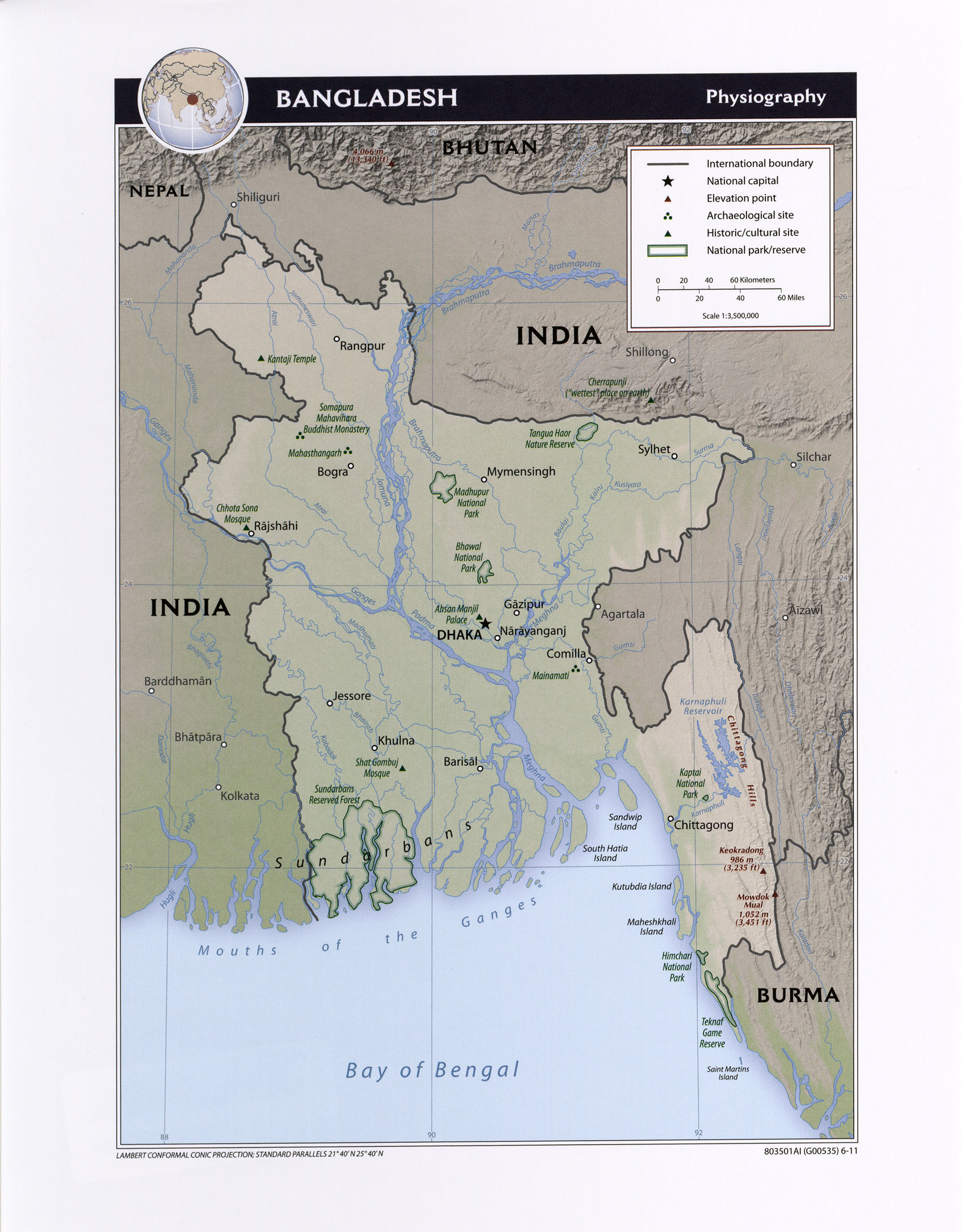
- Bangladesh (Physiography) 2011 (620K) and pdf format (644K)
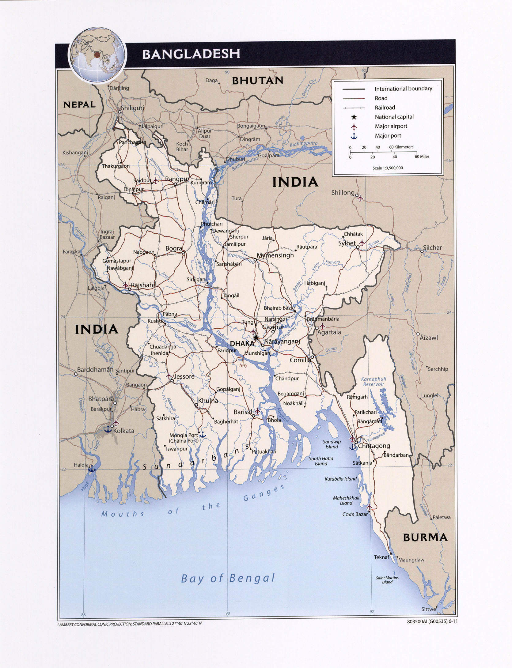
- Bangladesh (Political) 2011 (642K) and pdf format (822K)
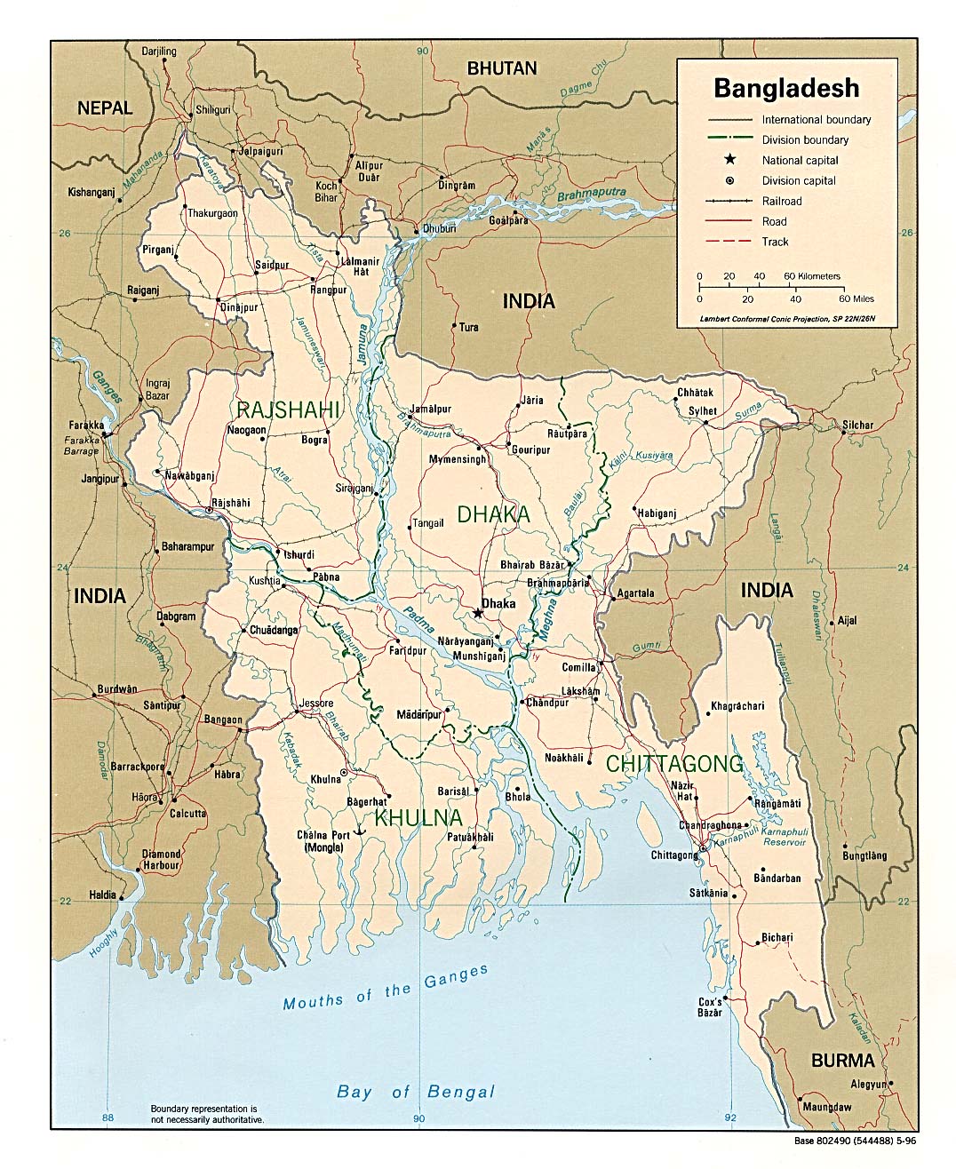
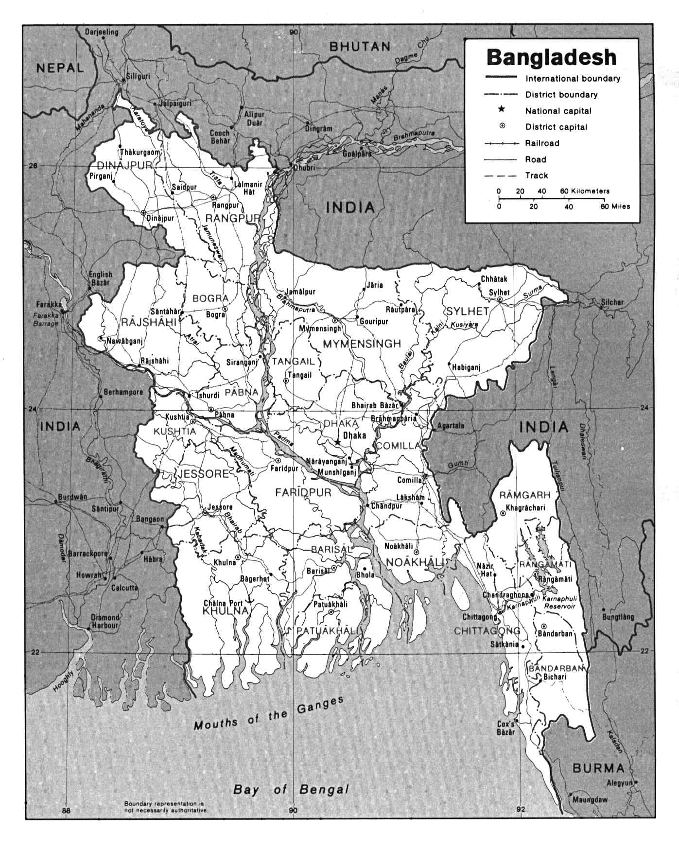
- Bangladesh (Political) 1996 (324K) and pdf format (328K)
- Bangladesh (Political) U.S. Department of State 1992 (245K)
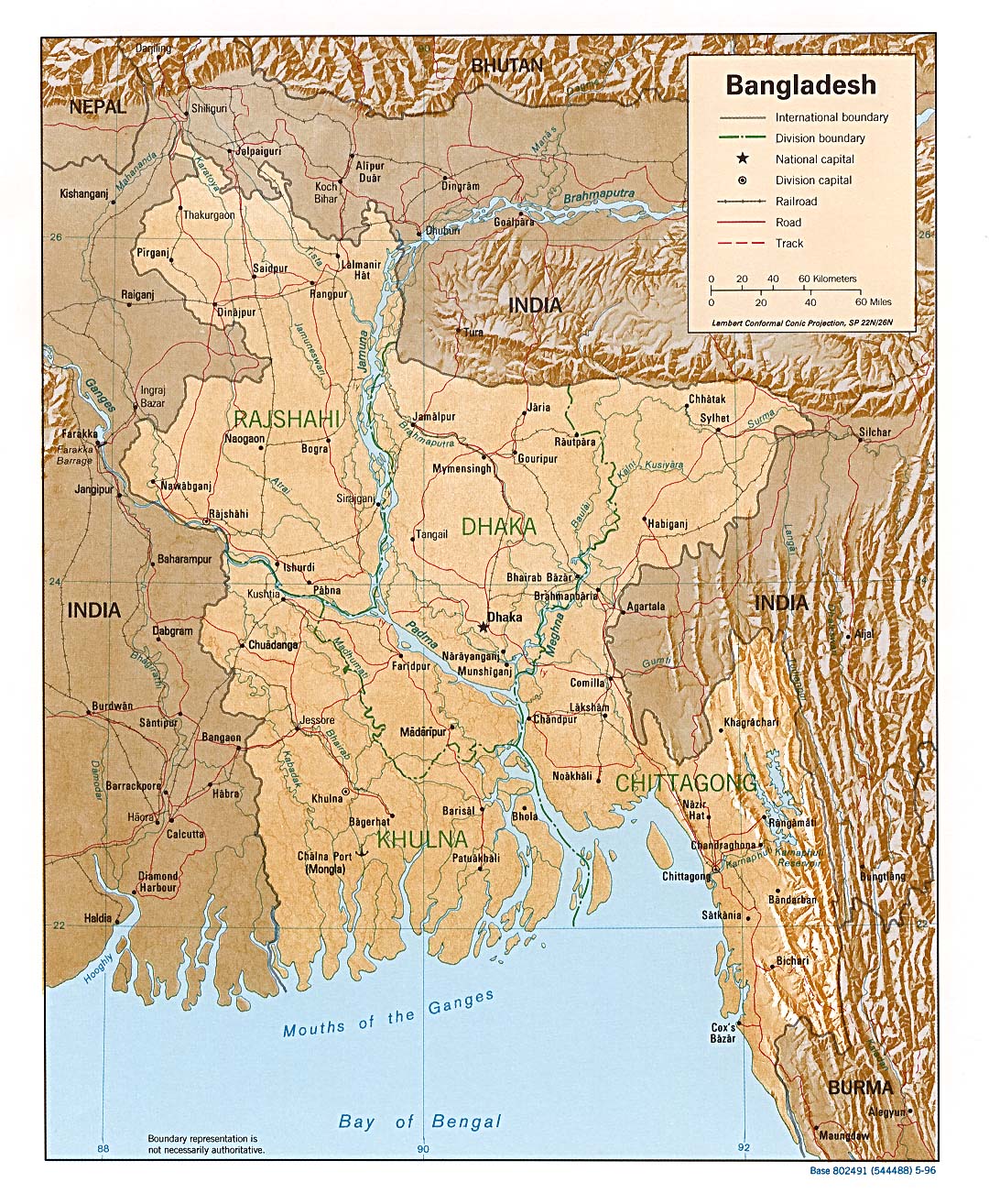
- Bangladesh (Shaded Relief) 1996 (433K) and pdf format (436K)
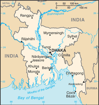
- Bangladesh (Small Map) 2016 (26.1K)
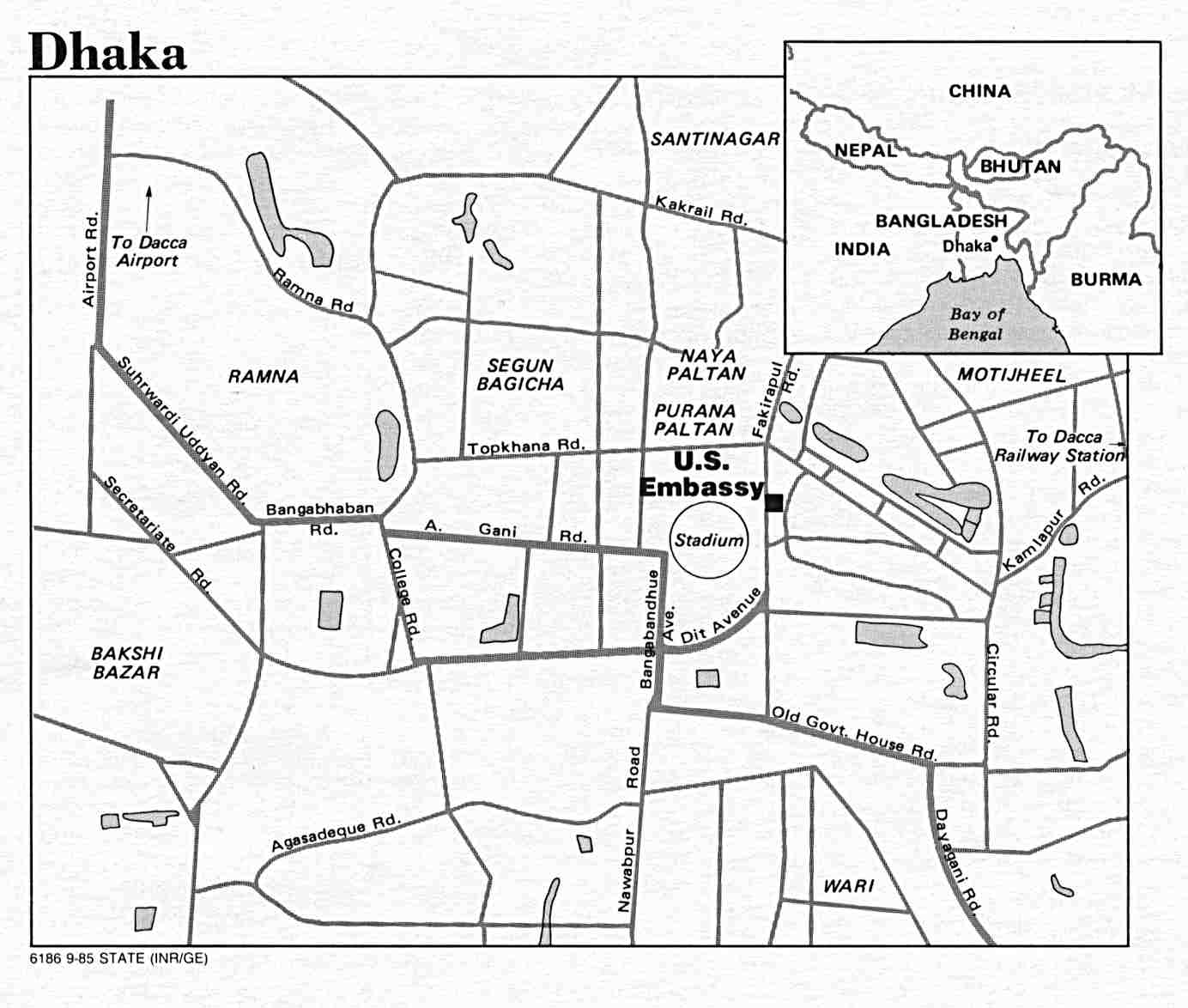
- Dhaka U.S. Dept. of State 1985 (83K)
- 1:1,000,000 - Operational Navigation Chart Series U.S. Defense Mapping Agency Aerospace Center Not for navigational use
- This series covers all of Bangladesh
- 1:1,000,000 - International Map of the World
- This series covers what is now northern Bangladesh
- 1:500,000 - Tactical Pilotage Charts U.S. National Imagery and Mapping Agency. Not for navigational use
- This series covers the southern part of Bangladesh
- 1:250,000 - India, Joint Operations Graphic Series 1501 AIR, U.S. National Imagery and Mapping Agency, [ca. 1990] Not for navigational use
- This series includes parts of Bangladesh, including Dhaka and Chittagong
- 1:250,000 - India and Pakistan - Topographic Maps Series U502, U.S. Army Map Service, 1955-
- This map series includes all of East Pakistan [Bangladesh]
- This series covers all of Bangladesh
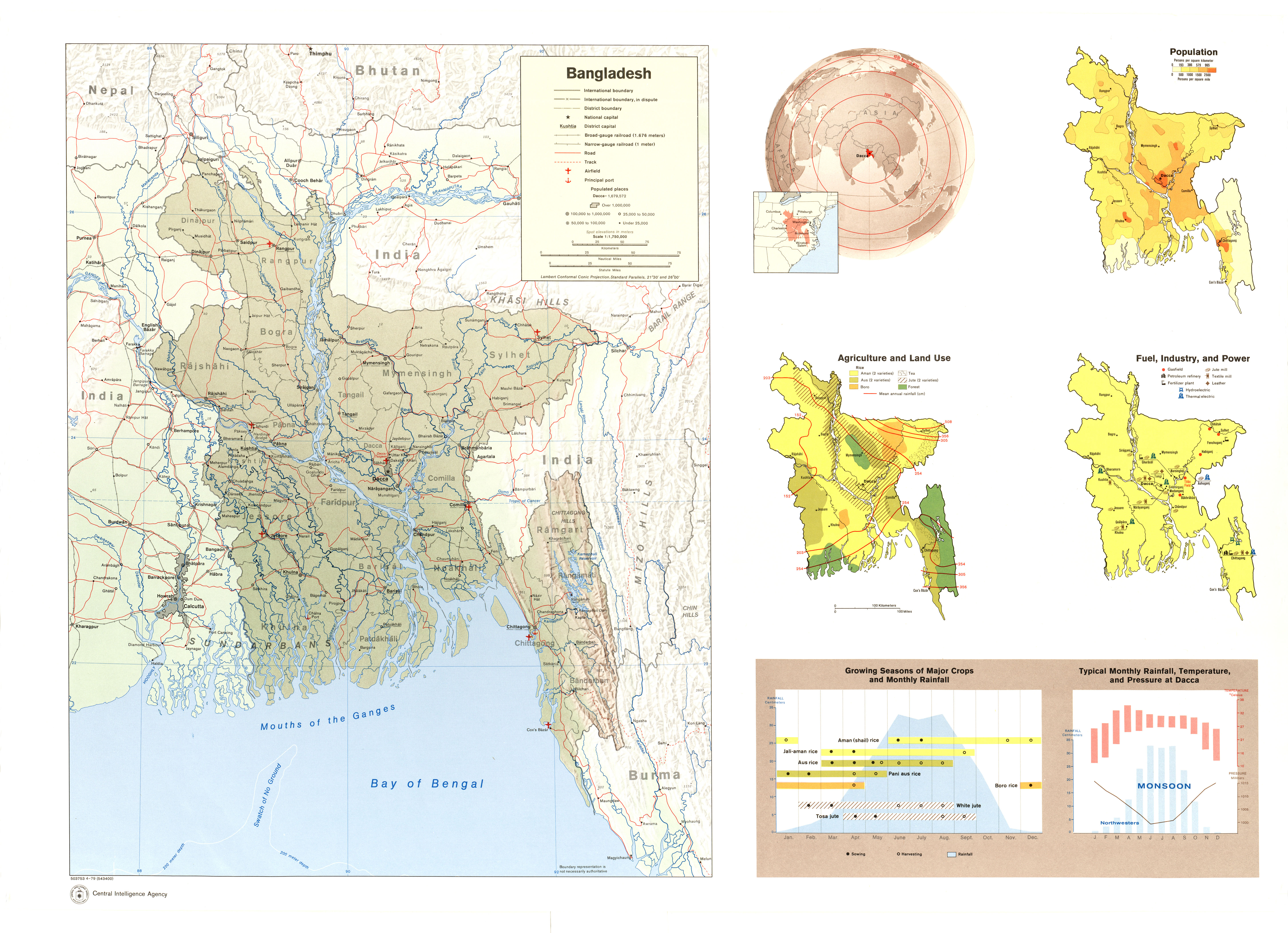
- Bangladesh (Shaded Relief; Location; Population; Agriculture and Land Use; Fuel, Industry and Power; Growing Seasons of Major Crops and Monthly Rainfall (Chart); Typical Monthly Rainfall, Temperature and Pressure at Dacca (Chart)) Map No. 503753 1979 (4.7MB)
Maps on Other Web Sites